|
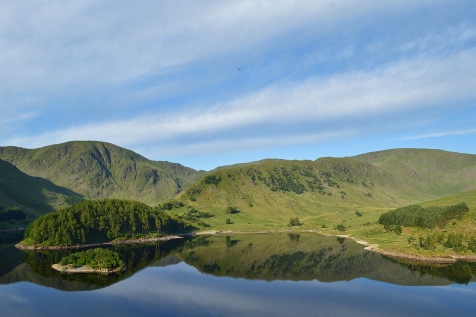
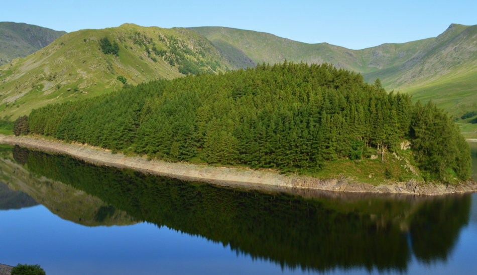
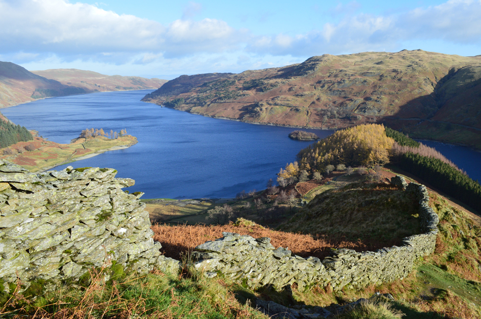
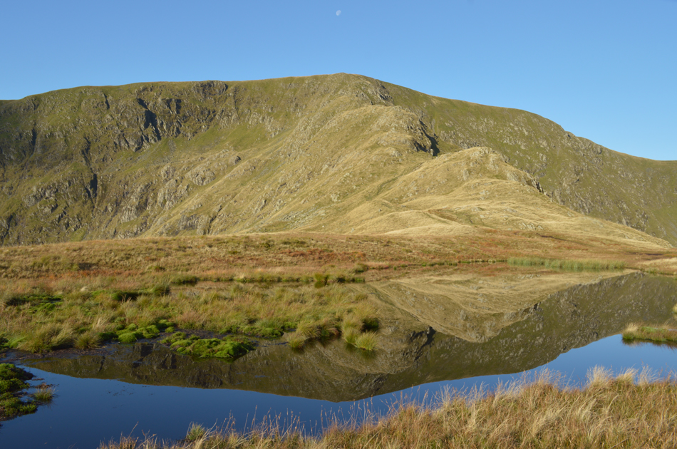
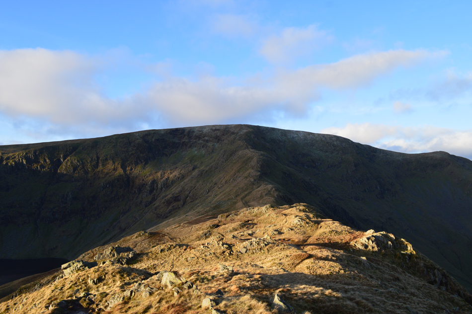
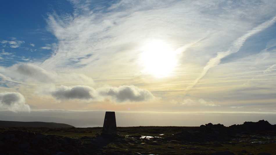
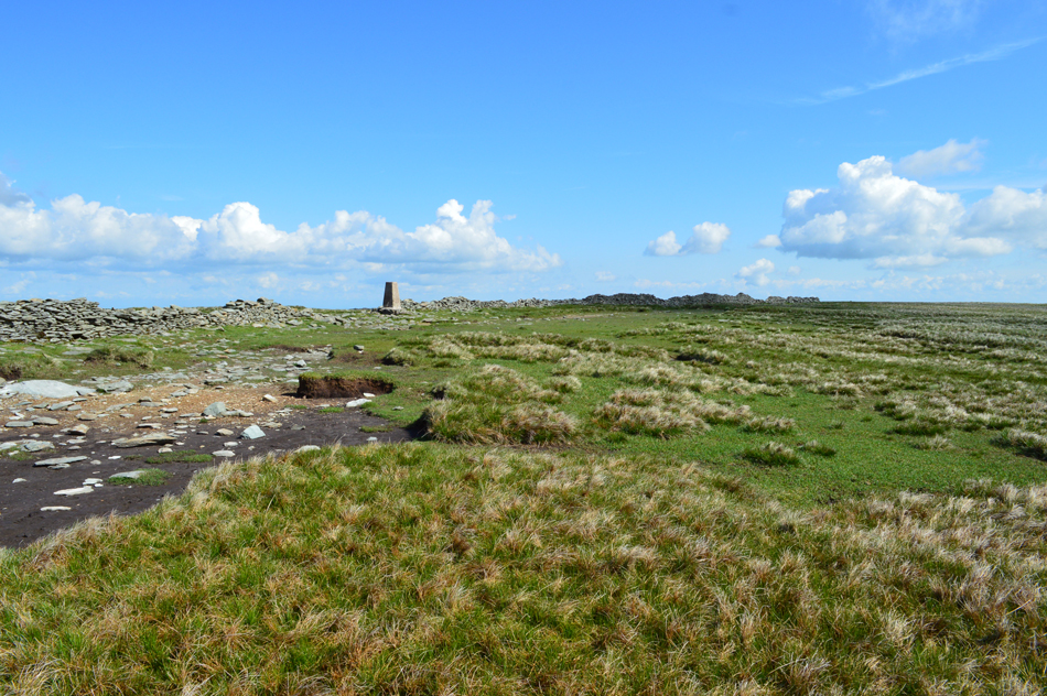
High Street |
 |
 |
Overview |
 |
|
| Height: |
2,718 Feet - 828 Metres |
| Grid Ref: |
NY 440 110 |
| Area: |
Far Eastern |
| Group: |
E/HST |
| Ordnance Survey: |
OL5 |
| Wainwright Guidebook: |
Two |
 |
"A striking range in grandeur and wilderness"
The range forms across the eastern spirit of Lakeland, providing a splendid full days march at a consistently high altitude, but is, distant to the areas most favoured by the fell walker and is comparatively unfrequented, appealing mainly to the lovers of mountain solitude.

|
|
| |
|
There are 57 walks to choose from including High Street |
|
|
A Riggindale Round |
|
|
 |
|
1st May 2026 |
| ASCENT: |
2,843 Feet - 867 Metres |
| MILES: |
8.1 |
| WAINWRIGHTS: |
5, High Street - The Knott - Rampsgill Head - High Raise - Kidsty Pike |
| ROUTE: |
Mardale Head - Rough Crag - Caspel Gate Tarn - Long Stile - High Street - Straights of Riggindale - The Knott - Rampsgill Head - High Raise - Kidsty Pike - Kidsty Howes - Riggindale Beck - The Rigg - Mardale Head |
|
| |
|
A Mardale Head Circuit |
|
|
|
|
28th February 2026 |
| ASCENT: |
2,620 Feet - 799 Metres |
| MILES: |
7 |
| WAINWRIGHTS: |
3, High Street - Mardale III Bell - Harter Fell (Mardale) |
| ROUTE: |
Mardale Head - The Rigg - Rough Crag - Caspel Gate - Long Stile - High Street - Mardale III Bell - Top of Nan Bield Pass - Harter Fell (Mardale) - Little Harter Fell - Top of Gatescarth Pass - Mardale Head |
|
| |
|
High Street via The Ill Bell Ridge |
|
|
|
|
3rd January 2026 |
| ASCENT: |
3,334 Feet - 1,016 Metres |
| MILES: |
12.8 |
| WAINWRIGHTS: |
5, Yoke - III Bell - Froswick - High Street - Thornthwaite Crag |
| ROUTE: |
Church Bridge - Garburn Pass - Top of Garburn Pass - Yoke - III Bell - Froswick - High Street - Thornthwaite Crag - Scot Rake - Hagg Gill - Hagg Bridge - Ing Bridge - Ing Lane - Truss Lane - A592 - Troutbeck - Jesus Church - Church Bridge |
|
| |
|
Extended Riggindale Round |
|
|
|
|
25th August 2025 |
| ASCENT: |
3,165 Feet - 964 Metres |
| MILES: |
10.5 |
| WAINWRIGHTS: |
7, High Street - Mardale III Bell - Thornthwaite Crag - The Knott - Rampsgill Head - High Raise (Martindale) - Kidsty Pike |
| ROUTE: |
Mardale Head - The Rigg - Rough Crag - Caspel Gate - Long Stile - High Street - Mardale III Bell - Top of Hall Cove - Thornthwaite Crag - High Street - Straights of Riggindale - The Knott - Rampsgill Head - High Raise (Martindale) - Kidsty Pike - Kidsty Howes - Bowderthwaite Bridge - The Rigg - Mardale Head |
|
| |
|
Mardale Head to Cawdale |
|
|
|
|
21st June 2025 |
| ASCENT: |
2,708 Feet - 825 Metres |
| MILES: |
11 |
| WAINWRIGHTS: |
6, High Street - The Knott - Rampsgill Head - Kidsty Pike - High Raise (Martindale) - Wether Hill |
| ROUTE: |
Mardale Head - The Rigg - Rough Crag - Caspel Gate - Long Stile - High Street - Straights of Riggindale - The Knott - Rampsgill Head - High Raise (Martindale) Raven Howe - Red Crag - Wether Hill - High Kop - Low Kop - The Hause - Hause End - Cawdale |
|
| |
|
A High Level Circuit of Mardale Head |
|
|
|
|
20th April 2025 |
| ASCENT: |
3,600 Feet - 1,098 Metres |
| MILES: |
11 |
| WAINWRIGHTS: |
5, High Street - Mardale III Bell - Harter Fell (Mardale) - Branstree - Selside Pike |
| ROUTE: |
Mardale Head - Rough Crag - High Street - Mardale III Bell - Top of Nan Bield Pass - Harter Fell (Mardale) - Top of Gatescarth Pass - Branstree - Artle Crag - Selside Pike - Selside End - Old Corpse Road - Rowantreethwaite Beck - Mardale Head |
|
| |
|
50th High Street |
|
|
|
|
23rd December 2024 |
| ASCENT: |
2,456 Feet - 748 Metres |
| MILES: |
7.2 |
| WAINWRIGHTS: |
3, High Street - Rampsgill Head - Kidsty Pike |
| ROUTE: |
Mardale Head - Rough Crag - Caspel Gate Tarn - Long Stile - High Street - Straights of Riggindale - Rampsgill Head - Kidsty Pike - Kidsty Howes - Bowderthwaite Bridge - The Rigg - Mardale Head |
|
| |
|
An Alternative Hayeswater Circuit |
|
|
|
|
14th December 2024 |
| ASCENT: |
2,727 Feet - 831 Metres |
| MILES: |
8.5 |
| WAINWRIGHTS: |
5, The Knott - Rampsgill Head - High Street - Mardale III Bell - Thornthwaite Crag |
| ROUTE: |
Hartsop - Hayeswater Gill - Hayeswater - The Knott - Rampsgill Head - Two Penny Crag - High Street - Mardale III Bell - Thornthwaite Crag - Hayeswater Gill - Hayeswater - Hayeswater Gill - Hartsop |
|
| |
|
High Street & Mardale Ill Bell from Mardale Head |
|
|
|
|
1st December 2024 |
| ASCENT: |
2,073 Feet - 625 Metres |
| MILES: |
5.8 |
| WAINWRIGHTS: |
2, High Street - Mardale III Bell |
| ROUTE: |
Mardale Head - The Rigg - Rough Crag - Caspel Gate - Long Stile - High Street - Mardale III Bell - Top of Nan Bield Pass - Small Water - Small Water Beck - Mardle Head |
|
| |
|
High Street via The Ill Bell Ridge |
|
|
|
|
18th November 2024 |
| ASCENT: |
3,616 Feet - 1,102 Metres |
| MILES: |
13.2 |
| WAINWRIGHTS: |
6, Yoke - III Bell - Froswick - High Street - Thornthwaite Crag - Troutbeck Tongue |
| ROUTE: |
Church Bridge - Garburn Pass - Top of Garburn Pass - Yoke - III Bell - Froswick - High Street - Thornthwaite Crag - Scot Rake - Hagg Gill - Troutbeck Tongue - Hagg Bridge - Ing Bridge - Ing Lane - Truss Lane - A592 - Troutbeck - Jesus Church - Church Bridge |
|
| |
|
Kirkstone Pass to Hartsop via High Street |
|
|
|
|
2nd November 2024 |
| ASCENT: |
2,238 Feet - 682 Metres |
| MILES: |
7.7 |
| WAINWRIGHTS: |
4, Caudale Moor - Thornthwaite Crag - High Street - The Knott |
| ROUTE: |
Top of Kirkstone Pass - St Raven's Edge - Caudale Moor - Stony Cove Pike - Thresthwaite Mouth - Thornthwaite Crag - High Street - Straights of Riggindale - The Knott - Hayeswater Gill - Hartsop - Cow Bridge |
|
| |
|
Hayeswater Circuit |
|
|
|
|
26th October 2024 |
| ASCENT: |
2,738 Feet - 835 Metres |
| MILES: |
8 |
| WAINWRIGHTS: |
6, The Knott, Rampsgill Head - Kidsty Pike - High Street - Thornthwaite Crag - Gray Crag |
| ROUTE: |
Hartsop - Hayeswater Gill - Hayeswater - The Knott - Rampsgill Head - Kidsty Pike - Straights of Riggindale - High Street - Thornthwaite Crag - Gray Crag - Hayeswater Gill - Hartsop |
|
| |
|
A Riggindale Round |
|
|
|
|
16th September 2024 |
| ASCENT: |
2,539 Feet - 775 Metres |
| MILES: |
7.3 |
| WAINWRIGHTS: |
4, High Street - The Knott - Rampsgill Head - Kidsty Pike |
| ROUTE: |
Mardale Head - Rough Crag - Caspel Gate Tarn - Long Stile - High Street - Straights of Riggindale - The Knott - Rampsgill Head - Kidsty Pike - Kidsty Howes - Riggindale Beck - The Rigg - Mardale Head |
|
| |
|
A Riggindale Round |
|
|
|
|
19th May 2024 |
| ASCENT: |
2,539 Feet - 775 Metres |
| MILES: |
7.3 |
| WAINWRIGHTS: |
4, High Street - The Knott - Rampsgill Head - Kidsty Pike |
| ROUTE: |
Mardale Head - Rough Crag - Caspel Gate Tarn - Long Stile - High Street - Straights of Riggindale - The Knott - Rampsgill Head - Kidsty Pike - Kidsty Howes - Riggindale Beck - The Rigg - Mardale Head |
|
| |
|
Yoke via Rainsborrow Crag |
|
|
|
|
31st March 2024 |
| ASCENT: |
3,588 Feet - 1,093 Metres |
| MILES: |
12.2 |
| WAINWRIGHTS: |
6, Yoke - III Bell - Froswick - Thornthwaite Crag - High Street - Mardale III Bell |
| ROUTE: |
Kentmere Church - Hartrigg - Rainsborrow Quarry - Rainsborrow Crag - Rainsborrow Tarn - Yoke - III Bell - Froswick - Thornthwaite Crag - High Street - Mardale III Bell - Top of Nan Bield Pass - Kentmere Reservoir - Hartrigg - Kentmere Church |
|
| |
|
New Years Day on High Street |
|
|
|
|
1st January 2024 |
| ASCENT: |
2,454 Feet - 747 Metres |
| MILES: |
7 |
| WAINWRIGHTS: |
2, High Street - Kidsty Pike |
| ROUTE: |
Mardale Head - The Rigg - Rough Crag - Caspel Gate - Long Stile - High Street - Straights of Riggindale - Two Penny Crag - Kidsty Pike - Kidsty Howes - Bowderthwaite Bridge - The Rigg - Mardale Head |
|
| |
|
Extended Hayeswater Circuit |
|
|
|
|
15th October 2023 |
| ASCENT: |
3,140 Feet - 957 Metres |
| MILES: |
10.5 |
| WAINWRIGHTS: |
8, The Knott - Rampsgill Head - High Raise (Martindale) - Kidsty Pike - High Street - Mardale III Bell - Thornthwaite Crag - Gray Crag |
| ROUTE: |
Hartsop - Hayeswater Gill - Hayeswater - The Knott - Rampsgill Head - High Raise (Martindale) - Kidsty Pike - Straights of Riggindale - High Street - Mardale III Bell - Top of Hall Cove - Thornthwaite Crag - Gray Crag - Hayeswater - Hayeswater Gill - Hartsop |
|
| |
|
A Riggindale Round |
|
|
|
|
4th April 2023 |
| ASCENT: |
2,539 Feet - 775 Metres |
| MILES: |
7.3 |
| WAINWRIGHTS: |
4, High Street - The Knott - Rampsgill Head - Kidsty Pike |
| ROUTE: |
Mardale Head - Rough Crag - Caspel Gate Tarn - Long Stile - High Street - Straights of Riggindale - The Knott - Rampsgill Head - Kidsty Pike - Kidsty Howes - Riggindale Beck - The Rigg - Mardale Head |
|
| |
|
New Years Day on High Street |
|
|
|
|
1st January 2024 |
| ASCENT: |
2,620 Feet - 799 Metres |
| MILES: |
7 |
| WAINWRIGHTS: |
3, High Street - Mardale III Bell - Harter Fell (Mardale) |
| ROUTE: |
Mardale Head - The Rigg - Rough Crag - Caspel Gate - Long Stile - High Street - Mardale III Bell - Top of Nan Bield Pass - Harter Fell (Mardale) - Little Harter Fell - Top of Gatescarth Pass - Mardale Head |
|
| |
|
A Mardale Head Circuit |
|
|
|
|
11th October 2022 |
| ASCENT: |
2,620 Feet - 799 Metres |
| MILES: |
7 |
| WAIMWRIGHTS: |
3, High Street - Mardale III Bell - Harter Fell (Mardale) |
| ROUTE: |
Mardale Head - The Rigg - Rough Crag - Caspel Gate - Long Stile - High Street - Mardale III Bell - Top of Nan Bield Pass - Harter Fell (Mardale) - Little Harter Fell - Top of Gatescarth Pass - Mardale Head |
|
| |
|
A Riggindale Round |
|
|
|
|
27th August 2022 |
| ASCENT: |
2,680 Feet - 817 Metres |
| MILES: |
7.6 |
| WAINWRIGHTS: |
4, High Street - The Knott - Rampsgill Head - Kidsty Pike |
| ROUTE: |
Mardale Head - Rough Crag - Caspel Gate Tarn - Long Stile - High Street - Straights of Riggindale - The Knott - Rampsgill Head - Kidsty Pike - Riggindale Beck - The Rigg - Mardale Head |
|
| |
|
High Street from Burnbanks |
|
|
|
|
14th May 2022 |
| ASCENT: |
3,461 Feet - 1,055 Metres |
| MILES: |
16 |
| WAINWRIGHTS: |
6, Wether Hill - Rampsgill Head - The Knott High Street - Kidsty Pike - High Raise |
| ROUTE: |
Burnbanks - Burn Banks - Four Stones Hill - Low Kop - High Kop - Wether Hill - Red Crag - Raven Howe - High Raise (no summit) - Rampsgill Head - The Knott - Straights of Riggindale - High Street - Straights of Riggindale - Kidsty Pike - High Raise - Low Raise - Long Grain - Measand End - Pultsgill Sike - Measand Beck - Haweswater Shore Path - Burnbanks |
|
| |
|
A Mardale Head Circuit |
|
|
|
|
10th December 2021 |
| ASCENT: |
2,588 Feet - 789 Metres |
| MILES: |
7 |
| WAINWRIGHTS: |
3, Harter Fell (Mardale) - Mardale III Bell - High Street |
| ROUTE: |
Mardale Head - Gatescarth Pass - Harter Fell (Mardale) - Top of Nan Bield Pass - Mardale III Bell - High Street - Long Stile - Gaspel Gate - Rough Crag - The Rigg - Mardale Head |
|
| |
|
High Street, Thornthwaite Crag & Pasture Bottom from Hartsop |
|
|
|
|
11th April 2021 |
| ASCENT: |
2,619 Feet - 798 Metres |
| MILES: |
8 |
| WAINWRIGHTS: |
4, The Knott - High Street - Mardale III Bell - Thornthwaite Crag - |
| ROUTE: |
Hartsop - Hayeswater Gill - The Knott - Straights of Riggindale - High Street - Mardale III Bell - Top of Hall Cove - Thornthwaite Crag - Thresthwaite Mouth - Pasture Bottom - Pasture Beck - Hartsop |
|
| |
|
Hayeswater Circuit |
|
|
|
|
14th July 2020 |
| ASCENT: |
2,738 Feet - 835 Metres |
| MILES: |
8 |
| WAINWRIGHTS: |
6, The Knott, Rampsgill Head - Kidsty Pike - High Street - Thornthwaite Crag - Gray Crag |
| ROUTE: |
Hartsop - Hayeswater Gill - Hayeswater - The Knott - Rampsgill Head - Kidsty Pike - Straights of Riggindale - High Street - Thornthwaite Crag - Gray Crag - Hayeswater Gill - Hartsop |
|
| |
|
A Riggindale Round |
|
|
|
|
7th February 2020 |
| ASCENT: |
2,843 Feet - 867 Metres |
| MILES: |
8.1 |
| WAINWRIGHTS: |
5, High Street - The Knott - Rampsgill Head - High Raise - Kidsty Pike |
| ROUTE: |
Mardale Head - Rough Crag - Caspel Gate Tarn - Long Stile - High Street - Straights of Riggindale - The Knott - Rampsgill Head - High Raise - Kidsty Pike - Kidsty Howes - Riggindale Beck - The Rigg - Mardale Head |
|
| |
|
A Riggindale Round |
|
|
|
|
4th December 2019 |
| ASCENT: |
2,533 Feet - 772 Metres |
| MILES: |
6.5 |
| WAINWRIGHTS: |
3, High Street - Rampsgill Head - Kidsty Pike |
| ROUTE: |
Mardale Head - Rough Crag - Caspel Gate Tarn - Long Stile - High Street - Straights of Riggindale - Rampsgill Head - Kidsty Pike - Kidsty Howes - Riggindale Beck - The Rigg - Mardale Head |
|
| |
|
A Mardale Head Circuit |
|
|
|
|
27th October 2019 |
| ASCENT: |
2,646 Feet - 806 Metres |
| MILES: |
6.4 |
| WAINWRIGHTS: |
3, High Street - Mardale III Bell - Harter Fell (Mardale) |
| ROUTE: |
Mardale Head - The Rigg - Rough Crag - High Street - Mardale III Bell - Top of Nan Bield Pass - Harter Fell (Mardale) - Harter Fell North Ridge - Mardale Head |
|
| |
|
A Riggindale Round |
|
|
|
|
29th June 2019 |
| ASCENT: |
2,843 Feet - 867 Metres |
| MILES: |
8.1 |
| WAINWRIGHTS: |
5, High Street - The Knott - Rampsgill Head - High Raise - Kidsty Pike |
| ROUTE: |
Mardale Head - Rough Crag - Caspel Gate Tarn - Long Stile - High Street - Straights of Riggindale - The Knott - Rampsgill Head - High Raise - Kidsty Pike - Kidsty Howes - Riggindale Beck - The Rigg - Mardale Head |
|
| |
|
A Riggindale Round |
|
|
|
|
5th September 2018 |
| ASCENT: |
2,539 Feet - 775 Metres |
| MILES: |
7.3 |
| WAINWRIGHTS: |
4, High Street - The Knott - Rampsgill Head - Kidsty Pike |
| ROUTE: |
Mardale Head - Rough Crag - Caspel Gate Tarn - Long Stile - High Street - Straights of Riggindale - The Knott - Rampsgill Head - Kidsty Pike - Kidsty Howes - Riggindale Beck - The Rigg - Mardale Head |
|
| |
|
A Riggindale Round |
|
|
|
|
25th November 2017 |
| ASCENT: |
2,843 Feet - 867 Metres |
| MILES: |
8.1 |
| WAINWRIGHTS: |
5, High Street - The Knott - Rampsgill Head - High Raise - Kidsty Pike |
| ROUTE: |
Mardale Head - Rough Crag - Caspel Gate Tarn - Long Stile - High Street - Straights of Riggindale - The Knott - Rampsgill Head - High Raise - Kidsty Pike - Kidsty Howes - Riggindale Beck - The Rigg - Mardale Head |
|
| |
|
High Street and Mardale III Bell |
|
|
|
|
16th November 2017 |
| ASCENT: |
2,708 Feet - 825 Metres |
| MILES: |
6 |
| WAINWRIGHTS: |
2, High Street - Mardale III Bell |
| ROUTE: |
Mardale Head - The Rigg - Rough Crag - Caspel Gate - High Street - Mardale III Bell - Top of Nan Bield Pass - Small Water - Small Water Beck - Mardale Head |
|
| |
|
A Riggindale Round |
|
|
|
|
26th August 2017 |
| ASCENT: |
2,770 Feet - 844 Metres |
| MILES: |
10.6 |
| WAINWRIGHTS: |
5, High Street - The Knott - Rampsgill Head - Kidsty Pike - High Raise (Martindale) |
| ROUTE: |
Mardale Head - The Rigg - Rough Crag - Caspel Gate - Long Stile - High Street - Straights of Riggindale - The Knott - Rampsgill Head - Kidsty Pike - High Raise (Martindale) - Low Raise - Castle Crag (Fort) - Randale Beck - Riggindale Beck - The Rigg - Mardale Head |
|
| |
|
High Street via The Ill Bell Ridge from Troutbeck Bridge |
|
|
|
|
5th August 2017 |
| ASCENT: |
3,817 Feet - 1,164 Metres |
| MILES: |
14 |
| WAINWRIGHTS: |
5, Yoke - Ill Bell - Froswick - Mardale III Bell - High Street |
| ROUTE: |
Troutbeck Bridge - Garburn Pass - Garburn Nook - Yoke - Ill Bell - Froswick - Top of Hall Cove - Mardale III Bell - High Street - Thornthwaite Crag - Scotts Rake - Hagg Gill - Hagg Bridge - Ing Bridge - Ing Lane - Truss Lane - A591 - Troutbeck - Jesus Church - Troutbeck Bridge |
|
| |
|
Caudale Moor to Brock Crags via High Street |
|
|
|
|
1st July 2017 |
| ASCENT: |
4,374 Feet - 1,334 Metres |
| MILES: |
14 |
| WAINWRIGHTS: |
10, Caudale Moor (Stoney Cove Pike) - Thornthwaite Crag - High Street - Kidsty Pike - High Raise (Martindale) - Rampsgill Head - The Knott - Rest Dodd - Angletarn Pikes - Brock Crags |
| ROUTE: |
Cow Bridge - Brothers Water - Hartsop Hall - Sykeside - Kirkstone Pass - Caudale Beck - Caudale Quarry - Caudale Moor (Stoney Cove Pike) - Threshthwaite Mouth - Thornthwaite Crag - High Street - Straights of Riggindale - Kidsty Pike - High Raise (Martindale) - Rampsgill Head - The Knott - Rest Dodd - Satura Crag - Angle Tarn - Angletarn Pikes - Cat Crag - Brock Crags - Hartsop - Cow Bridge |
|
| |
|
A High Level Circuit of Mardale Head |
|
|
|
|
3rd June 2017 |
| ASCENT: |
3,600 Feet - 1,098 Metres |
| MILES: |
11 |
| WAINWRIGHTS: |
5, High Street - Mardale III Bell - Harter Fell (Mardale) - Branstree - Selside Pike |
| ROUTE: |
Mardale Head - Rough Crag - High Street - Mardale III Bell - Top of Nan Bield Pass - Harter Fell (Mardale) - Adam Seat - Top of Gatescarth Pass - Branstree - Artle Crag - Selside Pike - Selside End - Old Corpse Road - Rowantreethwaite Beck - Mardale Head |
|
| |
|
A Riggindale Round from Mardale Head |
|
|
|
|
27th December 2016 |
| ASCENT: |
2,843 Feet - 867 Metres |
| MILES: |
8.1 |
| WAINWRIGHTS: |
5, High Street - The Knott - Rampsgill Head - High Raise - Kidsty Pike |
| ROUTE: |
Mardale Head - Rough Crag - Caspel Gate Tarn - Long Stile - High Street - Straights of Riggindale - The Knott - Rampsgill Head - High Raise - Kidsty Pike - Kidsty Howes - Riggindale Beck - The Rigg - Mardale Head |
|
| |
|
Walking the Wainwrights in 30 Walks - Walk 20 Fourteen Fells east of Ullswater |
|
|
|
|
3rd July 2016 |
| ASCENT: |
4,790 Feet - 1,460 Meters |
| MILES: |
19.9 |
| WAINWRIGHTS: |
14, Bonscale Fell - Arthurs Pike - Loadpot Hill - Wether Hill - High Raise (Martindale) - Kidsty Pike - Rampsgill Head - High Street - The Knott - Rest Dodd - The Nab - Brock Crags - Angletarn Pikes - Beda Fell |
| ROUTE: |
Martindale New Church - Mellgaurds - Bonscale Pike - Top of Swarth Beck - Arthurs Pike - Loadpot Hill - Wether Hill - Red Crag - High Raise (Martindale) - Rampsgill Head - Kidsty Pike - Straights of Riggindale - High Street - Straights of Riggindale - The Knott - Rest Dodd - The Nab - Satura Crag - Brock Crags - Angletarn Pikes - Heckbeck Head - Beda Knott - Beda Fell - Winter Crag - Martindale Old Church - Martindale New Church |
|
| |
|
High Street and Mardale III Bell North Ridge |
|
|
|
|
30th May 2016 |
| ASCENT: |
2,200 Feet - 671 Meters |
| MILES: |
5.8 |
| WAINWRIGHTS: |
2, High Street - Mardale III Bell |
| ROUTE: |
Mardale Head - Rough Crag - High Street - Mardale III Bell - Mardale Ill Bell North Ridge - Blea Water - Dudderwick - Mardale Head |
|
| |
|
Riggindale, Short Stile and a High Street skyline |
|
|
|
|
3rd October 2015 |
| ASCENT: |
2,913 Feet - 889 Meters |
| MILES: |
9.5 |
| WAINWRIGHTS: |
4, Kidsty Pike - High Raise (Martindale) - Rampsgill Head - High Street |
| ROUTE: |
Mardale Head - The Rigg - Riggindale - Riggindale Beck - Short Stile - Straights of Riggindale - Kidsty Pike - High Raise (Martindale) - Rampsgill Head - Straights of Riggindale - High Street - Caspel Gate - Rough Crag - The Rigg - Mardale Head |
|
| |
|
The Harry Griffin 2,000 footers Walk 14 -Walking High Street |
|
|
|
|
23rd May 2015 |
| ASCENT: |
3,864 Feet - 1,178 Metres |
| MILES: |
12 |
| SUMMITS OVER 2,000 Ft: |
Loadpot Hill - Wether Hill (NY 456 167) Wether Hill (NY 455 163) - Red Crag - Raven Howe - High Raise - Kidsty Pike - Rampsgill Head - The Knott - Rest Dodd - High Street - Rough Crag |
| ROUTE: |
Martindale New Church - Howtown - Fusedale - Brock Crag - Loadpot Hill - Wether Hill - Red Crag - Raven How - High Raise - Kidsty Pike - Rampsgill Head - The Knott - Straights of Riggindale - High Street - Rough Crag - Mardale Head |
|
| |
|
Angletarn Pikes to Gray Crag from Hartsop |
|
|
|
|
31st January 2015 |
| ASCENT: |
2,800 Feet – 853 Meters |
| MILES: |
10.4 |
| WAINWRIGHTS: |
2,800 Feet – 853 Meters |
| ROUTE: |
Hartsop – Dubhow – Boredale Hause – Angletarn Pikes – Angle Tarn – Satura Crag – The Knott – Straights of Riggingdale – High Street – Thornthwaite Crag – Gray Crag – Hartsop |
|
| |
|
A Riggindale Round |
|
|
|
|
12th October 2014 |
| ASCENT: |
2,960 Feet 902 Meters |
| MILES: |
8.5 |
| WAINWRIGHTS: |
5, High Street – The Knott – Rampsgill Head – Kidsty Pike – High Raise |
| ROUTE: |
Mardale Head – Rough Crag (Riggindale) – Caspel Gate Tarn – Long Stile – High Street – Straights of Riggindale – The Knott – Rampsgill Head – Kidsty Pike – High Raise – Low Raise – Castle Crag (Mardale) – The Rigg – Mardale Head |
|
| |
|
The Hayeswater Fells from Hartsop |
|
|
|
|
10th November 2013 |
| ASCENT: |
2,600ft, 793 Meters |
| MILES: |
7.6 |
| WAINWRIGHTS: |
4, The Knott – High Street – Thornthwaite Crag – Gray Crag |
| ROUTE: |
Hartsop – Hayeswater – The Knott – Straights of Riggindale – High Street – Thornthwaite Crag – Gray Crag – Hayeswater – Filter House – Hartsop |
|
| |
|
High Street via Rough Crag |
|
|
|
|
3rd August 2013 |
| ASCENT: |
2,637 Feet, 758 Meters |
| MILES: |
7.9 |
| WAINWRIGHTS: |
3, High Street – Rampsgill Head – Kidsty Pike |
| ROUTE: |
Mardale Head – The Rigg – Rough Crag – Caspelgate Tarn – Long Stile – High Street – Straights of Riggindale – Rampsgill Head – Kidsty Pike – Kidsty Howes – The Rigg – Mardale Old Road – Mardale Head |
|
| |
|
A Riggindale Round |
|
|
|
|
3rd January 2013 |
| ASCENT: |
2,139 Feet, 663 Metres |
| MILES: |
8 |
| WAINWRIGHTS: |
5, Mardale lll Bell – High Street – Kidsty Pike – Rampsgill Head – High Raise |
| ROUTE: |
Mardale Head – Small Water Beck – Small Water – Nan Bield Pass – Mardale lll Bell – High Street – Straights of Riggindale – Kidsty Pike – Rampsgill Head – High Raise – Low Raise – Birks Crag – Lady’s Seat – Band End – Bowderthwaite Bridge – The Rigg – Mardale Head |
|
| |
|
One year on… |
|
|
|
|
27th October 2012 |
| ASCENT: |
3,713 Feet, 1,132 Metres |
| MILES: |
12.8 |
| WAINWRIGHTS: |
5, Place Fell – Angletarn Pikes – The Knott – High Street – Thornthwaite Crag |
| ROUTE: |
Hartsop – Dubhow – Beckstones – Crookabeck – Rooking – Side Farm – Place Fell – Round How – Steel Edge – Boredale Hause – Angletarn Pikes – Angle Tarn – Satura Crag – The Knott – Straights Of Riggindale – High Street – Thornthwaite Crag – Thresthwaite Mouth – Pasture Bottom – Pasture Beck - Hartsop |
|
| |
|
The High Street Roman Road - 'Brocavvm to Galava' |
|
|
|
|
30th June 2012 |
| ASCENT: |
4’000 Feet, 1,219 Metres |
| MILES: |
5, Wether Hill, High Raise, Rampsgill Head, High Street & Thornthwaite Crag |
| WAINWRIGHTS: |
25.1 |
| ROUTE: |
Brougham Castle – BROCAVVM ROMAN FORT (Penrith) – Brougham Hall – Eamont Bridge – Yanwath – Tirril – Celleron -Winder Hall Farm – Moor Divock – Lambert Lad – Loadpot Hill – Wether Hill – Red Crag (High Street) – Raven Howe – High Raise (Martindale) – Rampsgill Head – Two Penny Crag -Straits of Riggindale – High Street – Thornthwaite Crag – Thornthwaite Beacon – Park Fell – Hagg Gill – Troutbeck Park – Ing Lane – Troutbeck – Truss Lane – A592 – Robin Lane – Jenkin Crag – High Skelghyll – Skelghyll Wood – A591 – A5075 – GALAVA ROMAN FORT (Ambleside) |
|
| |
|
Dodging The Showers On High Street |
|
|
|
|
7th May 2011 |
| ASCENT: |
3,406 Feet, 1,038 Meters |
| MILES: |
7.7 |
| WAINWRIGHTS: |
4, The Knott, High Street, Caudale Moor, Hartsop Dodd |
| ROUTE: |
Hartsop - Hayewater Gill - The Knott - Straighst of Riggindale - High Street - Thornthwaite Crag - Thresthwaite Mouth - Stony Cove Pike - Caudale Moor - Hartsop Dodd - Hartsop |
|
| |
|
The Kentmere Horseshoe |
|
|
|
|
6th March 2011 |
| ASCENT: |
4,040 Feet - 1,231 Metres |
| MILES: |
13.9 |
| WAINWRIGHTS: |
10, Sallows, Yoke, III Bell, Froswick, Thornthwaite Crag, High Street, Mardale III Bell, Harter Fell (Mardale), Kentmere Pike & Shipman Knotts |
| ROUTE: |
Kentmere - Garburn Pass - Sallows - Yoke - III Bell - Froswick - Thornthwaite Crag - High Street - Mardale III Bell - Harter Fell - Brown Howe - Kentmere Pike - Shipman Knotts - Stile End - High Lane - Kentmere |
|
| |
|
An Afternoon On The Eastern Fells |
|
|
|
|
7th November 2010 |
| ASCENT: |
2,600 Ft, 793 Metres |
| MILES: |
8 |
| WAINWRIGHTS: |
4, Kidsty Pike, High Raise, Rampsgill Head & High Street |
| ROUTE: |
Mardale Head - The Rigg - Kidsty Howes - Kidsty Pike - High Raise - Rampsgill Head - Straights of Riggindale - High Street - Rough Crag - The Rigg - Mardale Head |
|
| |
|
Harter Fell to Kidsty Pike |
|
|
|
|
17th October 2009 |
| ASCENT: |
2,646 Feet - 806 Metres |
| MILES: |
6.4 |
| WAINWRIGHTS: |
4 Harter Fell, Mardale III Bell, High Street, Kidsty Pike |
| ROUTE: |
Mardale Head - Gatescarth Pass - Harter Fell - Top of Nan Bield Pass - Mardale III Bell - High Street - Straights of Riggindale - Kidsty Pike - Kidsty Howes - The Rigg - Mardale Head |
|
| |
|
High Street From Patterdale |
|
|
|
|
8th February 2009 |
| ASCENT: |
828 Mtrs 2718 ft |
| MILES: |
11 |
| WAINWRIGHTS: |
3 Angletarn Pikes, The Knott, High Street |
| ROUTE: |
Patterdale - Rooking - Boredale Hause - Angletarn Pikes - Satura Crag - The Knott - Straights of Riggindale - High Street - Straights of Riggindale - Satura Crag - Boredale Hause - Rooking - Patterdale |
|
| |
|
High Street From Mardale Head |
|
|
|
|
6th December 2008 |
| ASCENT: |
2,718 Feet - 2,719 Metres |
| MILES: |
6 |
| WAINWRIGHTS: |
High Street |
| ROUTE: |
Mardale Head - The Rigg - Rough Crag - High Street - Rough Crag - The Rigg - Mardale Head |
|
| |
|
High Street From Hartsop |
|
|
|
|
11th April 2008 |
| ASCENT: |
2,718 Feet - 828 Metres |
| MILES: |
6.4 |
| WAINWRIGHTS: |
2, The Knott, High Street |
| ROUTE: |
Syke Side Camp Site - Hartsop - Hayeswater Gill - Hayeswater - The Knott - Straights of Riggindale - High Street - Straights of Riggindale - The Knott - Hayeswater - Hayeswater - Hartsop - Syke Side Camp Site |
|
| |
|
High Street from Mardale Head |
|
|
|
|
12th January 2008 |
| ASCENT: |
2,716 Feet - 827 Metres |
| MILES: |
6 |
| WAINWRIGHTS: |
High Street |
| ROUTE: |
Mardale Head - The Rigg - Rough Crag - High Street - Rough Crag - The Rigg - Mardale Head |
|
| |
| Back to top |
 |
|