|
A Mardale Head Circuit |
 |
 |
11th October 2022 |
 |
|
With a few days off work this week I set about planning a couple of walks which I had planned around the weather. On the cusp of Autumn during a wave of low pressure it wasn't the easiest of tasks.
Looking ahead this week looked a total right off but with the weekend out of the way things started to calm down and I was able to pick out a couple of days when the forecast looked to be dry and bright, today being one of those days. I don't mind cloud, in fact it can be a came changer but I can't get my head around how the forecasters can get it totally wrong.
It's been an age old question which as a fell walker I should be used to by now but that doesn't stop the frustrations creeping in. I'd originally planned a walk through the Great Langdale valley taking in Lingmoor Fell but according to the forecasters the east, and far east of the park looked the brighter day and when someone mentions the far eastern fells to me I immediately think High Street. |
|
| Wainwright Guide Book Two |
 |
| The Far Eastern Fells |
Of the many excellent climbs available from Mardale Head the direct ascent of Mardale Ill Bell ranks high, the walk being favoured by two of the finest tarns in Lakeland, each set amongst crags in wild and romantic surroundings. |
 |
|
|
|
|
| |
|
Overview |
|
|
| Ascent: |
2,620 Feet - 799 Metres |
| Wainwrights: |
3, High Street - Mardale III Bell - Harter Fell (Mardale) |
| Visiting: |
Rough Crag |
| Weather: |
Cloudy With Moderate Winds Across The Summits Highs of 12°C Lows of 9°C Feels Like 6°C |
| Parking: |
Mardale Head Car Park |
| Area: |
Far Eastern |
| Miles: |
7 |
| Walking With: |
On My Own |
| Ordnance Survey: |
OL5 |
| Time Taken: |
4 Hours |
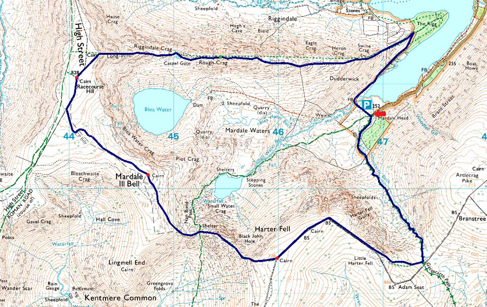
| Route: |
Mardale Head - The Rigg - Rough Crag - Caspel Gate - Long Stile - High Street - Mardale III Bell - Top of Nan Bield Pass - Harter Fell (Mardale) - Little Harter Fell - Top of Gatescarth Pass - Mardale Head |
|
| |
|
Parking Details and Map |
|
|
| Nearest Post Code: |
CA10 2RP |
| Grid Reference: |
NY 469 310 |
| Notes: |
Probably one of the most scenic car parks in Lakeland found at the head of the Mardale Valley offering easy access onto the High Street fells plus many more. The car park during Summer can fill up quickly but with most car parks in Lakeland if you time your arrival early enough your always guaranteed a parking place. Parking is free. |
|
| |
|
Map and Photo Gallery |
|
|
 |
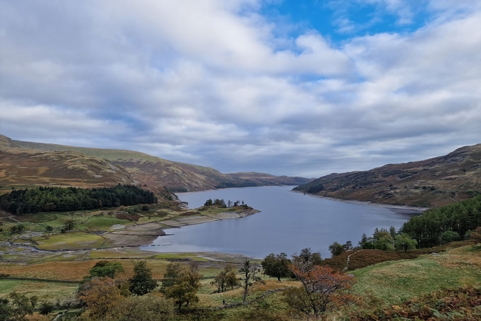
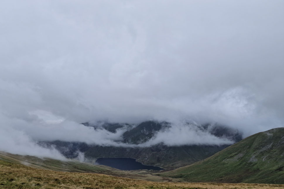
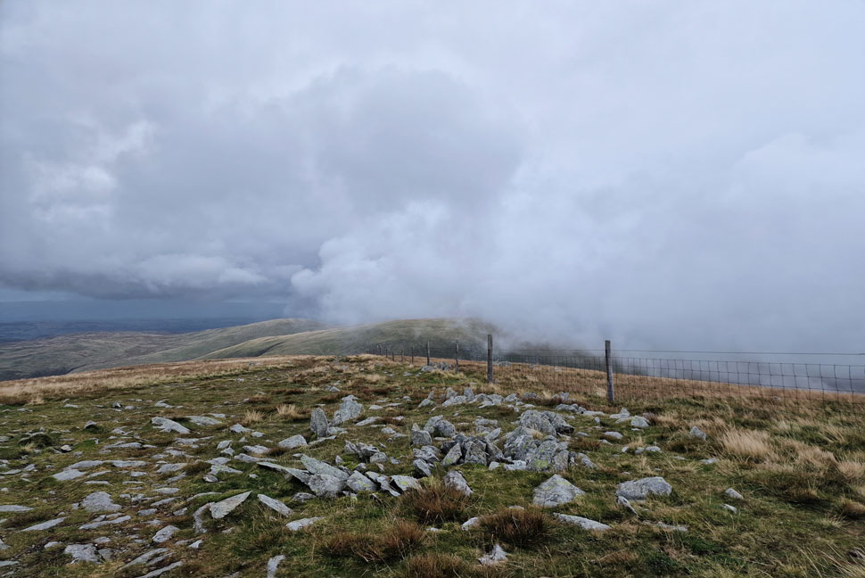
| Mardale III Bell, the Rigg, the Rough Crag Ridge, High Street, Riggindale and Kidsty Pike seen over Haweswater. |
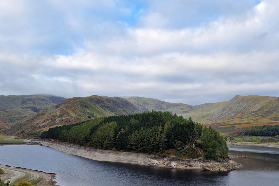
| I couldn't resist a cheeky stop as I drove towards Mardale Head to take in the view of High Street where I was shocked to find the reservoir was still as low as it was back in August when I was last here. No wonder the water companies and indeed farmers are crying out for rain. |
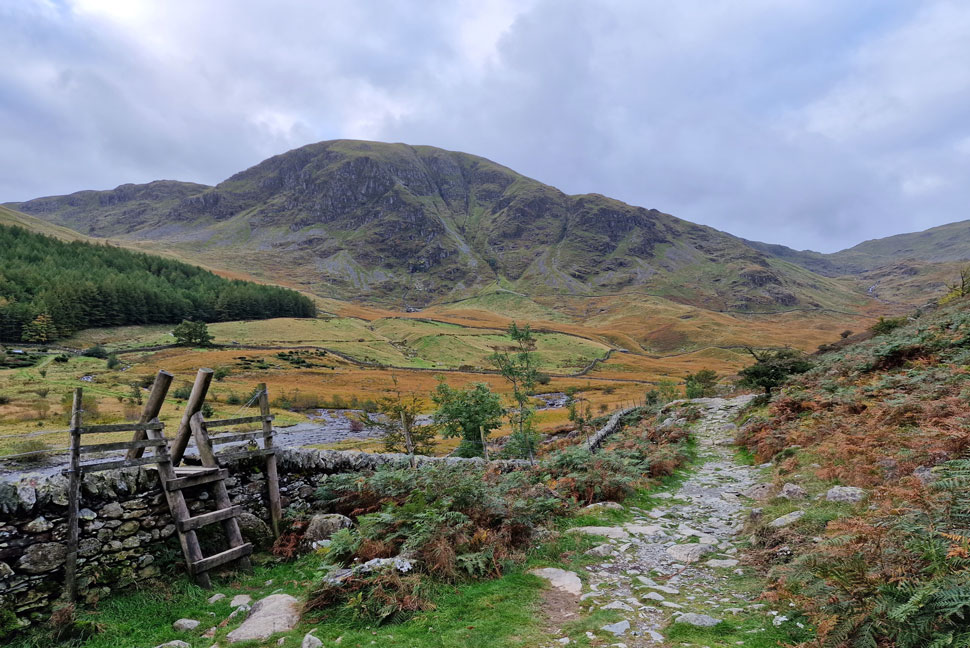 |
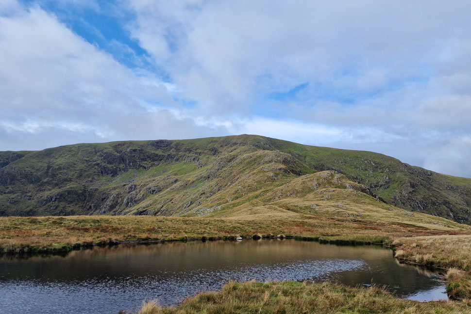
| Harter Fell (Mardale) and the top of Nan Bield Pass (right) as I head towards The Rigg 09:15am 9°C |
Even though there was a lot more cloud about than I'd anticipated down in the valley it was feeling quite mild and for now there was no need for a hat or gloves. I'd managed to park against the stone wall which divides the car park, a privileged space where I don't think I've ever parked before during all my visits to Mardale. On the opposite side of the car park a chap is also kitting up who nods a 'morning' as I lace my boots up. By the time I was ready to lock my car I noticed the chap walking the footpath close to where I took this photo so I hung around a few more minutes just so he could get a good lead on me.
As expected for a Tuesday morning the car park isn't full and the valley has a real quiet feel to it, just the way I like it. Once the chap was out of site I locked the car and passed through the Deer gate noticing just how damp underfoot it was which isn't surprising given the amount of rain we've had over the last week. I cross the footbridge over Mardale Beck and tell myself to slow down, this isn't a race, there's no rush to get home and you've no work in the morning. Perfect. |
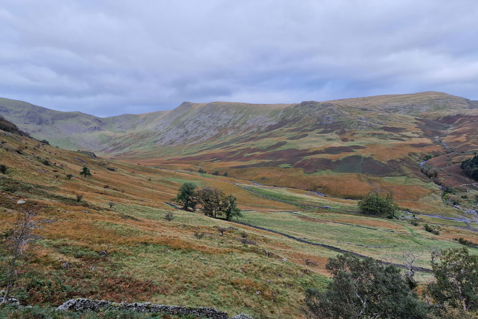 |
| Views into the Riggindale Valley. |
Autumn has reached Riggindale where the wild grasses had turned into a rich orange now that the bracken has died back while in the distance I can hear the distinct sound of the Deer rutting as I stand on the spot listening in silence to try and distinguish where the sound is coming from. Sighting no Deer the rutting continues until it fades into the distance.
Wherever the Deer where, they appear to have moved on possibly above the ridge. |
 |
| Looking back on Haweswater Reservoir. |
| With Gate Crag and Speaking Crag forming the wooded peninsula. |
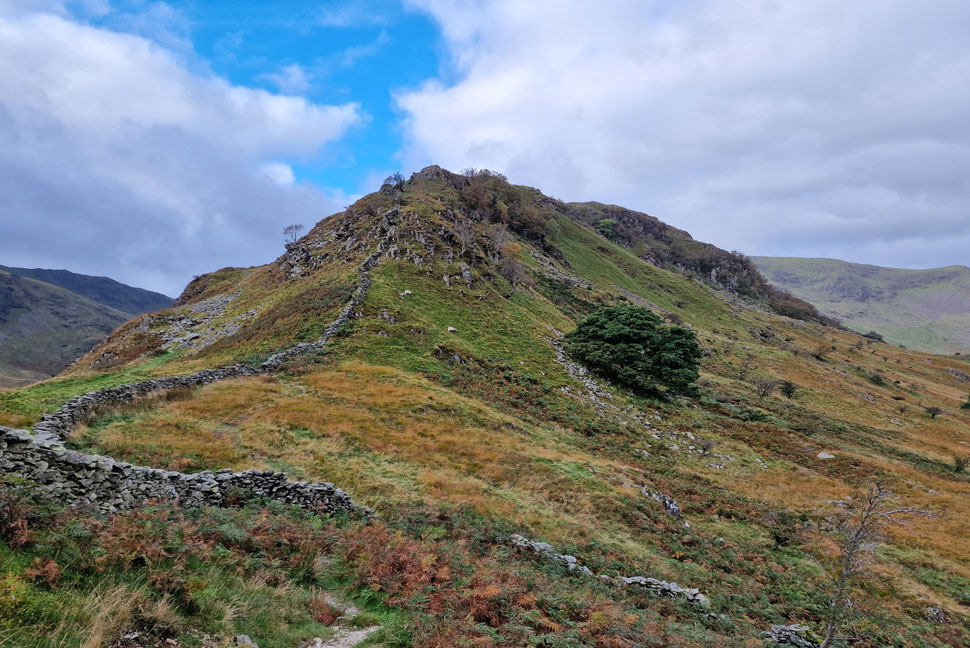 |
| Swine Crag comes into view. |
| Well, that's the last of the blue skies for now. |
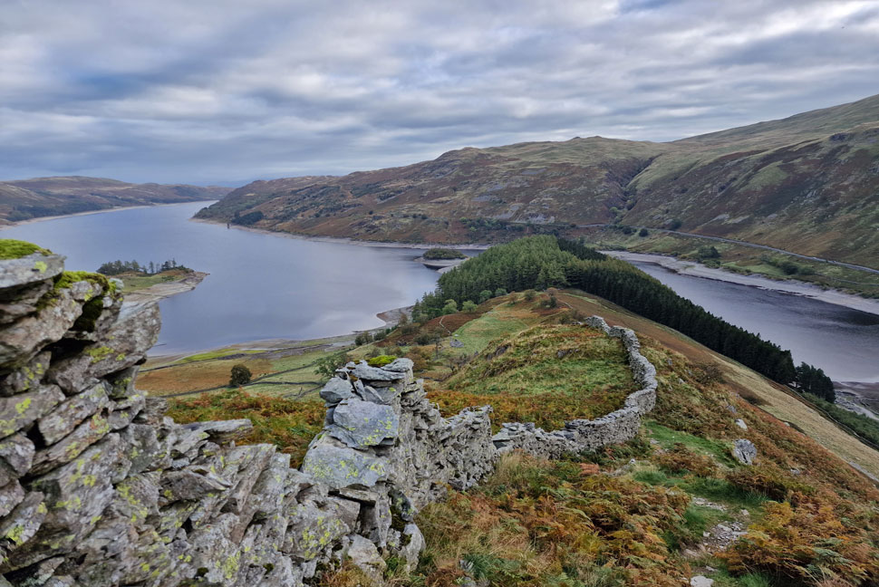 |
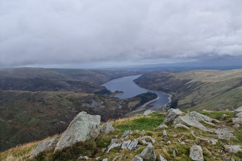
| Looking down on Haweswater Reservoir, The Rigg, Speaking Crag, Brown Howe, Hare Shaw and Rowantreethwaite Beck from Swine Crag. |
| I find it impossible to pass this viewing point without stopping to take a few photos. Whatever the weather this view is stunning. |
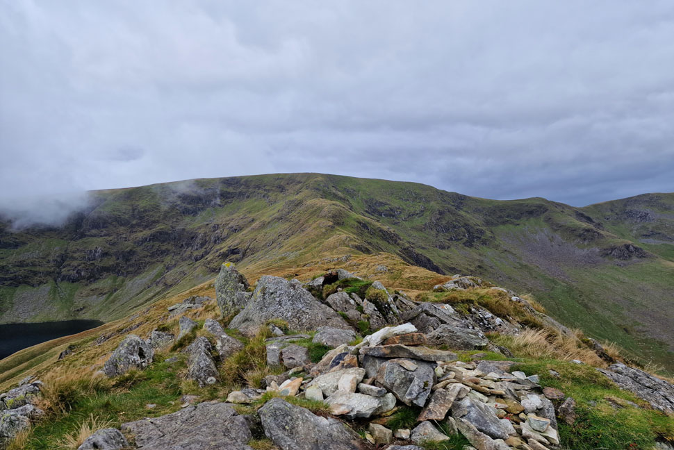 |
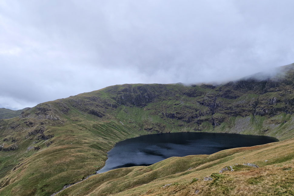
| Blea Water, Long Stile, High Street and Short Stile (right) from Rough Crag summit. |
I continued over Swine Crag and spotted the chap who had left just before me less than 50 yards ahead. I lost sight of him then spotted him again who by now had somehow gained a good 200 yards on me, jeez I muttered, this guy isn't just fast, he must have a flipping time machine! I crested Heron then Eagle Crag(s) and soon arrived at the splendid summit of Rough Crag.
From Rough Crag I took in the view up the ridge towards Caspel Gate and Long Stile where I spotted the chap again, yep the guys got a time machine I muttered again. By now any sunlight had succumbed to cloud which had overcome Mardale III Bell and was creeping over Blea Water towards High Street. The cloud seemed endless and no sooner had one wave passed another was on its way.
Yeah, Autumn has definitely reached the fells. |
 |
| Long Stile and High Street from Caspel Gate. |
| With Rough Crag behind me I detoured left and joined a single track towards Caspel Gate Tarn where I was blessed by a very momentary hint of blue sky and sunshine. |
 |
| Views over Short Stile towards Two Penny Crag, Kidsty Pike, High Raise (behind Kidsty Pike) and Low Raise seen right. |
| I seemed to be within reach of the chap again as I ascended Long Stile spotting glimpses of his blue jacket here and there. The gap lengthend again as I stopped to peer down into the Riggindale valley where I was convinced I'd spot Deer but spot nothing. |
 |
| Mardale III Bell seen above Blea Water. |
| The thought did creep into my mind whether I should head for Kidsty Pike and High Raise seeing as it was brighter further east but I choose to stick to my guns where seemingly I'd be heading into the cloud. |
 |
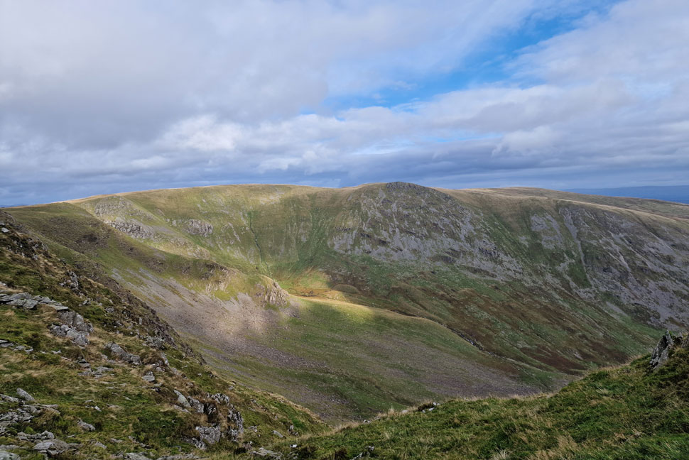
| Selside Pike and Branstree seen beyond the Rough Crag ridge. |
| With the Riggindale valley seen left and Haweswater beyond. |
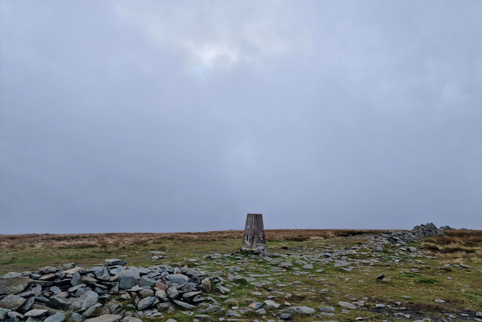 |
| High Street summit. |
I'd reached the top of Long Stile where I stopped to add a pair of gloves and a hat as my hands and ears where starting to feel the pinch by now. Feeling much more cosy I head off towards the summit trig point and spot the chap who was using the wall as a windbreak while he sat and drank from a flask. I removed my left glove and drew my wedding ring across the trig point making sure I heard the scratch before slipping my glove back on, it's a ritual that I've always done today being that little bit more significant as its my 40th High Street summit.
I pass the chap with a 'hi' and we break into conversation on where we're heading next, as it turns out the chap is from Nelson in east Lancashire and was repeating a walk that he'd last walked 20 years ago. "Looks like you'll get the clearer views" pointing towards Mardale III Bell which by now was lost in a wall of cloud. We part with 'enjoy the rest of your day'
I totally forgot to ask him where he got his time machine from! |
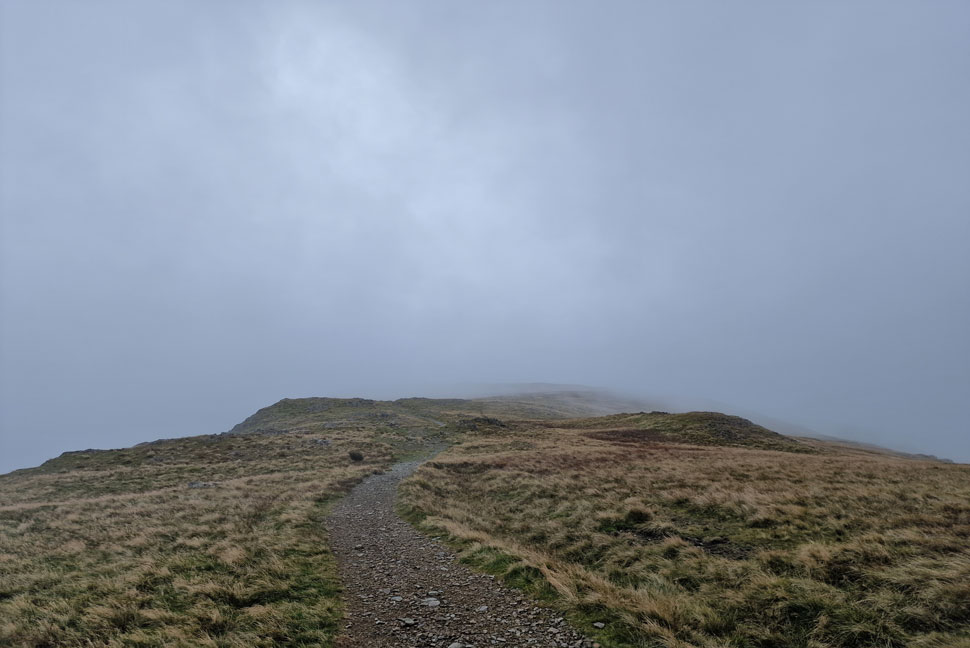 |
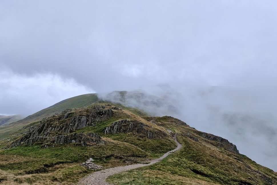
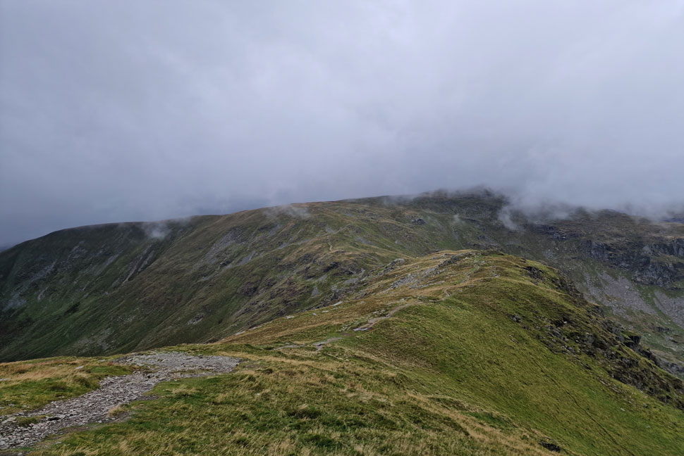
| Heading towards Mardale III Bell. |
I left the summit of High Street and followed the stone wall for a short while before parting left for the singular grassy track where visibility was cut to just 10 yards in places. After joining the stone path the cloud would part then close in again. I reached the summit in eerily silence even the wind seemed to have dropped. It's been some months since I last walked in cloud and it's easy to forget the silence it brings.
An hour ago I was down beat knowing I'd lose the views but I wouldn't change it for the world now and, it's only going to get better. |
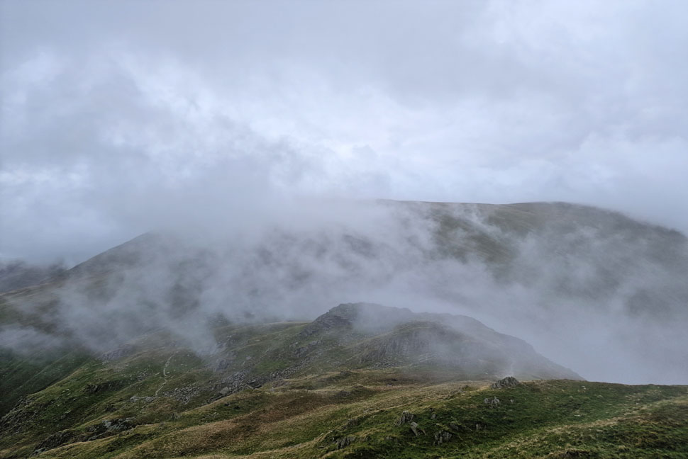 |
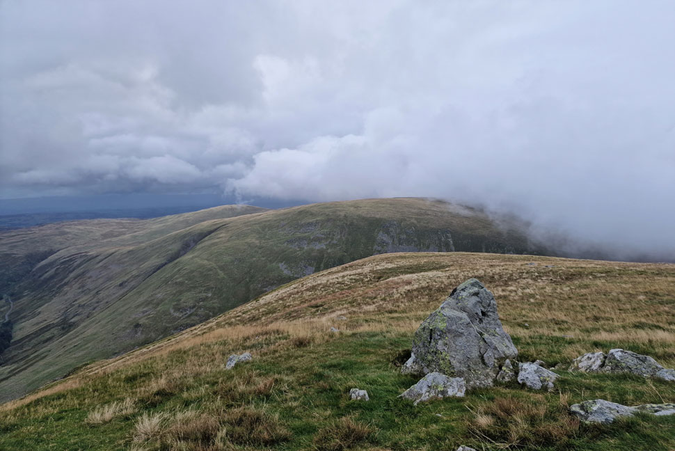
| Cloud lifting revealing Harter Fell (Mardale) |
| With Mardale III Bell behind me I began the rocky descent towards the top of Nan Bield Pass in dense cloud only for it to begin to lift the more I descended. |
 |
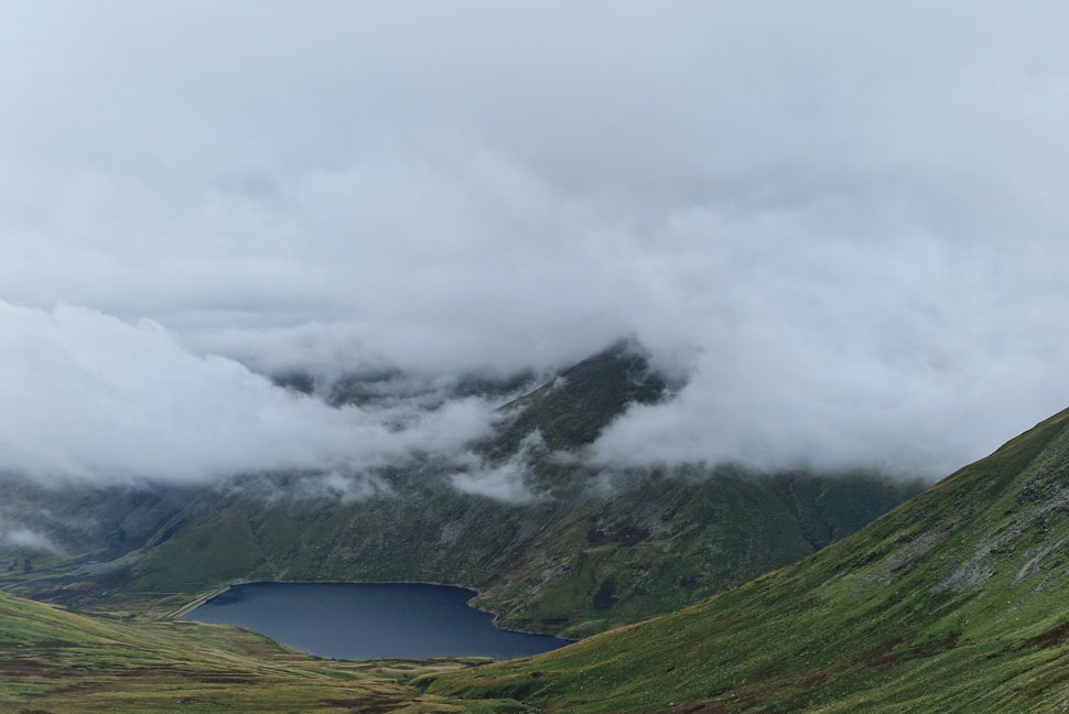
| Views down towards Kentmere Reservoir and III Bell. |
| As I descended further it became obvious that the cloud was pouring over the top of Nan Bield Pass from the Kentmere valley. |
 |
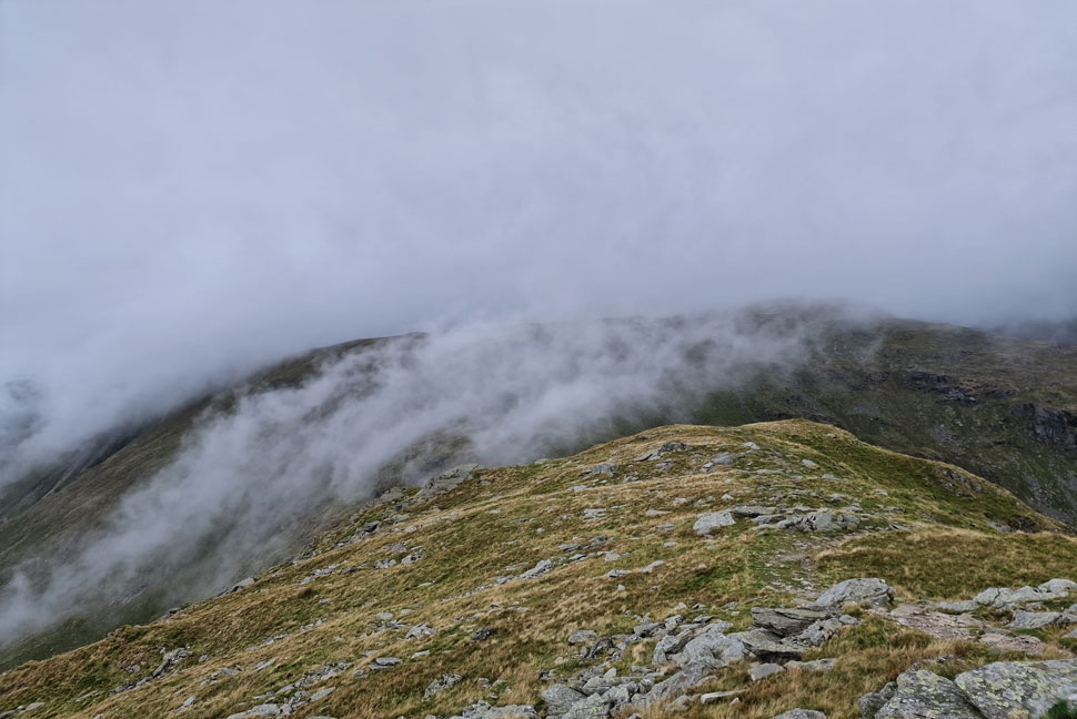
| Cloud watching. |
| As I approached the top of Nan Bield the wind strengthened and carried the cloud over the ridge sometimes obscuring Harter Fell and others leaving it completely clear. Boy have I missed scenes like this. |
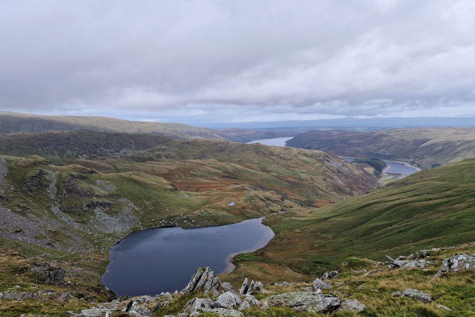 |
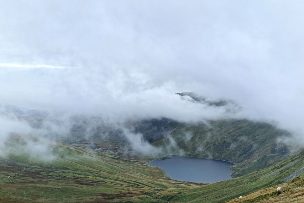
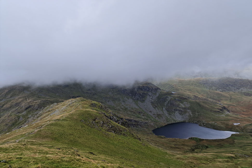
| The view down towards Small Water, the Rough Crag Ridge and Haweswater. |
| With the cloud came a little light rain which thankfully didn't amount to much. |
 |
| Kentmere Reservoir and III Bell. |
| The summit of III Bell never came into view which was kind'a sad as anyone walking along it wouldn't have had the same cloud dramatics as I had. |
 |
| I look back towards Mardale III Bell. |
| It was somewhere along here did I pass an elderly chap where 'hi's' are exchanged. |
 |
| Fan-flipping-tastic. |
| |
 |
| The view back along the ridge towards Lingmell End (left) and Mardale III Bell, below cloud (right) |
| The light rain continues. |
 |
| More cloud arrives... |
| ...as Small Water and Blea Water comes into view. |
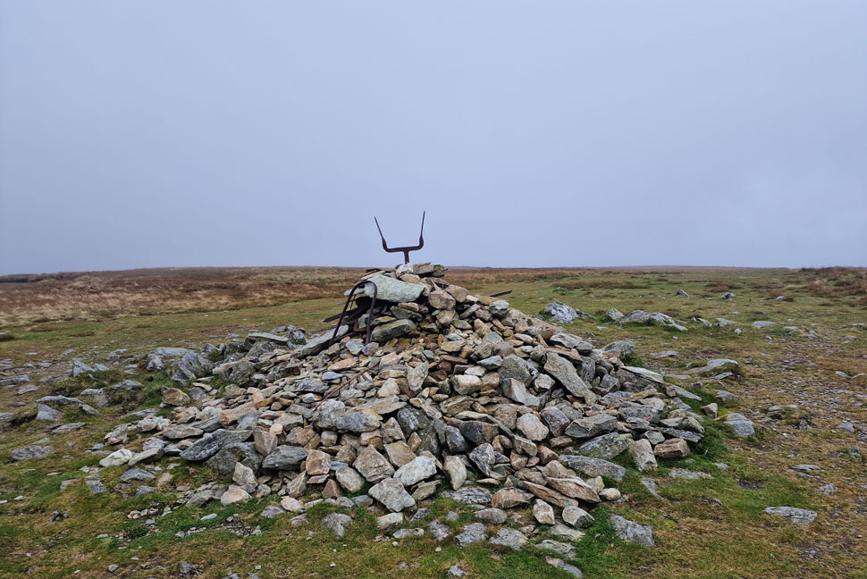 |
| Harter Fell (Mardale) summit cairn. |
| Rain was still in the air as I crested the summit and walked the short distance towards the summit cairn where more twisted old iron fencing seems to have been added. With limited views I left the summit and walked towards the third carin on the east side of the summit. |
 |
| The cloud dramatics continued. |
| This time over Branstree and Selside Pike. |
 |
| From the stones I look down onto Haweswater and The Rigg. |
| As seen from the third cairn. |
 |
| Branstree and Selside Pike from the Third Cairn. |
| |
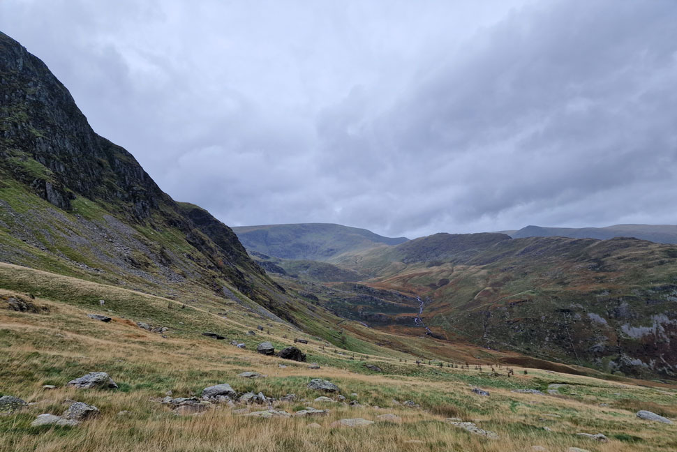 |
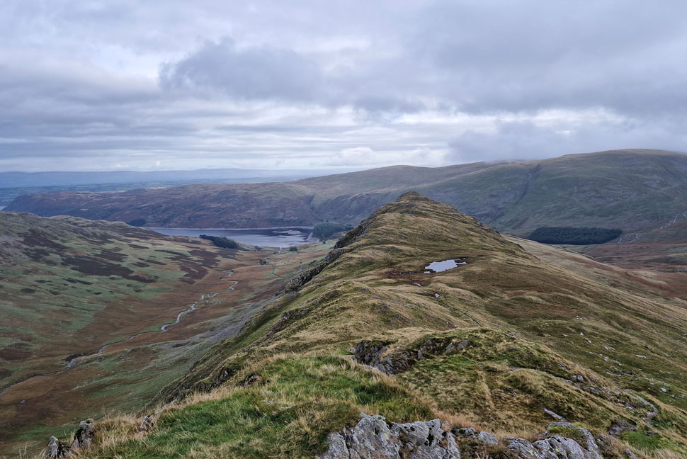
| Views over Mardale Head into Dudderwick, Blea Water Beck, the Rough Crag Ridge, High Street and Kidsty Pike. |
The rain stopped but it still felt very Autumnal across the summits as I began my descent towards the top of Gatescarth Pass. I seemed to make the descent in no time unlike the three chaps carrying mountain bikes up the pass who I passed with an "alright" "think so" one chap replied.
It was mild enough to remove my gloves but I kept my hat on through the embarrassment of hat hair. Further down the pass I pass a Norwegian woman and her dog who in broken English explained that she was only hiking to the top of the pass. We commented on the forecast which we agreed, hadn't turned out as planned before bidding each other to enjoy the rest of the day. |
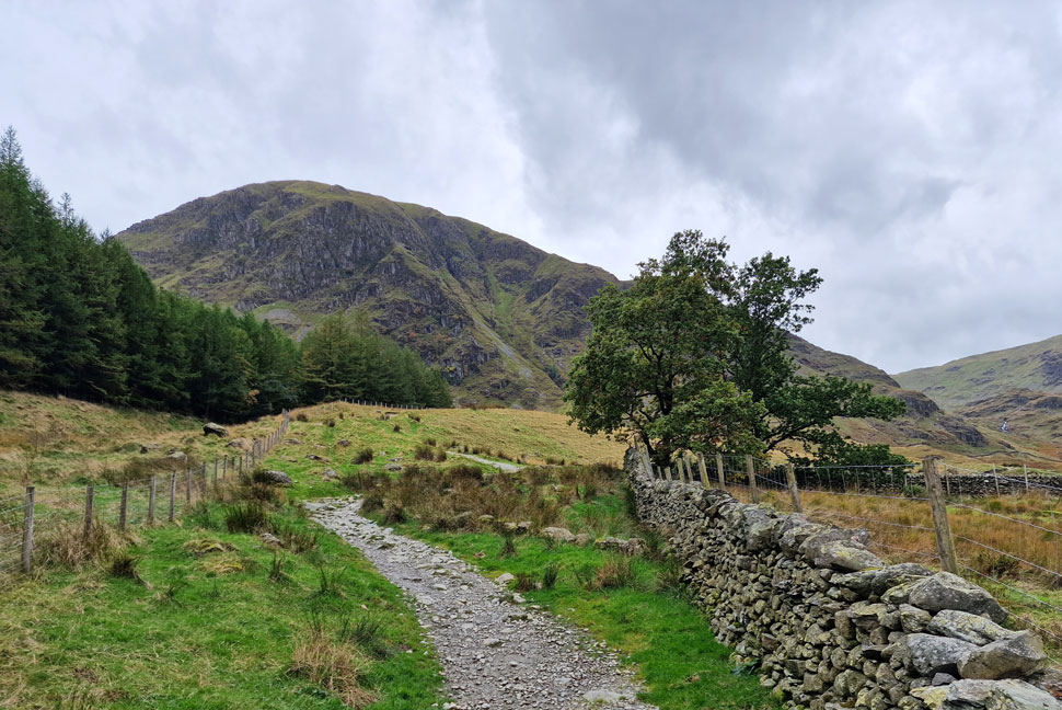 |
| Harter Fell (Mardale) from Mardale Head. |
As with most lakeland passes the ground underfoot was rough which didn't seem to hold me back as I took in the twist and turns before the pass begins to level. Peering up to Harter Fell gully I was drawn back to a conversation I had with the late Ron Black who asked me "had I ever attempted to climb it" "are you trying to kill me" I joked back. The car park was much busier now but there was still places to park as I pass through the Deer gate around the same time a lady with a Cocker Spaniel arrived from Haweswater permissive footpath "what a perfect day for walking" she cheerily smiled. I agreed while hooking my jacket into a waiting coat hanger.
I'd arrived this morning on the pretence of a much sunnier walk than what I got but what I lacked in sunshine was made up by the cloud dramatics over the Kentmere valley, the light rain that was never forecast and the feeling of solitude that only the far eastern fells can provide on a damp, cloudy weekday. |
|
| |
| Back to top |
 |
|