|
High Street and Mardale III Bell North Ridge |
 |
 |
30th May 2016 |
 |
|
In between my walking the Wainwrights project this month I had set myself two goals one of which was to climb Dow Crag via the South Rake and the other, was to return to my beloved High Street starting the walk from the one and only Mardale Head.
Usually this walk would have been done by now and my cravings would have been laid to rest yet due to my project walks and the landslip that blocked access to Mardale Head I had to wait that bit longer and before I knew it I was well into the project walks and the thought of returning to Mardale seemed a distant memory until I got wind of the news that the Landslip had been cleared by which time, my focus was on my project walks.
It is quite difficult for me to step out of anything that I am focused on due to how difficult I find it to just switch off but this weekend, it being a Bank Holiday I thought I'd kill two birds with one stone and include a project walk, and settle my craving with a return to Mardale Head, the only problem was that the evening before I was out with old friends, and well, you know how those evenings go.
It was mid morning by the time I arrived at Mardale Head and with the hangover already taken care of I secured one of the last parking spaces as I kitted up under yet another warm sun, it almost felt like I'd never been away as I thought on which route to take, initially I had planned to do a simple ascent by the Rough Crag Ridge then return via either Kidsty Pike or Mardale III Bell, but as the title suggests,I had a last minute change of plan, then a slight stumble within eyesight of my car. |
|
| Wainwright Guide Book Two |
 |
| The Far EasternFells |
-Mardale III Bell
Of the many excellent climbs available from Mardale Head the direct ascent of Mardale Ill Bell ranks high, the walk being favoured by two of the finest tarns in Lakeland, each set amongst crags in wild and romantic surroundings. |
 |
|
|
| |
|
Overview |
|
|
| Ascent: |
2,200 Feet - 671 Meters |
| Wainwrights: |
2, High Street - Mardale III Bell |
| Weather: |
Warm and Sunny turning Overcast with Sunny Spells, Highs of 21°C Lows of 18° |
| Parking: |
Mardale Head |
| Area: |
Far Eastern |
| Miles: |
5.8 |
| Walking With: |
On My Own |
| Ordnance Survey: |
OL5 |
| Time Taken: |
4 Hours 55 Minutes 09:35am to 14:30pm |
| Route: |
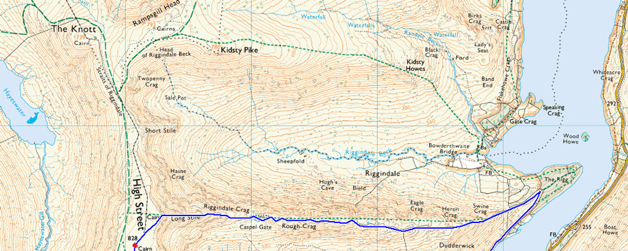
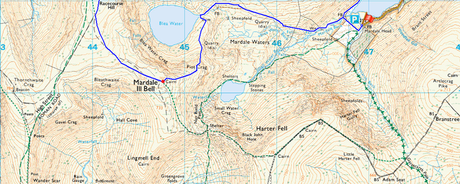
Mardale Head - Rough Crag - High Street - Mardale III Bell - Mardale Ill Bell North Ridge - Blea Water - Dudderwick - Mardale Head |
|
| |
|
Map and Photo Gallery |
|
|
 |
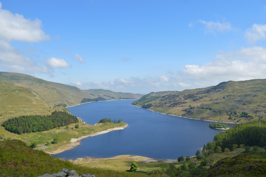
| Mardale III Bell, The Rigg, Rough Crag, High Street and Kidsty Pike from Mardale Road. |
| I couldn't help but stop to take this photo of one of my favorite views in Lakeland on route to Mardale Head. |
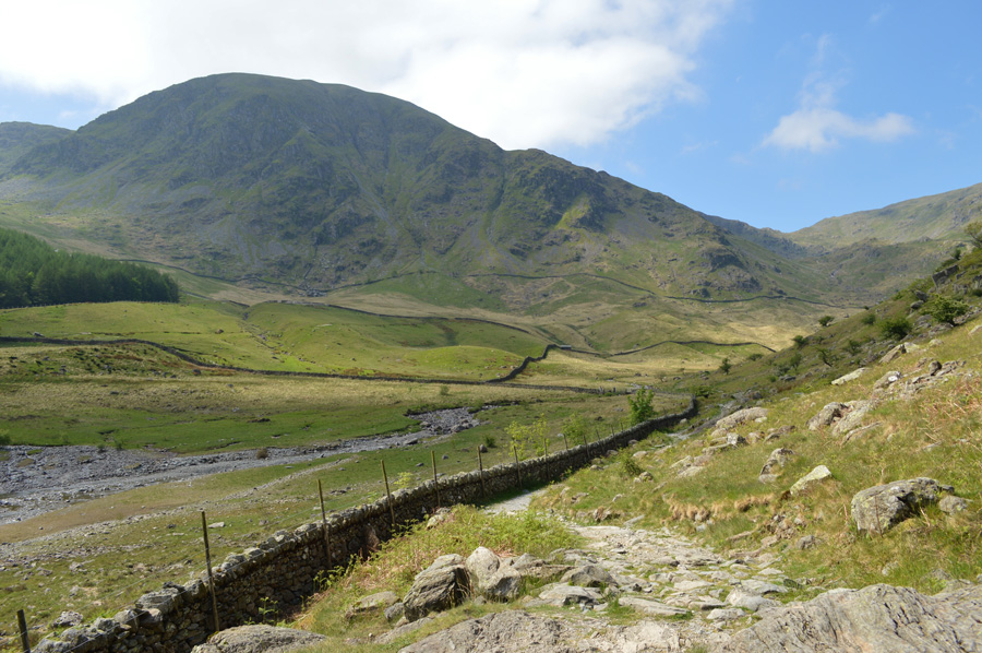 |
| Looking back on Harter Fell (Mardale) as I head towards The Rigg 09:45am 18°C |
I followed a line a four cars after passing Burnbanks through to Mardale Head two of which were motorhomes which didn't only block my views of the car park but if there were to be any spaces left, well I'm guessing the cars and motorhomes ahead would get there before me. I arrived and waited for the first motorhome to do a circuit of the car park who found he couldn't park, he then wound down his window to inform the second motorhome 'best try elsewhere' that'll do me, they soon left leaving the last parking space which I squeezed into neatly.
At the side of me a middle aged couple are kitting up and 'mornings' are shared as lift the boot open, now that I had my parking space I could relax and use my kitting up time to soak up Mardale which can be difficult when it's so busy although after one look over the stone wall towards Haweswater I start to visualize where the farms once stood and of course, it's the village pub, the Dun Bull.
I hadn't given todays route any thought with the exception of that it was to be kept short and sweet, by this I mean I won't be continuing towards High Raise of Harter Fell for that matter but High Street's closer satellite summits of Kidsty Pike or Mardale III Bell, which however I hadn't quite decided. In no time at all I was ready for the off as I closed my boot and zipped my keys away in the hood of my pack, why I do this I'll never know because all I can hear is them jangling around right besides my ear, but it's soon forgot about. By the Information sign a large group of walkers block the path as I head towards the gate, it was only when I almost upon them did they stop chatting, apologise and let me through.
The sun was bearing down by now and I was already regretting wearing two thin midlayers when one would have been suffice, especially at ground level, ahead I catch up to a chap who had passed me as I kitted up besides the car, this time passing with a 'hello again' he diverts taking the steep path before The Rigg is reached, a path that still to this day I have never used, not because of how steep it is, but because of the views I would have missed. |
 |
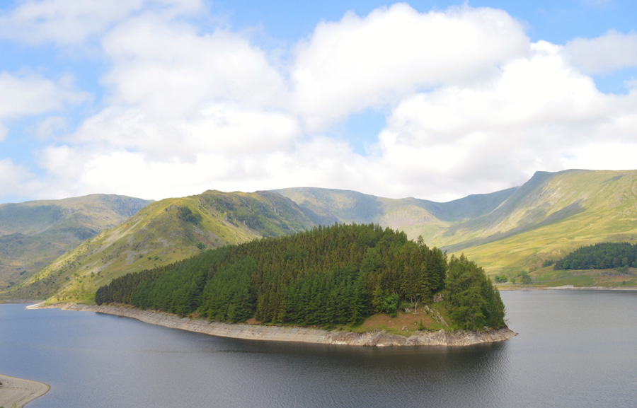
| Haweswater with Gate Crag, Speaking Crag and Wood Howe Island. |
I climbed steadily above The Rigg and started to feel the morning heat which started to slow my ascent almost immediately, ahead a couple and two dogs look to be suffering from the heat too as they stop quite frequently, I soon catch them up passing comment about just how hot it is, the guy by now is sat down and sweating quite heavily, he smiles and agrees.
Onwards and upwards as they say. |
 |
| Small Water seen below Nan Bield Pass. |
| |
 |
| Blea Water is viewed from the summit of Rough Crag. |
I'm not sure why but the time it took to reach Rough Crag seemed to take much longer than usual which I put down to a combination of heat and errmm...last nights shenanigans shall we say, although I am leaning more towards the latter.
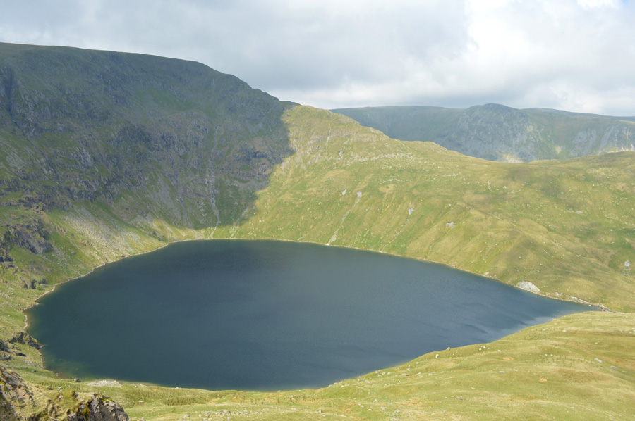
With Rough Crag reached Blea Tarn opened up before me by which time every now and again a brisk wind would blow across the waters surface making it change in colour from a deep blue to a darkened black, the same wind felt more than welcome as it cooled me down, a little too chilled at times but I wasn't complaining, next I pay a small detour to Caspel Gate Tarn, found in between Rough Crag and the base of Long Stile. |
 |
| Long Stile as I approach Caspel Gate Tarn. |
| |
 |
| Long Stile from Caspel Gate Tarn. |
| It hadn't rained for the past week and the ridge crossing reflected this by the dried out bogs and wild grasses found along the ridge. The area around the Tarn can get too boggy soaking up boots to the laces but not today the ground was dry and firm underfoot. Ahead is Long Stile which is the last section of the ridge to be climbed before reaching the summit, soon after leaving the Tarn behind the summit disappears behind the first and second craggy outcrops which make up Long Stile before the last and final push towards the summit which is found after a short but pleasant walk across the summit plateau. |
 |
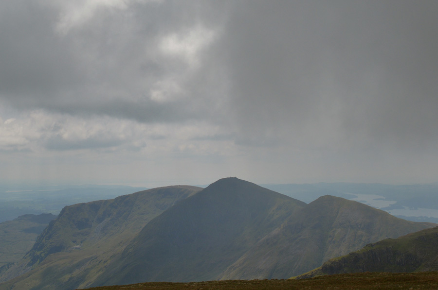
| Threatening cloud approaches the summits of Kidsty Pike and Short Stile. |
During the ascent of Long Stile I had watched the cloud roll in and out sometimes engulfing the summit of Kidsty Pike before rolling back out again which I thought for anyone at the summit would have been one of those special atmospheric moments, what I couldn't see during my ascent however, was what was behind the cloud...
More cloud, and lots of it. |
 |
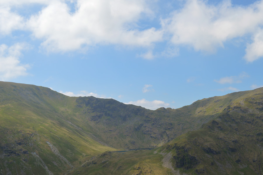
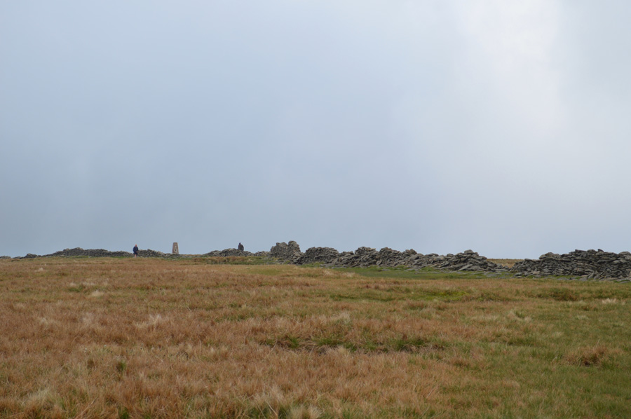
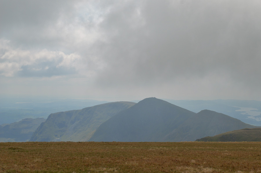
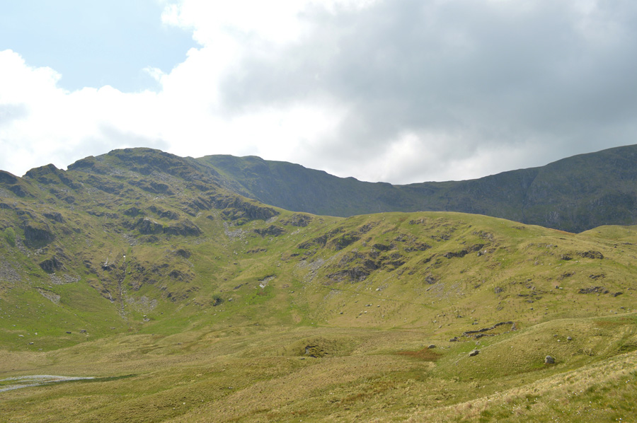
| Blea Water, Harter Fell (Mardale) and Mardale III Bell and Mardale III Bell North Ridge. |
| Not far from the summit now and time to forget about that cloud, well for now anyway. |
 |
| Riggindale with Haweswater and the Naddle Forrest beyond. |
| |
 |
| The summit of High Street soon comes into view. |
With the top of Long Stile reached I headed over familiar ground towards High Street summit, with the car park back at Mardale Head full to bursting I expected to find more than just the two walkers at the summit who I found wearing hats and jackets, agreed it was a tad cool with the summit winds but I thought the need to wear a hat might have been too excessive.
Nevertheless 'afternoons' are passed as the couple at the summit packed away their gear and headed out over the Straights of Riggindale leaving just myself at the summit. This morning I hadn't had time to prepare a proper lunch instead I bought a pack of sandwiches from my local Tesco together with one of those extra large Lion Bars.
Behind the summit wall a small shelter large enough for one, or maybe two people had been fashioned from the stone wall which I must admit, made a good shelter from the summit cross winds which initially I didn't feel but soon finger tips and the bottom of my ears told me differently. From my sitting down position I hadn't noticed the cloud roll in as it clung to what felt like a hands length about my head, while beyond towards Helvellyn the views that I had seen minutes earlier had gone beneath a wall of cloud and haze.
I stood up and looked back towards Kidsty Pike which surprised me as its summit had by now escaped the cloud which had drifted further east towards Kirkstone and Patterdale, it would seem the Lakeland gods are looking down on High Street today. |
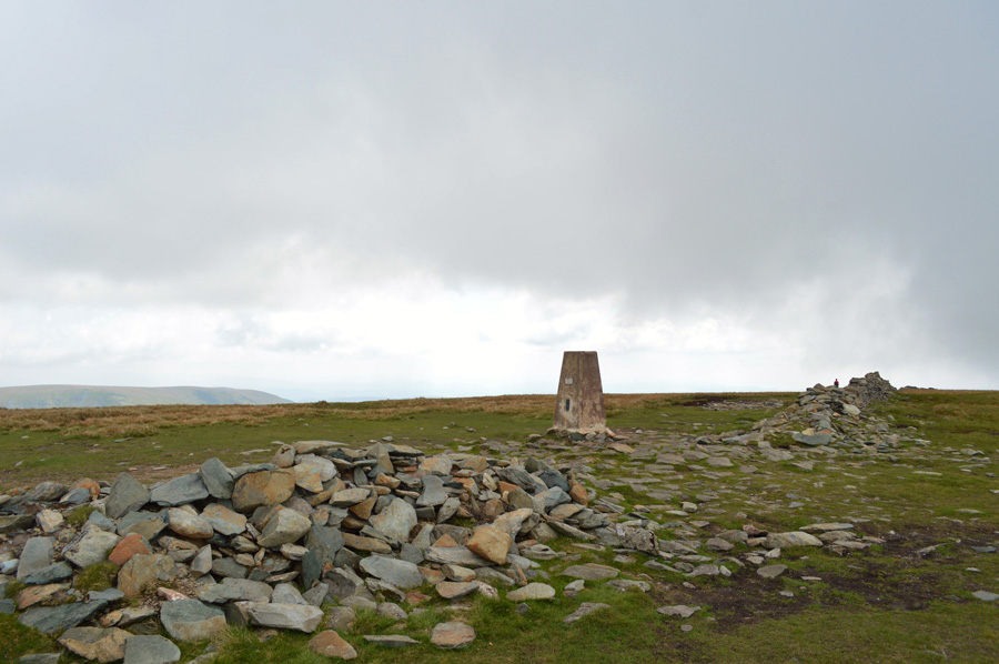 |
| High Street summit Trig Point. |
| With lunch eaten I ease myself up from the makeshift shelter while at the same time I can hear voices, after a quick scour around no one is to be seen by which time my pack is re-shouldered and I'm about ready to leave, then from the same direction that I had just come, two walkers approach, the same two who I had passed whilst at Long Stile summit, they ignored my 'morning' back then so I'm not about to get ignored again, perhaps they just didn't want to be disturbed, either way I strike out following the summit wall south until a small cairn is reached. |
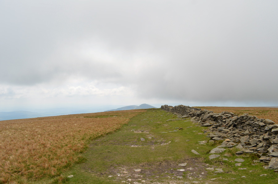 |
| Leaving High Street summit behind as I head out towards Mardale III Bell. |
| |
 |
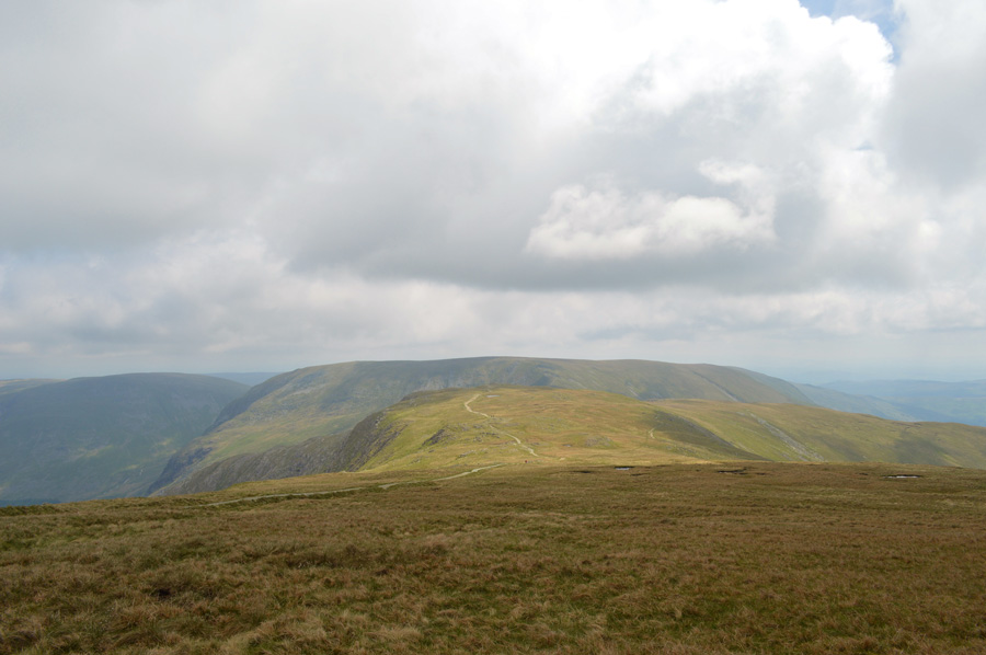
| Thornthwaite Crag as the low cloud begins to lift. |
| The cloud lifted as I approached the stone cairn revealing Thornthwaite Crag helped along by a brisk wind, it didn't seem that long ago when I was walking under blue skies complaining about just how hot it is, and now the weather has just flipped on its head as the cloud rolled in, Either way it's nothing to get worried about and to be honest, I think it's just one of those fleeting moments, time will tell I guess. |
 |
| The III Bell Ridge. |
| Blimey, I'm losing light rather quickly! |
 |
| Still as majestic as ever...The III Bell Ridge. |
| I personally think; as well as a few thousands others no doubt that Froswick, III Bell and Yoke whose 'fist like summits' make up the ridge are best viewed from Mardale III Bell, Thornthwaite Crag or the upper Kentmere valley even with low light as I have today. |
 |
| Mardale III Bell seen ahead with Harter Fell (Mardale) and a Branstree over on the left. |
| |
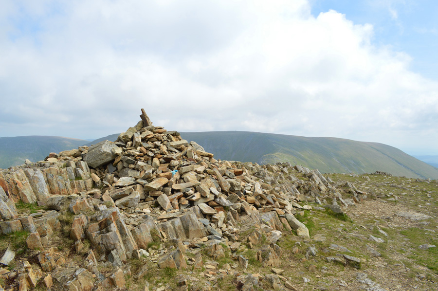 |
| Harter Fell (Mardale) from Mardale III Bell summit cairn. |
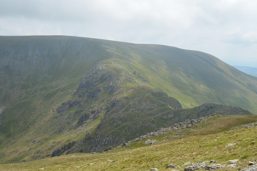
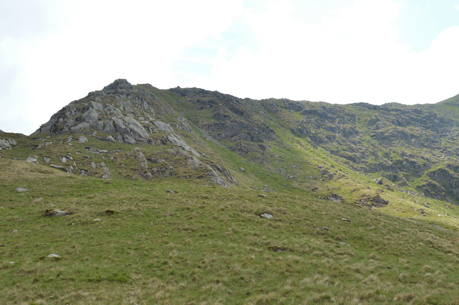
| The light started to pick up again by the time I had reached the summit of Mardale III Bell and with this the cloud towards the east started to rise yet due to my position I was unable to pick out any summits. Feeling content after taking a picture of the summit I thought I'd do a little exploring if only to take in the views of the North Ridge which extends all the way to Blea Water, a route that I have only ever ascended once a couple of years ago, I didn't quite know it just yet while at the summit, but I was about to make one of those sporadic decisions that I hadn't made for quite some time while fell walking. |
 |
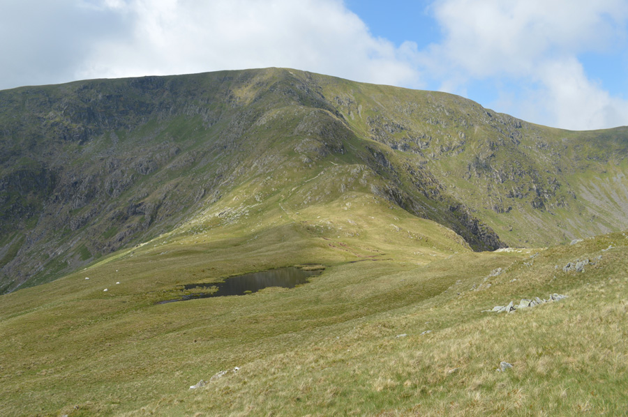
| The Ridge found between Mardale III Bell and Harter Fell (Mardale) |
| You might just be able to make out the stone shelter found on top of Nan Bield Pass in the right foreground of the photo. |
 |
| Blea Water and Long Stile seen as I start the North Ridge descent. |
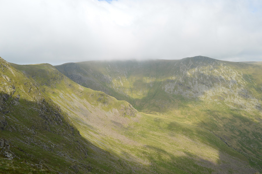
| Before I knew it I had made up my mind and took in the North Ridge descent without putting much thought into it. From the summit I followed a single trail which steered towards Piot Crag, it's quite a rough area and steep in descent which is mostly covered in grass although you do find yourself twisting your way around boulders especially below the summit. |
 |
| Rough Crag and Blea Water seen during my Piot Crag descent. |
| The path comes to an end almost at the top of Piot Crag which descends very steeply onto the North Ridge, from an earlier ascent I had remembered two routes up, the one to the right involved a slight scramble while the one on the left was a steep grassy pitch with a few large boulders to negotiate. I head left and pick my way down, at times having to throw my poles a few feet down just so I can steady my descent with the use of my hands against the rock. |
 |
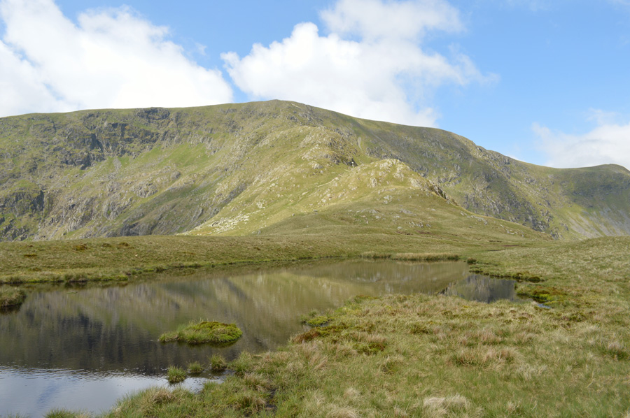
| Blea Water Beck with Haweswater now in view from Mardale III Bell North Ridge. |
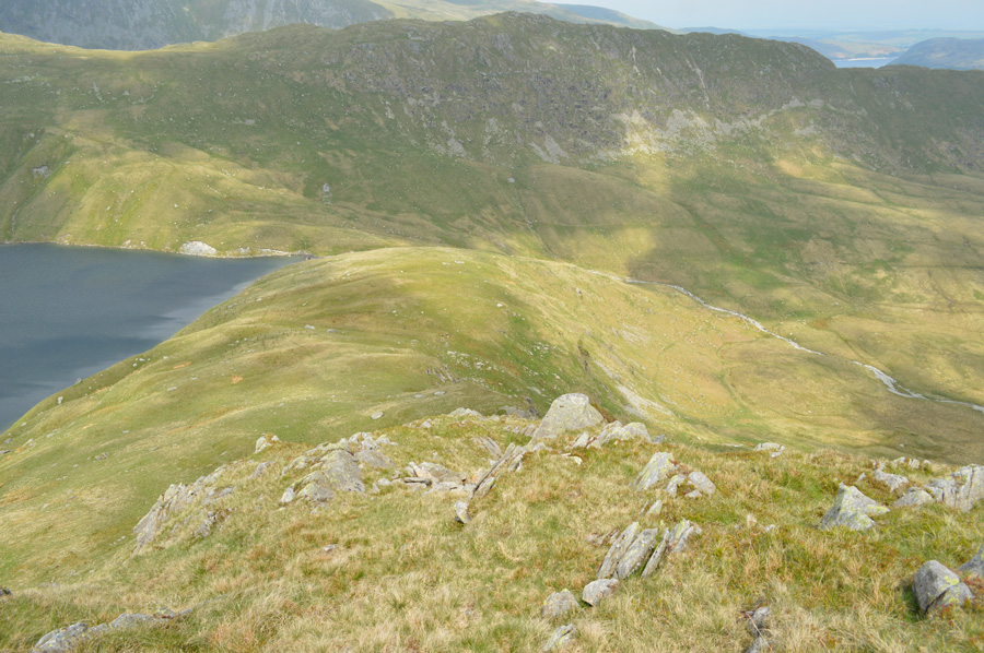
| In this photo you might be able to pick out the path back towards Mardale Head which follows Blea Water Beck for a short while before maintaining height above the area below known as Mardale Waters, I'm guessing it's going to be pretty damp down there hence its name. |
 |
| Pausing to look back up at Piot Crag. |
| My line of descent was from the right, or from the left is standing on top of Piot Crag. |
 |
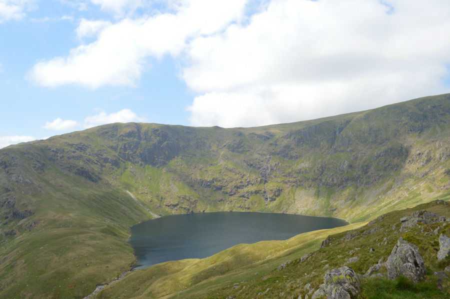
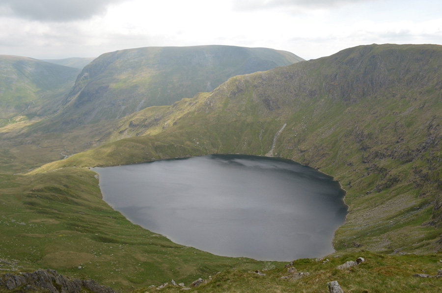
| Long Stile from the Blea Water. |
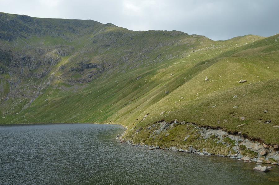
| It didn't take too long to reach the waters edge which fell away sharply from the bank, just a few steps ahead the water seeps down over the Dam wall almost trickle like and I am able to cross the outflow with ease almost now in line with the surface of Blea Water as I stop to look around the corrie from the edge of Lakelands deepest Tarn. |
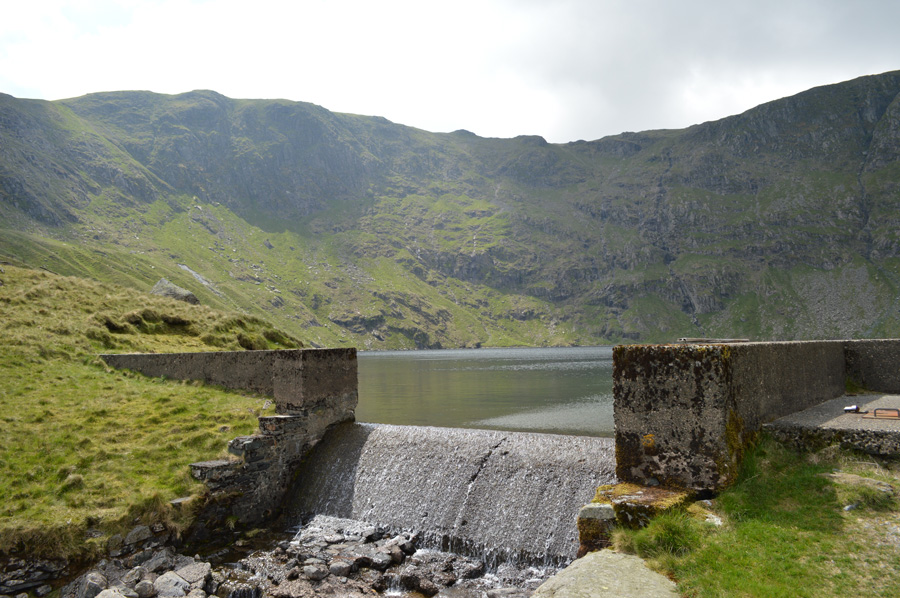 |
| Blea Water Dam. |
| After a few moments spent admiring the Long Stile ridge and indeed the vertical head wall that falls steeply into Blea Water I cross the Dam and climb onto the other side, behind an infant Blea Water Beck flows through an area of bog-land known as Mardale Waters before reaching Haweswater. |
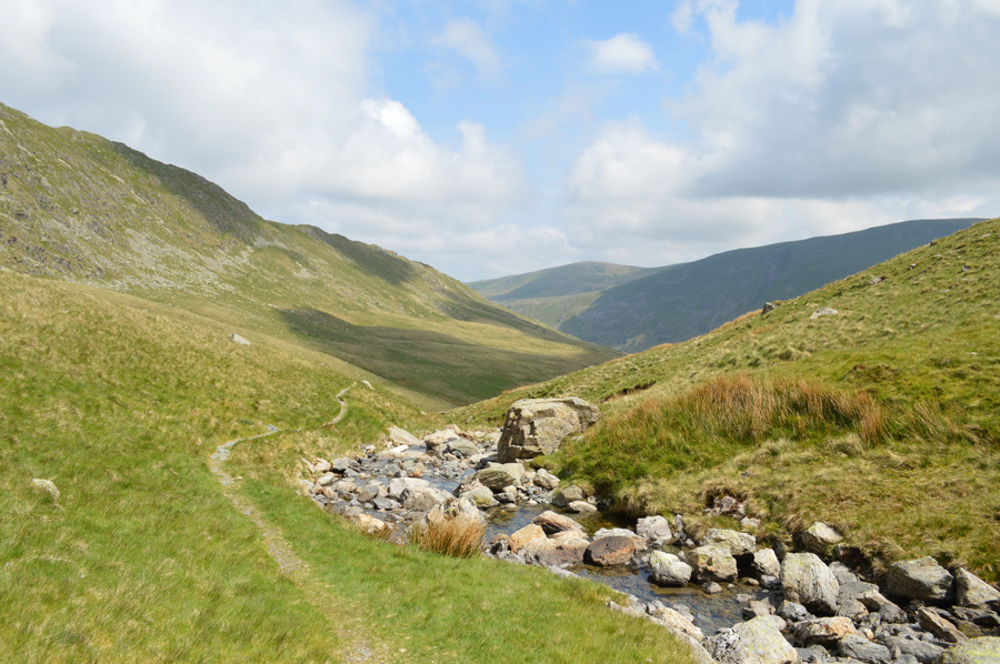 |
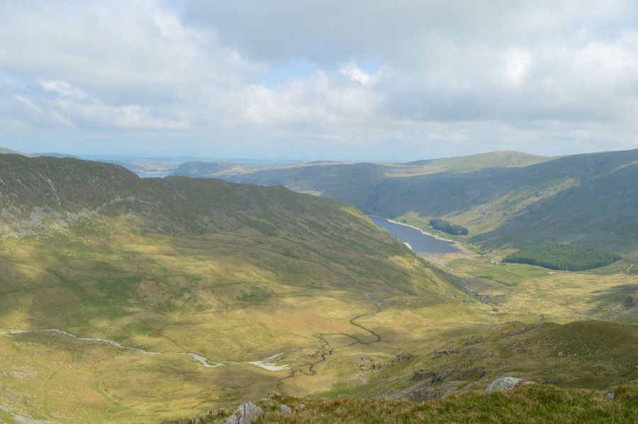
| Descending back to Mardale via Blea Water Beck. |
| The path is singular and dry underfoot but this isn't the case once Blea Water Beck falls further away, here the path although widens becomes quite boggy and even after days without rain, retains the water well. |
 |
| Mardale III Bell North Ridge. |
| |
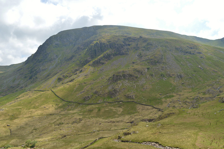 |
| Views towards Harter Fell (Mardale) |
| |
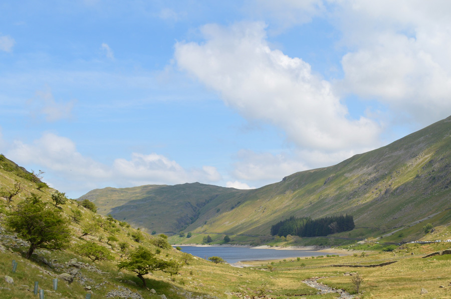 |
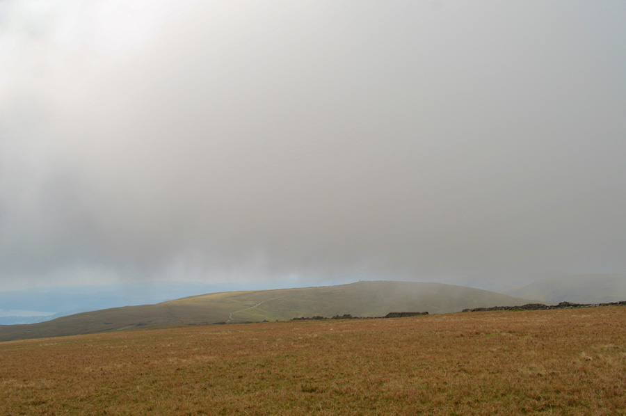
| Selside Pike from Mardale Head. |
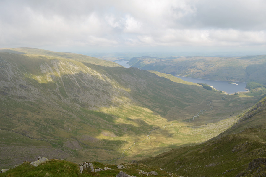
Despite the wet ground underfoot it was a pleasant walk back through Dudderwick as walkers on route to Blea Water as I take in the last mile or so under a scorching afternoon sun, ahead the car park is still as busy at it was when I left it nearly five hours eailer and like me, people are returning back to the cars feeling satisfied after a good day spent on the fells.
I would like to say that last half mile was spent reflecting back on what a great walk I had, and indeed, quite an adventurous month by all accounts which had never been far from mind as May draws to an end but after stumbling awkwardly my right ankle bent over quite severely and for that split second I can't every recall my ankle bending so far over the way it did, I recovered well, or so I thought with a painful limb I thought I would, like all the other times, be able to walk it off. But then came the following morning when I looked down on very swollen and bruised ankle, thankfully the swelling is doing what it should and protecting the bone as day by day the swelling and bruises start to fade, despite this I'm still packing the ankle with ice taking anti-inflammatory tablets daily which probably means I won't be fell walking for at least another week, possibly longer.
What is it they say....absence makes the heart grow fonder. |
|
| |
| Back to top |
 |
|