|
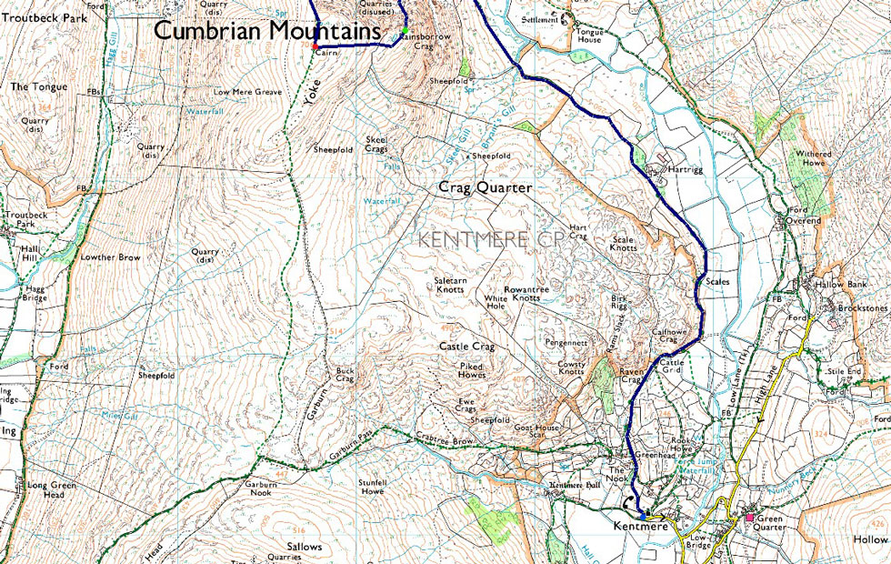
Yoke via Rainsborrow Crag |
 |
 |
31st March 2024 |
 |
|
This walk originated during a drive to work one bleak January morning while coming up with routes that I hadn't yet explored one of which was the ascent of Yoke via Rainsborrow Crag. I've often walked through the Kentmere valley whilst gazing up at Yoke in awe often during my early days as a fell walker believing an ascent looked un-climbable but with experience comes the need to explore.
Other than mapping the route I wasn't going to do any online research but I'm pleased I did after finding that friend of mine Andy Beck had indeed climbed the route back in October 2015. Not only did Andy's report provide me with valuable information but he also explored the quarries along the route as part of his Painting the Wainwrights in Colour project.
This route isn't for the faint hearted, it's relentlessly steep from valley to summit and with no real paths to follow having a good eye for the lay of the land is key to allow a safe ascent. I will probably have to go back to last Summer when the trio made a direct ascent on Rampsgill Head since I last climbed something as continuosly as steep as Rainsborrow Crag but boy what a route for my first 'big walk' of 2024 |
|
| Wainwright Guide Book Two |
 |
| The Far Eastern Fells |
| On this side, below the summit is the formidable thousand precipice of Rainsborrow Crag (the safety of which is a subject of disagreement between rock climbers and foxes) and rising above Kentmere village is a knobbly spur that looks like the knuckles of a clenched fist. |
 |
|
|
|
| |
|
Overview |
|
|
| Ascent: |
3,588 Feet - 1,093 Metres |
| Wainwrights: |
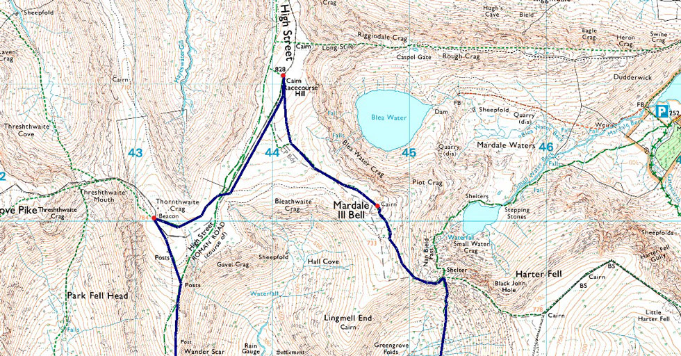
6, Yoke - III Bell - Froswick - Thornthwaite Crag - High Street - Mardale III Bell |
| Visiting: |
Rainsborrow Crag |
| Weather: |
A Stunning Spring Day, Windy Across The Summits. Highs of 12°C Lows of 7°C Feels Like 1°C |
| Parking: |
Kentmere Village / Kentmere Institute |
| Area: |
Far Eastern |
| Miles: |
12.2 |
| Walking With: |
On My Own |
| Ordnance Survey: |
OL5 |
| Time Taken: |
7 Hours |
| Route: |
Kentmere Church - Hartrigg - Rainsborrow Quarry - Rainsborrow Crag - Rainsborrow Tarn - Yoke - III Bell - Froswick - Thornthwaite Crag - High Street - Mardale III Bell - Top of Nan Bield Pass - Kentmere Reservoir - Hartrigg - Kentmere Church |
|
| |
|
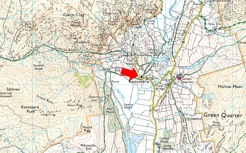
Parking Details and Map |
|
|
| Nearest Post Code: |
LA8 9JL |
| Grid Reference: |
NY 456 004 |
| Notes: |
The car park in the village of Kentmere is quite small with room for only around five well parked cars meaning arriving early is a must. The car park is found on Hollinrigg Lane on the left after passing St Cuthberts Church opposite a phone box. Donation Box on the wall of the Kentmere Institute. |
|
| |
|
Map and Photo Gallery |
|
|
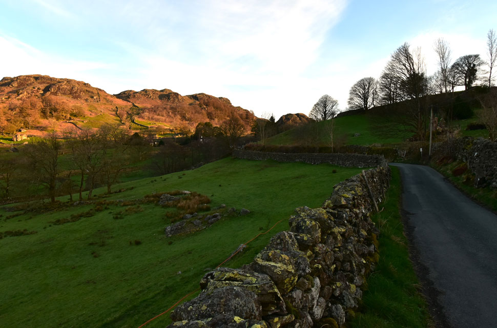 |
| Cowsty Knotts from Hollin Lane, Kentmere 7:30am 7°C |
I had the perfect forecast for such a walk the only thing worrying me was being able to park at the limited spaces in Kentmere given that today is Easter Sunday, I had every right to be worried. Despite my early arrival cars were already double parking and the only reason I managed to get into a space was I arrived at the same time a woman and her daughter were leaving. Jeez that was close.
As I was kitting up two more cars arrived, the first one turned around but the second crept onto the verge opposite the Institute. The driver got out and asked me did I think a car would still be able to get up and down the lane and although I didn't say it, I reckon you'd still get a tractor through comfortably "aye no bother" I replied. We got chatting about how nice a morning it was and I was asked how early I'd arrived to park where I had "I got lucky I arrived just five minutes before you just as someone was leaving"
Despite the sunshine it's a tad windy with winds forecasted to reach thirty-plus mph across the summits but that didn't stop me from wearing my shorts for the first time this year. To take the chill off I pulled on my beanie and slid a pair of gloves over my hands which was a waste of time as I'd be removing them ten minutes later. I nodded a 'see-ya' to the two lads, locked my car and headed up the lane to the sound of bleating lambs in the field below, What a cracking start to the morning. |
 |
| Do you ever get the feeling you're being watched? |
| I left Hollin Lane lane and turned right through the large metal gate towards Hartrigg Farm. The sun still hadn't climbed high enough to cast light into the valley but it was slowly getting there as I noticed I was being watched by a sheep standing precariously on the edge of Calfhowe Crag, the sheep watched me for a full five minutes until I had passed. |
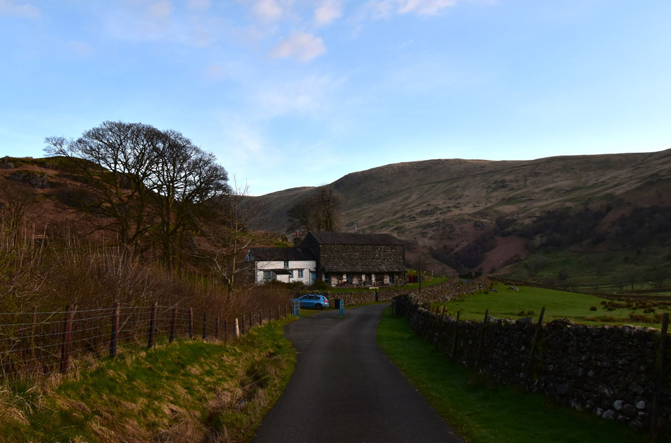 |
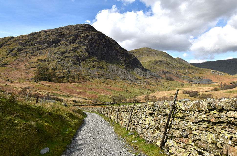
| Passing Scales farm house and barn. |
| With Kentmere Pike and Brown Howe in the distance. |
 |
| Yoke, III Bell, Froswick (Ill Bell Ridge) Hall Cove and Lingmell End come into view at the head of the Kentmere valley. |
| Seen here as I pass Hartrigg Farm over on the right. |
 |
| The III Bell Ridge. |
| Now dappled in lovely morning sunshine. |
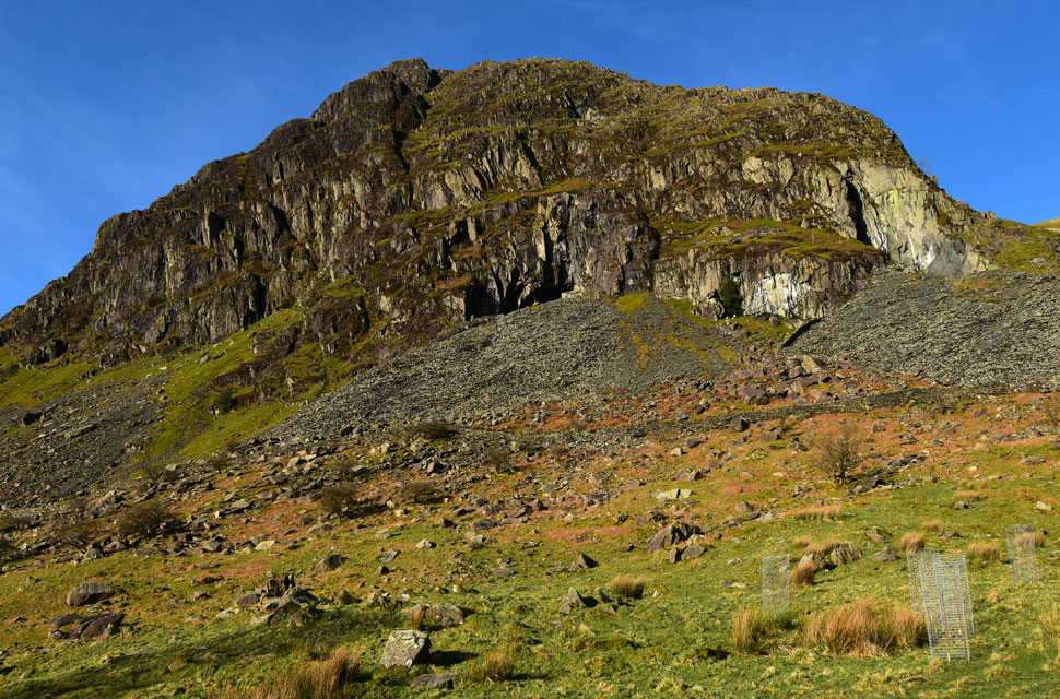 |
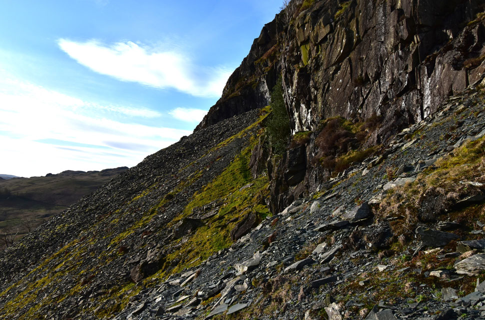
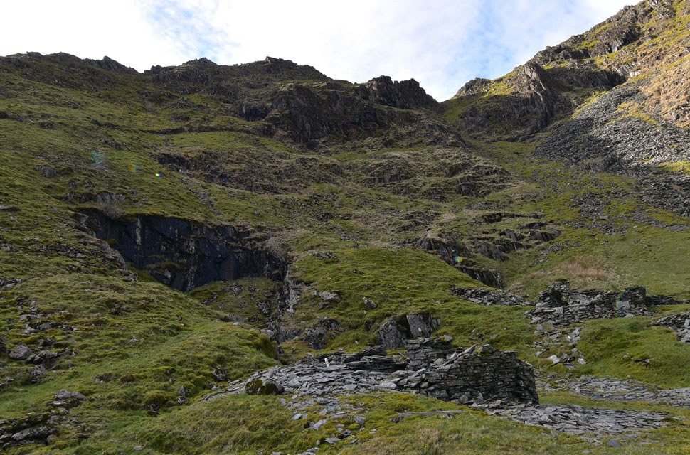
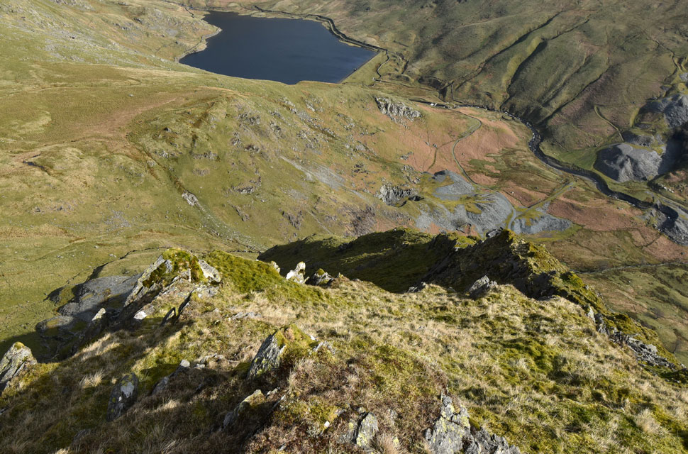
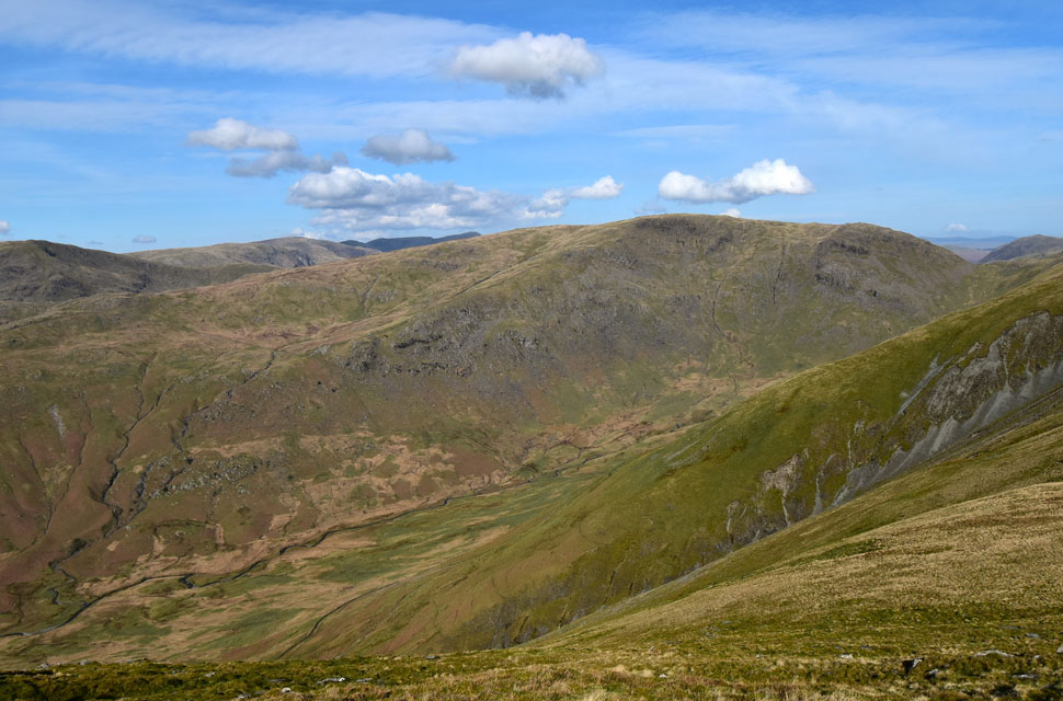
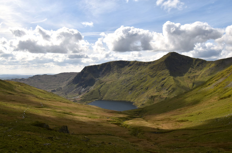
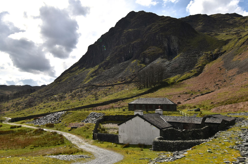
| Passing Rainsborrow Crag with Cauldron Quarry seen left and Lambfold Quarry right. |
| My plan is to visit both quarries by ascending from Steel Rigg Quarry (below and out of view) via the steep grassy bank seen far right, after viewing the workings of Lambfold Quarry I will pass over the spoil, scale the wall seen right then follow the old quarry path to Cauldron Quarry. |
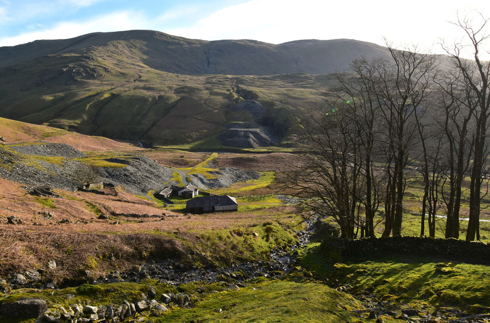 |
| Views opening out over Steel Rigg Quarry towards Jump Quarry and Hart Quarry. |
| I left the valley via the old quarry path found between the reservoir cottage and stone wall before crossing the beck where it forks below. |
 |
| Lambfold Quarry ahead. |
| It's a relatively short, but very steep ascent to reach Lambfold Quarry. |
 |
| Lambfold Quarry. |
| Lambfold produced long lengths of slate to supply material for constructing Kentmere reservoir dam via a trackbed which runs northward from Steel Rigg to join the line of the present road to the dam. |
 |
| Crossing the slate spoil to reach Cauldron Quarry. |
| After taking in the impressive face of Lambfold Quarry I followed the old (now faint) quarry path linking both quarries. Up ahead you can see where the path rises up over the spoil before dropping down on the other side where the stone wall is crossed. |
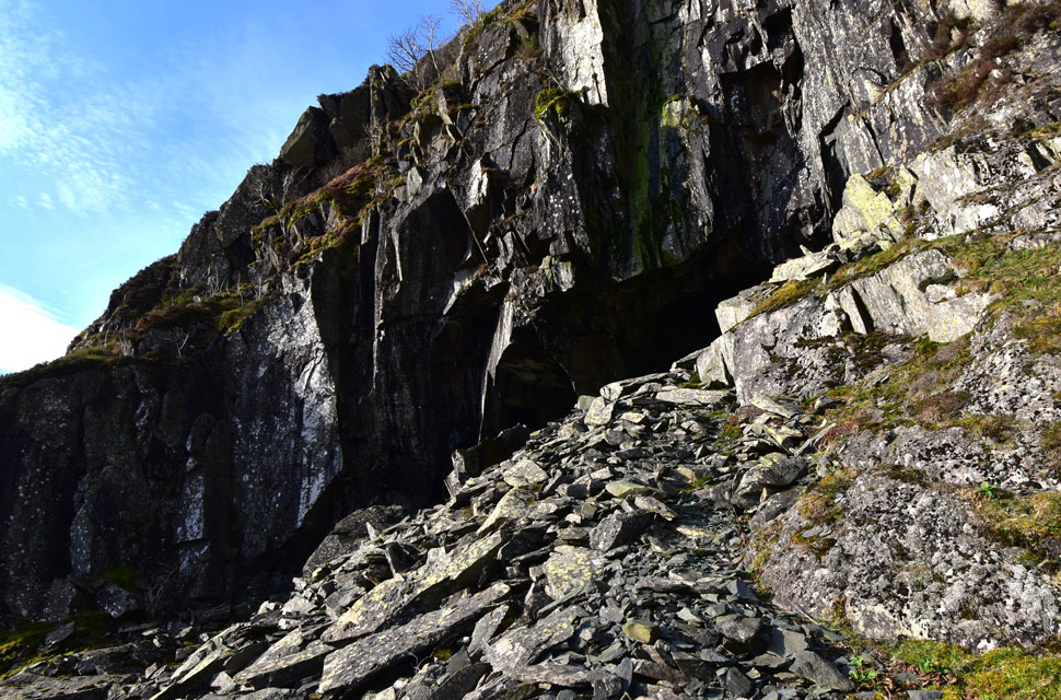 |
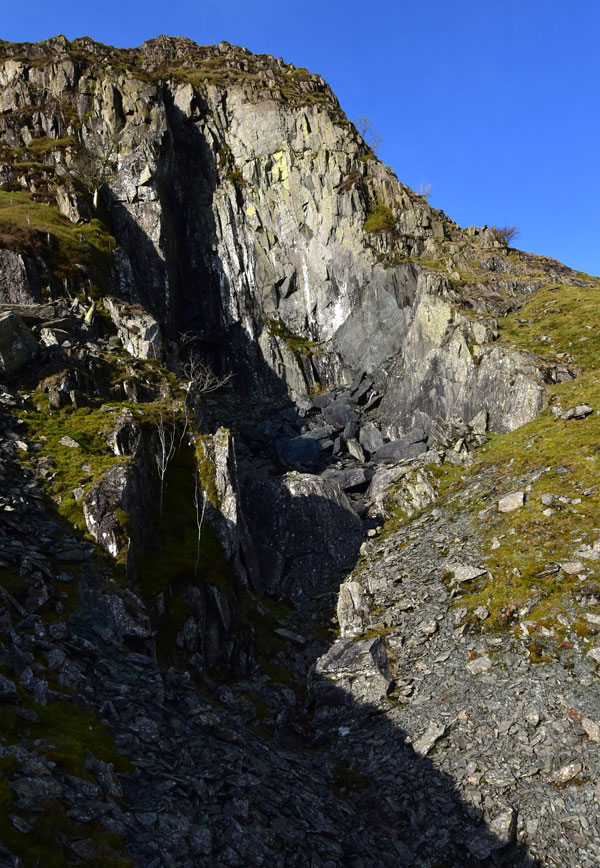
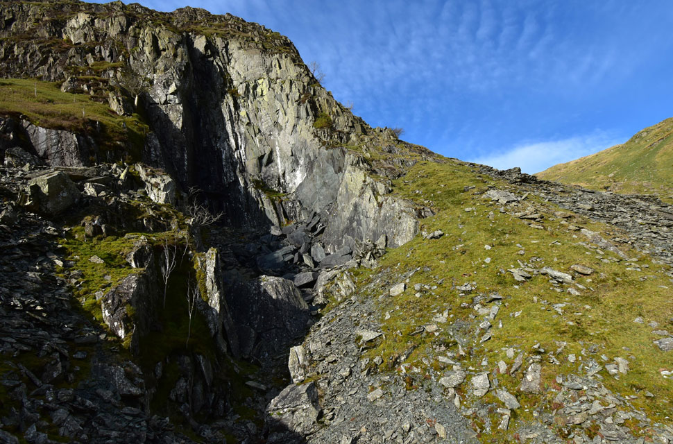
| Arriving at Cauldron Quarry - 1845 to the late 1880's |
| it was a bit of an exercise to get over the stone wall which was around chest height but luckily the stone waller had left a couple of protruding stones more so on the Lambfold side. Once over the wall the path climbs above the spoil to the mouth of the cavern which I ascend via a narrow path through the slate. |
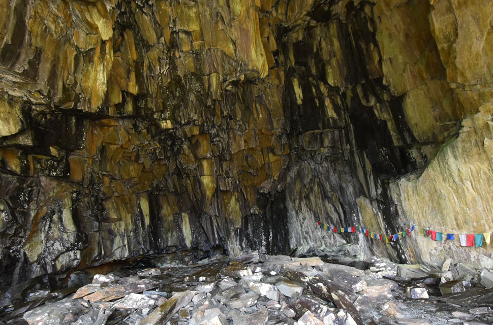 |
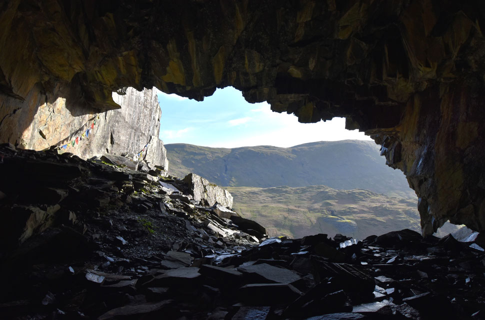
| Cauldron Quarry cavern. |
| On reaching the entrance I was presented with amazing views into the cavern which had two chambers seen lower left where more Nepalese prayer flags can be found just like the one on the cavern wall. |
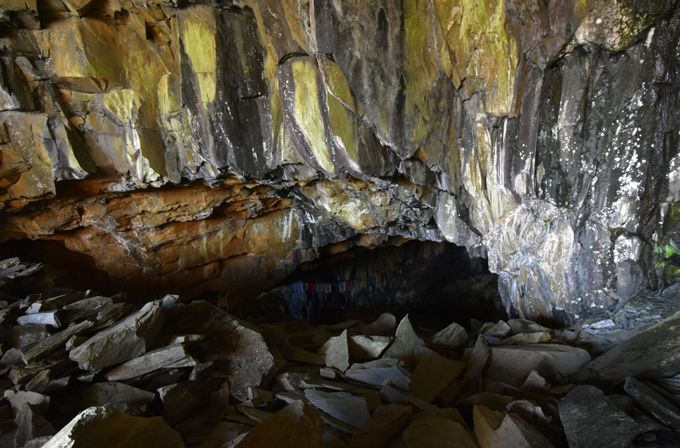 |
| Views into one of the chambers. |
| Being a tad claustrophobic this is as close as I got to one of the chambers where it's not uncommon for folk to bivvie overnight. |
 |
| The view back from the Cavern towards Harter Fell (Mardale) |
| Andy's report mentioned that the cavern floor was dry and made up of a jumble of boulders but today I found most areas were wet making traction underfoot difficult especially when dodging droplets of water no doubt draining into the cavern after recent rain fall. A fascinating and generally dark insight into what the quarrymen had to endure day in day out, |
 |
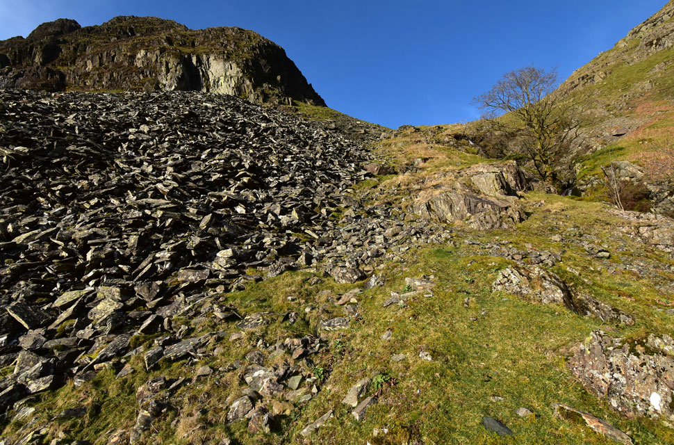
| After retracing my steps I arrived back at Lambfold Quarry. |
| Ready for the steep ascent into Rainsborrow Cove via the grassy bank seen right. |
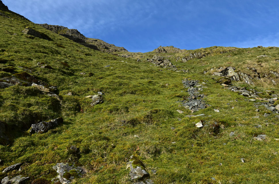 |
| Ascending towards Rainsborrow Cove. |
| There is no way for the walker to gain the upper Edge (above Lambfold Quarry) other than to ascend into Rainsborrow Cove. |
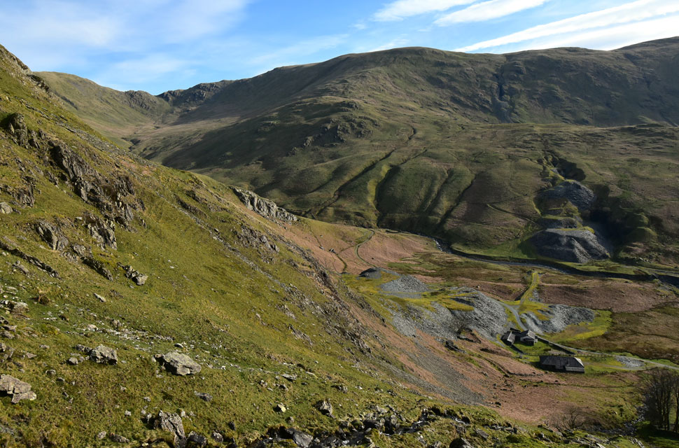 |
| The view down... |
| ...towards Steel Rigg Quarry, Jump Quarry, Hart Quarry, Harter Fell, Brown Howe and the top of Nan Bield Pass. |
 |
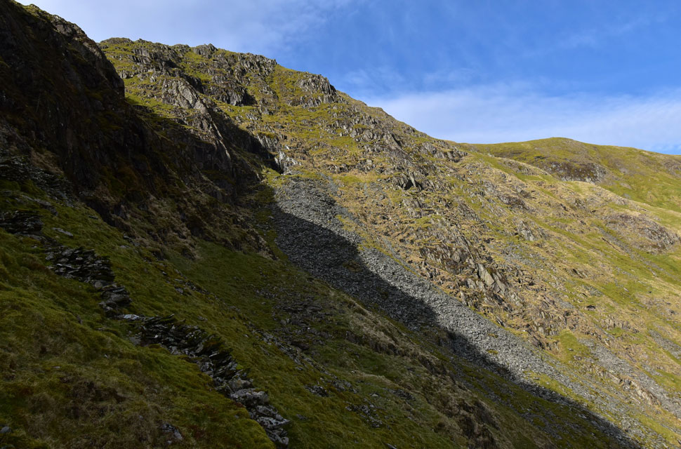
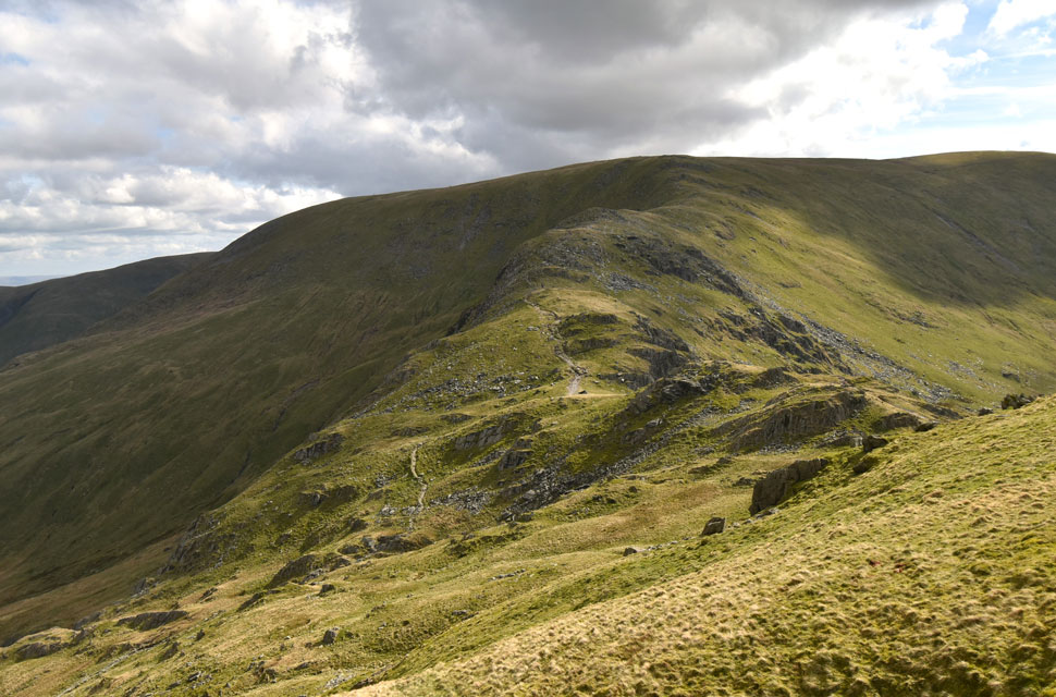
| The Edge (left) from Rainsborrow Cove. |
| It was a brutally steep ascent into the cove where I found old miners huts and quarried fell side. From the base of the cove the Edge can be gained via the left which in hindsight, I wished I'd taken but instead I opted to ascend by the quarry seen left before continuing to the lowest point on the Edge. Alternatively the grass rake on the other side of the cove can be ascended which will totally by-pass ascent via the Edge. |
 |
| Views over to Star Crag / Rainsborrow Cove. |
| Where I spotted another cave entrance which would probably be easier to reach from the summit by descending the grass rake in the previous photo. |
 |
| III Bell, Hall Cove, Lingmell End and Steel Rigg seen across Rainsborrow Cove. |
| It's getting to that time of the morning when walkers started to appear on Ill Bell seen across Rainsborrow Cove. I couldn't but help envy their easy ascent whilst I was digging deep in the cove below. |
 |
| In the sunlight now! |
| Climbing higher I came in line with the Edge (seen right) which I will join for the last 300 feet or so. That was one hell of a tough ascent! |
 |
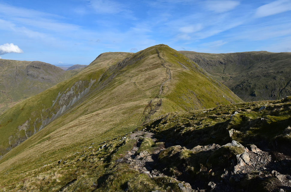
| Peering down the Edge. |
| The Edge is navigable and after looking back on this view I was a little saddened that I hadn't joined it from the cove but in hindsight it's pretty windy away from the shelter of the cove so maybe I made the right choice after all. |
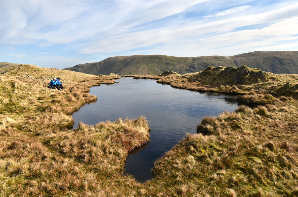 |
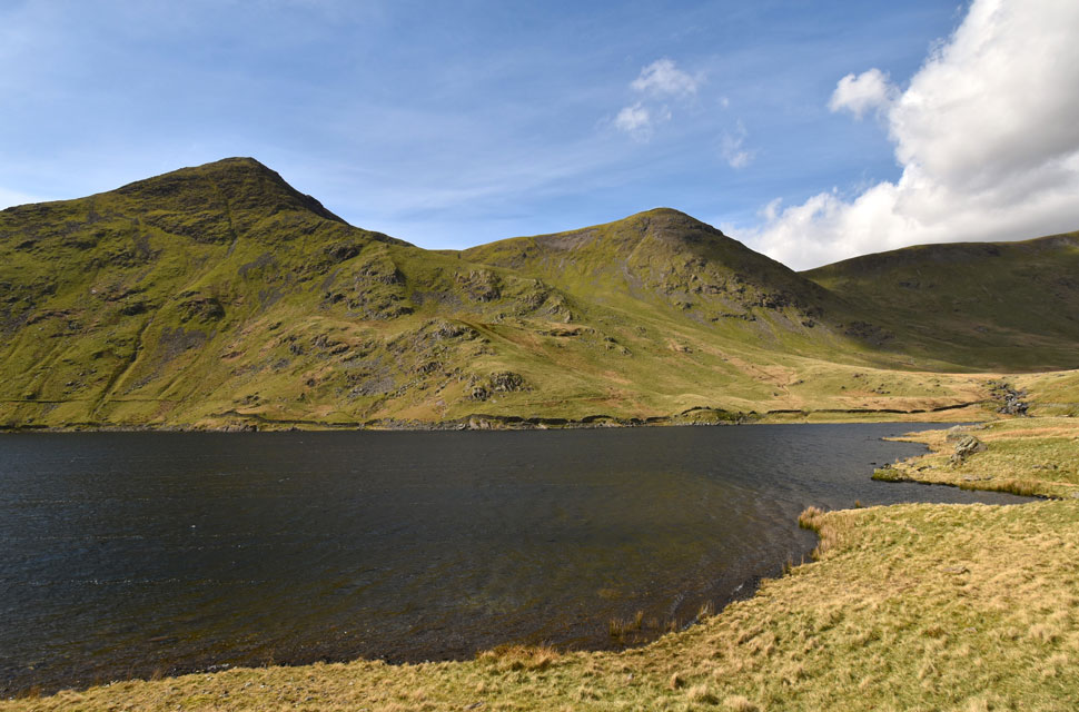
| Rainsborrow Tarn. |
The tarn isn't clearly visible from the top of the Edge so you might imagine my surprise when I arrived at one of Lakelands most secluded tarns to find two walkers having a bite to eat and (out of view) a wild-campers tent. The two guys gave me a wave followed by "have you just come up from there" while the other checked his map "how was it" Bloody steep I laughed.
They mentioned that they were descending that way having not done it before I advised them to take the grassy rake option for which they thanked me for before we wished one another to enjoy the rest of our walks. |
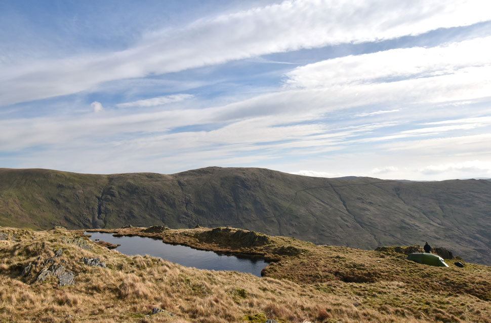 |
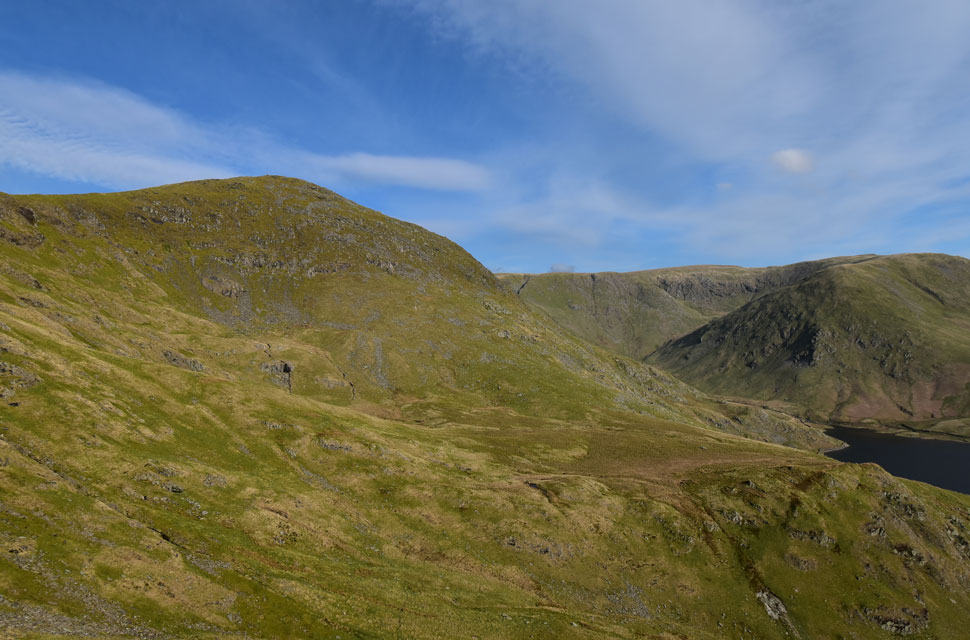
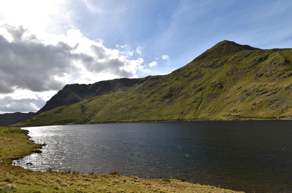
| Looking back on Rainsborrow Tarn. |
| With Kentmere Pike in the distance. |
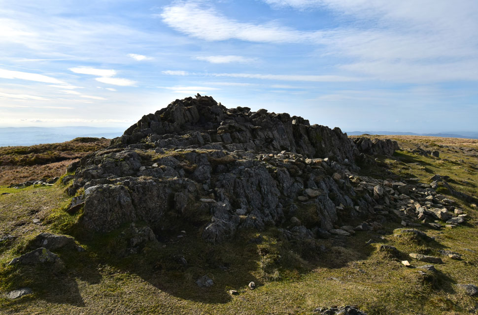 |
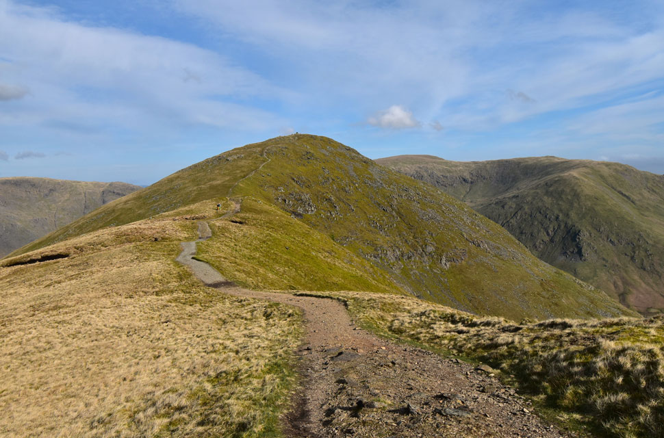
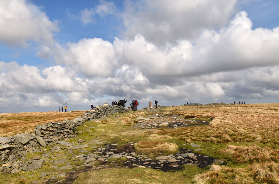
| Yoke summit. |
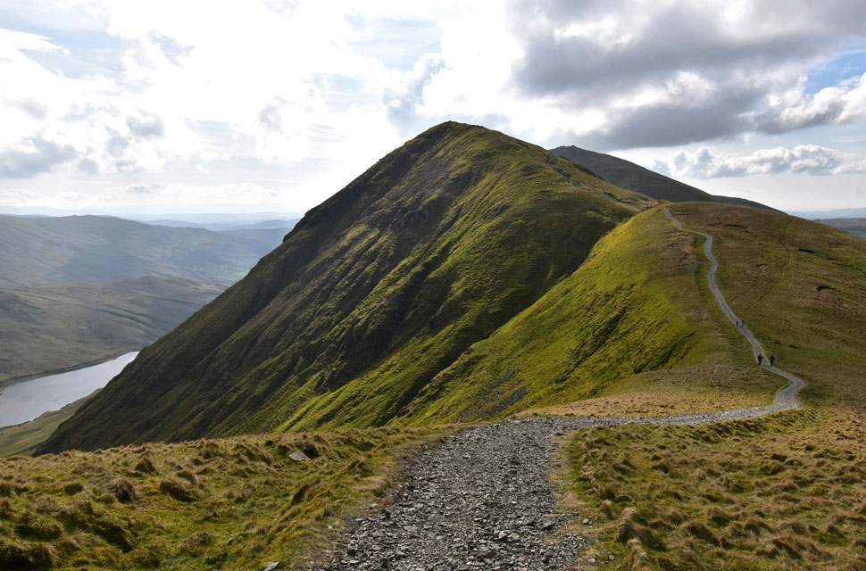
| I followed the fence all the way to Yoke's summit where I was pleased to have a path underfoot for the remainder of the walk, mind you the wind was so strong I was forced to add my beanie and gloves such the windchill. |
 |
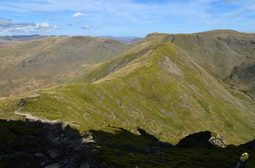
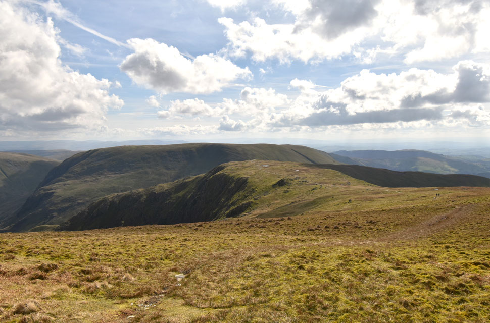
| III Bell ahead. |
| With Stony Cove Pike seen left, High Street, Mardale III Bell and Lingmell End seen right. |
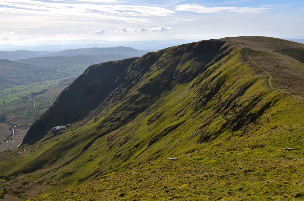 |
| Through the strong sunshine I look back on Rainsborrow Crag over Rainsborrow Cove. |
| Minutes earlier I spotted the two walkers I'd seen back at the Tarn had taken my advice and begin their descent via the grass rake. |
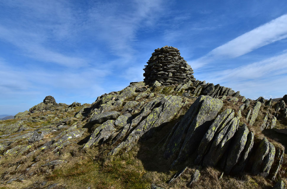 |
| III Bell summit. |
| Taken from the south cairn. |
 |
| Descending III Bell for Froswick. |
| With views of Caudale Moor, Stony Cove Pike, Thresthwaite Mouth, Thornthwaite Crag and High Street. |
 |
| Views over Park Fell Head towards St Raven's Edge, Caudale Moor, Stony Cove Pike and Thresthwaite Mouth. |
| |
 |
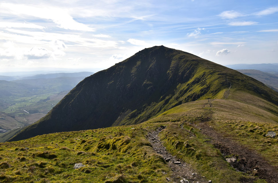
| Froswick and Thornthwaite Crag. |
| It was around here I de-layered again around the same time I was passed by two wild campers who had camped out on Thornthwaite Crag having enjoyed a great sunset last night but missed out on the sunrise because they'd forgot to set their alarms, I must agree, Thornthwaite Crag looks a cracking spot for a wild camp. |
 |
| Views beyond Over Cove towards III Bell. |
| |
 |
| Thornthwaite Crag from the descent of Froswick. |
| Having ascended the smooth grassy slopes of Froswick I was unable to capture a summit photo after finding two young'un's sat by the summit cairn, it was no biggie and no sooner had I arrived I'd began my descent. |
 |
| Looking back on Froswick and III Bell. |
| |
 |
| Where's the sunshine gone? Thornthwaite Crag. |
| Cloud had obscured the sunlight for the last ten minutes and with it came a sudden drop in temperature giving the wind a bite to it, despite this I was feeling hungry and decided to break out one half of my sandwich followed by half a Twix washed down with long gulps of summer fruits. |
 |
| High Street is next. |
| Going back further to planning this walk I'd actually planned on walking the III Bell ridge from Troutbeck and on that walk I'd included High Street and Mardale III Bell and seeing that I was so close to both summits I decided to include them into todays walk. |
 |
| Hey up little fella. |
This little chap's owner was about forty yards behind but being the little explorer that he was headed towards the summit on his own while I kept my eye on him from the other side of the wall. On my way back we crossed paths and I shared a laugh with his owner who'd set off from Hartsop earlier. |
 |
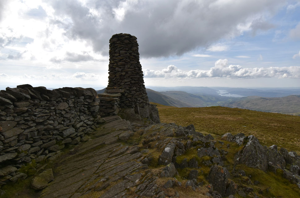
| High Street summit. |
I left Thornthwaite Crag behind two groups of walkers all of whom ascended High Street to the left of the wall so I choose to ascend by the right. By the time I'd reached the summit the sun had come back out but to be honest, it was that busy I simply walked over to the trig point, drew my wedding ring across its concrete making sure I gave it a good o'l scratch and walked away.
It had been the busiest I'd seen High Street in all my forty four summits counting nineteen either at, or approaching the summit. |
 |
| Mardale III Bell and Harter Fell (Mardale) |
| I traced my steps south until I came across the small cairn where I broke left bound for Mardale III Bell summit, trouble was some of the crowds from High Street where on my tail along with a dog that wouldn't stop barking. I try to create a gap but an energy boost was on short supply so I put up with the barking all the way to Mardale III Bell. |
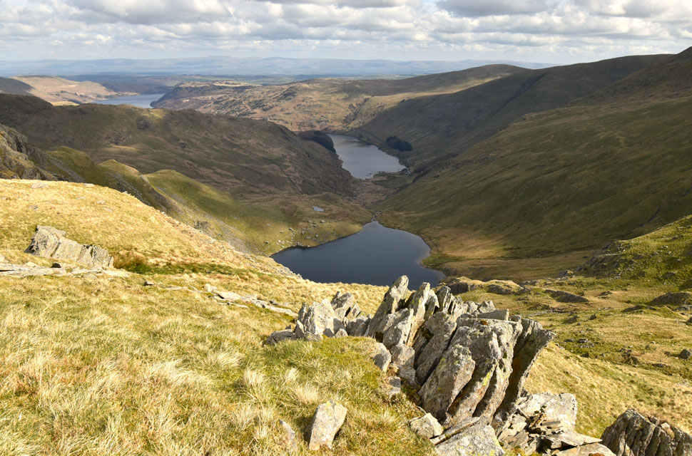 |
| Small Water and Haweswater Reservoir from Mardale III Bell. |
| With the summit of Mardale III Bell reached I broke away from the path after spotting this view allowing the large group and barking dog to summit before beginning their descent. With silence resumed I took in the views for a while longer before beginning my own descent. |
 |
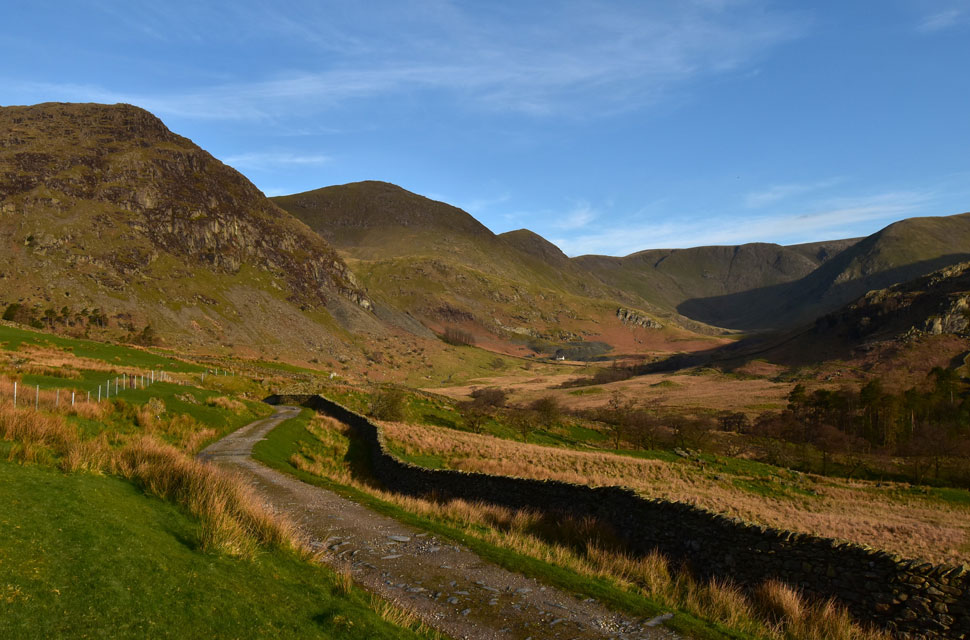
| The view over the top of Nan Bield Pass towards Harter Fell (Mardale) |
| If parking at Kentmere was anything to go by then Mardale was three times as worse with cars stretching a quarter of a mile back up the valley road. |
 |
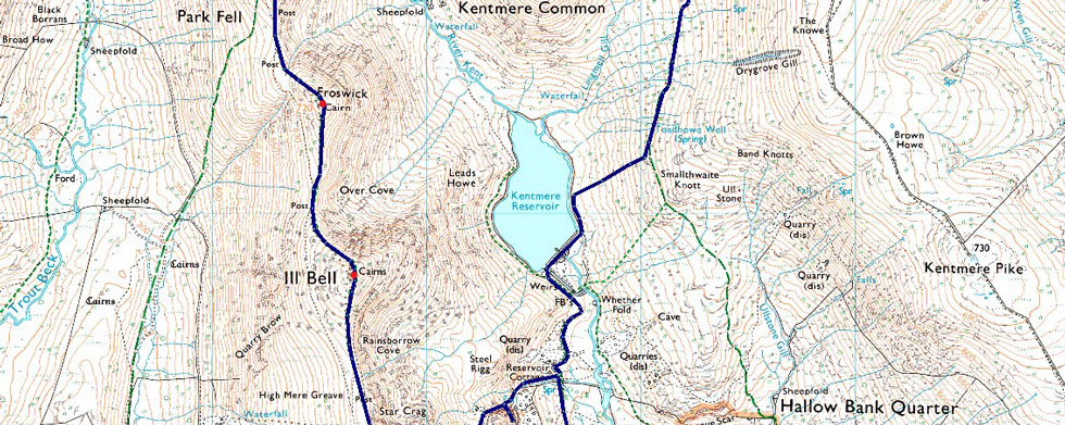
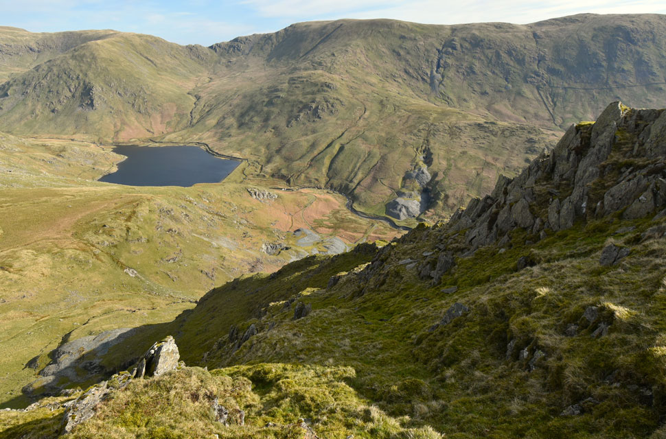
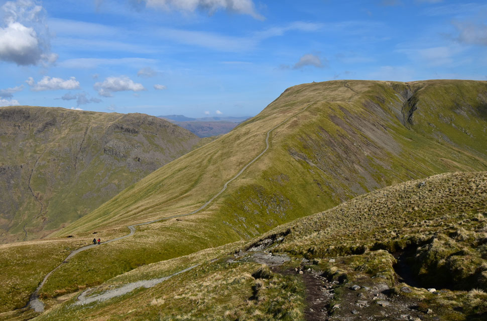
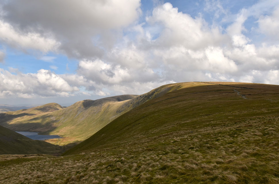
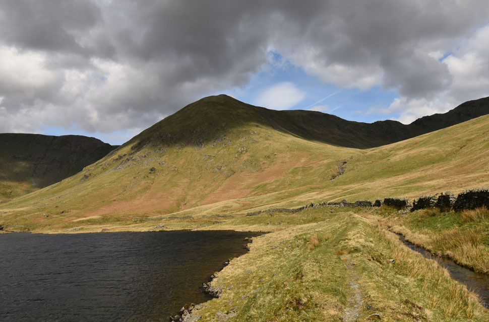
| Yoke, III Bell and Kentmere Reservoir from the top of Nan Bield Pass. |
| I somehow managed to catch up with the large group whose dog had found another dog to bark at and soon both dogs were going at it. I will have to check on past photo's but it looked like one half of the shelter wall had collapsed (on the Mardale III Bell side) A couple of chaps or lasses could spend half an hour repairing it and it will look like new in no-time. |
 |
| III Bell, III Bell North East Ridge and Froswick from Kentmere Reservoir. |
| With the top of Nan Bield Pass behind me I seemed to find the spring in my step again and descended the steep zigzags with ease finding comfort as the path eased before the final steep descent of the day towards the shores of Kentmere Reservoir. |
 |
| Yoke and III Bell from Kentmere Reservoir. |
| Despite the arrival of high cloud the sun was still beaming down so off came my jacket and base layer for the walk back to Kentmere in just a technical T-shirt. |
 |
| Looking back on Lingmell End and the top of Nan Bield Pass. |
| I was surprised to find that there was only a Dad and his son at the reservoir whom I pass with a hi before crossing the outflow where I swilled my boots and in the process, the water, although not deep, sprayed mist all over my legs and short bottoms. |
 |
| Rainsborrow Crag and Yoke from the old Reservoir Cottages. |
| I think there's time for a re-vist one day where I'll walk the Edge from the base to the summit of Rainsborrow Crag. |
 |
| Looking back on Yoke, III Bell and Froswick. |
| |
 |
| Kentmere Pike, Brown Howe and Harter Fell (Mardale) |
| Seen across the wonderful Kentmere valley. |
 |
| Back in the hamlet of Kentmere. |
Despite the aching feet I made sure I relished the walk back into Kentmere where I was passed by a farmer towing a trailer full of bleating lambs which he later released into a nearby field close to Scales. With the Spring sunshine beaming down I took one last look across the valley accompanied by Ravens whose squawks drowned out the sound of the lambs and their new found freedom. With the large metal gate reached I could hear kids playing in the nearby farm yard while below close to Kentmere Hall, more lambs joined the Spring chorus.
I could see the Church now and I dreaded how the chaotic the parking would be but much to my surprise there was actually places available to park. Over the lambs I could hear the farmer approaching, his trailer shattering the silence as he passes before fading into the distance as the valley returned to the sound of lambs. Spring sunshine and the rustling of leaves from the trees in nearby Church yard. |
|
| |
| Back to top |
 |
|