|
Caudale Moor to Brock Crags via High Street |
 |
 |
1st July 2017 |
 |
|
To start my weeks holiday I planned a nice little fourteen miler covering much favoured ground amongst the High Street Fells. I guess every walk I plan has a reason behind it and on todays walk that was to take Caudale Moor's north west ridge or Rough Crag as it more commonly known and maybe even do a little exploring around Caudale Quarry which lies just a short walk away off the ridge.
I'm really enjoying my fell time at the moment with the exception of my Outlying walk project, I can walk spontaneously where and when I like but the lure of a long day spent on the fell is never far away and I can wholly put that down to my previous walking projects where I came to enjoy the tough long days. After picking up foot and knee injuries I said that it would be too much to take such walks on again but that didn't mean that every now and again I couldn't just pick out a route and let my legs and lungs do the rest.
It felt great knowing I'd be spending a full day on the fell again and dare I say, to have to train my mind-set on the long route ahead which in actual fact isn't as arduous as the figures suggest with most of the hard work behind me once I had summated Thornthwaite Crag before enjoying the views amongst my favourite Lakeland fells which only left me feeling one way.
I kinda felt like a kid in a sweet shop. |
|
| Wainwright Guide Book Two |
 |
| The Far Eastern Fells |
-Ascent from Brothers Water
This beautiful retrospect over Patterdale is justification for frequent halts during this continuously steep ascent. The route follows the well defined crest of the ridge. Of the many approaches to the summit this is by far the best. |
 |
|
|
|
| |
|
Overview |
|
|
| Ascent: |
4,374 Feet - 1,334 Metres |
| Wainwrights: |
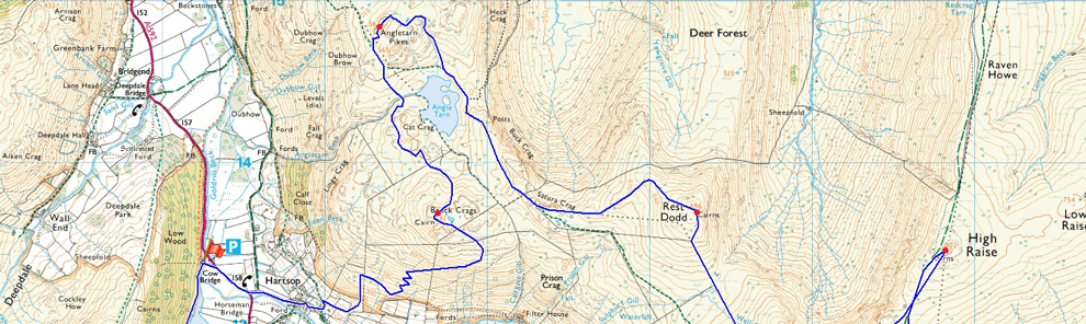
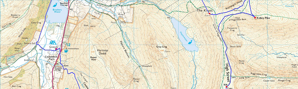
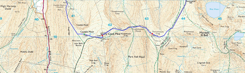
10, Caudale Moor (Stoney Cove Pike) - Thornthwaite Crag - High Street - Kidsty Pike - High Raise (Martindale) - Rampsgill Head - The Knott - Rest Dodd - Angletarn Pikes - Brock Crags |
| Weather: |
Overcast To Start Bright Spells Later. Strong Winds Over The Summits. Highs of 17°C Lows of 13°C Feels Like 10°C |
| Parking: |
Cow Bridge Car Park, Outside Hartsop |
| Area: |
Far Eastern |
| Miles: |
14 |
| Walking With: |
On My Own |
| Ordnance Survey: |
OL5 |
| Time Taken: |
7 Hours 30 Minutes |
| Route: |
Cow Bridge - Brothers Water - Hartsop Hall - Sykeside - Kirkstone Pass - Caudale Beck - Rough Edge - Caudale Quarry - Caudale Moor (Stoney Cove Pike) - Threshthwaite Mouth - Thornthwaite Crag - High Street - Straights of Riggindale - Kidsty Pike - High Raise (Martindale) - Rampsgill Head - The Knott - Rest Dodd - Satura Crag - Angle Tarn - Angletarn Pikes - Cat Crag - Brock Crags - Hartsop - Cow Bridge |
|
| |
|
Map and Photo Gallery |
|
|
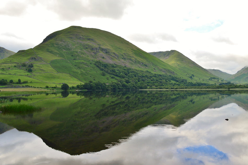 |
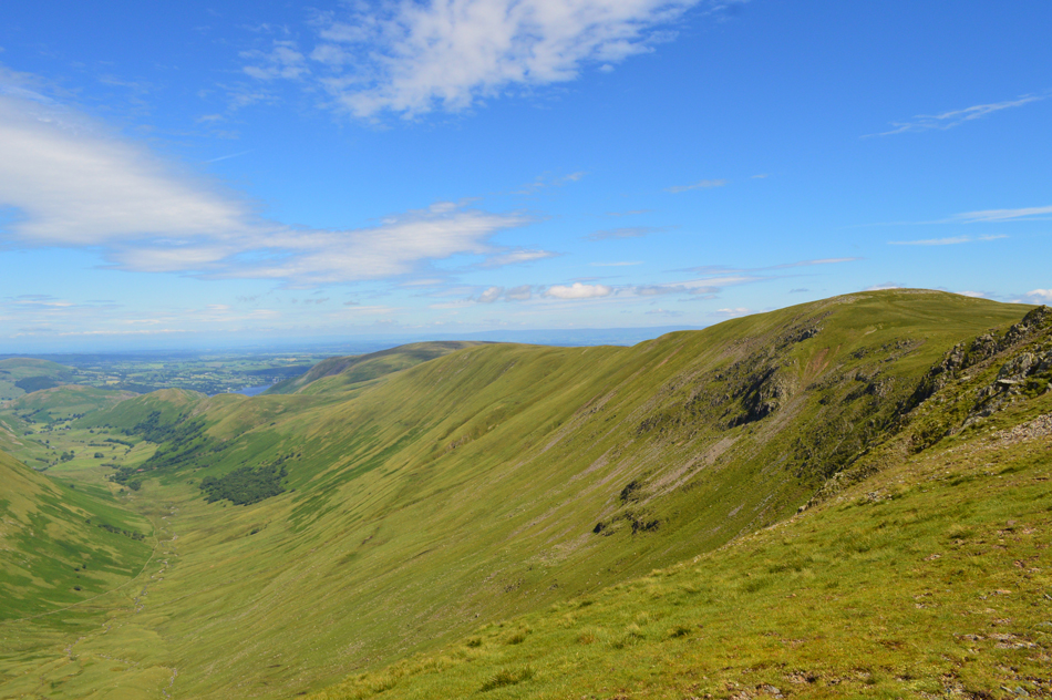
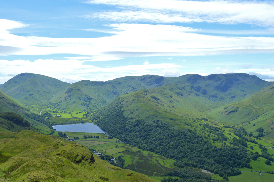
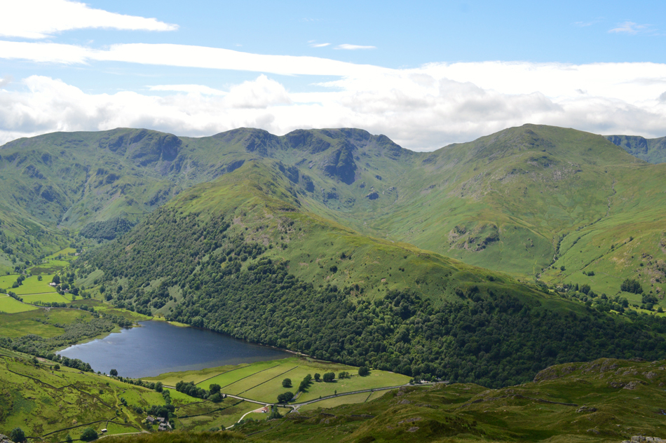
| Hartsop Dodd, Rough Edge and Caudale Moor reflecting in Brothers Water 07:30am 13° |
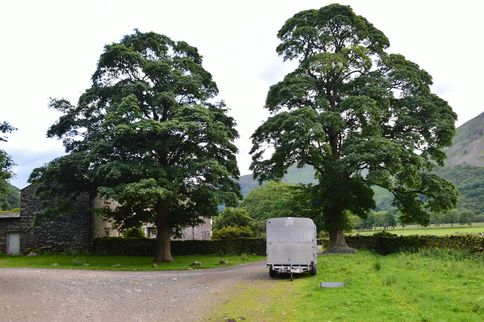
In anticipation to get to Lakeland this morning I woke a half hour before my alarm clock was due to go off so after checking the forecast one last time I got up and ready then set about loading the car. Being half an hour ahead I arrived at the car park at Cow Bridge around 07:20am after an uneventful drive north. I parked easily but was left angered by the inconsiderate van driver who had parked his van across three spaces, I mean why on earth would you do that on such a relatively small car park. I'm soon joined by a fellow walker who only mirrored my thoughts, admittedly nothing was said with the exception of 'morning' over the car roof tops but by the way he looked at the van I knew he was thinking exactly the same as I was.
It's lovely and mild with only the smallest hint of a nip to the morning air meaning my soft shell gets rolled up and packed away in my pack. If the forecast is to be correct it should start to brighten up soon but overhead all I can see is a gathering of high white cloud, I guess I'll take a rain check on that forecast for now.
With my car locked I shoulder my pack before passing the van which was still managing to churn me up inside all of which though was soon forgotten as I started to make my way towards Brothers Water. Further up the shoreline I spot an elderly gent photographing the waters reflections with his camera before he climbs back onto the path in the direction of Hartsop Hall. After a few moments spent on the shoreline I too climb back onto the path where I stop at a gap between the trees and survey my route into Caudale's north west ridge (Rough Edge) bracken obscures the lower reaches of the path but it's still traceable all the way from Brothers Water Inn.
Up ahead, Hartsop Hall. |
 |
| Hartsop Hall. |
| I only walk as far as this point to take this photograph before heading towards Sykeside Campsite via the Farm access track in front of the Farm. |
 |
| High Harstop Dodd, Dove Crag and Dovedale from Sykeside Campsite. |
| Delightful views into Dovedale towards a cloud topped Dove Crag while being accompanied by the smell of cooked bacon! |
 |
| Views towards High Hartsop Dodd shortly after crossing the bottom of Kirkstone Pass. |
| With my mouth still watering from the smell of bacon I pass Brothers Water Inn via the car park before crossing Kirkstone Pass. From the Inn access onto the fell side is easily gained via a wooden gate situated almost directly opposite the entrance to the Inn, access can also be found closer to Caudale Bridge a little further up the pass. |
 |
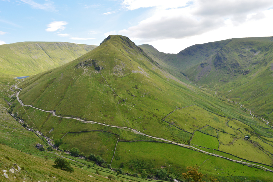
| Views towards Hartsop Dodd over Caudale Quarry and The Tongue. |
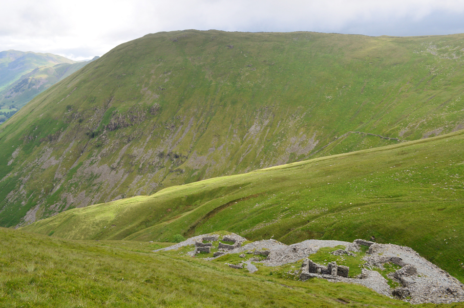
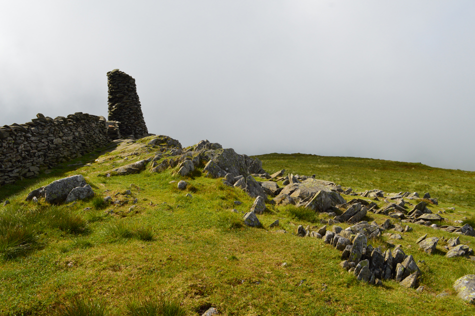
Once Caudale Beck is crossed at a Ford the climb onto Rough Edge begins instantly accompanied by Caudale Beck where the path follows a steep groove through bracken. Once the ruined huts are reached I take time out to explore the old ruins finding lengths of old Iron track rusting in the grass, and further into the ruins the head of a shaft open to the elements whose entrance is covered by two old Iron gates.
The Quarry was worked right up until the 1930's and it's difficult not to spare a thought for the men who worked the Quarry day in day out, month after month year after year, it couldn't have been a pleasant life by any means. |
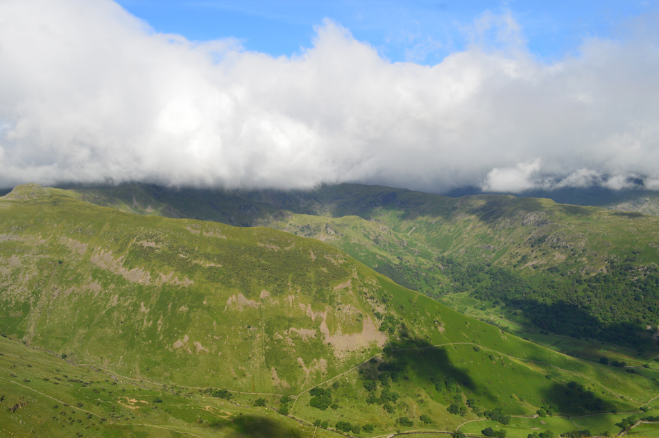 |
| Cloud topped Dove Crag, Hart Crag and Fairfield. |
| Despite its beauty the cloud was worth while keeping an eye on in which direction it was moving, with any luck it should miss me, little did I know at this point that there was more low lying cloud lying in wait on the Troutbeck side of Caudale Moor. |
 |
| Fine views from Rough Edge as far as Ullswater and Place Fell. |
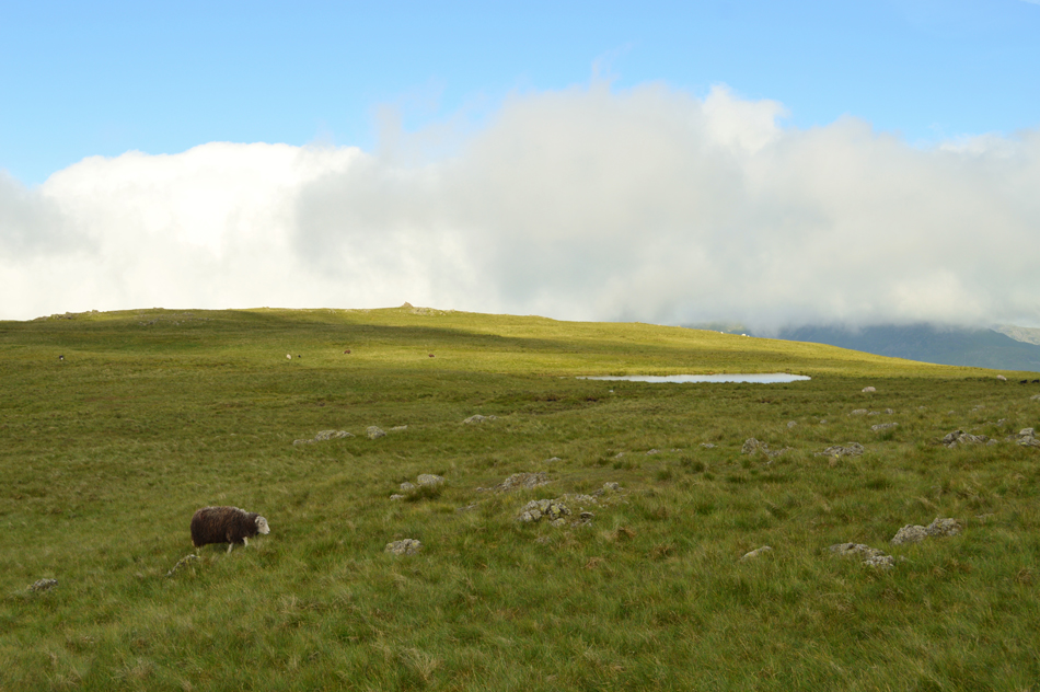
| Having crested the ridge after the continuous pull up, and through the Quarry it was time to relax and enjoy the ridge walk all the way towards Caudale Moor summit. With lungs breathing normally again I could now enjoy the fine views in every direction. |
 |
| A close up of Brothers Water, Arnison Crag, Place Fell and Ullswater from Rough Edge. |
| |
 |
| Views over Kirkstone Pass towards Red Screes and Middle Dodd from Rough Edge. |
| |
 |
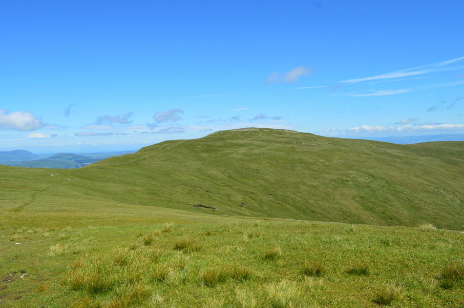
| Looking back towards Caudale Moor summit. |
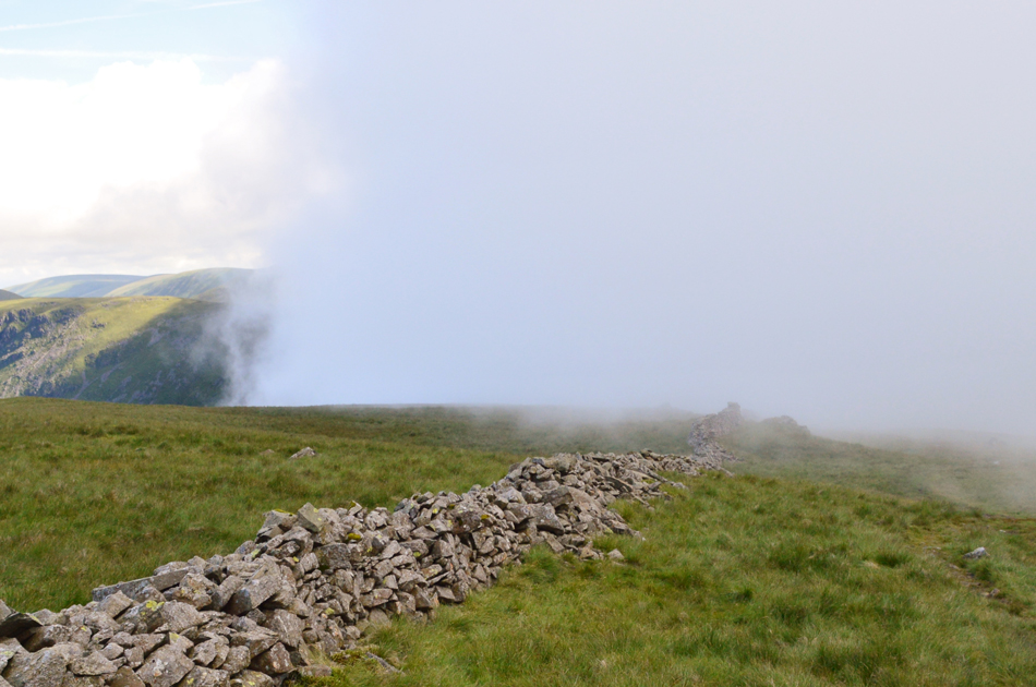
| I had very much looked forward to the last stretch over the shoulder of the ridge before the summit cairn was reached and it was here I was able to view the cloud on the Troutbeck side of the summit. Lapwings call over the top of the summit breeze and foot by foot the cloud started to creep my way first losing light and for a few moments, visibility. |
 |
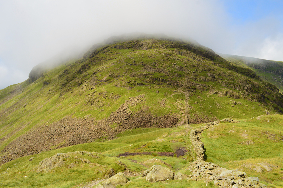
| Cloud advances over the summit of Caudale Moor. |
| |
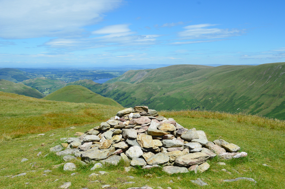
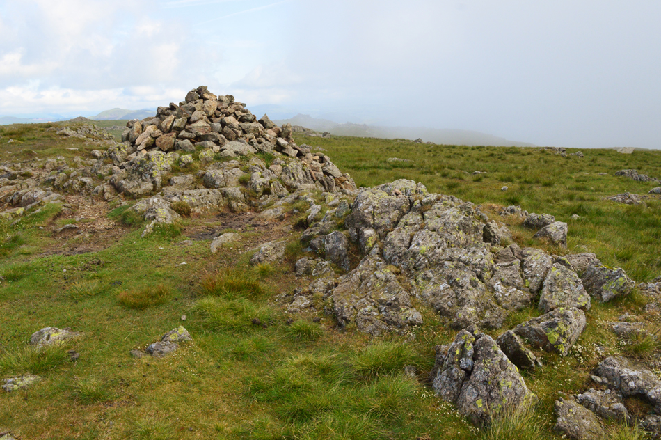 |
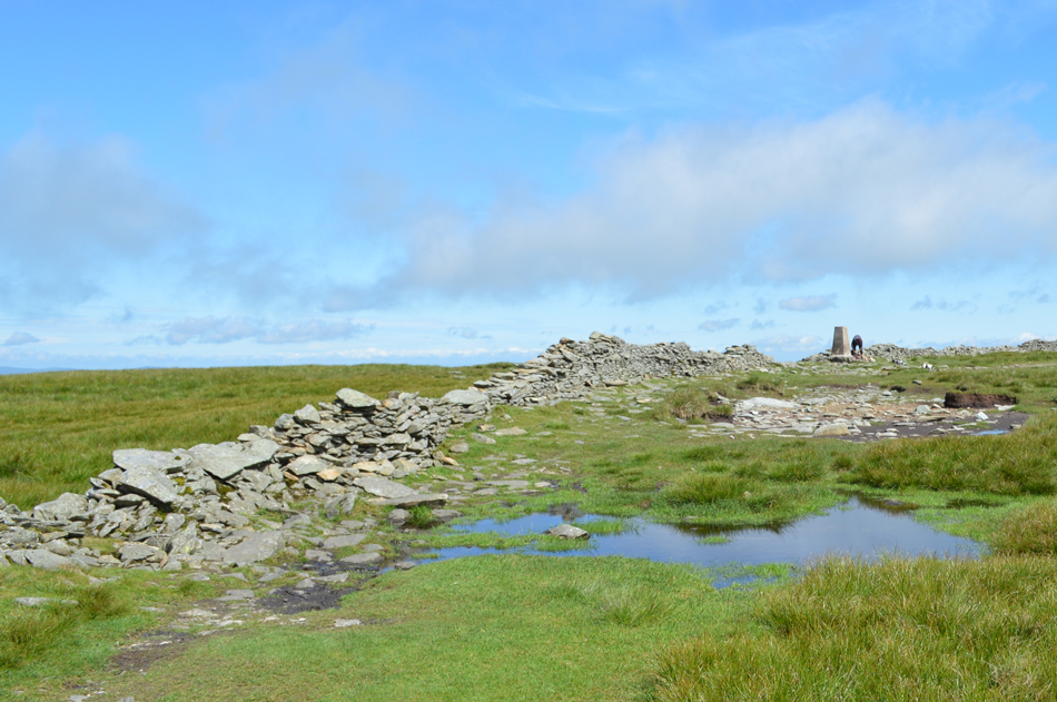
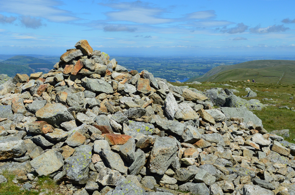
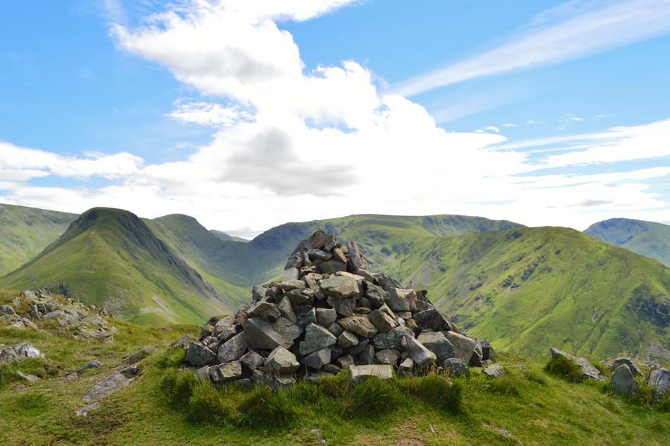
| Caudale Moor (Stoney Cove Pike) summit cairn. |
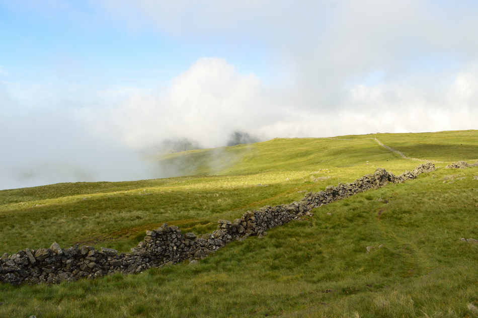
| I followed the familiar summit stone wall first from the left before hopping over to the right, soon enough the wall ended and just a short distance away the summit cairn appeared through the cloud which by now was starting to lift, perfect timing I thought. |
 |
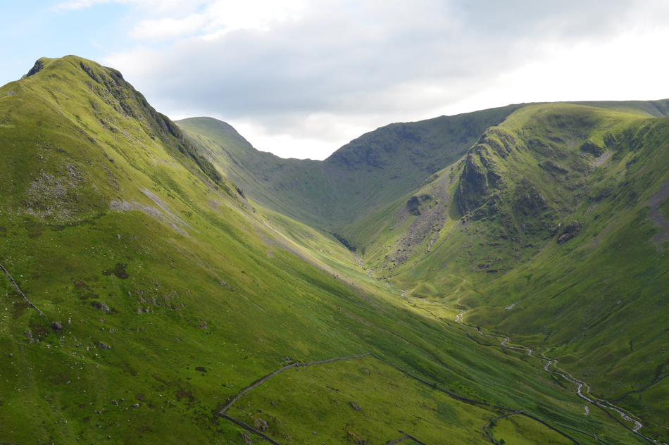
| Descending into Threshthwaite Mouth. |
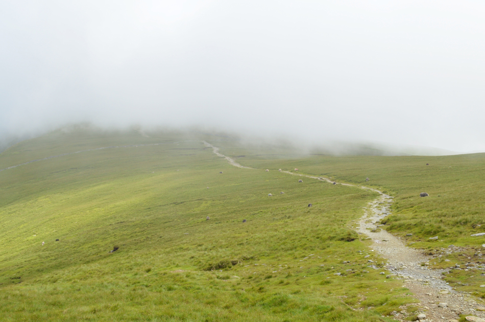
I again lost light and visibility soon after leaving the summit but I was lucky enough to find myself in a break in the cloud where I watched the cloud roll in right over the top of Threshthwaite Mouth, this time the cloud was much thicker and the whole descent was done in loose visibility. My descent over Threshthwaite Mouth was again something that I had been looking forward too mainly because it had been sometime since I was last here where at times I could only see just yards ahead of me, oh well not to worry.
The rock was wet and was still slippery from the previous days rainfall which meant my descent didn't half require my full attention meaning precaution was key to a safe descent.
By the time I had descended the cloud had started to lift revealing Threshthwaite Mouth and soon afterwards the summit of Thornthwaite Crag, more great timing I thought. |
 |
| Views into Throutbeck from Threshthwaite Mouth. |
| |
 |
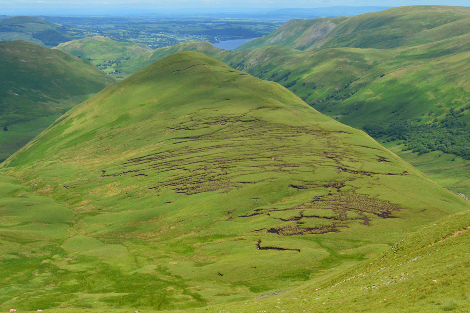
| Looking back on Caudale Moor (Stoneycove Pike) from my ascent on Thornthwaite Crag. |
| It would appear that the cloud was just confined to the summits, much like I had seen earlier over Dovedale but with vast breaks between the valleys, for now though it looks like that's the last I'll see of the cloud. |
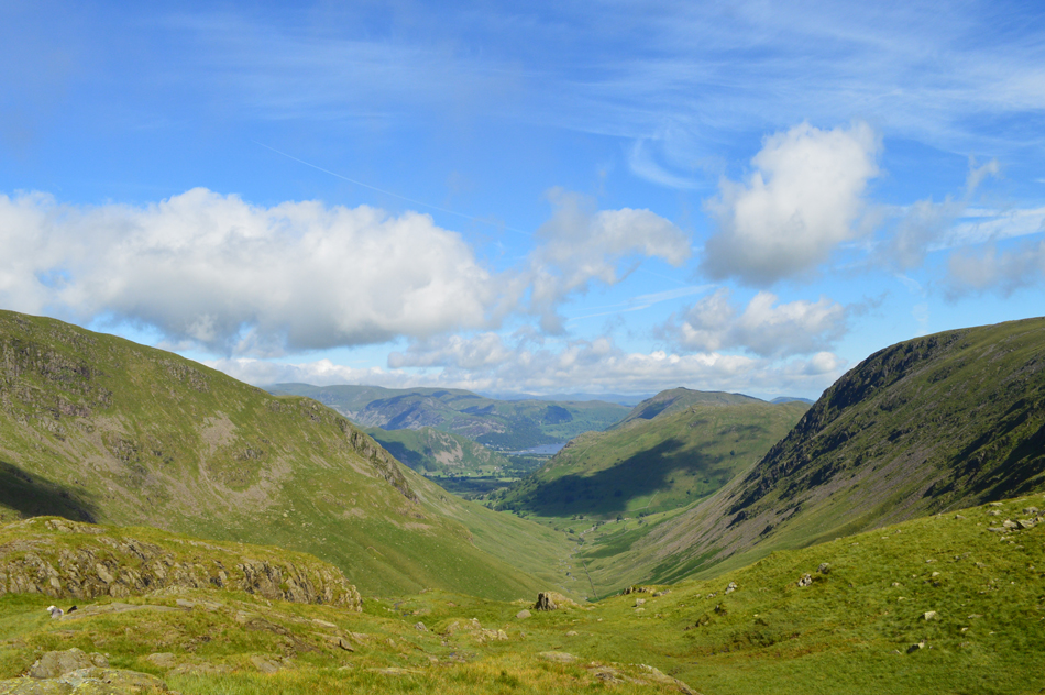 |
| Views over Pasture Bottom towards Brock Crags, Place Fell, Arnison Crag, Sheffield Pike, Gowbarrow Fell and Ullswater. |
| |
 |
| Looking back over Threshthwaite Mouth towards Caudale Moor (Stoney Cove Pike) Threshthwaite Cove, Raven Crag and Gray Crag. |
| |
 |
| Thornthwaite Crag Beacon. |
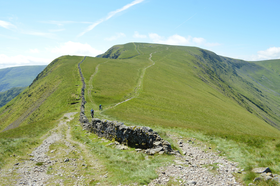
I always enjoy the ascent from Threshthwaite Mouth to Thornthwaite Crag and todays ascent was no different as I picked my way up the rocky path which then plateaued once the summit shoulder was reached leaving a gentle stroll towards the summit beacon. Having stayed on this side of the summit wall I couldn't but help notice more cloud was on its way which continued to rise from the Troutbeck Valley. |
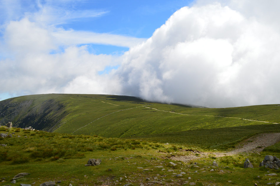 |
| Cloud advanced on High Street seen from Thornthwaite Crag. |
| Well, If I'm going to lose my view I might as well watch it happen, just spectacular! |
 |
| Heading towards High Street. |
| |
 |
| Views over Hayeswater towards Rampsgill Head, The Knott and Rest Dodd with Gray Crag over on the left. |
| Now sandwiched between the cloud which is now being helped along by strengthening winds. |
 |
| High Street summit. |
The cloud thinned out but didn't clear properly until I crossed the wall not far from the little stone cairn which marks the route towards Mardale III Bell which I did think of also including but while I was still in cloud and without a hint of the III Bell ridge behind me I continued towards High Street keeping the stone wall to my left.
Up ahead I could see walkers heading from Mardale III Bell all heading for High Street, two of whom stopped at the stone wall who I passed with a 'morning' Further up ahead I pass another walker but while doing so I scare the poor fellow half to death as he hadn't heard my approach, we walk the last few yards laughing about it towards the summit trig point.
At the summit a woman is packing gear into her pack and starts chatting to the fellow while I try capture a few images before the fellow explains he would be heading back to Mardale via the Rough Crag ridge.
The woman who I later learned was from Preston is heading for The Knott and seeing as we left at the same time we struck up conversation along the way. |
 |
| Short Stile and High Street from the Straights of Riggindale. |
I was asked which was the best descent back to Mardale "Kidsty Pike or High and then Low Raise"? Both are great routes I explained but on a day like today I'd personally go with the Low Raise route.
The path leading towards Kidsty Pike was soon reached which was where I was heading next so after an 'enjoy the rest of your day' the lady then continued towards The Knott while I started the short ascent towards Kidsty Pike.
A nice lady who I never got the name of. |
 |
| Views over Riggindale towards Two Penny Crag, Short Stile, Long Stile, High Street, Thornthwaite Crag and Caudale Moor (Stoney Cove Pike) |
| |
 |
| And here's a similar view from Kidsty Pike summit. |
| Blimey that wind isn't half whipping up. |
 |
| From Kidsty Pike I now head towards High Raise (Martindale) |
| With only a few moments spent at Kidsty Pike I start to head towards High Raise passing two walkers along the way, continuing towards my fourth summit I approach a fork in the path where I met a chap from Southampton who is also heading towards the summit, so in conversation we head up together. |
 |
| Red Crag, Wether Hill and Great Mell Fell from High Raise summit cairn. |
As it turns out the chap I have just met is having a break on the Lakeland Fells before starting a new job in Hull next week and believe it or not he's doing the exact same route as I am only in reverse, chances of that eh.
"There's a bus that'll take me back to Ambleside from the top of Kirkstone Pass, reckon i'lll get there by four he asked"? Aye I reckon you will, but if you do miss the bus you can always call in for a pint until the next one comes along. |
 |
| From High Raise we now head towards Rampsgill Head. |
| Despite the chap coming from the direction of Rampsgill Head earlier he hadn't actually been over the summit so we head back together as it's on route. |
 |
| Rampsgill Head summit. |
| You wouldn't know it but there's a guy sat eating a bag of crisp behind the summit cairn which might explain the rather peculiar shot! I shake hands with my fellow walker and wish him well in his new job, a nice chap. |
 |
| The view over Rampsgill (valley) towards High Raise (Martindale) Red Crag, Wether Hill and Bonscale Pike. |
| Further down the valley we have Steep Fell and Hallin Fell with a glimpse of Ullswater in the distance. |
 |
| Taking the short cut to The Knott from Rampsgill Head. |
It's starting to get quite busy now after passing two walkers both heading for Rampsgill Head and after turning around to have one last look at Kidsty Pike I noticed you couldn't find a place to stand on the summit all of whom started to head towards High Raise afterwards. The Knott however, appears deserted and I'll never understand why so many people stop at the wall below, then have a look up towards the summit then continue towards High Street without summating The Knott.
Anyway, that means today I'll get the summit to myself and if there's time, a quick breather too. |
 |
| Rampsgill Head and High Raise (Martindale) from The Knott. |
| It was exactly midday by the time I arrived at the summit and to be honest I was wanting to refuel but seeing as I had the ascent of Rest Dodd yet to do I best do that on a empty stomach rather than a full one. |
 |
| Rest Dodd and The Nab from The Knott summit. |
| It's just a simple case of following the wall all the way before breaking of right over the shoulder towards Rest Dodd summit although I must add simple doesn't mean it isn't going to be hard work and I'm thinking it's going to be notoriously wet down there too. |
 |
| The Nab from Rest Dodd summit. |
| The descent from The Knott was uneventful but I still had the boggy section to contend with which I'm pleased to report was simply avoided by crossing over the wall then hopping back over again once the boggy area was passed although I must add, it never normally works out as easy as it did today. I hit the ascent hard and had tired myself out by the time I reached the end of the wall, for the first time today I started to feel empty while approaching the eighth summit, it's definitely time to refuel. |
 |
| The Nab from Rest Dodd summit. |
Surprisingly it was quite busy with around five people milling around the summit cairn and we swapped Hi's but more importantly they had taken all the dry spots ie; rocks on which to sit on, oh bugger never mind.
It looks like I'll have to wait until my next summit which will be Angletarn Pikes until I break for lunch. |
 |
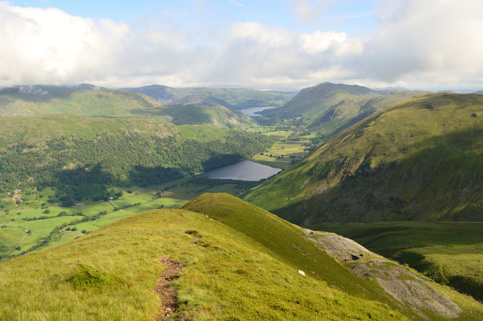
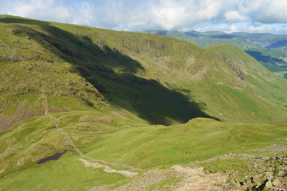
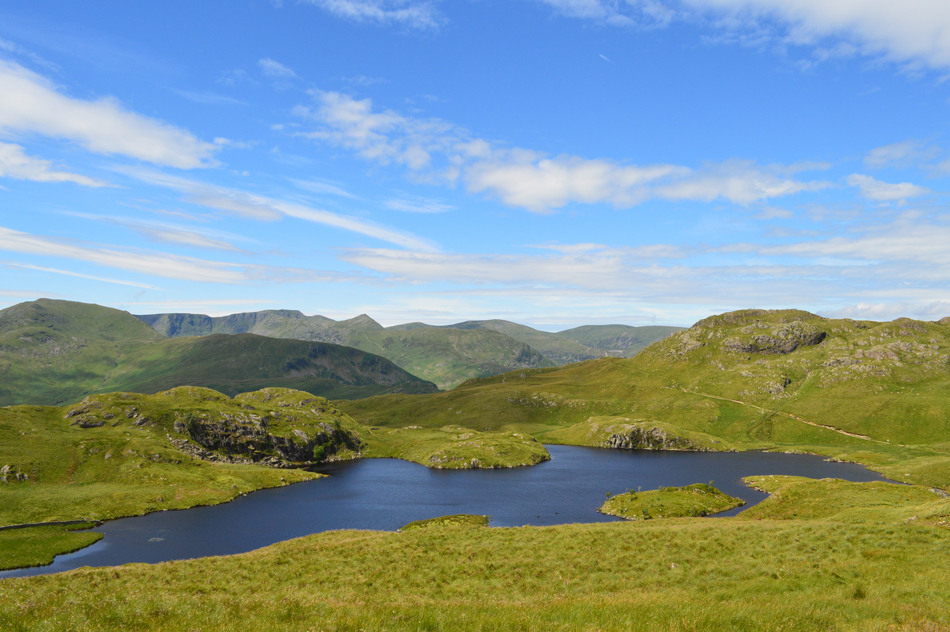
| The view from my Rest Dodd descent towards Satura Crag, Brock Crags, Angle Tarn and Angletarn Pikes. |
| The clarity is probably the best I've seen it all day with the Helvellyn range looking like it's just a stones throw away. |
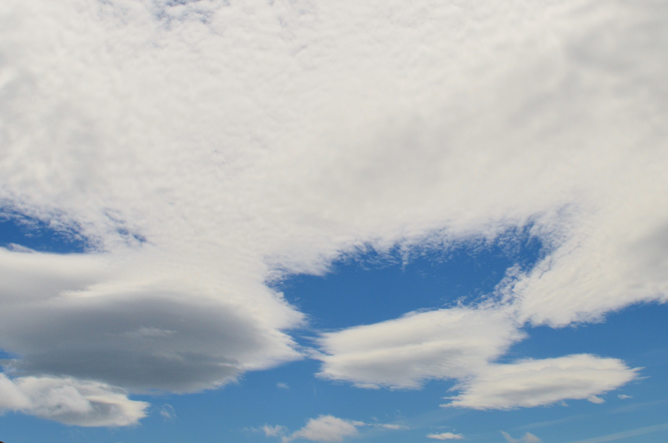 |
| Strange cloud formation overhead. |
| The last time I saw clouds like that it was in a alien abduction movie, please don't abduct me yet I've still not had me dinner and I'm starting to get cranky. |
 |
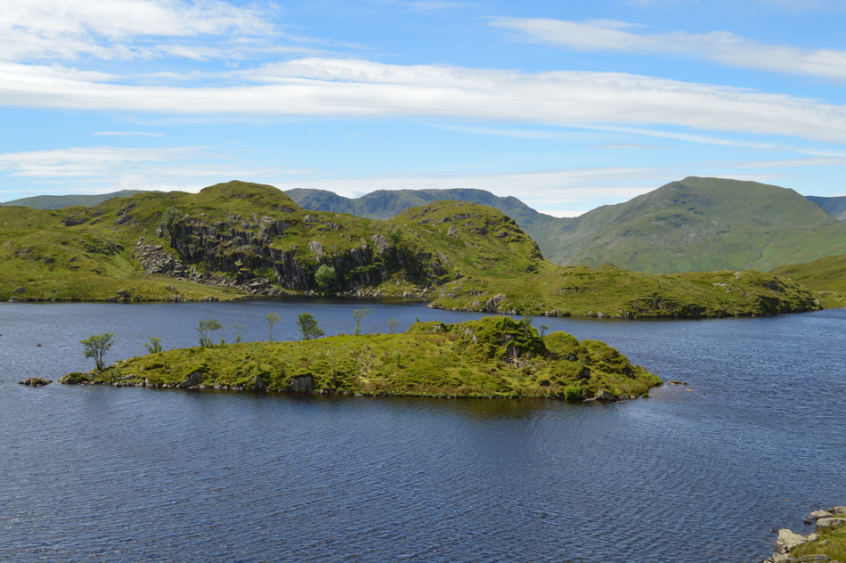
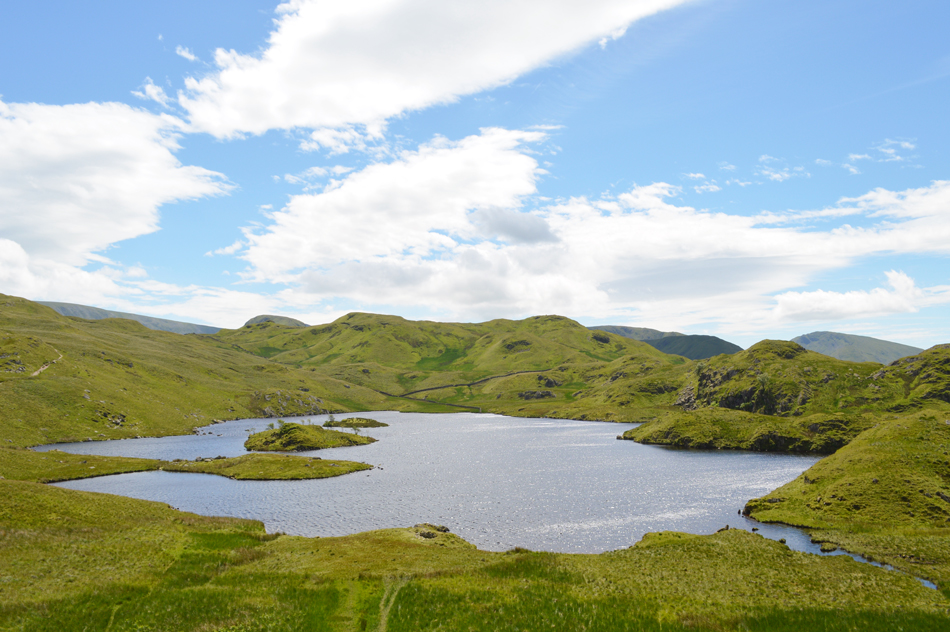
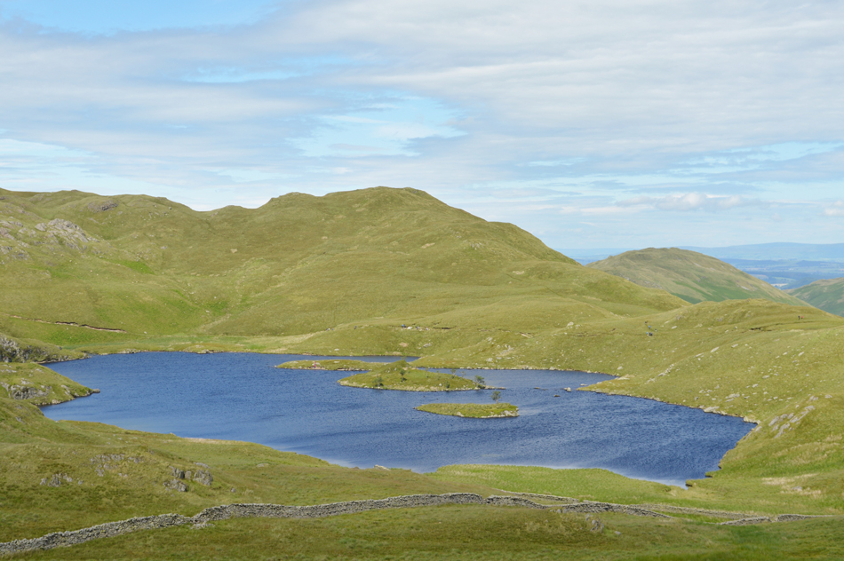
| Blissful Angle Tarn. |
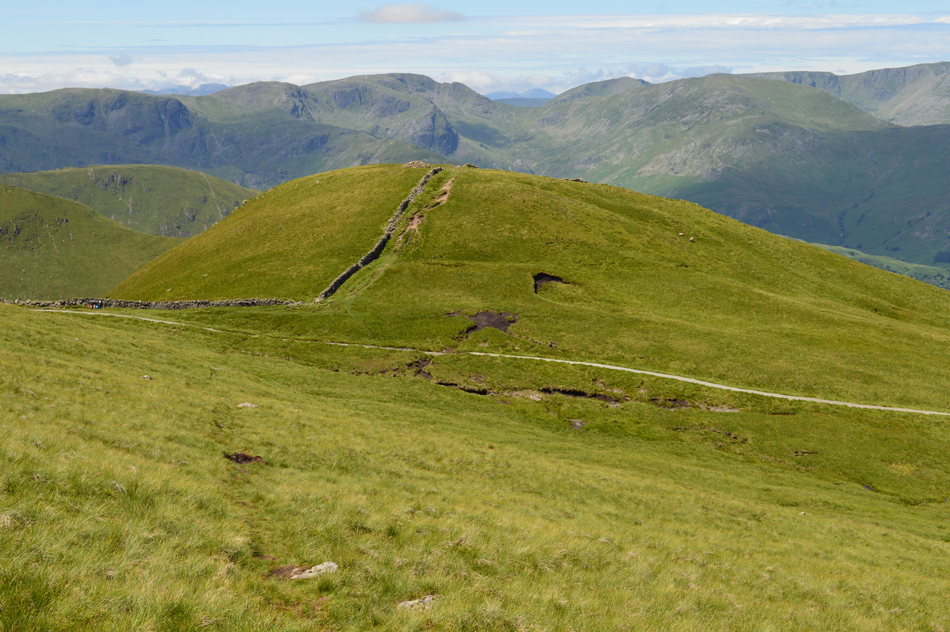
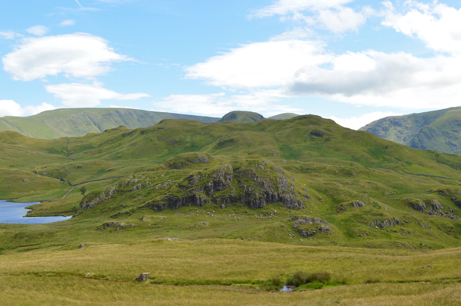
| The path by Satura Crag was starting to fill up with walkers who had avoided Rest Dodd and had used the path over Prison Gill instead some of whom are heading out towards Brock Crags which will feature as my tenth and last summit. Having already intentionally passed the path towards Brock Crags I head for Angletarn Pikes before returning via Cat Crag seen as the outcrop on the other side of Angle Tarn on a path that I don't believe I've used before. |
 |
| Dove Crag, Fairfield, Cofa Pike and St Sunday Crag seen over Angle Tarn and Cat Crag. |
| |
 |
| Brock Crag is seen over Angle Tarn as I head towards Angletarn Pikes summit. |
This is where I left the path from the tarn to ascend towards the summit passing the north summit first which is only divided from the south top by just six feet.
Tired legs are starting to kick in now despite the not much effort needed to gain the summit I was fast running out of energy still not quite believing I hadn't eaten anything other than a Banana and a breakfast bar in the car this morning.
It's no good I'll have to stop and soon. |
 |
| Lunch with a view, Place Fell seen over Boredale Hause. |
| Finally after navigating around the boggy area that divides the south summit from the north summit I found a nice little spot out of the wind and eased myself down. Today I'm on my usual cold beef and tomato rice washed down with two large juicy Satsuma's! That should do the trick. |
 |
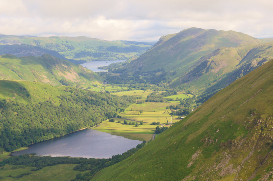
| Breathtaking views over Brothers Water towards Middle Dodd, Red Screes, Hart Crag, Hartsop above How, Dove Crag and Fairfield. |
| And when I say breathtaking I literally meant it, wowzers the wind was so strong at the summit it took my breath away, time to descend I think. |
 |
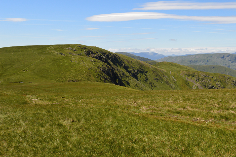
| Cat Crag and Brock Crags are just ahead. |
| After descending Angletarn Pikes I descended sharply back towards the Boredale Hause / Angle Tarn Path and started to head back towards the tarn, but before the path veers left I continue over pathless ground and crossed Angletarn Beck with one easy jump. There was no need to summit Cat Crag seen ahead, instead I follow a singular grassy trod all the way towards Brock Crag summit. |
 |
| Angle Tarn seen with Heck Crag and Beda Fell beyond |
| On the other side of Angle Tarn you might be able to spot the lighter shade of greenery which was the route I used to summit Angletarn Pikes by, it isn't clear in the picture but there is a slight path there which tends to disappear once the bracken takes over. |
 |
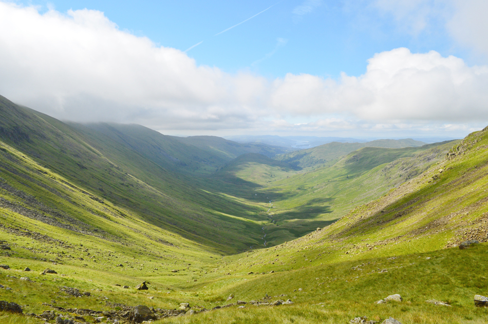
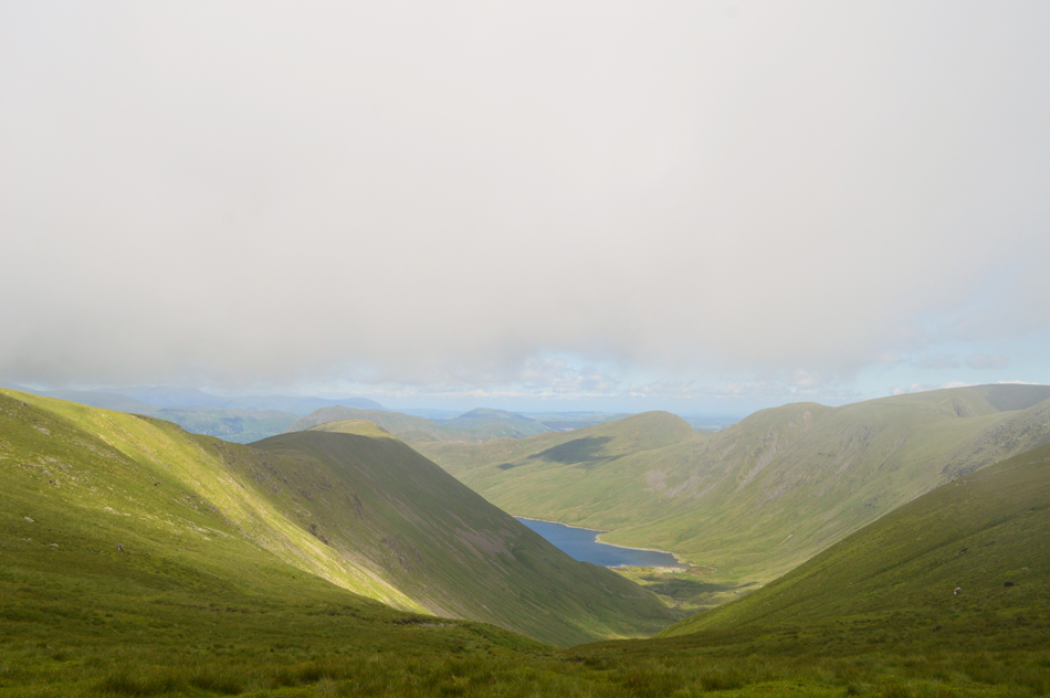
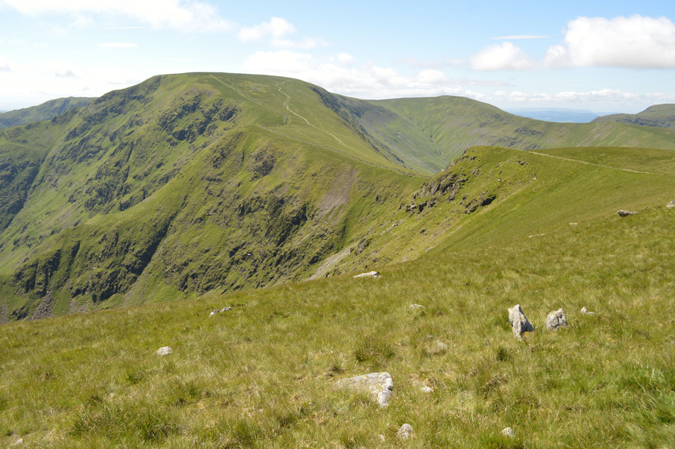
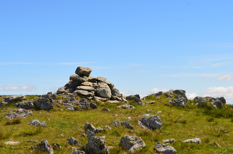
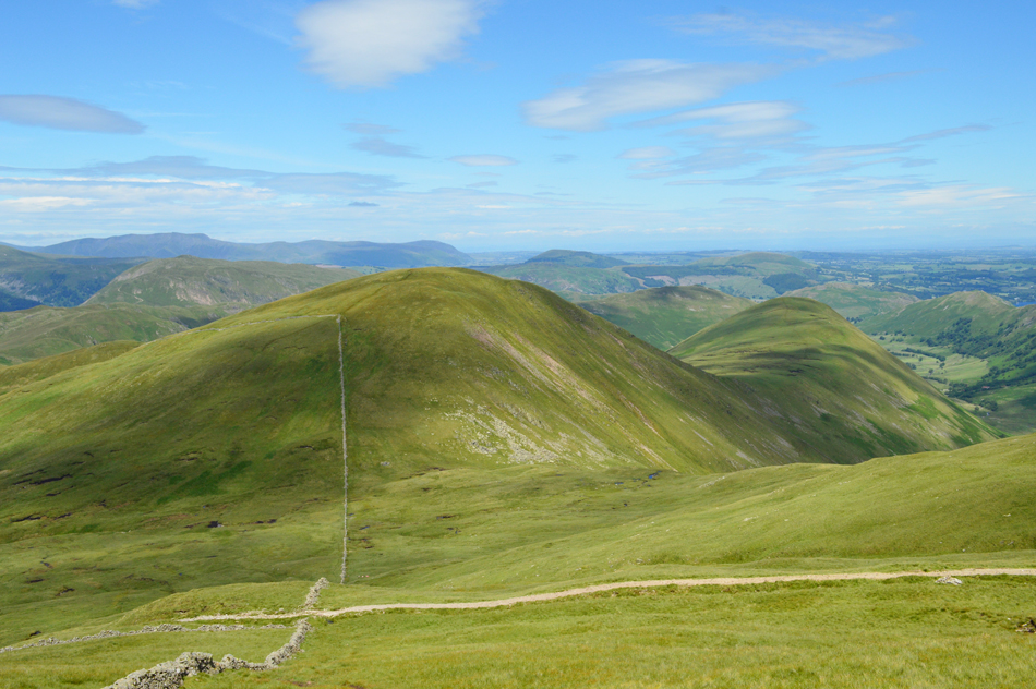
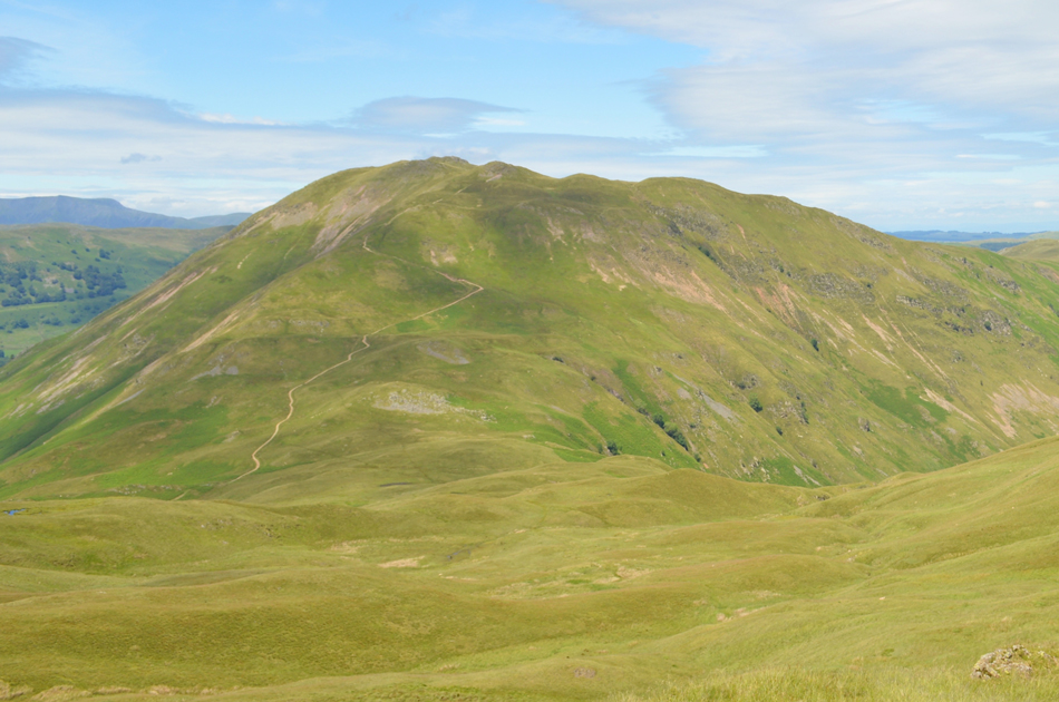
| Fantastic views over towards Gray Crag, Threshthwaite Mouth, Caudale Moor (Stoneycove Pike) and Hartsop Dodd from Brock Crags. |
Having never used the Cat Crag route before I found an urge to pull away at times and make a direct ascent but my head told me to stick to the path which ascended gently all the way towards the summit cairn.
What a cracker. |
 |
| Brothers Water and Harstop above How domineer the view. |
| My line of descent will be direct using the old cart track to the south of the summit, happen I'm going to make it up as I go along if the views are as good as this. |
 |
| Gray Crag domineered my descent. |
Wowzers what a view! Okay I knew this would happen, the track is situated to the far left at the end of a stone wall which will descend me much gentler rather than if I choose to descend pathless.
Although if I take the cart track I'm going to miss out on this amazing view into Pasture Bottom...decisions decisions. |
 |
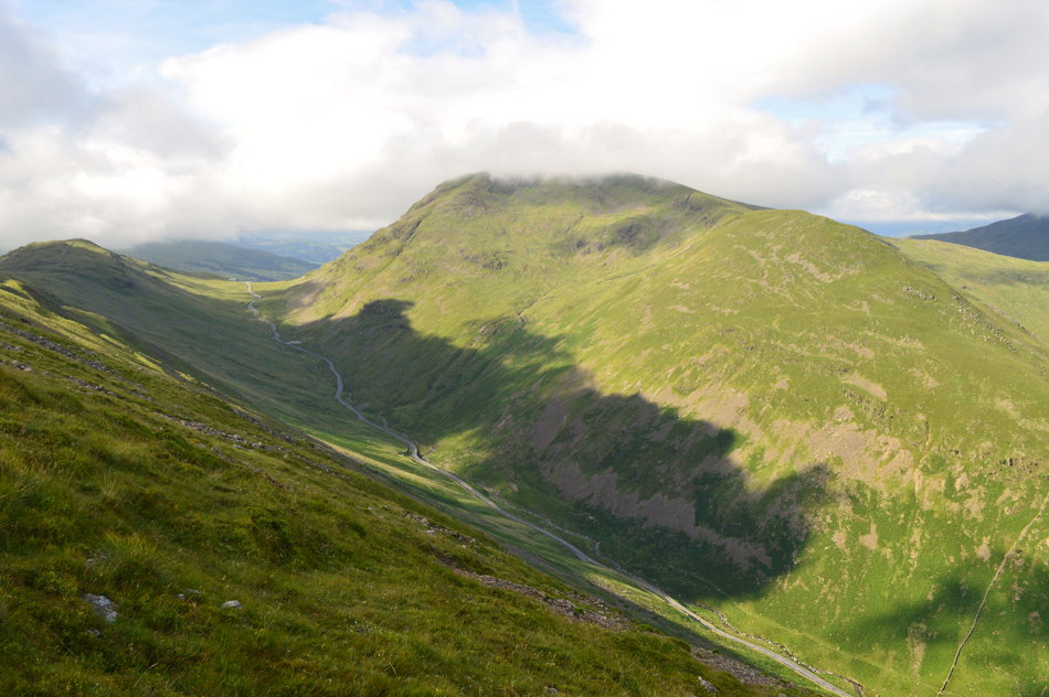
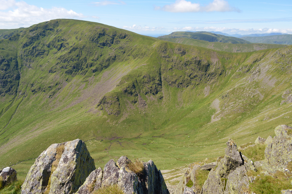
| Fantastic views over Pasture Bottom towards Gray Crag, Raven Crag, Thornthwaite Crag, Threshthwaite Mouth and Caudale Moor. |
| There was only going to be one winner, I'll thank my knees later after they have forgiven me for the exceptionally steep descent. |
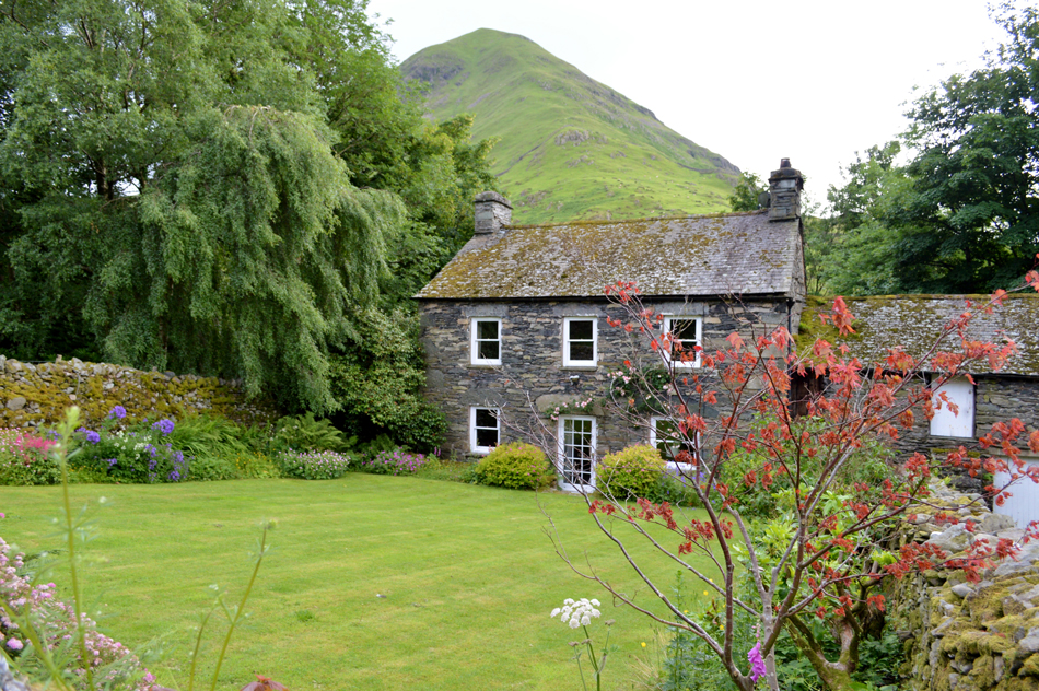 |
| Hartsop Dodd behind Hartsop Cottages. |
The descent was unforgiving but I split it up using the zigzags which was a little easier on the knees and soon I found myself on the lower half of the cart track. With the familiar Cattle Shed close by I followed a walled lane keeping the car park and the village to my left before the lane ended in the heart of the village. I kick my feet back into my boots and in doing so I can feel that my right boot lace is loose but there's no point in bending down to tie it so close to the car besides, I don't think I'll be able to get back up again.
|
|
| |
| Back to top |
 |
|