 |
A Riggindale Round |
 |
 |
27th August 2022 |
 |
|
I had a well deserved weekend off last week which did me a world of good. This weekend I was working but with a great forecast ahead the plan was to head up to the Lakes straight from work. Trouble was it's a Bank Holiday weekend and the roads plus parking was going to be a nightmare.
I really fancied walking the Coniston fells as it seems ages since I was last there and, funnily enough that's where the best forecast was, but there was no way I'd have been able to park so I looked elsewhere. The lure of walking High Street is never far from mind but it would have been darn right cheeky of me to expect to find a parking place gone midday.
I left Preston under afternoon sunshine and as I drove further north the skies were filled with high level cloud yet over the far east of the park blue skies filled the horizon. I'd just have to chance my luck and hope I'd get lucky finding somewhere to park. |
|
| Wainwright Guide Book Two |
 |
| The Far Eastern Fells |
High Street "A striking range in grandeur and wilderness" |
 |
|
|
|
|
| |
|
Overview |
|
|
| Ascent: |
2,680 Feet - 817 Metres |
| Wainwrights: |
4, High Street - The Knott - Rampsgill Head - Kidsty Pike |
| Visiting: |
Rough Crag |
| Weather: |
Hot & Sunny With Light Winds Across The Summits. Highs of 24°C Lows of 21°C |
| Parking: |
Car Park, Mardale Head |
| Area: |
Far Eastern |
| Miles: |
7.6 |
| Walking With: |
On My Own |
| Ordnance Survey: |
OL5 |
| Time Taken: |
4 Hours 10 Minutes |
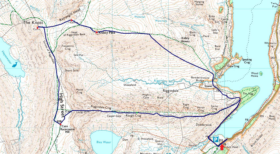
| Route: |
Mardale Head - Rough Crag - Caspel Gate Tarn - Long Stile - High Street - Straights of Riggindale - The Knott - Rampsgill Head - Kidsty Pike - Riggindale Beck - The Rigg - Mardale Head |
|
| |
|
Parking Details and Map |
|
|
| Nearest Post Code: |
CA10 2RP |
| Grid Reference: |
NY 469 310 |
| Notes: |
Probably one of the most scenic car parks in Lakeland found at the head of the Mardale Valley offering easy access onto the High Street fells plus many more. The car park during Summer can fill up quickly but with most car parks in Lakeland if you time your arrival early enough you're always guaranteed a parking place. Parking is free. |
|
| |
|
Map and Photo Gallery |
|
|
 |
| |
| |
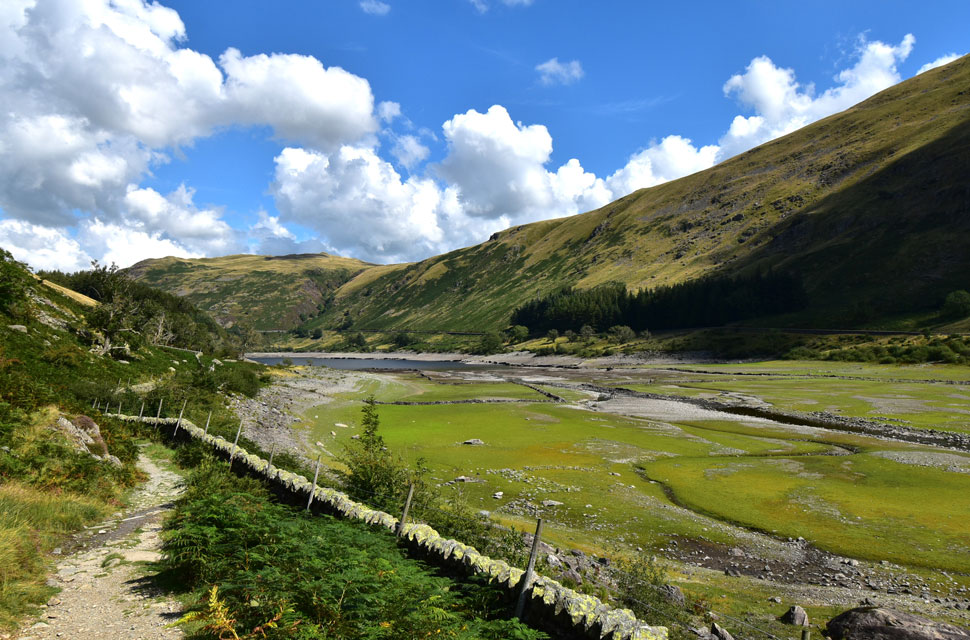 |
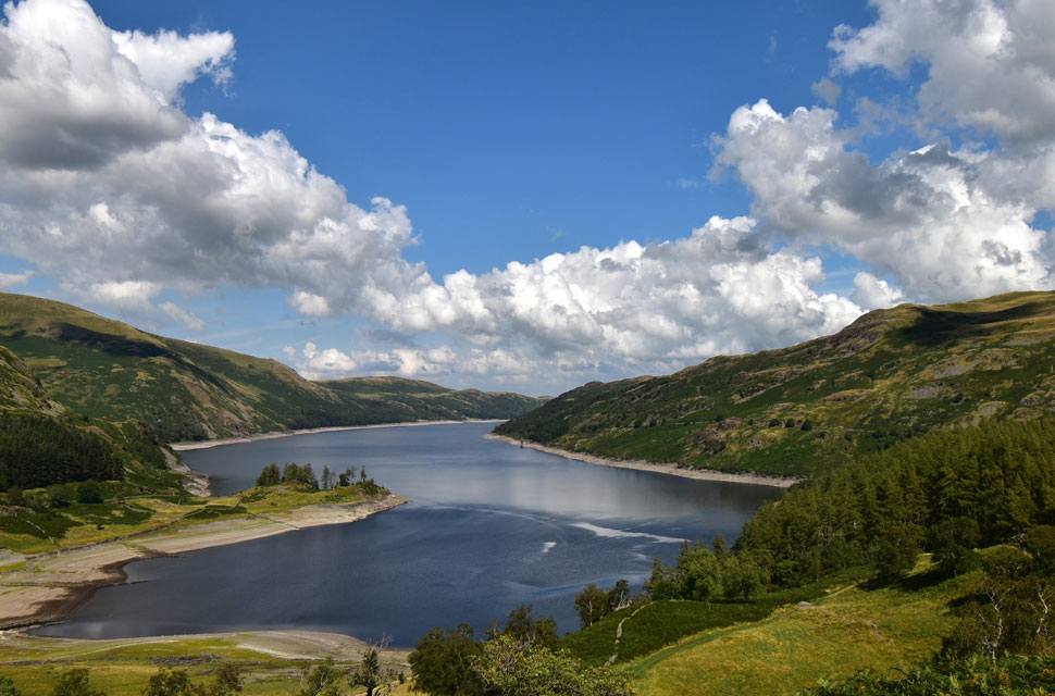
| Views from a very low Haweswater Reservoir towards Brown Howe 13:45pm 21°C |
I left the motorway at JCT 39 and passed through the village of Shap and hardly saw another car until I reached the Dam end of Haweswater Reservoir which I'd expect at 06:30am in the morning but not after midday which wasn't the best sign as it meant no cars were leaving the car park. I continued towards Mardale Head and was then passed by three cars one after the other, either they can't park or they'd just left. Parked cars stretched from the car park back up the road which by no means, were causing any obstruction. At the end of the line of cars I found somewhere to park and chanced my luck further by passing it, driving around the actual car park and returning just so I'd be facing the right way for my return. With my heartbeat returning to normal through the rear view mirror I noticed a couple returning to their car parked behind mine and seconds later I'm joined by a couple who parked in front of me. I'm fine with that but I'm still wearing my work clothes but now both couples are gonna witness me change into my walking gear, no biggie.
It was a quick change mainly because I'm wearing just shorts and a Technical Tee. It feels hotter than 21°C but that's what my anemometer was reading and no doubt it's gonna climb higher. I finished off the litre of Summer Fruits and left the empty bottle in my boot and rolled up my montane stretchy hoodie should it get cooler but I doubt it would. By now the couple who had parked up in front of me were making their way towards the Reservoir and the couple behind were chatting at the rear of their car.
I was ready to go but it still felt like I'd forgot something, if I had forgot something it would stay left behind. I locked my car and followed the line of cars back through the car park where I was passed by a fell runner who I'd seen running along this stretch of path while back at my car. Through the Deer gate two mountain bikers push their bikes up Gatescarth Pass and along the banks of Mardale Beck two walkers are presumingly making their way towards Blea Water. For now I have the path to myself but it won't be for long. |
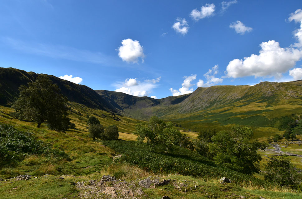 |
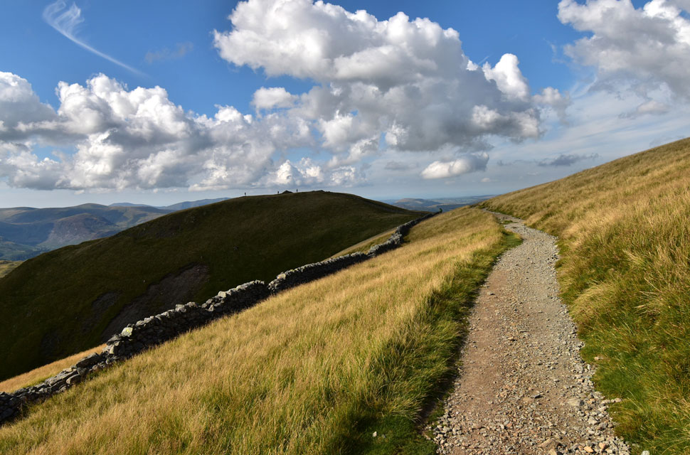
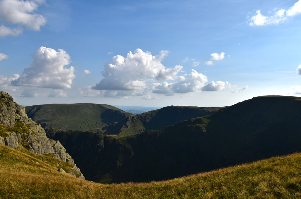
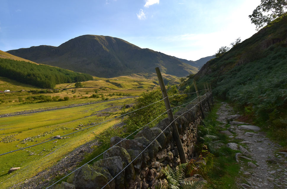
| The Riggindale Valley with High Street seen ahead and Kidsty Pike seen right. |
I'd been basking in my own luck what with being able to park and starting the walk with no one around when all that changed as I passed the ladder stile from where three lads each carrying laden packs emerged one by one over the stile.
They were nice enough lads and after a 'hi' I broke away from them but they were never far from earshot, they were either heading up the Rough Crag ridge as I was or Kidsty Pike and I soon got my answer as they broke right from The Rigg. |
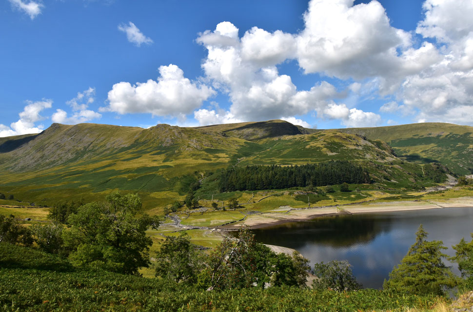 |
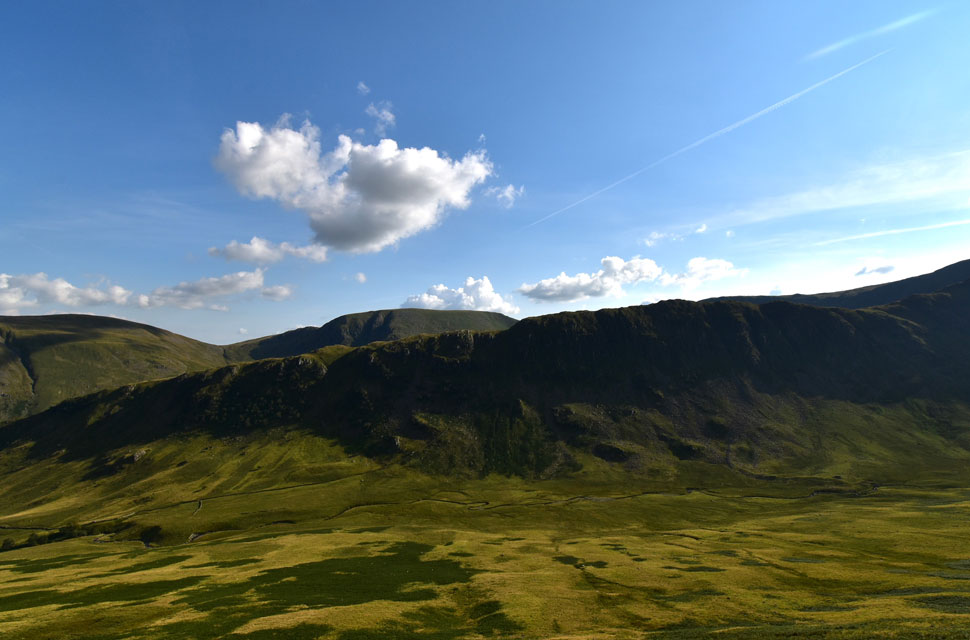
| Views over Haweswater Reservoir towards Kidsty Pike, Kidsty Howes, Low Raise, Hanging Stones, Birks Crag, Castle Crag and Long Grain. |
| Not clearly seen but below Kidsty Howes are the ruins of what appears to be a sheep fold which I'd seen previously but have never visited. Today might be that day. |
 |
| Views beyond Speaking Crag (foreground) towards Haweswater Reservoir. |
| The wind seems to blowing across the reservoir below but it's nice and calm as I begin my ascent on Swine Crag. |
 |
| Haweswater Reservoir, The Rigg, Speaking Crag, Brown Howe, Hare Shaw and Rowantreethwaite Beck from Swine Crag. |
| This step in the wall offers fantastic views over the Haweswater Valley. |
 |
| Ahead, Eagle Crag. |
| From Swine Crag I continued my ascent passing the cairn marking the top of Heron Crag over to my right. Next up is Eagle Crag. |
 |
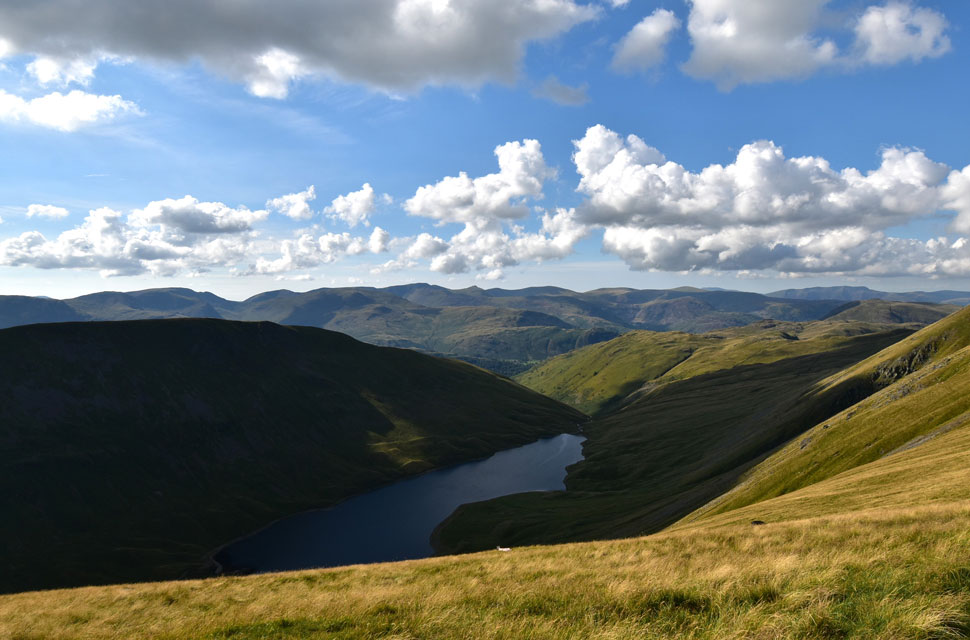
| Looking over Bleawater Beck towards Harter Fell (Mardale) |
| With Mardale III Bell north and north east ridges seen over on the right where Piot Crag forms the head of both ridges. |
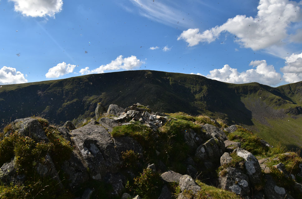 |
| High Street from Rough Crag summit. |
| No need to get the screen wipes out this was the scene when I arrived at Rough Crag summit where I was met by a swarm of flying ants. After doing some research the reason why flying ants swarm around high ground is part of a mating ritual. Can't they just get a room like everyone else! |
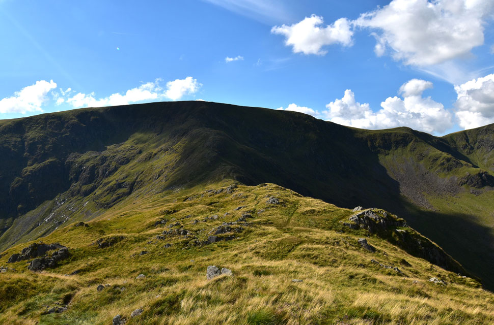 |
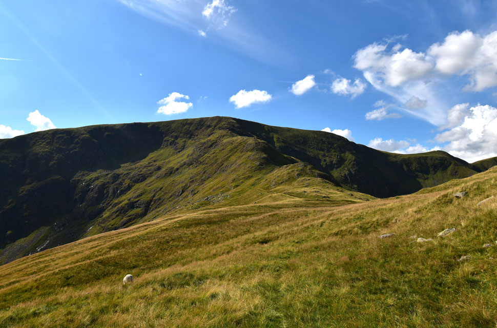
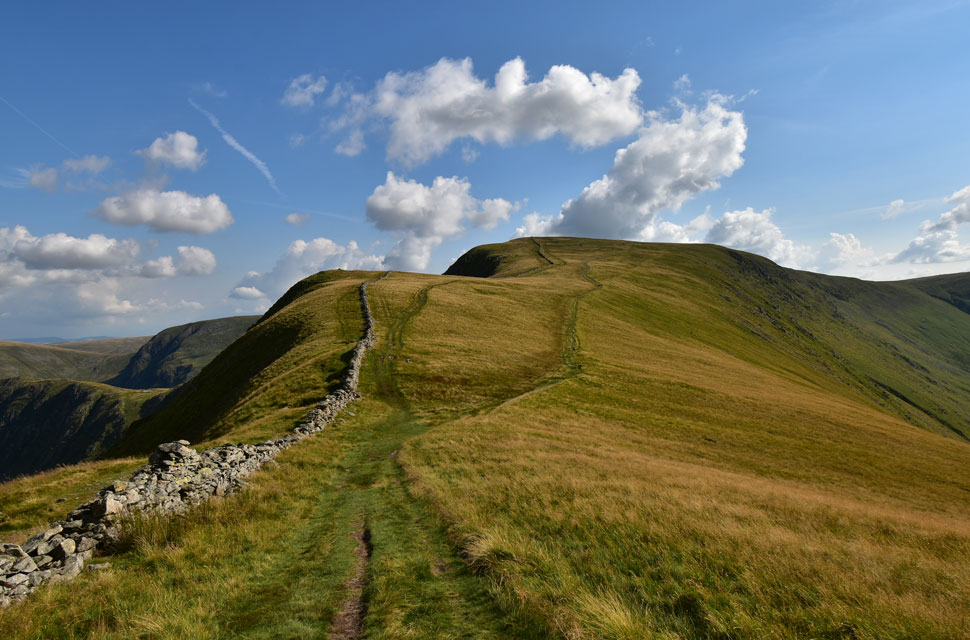
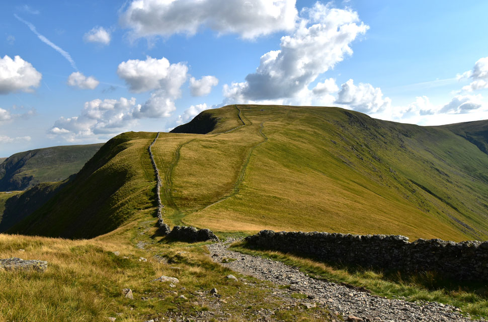
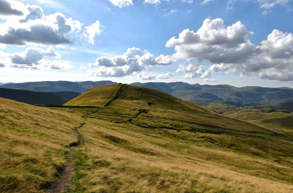
| Long Stile, Short Stile and High Street from Rough Crag. |
| Just a few feet away from the flying ants I took in this view of Long Stile and High Street from Rough Crag summit, |
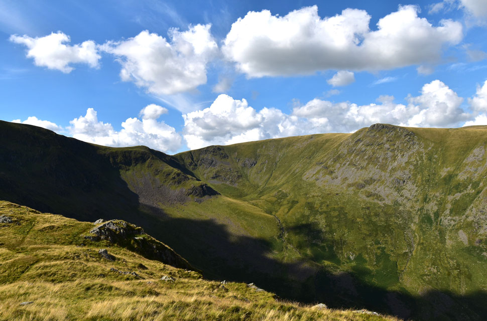 |
| Short Stile, Two Penny Crag, Sale Pot and Kidsty Pike from Rough Crag. |
| That's the head of Riggindale Beck seen descending from Sale Pot. |
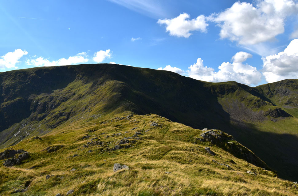 |
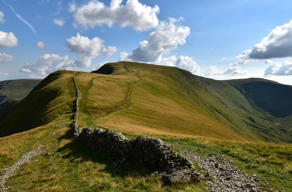
| High Street, Long Stile, Short Stile and Two Penny Crag from Rough Crag. |
| Instead of continuing along the path I head left making a direct descent towards Caspel Gate. |
 |
| Heading towards Caspel Gate. |
| Seen as the flat area in the foreground. |
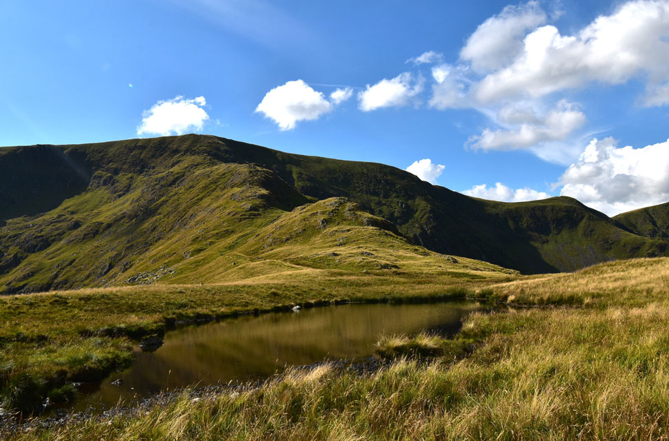 |
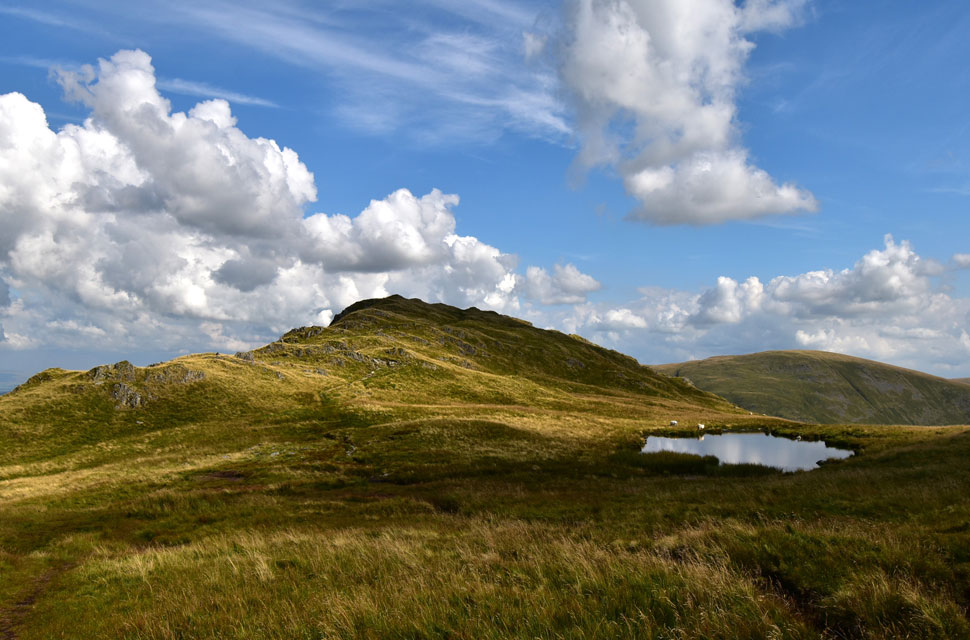
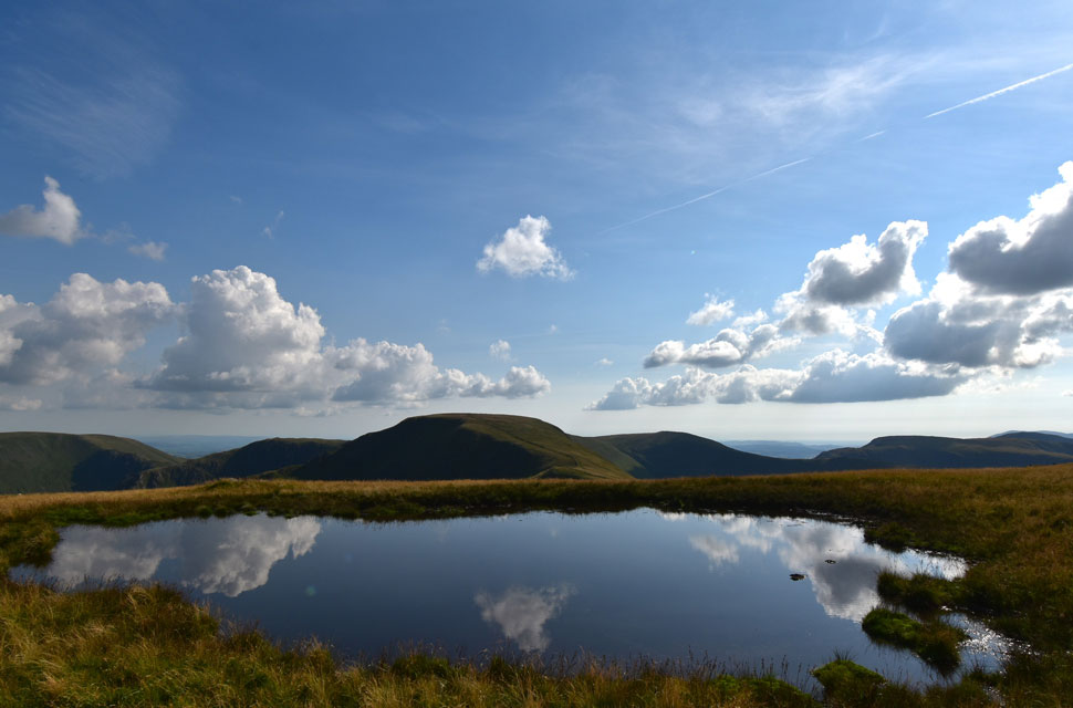
| Long Stile and Short Stile from Caspelgate Tarn. |
| Although the name Caspelgate Tarn does not appear on the map I can't think of a more appropriate name for the tarn. |
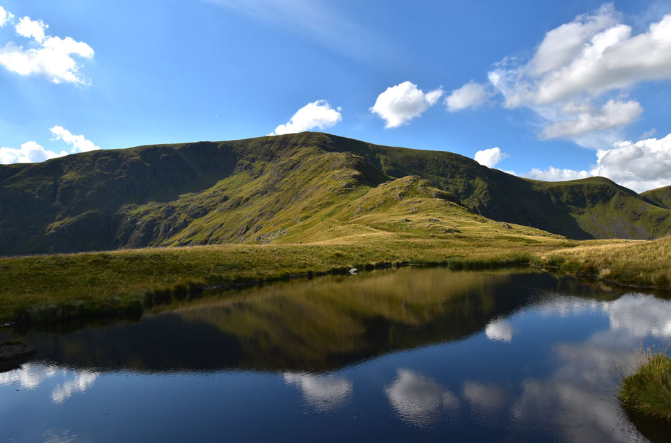 |
| Long Stile reflections. |
| Even after long periods without rain this fabulous tarn never seems to dry up which I find odd as it has no inlet or outlet. |
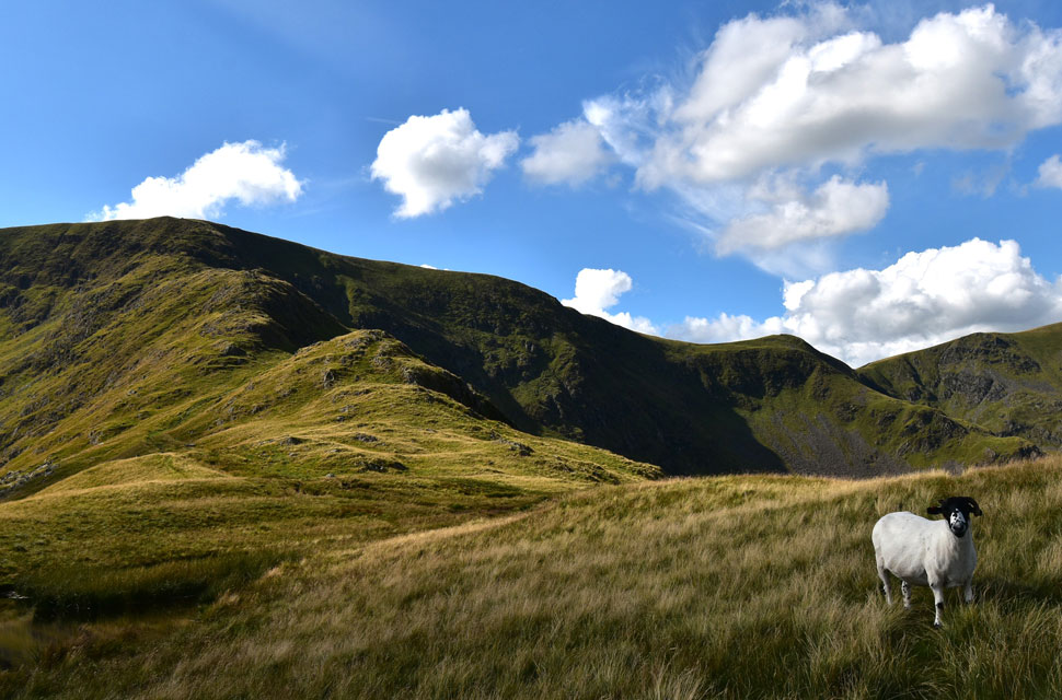 |
| It's also very popular with the locals. |
| Nice hair cut. |
 |
| Looking back on Rough Crag from Caspel Gate. |
| With Branstree seen over on the right. |
 |
| The view from Long Stile towards... |
| ...Rough Crag, Riggindale, Haweswater, The Rigg, Brown Howe, Hare Shaw, Selside Pike, High Howes, Branstree. the Gatescarth Pass, Tarn Crag (Longsleddale) and finally Harter Fell. |
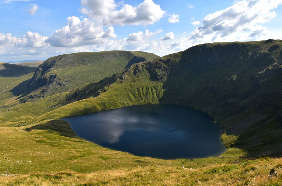 |
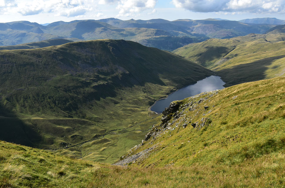
| Blea Water, Harter Fell (Mardale) and Mardale III Bell from Long Stile. |
| At 63m / 207ft Blea Water is the deepest tarn in Lakeland exceeded only by Lake Windermere and Wast Water. |
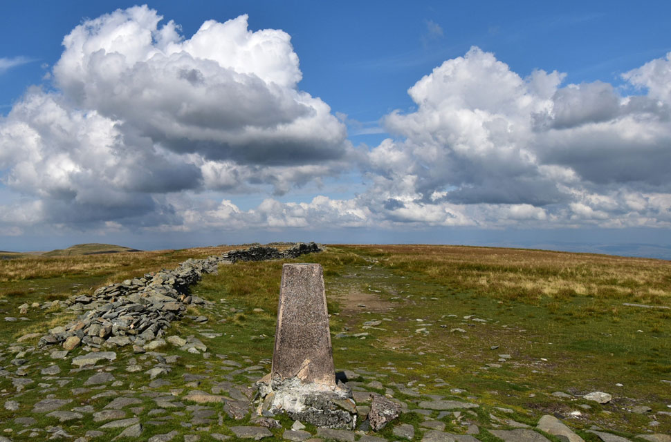 |
| High Street summit trig point. |
I'd given myself half and hour to ascend Long Stile but I'd actually ascended in half that time and reached a deserted summit trig point a few minutes later. I've been here dozens and dozens of times but today was the first time I'd noticed chunks of concrete missing from this side of the trig with cracks forming in the upper column.
I can't see this being an act of vandalism as the cracks could be due to a lightening strike but don't hold me to that. Either way it's something that should be monitored. |
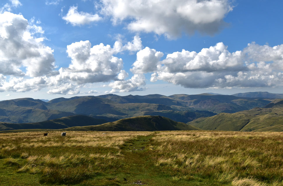 |
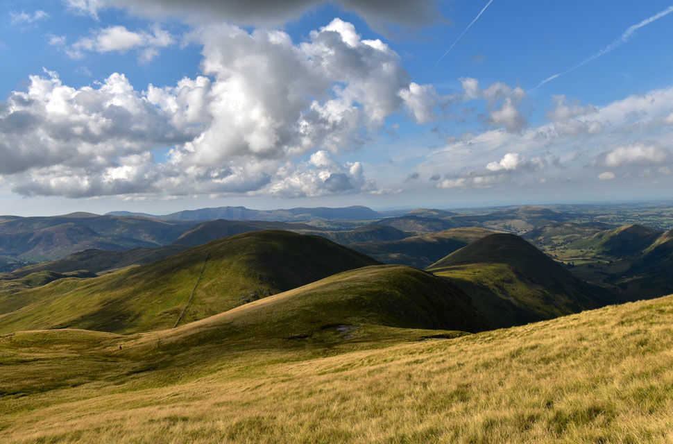
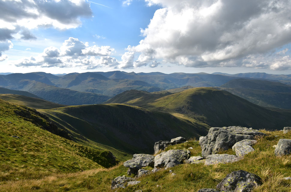
| Unfolding views over the Eastern fells from High Street summit. |
| From centre left to right here we have Gray Crag, Hartsop Dodd, Hartsop above How, Hart Crag, Fairfield, Cofa Pike, St Sunday Crag, Birks, Arnison Crag, Dollwagon Pike, Nethermost Pike, Helvellyn, Catstye Cam, Birkhouse Moor, Whiteside, Raise, Stybarrow Dodd,Hart Side, Sheffield Pike, Great Rigg, Skiddaw. Blencathra, Brock Crags and finally Angletarn Pikes...phew! |
 |
| The view down into Hayeswater. |
| With Grey Crag beyond. |
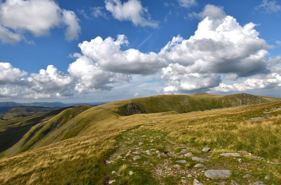 |
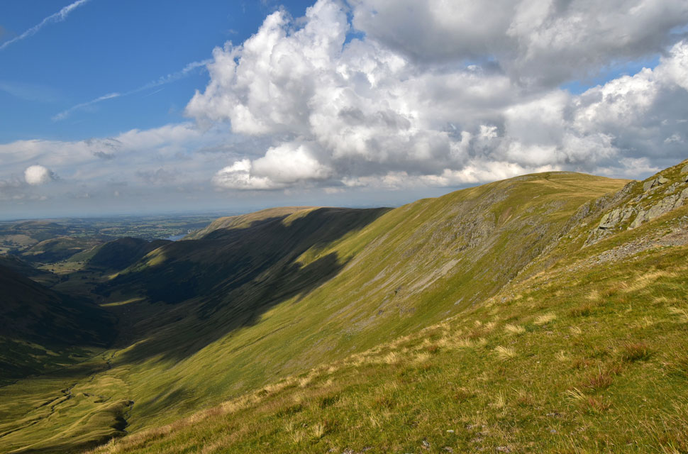
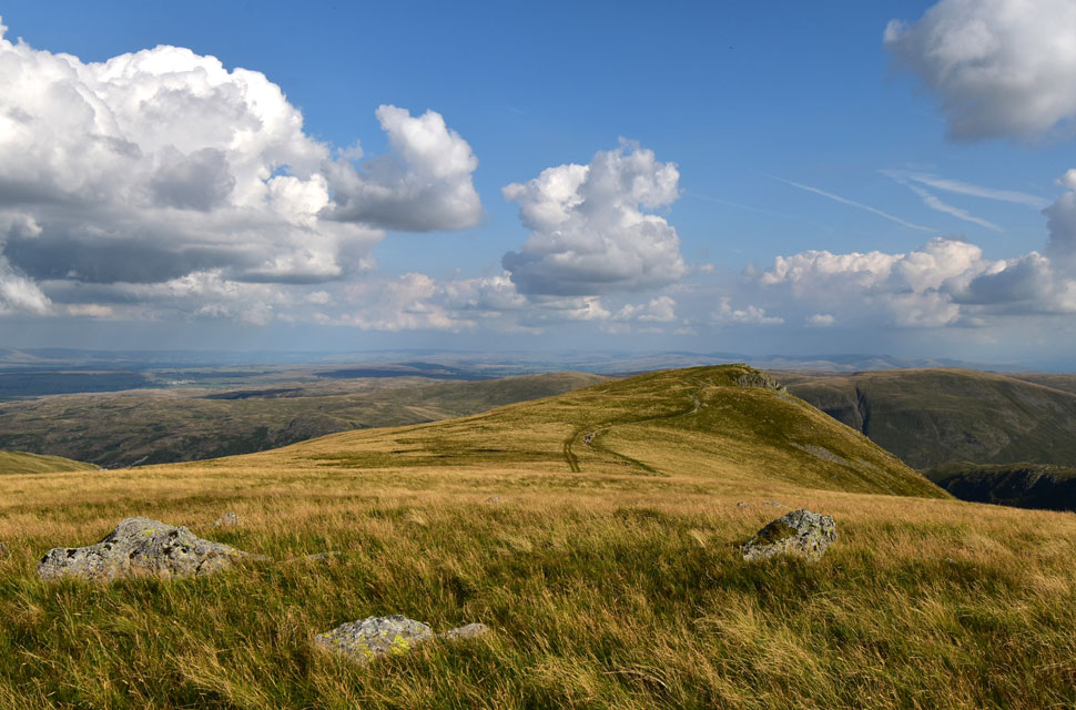
| The Knott, High Raise (Martindale) and Kidsty Pike from the Straights of Riggindale. |
| I have lots of favourite places in Lakeland with the Straights of Riggindale coming in a very close second to the fell under my feet. |
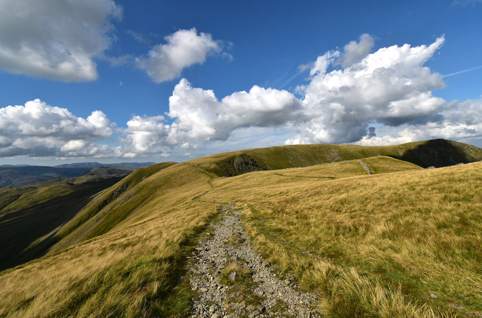 |
| The Straights of Riggindale. |
| Unbelievably I haven't seen or passed anyone since the three lads back at The Rigg nearly two hours ago. |
 |
| Hayeswater again. |
| To help cool things down I'm met with a lovely breeze across here. |
 |
| That's the view. |
| Short Stile and High Street from the Straights of Riggindale. |
 |
| Short Stile, High Street and Thornthwaite Crag from the Straights of Riggindale. |
| |
 |
| Just incredible. |
| Here I have a momentary decision whether to include The Knott and Rampsgill Head or head straight for Kidsty Pike. |
 |
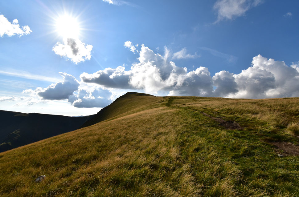
| Ahead... |
| ...The Knott. |
 |
| High Raise (Martindale) and Rampsgill Head from The Knott. |
After not seeing anyone since The Rigg The Knott seemed the place to be this afternoon where I found a couple just leaving, a guy flying a drone followed by a couple and their dog who had just descended from Rampsgill Head.
The guy flying the drone was keeping himself to himself and wasn't causing anyone any bother as his drone seemed to be in the direction of the Straights of Riggindale (he must have taken some great footage) but I did have a short conversation with the couple who had the dog with them.
After a few moments it was time to leave for Rampsgill Head which I ascend using the path seen to the right of the summit cairn. |
 |
| Looking back on The Knott. |
| It looks like the drone guy is the only one still there. |
 |
| Views over Rampsgill Head towards Rest Dodd and The Nab. |
| The guy below just appeared from nowhere and appeared to looking for something he'd dropped. |
 |
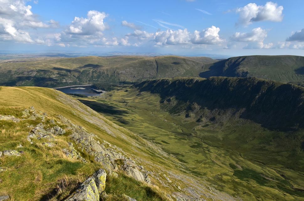
| The Ramps Gill and Fusedale valleys from Rampsgill Head. |
| With extended views towards Ullswater, Hallin Fell, Steel Knotts, Loadpot Hill, Wether Hill, Red Crag and High Raise. |
 |
| Rest Dodd and Brock from Rampsgill Head summit. |
| Rampsgill Head was easily reached where I was lured past the summit cairn to take in this view over Rampsgill Head towards Rest Dodd and beyond. |
 |
| Harter Fell, Mardale III Bell, High Street, Thornthwaite Crag, Stony Cove Pike and Caudale Moor from Rampsgill Head. |
| |
 |
Kidsty Pike from Rampsgill Head. |
| Todays final summit is just a short walk away from Rampsgill Head. |
 |
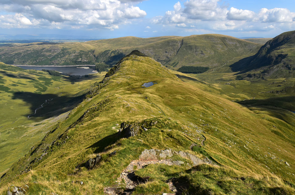
| Ridges. |
| An impressive view over the Riggindale valley towards Rough Crag, Caspel Gate, Long Stile, Mardale III Bell and Harter Fell. |
 |
| The Riggindale valley from Kidsty Pike summit. |
I arrived at the same time as a mountain biker who had rode up from Kidsty Howes further down the ridge "must have been steep coming up I asked" it was but worth it he replied. His plan was to ride over High Street and Mardale III Bell, ascend Harter Fell and Branstree, over Selside Pike and return via the Corpse Road. I couldn't but help look impressed.
The guy told me he'd done it before on an electric mountain bike and wanted to try it on his regular mountain bike which made my Trek mountain bike look like a piece of old scrap iron. Good luck I told the guy before he sped off. Just minutes later I spotted him peddling up High Street. |
 |
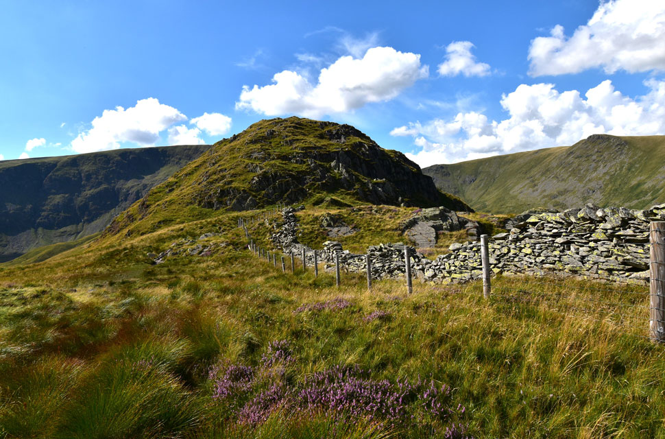
| Looking back on Kidsty Pike. |
| What a stunning late afternoon it's turning out to be. |
 |
| Pathless descent into the Riggindale Valley. |
Instead of descending via Kidsty Howes (seen left) I made the decision to make a pathless, almost diagonal descent into the Riggindale Valley from where I'd visit the sheep fold which lies on the 1,300ft contour. You can just make out the sheep fold in the centre of the image. From up here the descent looks pretty straightforward, but looks can be deceiving. |
 |
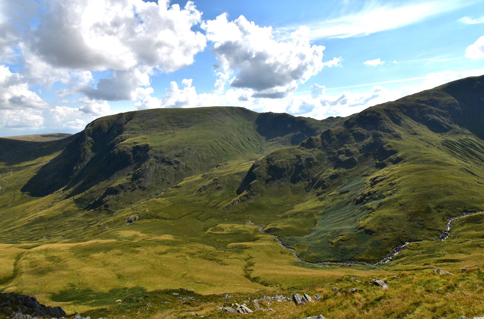
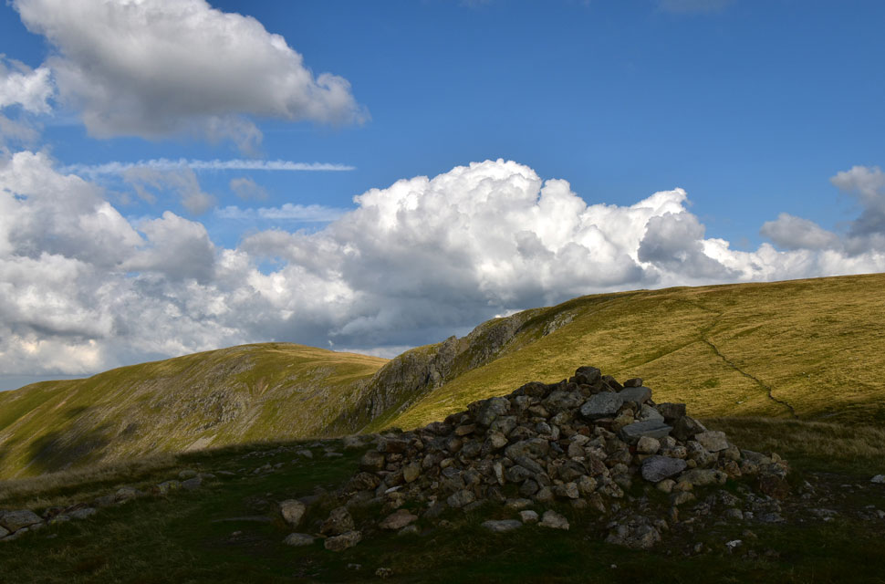
| Impressive views over the Riggindale Valley towards the Rough Crag Ridge with Branstree and Harter Fell seen beyond. |
The line I took avoided crag and scree and was for the most part direct. I'm used to steep descents which I quite enjoy but this seemed on another level. The steepness does ease once a large cairn came into view which I'd never seen before, oddly no path lead to or from the cairn. I pass the cairn then the base of scree run before arriving at the sheep fold. |
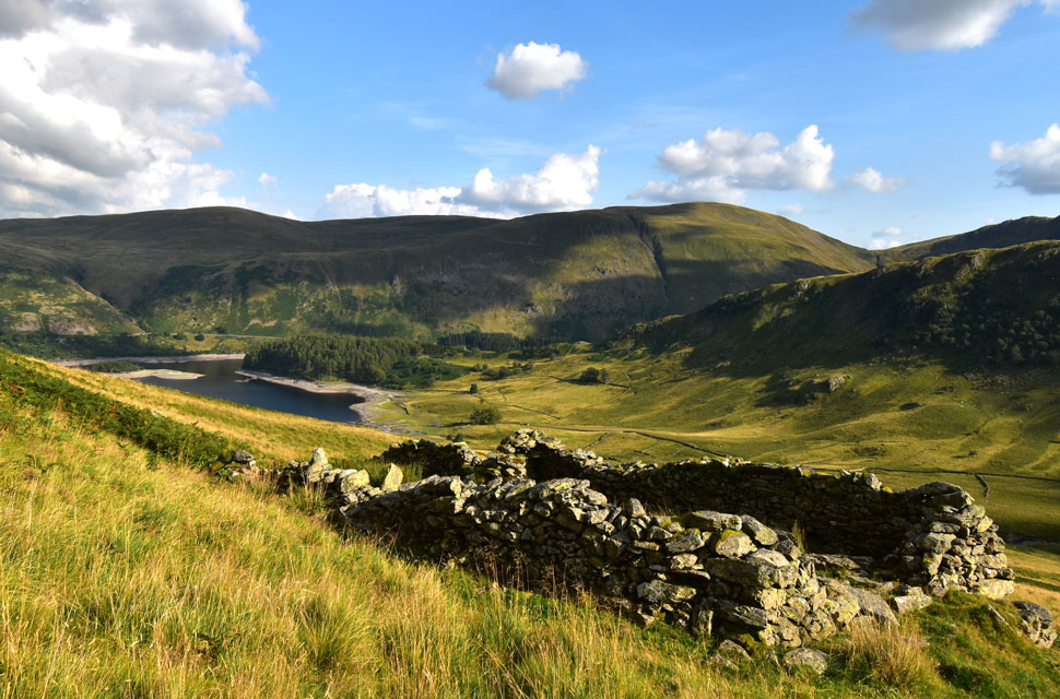 |
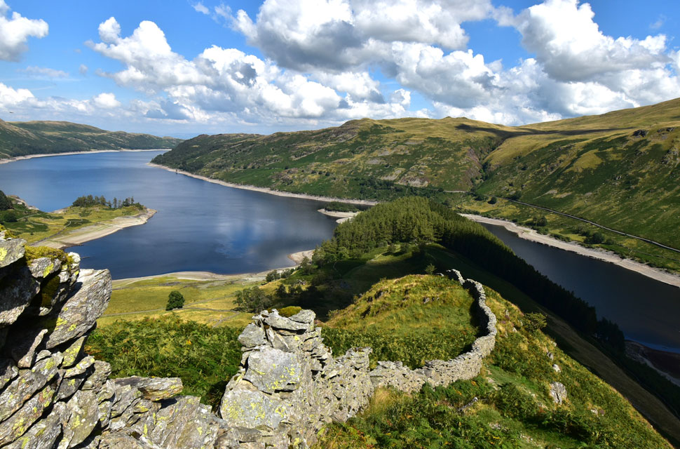
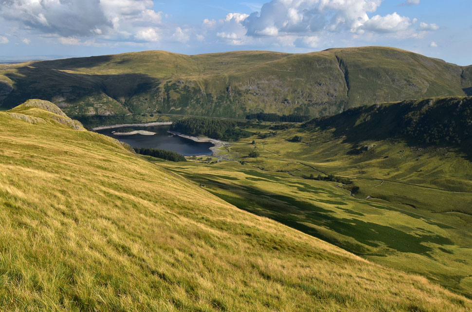
| Selside Pike, High Howes, Branstree, Haweswater, Harter Fell (Mardale) The Rigg and Swine Crag from the Sheep Fold. |
| On first appearance I mistook the sheep fold as an old shepherds hut its structure being so impressive. The sheep fold isn't marked on any map but it does appear in Wainwrights Far Eastern Fells - Kidsty Pike. |
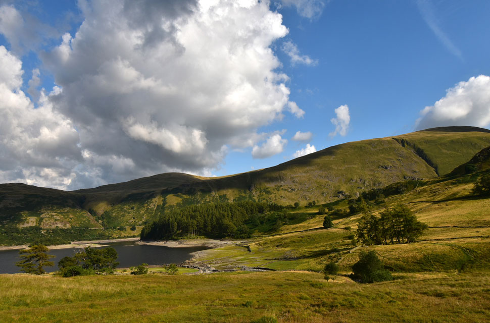 |
| Haweswater Reservoir, The Rigg, Brown Howe, Selside Pike and Branstree. |
A faint path lead from the sheep fold sometimes through bracken other times the path cleverly avoided it until it linked back up with the smooth grassy path where Kidsty Howes is ascended/descended by.
By now my feet felt like they'd been in a war with my boots not helped by wearing Summer season socks which don't offer the same cushion as a mid, or Winter sock. |
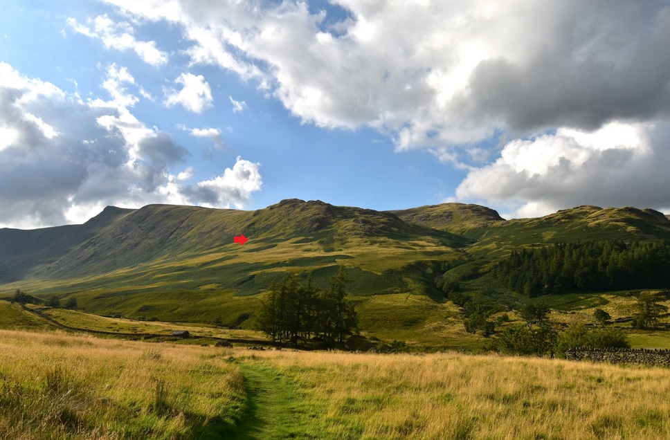 |
| Looking back on Kidsty Pike, Kidsty Howes, Hanging Stones and Birks Crag. |
| Here I've pin pointed the location of the sheep fold. |
 |
| Harter Fell (Mardale) and Adam Seat. |
Despite rolling into early evening the temperature was at its peak and sunlight, glaring. After numerous 'kick backs' my feet were starting to feel normal again and I took great pleasure when I joined the smooth grassy path below Kidsty Howes where I thought about removing my boots and socks to take a paddle in Riggindale Beck. Instead I cupped my hands into the cool water and doused it over my face, so near to the end of my walk I felt instantly refreshed. After crossing Bowderwaite Bridge I continued along the path passing the upright stones which line the pathway.
Beyond two gates are passed before arriving back at The Rigg where I was met with the smell of a camp fire, I wasn't best pleased and was certain it was coming from the woodland on The Rigg. Why would anyone light a fire within a wooded area on ground that was like a tinder box? I had to let my frustration go not wanting to take away the pleasure of todays fell time.
Clean air returned to my nostrils and beyond the trees sunlight glanced off the car windscreens by which time the car park was, less than half full. Over the wall fields of grass grew where water once flowed but at least the channel which forms Mardale Beck was still in flow. Alongside this channel a family sit down on a picnic blanket possibly oblivious that usually the water line would be well above their heads. The sun continues to beat down and despite it nearing 6pm now, it's still quite warm. Dark clouds were starting to form over Mardale III Bell as shadows lengthened down the fell side. There's still a good couple of hours of sunlight left but that familiar feeling of the fells turning in the for the day crept up on me while I wondered how many were due off the hill or had I been the last of the day. |
|
| |
| Back to top |
 |
|

