|
An Alternative Hayeswater Circuit |
 |
 |
14th December 2024 |
 |
|
|
| |
|
Overview |
|
|
| Ascent: |
2,727 Feet - 831 Metres |
| Wainwrights: |
5, The Knott - Rampsgill Head - High Street - Mardale III Bell - Thornthwaite Crag |
| Visiting: |
Two Penny Crag |
| Weather: |
After a Brilliant Sunrise Predominantly Cloudy With a Few Bright Spells. Highs of 6°C Lows of 2°C Feels Like -7°C |
| Parking: |
Car Park, Hartsop |
| Area: |
Far Eastern |
| Miles: |
8.5 |
| Walking With: |
David Hall |
| Ordnance Survey: |
OL5 |
| Time Taken: |
6 Hours 30 Minutes |
| Route: |
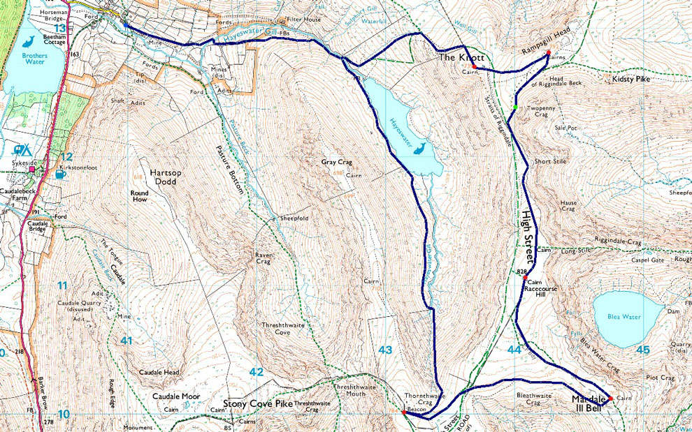
Hartsop - Hayeswater Gill - Hayeswater - The Knott - Rampsgill Head - Two Penny Crag - High Street - Mardale III Bell - Thornthwaite Crag - Hayeswater Gill - Hayeswater - Hayeswater Gill - Hartsop |
|
| |
|
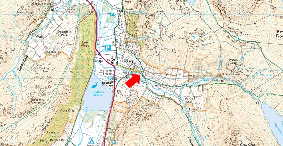
Parking Details and Map |
|
|
| Nearest Post Code: |
CA11 0NZ |
| Grid Reference: |
NY 410 213 |
| Notes: |
A very popular car park in the hamlet of Hartsop giving access within the heart of the east and far eastern fells just a few minutes stroll away from Brothers Water. The car park is situated at the end of a narrow lane which provides the backbone to the village. A honesty box can be found next to the gate at the far end of the car park. |
|
| |
|
Map and Photo Gallery |
|
|
 |
| |
| |
 |
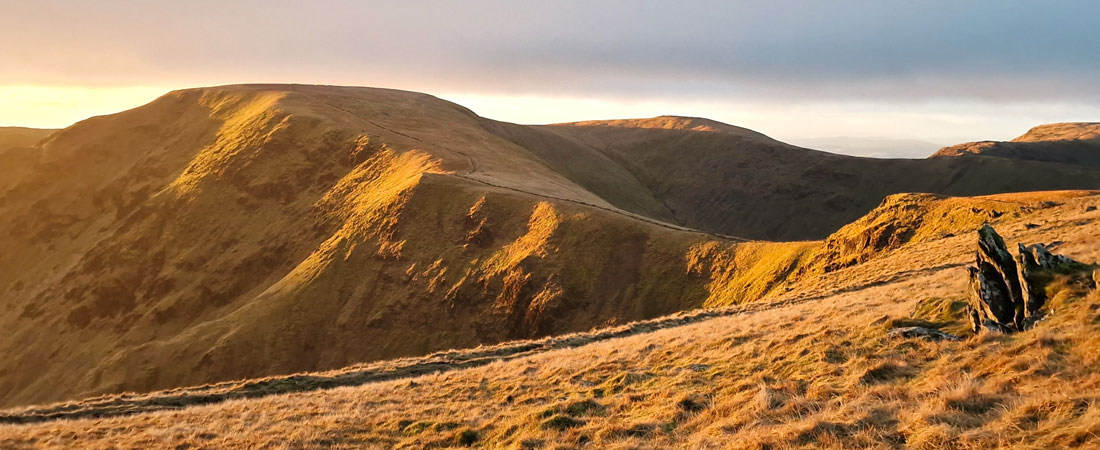
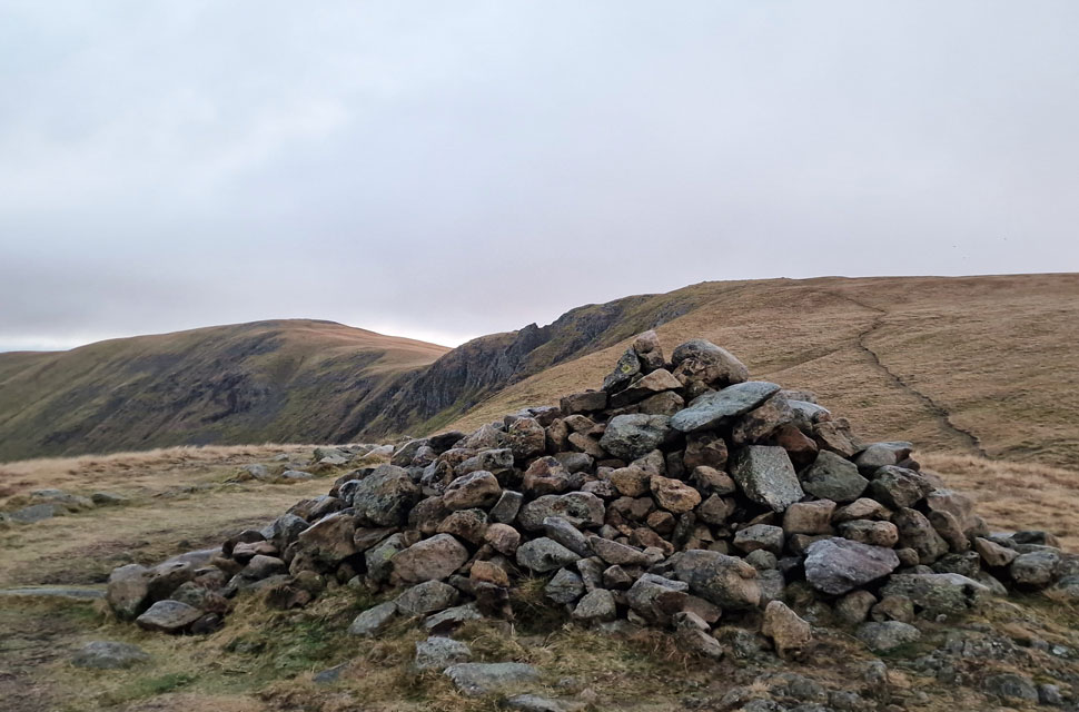
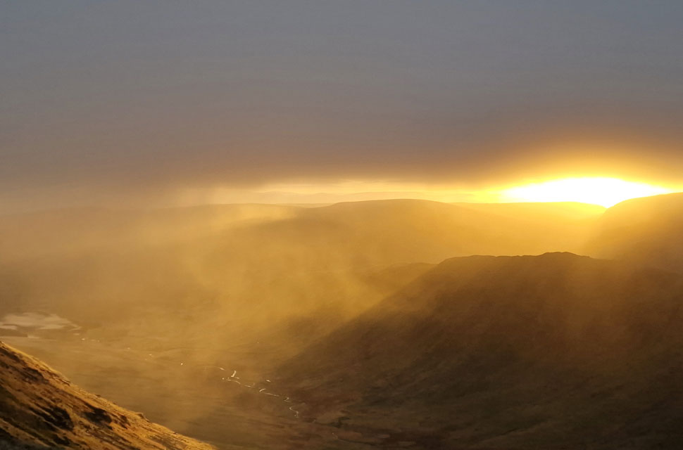
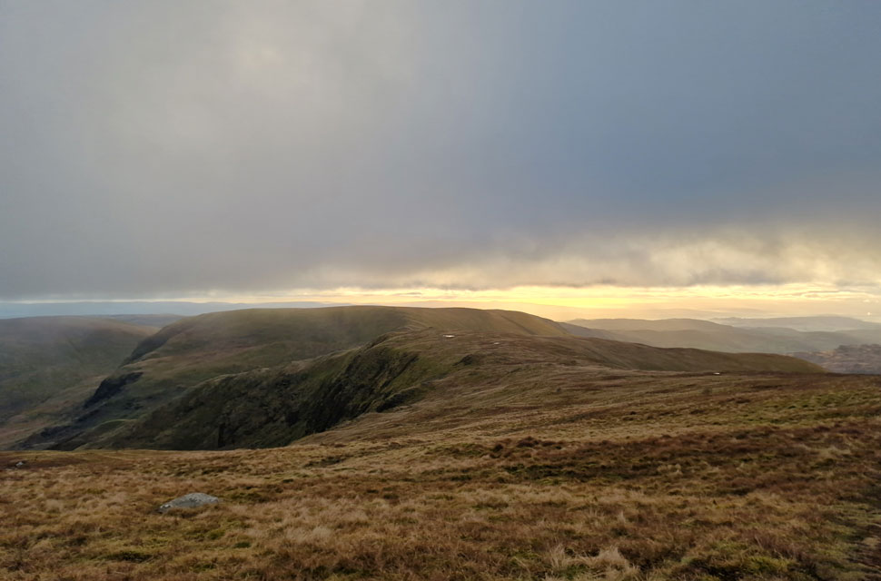
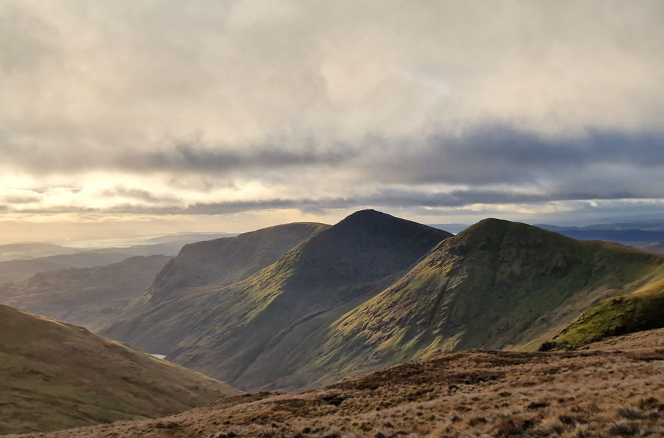
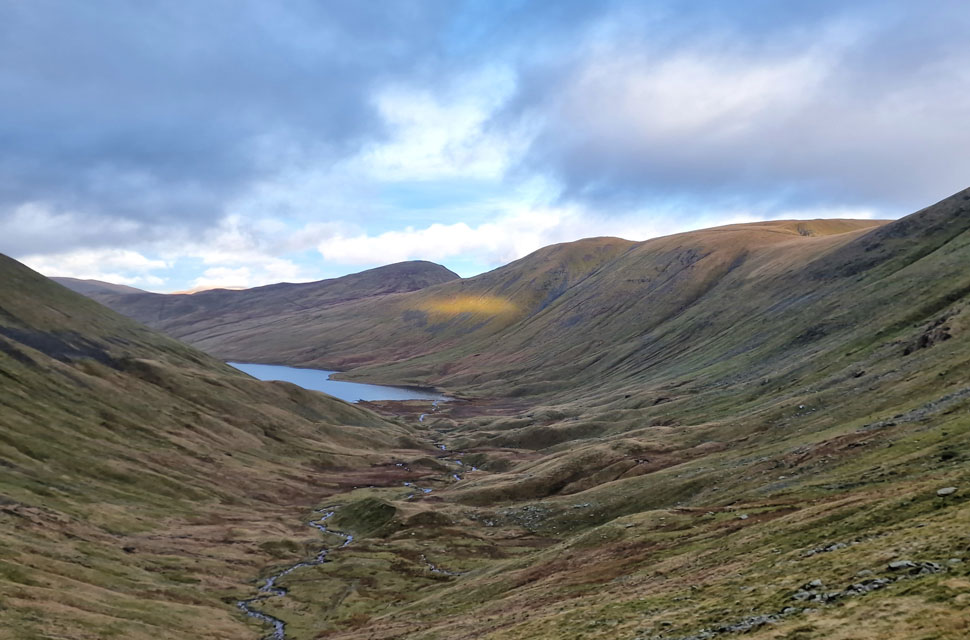
| Ascending alongside Hayeswater Gill with The Knott on the skyline 07:23am 2°C |
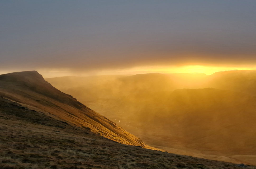
High pressure took over after Storm Darragh passed, leaving the week dry with plenty of sunshine, which frustratingly ended come the weekend. That said, it was dry enough to arrange another High Street walk, but it wasn't the route I had intended; instead, David and I spoke at length on Thursday evening about an alternative route. I suggested a Mardale Head Round before David mentioned another Hayeswater Circuit with a twist: instead of completing on Gray Crag, why not descend into Hayeswater via Hayeswater Gill? I've only walked through the Hayeswater valley once many years ago with fellow walking buddy Ian Sharples and it hammered it down from start to finish. At least today I'll be able to experience Hayeswater on a drier level. We had arranged to meet at Hartsop at 07:00am, an hour and a half before sunrise. Back in Summer I took a leaf out of David's book starting my walks at 07:00am, this was for many reasons, the main one being I could get ahead of the crowds, park easily, and get home at a reasonable time too. As it turns out, the early starts extended through autumn and into winter whenever the forecast would allow; this morning's conditions were just perfect.
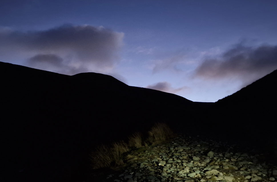
David had already parked up when I arrived, and this time I remembered to have my head torch at hand instead of rooting for it in the darkness like I did last time. This morning I was more organised, and within five minutes of arriving, I was slipping a pair of gloves on, ready to lock the car. It was pitch black in the car park, our head torches guiding us through the nearby gate which opened with a creak. Funny how your senses instantly adjust to your surroundings. After leaving the car park behind, we passed the familiar sheep pens, the sky as dark as ink with the exception of faint glow from the moon which had dipped behind the Helvellyn range its glow still visible on the underside of the clouds. Had the moon not been so low, I'm sure we could have done without the head torches. We crossed Hayeswater Gill, the white of the cascades visible and very audible as we began the ascent alongside the ravine with the night sky slowly getting lighter creating silhouettes of The Knott and Gray Crag. Our head torches shone into deep channels that had been dug out as part of drainage repairs to the path, or so we thought. The channels just looked too natural, but it was clear the drains had been worked on. Soon the steepness of the incline levelled and minutes later we had arrived at Hayeswater's outflow, its bridge still on its side after being washed away. Despite it being just under an hour away from sunrise, the sky was getting lighter by the minute, and after crossing the stepping stones, David removed his head torch, and I followed about five minutes after. |
 |
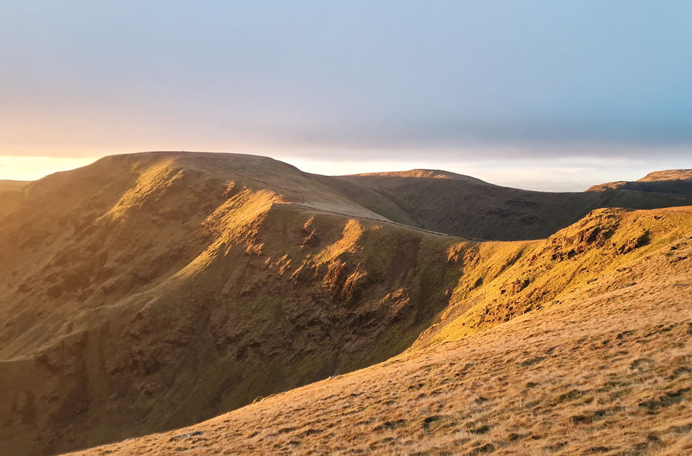
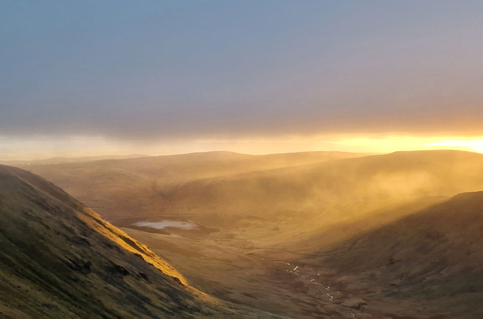
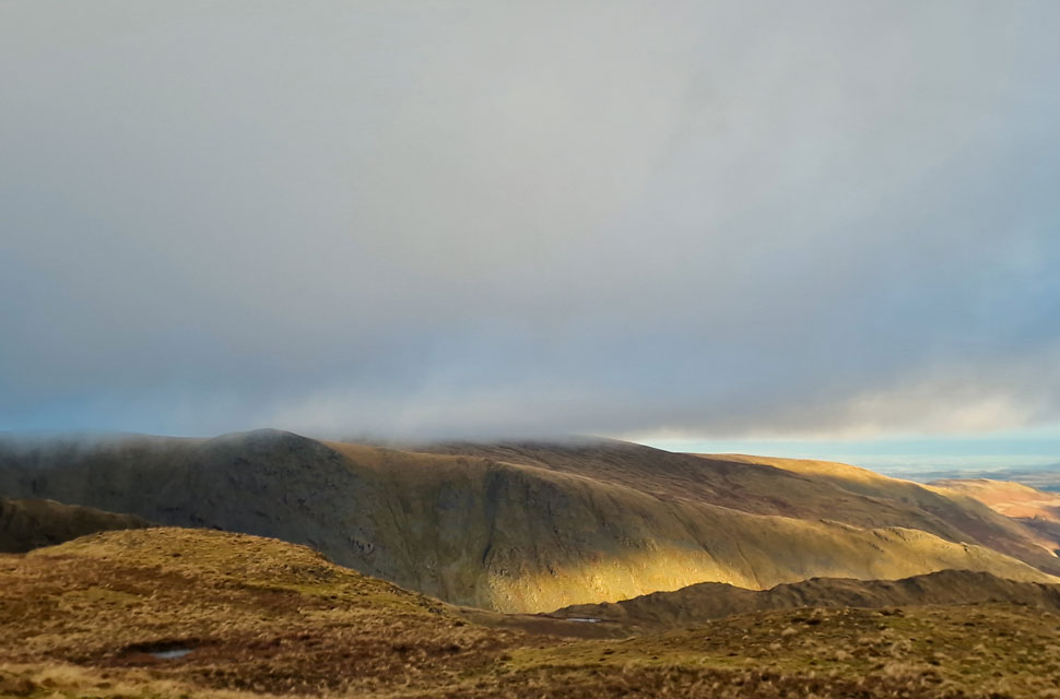
| High Raise (Martindale) and Rampsgill Head from The Knott 08:26am |
After crossing the outflow, we began the steep ascent towards the path that links Brock Crags with Rest Dodd and The Knott. It was around 07:40am and light enough to walk without head torches. I had taken a number of photos from our ascent looking back on Hartsop and over Hayeswater, but sadly none of these turned out. It was during our ascent that we looked back on St Sunday Crag and the Helvellyn range where we spotted head torches, and it took a few seconds for us to locate which mountain they were on, settling on Helvellyn but not its summit. With the path reached, Rest Dodd came into view where we spotted half a dozen Deer on its west flank.
The closer we looked, the more Deer we spotted, all of them looking back as we were in a stare-off. It was biting cold; I could feel the wind chill through the weave of my Napapijri hat. Then came the runny nose. Continuing our ascent towards The Knott, we were forced off path by an invisible coating of frost/verglas underfoot, which slowed our ascent; that said, so did the Deer spotting. The path twists and turns until the shoulder of The Knott was reached, from where we ascended the last 120 feet by the familiar wall, arriving at the summit at exactly 08:26am, two minutes before sunrise. The wind chill was baltic, probably the coldest I've experienced so far as we edge deep into winter on the Lakeland fells. Summit time was kept brief as we spotted a pink hue over the Riggindale valley. The sunrise was here, but for the moment we were in the wrong place, we needed to ascend, and quickly. |
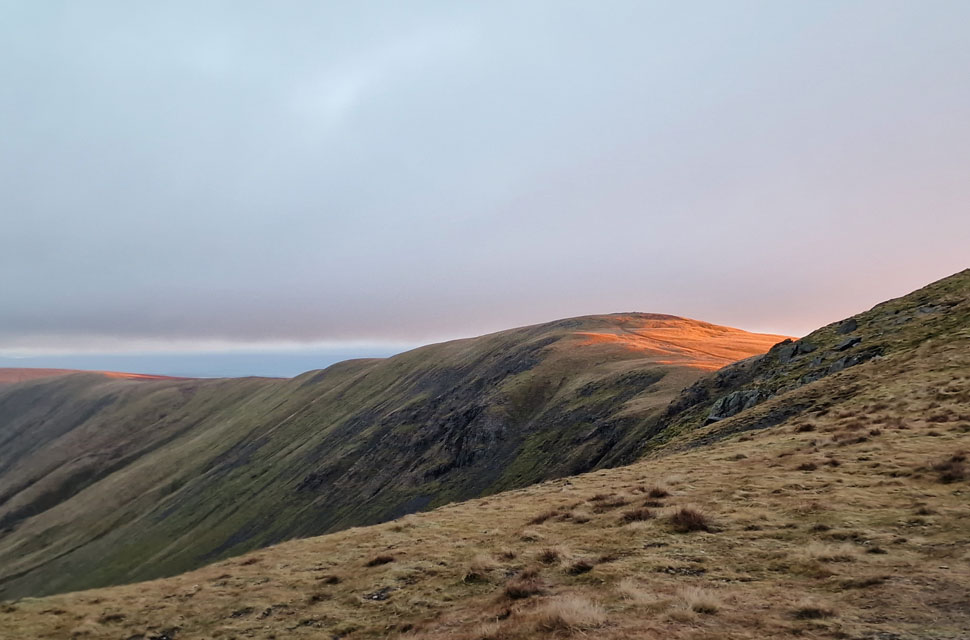 |
| First light on High Raise (Martindale) |
| As always after a week away from the fells I always seem to struggle to find my fell fitness and this morning was no different secretly blowing like a steam train in David's wake but that changed during the ascent on Rampsgill Head the pair of us tramping away eager to view the sunrise evolving less than 200 foot above our heads. We weren't to be disappointed. |
 |
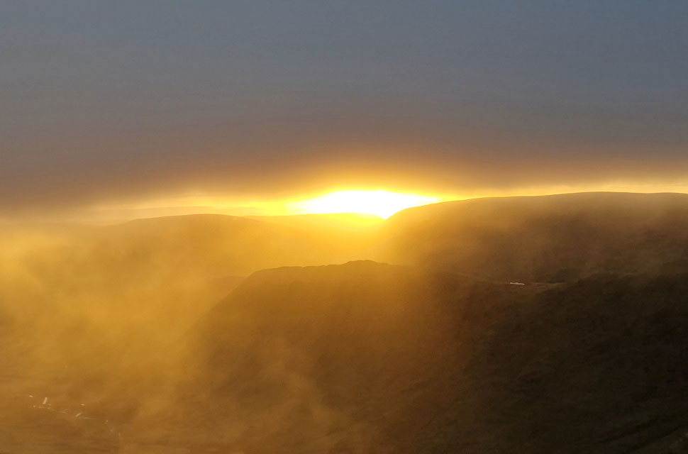
| Sunrise from Rampsgill Head. |
| I shouldered Rampsgill Head, blowing like a proverbial steam train, and arrived at the summit twelve minutes after leaving The Knott summit cairn. We hadn't expected to see the sunrise due to cloud being forecast; in fact, we thought we'd be in cloud from Hayeswater onwards, so as you can imagine, we were pretty gobsmacked at not just witnessing the sunrise but also the dramatics that came with it. |
 |
| Here looking back on High Street and Thornthwaite Crag from Rampsgill Head. |
| The first light was incredible to see; it was stomach-dropping stuff, and I asked David if instead of heading for High Raise, would he mind if we made our way over to the head of Riggindale instead. He didn't need asking twice. |
 |
| Kidsty Pike and Riggindale sunrise. |
| We could see we had a window of around ten minutes as the sun was climbing into a layer of cloud, the effects of which were absolutely stunning. |
 |
| Looking across The Straights of Riggindale towards High Street, Thornthwaite Crag and Stony Cove Pike (Caudale Moor) |
| The light was incredible, but the wind chill was devastatingly cold, so much so that if we were to hang about watching the sunrise we needed to layer up, so we de-shouldered packs and added extra layers. |
 |
| Sunrise sillouettes. |
| The timing of a layer of cloud that arrived couldn't have been better, adding to our already dramatic views into the Riggindale valley towards the Rough Crag ridge and beyond. |
 |
| Kidsty Pike. |
| Note the Deer stood half way down the slope. |
 |
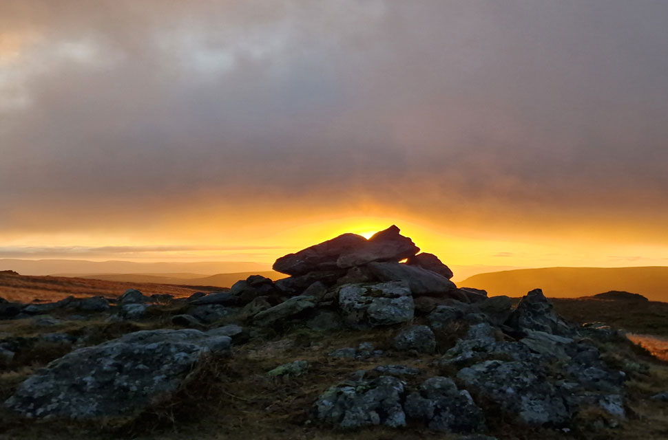
| Riggindale sunrise. |
| Just minutes left before the sun would climb into the cloud but the dramatics kept coming. |
 |
| Shafts of light, Kidsty Pike. |
| It had been one of the best sunrises I had been lucky enough to witness, but the light was slowly fading the higher the sun climbed, and then, as if someone had drawn the blinds, the grey and biting chill of dawn returned. |
 |
| High Street from The Straights of Riggindale. |
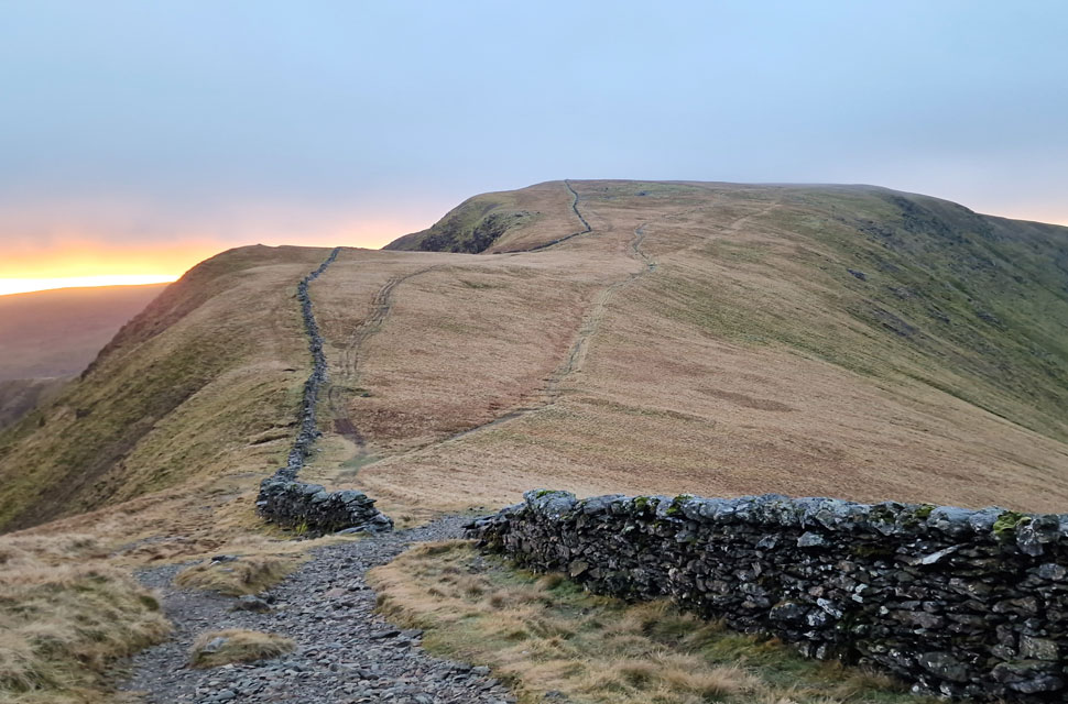
| We had sacrificed High Raise and indeed Kidsty Pike for what we felt was a good cause: "Fancy adding Mardale III Bell?" "Aye, why not" David replied. Butterflies were still somersaulting in my stomach as we made our way over Two Penny Crag before descending onto the Straits of Riggindale. It had just gone 08:30am and was biting cold, agreeing that we'd warm up with the ascent on High Street. |
 |
| High Street summit trig point. |
| We got stuck into the ascent of High Street, momentarily turning around to see a layer of cloud resting on Kidsty Pike with High Raise nowhere to be seen. I know we missed those two summits I repeated, but bloody hell, I'd have been more disappointed if I'd missed that sunrise; David most definitely agreed. On shouldering High Street the trig point soon came into view right at the same time as two Deer were running towards us, approaching so close I could see their startled faces, who, after spotting us, ran off in the direction of Long Stile. It was the first time I'd ever seen Deer on High Street. |
 |
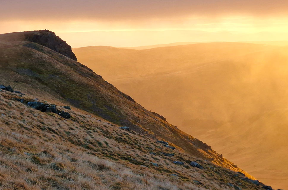
| Heading towards Mardale III Bell. |
| We stopped for a quick hot drink while at High Street summit the liquid so hot I felt it trickle down my throat and drop into my stomach. The hot drink had revitalized me and was just what I needed. Light was increasing now as we left the summit and made our way south easterly towards Mardale III Bell where I reminded David how strong the wind was here a couple of Mondays ago so much so I made it back to Mardale Head via Small Water from High Street summit in just fifty minutes. This morning is still windy but nowhere near as strong as it's been as of late. |
 |
| Haweswater seen over the Rough Crag ridge from Mardale III Bell summit. |
| We were starting to pass fellow walkers, all of whom appeared to be heading up from Mardale Head via Small Water or Gatescarth Pass, who, like us, would have set off in the dark. This included one chap carrying full camping gear...jeez, we hoped he'd seen tonight's forecast. |
 |
| Cloud was still lingering over Kidsty Pike. |
| Despite the welcome sunshine. |
 |
| Views over Hall Cove towards Thornthwaite Crag. |
| We left Mardale III Bell and linked up with the path across the head of Hall Cove where we were treated to more sunshine and lots of layered cloud. It was also here David mentioned about his ascent on Hall Cove some years ago via the gill seen in the foreground. I quickly came up with a route and committed it to memory to walk in 2025 |
 |
| Yoke, III Bell and Froswick above the Kentmere Valley. |
| "Like the knuckles of a clenched fist" Alfred Wainwright. |
 |
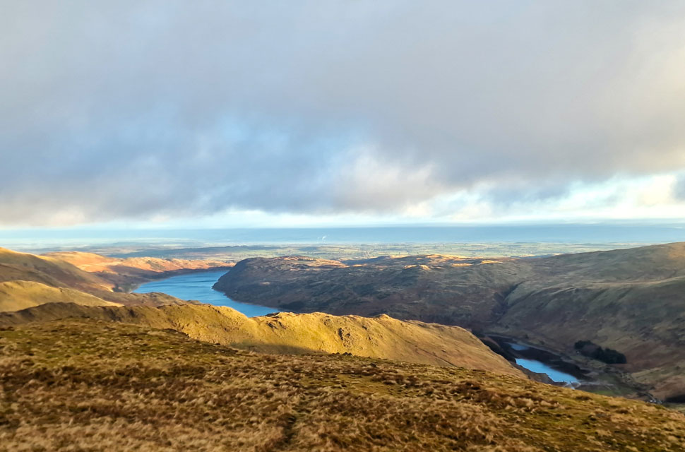
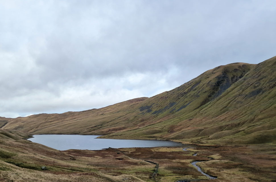
| Views into Hayeswater. |
| We only had to navigate the top of Hall Cove before leaving the path to join the path that links Thornthwaite Crag with High Street. It was here we had clear views down into Hayeswater, todays route of descent. |
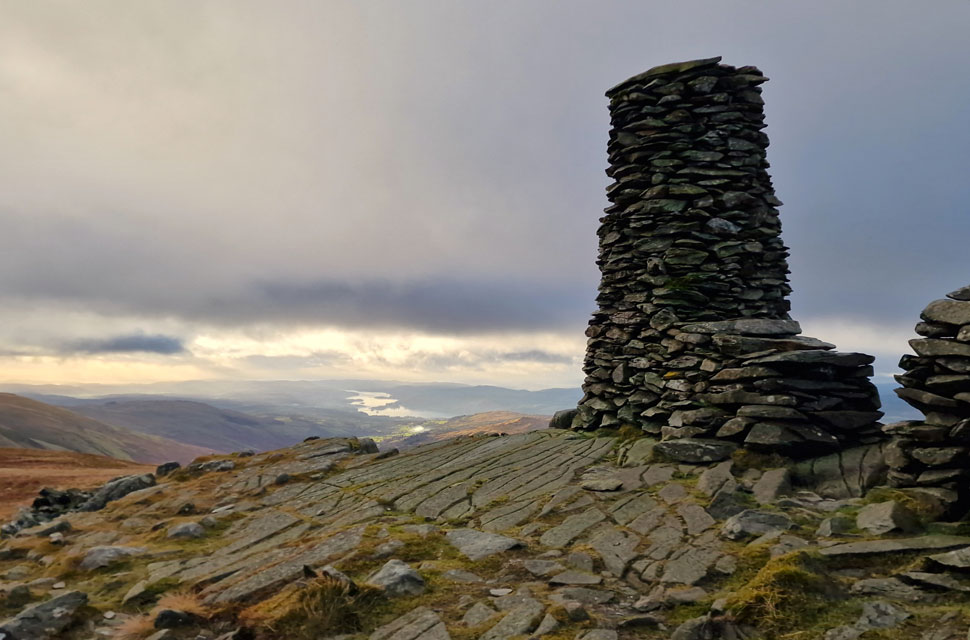 |
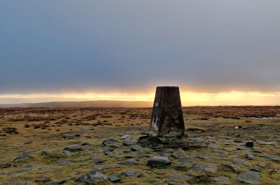
| Thornthwaite Crag summit beacon. |
| There was a few walkers milling about coming and going from High Street and indeed via the III Bell ridge. On hearing voices on the opposite side of the wall we stopped to take a couple of summit photos before retracing our steps towards the top of Hayeswater Gill. |
 |
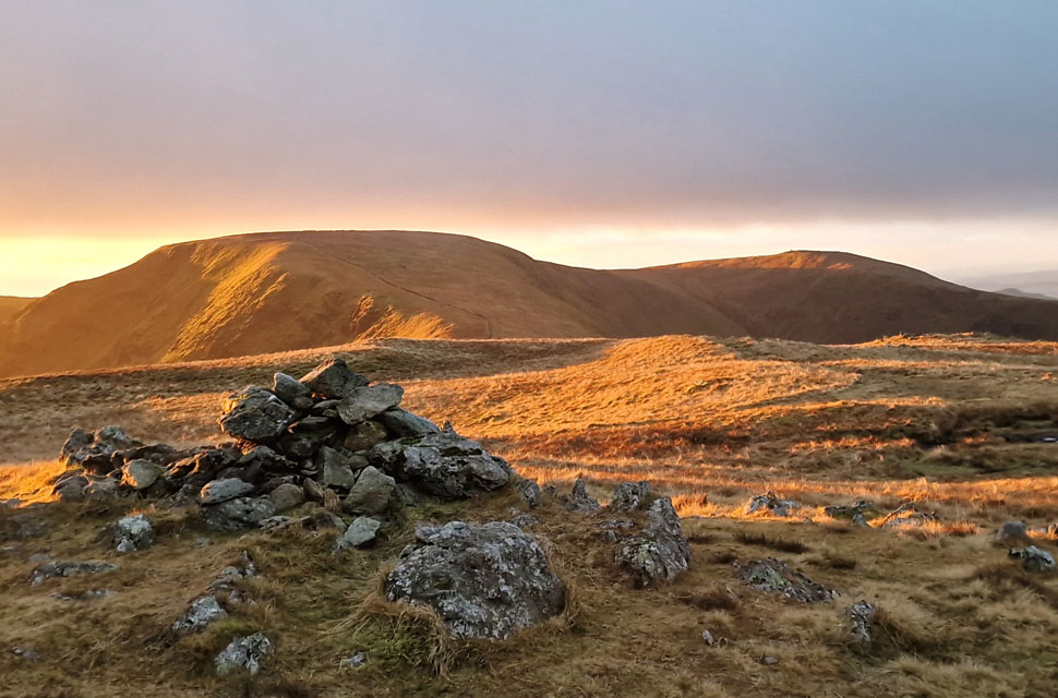
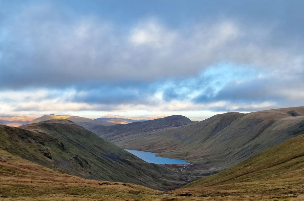
| Views over Hayeswater towards Rest Dodd, The Knott, Rampsgill Head, Kidsty Pike and High Street. |
| We both knew we were in for a tricky descent agreeing to descend with Hayeswater Gill to our left initially before crossing the gill half way into the descent. |
 |
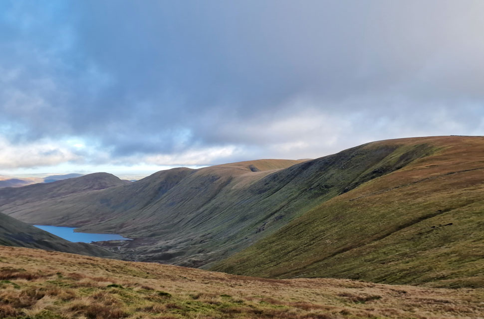
| Hayeswater. |
| We began our pathless descent keeping the gill to our left and about fifty feet above the ravine. The further we descended the more we realised there was no need to cross the gill agreeing to head for a cluster of boulders next to a ruined wall at the valley floor. |
 |
| Looking back on Hayeswater Gill. |
| It doesn't look it from here but that was one incredibly steep descent. |
 |
| Hayeswater comes into view with The Knott seen right. |
| |
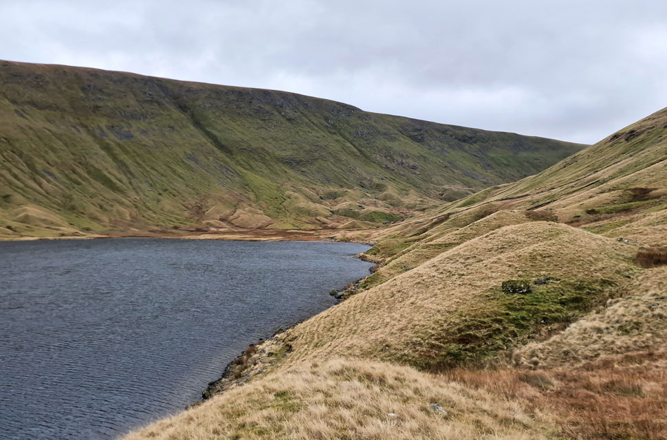 |
| Hayeswater with flanked by High Street. |
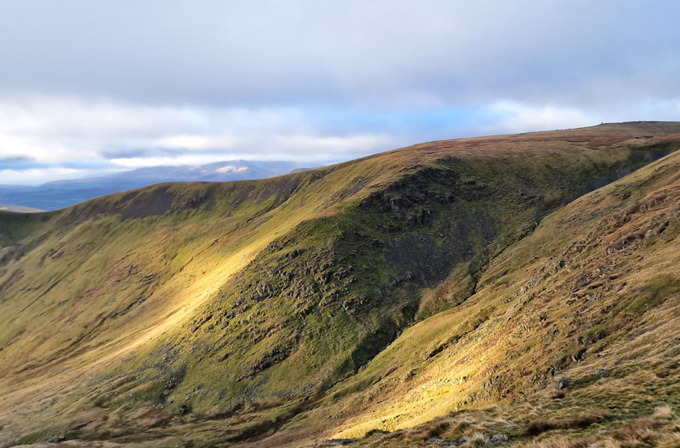
The ruined stone wall was soon reached, where I kicked my feet into the backs of my boots the shift felt heavenly knowing there was still a good tramp of pathless walking ahead. Luckily we found a trod above the valley floor that eventually descended towards the southern end of the tarn. My feet couldn't thank me enough after side-stepping over steep ground. The wind had eased, and all the layers I'd added were by now causing a slight sweat, but nothing too uncomfortable. Weeks ago I had put much thought into a direct ascent on High Street from Hayeswater, but recent storms laid that to rest. From the valley floor we picked off several routes of ascent, all steep but 'doable' in the grand scheme of things. With the windchill confined to the tops a breeze blew across the tarn from where we could make out walkers on The Knott and The Straights of Riggindale. It was only 11:30am, and the early start had paid off, estimating we'd be back at Hartsop within the hour. We soon reached the tarn's outflow and the stone track that used to serve Hayeswater Dam until 2014, after which the reservoir was returned to its natural state.
We passed a young couple in ascent, and two more walkers dropped onto the path from their Gray Crag descent ahead of us and to be fair, for a Saturday, it felt quiet, not that we were complaining. Continuing further, we took in the views into Pasture Bottom and studied the channels that had been cut into the path as part of the drainage repairs, or at least we thought they were part of the repair. We crossed a raging Hayeswater Gill and the footbridge we'd crossed over six hours earlier, its white cascades drowning out the silence that our ears had become accustomed on what turned out to be another brilliant High Street walk. |
|
| |
| Back to top |
 |
|