|
The High Street Roman Road |
 |
 |
30th June 2012 |
 |
|
‘BROCAVVM to GALAVA’
It’s 77 AD & the Roman Conquest to besiege ancient Britain is getting closer & closer, Wales & Anglesey had just fallen under the Roman Empire, this was not done lightly as the Celts fought through blood thirsty battles. This was a time when a fearless Roman Commander was called upon to take the Celts & the Druids of Anglesey. His name was Julius Agricola, born in Roman Occupied France in 40 AD Agricola quickly rose in ranks as a statesman, Solider & Roman Commander.
It took just one year for Julius Agricola to take Wales & diminish the Druid society that thrived as a stronghold in Anglesey, Agricola & his legions were then ordered to push north.
Between 80-81 AD Agricola had by now, established much of the north west of England. Around about the same time, the Roman Fort of BROCAVVM had been constructed which lies north west of what was then, Old Penrith. Here a settlement was co-ordinated as mainly a marching camp & a minor settlement. It was here Julius Agricola had chosen the spot to penetrate Lakeland by the south west (Ambleside) & by the north west (Ravenglass & Maryport) Ambleside’s Fortress of GALAVA had yet to be established & not to be completed until a further ten years – in & around 90 AD.
Brethstrett was the local name given to what we now know as the ‘High Street Roman Road’ an ancient Cumbrian route used to link the old town of Penrith to Ambleside. Julius Agricola saw that this was key in linking his Fortresses of BROCAVVM, CALAVA, MEDIOBOGDUM (Hardknott) & GLANNAVENTA (Ravenglass) here, Agricola could defend against attack along the north west coast line.
JUNE MMXII
It was back in February when I first laid thought about walking the whole High Street Roman Road, all 25 miles of it to be exact, logistically, this I thought, is going to be a nightmare. I gave it little thought as to how I was going to re-connect myself with Ambleside & Penrith before & after a gruelling ten hour walk, but that little problem got pushed to the back of my mind yet again, after all it was some months away & I was still within the depths of winter. All I knew back then, was it was penned for the last weekend In June.
I of course asked Tim would he be up for the gruelling march across this Lakeland Frontier, as I predicted, Tim jumped at the chance.
Again we toyed with the logistics. Thirty one miles by road or as you may gather or 25 miles by foot as the crow flies lay in-between Ambleside & Brougham Castle on the outskirts of Penrith, or if your as clinical as I was when planning; a journey time of around fifty minutes by car.
It was only back in March while on a bit of a Yorkshire epic in-between Ingleborough & Whernside with Stuart Greig – did Stuart ask me my plans for 2012? Well Stu, I’m going to be walking the whole High Street Roman Road from Penrith to Ambleside, hopefully come the end of June, really Stuart replied? would you mind if I joined you?
This was turning out to be some trip…
It seemed just like Robert Falcon Scot had chosen Petty Officer’s Edgar Evans, & Captain Lawrence Oates & Co to accompany him to the South Pole, I like Captain Scot, had my team.
It’s funny, isn’t it? what you rely on in people? We all carry the determination to carry out a feat such as this, especially Stuart Greig at which twenty three miles seems such a stroll in the park for a Long Distant Walker such as Stu, like men – Tim & I do not ask how about we come about a twenty three miler? eating less & drinking less for a start Paul…
But even though England are out. How do you do this within the mist of Euro 2012?
Approximately one week before embankment I sent Tim & Stu the most anal email I’d ever written, wait go back… that just does NOT sound right.
Okay, a week prior, I sent both Tim & Stu the most anal email I’d ever written, I’m sorry but it was, the planning side of my brain exploded & I wondered if the guys had thought I’d lost the plot, & indeed, would they actually want to spend ten hours plus with me knowing how detailed I can be. That email consisted of start times, end times, the names & tariffs of the car parks we would be using, postcodes, coordinates you name it if we walked or drove past it – it was most probably in that email.
What did I get back? two idiots sending me pictures of men dressed in frocks calling themselves Tim Bigcockus & Stuart Bigcockus
Like I said, I had my team…
Please, before you go on reading, put the kettle on, pop open a beer or reach for your favourite tipple.
There’s three blokes here, pretending to be Romans… |
|
|
|
| |
|
Overview |
|
|
| Ascent: |
4’000 Feet, 1,219 Metres |
| Wainwrights: |
5, Wether Hill, High Raise, Rampsgill Head, High Street & Thornthwaite Crag |
| Weather: |
Blustery With Scattered Heavy Showers, Strong Summit Winds, More Dry Spells Towards The Latter Of The Day, Highs Of 14°C Lows Of 13°C |
| Parking: |
USING x2 CARS: Borrans Road Pay & Display Ambleside (£7 for 12 hours) / Road Side Parking, Brougham Castle Penrith |
| Area: |
Eastern & Far Eastern |
| Miles: |
25.1 |
| Walking With: |
Tim Oxburgh & Stuart Greig |
| Ordnance Survey: |
OL5 & OL7 |
| Time Taken: |
10 Hours 25 Minutes |
| Route: |
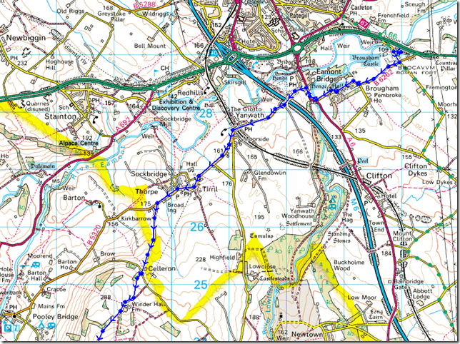
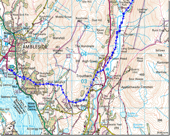
Brougham Castle – BROCAVVM ROMAN FORT (Penrith) – Brougham Hall – Eamont Bridge – Yanwath – Tirril – Celleron -Winder Hall Farm – Moor Divock – Lambert Lad – Loadpot Hill – Wether Hill – Red Crag (High Street) – Raven Howe – High Raise (Martindale) – Rampsgill Head – Two Penny Crag -Straits of Riggindale – High Street – Thornthwaite Crag – Thornthwaite Beacon – Park Fell – Hagg Gill – Troutbeck Park – Ing Lane – Troutbeck – Truss Lane – A592 – Robin Lane – Jenkin Crag – High Skelghyll – Skelghyll Wood – A591 – A5075 – GALAVA ROMAN FORT (Ambleside) |
|
| |
|
Map and Photo Gallery |
|
|
 |
| |
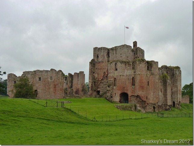
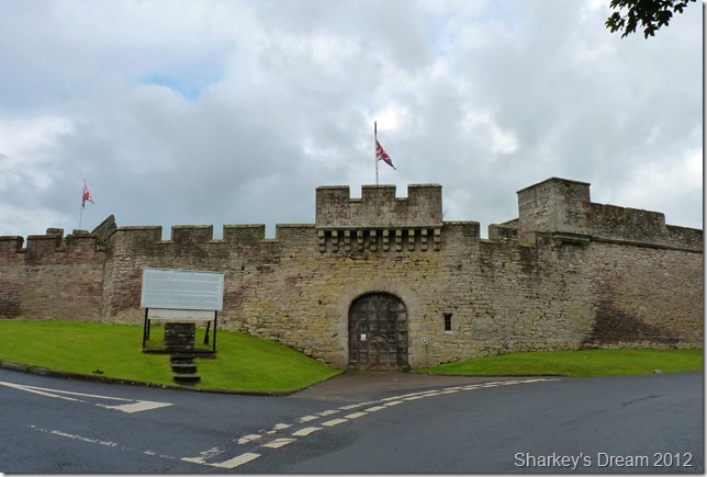
Built in medieval times during the 13th Century, Brougham Castle.
7:35am 14°C
We arrive within the castle grounds under overcast & moody skies, for now anyway. We met Stuart at Borrans Road CP as planned at around 6:50am, It was here I was to leave my car & transfer mine & Tim’s gear into the back of Stuarts car, parked photogenicly I might add, against a Windermere backdrop.
Did you park there on purpose I asked Stuart? holding a slight grin at the same time! No-no Stu smirks, yeah right!
The transfer was quick & simple & no sooner had we emptied seven pound coins into the parking metre was we all on our way.
Right about this point did we experience our first downpour of the day, it certainly wasn’t going to be our last. |
 |
| |
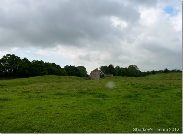
Constructed between 80-81AD These mounds are all that remain of BROCAVVM ROMAN FORT built by Agricola.
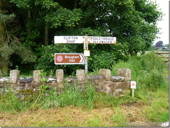
With heavy packs shouldered we leave Brougham Castle & no sooner did we find ourselves at the site of what once was Brocavvm Roman Fort, for the untrained eye, I could well imagine that this is just a field full of sleeping sheep, I was a little let down from at least the roadside as we passed that there didn’t seem to be any sign pointing out that this once was a Roman Fort.
From here we chatted & caught up with one another & pressed on towards Brougham Hall. |
 |
| |
| |
 |
| |
Brougham Hall circa 1520
I was amazed at the little hamlet of Brougham, here, in the centre of the village stood this magnificent sixteenth century Hall surrounded by apt little cottages & lawns so well kept, you could crown green bowl right off them.
Brougham Castle has history, Many men have stood here or within the vicinity including the Roman Emperor Hadrian, other famous people that have graced Brougham includes Sir Winston Churchill accompanied by Eisenhower, between 1940-1945 the most intriguing fact about Brougham Hall was that the bunkers secretly directly beneath the Hall, held tanks that would further go on to be the first British tanks that crossed the Rhine at Remagen on 7th March 1945.
The hall and grounds are reportedly haunted by sounds of soldiers battling in the middle of night, world war soldiers marching and various people who were employed at the property including a woman called Emily and a boy who died there. Henry Brougham who lived there in the nineteenth century was reported to be highly interested in spirituality and his spirit and that of his brother William are also said to have been felt by visitors. The hall was investigated in the series Most Haunted where the team supposedly communicated with the spirits of Emily, the boy and Henry Brougham during a seance and moved a heavy table across the room without explanation. |
 |
| |
| |
 |
| |
| |
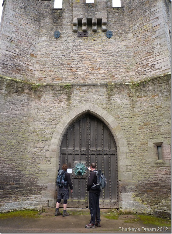 |
| |
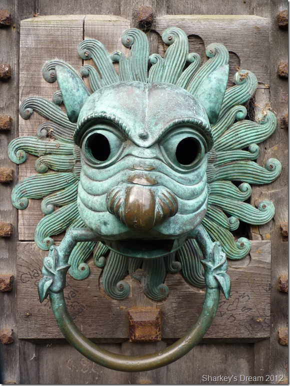
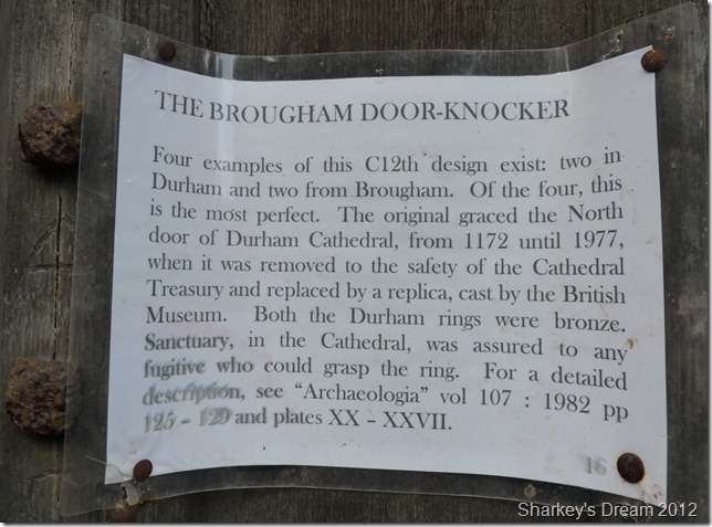
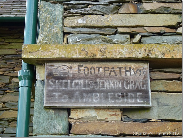
| Go on, give it a knock!! |
 |
| |
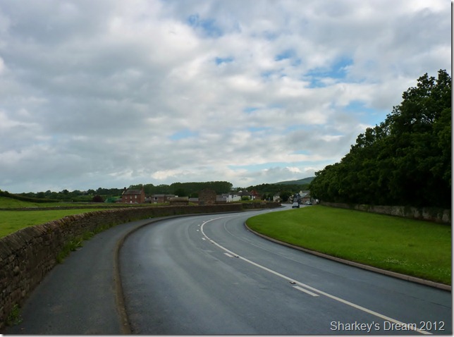
Crossing the A6 close to Eamont.
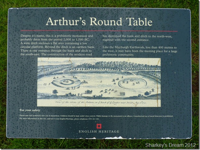
After crossing the River Eamont do we then turn our attention to another Roman Site, that of King Arthurs Round Table, its situated at the next junction just where the white building is. |
 |
| |
King Arthurs Round Table. |
 |
| |
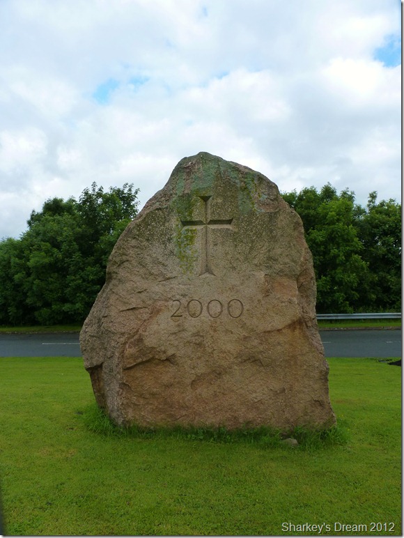
The Mayburgh Millennium stone. |
 |
| |
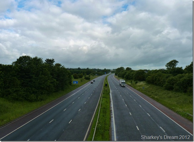
Crossing the M6
Mayburgh Henge lies towards the right just behind the trees, prehistoric in age & most probably a trading post as early stone axes were found nearby, all neighbouring sites are connected with Brougham/Eamont & their prehistoric past.
Spare a thought the next time you pass junction 40 of the M6, until the year 1237 you would have actually still been in Scotland at this exact location, so if I say your looking at a period of over 2’000 years & more in this shot would you believe me? no I guess not, but do spare a thought… |
 |
| |
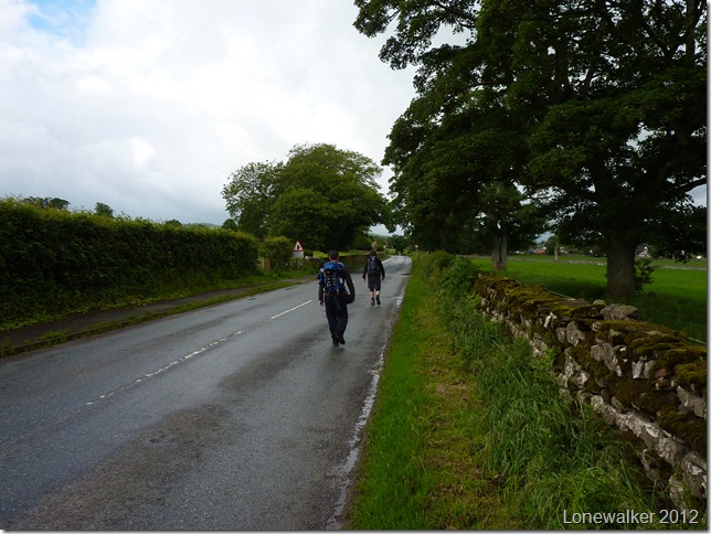
Taking in the lanes of Yanwath. |
 |
| |
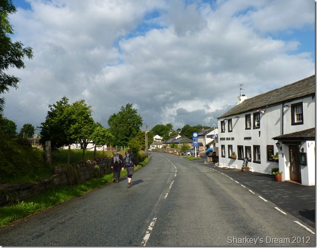
Passing the Queens Head, Tirrel.
After dodging early morning traffic along the lanes of Yanwath do we then find ourselves in the quaint walk through village of Tirrel. It is here the sun breaks through briefly as we pass a woman taking her dog out for an early morning walk, she greets each of us with a pleasant ‘morning’ as we return her gesture in chorus.
I chat with Stu about just how much I’m enjoying the small villages we are passing through as it is something that I rarely do as a fell walker. |
 |
| |
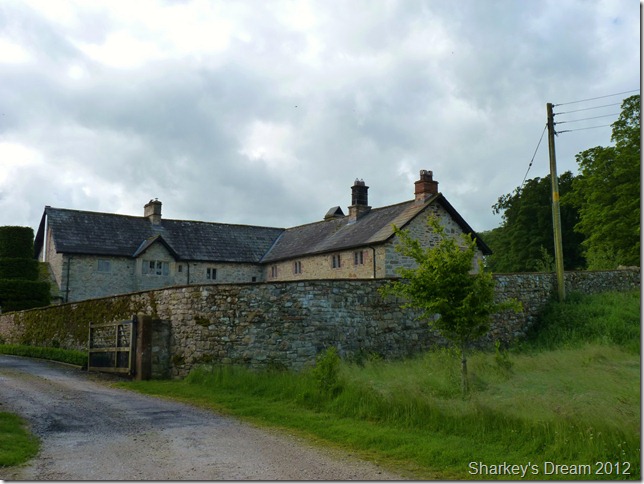
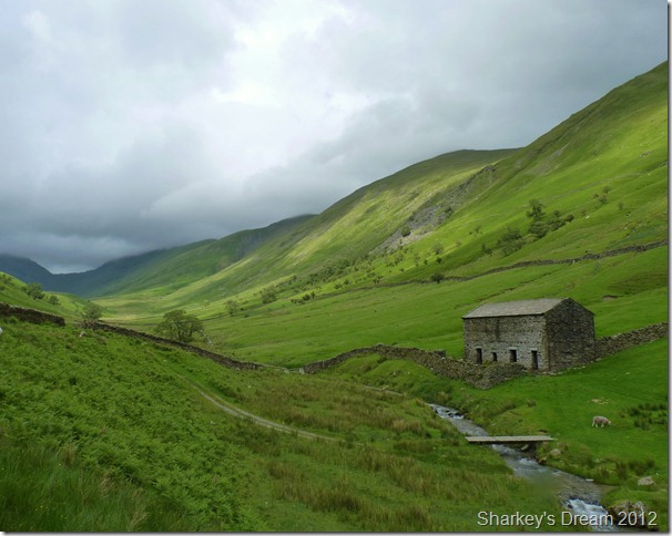
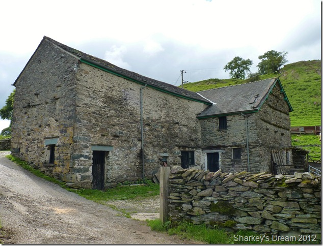
Winder Hall Farm.
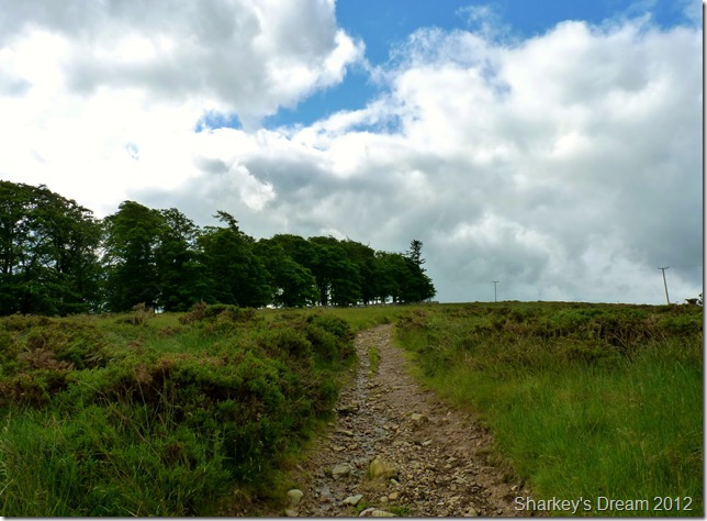
After a fairly steepish pull up a narrow over-grown tarmac path do we reach Winder Hall Farm, the last of civilisation until we reach Ambleside, it is just after leaving Winder Hall do we take on the course of the old Roman Road. |
 |
| |
After leaving Winder Hall we follow this narrow track to the end of the trees, its only then do the views start to open up. |
 |
| |
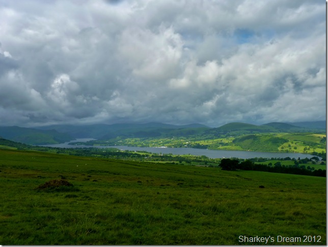
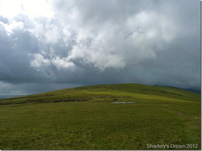
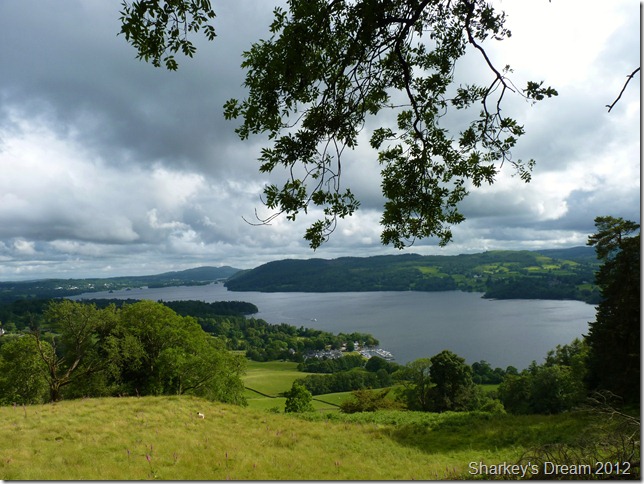
Ullswater & surrounding east & far eastern Lakeland.
This view for me was a highlight of the whole day, the camera really does not do it justice, I don’t know why but I didn’t expect to see Ullswater so early on into the walk, I let a WOW! before taking this picture.
Stu suggested would we mind making an ever so slight de-tour away from the Roman Road as he wanted to bag Heughscar Hill just out of shot to the left & a mere couple of hundred metres away |
 |
| |
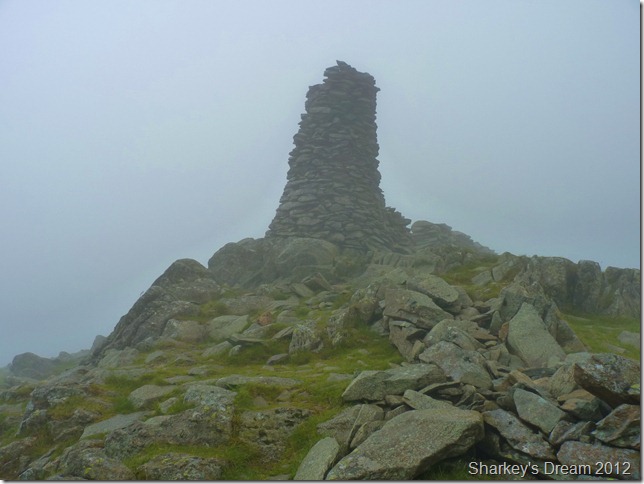
Heughscar Hill summit cairn.
We make a brief stop to take a few photos before we re-join with the main path |
 |
| |
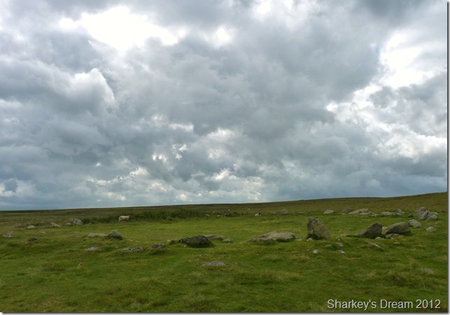
In keeping with the path shortly after leaving Heughscar Hill do you then pass the Cockpit, at Moor Divock. |
 |
| |
On course with the Roman Road from Brown Rigg
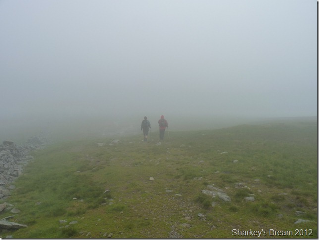
After leaving Moor Divock & the Cockpit we seamlessly went along our way only to be treated to more heavy rain showers, by now we were all still in our mid-layers so just before I took this photo we stopped to don the jackets.
We soon found after re-shouldering packs that we were a little off course & that the path lay a little to our left 60 metres away, it seemed odd to leave a gravel track for this narrow bead of what can only be described as a stream in places, both me & Stuart compared GPS’s & were soon on our way again.
High expectations of the route caused this point to be a low point so early into the walk for me personally, although the weather looks kind in this photo it was only at the times the sun briefly shone I was able to get the camera out, as the heavy rains & wind picked up, the next three quarters of an hour were a look at your boots as you walk affair!
We press on… |
 |
| |
Ahead, Loadpot Hill.
Still on track & during another respite from the rain, I took this photo looking towards Loadpot Hill. This was the first cairn we’d seen since leaving the gravel path sometime ago which was a welcome site.
By now both Tim & Stuart had noted that their toes were swimming in water, I was lucky as mine hadn’t quite succumbed to a bath yet, but its coming…
Having soaking wet socks so early on was a little disappointing for the guys yet the way the weather was so sporadic with heavy downpours & hot sun within minutes I figured it kind of counter acted with the mind-set.
As odd as it seems, a two minute sun burst did wonders for the morale. |
 |
| |
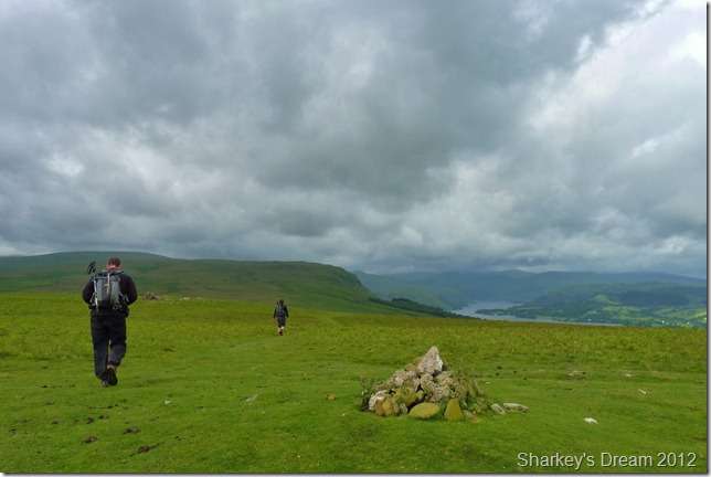
On the path as we flank Loadpot Hill.
It seems the Romans weren’t really into going over the tops of what lay in front of them & I guess that is why out of the six summits along the route its only five do we actually summit.
Stuart & I flank Loadpot Hill as Tim heads up to bag it as a new Wainwright, the difference between flanking the summit & heading over is marginal, we agreed to meet Tim on ‘the other side’
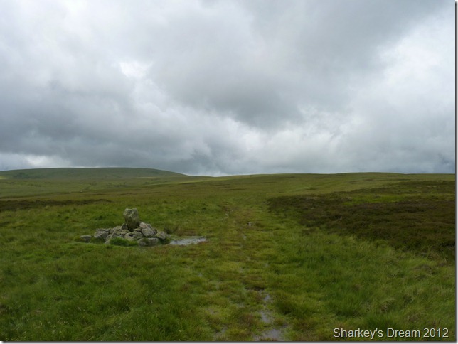
Sadly while doing this do I pass ‘Lambert Lad’ a boundary stone dating back to when the Romans used this route over 2’000 years ago, I’d done my research on its location but totally forgot about it until it was too late. |
 |
| |
Looking back on Arthurs Pike (R) & Bonscale Pike (L) as we head for Wether Hill. |
 |
| |
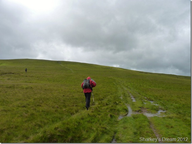
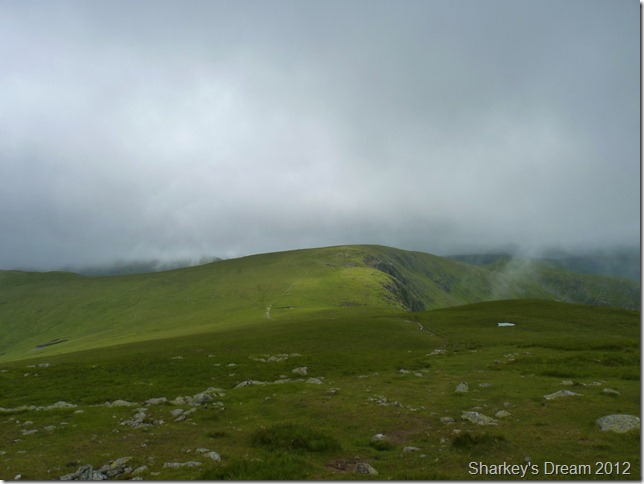
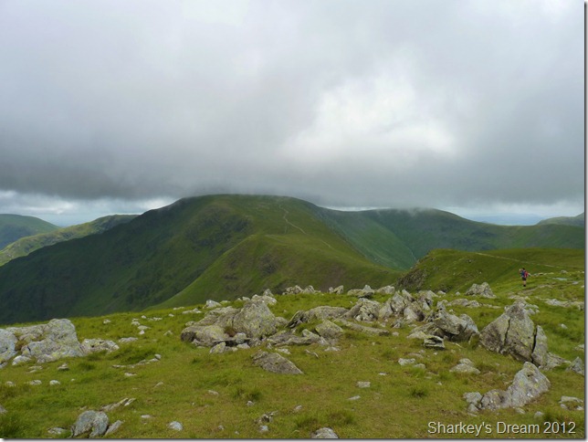
Wether Hill bound.
Despite the menacing cloud that we seem to be heading straight into, we escape another drowning until High Raise. |
 |
| |
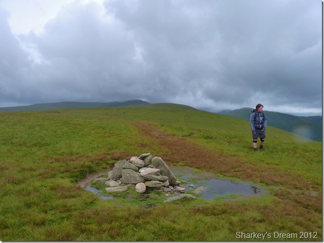
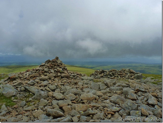
Wether Hill summit cairn.
We push on towards the next summit along the ridge, that of Red Crag. |
 |
| |
At the foot of Red Crag.
It is here we decide to stop for lunch, with heavy boots full of rain & bog water we take a little respite out of the wind & tuck into our lunches, we all find a seat behind the wall & sit down simultaneously with a awwwwhhhhhhh….my bloody feet!! |
 |
| |
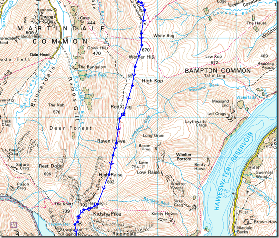
Looking over Raven Howe, High Raise & Rest Dodd (R) from Red Crag summit. |
 |
| |
High Raise summit cairn & shelter.
Stuart takes a reading on his Anemometer & records wind gust of around 25mph with a wind chill of just 2°C, I know the exact reason Stuart did this because it felt much colder with the more height we gained, ahead the wind would increase & the temperature would drop a little. |
 |
| |
| Rampsgill Head lies ahead marking an estimated half way mark, so we were just into double figures & prospects of my favourite fell of High Street set the butterflies going, morale here for all of us is at its highest |
 |
| |
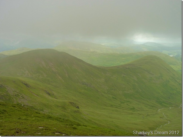
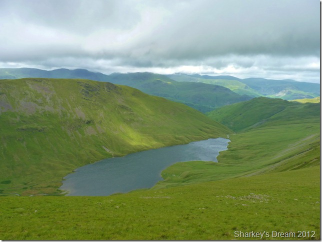
Rest Dodd & The Nab looking rather hazy through the cloud. |
 |
| |
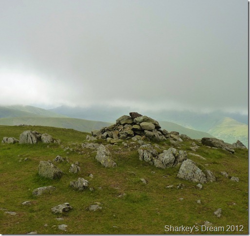
Rampsgill Head summit cairn (without the views!) |
 |
| |
The daddy of them all… High Street from Two Penny Crag.
The weather was kind as I take photo after photo, not only am I happy at the fact we are about to climb my favourite fell within the district, but this also was the only point that I could get trigger happy with the camera without having to quickly rush it back into its bag.
Tim & Stuart press on & by the time I had finished with my photos they are well out of sight, I feel a jog coming on to catch them up… |
 |
| |
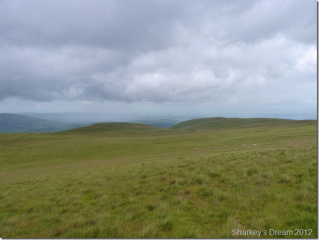
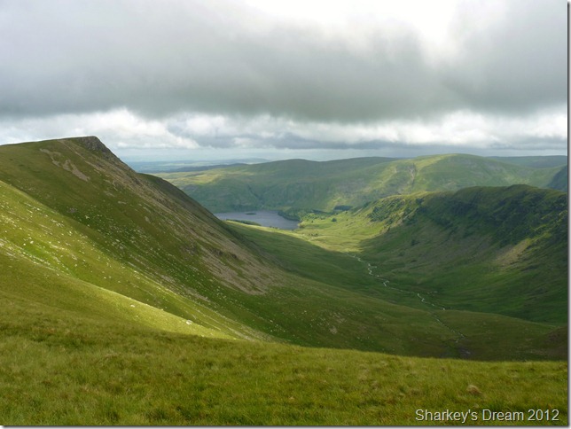
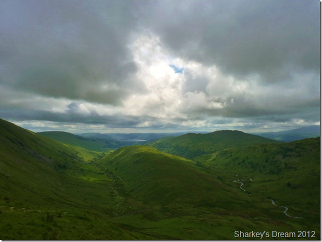
Inspiring views into Riggindale with Kidsty Pike distinctive summit on the left & the High Street Ridge on the right, at the bottom of Riggindale lies The Rigg & Mardale. Selside Pike sits in the shade in the background while Branstree basque in what the sun has to offer. |
 |
| |
Equally, High Street captures the sun beautifully over Riggindale. |
 |
| |
Hayeswater, Gray Crag & Brock Crag seen from our High Street ascent, the good views were momentarily.
Until we reach the summit this was the last photo I was to take as the whole of the fell was engulfed in passing cloud, it really did feel like a march towards the summit, those niggling injuries are good at showing up at times like these. |
 |
| |
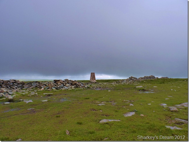
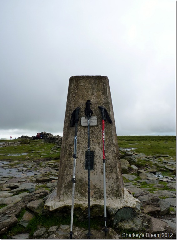
High Street summit trig point.
It was time for the second rest stop as we all tapped the trig point & made for some shelter behind the stone wall out of the wind, we had just passed a party of about half a dozen walkers leaving the summit behind, not all I might add had the inspiration that we carried judging by the looks on their faces. |
 |
| |
Good times… |
 |
| |
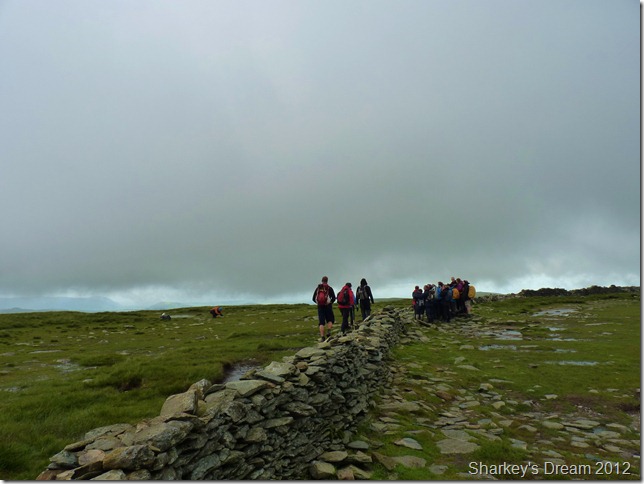
Where’d the summit go!
As we popped our heads above the wall after finishing the remainder of our lunch did we spot this huge party of walkers engulfing the summit, there was still more to come as I took the photo as it looked like forty plus, Stu took off towards the guy placing a camera on a tri-pod & asked do you want me to take the photo? as clearly the wind was blowing the camera all over the place, no thanks the guy replied. With this Stuart’s rarely but seen evil streak came out as the guy counted down from ten to zero & ran back into position, he now had ‘Stuart’ pulling a funny face with arms aloft in the background in his shot.
THANKS! the guy shouted at Stuart, by now Stu had this huge grin spread across his face as me & Tim were in fits of laugher, best get outa here eh? |
 |
| |
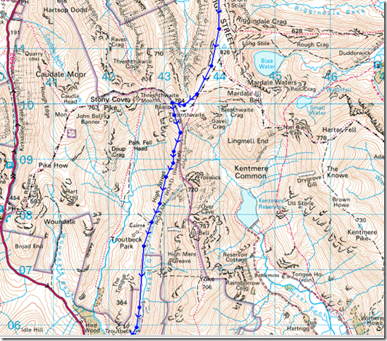
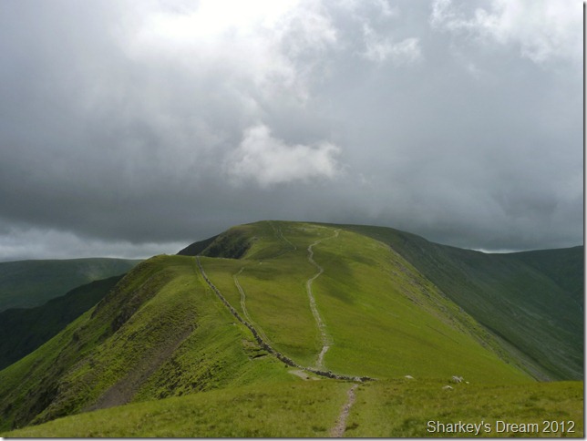
Thorthwaite Beacon.
By now the cloud was back & the crossing in-between here & High Street was pretty rough as we head strong into 36mph gust, the summit here wasn’t a place to hang around so little time was spent here. |
 |
| |
Heading of into the mist for Park Fell & Troutbeck.
I guess the hard work was out of the way as prospects of the final stages lay before us, we were all feeling the strain around the seventeen mile mark & each of us had our own aching limbs or desperately sore feet through trampling with heavy boots & wet socks for the best part of eight hours.
Despite the aches & pains we trundled on as the same butterflies that engulfed my stomach upon reaching High Street was doing the same with prospects of views onto Windermere. |
 |
| |
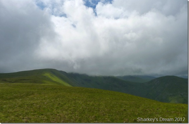
Foswick with IIIBell under cloud.
It wasn’t long before we were out of the cloud, I took this shot just after leaving the main path for our descent down Park Fell & Troutbeck bound. |
 |
| |
Troutbeck & Troutbeck Tongue. |
 |
| |
Troutbeck from Hagg Gill.
Our descent via Park Fell into Troutbeck was a little testing, the steep grassy paths played havoc with sore knee joints & for the first time I recall, my hips were also giving me a little pain beside that from my sore pads at the bottom of both my feet, Stuart’s left knee began to give him a little dis-comfort & Tim wasn’t far behind, in fact, I think it was Tim who fared the best out of the three of us at this point.
We decided to stop about half way down the path & we all could have done with airing out our soaked feet out but taking the boots of at this stage would be a big no-no. Instead while perched around a flat bed of rock we stopped & chatted a while, jovious even about the highs & lows of the day.
The site of High Street from Two Penny Crag as we left Rampsgill Head was just one of mine, oddly enough, I really enjoyed Brougham & its connections going back to the Roman Times & even the second world war.
Stuart spoke about High Street & his love for the fell as much as I did, Tim was a little saddened at the fact that he hadn’t enjoyed the connection in between Loadpot Hill & High Raise as much as he thought he would have, yet we all agreed our second wind came as we left Rampsgill Head for High Street, here the weather was kind & I could get my shots, it was also the longest period in between showers & at least we had a clear summit although the ascent at times was somewhat obscured by cloud.
We took a reading or I did on how many miles we had left, my GPS told me we had 4.7 to go, Stuart thought about it & said that cant be right Paul? Stuart checked his GPS & the difference was a little startling as his read we had 7.5 to walk, it was only afterwards did I realise that my GPS hadn’t been programmed to the walk as I’m currently having problems with one of my USB Ports on my laptop (its a long story!)
With this we stand up & brush ourselves down for the 7.5 mile journey out of Troutbeck & headway for Ambleside, no need to shoulder packs as we left them on as soon as our tired aching limbs hit the ground.
At least by know I note… We can see Windermere. |
 |
| |
A long distant view back up the Troutbeck valley towards Thresthwaite Mouth. |
 |
| |
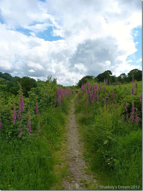
Truss Lane with its array of Fox Glove wild flowers. |
 |
| |
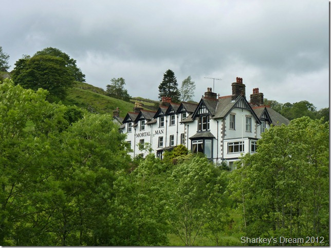
The Mortal Man.
"Thou mortal man that lives by bread, How comes thy nose so red? Thou silly ass that look so pale, It is by drinking Sally Birkett’s ale” |
 |
| |
High Fold, Troutbeck. |
 |
| |
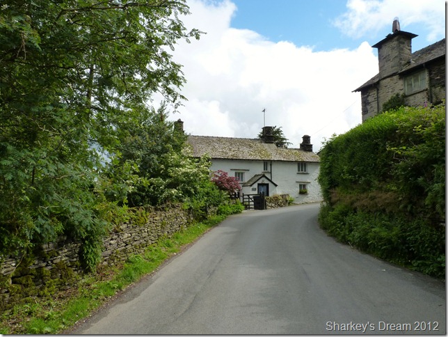
Troutbeck Post Office.
We picked our way through the lanes of Town End Troutbeck, when we came across a vacant Shop & amenity store, there was signs in the windows advertising Ice Cream for sale but sadly the shop was closed.
Just by the shop at the junction with Robin Lane stood a wooden bench, surrounded by neatly cut grass it was here the wind in our sails flagged a little, we needed a quick rest stop, ice cream or not.
As the traffic drove by we sat there basking in the afternoon sun, steaming like cattle wavering & plucking up the final musk for a three hundred foot ascent required for the tarmac track of Robin Lane.
This is done in mostly silence. |
 |
| |
High Skelghyll Farm.
After crossing a wooden footbridge nestled within a coppice of trees did we then pass High Skelghyll Farm, the gradient of the road here shows that it required a bit of energy & energy was in short supply, I feel a second wind hit me without really thinking about it.
It couldn’t of come at a better time. |
 |
| |
Windermere just before we descend into Skelghyll Wood.
The descent through the Skelghyll Wood was tricky to say the least, after the rain had subsided leaving extremely slippery conditions over wet rock & tree roots. By now we could hear the traffic along the A591 & I could even pick out in my head where the path would lead us out, its just getting there in one piece, because right now my feet aren’t to good at negotiating anything beneath them! |
 |
| |
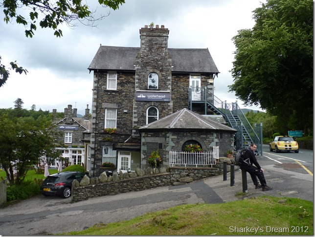
Stuart taking a well deserved rest as we wait for Tim to cross the busy road.
It was like stepping back into time as we crossed the busy road, with cars & people everywhere this taking a couple of seconds to adjust to.
Incidentally, the path chucked us out right opposite the Waterhead Hotel, before I planned this walk I never knew this path existed. |
 |
| |
Ambleside Mariner.
The concrete underfoot sent shooting pains all around the soles of my feet but I did not let it show, none of us let our ailments flag us so close to the end.
As we passed by the mariner as the tourist were enjoying their Ice Creams & indeed the pleasant views over Lake Windermere three Romans passed, stench to heaven with mud up to their leather Tunics we had indeed made it to Ambleside.
All that was left was a slow steady march to GALAVA ROMAN FORT. |
 |
| |
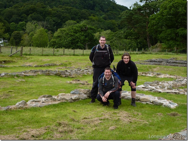
GALAVA ROMAN FORT Ambleside.
We enter the Fort silently, this was the end of our journey & that took a little to get used to, we are met by a broad Yorkshireman with a dog on the end of a blue rope.
I ask the Yorkshireman would he mind he take our photo, he does this but is stood so far away we kind of look like three strangers stood in a field. Stuart takes out his tripod & sets his camera on a ten second timer.
It seems my eyes couldn’t take the strain D’oh!!
This the final photograph of the day is the best out of the lot, it shows three extremely tired men, Romans Soldiers even. in the face of adversity masking aliments & aching limbs with giant bright smiles.
Accomplished, the smiles on our faces speke a thousand words. |
|
| |
| Back to top |
 |
|