|
High Street, Thornthwaite Crag & Pasture Bottom from Harstop |
 |
 |
11th April 2021 |
 |
|
I had a couple of plans to either head up to Coniston straight after work or pay homage to Counting Hill and Winter Hill which is something that I'd really like to do before settling back into my Lakeland routine. That was until Rod e-mailed me mid week asking would I like to join him on a route he'd planned during the previous lock down.
I feel like I have forged a bond with Winter Hill but I just couldn't turn down a walk which included my beloved High Street and Pasture Bottom, the latter being a place that I haven't visited for some years, damn right I was going to join Rod.
It's incredible to think that this time last year the whole country was enjoying wall to wall sunshine which lasted from March through to May. This year the snow is falling from cloudless skies and you need your thermals just to take the rubbish out, sounds like a typical UK Spring to me but despite this today we were lucky enough to be on the hill as the cloud peeled away revealing blue skies from horizon to horizon. |
|
| Wainwright Guide Book Two |
 |
| The Far Eastern Fells |
| Thornthwaite Crag is one of the better-known fells east of Kirkstone, owing not a little of its fame to its tall pillar of stones, a landmark for miles around. |
 |
|
|
|
|
| |
|
Overview |
|
|
| Ascent: |
2,619 Feet - 798 Metres |
| Wainwrights: |
4, The Knott - High Street - Mardale III Bell - Thornthwaite Crag |
| Weather: |
A Cloudy Start Soon Turning Bright & Sunny With Light Winds Across The Summits. Highs of 11°C Lows of -3°C |
| Parking: |
Car Park, Hartsop |
| Area: |
Far Eastern |
| Miles: |
8 |
| Walking With: |
Rod Hepplewhite |
| Ordnance Survey: |
OL5 |
| Time Taken: |
5 Hours |
| Route: |
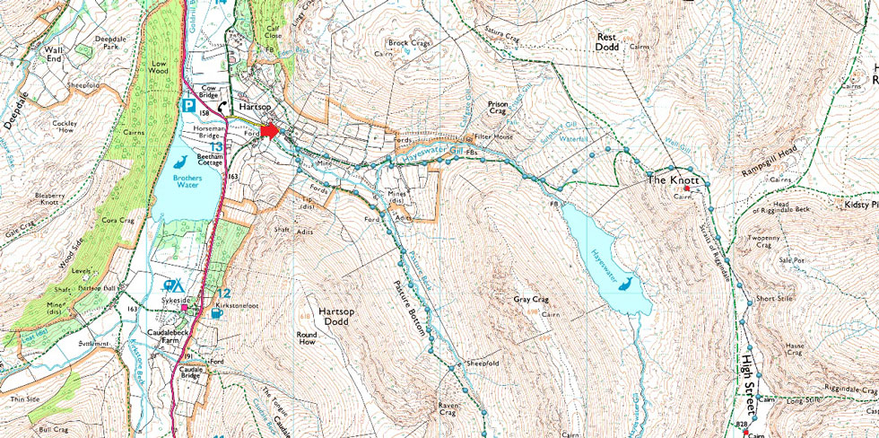
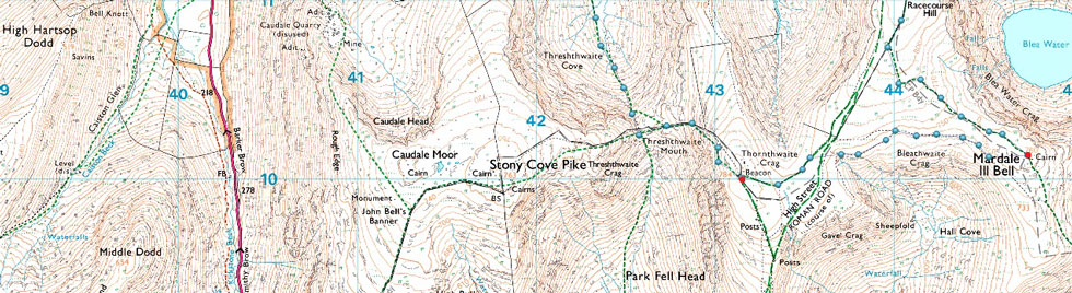
Hartsop - Hayeswater Gill - The Knott - Straights of Riggindale - High Street - Mardale III Bell - Top of Hall Cove - Thornthwaite Crag - Thresthwaite Mouth - Pasture Bottom - Pasture Beck - Hartsop |
|
| |
|
Parking Details and Map |
|
|
| Nearest Post Code: |
CA11 0NZ |
| Grid Reference: |
NY 410 213 |
| Notes: |
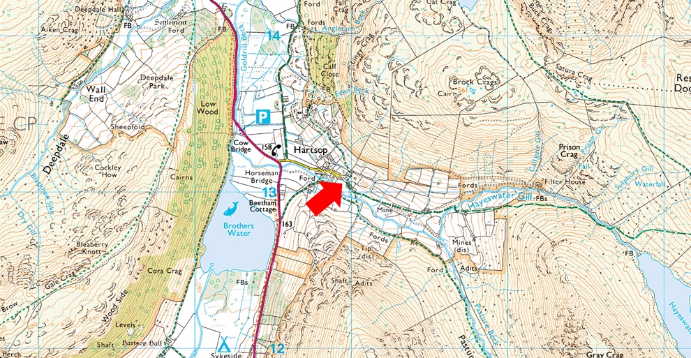
A very popular car park in the hamlet of Hartsop giving access within the heart of the east and far eastern fells just a few minutes stroll away from Brothers Water. The car park is situated at the end of a narrow lane which provides the backbone to the village. An honesty box can be found next to the gate at the far end of the car park. |
|
| |
|
Map and Photo Gallery |
|
|
 |
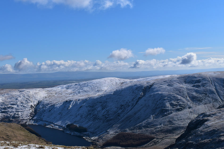
| Caudale Moor below cloud, Stony Cove Pike, Thresthwaite Mouth, Troutbeck, Thornthwaite Crag, Froswick, III Bell and finally Troutbeck Tongue. |
| As I joined Kirkstone Pass this was the view I had over Troutbeck which was enough for me to pull over and start taking a few photos. |
 |
| Cloud topped Red Screes seen close to the top of Kirsktone Pass. |
| I've always loved this view from the road and given that it was so quiet I squeezed into a layby and began taking a few more photos. |
 |
| Same view as I walked back to the car. |
| At the double mind as it was f-fur-freezing wearing just a thin base layer, cracking view though. |
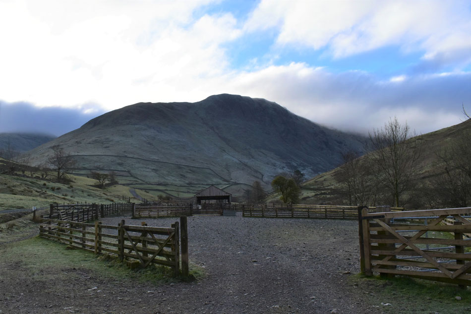 |
| Gray Crag from the Hartsop sheep pens 07:55am -3°C |
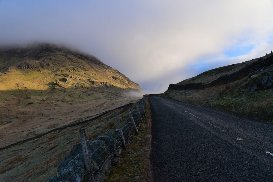
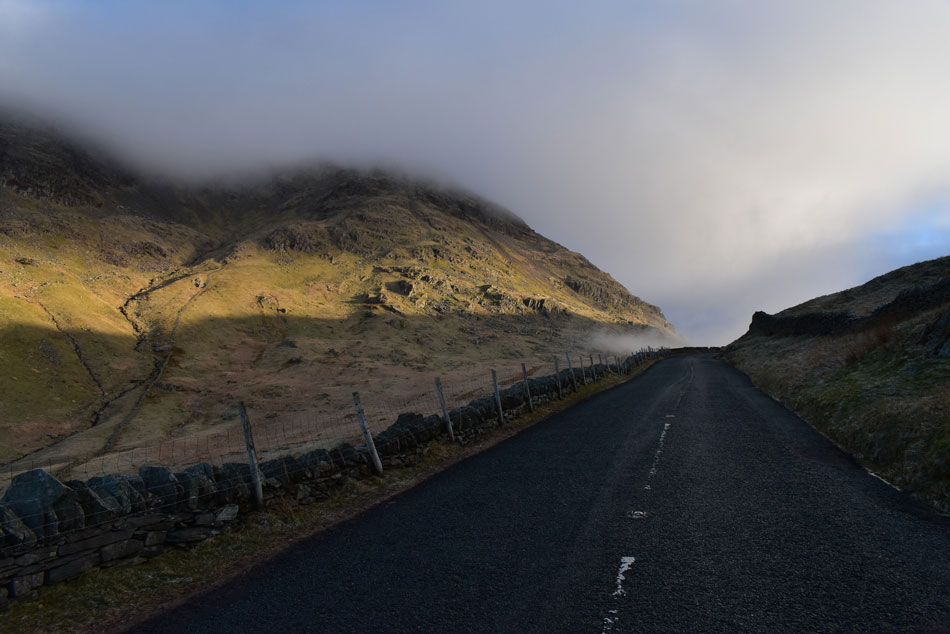
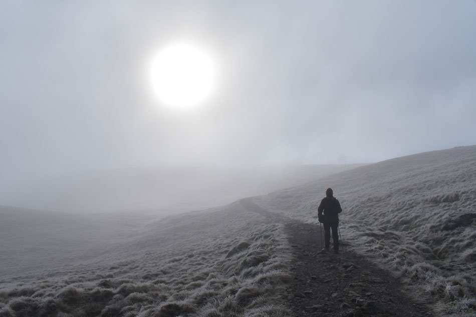
I left the top of Kirkstone Pass and descended into a valley of shadow which the sunrise hadn't yet penetrated. I was still shivering after leaving the car to take the previous photos and it was only after I'd had the heater on full blast did I start to feel normal again. The plan was to arrive at Hartsop by 07:45 for a 08:00am start but I was twenty minutes early and given that I could choose where to park I left the engine running while cloud watching. By 07:35 I was out the car during which time another car pulled onto the car park who's owner drew up at the far side of the car park next to a motorhome. I started to shiver again as I laced up my left boot then added my buff and jacket before lacing up the right.
As I extended my walking poles Rod pulled onto the car park and parked his car alongside mine. Despite keeping in weekly touch with Rod and David it was September last year when we last walked as a trio meaning there was alot of catching up to do but for now the only thing dominating conversation which was the cloud lingering over The Knott - todays first summit of the day. We remained optimistic that the cloud would lift and for now, put it to the back of our minds. |
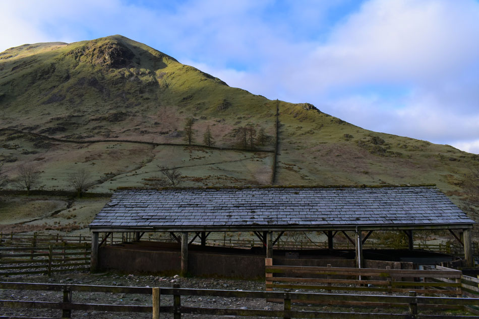 |
| Hartsop Dodd North ridge from the sheep pens. |
| Well at least Hartsop Dodd is enjoying a little sunshine. |
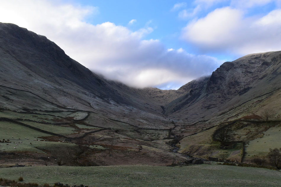 |
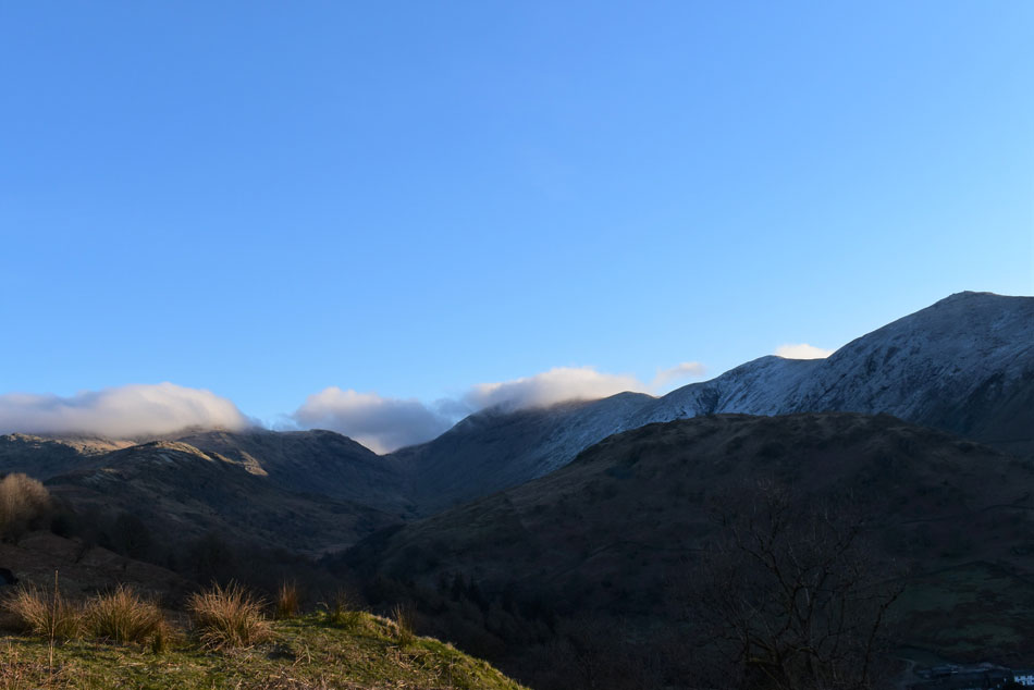
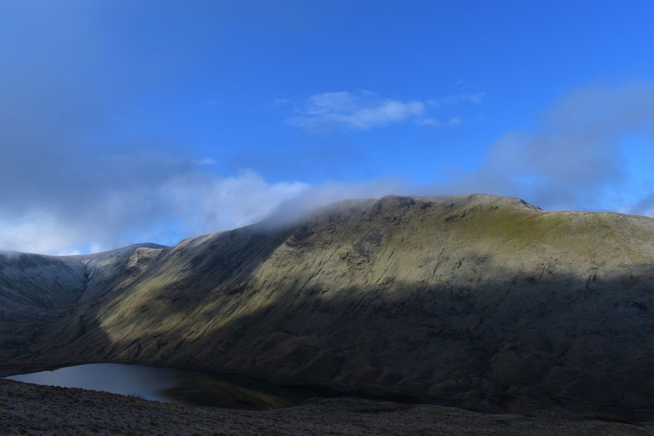
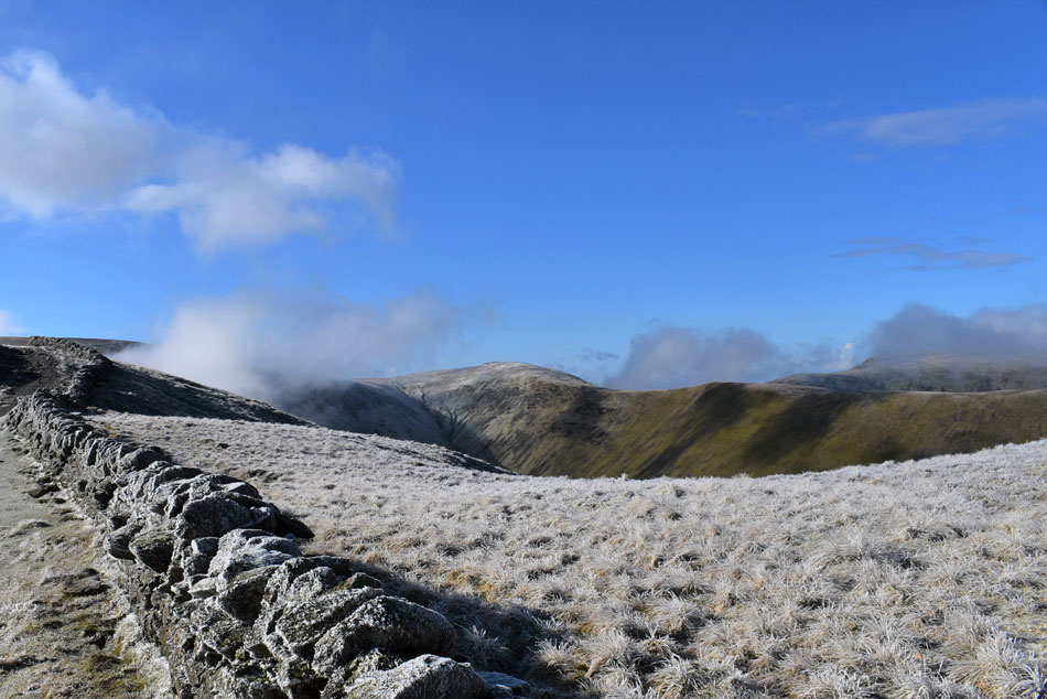
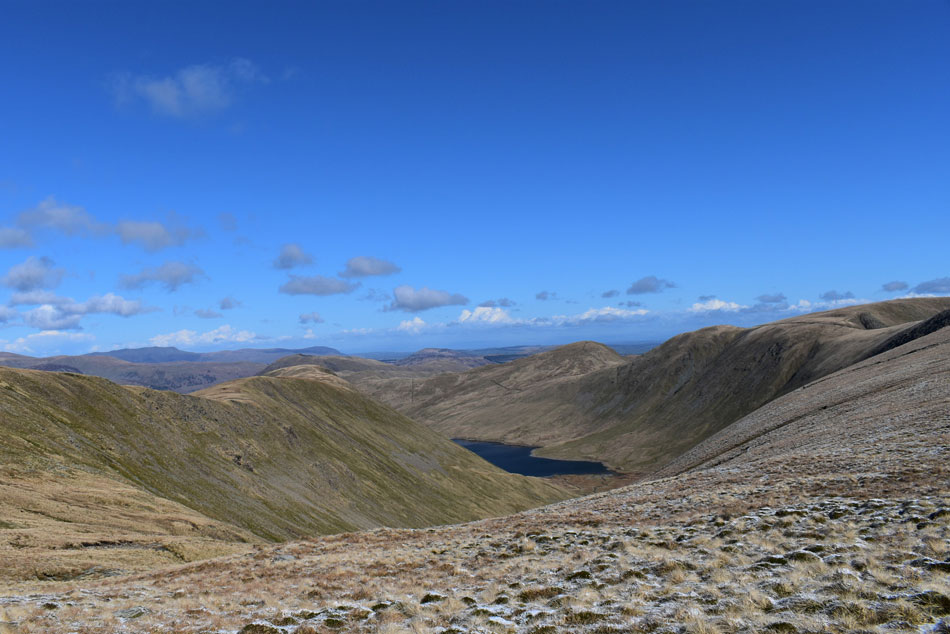
| Blue skies over Thresthwaite Mouth and Pasture Bottom. |
| It's been way too long since I walked through Pasture Bottom and whatever happens with todays forecast I was really looking forward to ending the walk through here. |
 |
| As we climbed out of Hartsop. |
| Harstop above How and Gavel Pike come into view, those with a keen eye may spot Deepdale Hause just below cloud over on the right. |
 |
| Sunlit Brock Crags. |
| The path started to climb steeply alongside Hayeswater Gill where both Rod and I dipped the clutch in and went for a lower gear, it wasn't so much hard or anything we just wasn't used to the steep ascents straight from the car after 6 months of local walking. |
 |
| Right on time... |
| We arrived at the new footbridge and crossed Hayeswater Gill while not quite believing our luck as the cloud started to peel from High Street summit, for now this incredible view wasn't to last as more cloud replaced what was lifting away but as the saying goes "there's promise in them there skies" |
 |
| Beyond Hayeswater. |
| Cloud was also peeling away from Thornthwaite Crag and Grey Crag too. |
 |
| Ahh. |
| We watched the cloud come and go then come, and come again until we were clag bound as we rounded on The Knott summit. The good news was it would seem the further we climbed the higher we got to the cloud base and with a strong sun bursting to get through we knew we wouldn't have to wait long until the cloud lifted and the views re-appeared. |
 |
| Rampsgill Head from The Knott summit. |
| Any minute now... |
 |
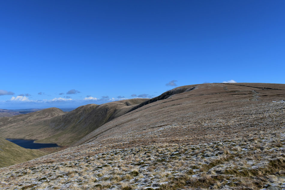
| High Street and Thornthwaite Crag from The Knott. |
| And as if by magic the cloud had lifted revealing High Street in all her glory. |
 |
| High Street, Thornthwaite Crag, Stony Cove Pike and Caudale Moor from The Knott. |
| Having descended from The Knott we linked back up with the footpath bound for the Straights of Riggindale both thinking the same thing 'where is everyone' aside the folk back at the car park (who separately all headed for the Brock Crags zigzags) we still hadn't seen a soul as yet, not that we were complaining mind. |
 |
| High Street and Thornthwaite Crag from the Straights of Riggindale. |
| It's views such as this which explain why I'm so fond of High Street. |
 |
| High Street and Thornthwaite Crag. |
| With the flat top summit of Caudale Moor seen over on the right. |
 |
| Gray Crag, Hayeswater, Brock Crags and Angletarn Pikes from the Straights of Riggindale. |
| Not forgetting the easten fells backdrop in the distance. |
 |
| The Knott and Two Penny Crag. |
| Seen over the Straights of Riggindale. |
 |
| Views beyond Gray Crag summit. |
| Towards Hartsop above How, Hart Crag, Fairfield, Cofa Pike, St Sunday Crag, Nethernost Pike, Helvellyn, Striding Edge and Gavel Pike. |
 |
| Looking back on the Straights of Riggindale. |
| As cloud advanced southwards but lifted before reaching us which was the last of the summit cloud we'd see all morning. |
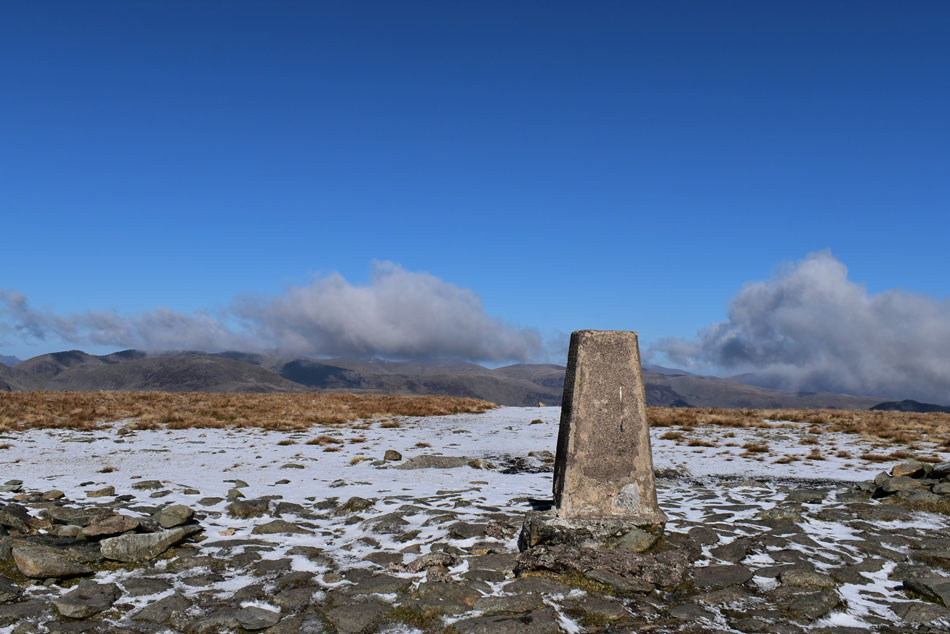 |
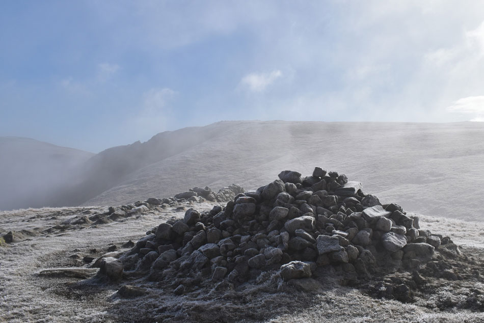
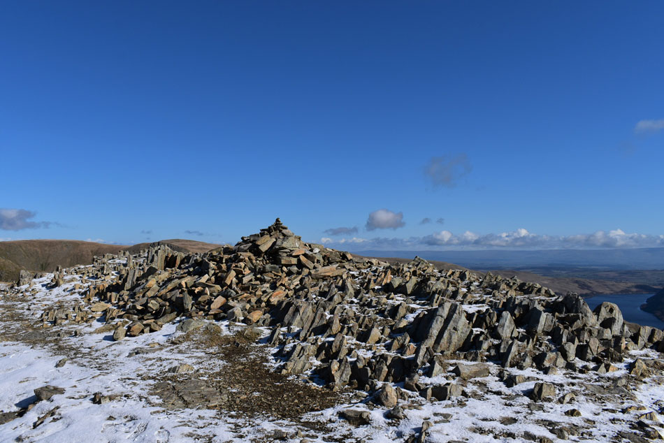
| High Street summit cairn. |
| We left our path a tad too early and advanced pathless towards the trig point which we found to ourselves but not for long as a couple of walkers were approaching from the direction of Thornthwaite Crag. There aren't many trig points in Lakeland which receive a heart warming pat followed by a whispered "hey its me" like this trig point does. |
 |
| Yoke, III Bell and Froswick. |
| More commonly known as the III Bell ridge seen here with Windermere over on the right. |
 |
| Selside Pike, Branstree, Mardale Head, Harter Fell (Mardale) and Mardale III Bell. |
The next summit to visit was Mardale III Bell which required a slight out and back from the High Street Roman Road. The plan was to make our summit then gain Thornthwaite Crag by traversing the head of Hall Cove (Kentmere)
Given the exposure here the windchill had taken a dive which we had to endure for the next half hour or so but I'll take the cold when you have views as good as this. |
 |
| High Street and Kidsty Pike. |
| Taken from a frozen pool not far from Mardale III Bell summit. |
 |
| Kidsty Pike and High Raise (Martindale) from Mardale III Bell. |
| With Haweswater seen over on the right. |
 |
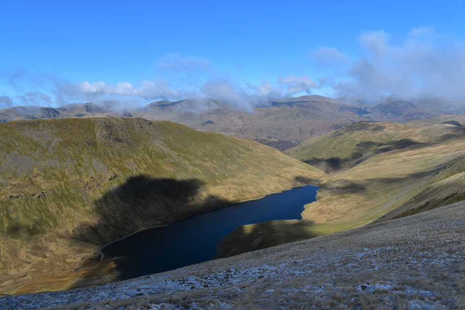
| Views over Mardale Head towards Haweswater, Selside Pike and Branstree. |
| Up until now we had been walking over what felt like fresh hail but here on Mardale III Bell it was actually powdery snow that had fallen. |
 |
| Still feeling the nip. |
| We took in a slight descent easterly and joined the narrow path around the head of Hall Cove, that's Thornthwaite Crag in the distance. |
 |
| Views over Kentmere Reservoir and the III Bell ridge. |
| Gaining III Bell by its east ridge is up there as one of the steepest ascents in the Lake District where in places 'clutching at grass' becomes the norm and this morning it's looking that bit more daunting as the fresh snow profiled the ruggedness of the ridge. |
 |
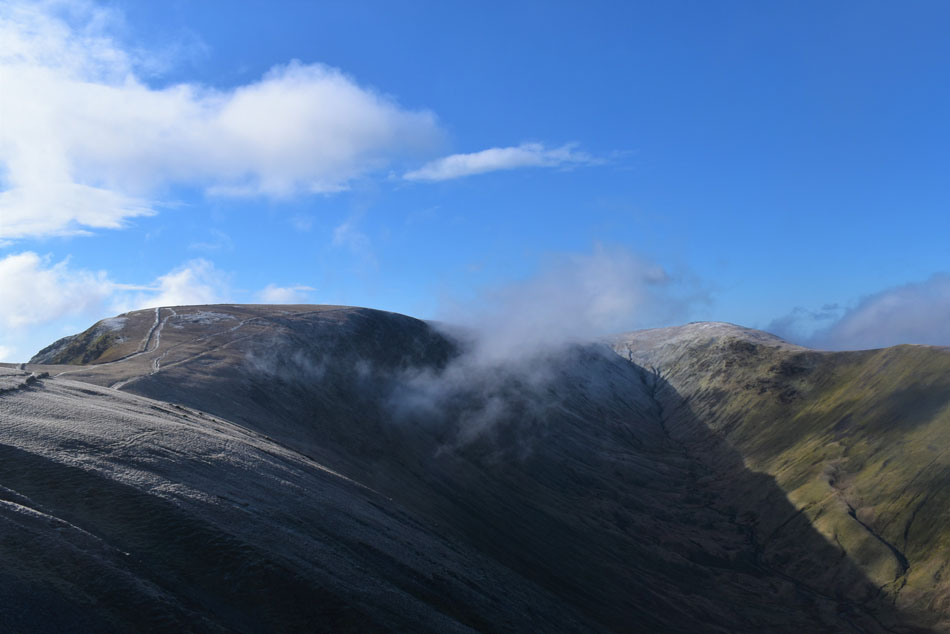
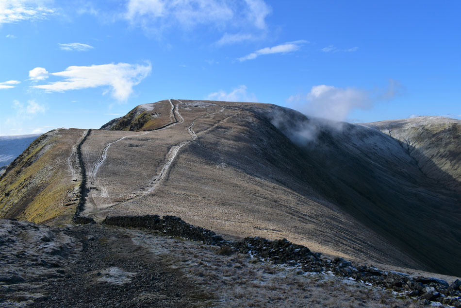
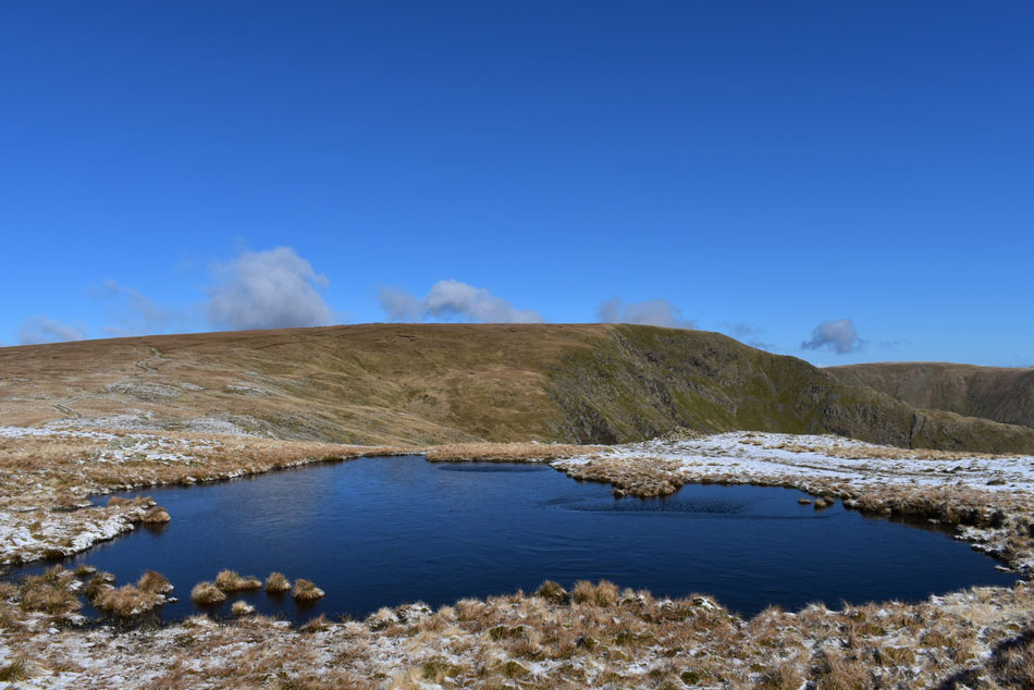
| Thornthwaite Crag. |
| Taken from another frozen pool before we link back up with the Roman Road. |
 |
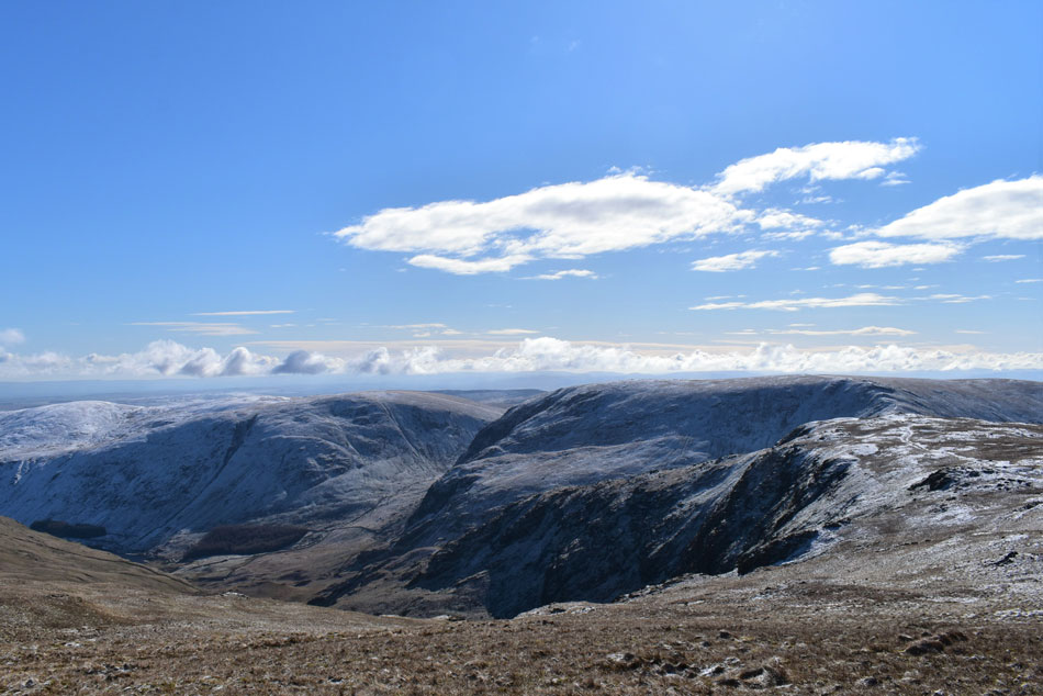
| Looking back on High Street, The Straights of Riggindale, Kidsty Pike, The Knott and Rest Dodd. |
| With Hayeswater below. |
 |
| The same view. |
| Only this time Gray Crag can be seen over on the left. |
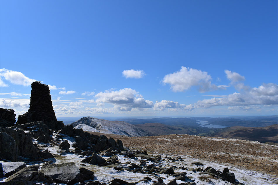 |
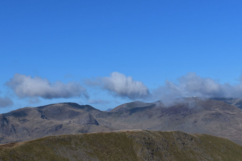
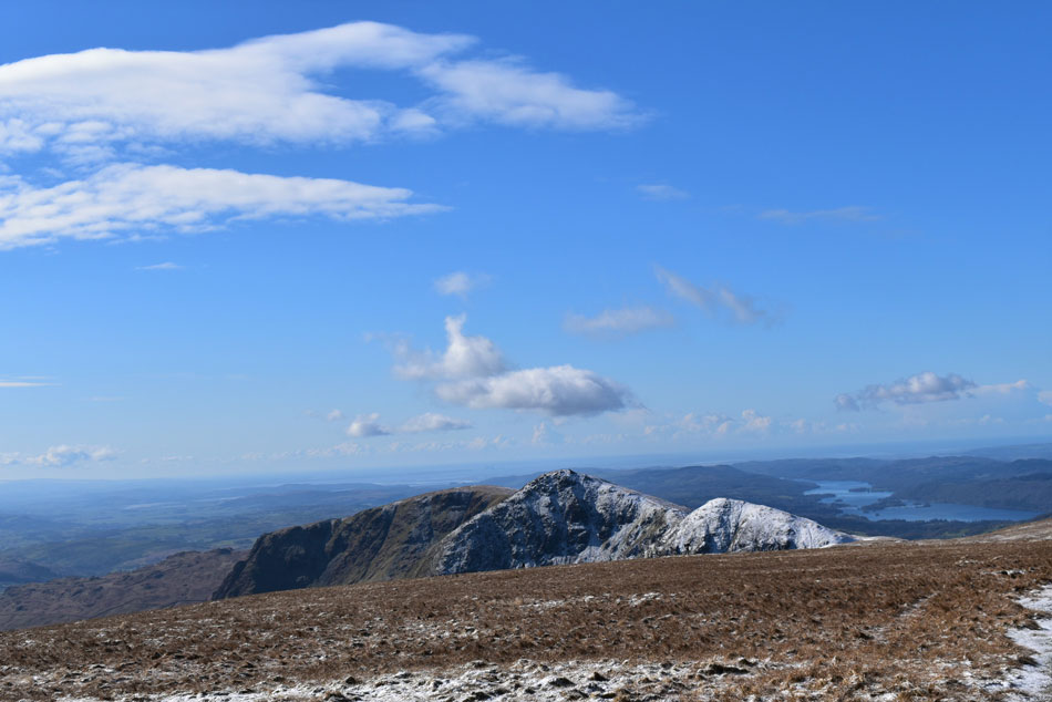
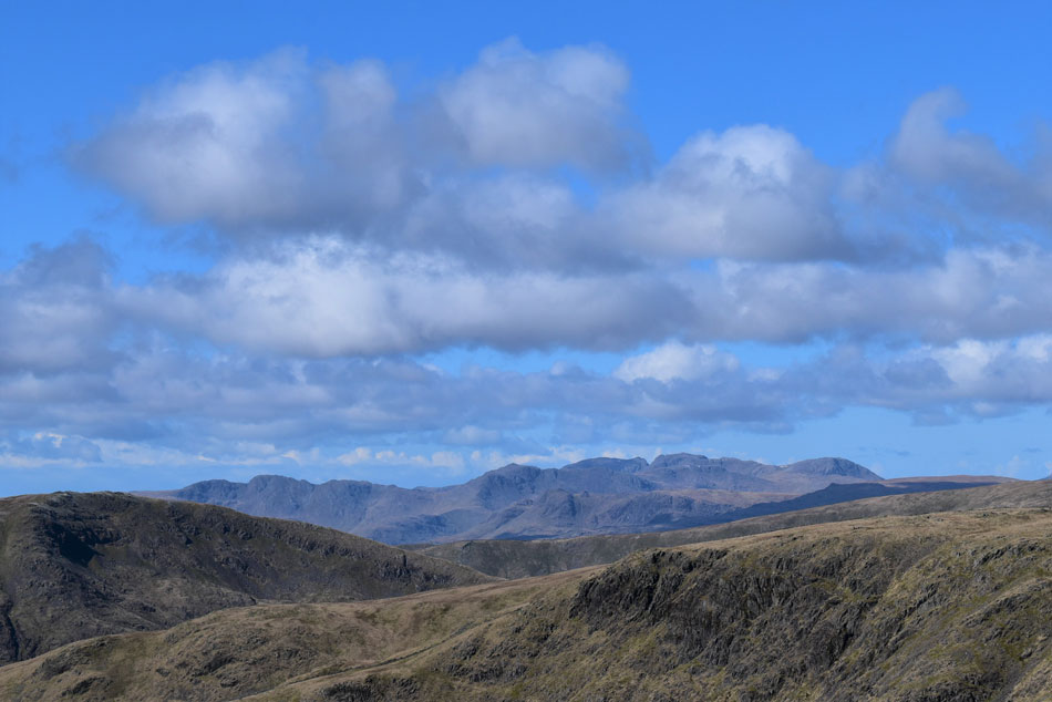
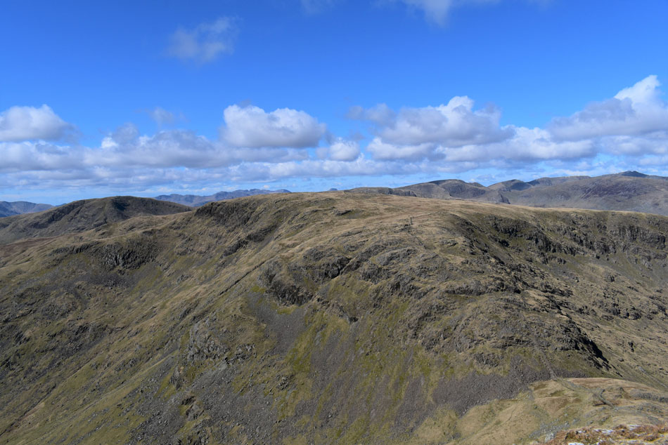
| The III Bell ridge and Windermere from Thornthwaite Crag summit. |
| By the time we arrived at Thornthwaite Crag a solo walker was seeking shelter on the south side of the stone column which was the only side where you could escape the windchill, thankfully he didn't hang around very long after our arrival and with us both complaining we were hungry having eaten breakfast some five and half hours ago we decided to have an early lunch so we settled down under the column instantly benefiting from the protection the column gave us. It felt good to be out of the windchill even if it was going to be for a few minutes while we refuelled. |
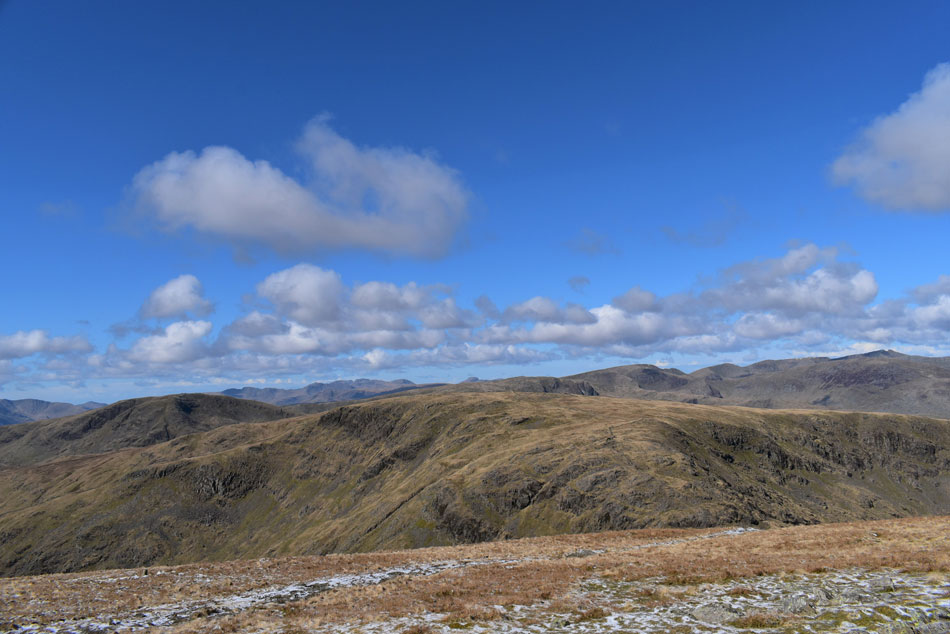 |
| If I tilted my head Westwards. |
| I could take in the view over Stony Cove Pike, Caudale Moor and Red Screes. |
 |
| And if I squinted at the same time. |
| Crinkle Crags, Bow Fell, Esk Pike, Great End, The Scafells and the Langdale Pikes all came into view. |
 |
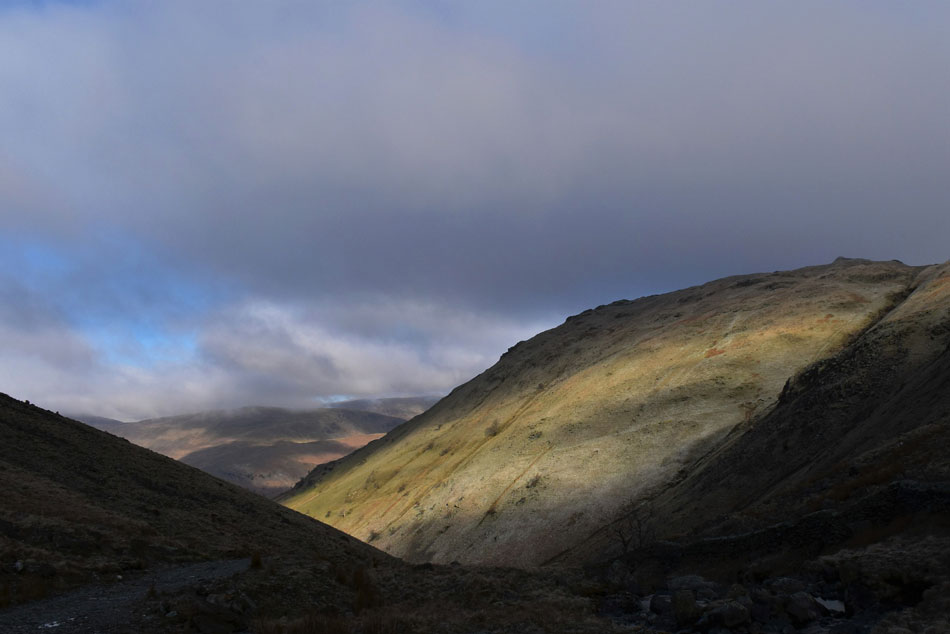
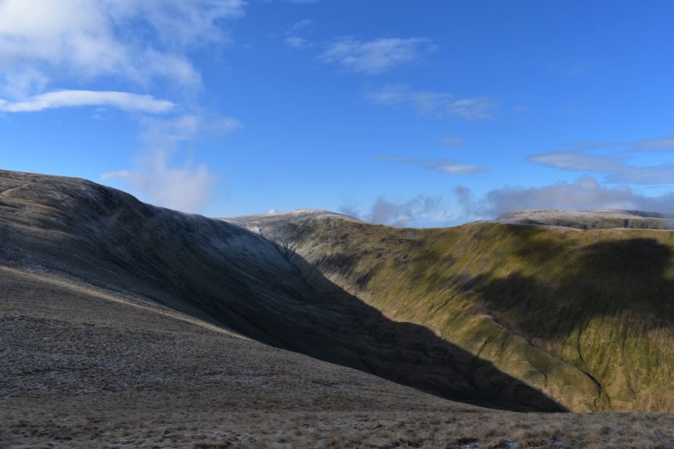
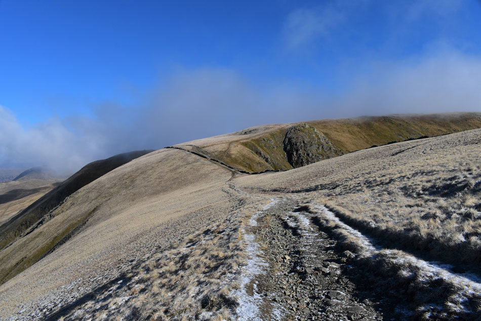
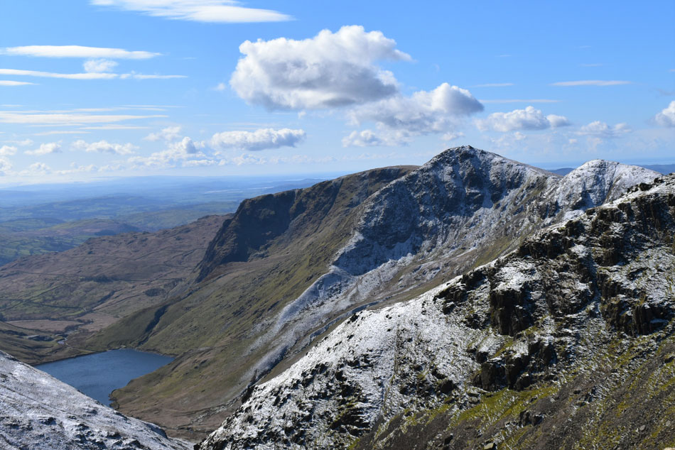
| Descending Thornthwaite Crag. |
| With views over Thresthwaite Mouth, Stony Cove Pike and Caudale Moor. |
 |
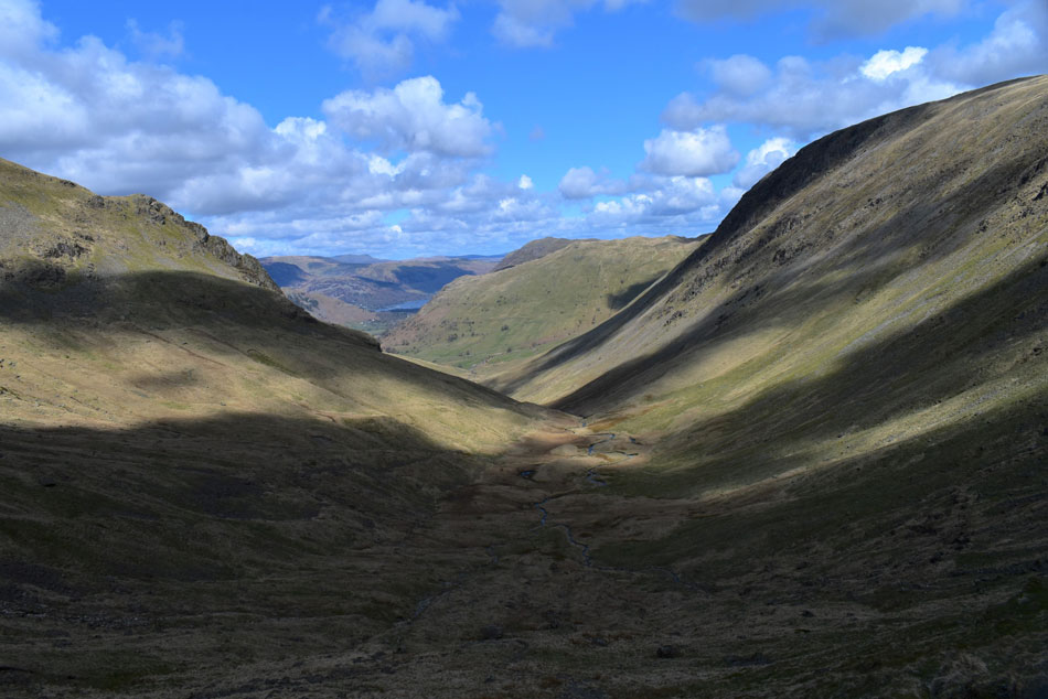
| Descending Thornthwaite Crag while peering into Pasture Bottom below. |
| I think after six months away both Rod and I had under estimated how rough (and steep) the descent from Thornthwaite Crag to Thresthwaite Mouth actually is when just after five minutes into the descent we both chirped up "blimey I forgot how steep this descent was" and given that we were both reading of the same page now we dropped down a gear and studied the path while making its descent. |
 |
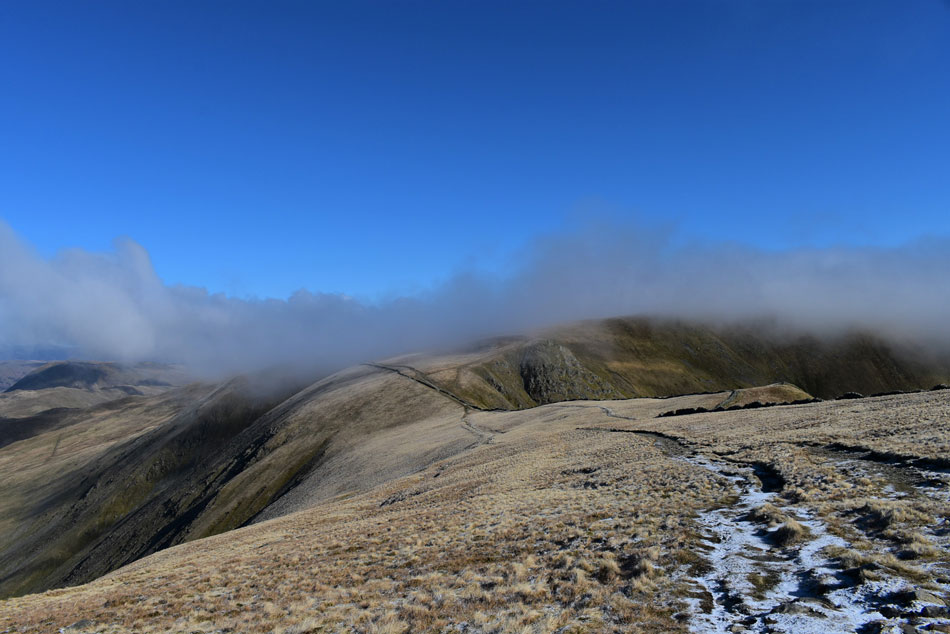
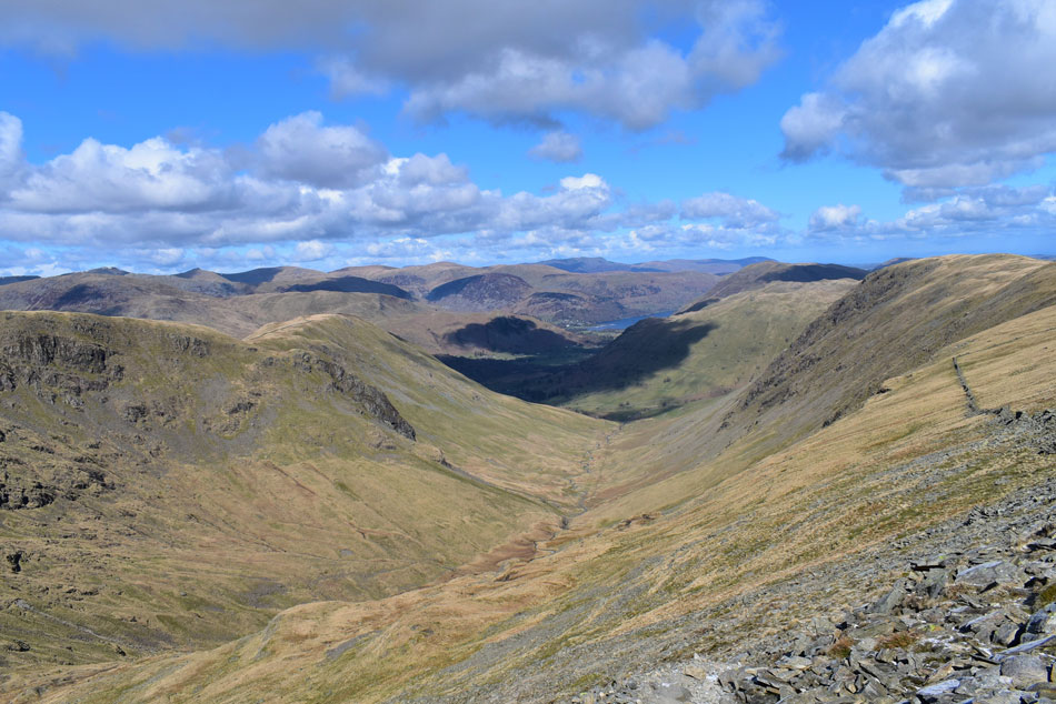
| Pasture Bottom and Brock Crags from Thresthwaite Cove. |
| The steep descent wasn't quite over with another 700ft of descent before reaching the valley floor where at times the path had was covered in verglas meaning the upper part of the descent was quite slow. |
 |
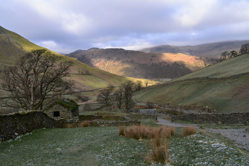
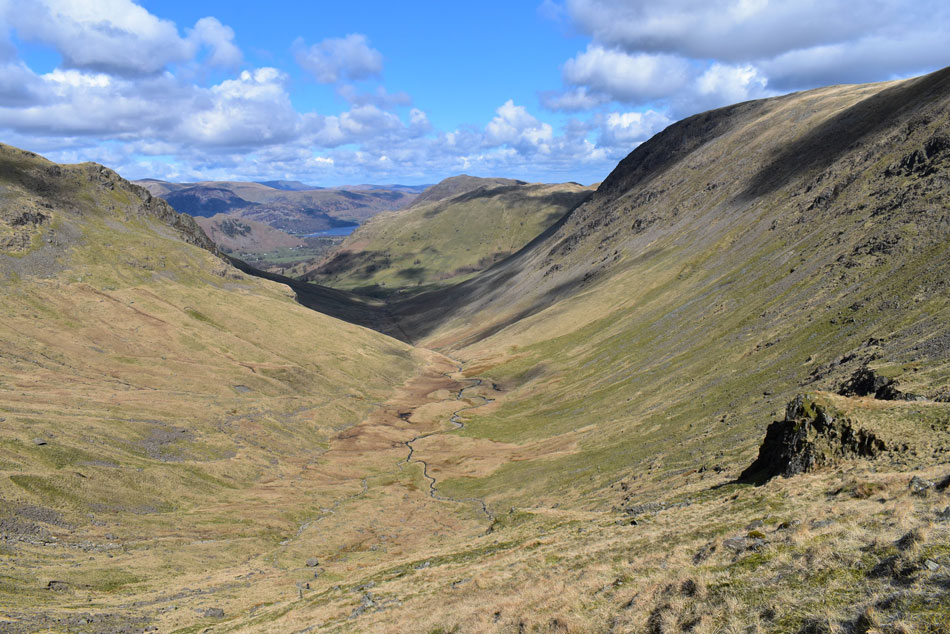
| Pasture Bottom. |
| The forecasters had predicted it to cloud over come midday and given that was right about now we half expected things to turn dull but as it turns out it had started to cloud over a little but by no means had we lost the sunshine. |
 |
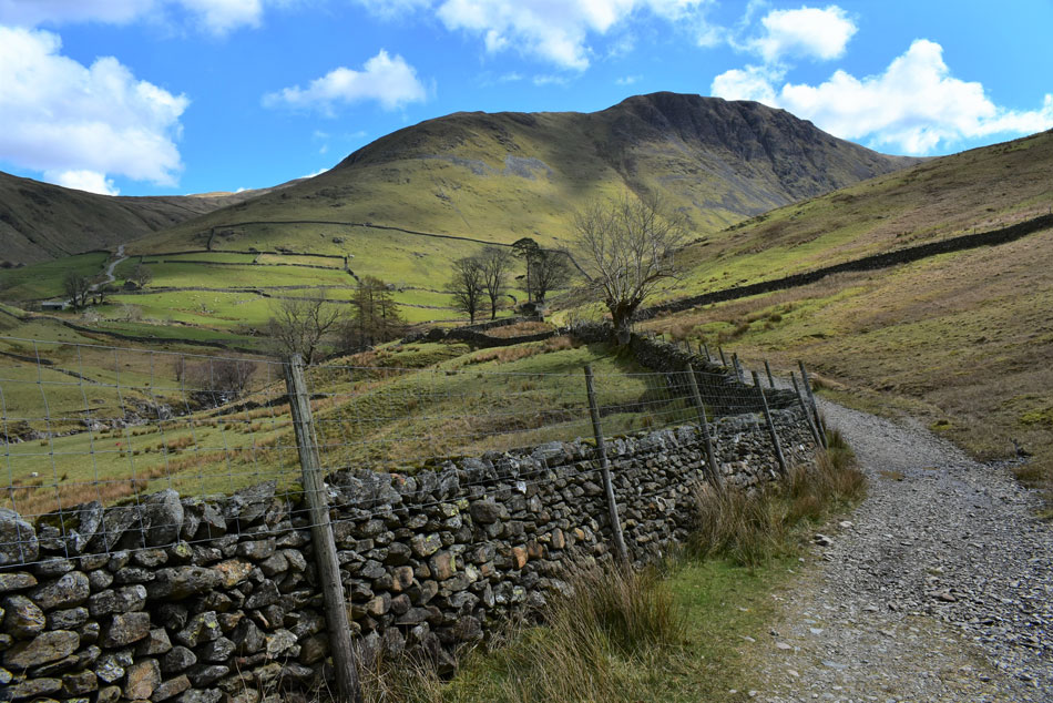
| Thornthwaite Crag, Raven Crag and Pasture Bottom as we near Hartsop. |
Before arriving at the valley floor we had to descend another 150ft through grass and boulder which was when we spotted half a dozen mountain bikers heading towards us which got Rod and I uttering "they're gonna be carrying those bikes very soon" Sure enough the awkward ascent and boulder had stopped them in their tracks as they asked "what's it like up ahead" at which point I heard one of the group mention he was wearing cleats at the same time spotting that one of the mountain bikes was electric which looked pretty heavy.
Lads we replied "this awkward bit is the easy bit, you have to gain the head of the valley via a steep rocky staircase and more boulder all 700ft of it while carrying a mountain bike on your back" The lads replied with a cocky yet friendly reply "no problem" We could only wish them the best of luck while forgetting to mention that once they had gained Thresthwaite Mouth they had to continue another 580ft before reaching the summit of Thornthwaite Crag, if they managed that I thought, then they deserved it. |
 |
| Gray Crag from Hartsop. |
Every now and again we would turn around and spot the mountain bikers slowly carrying their bikes through the boulder field until even the slowest holding up the rear disappeared out of view 11/10 for commitment I thought. By now we had left the windchill confined to the tops and with that I removed my gloves and tucked them into my pack side pocket, we left the rocky footpath for the delights of the grassy bank alongside Pasture Beck. By now we could see walkers descending the Brock Crags zigzags and through the trees a crammed car park appeared. Pasture Beck flowed into Hayeswater Gill just over our shoulders where we crossed at the footbridge before arriving back at the car park which we entered via the wooden gate.
It would be a tight squeeze to get the cars out but they weren't wedged in any serious way. We opened our boots before crouching down onto our folding stools before being approached by a young girl who we had noticed was blocking one of the exits with her car "excuse me, are you going to be long" she asked "give us five minutes I smiled, you can have one of these spaces" We'd made good time with only the descent of Thornthwaite Crag slowing us down but not in a serious way, give it a few more weeks and the rest will come naturally. |
|
| |
| Back to top |
 |
|