|
A Riggindale Round |
 |
 |
12th October 2014 |
 |
|
I was in two minds today to walk at all due to some time off work that I have coming up but the forecast hinted that walking today rather than midweek would work out drier than what was forecast towards the latter of the week.
My plans for my next walk would take me west of the district yet given the fact that tomorrow is a work day the drive out west, then a day spent on the high fells might be a bit too much for what I normally regard as a Sunday walk, my next concern was where to walk then?
Today’s forecast was clear which gave me the green light to stay east of the park, or far east if I much preferred, which I did.
The far eastern fells incorporate the valley of Mardale & for me the holy grail that is High Street, incorporating High Street into a circular round is easy & takes no imagination at all, the fells just provide the rest.
Here’s A Riggindale Round from Mardale Head. |
|
Wainwright Guidebook Two |
 |
| The Far Eastern Fells |
-High Street:
‘A striking range in grandeur and wilderness’
The range forms across the eastern spirit of Lakeland, providing a splendid full days march at a consistently high altitude, but is, distant to the areas most favoured by the fell walker and is comparatively unfrequented, appealing mainly to the lovers of mountain solitude.
|
 |
|
| |
|
Overview |
|
|
| Ascent: |
2,960 Feet 902 Meters |
| Wainwrights: |
5, High Street – The Knott – Rampsgill Head – Kidsty Pike – High Raise |
| Weather: |
Calm, Dry & Sunny Highs Of 12°C, Lows Of 5°C |
| Parking: |
Mardale Head |
| Area: |
Far Eastern |
| Miles: |
8.5 |
| Walking With: |
On My Own |
| Ordnance Survey: |
OL5 |
| Time Taken: |
5 Hours 30 Minutes |
| Route: |
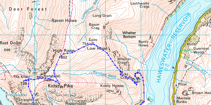
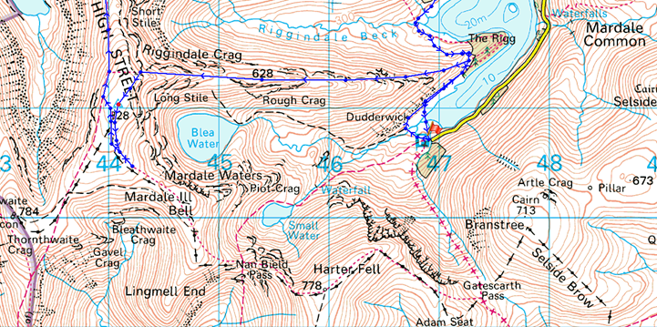
Mardale Head – Rough Crag (Riggindale) – Caspel Gate Tarn – Long Stile – High Street – Straights of Riggindale – The Knott – Rampsgill Head – Kidsty Pike – High Raise – Low Raise – Castle Crag (Mardale) – The Rigg – Mardale Head |
|
| |
|
Map and Photo Gallery |
|
|
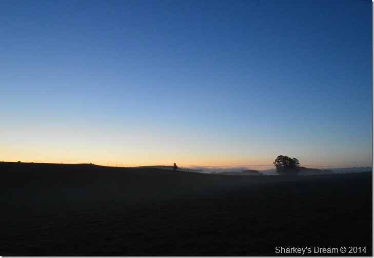 |
First light close to Bampton. |
| |
 |
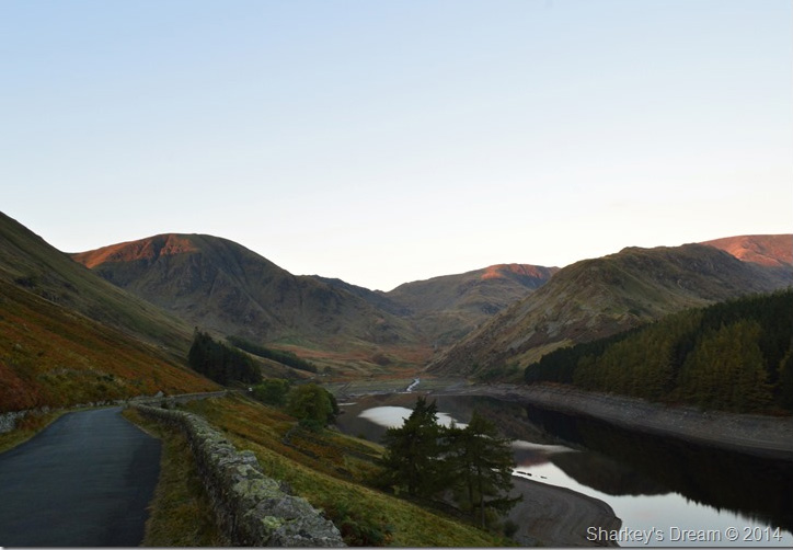
| Dawn over High Street & Riggindale from Mardale Road. |
| |
 |
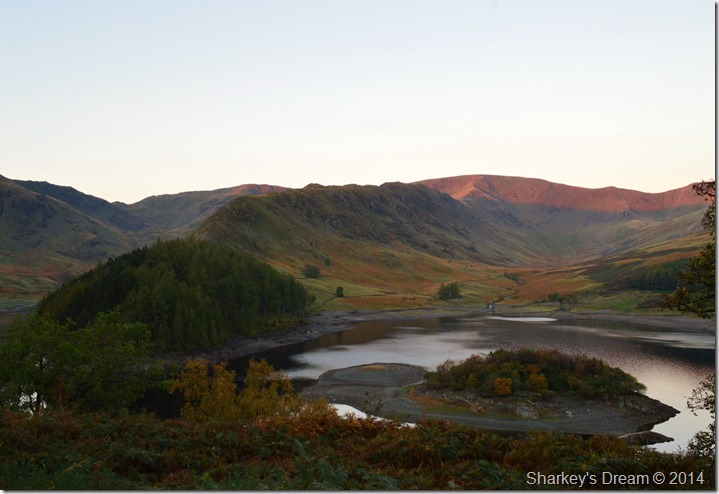
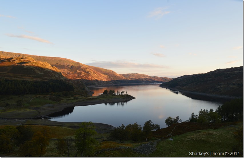
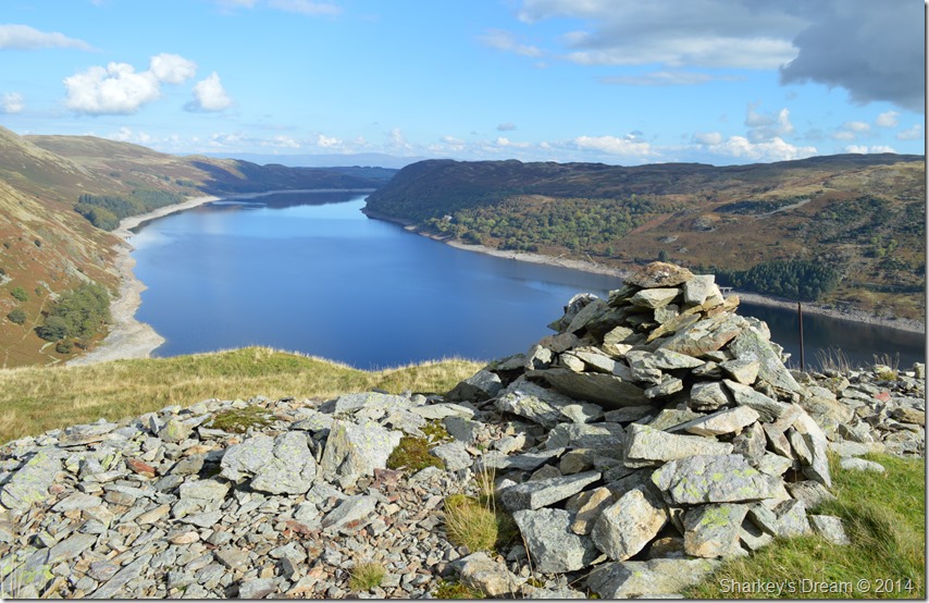
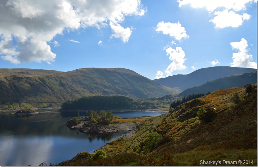
Haweswater & Mardale Head. |
The sun had only just rose as I reached Mardale Head breaching the tops of the summits leaving them glistening in a fiery afterglow.
Knowing that I had beaten the sunrise here in Mardale by a good half hour gave me time to do some exploring which I did by stopping my car every twenty yards or so to check if the scenery looked better from up there or down here…odd & a little strange I know but like I say, I had a bit of free time.
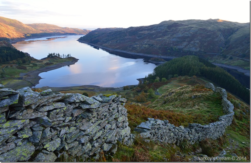
I stopped my car just short of Rowantreethwaite Beck where I scaled a rocky outcrop that over looked Haweswater Reservoir. The sun hadn’t breached the tops leaving the valley in a pre dawn state complemented by a morning chill that bit at the tops of my ears.
I scurried along the top of the crag after a short climb that saw me get my socks wet at a time when I was only wearing my mid boots or what I like to call ‘my North Face trainers’
It was here I began to snap away much for the purpose of prosperity rather than publish as I knew these pre dawn photos wouldn’t be to everyone’s taste.
I arrived back at my car which was still nice & warm & a world away from the morning chill here in the valley. From here it was just a short drive to the large car park at the head of the valley, a place whose only inhabitants are a camper van & two neatly parked cars that had been there all night given the dew that had gathered over the windows.
I picked my spot next to the stone wall & face my car back up the valley in preparation for my get away some hours ahead. The North Face trainers are kicked off without untying them, not because I’m feeling lazy, but because I couldn’t wait to get boot onto fell. Anytime now I expect to be joined by more fellow walkers, after all its nearly 08:00am and I’m still finding it strange that I’m the only person here this morning, not that I’m complaining mind. |
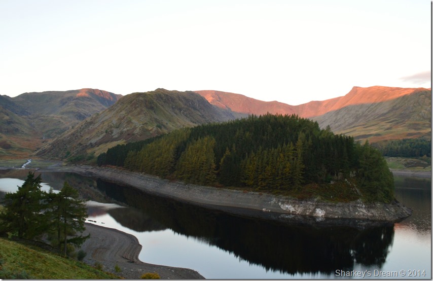 |
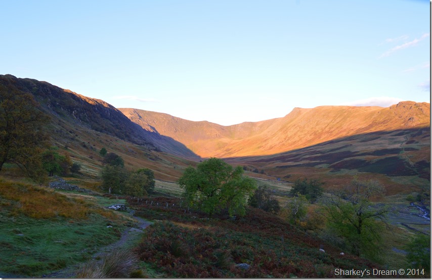
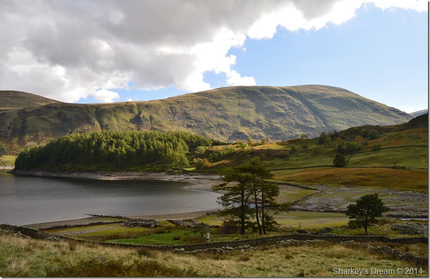
| The Rigg with the High Street Ridge & the valley of Riggindale under morning sunlight. |
| |
 |
| Here looking back on Harter Fell (Mardale) as I begin my steady climb towards The Rigg. |
With my car locked I headed out through a wooden gate before quickly taking a right turn at a stone wall that runs horizontal with the head of Haweswater. From my vantage point I look up the shores at what should be a healthy looking Haweswater yet due to just 2% rainfall during August & September all that is visible is the course of Mardale Beck as it is fed from both Blea Water & Small Water (s) found higher up the valley.
Feeder streams run down the hillside spilling over the path giving evidence of recent rainfall, perhaps just hours earlier I wondered.
Often I would turn around to take a glimpse at Harter Fell as the sunrise broke across the summit crags while at the same time not quite believing that for now, I have all this to myself. |
 |
| Riggindale sunrise with Kidsty Pike distinctive summit top dominating the valley. |
| |
 |
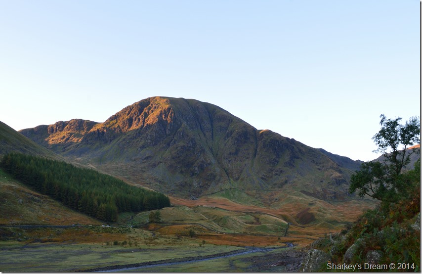
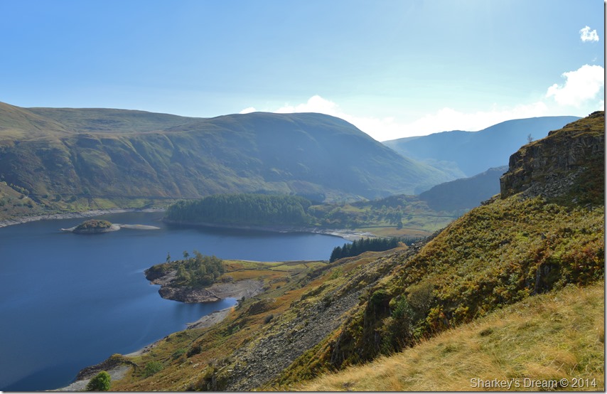
| Haweswater, Birks Crag & Measand End from the start of my climb towards Swine Crag. |
| As I climbed further towards The Rigg I pass a stony path that ascends sharply up the fell side, it is a path that I have seen many times & also a path that maybe one day I will take, then I remembered about the views I would miss out on should I take it like the one below which then changed my mind to take the longer way around. |
 |
| Looking back on Haweswater & the Naddle Forrest from my ascent on Swine Crag. |
| The stone wall marks the base of the ascent where I pick my way up to the right before crossing over where the wall has fell to ruin only to join a path that ascends away from the wall which then gradually rises steeper before joining the main ridge at the top of Swine Crag, which, is the first of many subsidiary summits that take in the main ridge before peaking out at Rough Crag found half way across the ridge. But, all that is a while away yet as right about now there’s something strange yet poetically beautiful occurring on the opposite side of the valley. |
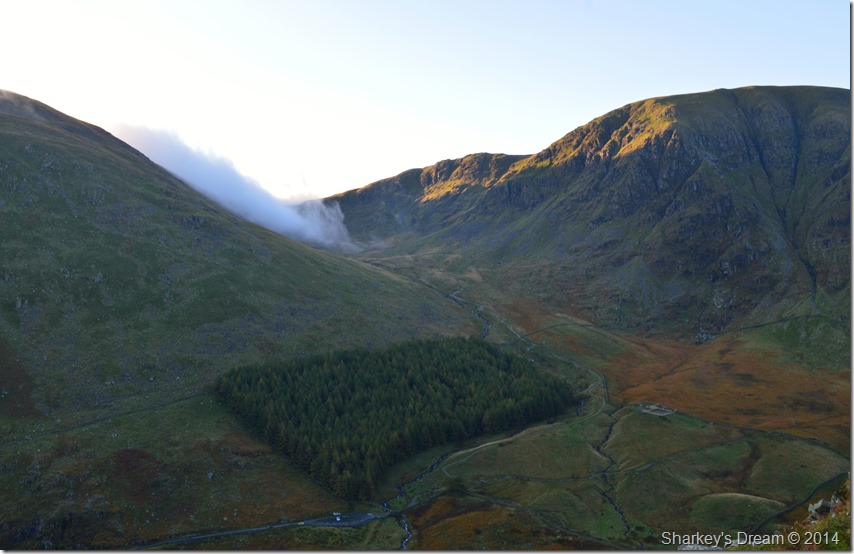 |
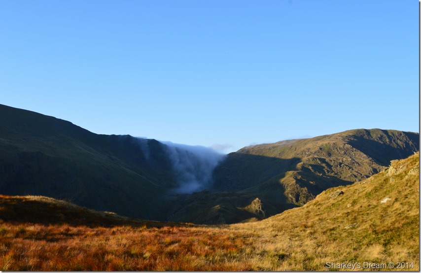
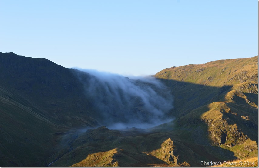
| Cloud slowly creeps down Gatescarth Pass between Branstree (L) & Harter Fell (R) |
| After leaving the stone wall behind I followed a succession of large cairns, here the path rises sharply & can be quite narrow in places, but, to take the mind of all that I had this wonderful view of an almost motionless wisp of thick cloud as it slowly descended down the Gatescarth Pass, little did I know what was behind it due to my low altitude. |
 |
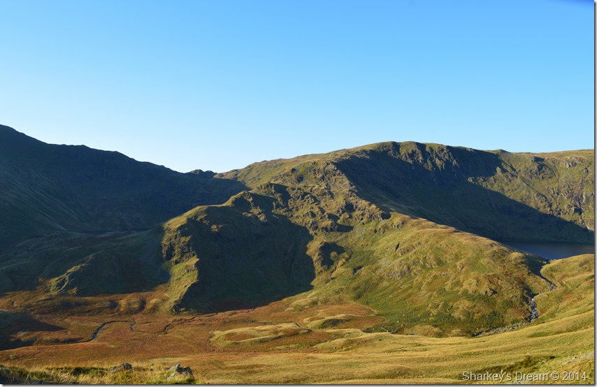
| The corrie of Small Water & the top of Nan Bield Pass. |
| Having gained the top of Swine Crag glimpses of Small Water can be seen still under morning shadow as the same cloud breaches the top of Nan Bield Pass before slowly dispersing over Small Water Tarn. |
 |
| Conditions show little to no wind in this close up of Small Water. |
| By now the sun had risen & was climbing rapidly over the fell tops, the strength of the sunlight & the warmth it brought would surely disperse any lingering hill fog… |
 |
| Small & Blea Water Corries seen with Mardale Ill Bell’s east ridge (L) & the north ridge (R) |
Only ten or so minutes had passed between taking this & the last photo, sure enough I thought the warmth & the strong sunlight had done its job of dispersing the hill fog.
How wrong I was, but more on that a little later. |
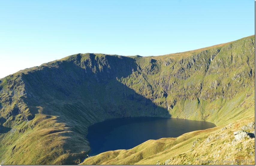 |
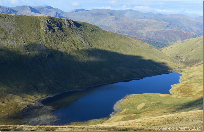
| Blea Water (63m) seen with Mardale Ill Bell north ridge. |
When viewing Blea Water from the Rough Crag ridge it really isn’t hard to imagine why Blea Tarn is the deepest Tarn & indeed the third deepest body of water in the Lake District, only Wast Water at (74m) and Lake Windermere (67m) are deeper.
Just click on the photo to take you back to my ascent on Mardale Ill Bell via the north ridge during the summer of 2014 |
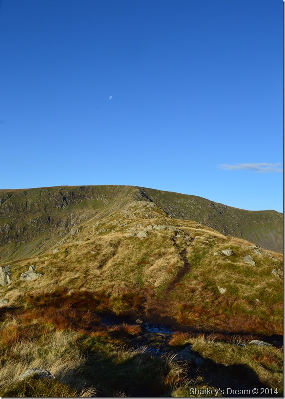 |
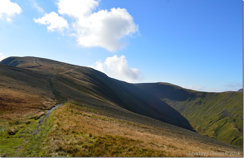
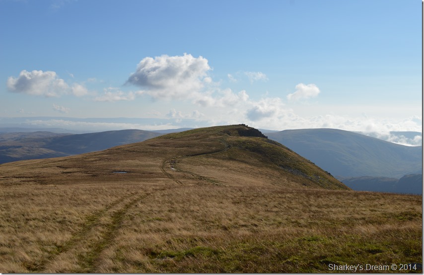
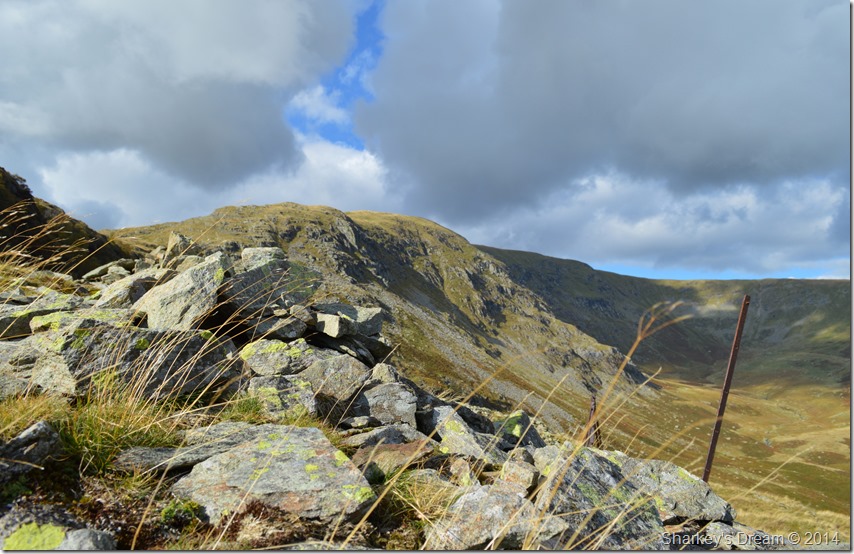
| Back to that ridge walk, High Street from Rough Crag. |
| I had a huge incentive to explore the ridge which is exactly what I did sometimes descending only having to re-ascend to take in vantage points over Blea Water. The warmth from the sun & the incredible clear views were truly inspiring given that we are almost mid October, it was here I downed pack & took my jacket off then rolling up my sleeves before taking in the little descent where I would pay a visit to Caspel Gate Tarn. |
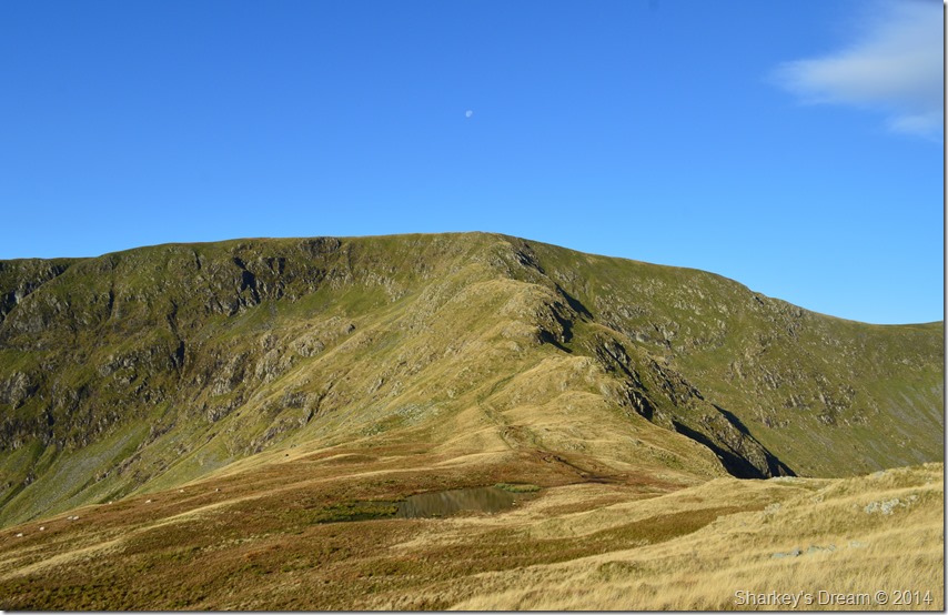 |
| High Stile in front of Caspel Gate Tarn. |
| I made sure to keep to the left shortly after leaving Rough Crag summit, this descent would lead me via a narrow grassy path directly towards the Tarn where the calmness of the morning transpired in reflections… |
 |
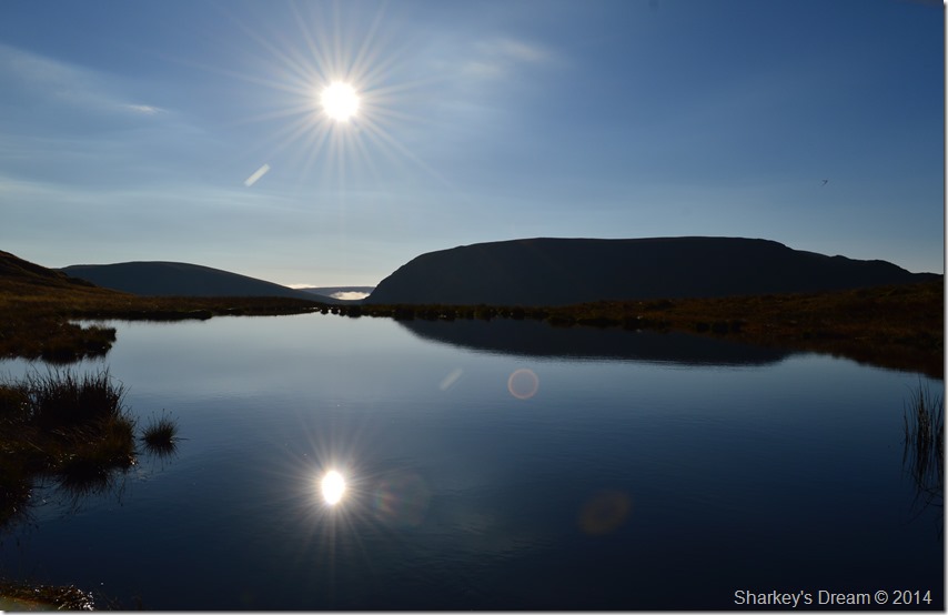
| Long Stile reflections from Caspel Gate Tarn. |
| |
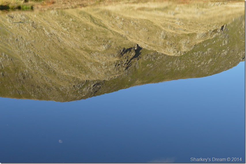 |
| Fly me to the moon. |
| |
 |
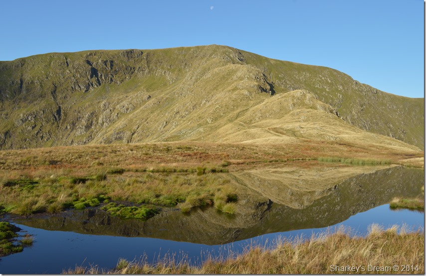
| Branstree & Harter Fell reflections over Caspel Gate Tarn. |
I was almost lost for words when I took this photo, not because it’s a nice photo but because of my location & the clearest of views it presented, not only that I had the best part of the climb still ahead before reaching the summit of High Street. And after all that, I even managed to keep my feet dry around Caspel Gate which can be notorious for being rather boggy at times.
Could it simply get any better? |
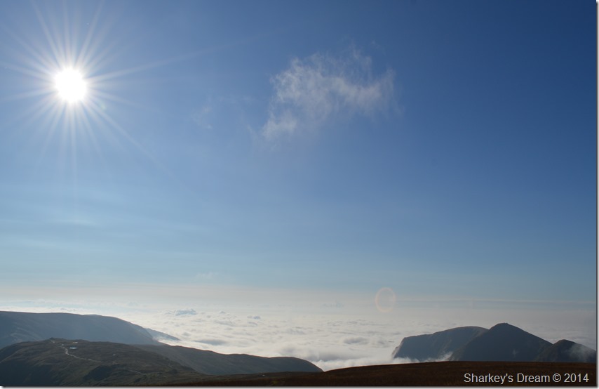 |
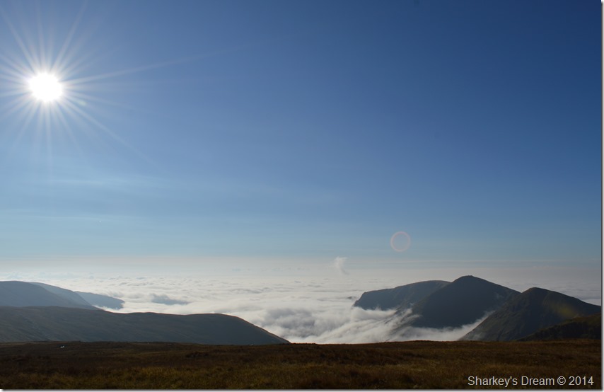
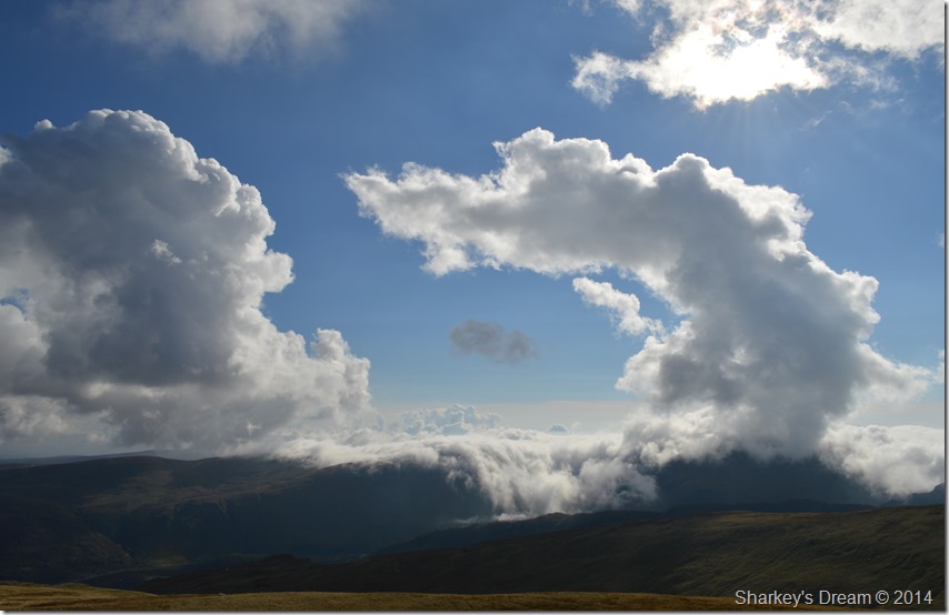
It just did…
Mardale Ill Bell, Harter Fell & the Ill Bell ridge peaking out over a Troutbeck valley Cloud Inversion. |
With the more height gained while ascending Long Stile towards the summit of High Street I could steadily see the mass of white cloud south of my position, this surely was the same cloud that I had witnessed just an hour or so earlier; only back then, I hadn’t realised the enormity of what was pushing that cloud over into the Mardale Valley.
Before I knew it I was making my way across the summit plateau, without making for the summit I soon found myself somewhere in between High Street, Mardale Ill Bell & Thornthwaite Crag in ankle high wild grass, it was there I stood to soak in this incredible occasion.
To my west stood Thornthwaite Crag where I could see people stood motionless whilst they looked back towards Froswick & the Ill Bell ridge, it was a shared moment, felt by all. |
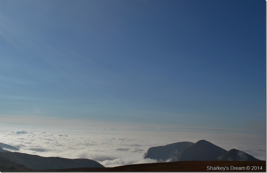 |
| The Ill Bell Ridge seen with Lingmell End, below the cloud, the valley of Troutbeck. |
| |
 |
| A close up of Froswick, Ill Bell & Yoke. |
| Anyone at their summits, surely feeling as blessed as I was. |
 |
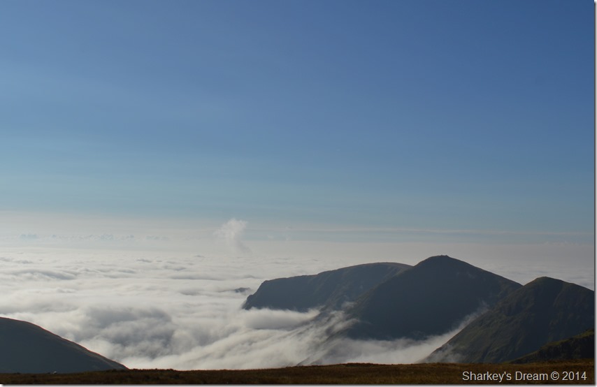
| One last photo before I had to turn my back on this beautiful & rare phenomenon. |
Why do cloud inversions occur?
A ground inversion develops when air is cooled by contact with a colder surface until it becomes cooler than the overlying atmosphere; this occurs most often on clear nights, when the ground cools off rapidly by radiation. If the temperature of surface air drops below its dew-point, fog may result. |
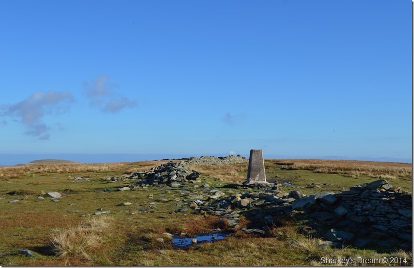 |
| High Street summit Trig Point. |
| It was no use I had to make my way back towards High Street summit where I least expected to be joined by more walkers but by chance I had the summit all to myself, with a ‘hey it’s me again’ and a solitary hand across the trig point, my summit time was a little more brief than usual given the fact that the sun shone so bright the only way to now feel comfortable, was to stand with my back to it which paved my way towards the Straights of Riggindale. |
 |
| The Straights of Riggindale seen shortly after leaving High Street summit. |
| With my back against a strong sun I made my descent over the Straights of Riggindale, ahead I had clear views of my next four summits of The Knott seen far left, Rampsgill Head is next forming the mass of ground between it & Kidsty Pike striking over the valley of Riggindale with its impressive craggy outcrop of rock almost triangular in shape, behind Kidsty Pike is my final (Wainwright) summit of High Raise. |
 |
| Here, looking down on the what is now known as Hayeswater Tarn (Formally Hayeswater Reservoir) |
| Still, saying Tarn rather than Reservoir will take a lot of getting used to although I suspect the lack of rainfall seems to be aiding efforts in keeping the water level low after the Dam was demolished during the summer of 2014 helping to return the old reservoir to a more natural body of water. |
 |
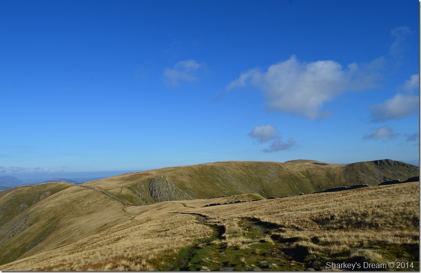
| Views back up to High Street & Thornthwaite Crag before making my way towards The Knott. |
| |
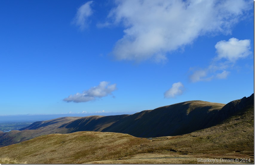 |
| Long distant views over a good proportion of the High Street Roman Road incorporating Red Crag, Wether Hill & finally Loadpot Hill in the far distance. |
The Straights of Riggindale will be remembered as a favoured part of this route despite what I had just witnessed over the Ill Bell Ridge as views demonstrated from the picture above have, and will always hold, a special fondness.
Ahead The Knott lies in wait along with a mass of walkers who had just claimed the summit moments earlier. They number well above fifteen as they envelope & swallow the large summit cairn with their presence, I squeeze through with a smile, tapping the stone cairn with my walking pole before anyone really noticed I had been there at all. |
 |
| Looking back on The Knott & its masses as I make my ascent on Rampsgill Head. |
| |
 |
| Clears views over Gray Crag & Stony Cove Pike from my Rampsgill Head ascent. |
Every now & again I would turn around in order to take in the views whilst getting my breath back, at the same time I noticed that one by one the walkers were descending The Knott all making their own way over the Straights of Riggindale.
My path is narrow lending its way over the grassy shoulder of Rampsgill Head, my legs feel a second burst & then another almost catapulting me towards the summit in great stead, below me views are widening over the valley Ramps Gill & beyond Fusedale. |
 |
| The Ramps Gill Valley with views over The Nab & Steel Knotts, beyond, Hallin Fell with Wether Hill & Load Pot Hill extending away towards the right. |
| |
 |
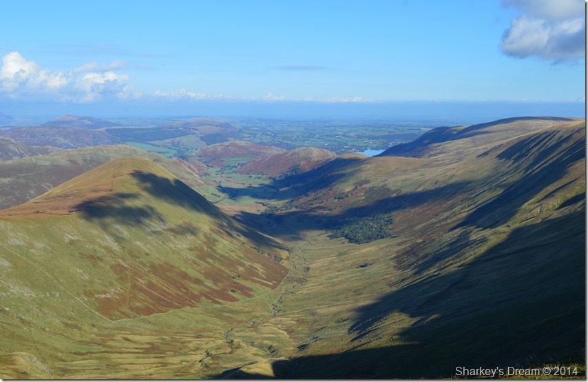
| Here looking over Rest Dodd, Brock Crags, Angletarn Pikes, Place Fell with a distantHelvellyn range beyond. |
| |
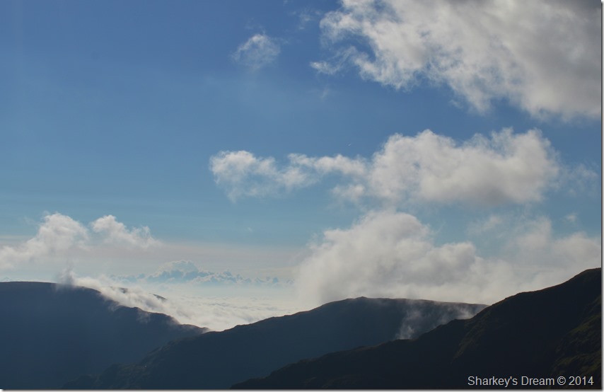 |
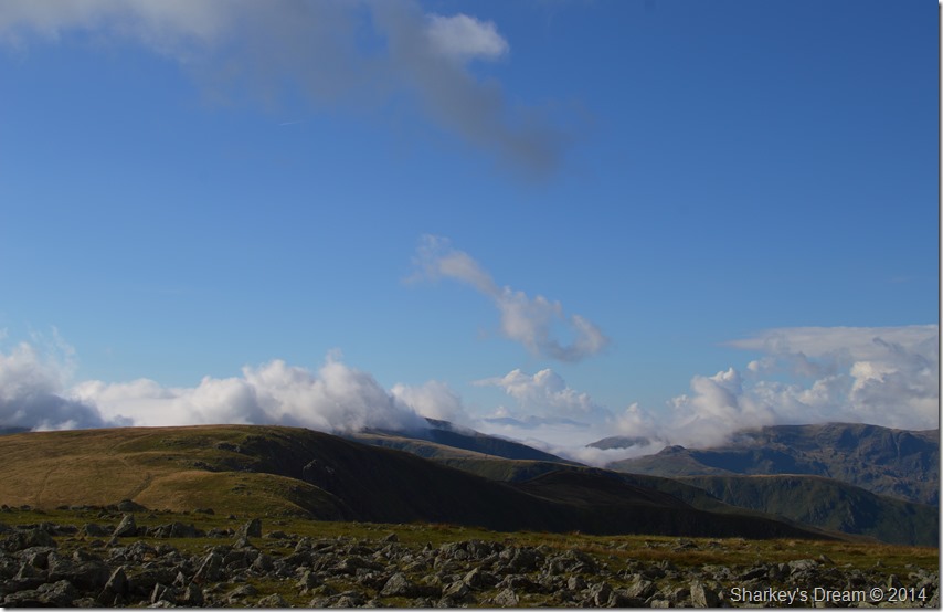
| Here I zoom in on the top of the Nan Bield Pass as the Cloud Inversion once again, begins to creep its way over the ridge from Rampsgill Head summit. |
| I had soon reached the summit of Rampsgill Head where I met the first person I’d seen on todays walk, an elderly gent was throwing his pack over his shoulder as we both commented on just how great and (unexpected) the weather was. He hadn’t seen the cloud inversion properly as he had come from the direction of High Raise, your timing is perfect I explained, it looks like it is waiting to spill over into Mardale, but there just isn’t enough wind behind it I said, well that’s the way I’m heading he replied, with some luck I’ll get to see it all unfold. |
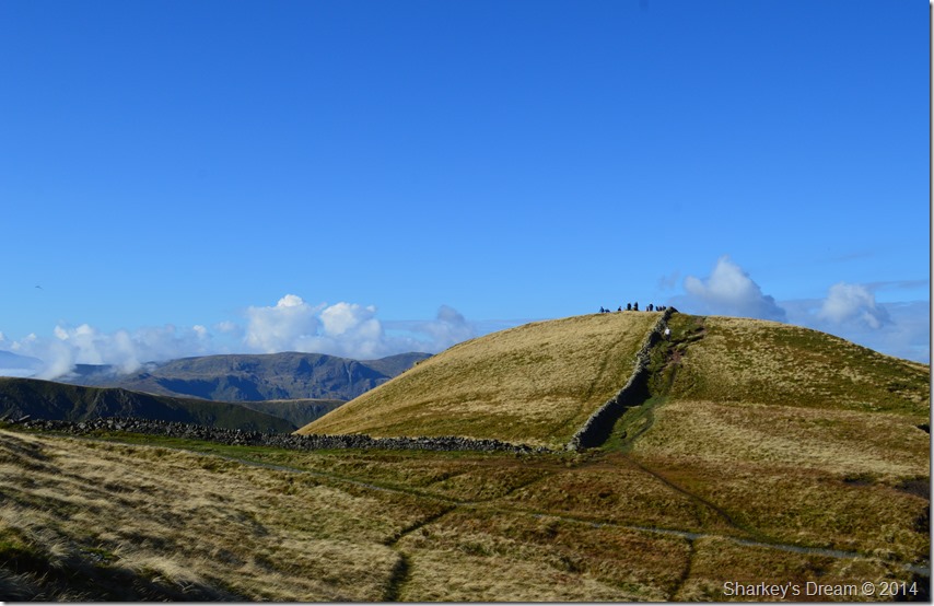
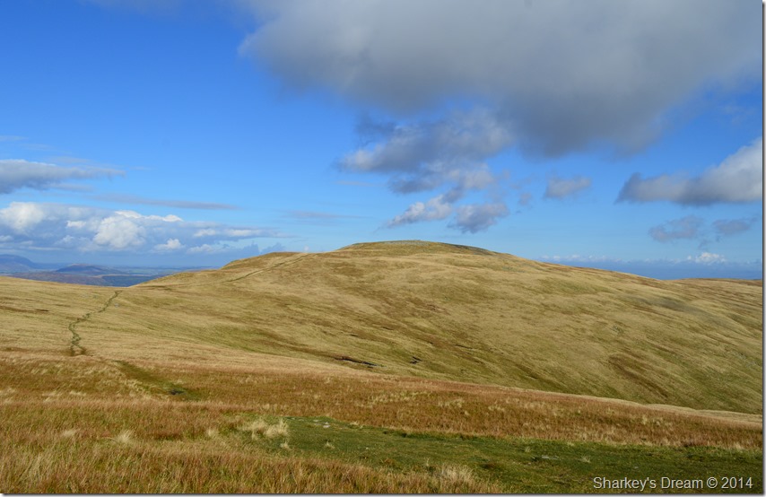 |
| A grand view of High Raise from my Kidsty Pike stroll, I’ll be over there very soon… |
| |
 |
| Kidsty Pike lies just a stroll away seen shortly after leaving Rampsgill Head. |
| I make the short walk from Rampsgill Head towards Kidsty Pike were before making my own summit two young walkers appear from the direction of Mardale, it seems they foresaw the great weather as they are dressed in only shorts & T-Shirts, and who could blame them, I hold back my pace as I see they are taking photos from the summit, by the time I arrived they were ready to leave as we both passed on our Hi’s just beneath the summit. |
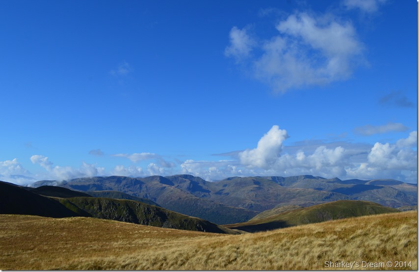 |
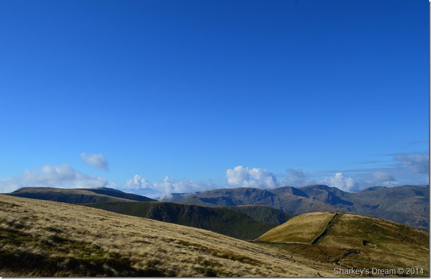
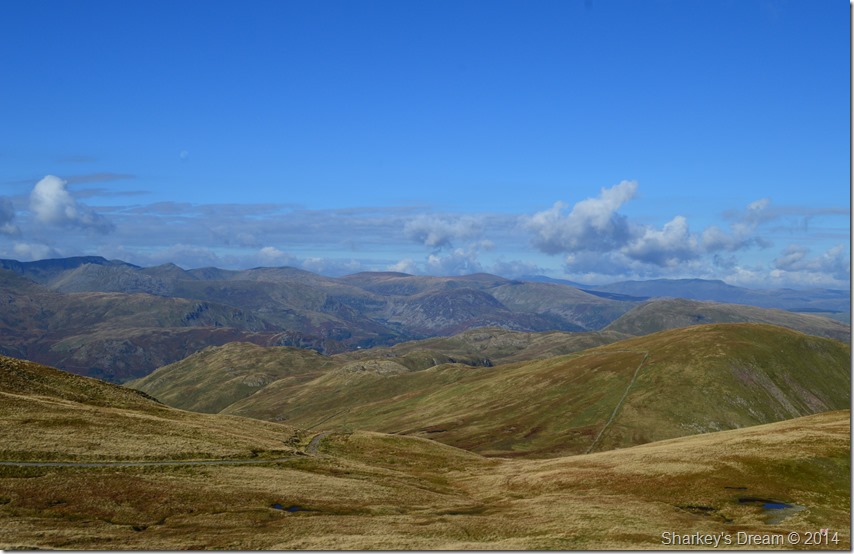
| Extensive & clear views over towards the eastern fells, Catstye Cam can be seen far right. |
| |
 |
| Rampsgill Head seen from High Raise summit. |
Between my last two summits walking time was less than twenty minutes or so, yet in that short time I could now see that the Inversion was starting to creep its way over Stony Cove Pike already swallowing Thornthwaite Beacon in the process.
The scenery from High Raise was utterly fantastic which was the main reason I downed pack & decided to eat lunch as the cloud slowly engulfed the summits before my eyes. |
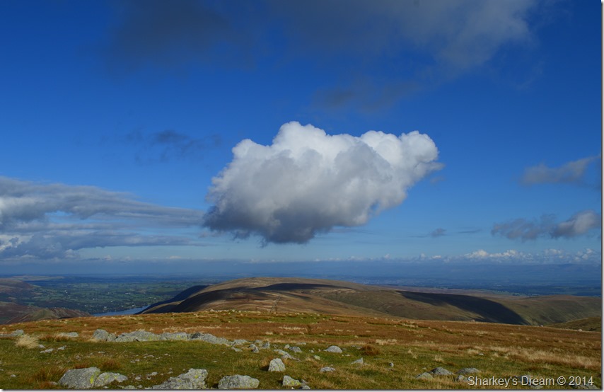 |
| I think this cloud was feeling a little left out floating high above Red Crag & Wether Hill though… |
| |
 |
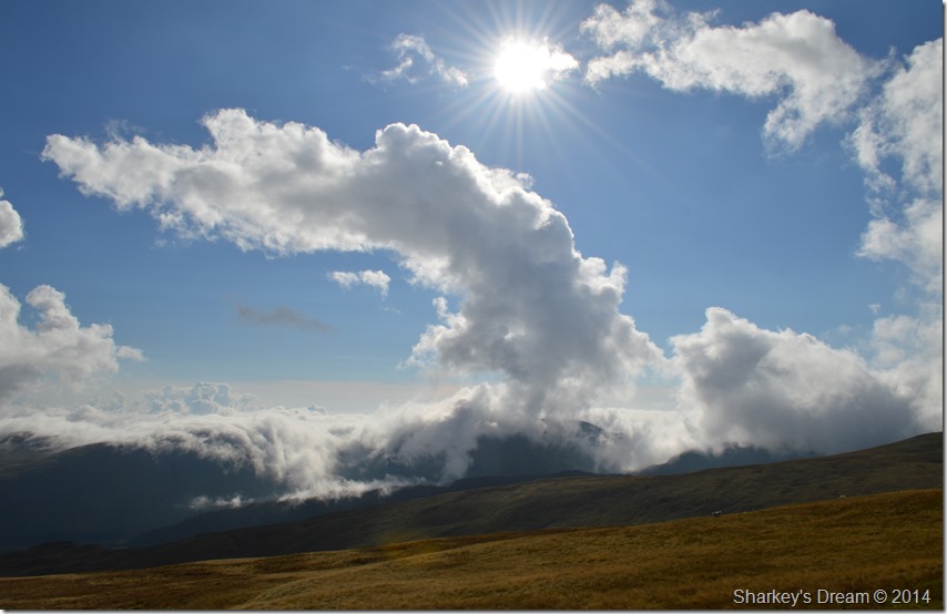
| An eruption of cloud spills like Lava into the Mardale valley. |
After lunch I pack my things together & re-shoulder my pack with thoughts of my next summit of Low Raise, but before all that I couldn’t believe what I was, and was about to witness over the head of the Mardale Valley.
Like a silk sheet a vast white cloud slowly slipped its way into the valley helped by no wind just sheer silk like movement as if I was stood still within the depths of time, I simply couldn’t believe not just my luck, but the magnificence & the beauty unfolding before my eyes. |
 |
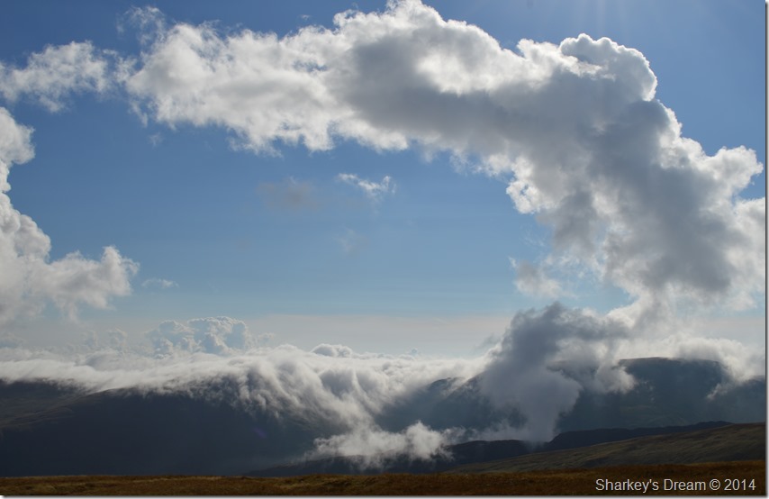
| From left to right we have Branstree, Harter Fell & Mardale Ill Bell. |
| It seems that the Inversion had lay dormant all the while between the valleys of Longsleddale, Kentmere & Troutbeck before the warm midday air finally pushed the cloud over the tops of the valleys before slowly dispersing. |
 |
| Anyone on the Gatescarth Pass right now may think he or she might have gone to heaven! |
| |
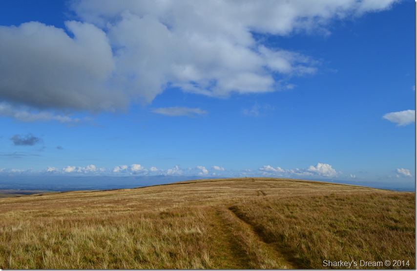 |
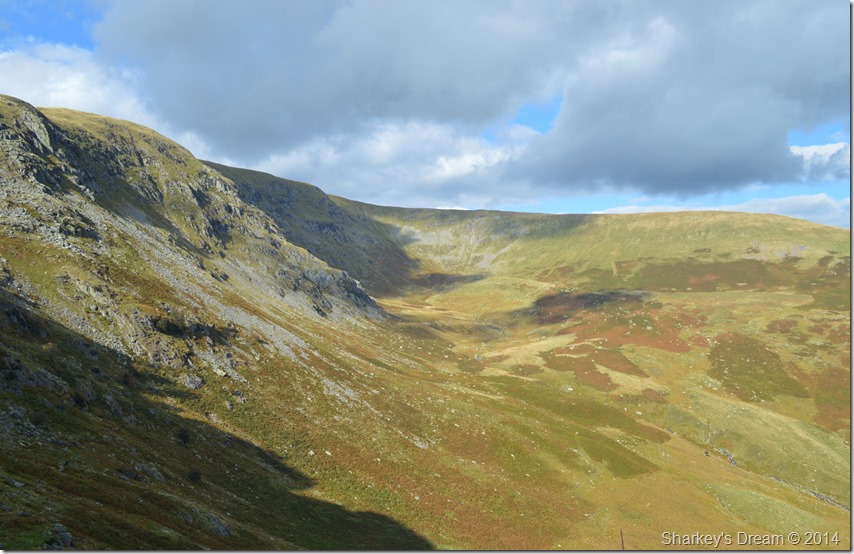
| En-route to Low Raise. |
| Walking at its best. |
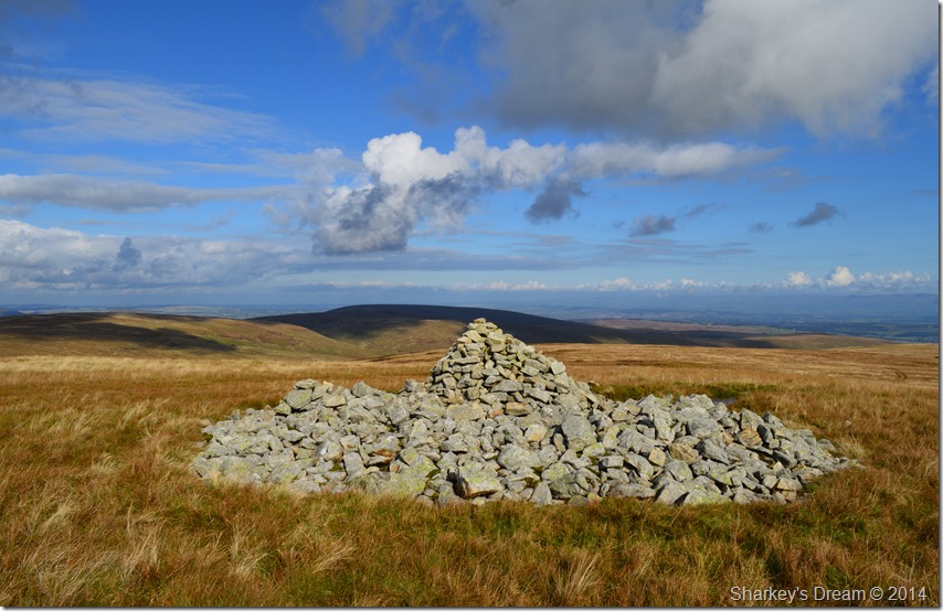 |
| The substantial ancient stone cairn found at Low Raise summit, with Wether Hill in the distance. |
| |
 |
| Mardale Head Cloud Inversion. |
| |
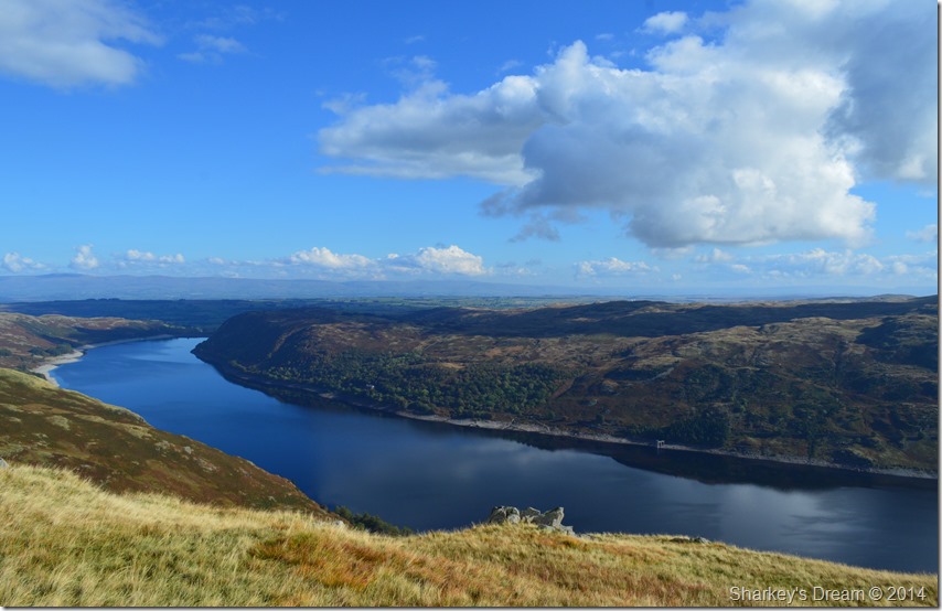 |
| Haweswater Reservoir with The Naddle Forest tops seen on the other side of the lake. |
| |
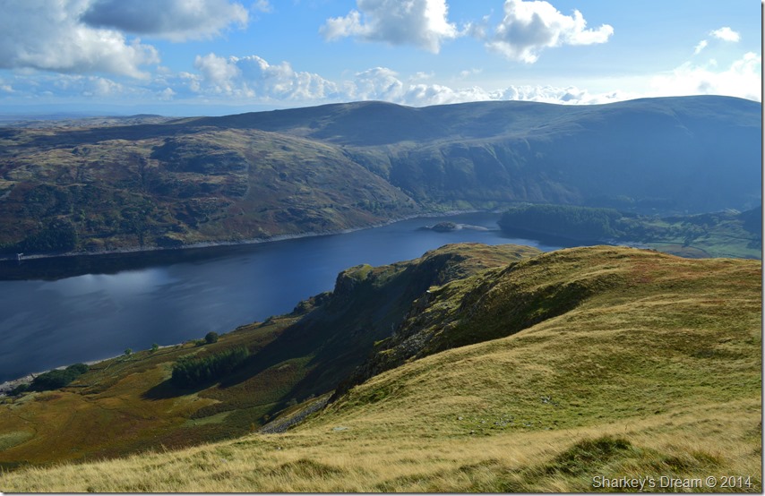 |
| Castle Crag Fort (Mardale) seen beyond Birk Crag. |
My next destination was Castle Crag Fort (Mardale) a place & a summit that I had always wanted to visit but somehow never managed to include it into a walk. From Low Raise the path is narrow that stretches through wild grasses & at some points can be vague, the best rule of thumb is to just head down hill more or less in a straight line while trying to avoid the peat bogs which on a day like today didn’t hamper my descent too much.
The descent is at times rough & steep due to the nature of how wild & baron this lonely ridge feels, ahead the top of Birks Crag arrives quickly with what looks like a more steep descent only this time hampered by a series of rocky shelves that can be negotiated via a zig-zag decline, finding the lay of the land would also be an advantage if only to avoid some of the steeper parts of the descent.
If descending towards Castle Crag initial thoughts are to keep left, however keeping further along right of the rocky shelves will ensure a more comfortable descent as a narrow path can be seen (if only I had!) Once at the base of Birk Crag there is only a short walk left before reaching Castle Crag Fort, it was here I had the pleasure of meeting three very tame Deer that instead of bolting, stood & watched me walk by from afar. |
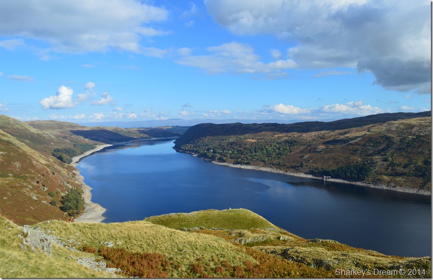 |
| Haweswater Reservoir & The Naddle Forest seen right, taken shortly after descending Birk Crag. |
| |
 |
| Haweswater Reservoir from Castle Crag (Mardale) summit cairn. |
| |
 |
| Birk Crag & Whelter bottom seen from Castle Crag Fort. |
Castle Crag Hill Fort is Iron Age in origin and occupies a steep drop down from the north-west, north-east and south-east sides of the Fort, past excavations have revealed The hillfort once included an oval-shaped internal enclosure measuring approximately 46m by 22m that is protected on its south-west side by a rampart of stones up to 2m wide and 1m high.
For now this once means of defence acts as my resting place where I lie on my side, pack still attached from the exact position from where I took this photo. |
 |
| Whelter Bottom seen from Castle Crag Fort. |
| In the year 1366 the Kendal Archers who were famously led by Captain Whelter ambushed Scottish raiders and buried them in the hollow below now aptly named, Whelter Bottom. |
 |
| Mardale Head seen from Castle Crag Fort. |
Despite my glorious down time spent at Castle Crag Fort I knew I had to make it down to the shore by means of another steep descent via the northern slope of Castle Crag. My descent took me through a wide patch of bracken which was extremely wet noting that it was almost likely well within the shade of the hill itself, this meant careful footings as the bracken clasped around my ankles sometimes feeling like it wasn’t going to let go, not even after three good tugs at times!
Eventually I made it down, taking your time & not rushing during this descent no matter how impatient it may leave you feeling was key. |
 |
| Mardale Head seen over Flakehowe Crags. |
| I welcomed the lake path with open arms & no sooner had I been walking had I forgot about my steep descent down Castle Crag. My narrow path overflows with ‘run off’ water from the hill side which gets walked through rather than around, after all, I am very close to the end of the walk. |
 |
| The Rigg & Branstree taken shortly before crossing Bowderthwaite Bridge. |
| Mardale Head, lies just beyond The Rigg bringing my walk to an almost end. |
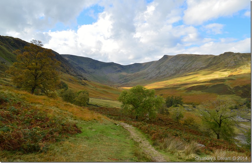 |
| Riggindale. |
I think if ever a photo can come close to just how well today’s walk went & indeed left me feeling, this one of the Riggindale Valley as the day light starts to close in to make way for thick cloud this photo comes close.
The light is fading & feels a million miles away from the scenes that I witnessed from Rampsgill Head all along through to Low Raise, scenes that I will never forget & scenes that I will hold dear for years to come.
Mardale Head is jam packed with visitors most of whom occupy the muddy banks where they throw sticks for dogs not really knowing the history beneath their feet.
I however make my way back to my car where I open a warm bottle of Diet Pepsi that has been lying in a warm boot for most of the day, cars around me drive around the car park looking for a parking space, some stop & stare ‘is he leaving yet’
I roll down the windows of my car & place my bum on the stone wall that overlooks Haweswater & its walls & boundaries that for now are visible & for a split second, all around me is forgotten.
I don’t think Mardale will ever leave me. |
|
| |
| Back to top |
 |
|