 |
News Years Day on High Street |
 |
 |
1st January 2024 |
 |
|
Despite being between storms the forecast was too poor to keep Rod off the fells today, but, living a tad closer than Rod, I thought I'd bring in the new year by walking my favourite fell, High Street.
My intention was to walk an anti-clockwise circuit of Mardale Head, and that was still the case before I arrived in Mardale to find thick cloud cover that stretched from Mardale III Bell right the way across to Harter Fell and Branstree, but what confirmed my change of route was also the south westerly wind direction, which would mean I'd be walking into the oncoming wind.
A few weeks ago, I mentioned to David and Rod that I'd like to reach 50 summits of High Street before my 50th birthday in May, which on paper is easily doable. Present conditions may keep me off, so may work, but it would be a nice figure to aim for to celebrate my 50th on the fells |
|
| Wainwright Guide Book Two |
 |
| The Far Eastern Fells |
| "A striking range in grandeur and wilderness" |
 |
|
|
|
| |
|
Overview |
|
|
| Ascent: |
2,454 Feet - 747 Metres |
| Wainwrights: |
2, High Street - Kidsty Pike |
| Visiting: |
Rough Crag |
| Weather: |
Rain To Start Soon Easing Leaving Intermitant Sunshine. Highs of 7°C Lows of 5°C Freezing Level Above The Summits. |
| Parking: |
Car Park, Mardale Head |
| Area: |
Far Eastern |
| Miles: |
7 |
| Walking With: |
On My Own |
| Ordnance Survey: |
OL5 |
| Time Taken: |
4 Hours 15 Minutes |
| Route: |
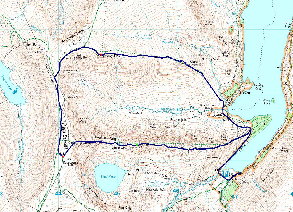
Mardale Head - The Rigg - Rough Crag - Caspel Gate - Long Stile - High Street - Straights of Riggindale - Two Penny Crag - Kidsty Pike - Kidsty Howes - Bowderthwaite Bridge - The Rigg - Mardale Head |
|
| |
|
Parking Details and Map |
|
|
| Nearest Post Code: |
CA10 2QT |
| Grid Reference: |
NY 469 310 |
| Notes: |
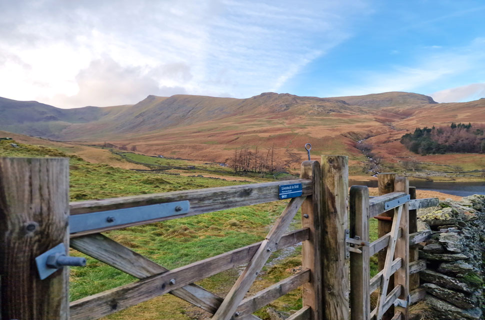
Probably one of the most scenic car parks in Lakeland found at the head of the Mardale Valley offering easy access onto the High Street fells plus many more. The car park during Summer can fill up quickly but with most car parks in Lakeland if you time your arrival early enough you're always guaranteed a parking place. Parking is free. |
|
| |
|
Map and Photo Gallery |
|
|
 |
| |
| |
 |
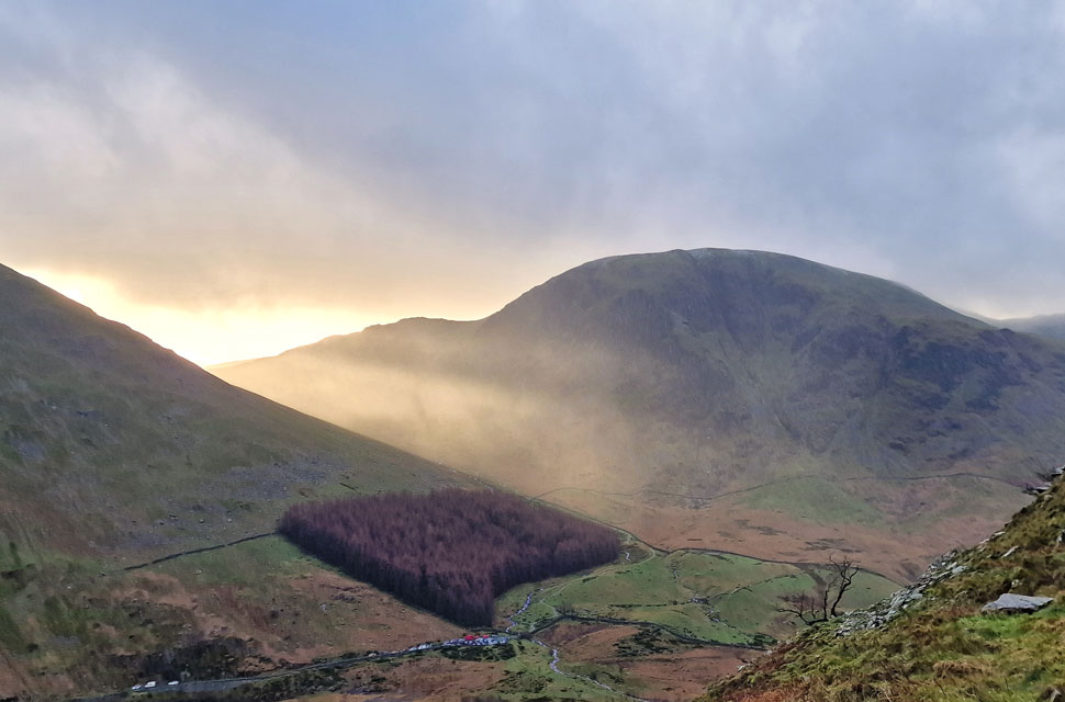
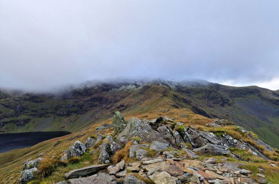
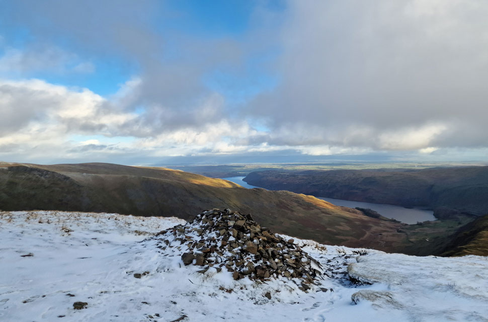
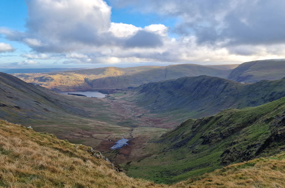
| Looking back on Harter Fell (Mardale) 10:15am 7°C |
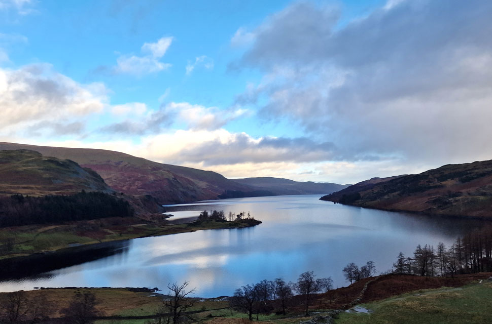
With a null between Storm Gerrit and Storm Henk I left home under cloudless skies, which remained that way as far as Shap, where I left the motorway to views of the High Street ridge which looked more like a scene from Mordor with summit cloud clinging to the entire High Street ridge from south to north. As the blue skies disappeared in my rear view I joined Pow Lane, bound for Haweswater, where I dodged fallen tree branches and flood water.
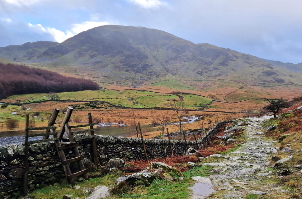
Despite my late arrival, and given that today is New Years Day and most of the nation are nursing a hangover the car park at Mardale Head was full, and after failing to park I settled a little further back up the lane in a rough cutting flanked by crag where water cascaded down eventually spilling out onto the road below.
Kitting up was fun with what appeared to be a river running beneath my car. I walked a few yards away carrying my boots, just as it started to rain. I don't think there was one person in that car park who wasn't cursing the incorrect forecast. Laced up, I returned to my car and placed my mids into my boot, and while using my tailgate to shelter from the rain, I completed my kit-up - or I thought I had. At this point, any normal person would have added over-trousers, but I sought sanction in the forecast, believing the rain would stop soon which it did but not after drowning me first. |
 |
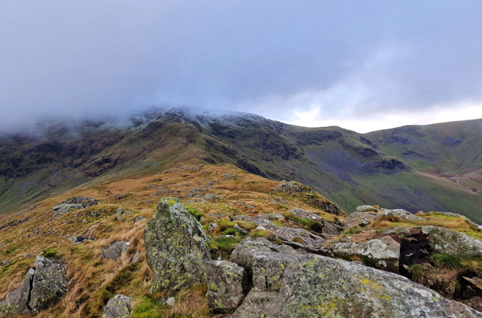
| Stunning views into Riggindale with High Street seen left and Kidsty Pike seen right. |
The rain fell heavy and vertical, and by the time I'd reached the footbridge over Mardale Beck, I looked like a drown't rat. I cursed myself. I found a large boulder which I rested my walking poles against and in the pouring rain I de-shouldered my pack and added my over-trousers, and, for good measure, my packs rain cover. Two minutes earlier, a solo walker had been approaching but turned around, and the last I saw of him, he was back at the car park. Either he'd forgotten something or the rain had put him off.
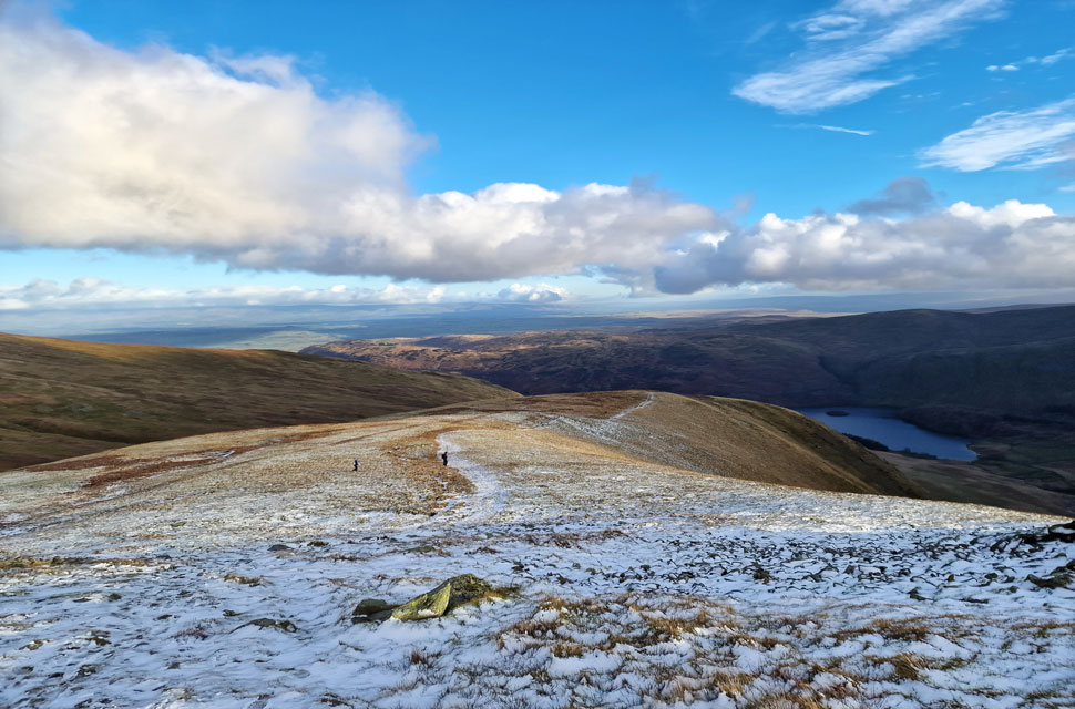
Had I added my over-trousers back at the car, my legs wouldn't feel so wooden under my over-trousers, which I hoped would dry soon. Re-shouldered, I followed the path towards The Rigg, where I spotted three pairs of walkers heading for Kidsty Pike. With no one behind me, it looked like I might have the ridge to myself, so I gripped my poles, and began my ascent on Swine Crag. |
 |
| Looking back on Haweswater and Speaking Crag. |
| |
 |
| Shafts of light emerge from the top of Gatescarth Pass. |
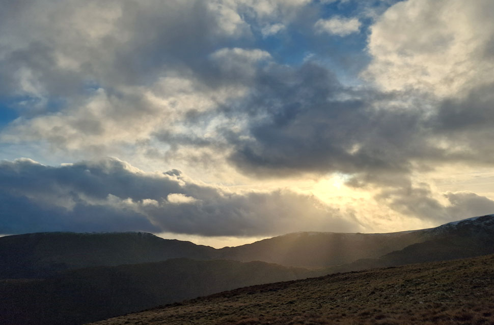
| By now it had stopped raining and much, if not most of the summit cloud was beginning to lift while I was treated to shafts of light emerging from the top of Gatescarth Pass. |
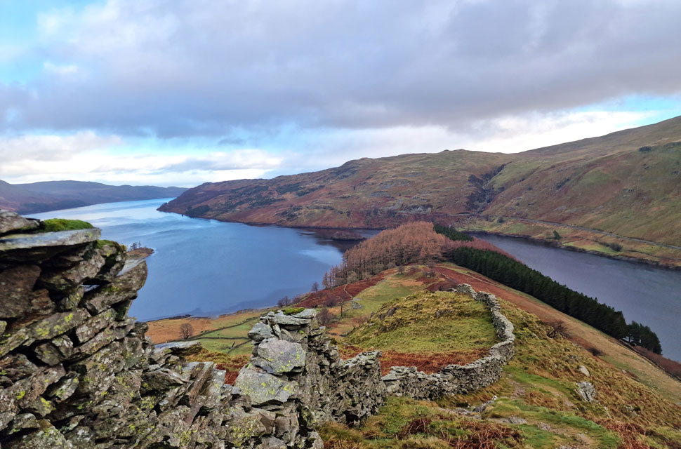 |
| The Rigg and Haweswater taken below Swine Crag. |
| Chinks of blue sky were beginning to appear particularly to the east while it remained cloudy directly overhead I ascended in the hope that the sunshine would break through as forecasted now that it had eventually stopped raining. The big question is, do I keep the over-trousers on or remove them? |
 |
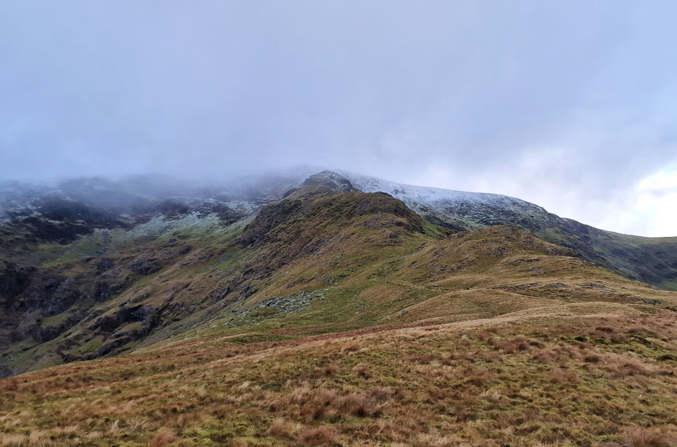
| Long Stile and High Street seen beyond Rough Crag ahead. |
No sooner had I thought about removing my over-trousers did it begin to rain again, this time heavier, but thankfully, it didn't last. With Swine Crag and Heron Crag behind me, I was able to get a good look at the ridge ahead, where I found a solo walker at the base of Eagle Crag. The walker was just standing there, and for a few seconds I started to get a bit worried, but the closer I got, the more I realised he was looking at a GPS that he had strapped to his left wrist.
Hanging from his pack was a notted carrier bag, which patted against his pack after the slightest movement. My first thought was, 'That would really annoy me' The wind by now was disguising my approach, so I snurched noisily, which got the walker's attention, causing him to spin around, by which time I was almost stood on top of him. "You ok, pal" I asked, and he replied in a bordered Scottish accent, "Aye, no bother; I just hope this weather will make its mind up. Do you think we'll get any sunshine?" "Well, it's done just about everything else" I laughed while noticing he had a GoPro fixed to his chest. I wished the chap to enjoy the rest of his walk before continuing towards Rough Crag. |
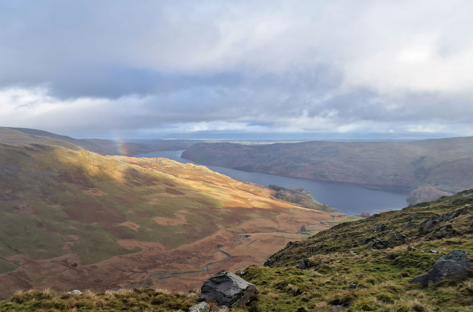 |
| Sighting the remnants of a rainbow over Riggindale. |
| With Haweswater in the distance. |
 |
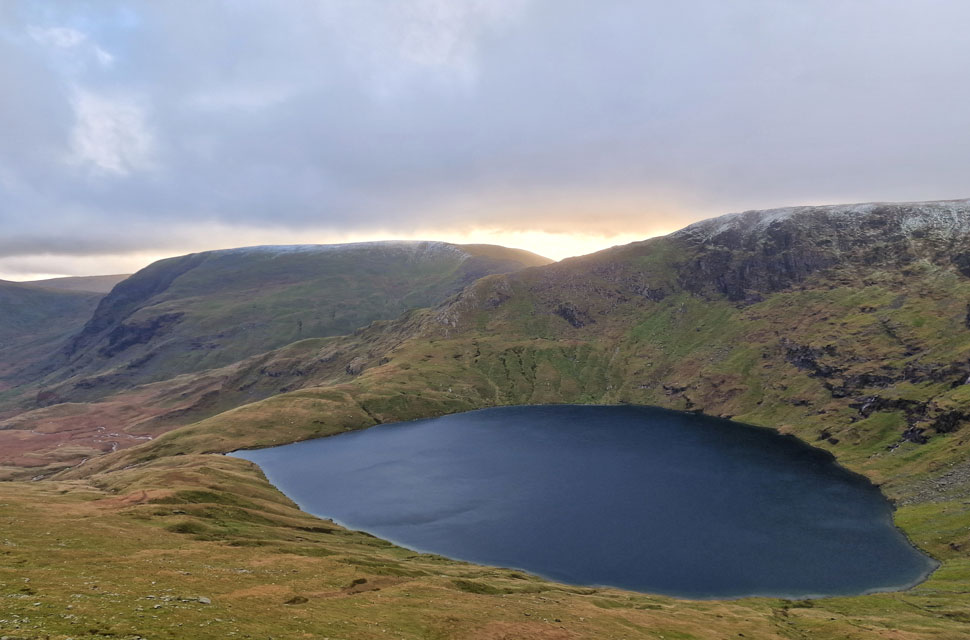
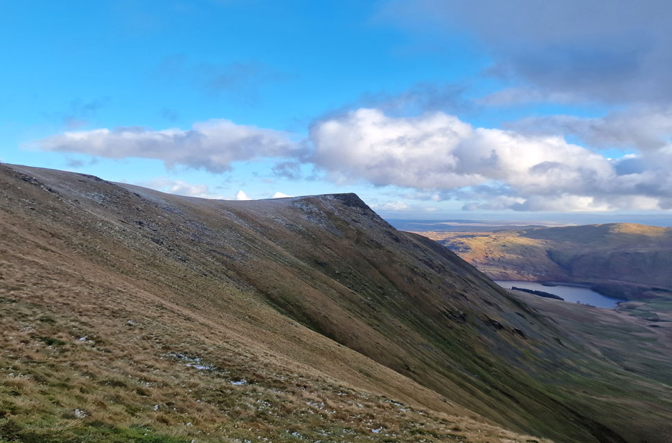
| Blea Water, Long Stile and High Street from Rough Crag. |
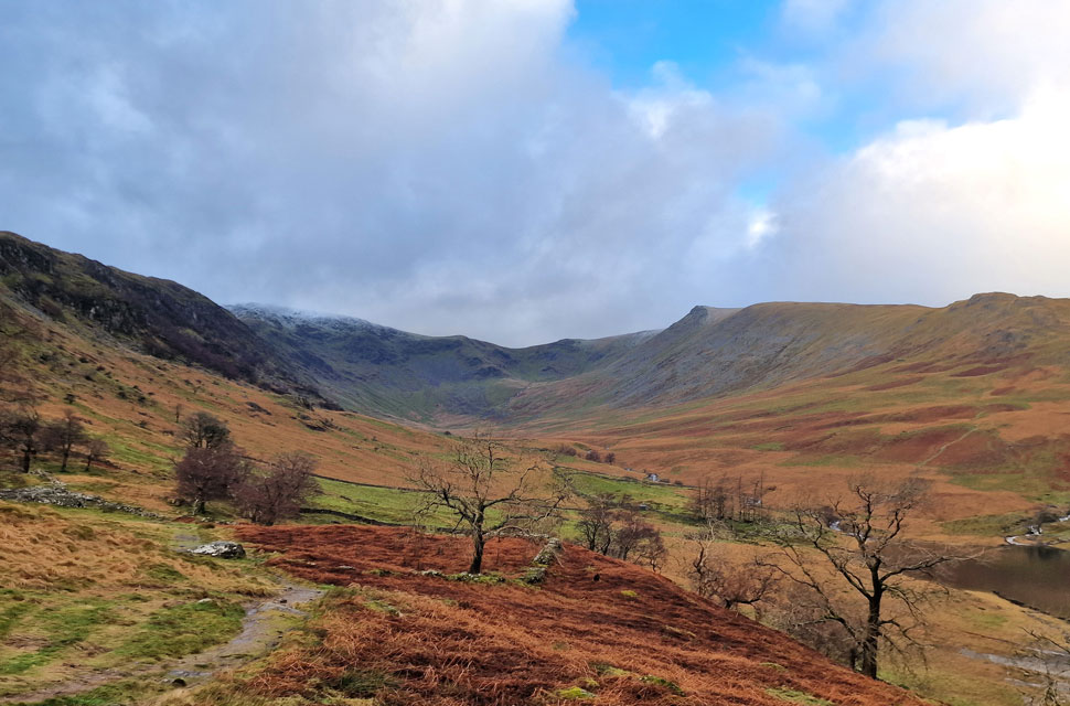
| I soon reached Rough Crag in between more showers which left the ridge ahead looking menacing and bleak. The wind had whipped up now causing a notable drop in temperature while further along the ridge I spotted two walkers in ascent. I really do hope the cloud clears sometime soon. |
 |
| Long Stile and Short Stile from Rough Crag. |
| Time to drop down on Caspel Gate tarn now. |
 |
| Long Stile and High Street from Caspel Gate. |
| I began my descent from Rough Crag from where I spotted a solo walker wearing a red jacket also heading towards Caspel Gate tarn who it would seem, had appeared from nowhere. He was taking photos from the tarn and I asked was he heading up, or had he come from High Street? Neither he explained "I've come from down there" pointing at Blea Water, ahh right well at least that would explain his sudden appearance. We bid each other to enjoy the rest of our walks as he headed for Rough Crag and I, Long Stile and High Street. |
 |
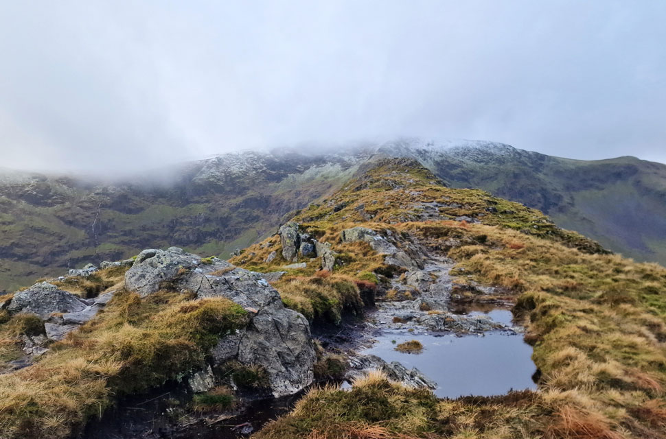
| Harter Fell (Mardalle) Blea Water and Mardale III Bell from Long Stile. |
| The rain held as I began the twisted craggy ascent on Long Stile where I followed the path into the snow line. |
 |
| Kidsty Pike, Kidsty Hows, Low Raise and Haweswater from High Stile summit cairn. |
| The snow was still fresh, soft and powdery causing no issues underfoot. |
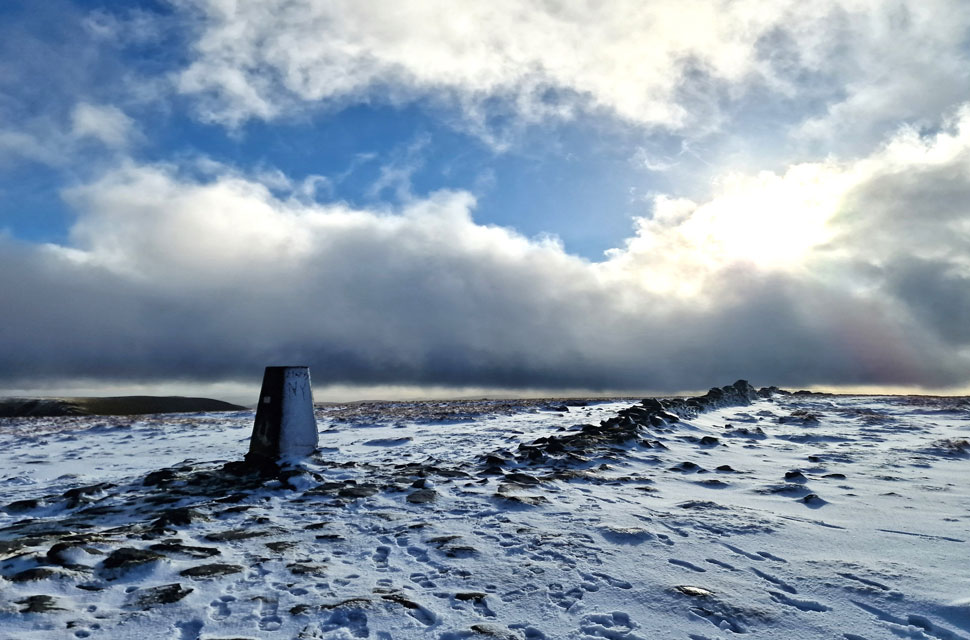 |
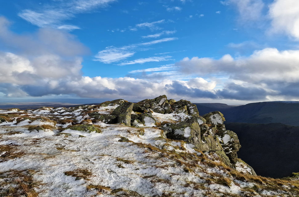
| High Street summit Trig Point. |
| Two walkers left as I approached and with more heading from the south I made sure I slid my wedding ring finger across the concrete top of the trig making sure I scratched the ring in the process. More walkers arrived in dribs and drabs and I greeted them all with individual 'mornings or hello's' The summit was getting packed now which was my queue to leave so I left westwards crossing the summit plateau until I dropped on west shoulder overlooking Hayeswater below. By now huge gaps were forming in the clouds revealing blues and greys barraged by sunlight seeking through. It certainly wasn't a moment for the camera but one not to forget. |
 |
| Blue skies opening out over grey. |
| I joined the path and headed north over the Straights of Riggindale while sunlight dappled over the Knott and Rampsgill Head. It was cold now with the windchill snapping at my exposed fingers so I looped my mitts into action feeling the benefit instantaneously, the downside to wearing mitt'ed gloves is they don't pair well with the loops on my walking poles which I'd extended as far as they would allow. |
 |
| High Street and Thornthwaite Crag from the Straights of Riggindale. |
| What sunlight there was, was great while it lasted. I'd normally head for The Knott and Rampsgill Head but due to my later arrival I'll be giving them a miss today and instead, head straight for Kidsty Pike. |
 |
| Riggindale. |
| With views extending towards the Short Stile, the Rough Crag ridge, Selside Pike, Branstree and Harter Fell. |
 |
| Kidsty Pike isn't far now. |
| Despite leaving the snow line behind I estimate the windchill across here to be around -5°C |
 |
| Kidsty Pike summit. |
| Woo hoo the sunshine is back! |
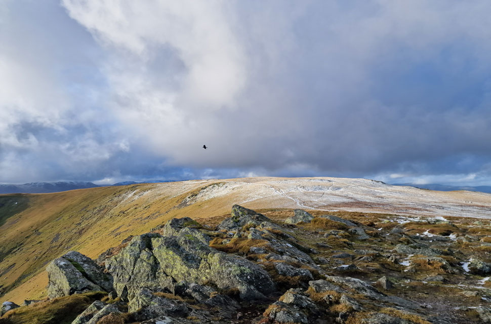 |
| Rampsgill Head from Kidsty Pike summit. |
| The gang of walkers I'd seen back on High Street had overtaken me as I stopped to take photo's from the Straights of Riggindale and had followed me almost to the summit of Kidsty Pike before leaving the path and making their way towards High Raise. There were two walkers already at Kidsty Pike as I arrived who began their descent with a cheery hello who I at first thought were also heading for High Raise but doubled back after descending the grassy flank rather than the bouldersome side which they were now below. I'd never seen that done before but it did make sense if you wanted to avoid the rock in favour of a descent by grass. Anyway, never mind that just look at that gorgeous light. |
 |
| Descending Kidsty Pike towards Kidsty Howes |
Here, you can see the pair of walkers re-joining the path. What happened next was totally magical. The two walkers, for now, maintained a good distance ahead until they dropped further onto the ridge ahead. Unbeknown to the pair, a herd of Deer were sprinting along the right shoulder of the fell side right below the couple, who were totally oblivious to it all, when, with no reason, the Deer doubled back, ascended the ridge, and crossed the path from right to left just feet in front of the couple. Even from my distance, I could see the couple were totally shocked by this, as was I. What had caused the Deer to double back and cross the ridge?
As I descended further, the couple were still amazed by what had just happened, and it looked like I'd soon catch them up, but before I did, I spotted the chap wearing the red jacket I'd seen at Caspel Gate earlier who must have spooked the Deer, not before taking well-timed photos with his DSLR camera. I didn't get a chance to talk to the red jacket guy, but I did pass the couple, who, as it turned out, were on holiday from Norway. They went on to explain that in Norway, they had never encountered wild Deer as close as they had a few moments earlier, and they went on to question me about how common it was. What just happened was extremely rare, I explained, and to see them as close as you did was a once-in-a-lifetime experience. |
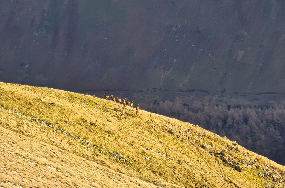 |
| Wild Deer, Kidsty Pike. |
| This photo was taken prior to the Deer being spooked by red jacket guy after which they bolted left and crossed the path directly in front of the couple. |
 |
| Sometimes, it's not always about the sunshine. |
| |
 |
| Descending towards Kidsty Howes. |
| With Haweswater below. |
 |
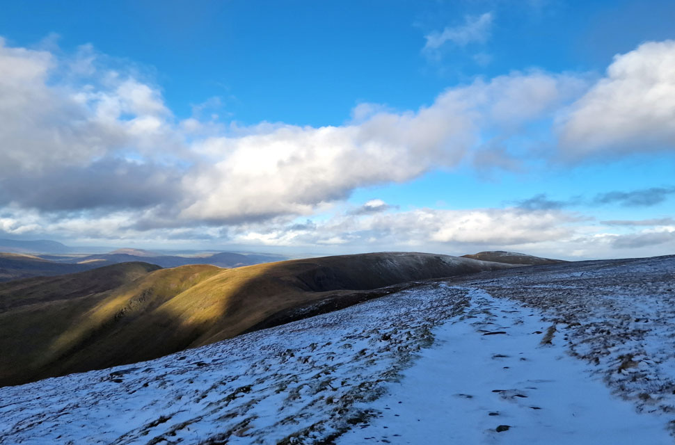
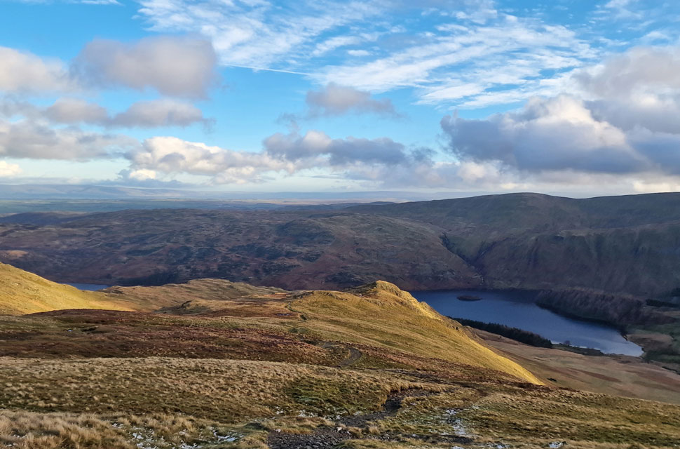
| Kidsty Pike, Kidsty Howes and Low Raise as I head back towards The Rigg. |
In the fading light, I left the Norwegians and began my descent, a descent that, after years, I have mastered to the point where I can descend at pace. With the gap widening, the couple were still on the ridge as I dropped into the hollows and crags that form Kidsty Howes. The path narrows and twists through groved rock and soft peat, which had been weakened by the rain where it paid to test footings first. With the rock and peat behind me, I found myself at the top of the steep grassy bank, which today felt and looked like a water slide.
Testing footings became more common, but I was still able to maintain a good pace as my boots soaked up the flank of the fell until the gradient eased over more boot-swallowing bog. There was no way around the bog; each step was as boggy as the next, it was just a case of going for it. Bowderthwaite Bridge came next, where I stamped my soaked boots on the concrete foundations to rid them of tangled grass. It worked, and for measure, I rinsed them in the beck. Just two walkers ahead disappeared around the headland that forms The Rigg, and minutes later I joined them, where my view was filled with Harter Fell in the fading light and folk returning to their cars who, like me, had just enjoyed their first walk of 2024. |
|
| |
| Back to top |
 |
|

