|
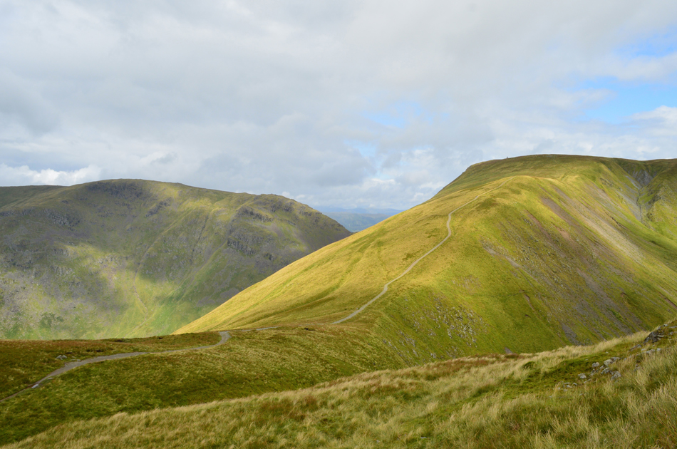
Thornthwaite Crag |
 |
 |
There are 24 walks to choose from including Thornthwaite Crag |
 |
|
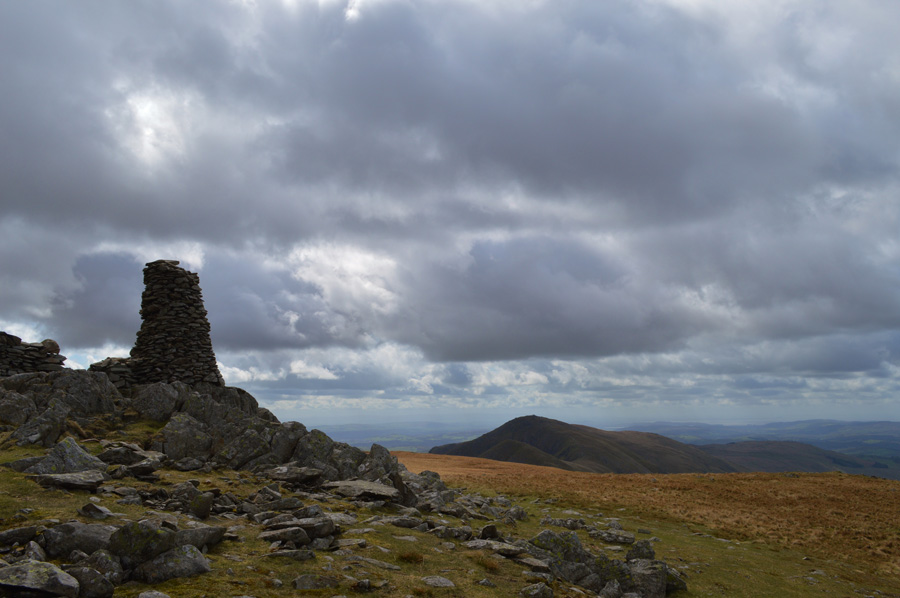
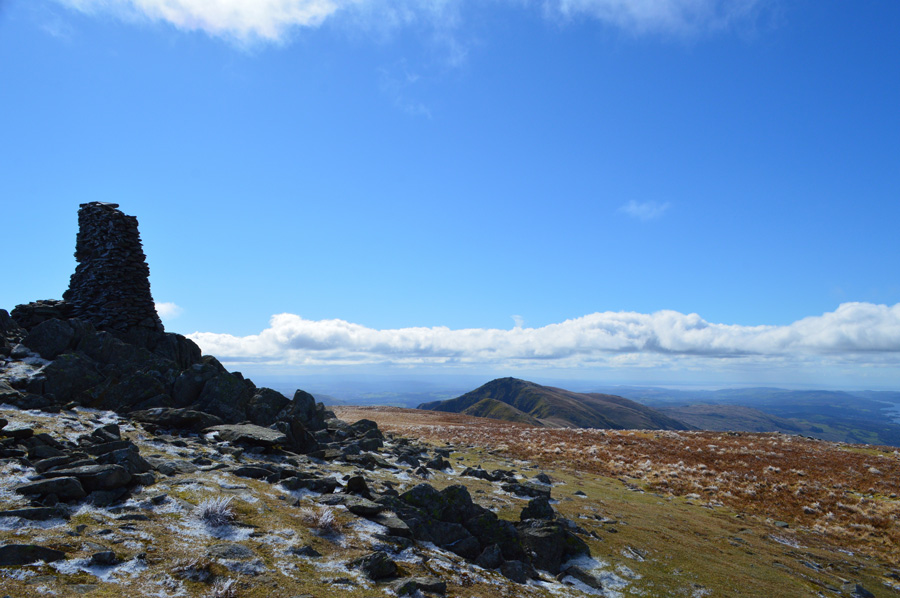
High Street via The Ill Bell Ridge |
|
|
 |
|
3rd January 2026 |
| ASCENT: |
3,334 Feet - 1,016 Metres |
| MILES: |
12.8 |
| WAINWRIGHTS: |
5, Yoke - III Bell - Froswick - High Street - Thornthwaite Crag |
| ROUTE: |
Church Bridge - Garburn Pass - Top of Garburn Pass - Yoke - III Bell - Froswick - High Street - Thornthwaite Crag - Scot Rake - Hagg Gill - Hagg Bridge - Ing Bridge - Ing Lane - Truss Lane - A592 - Troutbeck - Jesus Church - Church Bridge |
|
| |
|
Extended Riggindale Round |
|
|
|
|
25th August 2025 |
| ASCENT: |
3,165 Feet - 964 Metres |
| MILES: |
10.5 |
| WAINWRIGHTS: |
7, High Street - Mardale III Bell - Thornthwaite Crag - The Knott - Rampsgill Head - High Raise (Martindale) - Kidsty Pike |
| ROUTE: |
Mardale Head - The Rigg - Rough Crag - Caspel Gate - Long Stile - High Street - Mardale III Bell - Top of Hall Cove - Thornthwaite Crag - High Street - Straights of Riggindale - The Knott - Rampsgill Head - High Raise (Martindale) - Kidsty Pike - Kidsty Howes - Bowderthwaite Bridge - The Rigg - Mardale Head |
|
| |
|
An Alternative Hayeswater Circuit |
|
|
|
|
14th December 2024 |
| ASCENT: |
2,727 Feet - 831 Metres |
| MILES: |
8.5 |
| WAINWRIGHTS: |
5, The Knott - Rampsgill Head - High Street - Mardale III Bell - Thornthwaite Crag |
| ROUTE: |
Hartsop - Hayeswater Gill - Hayeswater - The Knott - Rampsgill Head - Two Penny Crag - High Street - Mardale III Bell - Thornthwaite Crag - Hayeswater Gill - Hayeswater - Hayeswater Gill - Hartsop |
|
| |
|
High Street via The Ill Bell Ridge |
|
|
|
|
18th November 2024 |
| ASCENT: |
3,616 Feet - 1,102 Metres |
| MILES: |
13.2 |
| WAINWRIGHTS: |
6, Yoke - III Bell - Froswick - High Street - Thornthwaite Crag - Troutbeck Tongue |
| ROUTE: |
Church Bridge - Garburn Pass - Top of Garburn Pass - Yoke - III Bell - Froswick - High Street - Thornthwaite Crag - Scot Rake - Hagg Gill - Troutbeck Tongue - Hagg Bridge - Ing Bridge - Ing Lane - Truss Lane - A592 - Troutbeck - Jesus Church - Church Bridge |
|
| |
|
Kirkstone Pass to Hartsop via High Street |
|
|
|
|
2nd November 2024 |
| ASCENT: |
2,238 Feet - 682 Metres |
| MILES: |
7.7 |
| WAINWRIGHTS: |
6, Caudale Moor - Thornthwaite Crag - High Street - The Knott |
| ROUTE: |
Top of Kirkstone Pass - St Raven's Edge - Caudale Moor - Stony Cove Pike - Thresthwaite Mouth - Thornthwaite Crag - High Street - Straights of Riggindale - The Knott - Hayeswater Gill - Hartsop - Cow Bridge |
|
| |
|
Hayeswater Circuit |
|
|
|
|
26th October 2024 |
| ASCENT: |
2,738 Feet - 835 Metres |
| MILES: |
8 |
| WAINWRIGHTS: |
6, The Knott, Rampsgill Head - Kidsty Pike - High Street - Thornthwaite Crag - Gray Crag |
| ROUTE: |
Hartsop - Hayeswater Gill - Hayeswater - The Knott - Rampsgill Head - Kidsty Pike - Straights of Riggindale - High Street - Thornthwaite Crag - Gray Crag - Hayeswater Gill - Hartsop |
|
| |
|
Yoke via Rainsborrow Crag |
|
|
|
|
31st March 2024 |
| ASCENT: |
3,588 Feet - 1,093 Metres |
| MILES: |
12.2 |
| WAINWRIGHTS: |
6, Yoke - III Bell - Froswick - Thornthwaite Crag - High Street - Mardale III Bell |
| ROUTE: |
Kentmere Church - Hartrigg - Rainsborrow Quarry - Rainsborrow Crag - Rainsborrow Tarn - Yoke - III Bell - Froswick - Thornthwaite Crag - High Street - Mardale III Bell - Top of Nan Bield Pass - Kentmere Reservoir - Hartrigg - Kentmere Church |
|
| |
|
Extended Hayeswater Circuit |
|
|
|
|
15th October 2023 |
| ASCENT: |
3,140 Feet - 957 Metres |
| MILES: |
10.5 |
| WAINWRIGHTS: |
8, The Knott - Rampsgill Head - High Raise (Martindale) - Kidsty Pike - High Street - Mardale III Bell - Thornthwaite Crag - Gray Crag |
| ROUTE: |
Hartsop - Hayeswater Gill - Hayeswater - The Knott - Rampsgill Head - High Raise (Martindale) - Kidsty Pike - Straights of Riggindale - High Street - Mardale III Bell - Top of Hall Cove - Thornthwaite Crag - Gray Crag - Hayeswater - Hayeswater Gill - Hartsop |
|
| |
|
High Level Circuit of Troutbeck |
|
|
|
|
10th August 2023 |
| ASCENT: |
4,251 Feet - 1,296 Metres |
| MILES: |
14 |
| WAINWRIGHTS: |
5, Yoke - III Bell - Froswick - Thornthwaite Crag - Caudale Moor |
| ROUTE: |
Church Bridge - Garburn Road - Top of Garburn Pass - Yoke - III Bell - Froswick - Thornthwaite Crag - Threshthwaite Mouth - Stony Cove Pike - Caudale Moor - John Bell's Banner - St Raven's Edge - Broad End - Kirkstone Pass - Idle Hill - Baystones - Nanny Lane - Troutbeck - Church Bridge |
|
| |
|
Hayeswater Circuit |
|
|
|
|
14th July 2020 |
| ASCENT: |
2,738 Feet - 835 Metres |
| MILES: |
8 |
| WAINWRIGHTS: |
6, The Knott, Rampsgill Head - Kidsty Pike - High Street - Thornthwaite Crag - Gray Crag |
| ROUTE: |
Hartsop - Hayeswater Gill - Hayeswater - The Knott - Rampsgill Head - Kidsty Pike - Straights of Riggindale - High Street - Thornthwaite Crag - Gray Crag - Hayeswater Gill - Hartsop |
|
| |
|
Thornthwaite Crag via the Ill Bell Ridge |
|
|
|
|
19th April 2019 |
| ASCENT: |
3,529 Feet - 1,076 Metres |
| MILES: |
11.4 |
| WAINWRIGHTS: |
6, Sour Howes - Sallows - Yoke - III Bell - Froswick - Thornthwaite Crag |
| ROUTE: |
Church Bridge - Garburn Pass - Sour Howes - Moor Head - Sallows - Yoke - Ill Bell - Froswick -Thornthwaite Crag - Scot Rake - Hag Gill - Troutbeck Park - Ing Bridge - Ing Lane - Truss Lane - Troutbeck Church - Church Bridge |
|
| |
|
High Street via The Ill Bell Ridge from Troutbeck Bridge |
|
|
|
|
5th August 2017 |
| ASCENT: |
3,817 Feet - 1,164 Metres |
| MILES: |
14 |
| WAINWRIGHTS: |
5, Yoke - Ill Bell - Froswick - Mardale III Bell - High Street |
| ROUTE: |
Troutbeck Bridge - Garburn Pass - Garburn Nook - Yoke - Ill Bell - Froswick - Top of Hall Cove - Mardale III Bell - High Street - Thornthwaite Crag - Scot Rake - Hag Gill - Hag Bridge - Ing Bridge - Ing Lane - Truss Lane - A591 - Troutbeck - Jesus Church - Troutbeck Bridge |
|
| |
|
Caudale Moor to Brock Crags via High Street |
|
|
|
|
1st July 2017 |
| ASCENT: |
4,374 Feet - 1,334 Metres |
| MILES: |
14 |
| WAINWRIGHTS: |
10, Caudale Moor (Stoney Cove Pike) - Thornthwaite Crag - High Street - Kidsty Pike - High Raise (Martindale) - Rampsgill Head - The Knott - Rest Dodd - Angletarn Pikes - Brock Crags |
| ROUTE: |
Cow Bridge - Brothers Water - Hartsop Hall - Sykeside - Kirkstone Pass - Caudale Beck - Caudale Quarry - Caudale Moor (Stoney Cove Pike) - Threshthwaite Mouth - Thornthwaite Crag - High Street - Straights of Riggindale - Kidsty Pike - High Raise (Martindale) - Rampsgill Head - The Knott - Rest Dodd - Satura Crag - Angle Tarn - Angletarn Pikes - Cat Crag - Brock Crags - Hartsop - Cow Bridge |
|
| |
|
The High Street Fells from Mardale Head |
|
|
|
|
27th December 2016 |
| ASCENT: |
3,105 Feet - 947 Metres |
| MILES: |
11 |
| WAINWRIGHTS: |
7, High Street - Mardale III Bell - Thornthwaite Crag - The Knott - Rampsgill Head - High Raise - Kidsty Pike |
| ROUTE: |
Mardale Head - Rough Crag - Caspel Gate Tarn - Long Stile - High Street - Mardale III Bell - Top of Hall Cove - Thornthwaite Crag - High Street - Straights of Riggindale - The Knott - Rampsgill Head - High Raise - Kidsty Pike - Kidsty Howes - Riggindale Beck - The Rigg - Mardale Head |
|
| |
|
The Kentmere Valley and the Ill Bell Ridge from Kentmere Church |
|
|
|
|
5th November 2016 |
| ASCENT: |
3,300 Feet - 1,006 Meters |
| MILES: |
10.5 |
| WAINWRIGHTS: |
5, Mardale III Bell - Thornthwaite Crag - Froswick - III Bell - Yoke |
| ROUTE: |
Kentmere Church - Hartrigg - Kentmere Reservoir - Nan Bield Pass - Mardale III Bell - Thornthwaite Crag - Froswick - III Bell - Yoke - Garburn Pass - The Nook - Kentmere Church |
|
| |
|
Walking the Wainwrights in 30 Walks - Walk 10 A Troutbeck Circuit |
|
|
|
|
16th April 2016 |
| ASCENT: |
4,406 Feet - 1,344 Meters |
| MILES: |
15 |
| WAINWRIGHTS: |
9, Sour Howes - Sallows - Yoke - III Bell - Froswick - Thornthwaite Crag - Gray Crag - Troutbeck Tongue - Wansfell |
| ROUTE: |
Troutbeck Bridge - Garburn Pass - Sour Howes - Sallows - Yoke - III Bell - Froswick - Thornthwaite Crag - Gray Crag - Thornthwaite Crag - Scot Rake - Troutbeck Tounge - Trout Beck - Kirkstone Pass - Iddle Hill - Baystones - Wansfell Pike - Nanny Lane - Troutbeck - Troutbeck Bridge |
|
| |
|
The Harry Griffin 2,000 footers Walk 10 - Around Pasture Beck |
|
|
|
|
7th May 2015 |
| ASCENT: |
3,010 Feet - 918 Metres |
| MILES: |
7.2 |
| SUMMITS OVER 2,000Ft: |
Hartsop Dodd - Caudale Moor (Stony Cove Pike) - Thornthwaite Crag - Gray Crag South Top - Gray Crag North Top - Gray Crag North West Top |
| ROUTE: |
Hartsop - Hartsop Dodd - Mark Atkinson Monument - Caudale Moor (Stony Cove Pike) Threshthwaite Mouth - Thornthwaite Crag - Gray Crag South Top - Gray Crag North Top - Gray Crag North West Top - Hartsop Gill - Hartsop |
|
| |
|
Angletarn Pikes to Gray Crag from Hartsop |
|
|
|
|
31st January 2015 |
| ASCENT: |
2,800 Feet – 853 Meters |
| MILES: |
10.4 |
| WAINWRIGHTS: |
2,800 Feet – 853 Meters |
| ROUTE: |
Hartsop – Dubhow – Boredale Hause – Angletarn Pikes – Angle Tarn – Satura Crag – The Knott – Straights of Riggingdale – High Street – Thornthwaite Crag – Gray Crag – Hartsop |
|
| |
|
Hayeswater & Gray Crag from Hartsop |
|
|
|
|
10th May 2014 |
| ASCENT: |
2,093 Feet, 638 Meters |
| MILES: |
6.3 |
| WAINWRIGHTS: |
2, Thornthwaite Crag – Gray Crag |
| ROUTE: |
Hartsop – Wath Bridge – Hayeswater – Hayeswater Gill – Thornthwaite Crag – Gray Crag – Hartsop |
|
| |
|
The Hayeswater Fells from Hartsop |
|
|
|
|
10th November 2013 |
| ASCENT: |
2,600ft, 793 Meters |
| MILES: |
7.6 |
| WAINWRIGHTS: |
4, The Knott – High Street – Thornthwaite Crag – Gray Crag |
| ROUTE: |
Hartsop – Hayeswater – The Knott – Straights of Riggindale – High Street – Thornthwaite Crag – Gray Crag – Hayeswater – Filter House – Hartsop |
|
| |
|
Nan Bield Pass & the Ill Bell Ridge |
|
|
|
|
7th April 2013 |
| ASCENT: |
3,300 Feet 1,006 Metres |
| MILES: |
11.4 |
| WAINWRIGHTS: |
5 Mardale Ill Bell – Thornthwaite Crag – Froswick – Ill Bell – Yoke |
| ROUTE: |
Kentmere – Overend – Nan Bield Pass – Mardale lll Bell – Thornthwaite Crag – Froswick – lll Bell – Yoke – Garburn Pass – Kentmere |
|
| |
|
One year on… |
|
|
|
|
27th October 2012 |
| ASCENT: |
3,713 Feet, 1,132 Metres |
| MILES: |
12.8 |
| WAINWRIGHTS: |
5, Place Fell – Angletarn Pikes – The Knott – High Street – Thornthwaite Crag |
| ROUTE: |
Hartsop – Dubhow – Beckstones – Crookabeck – Rooking – Side Farm – Place Fell – Round How – Steel Edge – Boredale Hause – Angletarn Pikes – Angle Tarn – Satura Crag – The Knott – Straights Of Riggindale – High Street – Thornthwaite Crag – Thresthwaite Mouth – Pasture Bottom – Pasture Beck - Hartsop |
|
| |
|
The High Street Roman Road - 'Brocavvm to Galava' |
|
|
|
|
30th June 2012 |
| ASCENT: |
4’000 Feet, 1,219 Metres |
| MILES: |
5, Wether Hill, High Raise, Rampsgill Head, High Street & Thornthwaite Crag |
| WAINWRIGHTS: |
25.1 |
| ROUTE: |
Brougham Castle – BROCAVVM ROMAN FORT (Penrith) – Brougham Hall – Eamont Bridge – Yanwath – Tirril – Celleron -Winder Hall Farm – Moor Divock – Lambert Lad – Loadpot Hill – Wether Hill – Red Crag (High Street) – Raven Howe – High Raise (Martindale) – Rampsgill Head – Two Penny Crag -Straits of Riggindale – High Street – Thornthwaite Crag – Thornthwaite Beacon – Park Fell – Hagg Gill – Troutbeck Park – Ing Lane – Troutbeck – Truss Lane – A592 – Robin Lane – Jenkin Crag – High Skelghyll – Skelghyll Wood – A591 – A5075 – GALAVA ROMAN FORT (Ambleside) |
|
| |
|
Thornthwaite Crag via the Ill Bell Ridge |
|
|
|
|
10th December 2011 |
| ASCENT: |
3,780 Feet, 1,152 Meters |
| MILES: |
11.6 |
| WAINWRIGHTS: |
7, Sour Howes, Sallows, Yoke, Ill Bell, Froswick, Thornthwaite Crag, Troutbeck Tongue |
| ROUTE: |
Troutbeck Church – Garburn Road – Sour Howes – Garburn Nook – Garburn Pass – Yoke – Ill Bell – Froswick – Thresthwaite Mouth – Troutbeck Tongue – Ings Lane – Truss Lane – Troutbeck Church |
|
| |
|
The Kentmere Horseshoe |
|
|
|
|
6th March 2011 |
| ASCENT: |
4,040 Feet - 1,231 Metres |
| MILES: |
13.9 |
| WAINWRIGHTS: |
10, Sallows, Yoke, III Bell, Froswick, Thornthwaite Crag, High Street, Mardale III Bell, Harter Fell (Mardale), Kentmere Pike & Shipman Knotts |
| ROUTE: |
Kentmere - Garburn Pass - Sallows - Yoke - III Bell - Froswick - Thornthwaite Crag - High Street - Mardale III Bell - Harter Fell - Brown Howe - Kentmere Pike - Shipman Knotts - Stile End - High Lane - Kentmere |
|
| |
|
Hartsop Dodd & Gray Crag |
|
|
|
|
24th April 2010 |
| ASCENT: |
3,012 Ft, 918 Mtrs |
| MILES: |
7 |
| WAINWRIGHTS: |
4 Hartsop Dodd, Caudale Moor (Stony Cove Pike) Thornthwaite Crag & Gray Crag |
| ROUTE: |
|
|
| |
| Back to top |
 |
|