|
Walking the Wainwrights in 30 Walks - Walk 10 A Troutbeck Circuit |
 |
 |
16th April 2016 |
 |
|
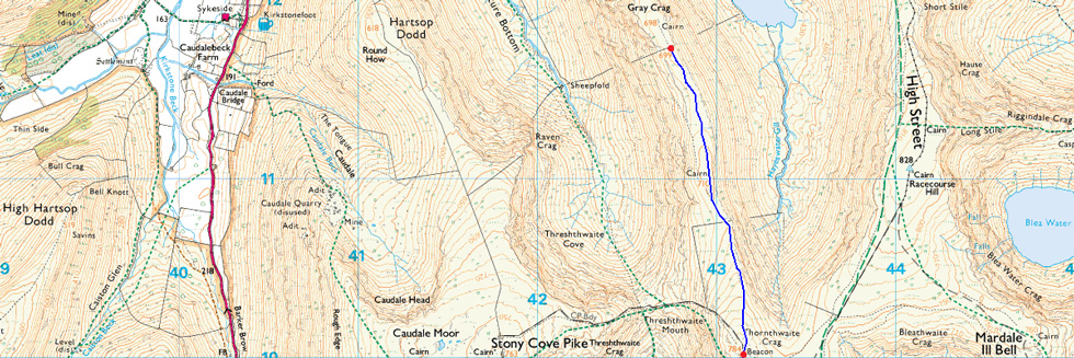
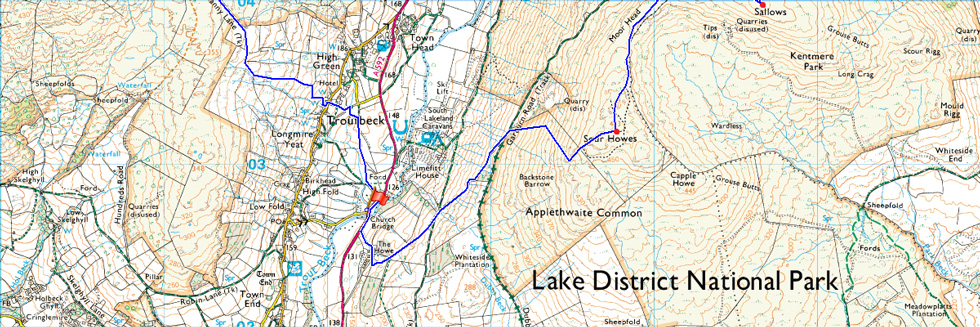
Due to a good Lakeland forecast I had the choice on where to walk today and even going back to mid week this walk, a Troutbeck circuit kind'a edged above the others for no particular reason other than I quite fancied walking the III Bell ridge, something that I haven't done since coincidentally, April last year during my two thousand footers campaign. Todays walk however is slightly more challenging in that I will first collect Sour Howes and Sallows before taking on the III Bell ridge and Thornthwaite Crag, then, continuing onto Gray Crag which I had created as an 'out and back' purely because that's how I had planned the routes to fit into thirty walks.
Once I had returned back to Thornthwaite Crag I will then descend into the delightful Troutbeck Valley via Scots Rake then continuing to summit Troutbeck Tongue before making my descent from where I'll cross Trout Beck thereafter ascending steadily towards the Kirkstone Pass once I had crossed many a stone wall that is. Once the Pass is crossed it's back onto open fell side rising steadily over sometimes pathless ground before summiting Baystones and thereafter continuing along the grassy ridge towards my final and ninth summit of the day in Wansfell Pike.
It all started eight hours earlier back at Church Bridge. |
|
| Wainwright Guide Book Two |
 |
| The Far Eastern Fells |
-Thornthwaite Crag
Occupying a commanding position overlooking four valleys, Thornthwaite Crag is one of the better-known fells east of Kirkstone, owing not a little of its fame to its tall pillar of stones, a landmark for miles around. |
 |
|
|
| |
|
Overview |
|
|
| Ascent: |
4,406 Feet - 1,344 Meters |
| Wainwrights: |
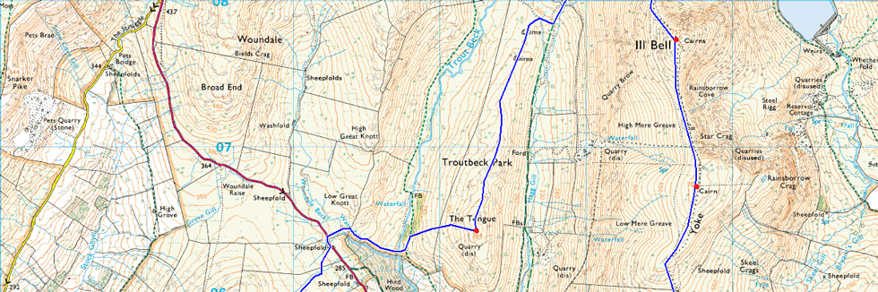
9, Sour Howes - Sallows - Yoke - III Bell - Froswick - Thornthwaite Crag - Gray Crag - Troutbeck Tongue - Wansfell |
| Weather: |
Overcast to Start Turning Bright and Sunny, Strong Winds Across The Summits. Highs of 8°C Lows of 3°C Feels Like -4°C |
| Parking: |
Parking Spaces Church Bridge, Troutbeck |
| Area: |
Far Eastern |
| Miles: |
15 |
| Walking With: |
On My Own |
| Ordnance Survey: |
OL5 |
| Time Taken: |
8 Hours |
| Route: |
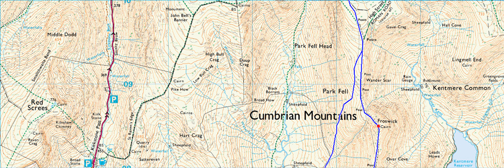
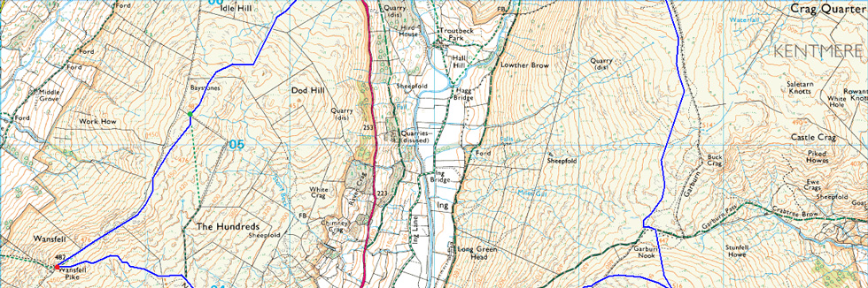
Troutbeck Bridge - Garburn Pass - Sour Howes - Sallows - Yoke - III Bell - Froswick - Thornthwaite Crag - Gray Crag - Thornthwaite Crag - Scotts Rake - Troutbeck Tounge - Trout Beck - Kirkstone Pass - Iddle Hill - Baystones - Wansfell Pike - Nanny Lane - Troutbeck - Troutbeck Bridge |
|
| |
|
Map and Photo Gallery |
|
|
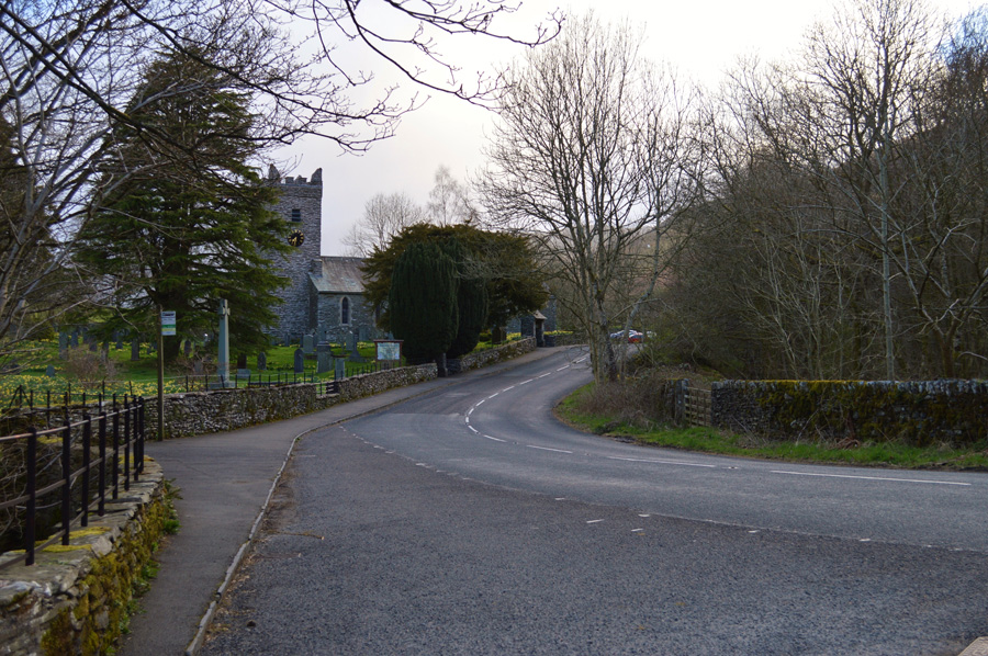 |
| Jesus Church from Church Bridge 07:30am 3°C |
I had timed my arrival in Troutbeck for around 07:30 but found myself running fifteen minutes ahead of schedule by the time I had parked up at Church Bridge, I was in no rush so I sat in the car for a couple of minutes before opening the boot from where I started to lace up my boots, only a few moments had passed as I was adding my Gaitors when it started to rain then hail and finally it started to snow, I had seen the showers approaching from the Troutbeck Valley and it came and went leaving my boot full with a scattering of hail. On both sides of Church Bridge I can hear the bleating of new born Lambs no doubt complaining about the nippy conditions and I'm not too far behind them, I mean right now there's not supposed to be a cloud in the sky according to the forecasters but the potential is there, beyond the grey clouds I can see snippets of the colour blue.
A delivery van passes and heads towards the Low Fold area of Troutbeck and I can hear every gear change over the next few minutes. There's a bite in the morning air which had been forecasted, arctic air from the north the forecasters said, at least they didn't get that bit of the forecast wrong as gloves and a hat are added. With the car locked I head out towards the Troutbeck end of the Garburn Pass first stopping to take this photo of Jesus Church before crossing for the first, but not last time Trout Beck. |
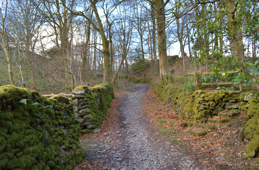 |
| Picking up the Garburn Pass shortly after leaving Church Bridge. |
| |
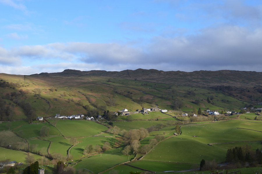 |
| Views over Troutbeck towards Wansfell Pike. |
| Garburn Pass rises steadily passing private cottages and farm buildings along the way, the track then makes a left turn as views start to open up ahead and over the Troutbeck rooftops towards my final summit of the day, Wansfell Pike, despite its summit only being a mile away it's going to take me almost eight hours and fifteen miles to reach it, I put it to the back of my mind. |
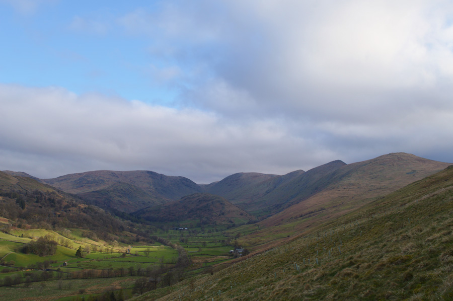 |
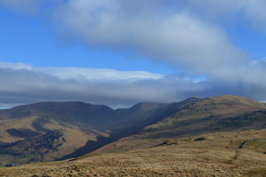
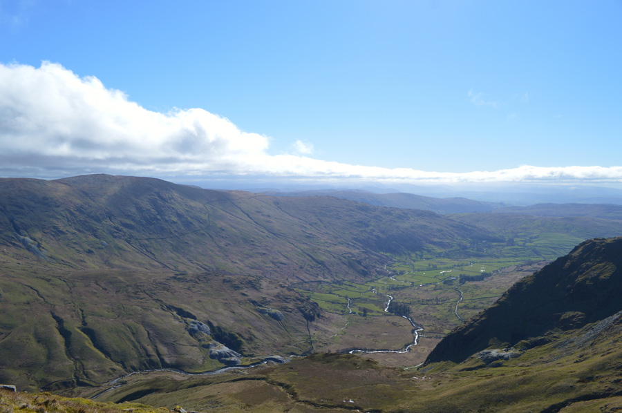
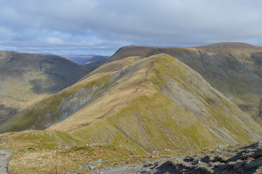
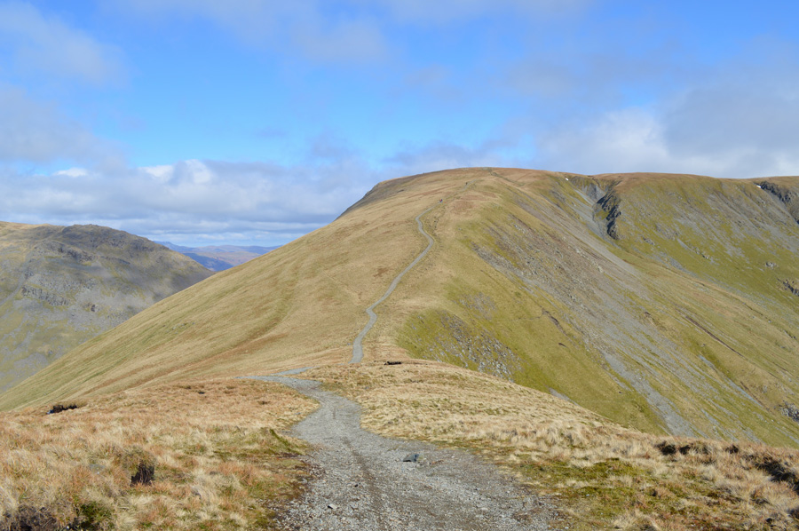
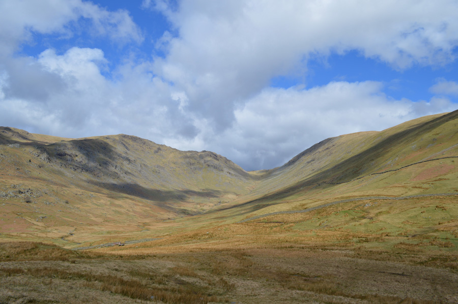
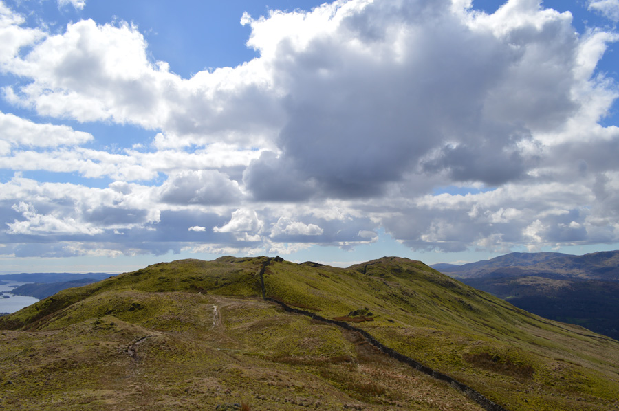
| The III Bell ridge seen towering over Troutbeck Tongue and the Troutbeck Valley. |
It's a little hazy and the valley will remain in shadow until the sun breaks through the cloud and starts to climb higher, until then I've got no choice than to put up with the wind which is causing some pretty severe chill even at valley level. |
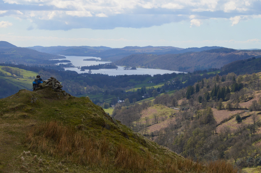
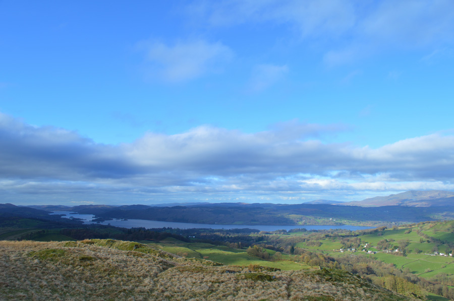 |
| The sun has broke through opeing views out over Windermere. |
| |
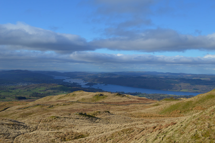 |
| Looking down on ground covered. |
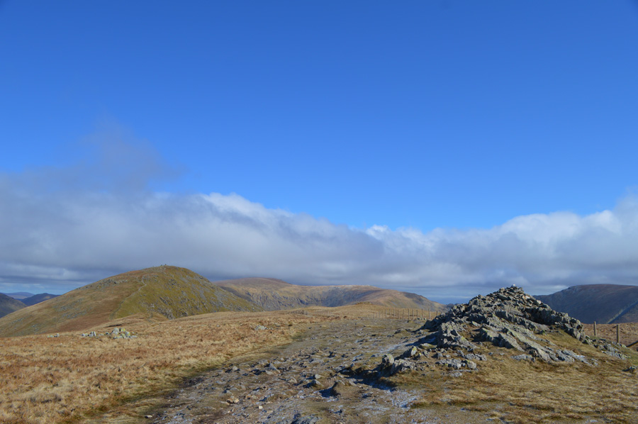
| I follow the Garburn Pass until the familiar sty was reached which opens out onto open fell side. A single track navigates towards the top of Backstone Barrow missing out on the ridge route itself but no harm done, it wasn't my intention to ascend via Backstone Barrow today. The path is steep and causes a succession of false summits up ahead all of which are all too familiar until the ground plateaus with the distinctive crown of the summit up ahead. |
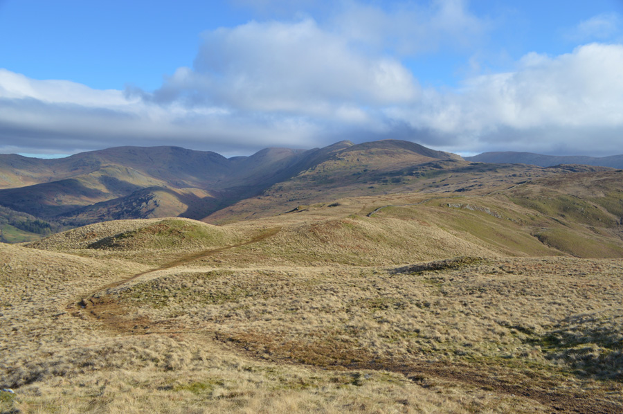 |
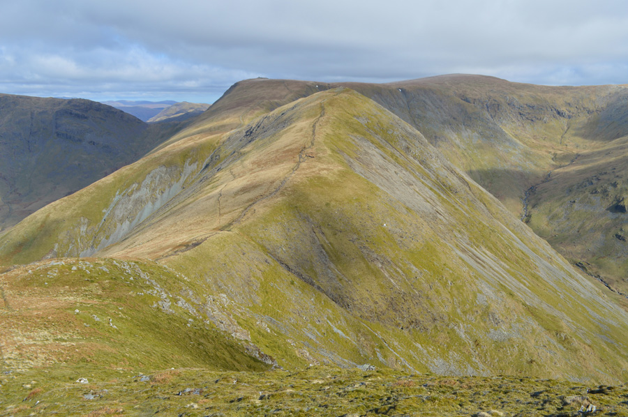
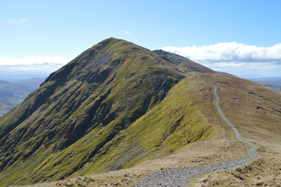
| Red Screes, Troutbeck Tongue and the III Bell Ridge from Sour Howes summit. |
The one good bonus that accompanied the wind-chill was that it brought with it air clarity leaving the views in almost every direction looking and feeling crisp indeed, especially when the sun started to shine, the flip side to this however was it was still bone chillingly cold despite the sun being out which soon saw me de-shouldering and adding more layers in the form of my neck Gaiter also adding my sunglasses due to the wind causing my eyes to stream, it may look very Spring like but it was more like Winter up here today, the forecasters had predicted a minus four wind-chill but it felt more like minus six, or even eight for that matter.
Ahead, one of the best half miles in Lakeland...Sour Howes to Sallows via Moor Head. |
 |
| Red Screes, Troutbeck Tongue and the III Bell Ridge |
The ground was semi frozen and so too was any standing water leaving Moor Head feeling more dry than I am familiar with, there is a white coating of frost over some exposed areas but no doubt this will disappear come midday. Moor Head offered no protection from the wind-chill and I wondered how this might affect my walk, I really am hoping for the sun to cast some warmth over the tops sometime soon.
Sallows is soon reached after an easy trod to its rampart like summit, again the sun sits high above and this time, I don't bother taking a photo, instead tapping the grassy crest with my walking pole. |
 |
| Descending Sallows with views over the top of Garburn Pass towards Yoke. |
| I had forgotten about lending my neck Gaiter to my son Owen who had used it throughout Winter whilst watching Wigan Athletic play, like most teenagers Owen douses himself in aftershave before going to the shops let alone a football game yet despite this, in only a way that a parent would, I take great comfort in being able to smell the scent of Owens aftershave on the fells today. |
 |
| Yoke. |
After descending Sallows easily I crossed the top of the Garburn Pass whilst views of Yoke opened up ahead of me, from no-where I am over taken by a young lad no older than my own son Owen, blimey I thought, where did he come from! He had obviously ascended from Kentmere and was only wearing a mid layer, either I'm getting old or this lad just doesn't feel the cold. Inevitably the young lad stops to add more layers which is where I pass with a 'morning' and in return a get a 'hi' from a rather nervous sounding voice. |
 |
| Looking back towards Sallows and Sour Howes. |
| The track here is good and despite feeling the burn from my third ascent I maintain good pace all the while taking advantage of a being in the shelter from the cold winds, for now that is. |
 |
| III Bell from Yoke summit. |
| From the summit of Yoke I can see three walkers making an ascent on III Bell and two fell runners making their way towards Yoke, with the young chap behind me it's starting to feel quite busy up here at the moment. |
 |
| III Bell over Rainsborrow Cove. |
| Feeling that severe wind-chill once again, brrr I thought Winter was over! |
 |
| Views over Kentmere Reservoir towards Lingmell End, Mardale III Bell, the top of Nan Bield Pass and Harter Fell (Mardale) |
I bet your thinking 'that' Lingmell End looks steep, well I can verify this by claiming it is still the steepest ascent I have undertaken, when the term 'clutching at the grass' and 'walking poles up to your shoulders' comes to mind! if you like a challenge Lingmell End is where you'll find it.
Good times. |
 |
| Views back along the ridge towards Yoke. |
| |
 |
| Kentmere and Kentmere Pike from the ascent on III Bell. |
| I scoured the valley for movement but saw nothing, not even a sighting of the wild Kentmere Ponies. |
 |
| III Bell summit. |
It was a steady slog onto III Bell summit where I managed to maintain good pace once more but for how long I don't know. The three walkers who had made their own ascents have long gone and are about to make an ascent on Froswick which means for now, I shall have the summit to myself which sadly I'm unable to take advantage of due to the wind-chill.
Best to keep moving and hold onto my hat while I'm at it. |
 |
| Froswick, Thornthwaite Crag, High Street, Mardale III Bell, Lingmell End and Upper Kentmere over Hall Cove. |
Despite the clear views and fantastic ridge scenery I could only spare a thought for David and Rod who right about now are making their way up Skiddaw, meanwhile back on the ridge I've had to fasten my hood up if only to ease the numbness in my cheek bones.
Time to descend III Bell, I wonder will I get any respite from the wind, answer coming shortly! |
 |
| Caudale Moor (Stony Cove Pike) Froswick, Thornthwaite Crag and High Street from my III Bell descent. |
| |
 |
| Spectacular ridge views towards Froswick and Over Cove. |
| I'll take the wind-chill anyday if I can have views as clear as this, just magical. |
 |
| Froswick, Thornthwaite Crag and High Street. |
| Sadly there was no respite from the wind but I didn't care with views as good as this. |
 |
| Looking back on III Bell and III Bell east ridge. |
| |
 |
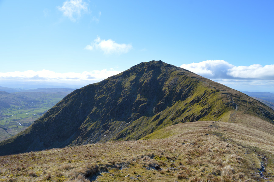
| Thornthwaite Crag seen with Caudale Moor (Stony Cove Pike) from Froswick summit. |
| Fearing not to burn myself out so early into the walk I change down a gear while taking on the ascent of Froswick nevertheless I soon reach the summit cairn and again I am reminded just how cold, and indeed how strong the summits winds are, without haste I begin my descent only stopping to take this photo. |
 |
| Ascent on Thornthwaite Crag. |
| There's no getting away from it, ascent of Thornthwaite Crag can feel like a pull and todays ascent was no exception, time to up that gear. |
 |
| Pausing to look back on Froswick from the top of Over Cove. |
| |
 |
| Views over Hall Cove. |
| Ahead the trio of walkers who I had been following stop at the junction where the path splits right for Hall Cove, a splendid path which heads towards Mardale III Bell and High Street with long distant views over the Kentmere Valley and of course Hall Cove, I've got to admit a little jealousy came over me as they made their way across. |
 |
| Views back over the III Bell Ridge. |
| It's starting to feel a tad bit warmer now that the sun is high in the sky and for once this morning, despite the cold winds I start to feel the benefits so it's off with the hood and I might even feel brave enough to take my neck Gaitor off too. |
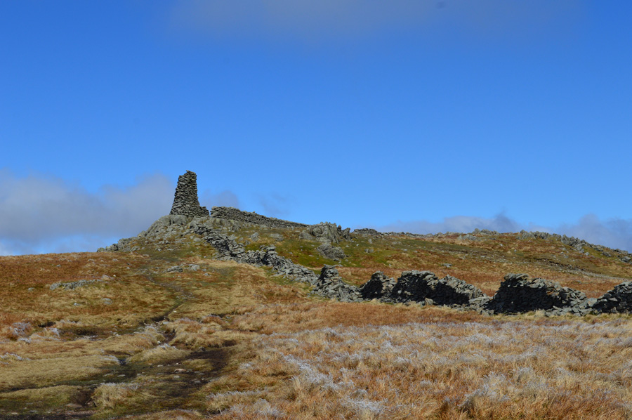 |
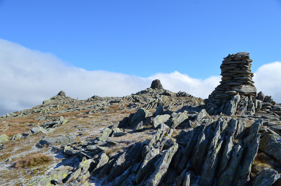
| Thornthwaite Crag summit. |
| Once the shoulder of Thornthwaite Crag had been crested the summit beacon is reached by a good stretch of level ground which I always feel is a great reward for previous work. Ahead a solo walker had been taking shelter from the winds and had just got up and left in the direction of High Street which meant by the time I would arrive I should have the summit to myself, a small treat for the length of time I plan to spend there. |
 |
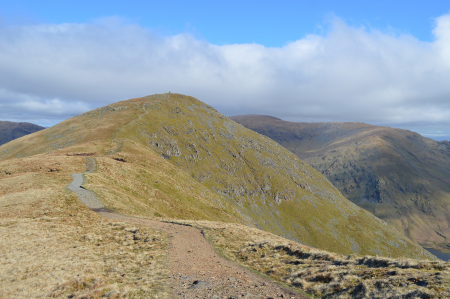
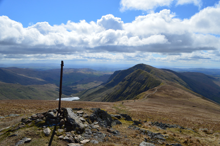
| The III Bell ridge from Thornthwaite Crag summit. |
With the summit of Thornthwaite Crag reached I make my way around the summit beacon where I take in the views from a much favoured spot of mine. The summit wall is making great work at protecting me against the winds and it's feeling pretty peaceful under an almost cloudless sky but it was no use, I didn't plan to stop or rest here, as my 'out and back' is waiting.
I cross the summit wall and instantly feel the summit winds again which thankfully now don't feel as cold as they did whilst back on the III Bell ridge, in fact, the further I started to walk the less I felt them, perhaps they are starting to drop a little. |
 |
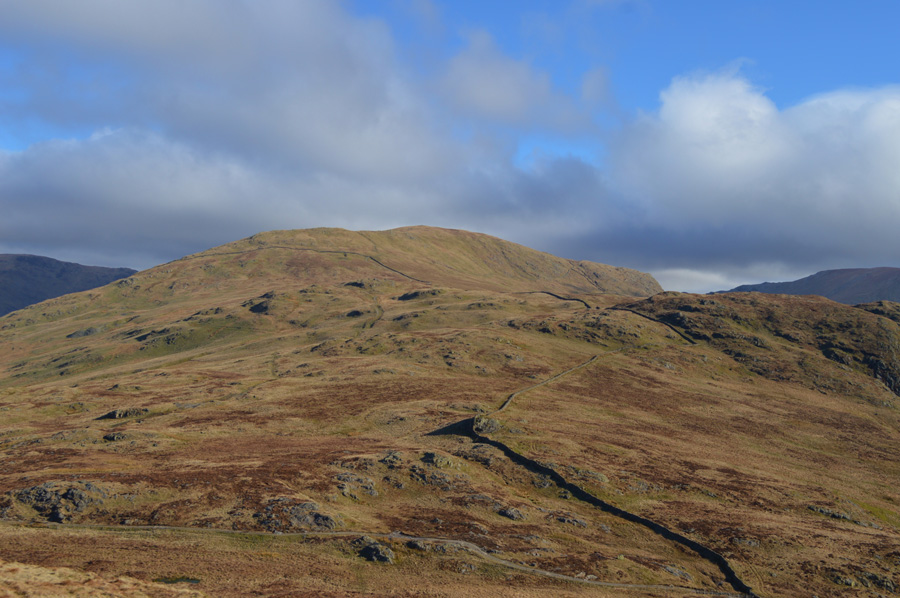
| High Steet, Kidsty Pike and The Knott from Thornthwaite Crag. |
| The summit shelter looks mighty inviting but I walk on by headlong towards my 'out and back' |
 |
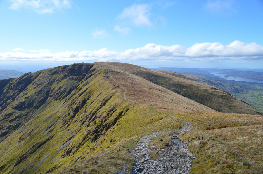
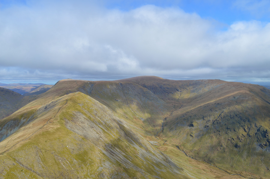
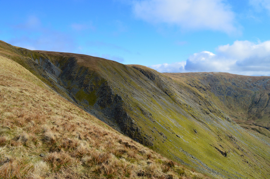
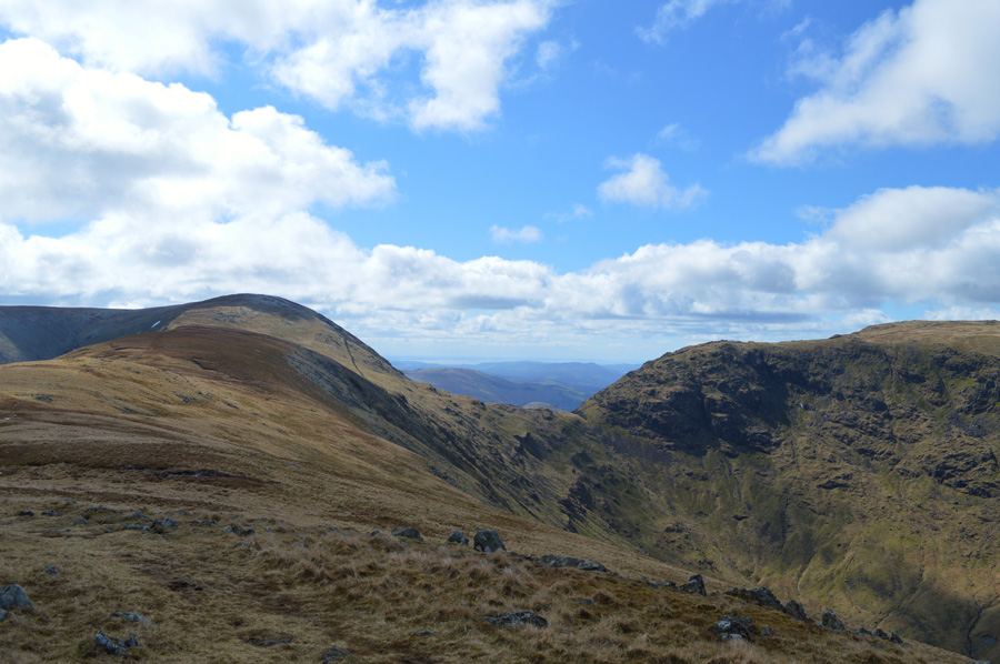
| Fantastic views along the Gray Crag ridge. |
Revealing a glimpse of Ullswater and Rest Dodd to name but a few. |
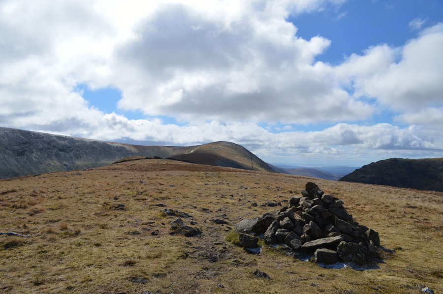 |
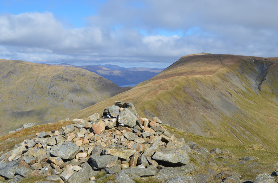
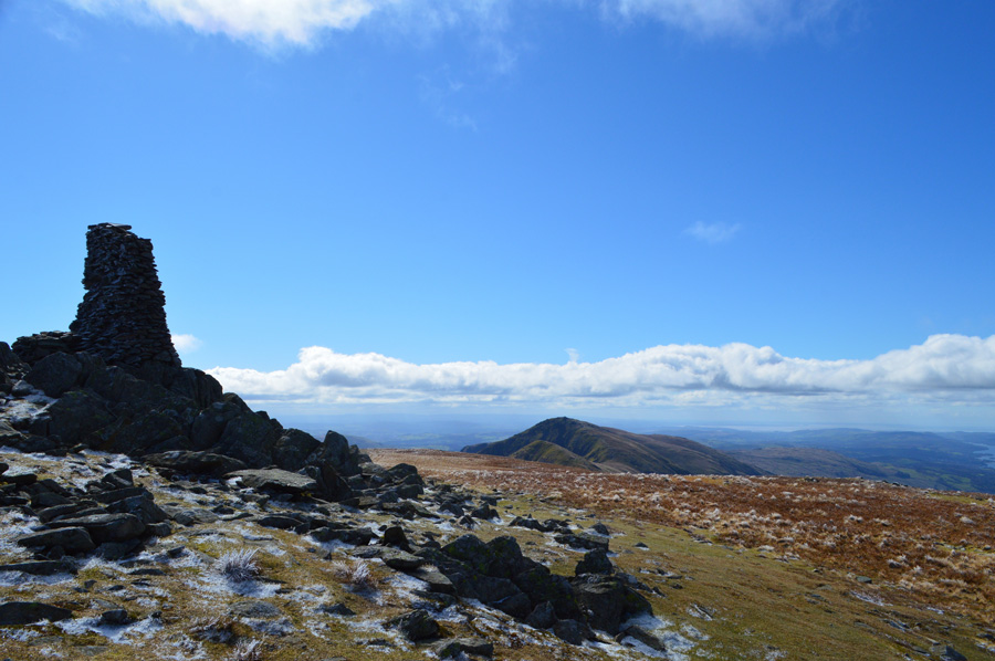
| Thorthwaite Crag and Caudale Moor (Stony Cove Pike) from Gray Crag summit. |
| It maybe an odd summit to include in todays walk but with views as good as this I down gear again perhaps as I enjoy my 'out and back' a little more than I should have, it's roughly 2.4 miles there and back and today this took me twenty five minutes to reach the summit , and thirty minutes to re-ascend back to Thornthwaite Crag by which time the wind had dropped so much I hardly noticed it which is good news because I can stop complaining about it now. |
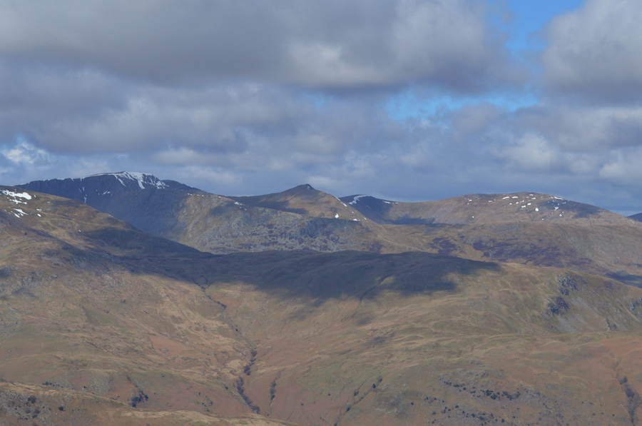 |
| Distant views over Birks towards Catstye Cam, Helvellyn and Raise. |
| The snow is slowly starting to disappear now. |
 |
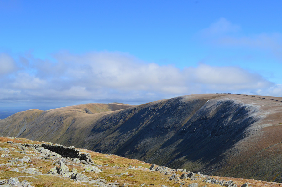
| Time to re-ascend with views over Thorthwaite Crag, Threshthwaite Mouth and Caudale Moor (Stony Cove Pike) |
| |
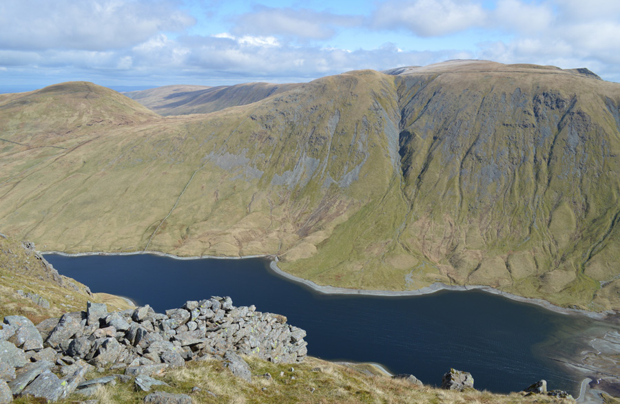 |
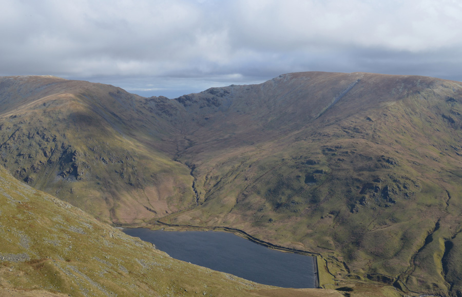
| Hayeswater, Rest Dodd, The Knott and Kidsty Pike from Gray Crag. |
| I'd like to shake the hand of the stone wall builder who built this wall which descends all the way down to Hayeswater, a man who no doubt took pride in his work, and it shows. |
 |
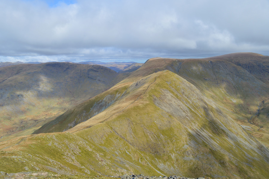
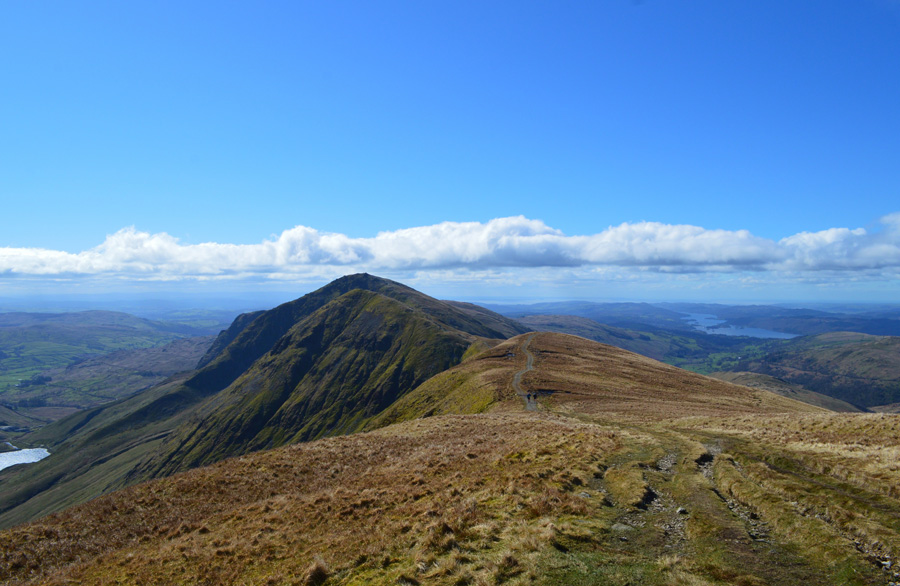
| The III Bell Ridge as I start my Thornthwaite Crag descent into the Troutbeck valley. |
I had passed two couples on route to Gray Crag and somehow, managed to over take them on my way back to Thornthwaite Crag, again I felt a little jealous of their pace which I quickly put to the back of my mind. It looked remarkably quiet on High Street which had a scattering of snow across its summit, I can only make out two people but I bet there's plenty out of view eating their lunches whilst enjoying the views.
It's now time to descend into the Troutbeck valley over on the right by means of a narrow path named Scots Rake, it's not very visible due to the strong light although the start of the path can be seen just past the last guy in this photo which is where I'm heading now. |
 |
| Troutbeck Tongue, Windermere and Wansfell Pike from the top of Scots Rake. |
| By the time I started my steep descent into the Troutbeck Valley it had started to feel much warmer and with this I told myself I would start to delayer and maybe even grab a bite to eat once I had descended into the valley, in fact, it was now so warm it made the descent feel pretty uncomfortable but I lived with it to save me stopping twice. |
 |
| Views towards Caudale Moor (Stony Cove Pike) and Threshthwaite Mouth. |
| |
 |
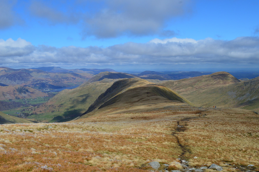
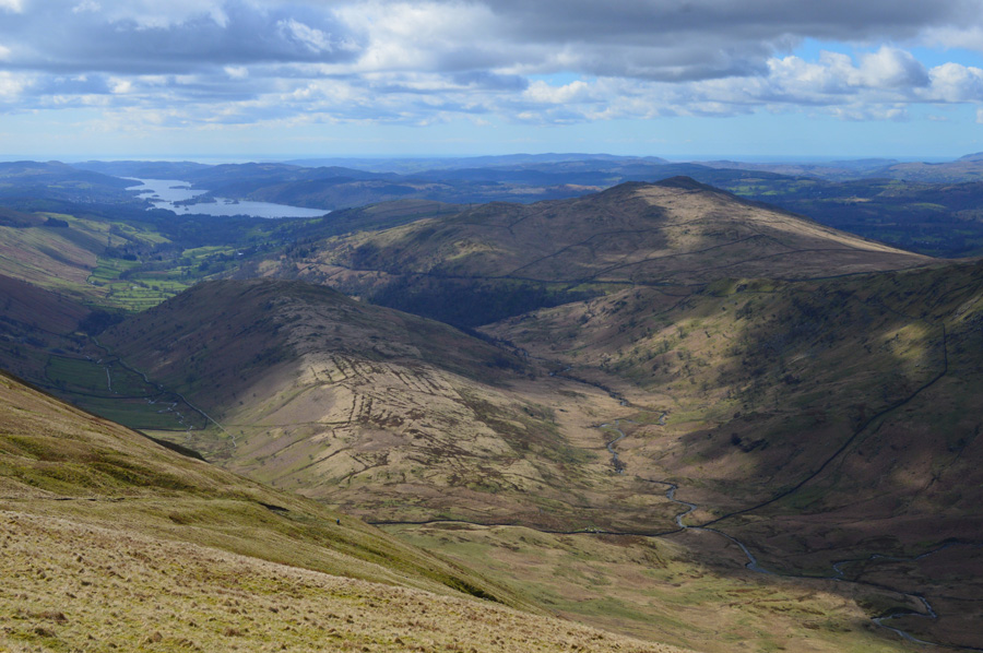
| Troutbeck Tongue and the Troutbeck Valley now lit up in glorious midday sunshine while in the distance, Wansfell Pike. |
I picked up my pace during the descent of Scots Rake soon catching this fellow up who I had been tailing which was one of the main reasons why I was starting to overheat, it's incredible in that one moment I couldn't feel my face and later, I'm boiling like a kettle. We have a brief chat at the gate found at the bottom of Scots Rake as we both seem to start de-layering while still on the move, we hadn't talked about routes more so on the weather.
I search for some dry ground struggling at first until I find a heap of boulders large enough to accommodate me and my lunch, my body was starting to tell me to refuel and to add to this I was still overheating, the moment when I finally de-layered felt like heaven enabling me to concentrate on what I regarded as the second part of the walk, Troutbeck Tongue to Wansfell Pike via the Kirkstone Pass. |
 |
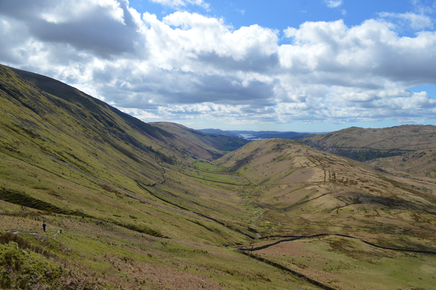
| Troutbeck Valley views towards Caudale Moor, Threshthwaite Mouth and Thornthwaite Crag. |
| Feeling refreshed and much more comfortable de-layered I strike out towards the bottom of the Troutbeck Tongue ridge, ahead the guy who I had been speaking to during the descent of Scots Rake was almost at the summit by which time it had started to cloud over a little. |
 |
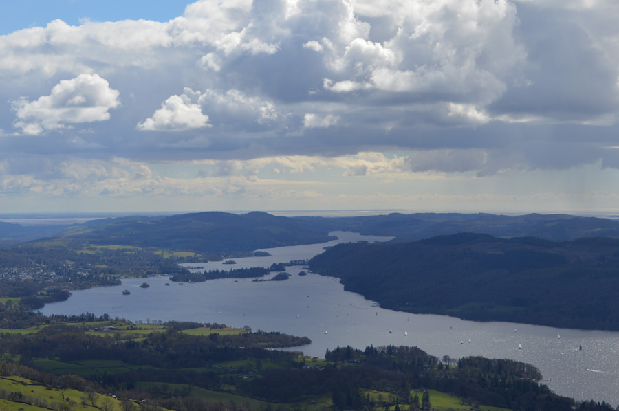
| Windermere from Troutbeck Tongue. |
| I had already passed another chap and 'afternoons' are swapped close to a gate found just over halfway across the ridge. At the summit I find the chap from Scots Rake sat down talking on his mobile phone, I make my way over to the summit cairn and tap my walking pole on one of the stones, the chap is deep in conversation and doesn't notice my presence, moments later I pick up a faint path and begin my descent through the dead Bracken towards Trout Beck. |
 |
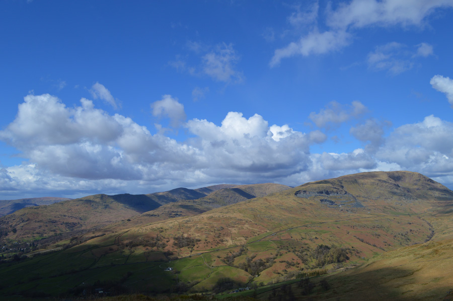
| Idle Hill and Baystones from my Troutbeck Tongue descent. |
The noise from the traffic travelling along the Kirkstone Pass brings me back into reality but all I could think about at this stage was making a safe crossing of Trout Beck and thereafter, the steep pull onto the Kirkstone Pass. My aim is to cross Trout Beck where the woodland comes to a point in the foreground of the photo, then to ascend via Woundale Beck which is unseen from here to the right edge of the woodland where I might be lucky enough to see the waterfalls.
Descent to Trout Beck was made time consuming due to the boggy nature of the area, it's an area where not many people walk meaning paths are few and far between on this side of the Beck, once at the waters edge the Beck is either narrow and deep or wide and shallow then deep, and at first I struggle to find a good crossing which I got a little frustrated with, it was no use getting this way I just needed to find a safe place to cross which came about fifty yards up stream where half a dozen stepping stones naturally laid across the river bed, the only trouble was there needed to be a seventh and a eight stepping stone but there was none, instead just a pool of water about three feet deep which if I'm careful, only one leg will need to go in.
My Gaiters held the water out and I was able to make the crossing stepping out onto the opposite bank from where a little climb out over wet grass was needed to reach the stone wall that ascended towards the Pass. Woundale Beck cascaded down the fell side directly into Troutbeck and the noise filled my ears for much of the ascent, I did manage to see the waterfalls through gaps in the trees where I found around half a dozen felled trees had formed a dam most possibly loosened from the banks of the beck caused by Storm Desmond back in December, the trees looked like match wood but in essence they were full grown trees stripped of their bark and branches.
There are two paths either side of the stone wall both as prominent as the other, the best way to ascend was by spotting the gaps in the wall which proved at any point, which side of the wall was the best to ascend by. My path sticks close to Woundale Beck and I can now see the roofs of the cars travelling along Kirkstone Pass, soon I have to break away from the Beck after spotting a gate but before that I climb over a stone wall right about the same time it started to hail, and then snow. The skies had darkened and I was still wearing my sunglasses by the time I reached Kirkstone Pass which was as busy as to be expected and I wondered what the drivers made of me, this chap having just emerged from behind a wall wearing sunglasses during a snow shower. |
 |
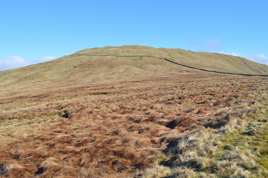
| Broad End and Hart Crag (Woundale) from my ascent on Idle Hill. |
The snow shower didn't last long and the sun came back out during my partial ascent on Idle Hill which I didn't summit, instead finding a narrow trod which flanked the summit to the east, my path although narrow and sometimes difficult to follow detoured around the lower flank of Idle Hill making ascent on Baystones much less direct, the reason for this was it was just too wet to make a crows eye ascent. By now I had passed over another stone wall and my legs were starting to feel the affects of the previous eight summits.
Idle Hill reminds me very much of Sour Howes where from the shoulder of the fell outcrops against outcrop line the ridge, making my way around and through the outcrops without having to summit them was hard work and I was left thinking that I should have made a direct ascent on Idle Hill summit rather than try to be clever trying to avoid the summit, nevertheless my hard work paid off as I spotted two people with a tripod on the summit of Baystones, and thereafter Wansfell Pike soon came into view.
I couldn't help but think that I'd made hard work of Idle Hill, much more than I needed to. |
 |
| Wansfell Pike from Baystones. |
| |
 |
| Snarker Pike and the Fairfield Horseshoe from Wansfell Pike. |
| The ridge crossing between Baystones and Wansfell Pike was busy and thankfully everyone was heading towards Baystones leaving just two people stood on Wansfell Pike summit who by the time I arrived had already started to make their way down in the direction of Troutbeck. |
 |
| Windermere from Wansfell Pike summit. |
| During the ridge crossing I told myself that I would find a nice quiet spot and take in the views while earning a much needed rest, and, that was just what I did, it was just me and the birds under a glorious afternoon sun, I couldn't ask for a better way to collect my last summit of the walk. |
 |
| Descending back to Troutbeck via Nanny Lane. |
| |
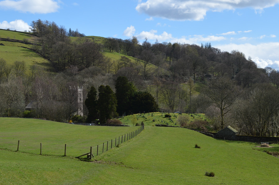 |
| Jesus Church, Troutbeck. |
The sound of new born lambs bleating accompanied my descent back into Troutbeck first taking in the narrow lonnings with views of the Mortal Man who's Beer Garden looked generously full, I too thought I had earned myself a cold one but not after spending eight hours on the fells, the last three under a warm sun. Daffodils are in bloom as I pass through the Church yard noting on the Church clock that it's exactly three thirty in the afternoon which brings my walk in at eight hours precisely .
When I first penned these walks I had in mind that spending up to eight hours on foot is the best way to enjoy Lakeland, and, by throwing in those 'out and backs' summits don't seem so silly now. |
|
| |
| Back to top |
 |
|