|
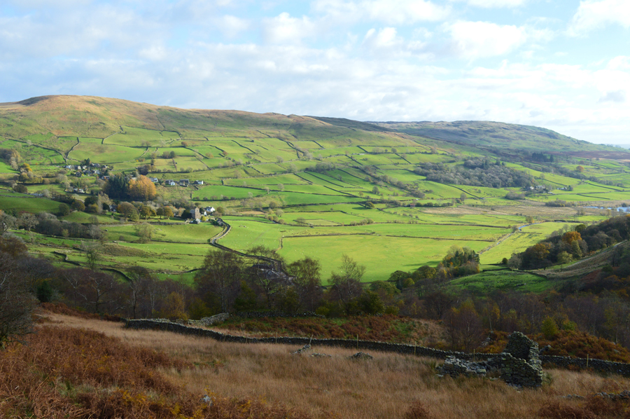
The Kentmere Valley and the Ill Bell Ridge from Kentmere Church |
 |
 |
5th November 2016 |
 |
|
I had been looking forward todays walk all week purely because it's been some time since I last walked through the Kentmere valley, a valley that I'm particularly fond of. I had been regularly checking the forecast which had remained bright all week although the forecasters had predicted it to be windy even at valley level with strong to gale force winds across the summits.
It did occur to me to change the route yet seeing as the walk I had planned had plenty of options should the summit winds get too much I decided to stick to my route despite experiencing some severe windchill across the tops.
With the wind strength predicted to drop around noon I thought it was the safer option to walk through the valley first with a warm sun on my back rather than risk being blown from the ridge but this did leave a slight complication in that if the brightness was only going to last until midmorning meaning once I was ready to take on the ridge which if the forecast was correct, I was going to lose some light which I guess is a small price to pay rather than risk being blown off the summits, a feeling that I know all too well after getting 'air borne' back in January this year, it's a feeling that I never wish to repeat if I can help it. |
|
| Wainwright Guide Book Two |
 |
| The Far Eastern Fells |
-Ill Bell
The walker who toils up the top of Ill Bell may be pardoned for feeling that he has achieved a major climb that has played a part of some consequence in mountaineering history, for he finds confronted by an imposing array of fine cairns that would do credit to a Matterhorn. |
 |
|
|
| |
|
Overview |
|
|
| Ascent: |
3,300 Feet - 1,006 Meters |
| Wainwrights: |
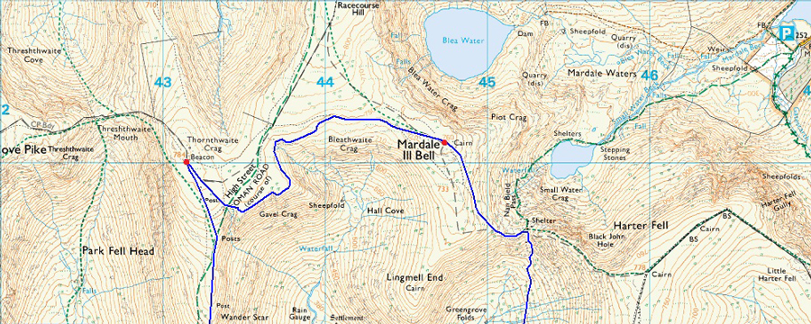
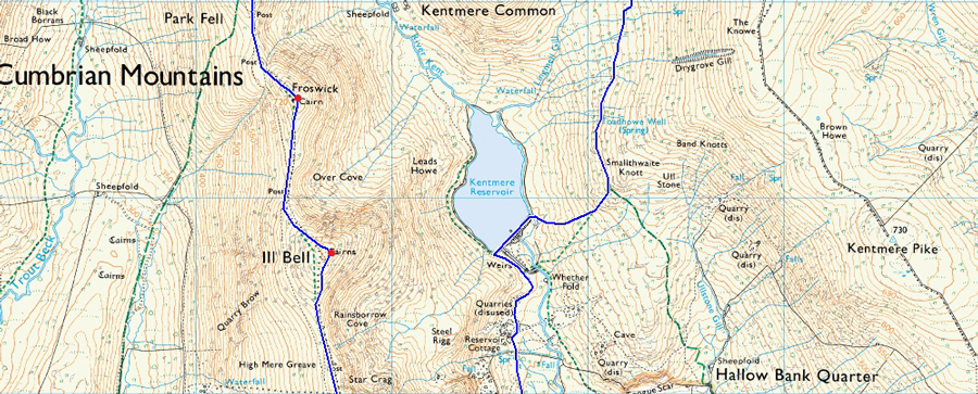
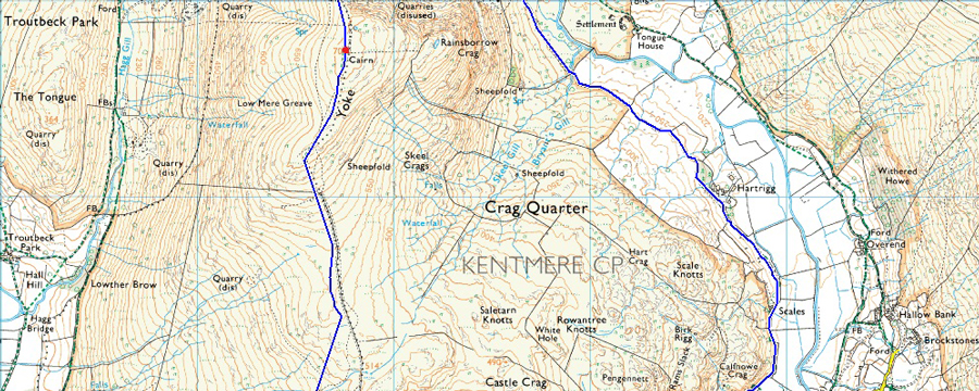
5, Mardale III Bell - Thornthwaite Crag - Froswick - III Bell - Yoke |
| Weather: |
Bright And Sunny To Start Turning Overcast. Gale Force Winds Across The Summits, Highs of 8°C Lows of 3°C Feels Like -14°C |
| Parking: |
Roadside Parking, Kentmere Church |
| Area: |
Far Eastern |
| Miles: |
11.5 |
| Walking With: |
On My Own |
| Ordnance Survey: |
OL5 |
| Time Taken: |
5 Hours 15 Minutes |
| Route: |
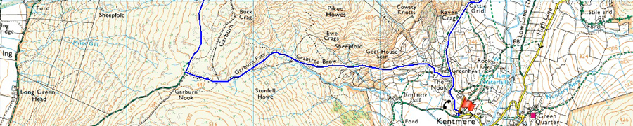
Kentmere Church - Hartrigg - Kentmere Reservoir - Nan Bield Pass - Mardale III Bell - Thornthwaite Crag - Froswick - III Bell - Yoke - Garburn Pass - The Nook - Kentmere Church |
|
| |
|
Map and Photo Gallery |
|
|
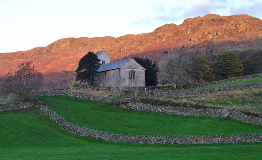 |
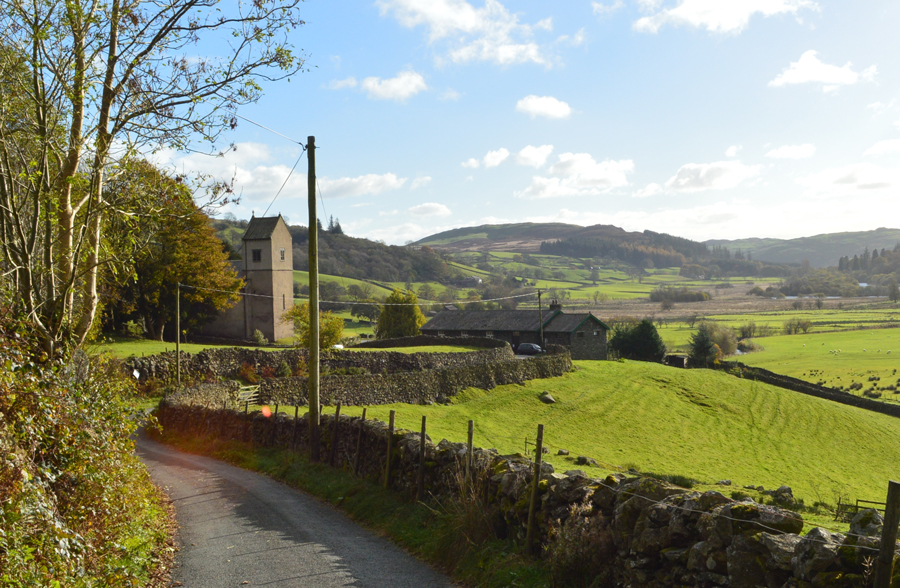
| Kentmere Church 07:50am 3°C |
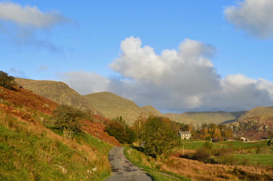
Kentmere is possibly one of the closest valleys I can get to with travel time just over an hour and a half. With this I treated myself to a lie in which saw me leave home around 06:30am arriving in Kentmere just in time for the sunrise shortly before 08:00am. I hadn't noticed any high winds at all when I took the dogs for a early morning walk before leaving home but as I drove further north I could see the trees swaying in the fields with a scatterings of leaves all over the carriage ways. Dawn had broke by the time I drove through Staveley after negotiating myself through the village, due to the bridge that crosses the River Gowan still under repair after last Decembers storms which is causing some local fury as to why the repairs are taking so long mainly because electric and sewer pipes are still to be diverted before the repairs can be completed.
The detour saw me drive though the village which I couldn't remember being sign posted at all but after one left and two right turns I soon found myself in familiar surroundings with the River Kent along side my right flank. Before I cross the Kent via another bridge I stop to remove dead wood which laid across the road although I guess anyone driving a 4x4 could have safely driven over it but I didn't want to risk it so the wood was pushed to the side. It was at the point after leaving the comforts of my warm car did I realise how bitter it felt, it's a good job I've doubled layered today which was in hindsight to the forecast.
Before I arrived at the parking spaces close to the Church I stopped my car again close to Low Bridge to take this photo as the morning sunrise which left the fell side in a wonderful afterglow. Despite it being relatively early I was a little shocked to see that there was only one parking space left which I eased the car into right opposite the Telephone Box. I didn't really pay too much attention to the car next to me until I spotted a chap sleeping in a red sleeping bag in the drivers seat which had been reclined all the way back, the guy must have heard me kitting up and soon he's stood at the side of his car yawning and stretching and a 'morning' was shared across the roof of the cars.
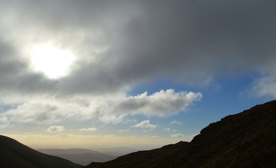
I kit up to the sound of a strengthening and bitterly cold wind which roars overhead. I waste no time in adding my hat and gloves for the first time this year yet despite this, it's bright and sunny although for how long with those winds rushing the clouds along I don't know. With the car locked I strike out towards a familiar steel gate sign posted Hartrigg. |
 |
| |
| |
 |
| A hint of sun over Kentmere Pike in the distance. |
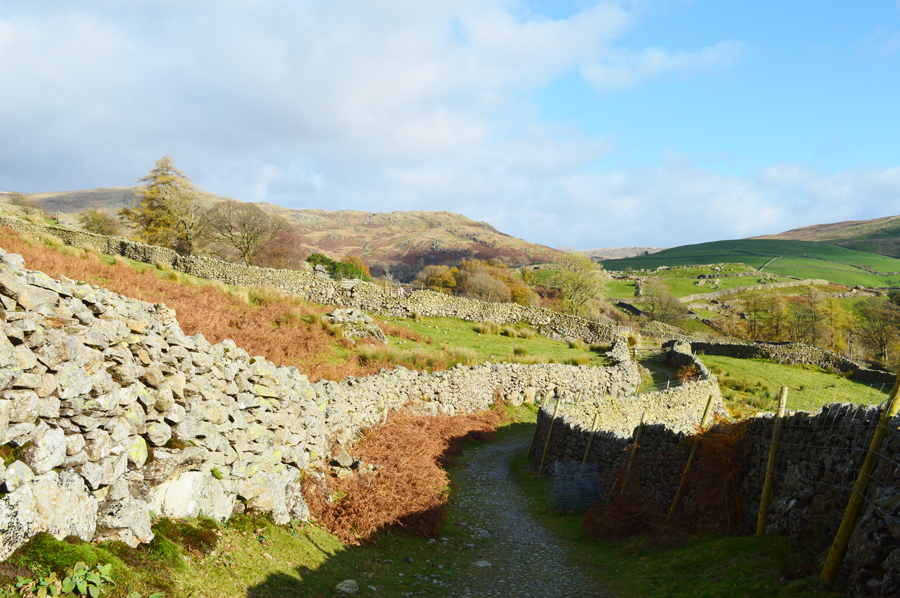
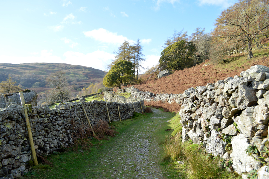
| After passing through the steel gate I pick up the access track which eases in gradient flanked by both Raven Crag and Calfhow Crag which shelter me from the winds which howl above. I wouldn't be telling the truth if I was having second thoughts right about now about climbing higher I just have to put some trust in the forecast when they say the winds will ease by midday, l do hope so. |
 |
| Scales Farm. |
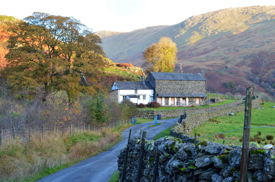
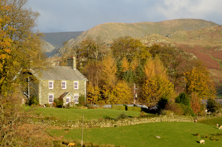
Scales Farm is the first of two farms I will pass while on route to Kentmere Reservoir. The Farm and attached Barn were built in 1890 and are now Grade II Buildings.
I press on towards Hartrigg Farm which is another mile or so into the valley by which time it looks like the sun is trying to break through right on queue. |
 |
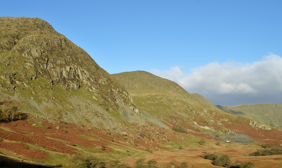
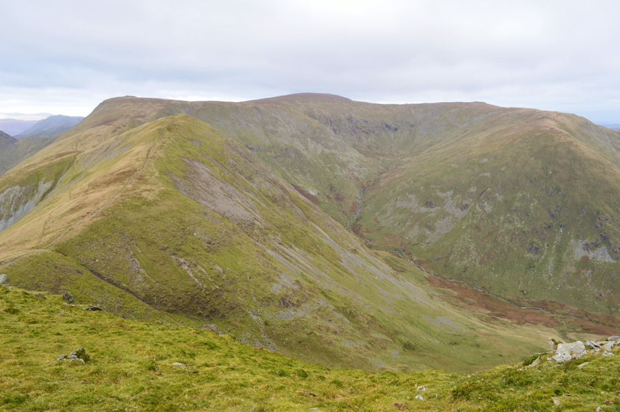
| Yoke, III Bell and Froswick affectionately know as the III Bell Ridge. |
| If ever you want that 'valley feeling' Kentmere is the perfect place to find it. That's Hartrigg Farm in the foreground with upper Kentmere beyond, to the right is Lingmell End which is still quite possibly the steepest ascent via the nose of the fell I've ever undertaken. Good times but it makes me tired just thinking about it. |
 |
| Autumn at Hartrigg Farm with Lingmell End in the distance. |
Despite having a more modern look than Scales Farm Hartrigg was built ealier around 1770 although I suspect the Farm has been modernised through the years. |
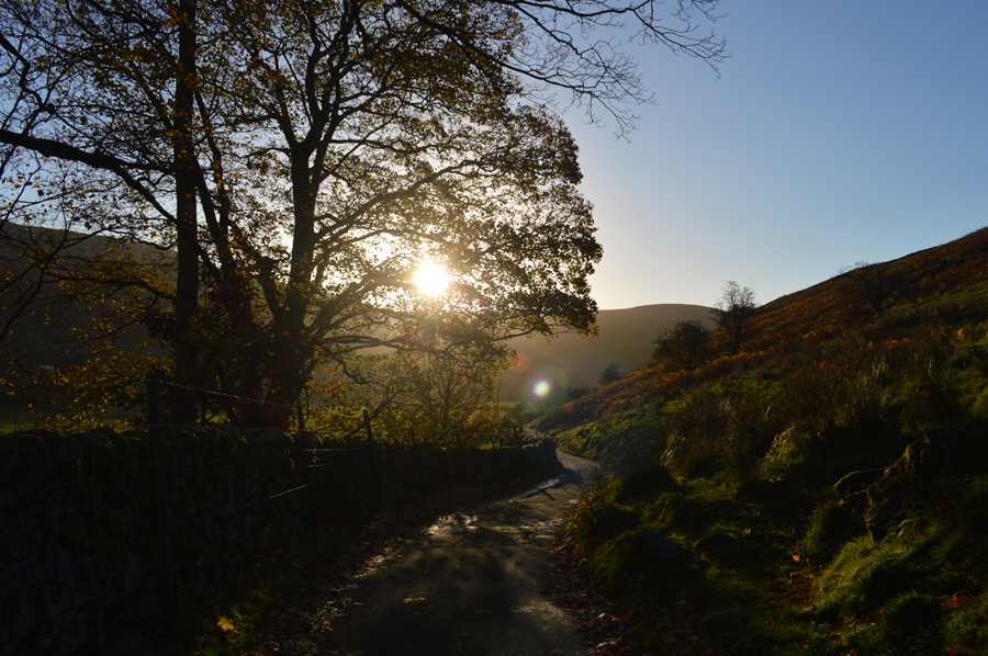 |
| Looking back along the valley as the morning sun spills through the trees. |
| I had been walking with the sun on my back which was the only thing keeping me warm as I was exposed to the elements once further into the valley at a time when the wind left my eyes and nose streaming constantly. The sun was by now creating long shadows which made picture taking difficult if I didn't want my shadow to be in the shot so I had to resort to cleverly disguising my shadow within the shadow of maybe a wall or a tree which didn't always work. |
 |
| Yoke, III Bell, Froswick and Thornthwaite Crag. |
| |
 |
| "Like the knuckles of a clenched fist" A.W |
| That's Reservoir Cottage in the distance which is where I'm heading to next, from where Kentmere Reservoir, is only a short distance away. |
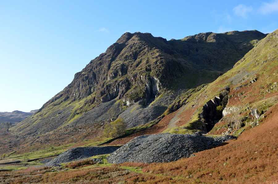 |
| The mighty Rainsborrow Crag with Yoke seen far right. |
| |
 |
| Lingmell End. |
Once past Reservoir Cottage the track climbs slightly leaving impressive sun drenched views back into the Kentmere valley which I'm unable to photograph due to the glare. Soon the Dam wall comes into view as I pass a wooden footbridge which crosses the outflow. I'll return to the footbridge later but first I want to pay a visit to the southern end of the Reservoir.
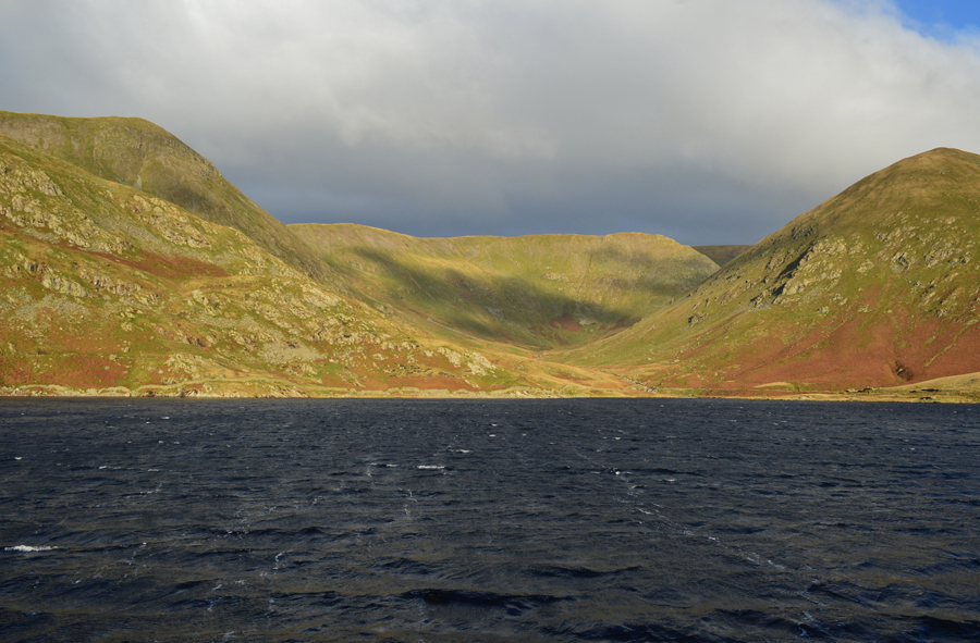
With the Reservoir reached I cast eye over the waters surface which in contrast is a deep blue as the waves crash onto the Dam wall rushed along by the ever strengthening wind. I'd have been quite happy to stay here all day and eat my sandwiches just watching the white horses break while listening to the wind but there's a ridge to be walked so I guess I should return to the wooden footbridge where it will be easier to cross the outflow rather than take my chances here at the Dam. |
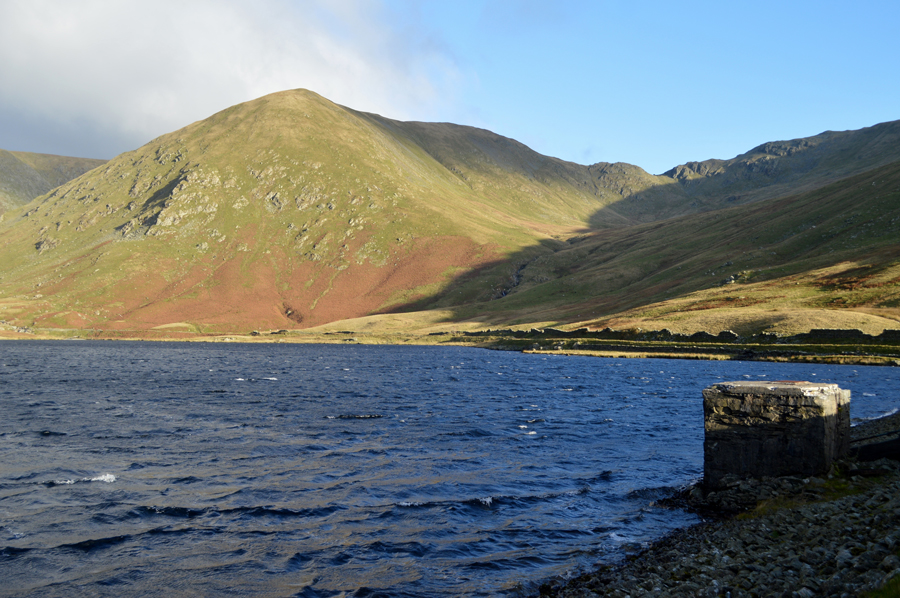 |
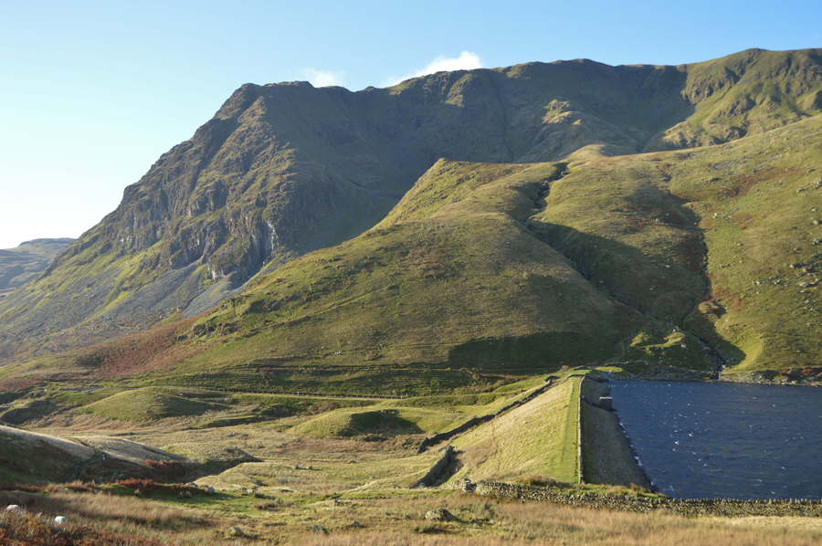
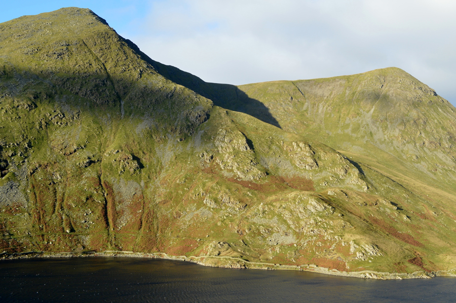
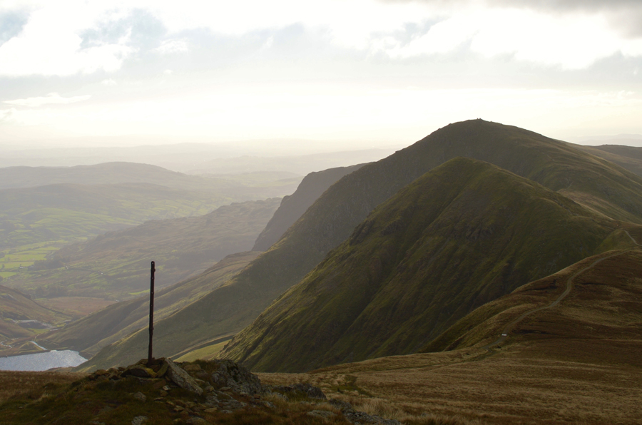
| Lingmell End seen with the top of Nan Bield Pass to the right. |
| If you look closely you can just make out the stone shelter at the top of the pass. |
 |
| Awesome display of light while watching the waves. |
| |
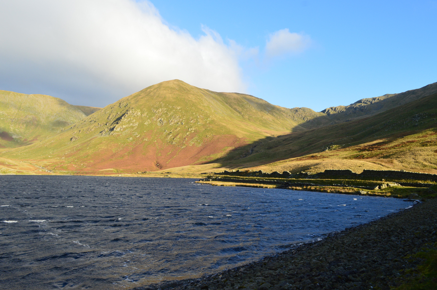 |
| Lingmell End and the top of Nan Beild Pass. |
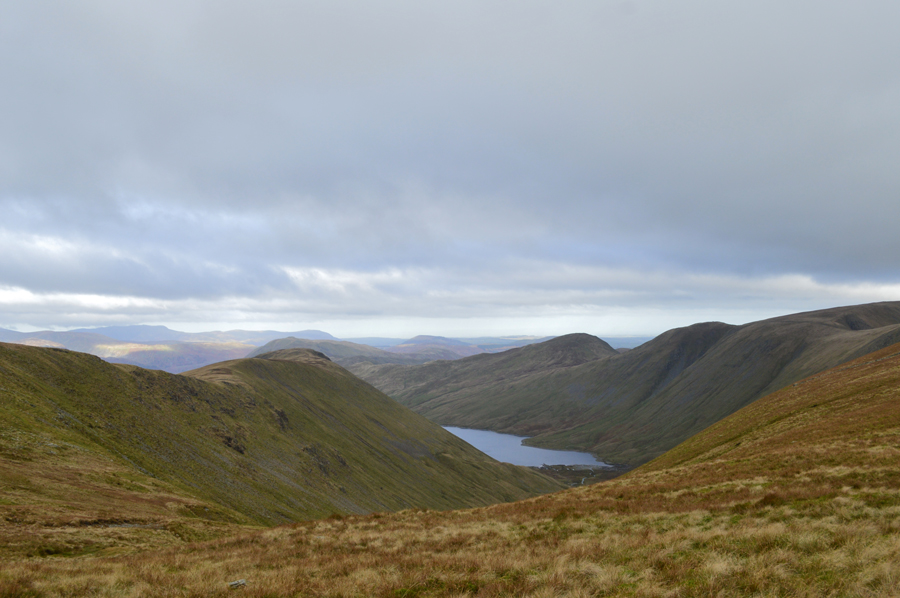
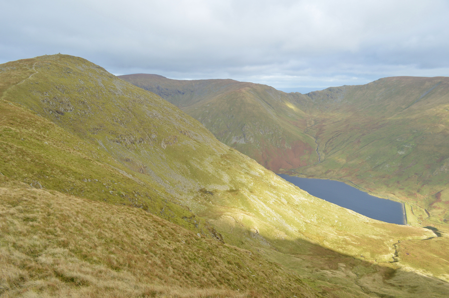
| After crossing the Dam I'm heading for the top of Nan Bield Pass which is the low depression in the right of the photograph but to get there I'm going off path to join the pass, it's going to be a short but steep climb so I muster up some strength while taking in the views. |
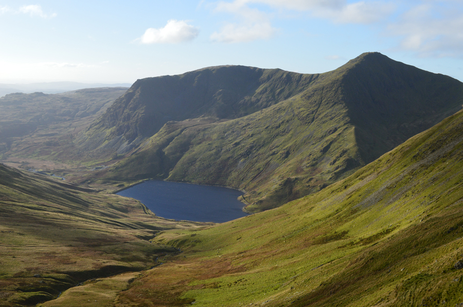
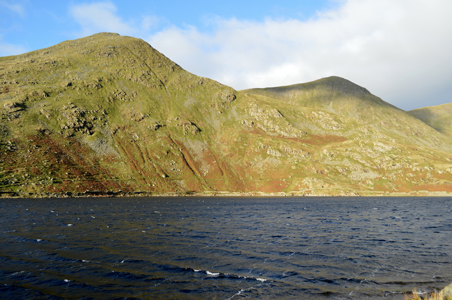 |
| Here's III Bell and Yoke seen towering over Kentmere Reservoir. |
| I'll be over there soon. |
 |
| Yoke, Rainsborrow Crag and Steel Rigg from the climb onto Nan Bield Pass. |
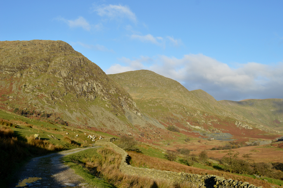
I made a direct ascent in order to gain the pass which was steep to say the least, despite taking on the III Bell ridge this section of the walk was the one I geared myself up for. My route is pathless and I take advantage of the grass as much as I can sometimes having to detour around the Bracken until I reached a narrow stream directly below Smallthwaite Knott above me which didn't appear to be getting any closer!
I use the rock in the stream bed to help which speeds up my ascent all the while stopping to capture the magnificent views just over my shoulder. |
 |
| III Bell East ridge, Over Cove and Froswick. |
| Two good reasons to stop and get my breath back. |
 |
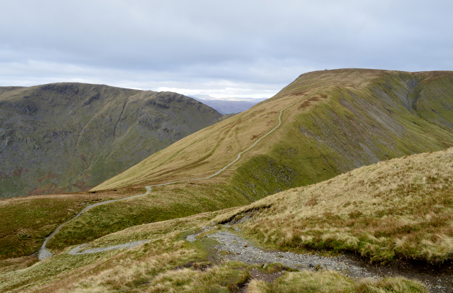
| The top of Nan Bield Pass is just ahead. |
With the top of Smallthwaite Knott reached I follow a narrow and sometimes swollen path which rises steadily before the final steep pull towards the top of the pass. It was here I experienced some significant buffering where the side of my face went almost numb due to the windchill, it was quite a painful few moments and by reckoning it's going to feel a lot colder once exposed.
Feeling very wintery indeed, I press on in good spirits. |
 |
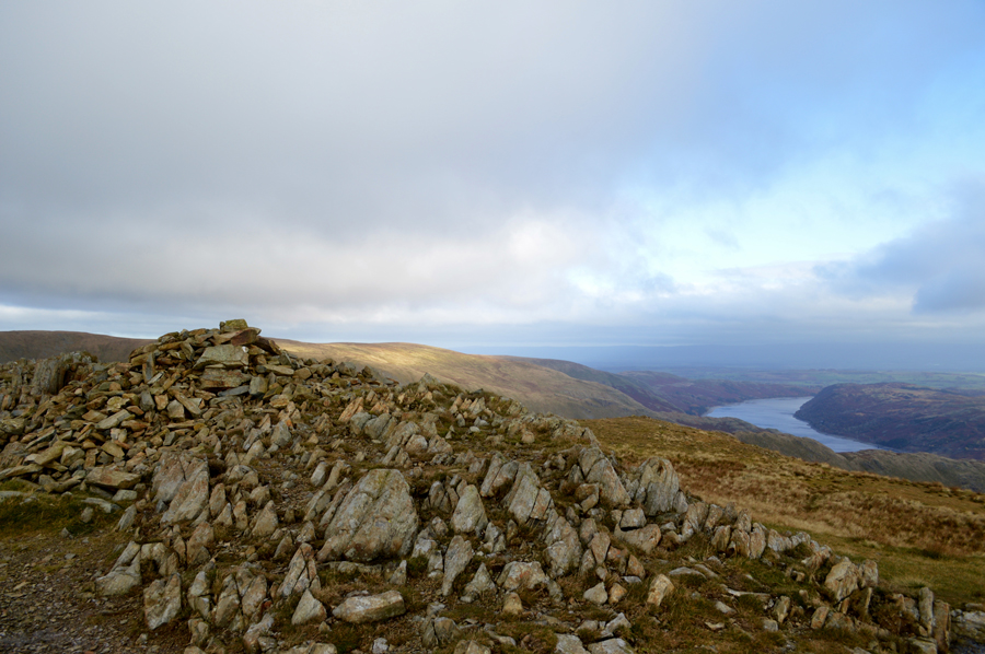
| Looking back on III Bell, Yoke and the Kentmere Reservoir from the top of Nan Bield Pass. |
I wasn't too surprised to find myself within a sudden null just below the top of the pass as the ridge above me acted as a wind break, it was here I found three sheep taking shelter along the path who took a little encouragement to move no doubt feeling snug in their shelter.
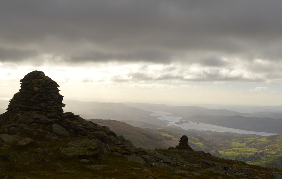
I joined the zig zags on the final approach towards the top of the pass where the wind returned with a vengeance. I had taken the liberty to make sure everything on me fastened down as a whip from a strap on chilled skin isn't very pleasant as I crested towards the shelter I took a few seconds to look down on Mardale Head where I tried to count the cars at the car park which would give me some indication if I'm likely to see anyone else this morning, it was no use though even while wearing sunglasses I could only manage to count three cars although I was certain there was more such the windchill against my face I thought it best to keep moving. |
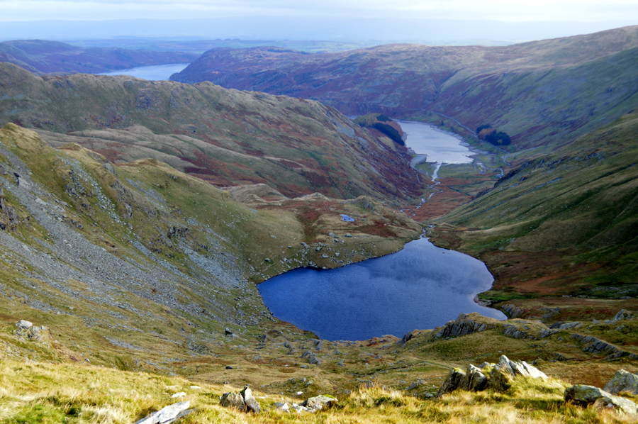 |
| Mardale Head seen below Small Water with Haweswater in the distance as I start my ascent on Mardale III Bell. |
| |
 |
| A turning poing during my ascent. |
From the top of Nan Bield Pass I began my ascent on Mardale III Bell all the while being buffered by the wind chill where once I again I found the further I ascended towards the summit shoulder the buffering eased which allowed me time to focus on the weather front which was approaching from the north. This is exactly what had been forecast and it came as no surprise with the exception that now I'm likely to be walking in low light for the remainder of the walk. If the forecast was to be correct any brightness will return after lunch by which time I'm more than likely going to be heading back to the car. |
 |
| Mardale III Bell summit |
Mardale III Bell summit was easily reached with impressive views back over Harter Fell (Mardale) It was during the ascent did I also notice that any standing water such as puddles had frozen over and Icicles had formed from the peat hags which were oozing water, a sure sign of how fresh it is across the summits but a more significant sign that winter is yet to come. |
 |
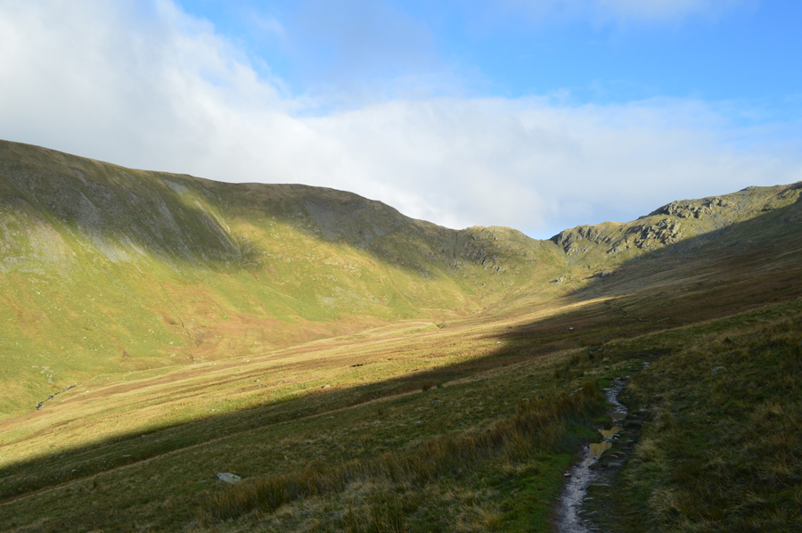
| Over the top of Hall Cove towards Thornthwaite Crag. |
From the summit of Mardale III Bell I track west where I pass over the top of upper Kentmere and Hall Cove. It had been my intention to look back on the III Bell ridge from what I consider to be its best vantage point but with the low light and increasing cloud cover I may not get the views I intended. |
 |
| Looking back on High Street, The Knott, The Nab and Hayeswater. |
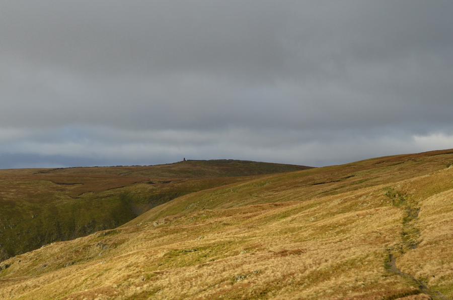
| I followed the narrow path over the top of Hall Cove as my views due to the low light were limited leaving the III Bell ridge looking very moody indeed. I track a pathless 'as the crows flies' route towards Thornthwaite Crag and soon found myself on the Roman Road while glancing back at High Street, I spot a group of walkers taking shelter behind the stone wall followed by a solo walker at Thornthwaite Crag summit who then sets of in the direction of Gray Crag, by the looks of it I may get the summit to myself although judging by how cold it feels I don't think I'm going to be hanging around for any length of time. |
 |
| A very similar shot which also includes Gray Crag. |
| |
 |
| The III Bell ridge seen with a distant Windermere from Thornthwaite Crag. |
| I was right and I did get time alone at Thornthwaite Crag summit but this didn't last long as a couple were on the approach from the direction of Threshthwaite Mouth, hands are raised as a means of a hello as trying to break into a conversation would be neon impossible! Summit time was kept brief but I did manage to take this next photo of the first snow in Lakeland... |
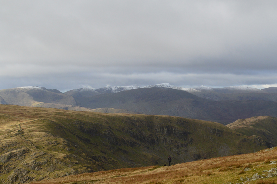 |
| The Helvellyn ridge had taken a dusting of snow over night. |
| Last year it was a little later in the month on the 21st November. |
 |
| Kentmere and the III Bell Ridge. |
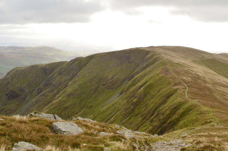
From the summit of Thornthwaite Crag I started the slight descent along the ridge towards Froswick and the III Bell Ridge by which time It would seem I'm travelling in t'other direction to everyone else where it was noted that I'd probably passed more people in the last five minutes than I had seen all morning.
I'm pleased to see the wind didn't keep everyone away. |
 |
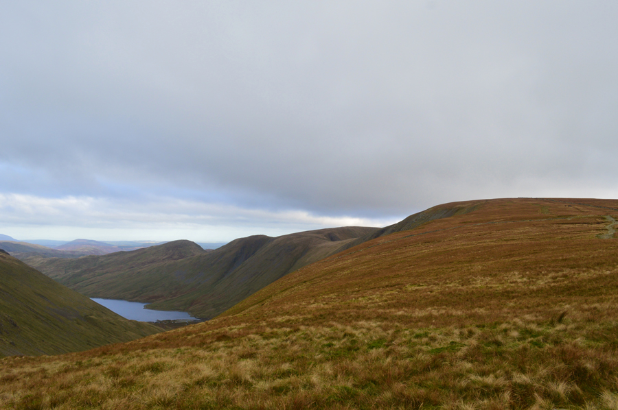
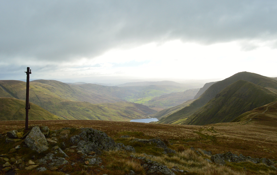
| Froswick, III Bell with the Kentmere Reservoir below. |
| |
 |
| Ascent on Froswick. |
| I guess if I was going to get tussled about by the wind it would have already happened by now at a point in the walk when I was pleased to report that the forecasters had got this one exactly right, hey presto it would seem that the wind had eased enough to enjoy the walk, but it was still mighty bitter though. |
 |
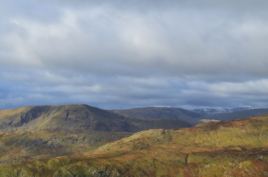
| Thornthwaite Crag and Stony Cove Pike from my ascent on Froswick. |
| From my descent from Thornthwaite Crag Froswick loomed and I told myself if only to keep the chill down I was going to run up that hill, well not exactly but seeing as I was feeling pretty good I didn't stop until I reached the summit not lifting my head for anyone who would pass me for which I I made mental apolagies for each person passed. |
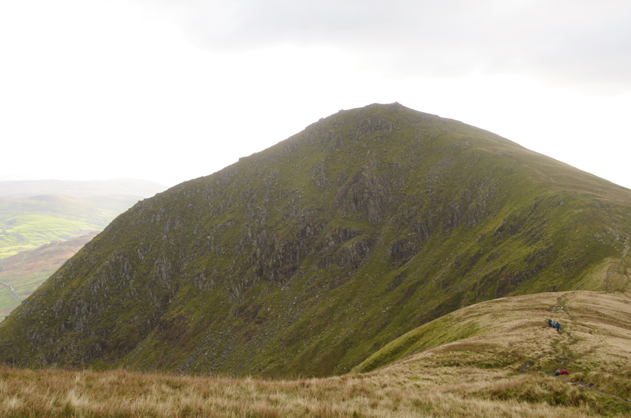 |
| III Bell. |
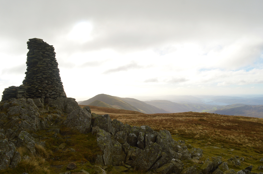
Which I didn't ascend with the enthusiasm of Froswick mainly because I'd burned myself out, but, I can forgive myself for not wanting to run up III Bell, instead opting to just take my time but I guess my legs were telling me I didn't have any choice, besides it's time to soak up one of thee best ridge walks in Lakeland, even if I can't feel my face and my nose is running like a tap.
The winter winds are here, and here to stay and I love it. |
 |
| Here looking back on Froswick and Thornthwaite Crag just below III Bell summit. |
| |
 |
| A distant Windermere from III Bell summit. |
The summit of III Bell was starting to get quite busy with groups of walkers both arriving and getting ready to descend the ridge towards Froswick. It was while at the summit did the winds remind me that they hadn't eased completely just yet while feeling the full force of a gale force wind mixed in with what the forecasters had predicted with a -14°C Windchill.
Moments earlier the only thing that occupied my mind was the sausage roll waiting to be eaten in my pack but that thought had long gone where despite the inspirational bleakness of III Bell today, I needed to descend to get out of the wind. |
 |
| Yoke seen over Rainsborrow Cove. |
| |
 |
| Red Screes and Middle Dodd seen over St Raven's Edge. |
| |
 |
| Looking back on III Bell, Thorthwaite Crag, Mardale III Bell, Lingmell End and Harter Fell. |
| Since leaving the summit of III Bell I pass more and more walkers on route towards the summit of all which bore the look of feeling chilled, some phased by this but others not. On the plus side however, the sun is now trying to break through as I stop to look back on ground covered. |
 |
| Sunny Kentmere. |
| |
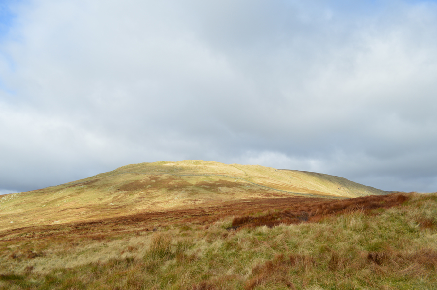 |
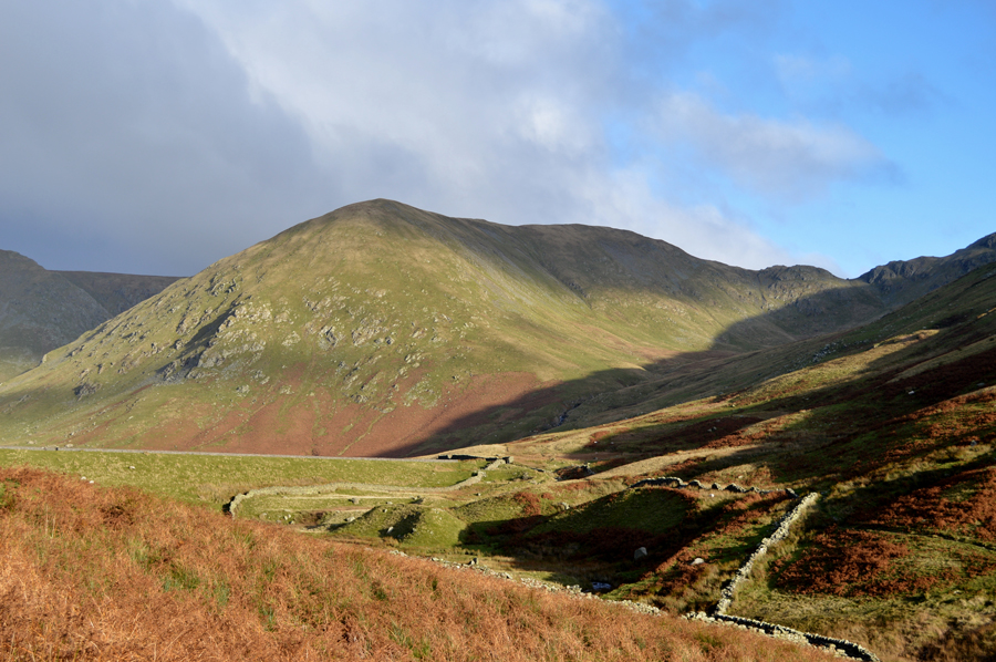
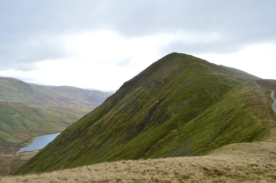
| Looking back on Yoke. |
| Before I had descended from the summit of Yoke I de-shouldered and pulled out that sausage roll that had been calling my name and enjoyed it while walking past many a walker some of whom only received muffled 'mornings' |
 |
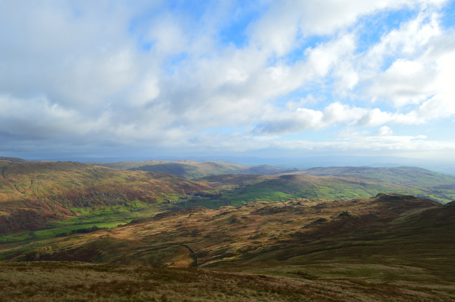
| Wansfell Pike with the Coniston Fells in the distance. |
| It's really starting to brighten up now. |
 |
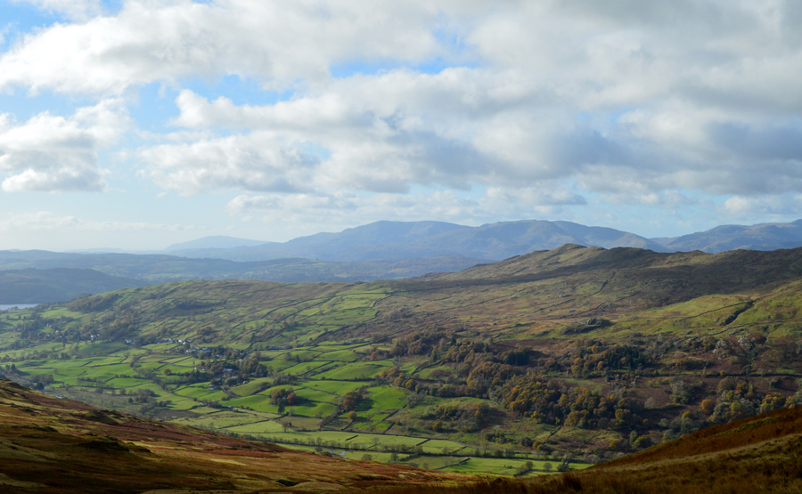
| Green Quarter over Kentmere. |
| |
 |
| Almost at the bottom of the Garburn Pass now. |
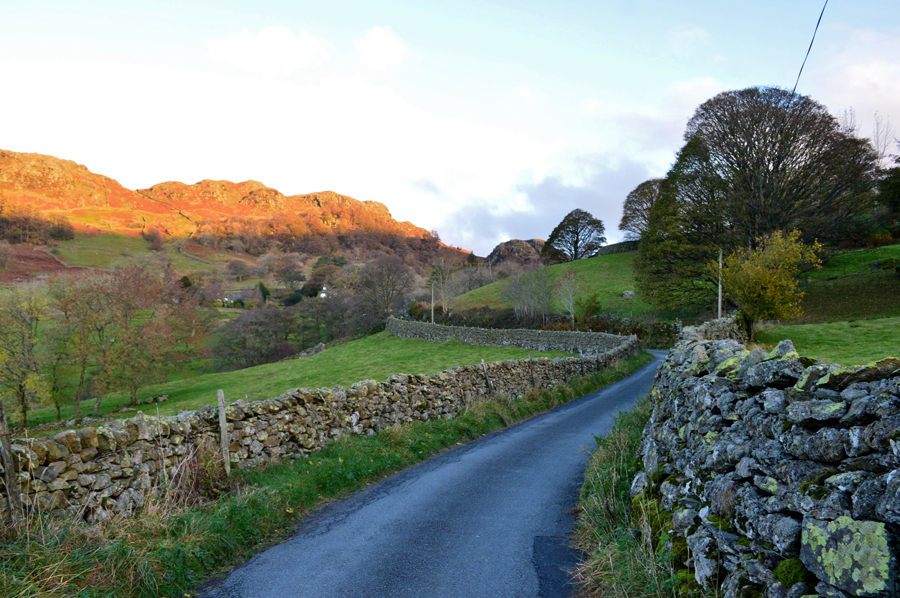
| A large herd of Cattle had congregated (they'd probably heard about my sausage roll) at the top of Garburn Pass and I was careful not to spook them as I de-toured around them before starting my descent back into Kentmere via the Garburn Pass by which time, despite not being too far away from the car I removed my hat and gloves and enjoyed my remainder of my walk with a warming sun on my back. |
 |
| Almost back in the village now where I stopped to take this photo looking back along Crabtree Brow. |
| For those with a keen eye you might be able to spot the top of Badger Rock in the left of the photo. |
 |
| Kentmere. |
My walking pace had slowed if only to enjoy the last half mile back into the village which could have been forgiven for looking and slightly feeling like it was Spring time. By the time I arrived back at the Church I decided that I'll finish the remainder of my lunch while enjoying the views which didn't work out as planned as once I had de-layered and the wind got a hold of the sweat which was now oozing out of me as a instant chill returned.
Back on Mardale III Bell I told myself that I'd look forward to whacking up the cars heater while my face tingles back to life as the sun shines through the glass of the village Telephone Box. |
|
| |
| Back to top |
 |
|