 |
Hayeswater & Gray Crag from Hartsop |
 |
 |
10th May 2014 |
 |
|
In the early part of last week I received an email from Ian ‘S’ a good friend & regular contributor to the website asking would I mind we do a walk, hopefully before the end of May to pay a last visit to Hayeswater before work gets underway to return the now redundant Reservoir back to its natural mountain tarn state. I of course jumped at the chance to witness this piece of history that will unfold over the next few years.
Hayeswater Dam was constructed back in 1908 to provide drinking water to the communities in the Patterdale area. Yet since the year 2005 a new bigger & better pipeline had been built from Haweswater thus making the Hayeswater Reservoir Redundant. The £700,000 project will begin at the end of May by first lowering the water level by two meters (six feet) which doesn’t sound a lot but this lowering of Hayeswater will make a significance difference to how Hayeswater looks as we know it today.
We both kept a watchful eye out on the forecast which was never good from the start, despite having until the end of May to visit Hayeswater I was fast running out of time with my walking diary towards the end of the month as days were limited, so, we gave ourselves the green light to do the walk, & in turn, we got a right royal soaking in the process.
Funnily enough our meet started at Preston Grasshoppers Rugby Club just outside Kirkham. |
|
Wainwright Guidebook Two |
 |
| The Far Eastern Fells |
-Gray Crag
A lofty ridge, bound by exceedingly steep flanks, extends northwards from Thornthwaite Crag with a slight curve to the west, and culminates high above Hayeswater Gill in a level platform from which on both sides, fall precipitous crags split by deep gullies.
This is Gray Crag.
|
 |
|
| |
|
Overview |
|
|
| Ascent: |
2,093 Feet, 638 Meters |
| Wainwrights: |
2, Thornthwaite Crag – Gray Crag |
| Weather: |
Overcast To Start With Heavy Rain For The Rest Of The Duration, High Winds Across The Tops, Highs Of 10°C Lows Of 9°C |
| Parking: |
Car Park, Hartsop Village |
| Area: |
Far Eastern |
| Miles: |
6.3 |
| Walking With: |
Ian Sharples |
| Ordnance Survey: |
OL5 |
| Time Taken: |
3 Hours 55 Minutes |
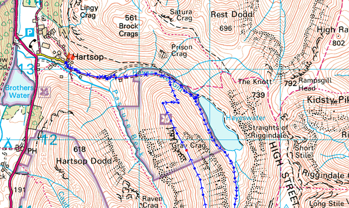
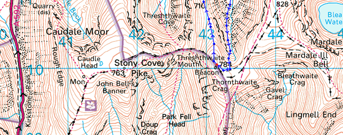
| Route: |
Hartsop – Wath Bridge – Hayeswater – Hayeswater Gill – Thornthwaite Crag – Gray Crag – Hartsop |
|
| |
|
Map and Photo Gallery |
|
|
  |
| |
| |
 |
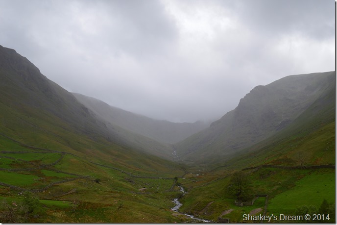
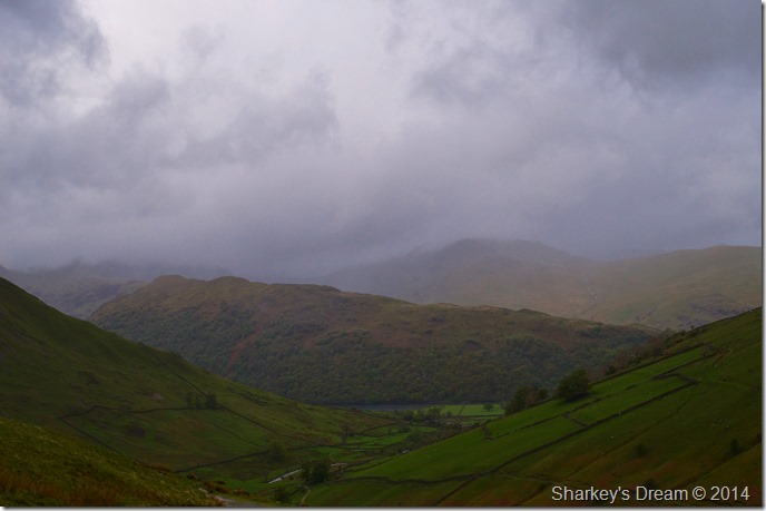
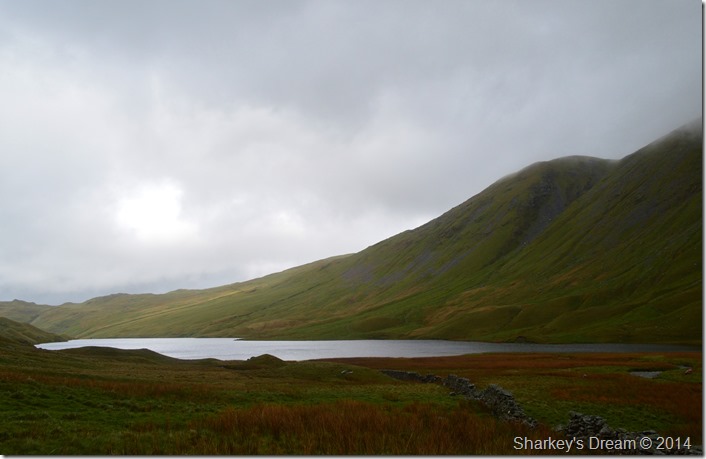
| Gray Crag & The Knott from Hartsop 12:09 10°C |
Both Ian & I arranged to meet at Preston Grasshoppers which isn’t too far from where Ian lives & only a short distance from the M6. Our meeting time of 10:45am was later than usual as were trying to avoid the forecasted showers during the early hours of the morning.
After a smile & a hearty handshake we were soon northbound heading up the M6 where we caught up on our recent walks & events, I gave Ian the option to avoid the three mile stretch of roadwork’s along the A591 by coming off at Penrith instead of Kendal thus dropping into Lakeland rather than driving through it, however Ian was pretty confident we take on the roadwork’s as they were flowing freely & he was right, we arrived in Hartsop right about midday which wasn’t too bad at all.
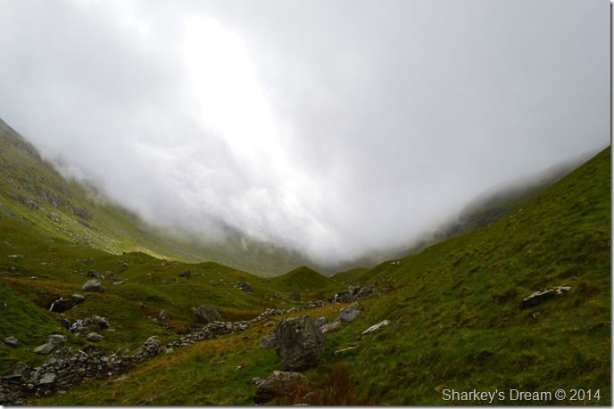
It’s quite difficult to describe what the weather was doing because as we drove over Kirkstone Pass things looked positivity clear, yet here in Hartsop despite a hint of sunshine through the lowering cloud large droplets of rain fell, as if a warning that more was on its way.
The car park at Hartsop was pretty clear given our arrival time & Ian managed to park easily despite nearly bottoming the car out in the huge pot holes that sadly litter the car park.
We kitted up whilst sat with the doors wide open as the ground was wet & muddy, the air was muggy & the wind light which gave Ian the idea to set off for now, without his jacket on. We were soon on our way passing the wooden pen from where we could see walkers heading back into Hartsop looking like drown’t rats.
Today we had a cunning about us, a cheeky grin as if we had given the rain showers the slip, we couldn’t have been more wrong.
But all that’s in a little while… |
 |
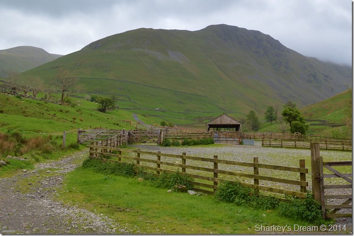
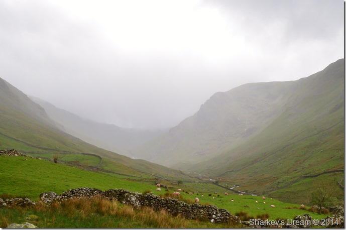
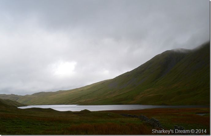
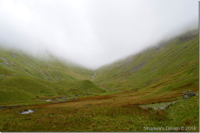
| Pasture Bottom during a heavy shower. |
Somehow & I don’t know how, but we managed to stay dry throughout all of this as the rain shower which looked liked to be heading straight for us only to disband into nothing leaving Ian & myself feeling pretty invincible.
We carry on up the track to Wath Bridge passing more walkers all heading back into Hartsop, at this stage we were not too sure how the weather will pan so conversation is turned to what might Hayeswater look like in a couple of years once the water level has been lowered & the Reservoir returned into a natural Lakeland Tarn, here we put our engineer caps on & think just how this project is going to be done.
Not before another shot of… |
 |
| That advancing shower that somehow seemed to elude us. |
| |
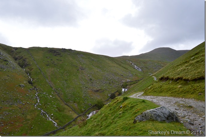 |
| A glimpse of Hayeswater Gill below with The Knott seen ahead. |
| The one thing that was more than evident was just how much water was flowing from the hill side into Hayeswater Gill, the last few hundred yards towards the Reservoir was met with the sound of audible water cascading down the many waterfalls in the Gill below. |
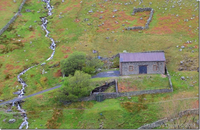 |
| The Filter House seen from the track. |
| The filter house is much a common site to Hayeswater as the Dam itself as both Ian & I wondered what Northern Utilities were going to do with the now debunked building…we agreed, it would make a great holiday cottage. |
 |
| Here, looking back on Hartsop Above How. |
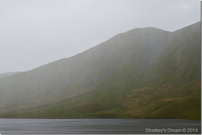
| During the last ten minutes of ascent the light & weather had begun to take a huge dip, dark cloud scurried across the sky threatening to unleash a downpour as we could see all around us bands of rain sweeping the skies, for now, we were dry & looking forward to reaching the Dam to see how the work had started. |
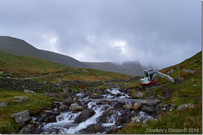 |
| The site of the new bridge crossing over Hayeswater Gill. |
We soon reached the site where construction on the new bridge would start, a natural flat bed of the Gill where what looks like the foundations for the new bridge might have already started.
You may notice on the other side of the Gill a new path has already been finished to divert walkers away from the project, I would imagine the new footbridge will be up & running over the next few weeks. |
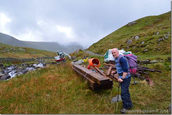 |
| Ian inspects the new bridge materials. |
| |
 |
| Now I’m no engineer… |
| Seen here is a better prospect of the new crossing of Hayeswater Gill, you may notice that this side of the river bank is much more raised than the other side, hence, is that the start of the bridge foundation seen as the pile of rock on the other side? we may be wrong but it’s still a good guess. |
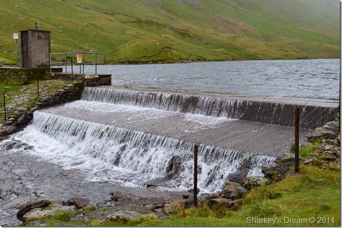 |
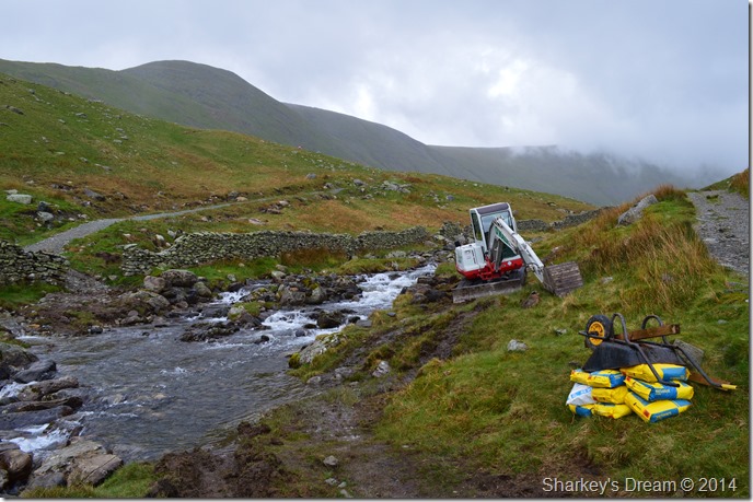
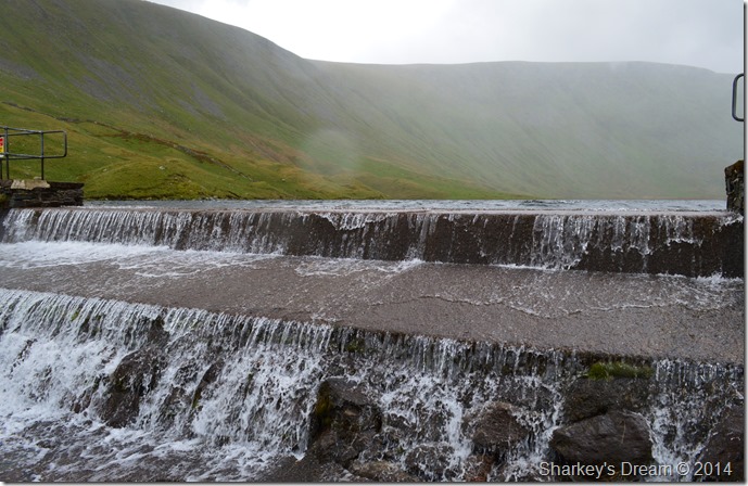
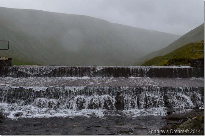
| Hayeswater Weir Dam. |
After leaving the new bridge site behind we continued the short distance until we reached the Dam where we struck our walking poles into the ground & set about a little exploration, Ian remained on the bank looking down at the Dam’s underwater foundations as I set about taking a few photos for prosperity.
It was difficult to imagine just how the project is going to work, there are so many questions to answer the main one being how will the new Hayeswater Tarn look once the work has been completed? Also on the mind of wildlife enthusiast’s are the Eels & Brown Trout that populate & migrate to & from Hayeswater Reservoir.
‘Steps will be taken to protect wildlife and the environment while work is under way, including Hayeswater’s population of Brown Trout’ a Northern Utilities spokesman said.
Lowering the level by two meters will make migration easier say conservationist.
It all sounds like things are on the up for Hayeswater but what we have to remember is non of this is going to happen over night, the project is deemed to last two years so the pleasant sight we all know & love especially when seen from the High Street ridge will be gone forever & after today, I for one, will miss it entirely.
Lets hope they get it right eh? |
 |
| |
| |
 |
| |
| |
 |
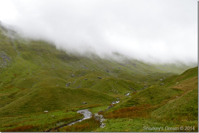
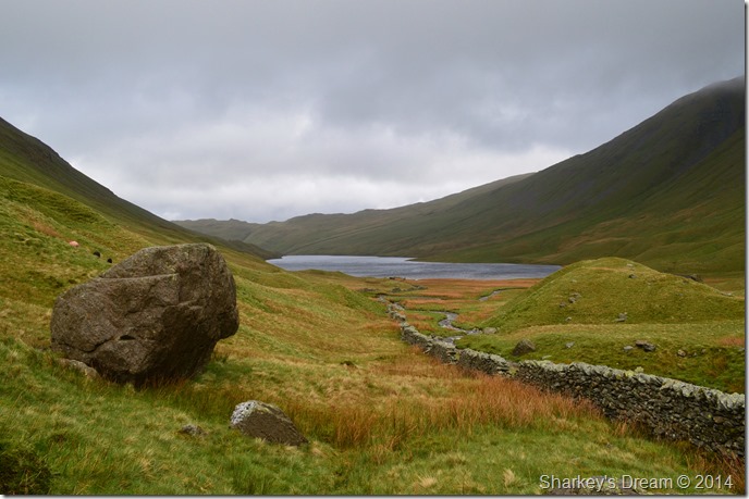
| After leaving the Dam we set off for the source of Hayeswater Gill. |
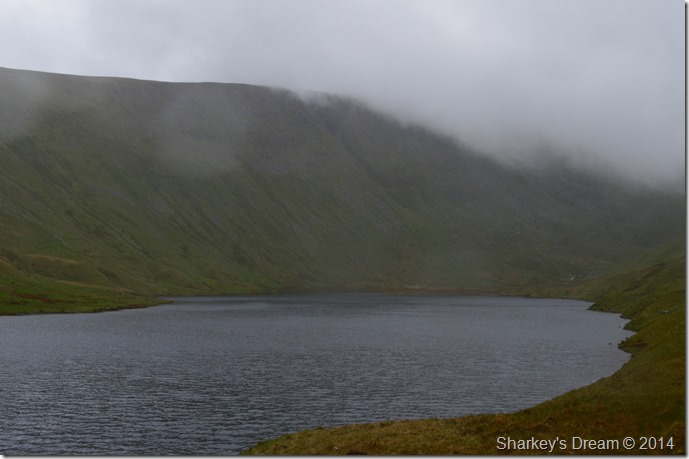
| A narrow grassy path flanks most of the circumference of Hayeswater sometimes coming close to the waters edge where we could clearly see the concrete embankment as it disappeared below the waterline (see photo below) For now it remained dry with sun spots appearing then disappearing just as quickly. |
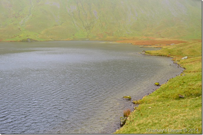 |
| Hayeswater Reservoir. |
As we neared the end of Hayeswater we spotted a guy on the other side of the embankment walking in a anti-clockwise direction around the Reservoir, he looked elderly with no pack as both our thoughts turned to ‘he must be local perhaps’ we couldn’t help but notice that the guy would have to walked through the boggy bit seen at the end of the Reservoir to reach the other side.
Definitely local, maybe paying his own homage to the Reservoir… |
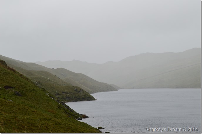 |
| Here, looking back up the Reservoir during a heavy rain shower. |
It was inevitable that we were going to get caught out sooner or later, our invisibility to escape a drenching massively decreased.
The showers while we traversed the shore path were brief but enough to tie the hoods down, some showers came & went tempting what to do whether to keep the hood up or down, the rain & wind danced beautifully across the water which was at least some conciliation to the drenching we were now receiving. |
 |
| There’s something magical watching rain sweep across a stretch of water. |
| Ian continued up the path as it began to become more & more faint while I stopped to take a few photos of the incoming showers, it’s mid May almost & although the temperature had dipped a little it wasn’t enough for hats or gloves, actually it was quite mild as the rain pelted at our exposed skin. |
 |
| After the rain showers, came light. |
| Once the first band of heavy showers had passed I caught up with Ian & suggested we take a walk through the Moraine field, here the ground underfoot was ‘bog like’ but not as bad as first thought after seeing the bloke on the other side of the reservoir moments earlier, literally ‘sit out’ the heavy showers. |
 |
| Hayeswater together with The Knott from the start of the Moraine field. |
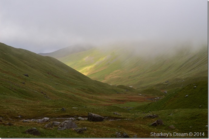
| I spotted some higher ground from where I wanted to take a couple of photos whilst looking back on Hayeswater, the Glacial Moraines common to the valley served perfectly for this as we gazed back looking at how the light was changing within the valley almost in second to second intervals. |
 |
| The Glacial Moraines mark the start of the steep ascent onto the ridge 1,000 ft above. |
The cloud blanketed the top of the ridge ahead & spilt over into the valley obscuring the full ascent of the steep climb ahead, which when I think back, may not have been a bad thing after all.
The Moraine field was much easier to negotiate than I first thought as we managed to flank them via side tracks or just by using the lay of the land ahead, as fascinating as the Moraines were we both knew that we had an incredibly steep climb ahead of ourselves.
But at this moment in time it was too difficult not to keep looking back over ones shoulder… |
 |
| I’m not too sure if I like things just the way they are. |
| |
 |
| Every now the sun would come out spilling light across the valley floor. |
We soon picked up the stone wall which we followed as it flanked Hayeswater Gill through the Moraine field, eventually the stone wall got less substantial than seen here, this owing to the fact that we had started the climb out of the valley.
Footnote
Moraines are made up of rock & soil debris left behind by retreating Glacier’s that covered & shaped the Lake District as we know it today, the boulder you see in this photograph could well be over two million years old. |
 |
| The sun tries to break through as we start our ascent. |
| This was one of the most promising & encouraging moments during our time here at Hayeswater Gill although at the time we never spoke of it. Here the sun tries to break through the cloud illuminating the Moraines momentarily while at the same time giving us a glimpse of hope that we had seen the last of the showers. |
 |
| Cocooned by cloud. |
| The cloud spectacle was massively uplifting & lifted our soaked spirits immensely. Here we have to negotiate what looks like to be a dry Tarn via the right at first, then only realising that the pair of us was by now almost up to the tops of our boots in water, did we then decide, give in, & ploughed straight through as the crow would fly. |
 |
| Beyond the Moraines & boulders, one defiant last show of light. |
It is quite difficult to put into words just how much the weather changed over the next half hour, indeed the whole duration of the steep climb was fought against horizontal rain & wind so strong it was almost enough to knock a man off his feet.
Such the intensity of the ascent at times we stopped for cover behind grassy ridges that form the last part of the ascent, on a number of occasions I felt the call to return down until I heard Ian shout over the wind ‘Id rather be doing this than flagging the back garden – which is exactly what I should be doing right now’! We laughed, we had too, there was no other way to describe that half hours ascent other than horrendous & I at this time would like to thank Ian for the jokes that made it possible. |
 |
| Topping out on the ridge (or what you can see of it) |
As we crested the ridge I uttered ‘I feel like I’m carrying another man’ such the pain in my legs, not caused by the steep ascent but possibly by the past weeks events catching up on me, my ascent was slow, much slower than Ian’s who hadn’t walked for two weeks. it showed.
I apologised to Ian for my slow progress & I think I got told to shut up or some kind gesture that made my awkwardness a little easier to handle, after covering just under 9,000 feet & 35 miles over the last seven days, I think I’m starting to show my age, in fact I know I am!
It’s now time to feed the bellies. |
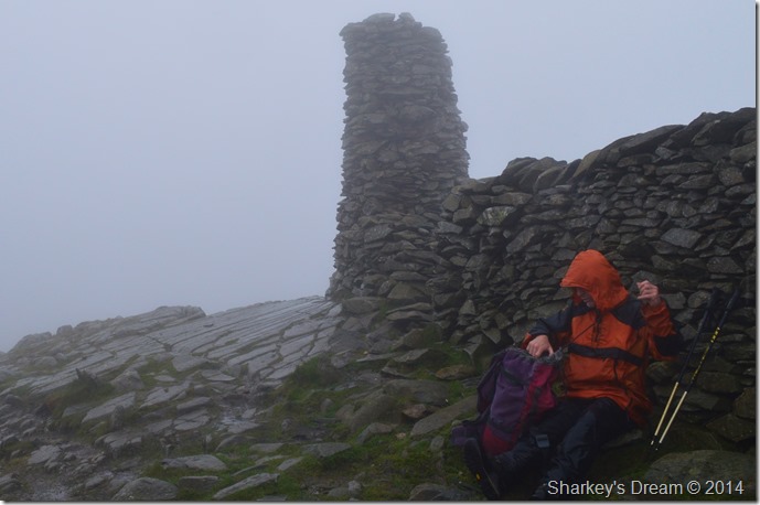 |
| At Thornthwaite Crag. |
The march from the top of the ridge brought my legs back to life & thankfully they started to feel much better quite quickly. Thornthwaite Crag slowly appeared through the thick intensity of the cloud where we took shelter from the strong winds behind summit wall, here the wind swept the water above our heads while we tucked into our late lunches.
From out of no-where a young girl appears in between the Beacon & the wall, she adjust herself looking like she’s just stepped out of the washing machine on full cycle, hello we say, she smiles & says Hi back…its odd I thought, to see a young girl on her own when out of the blue her partner literally flew in from the same direction, we could only guess that the wind had swept him off his feet as he toppled over looking much the same as his girlfriend.
I don’t think either of them expecting to find us at the summit, nor us them, not in these conditions anyway.
We spoke about our routes & the girl suggested she’d quite like to make her way to Rest Dodd & Brock Crags – I didn’t say nothing at first but thought this is just crazy in these conditions ‘that’s a bit of a tall order I chip up’ mmm, we’ll just have to see she says as I glance at the boyfriend who looks like he hasn’t recovered from literally being blown in on the summit.
They followed us off the hill. |
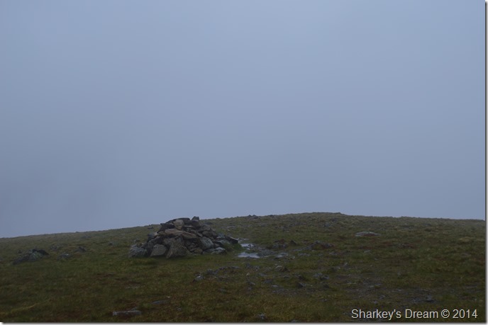 |
| Gray Crag summit cairn. |
| Both Ian & I crossed the ridge whilst being buffered from one side of the ridge to another, this doesn’t stop the conversation which was great for morale even in such a short walk. The outlines of the ridge would appear when one of us would shout ‘look’ by the time the other person looked the view had gone until the next time. Despite the lack of views & the weather the crossing of Gray Crag was a highlight of the whole walk. |
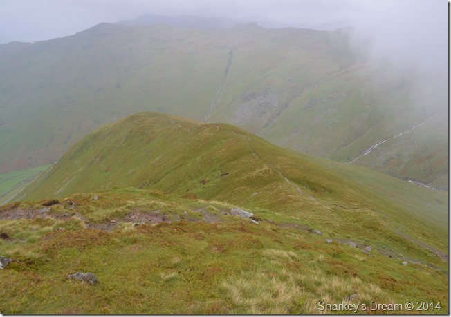 |
| Gray Crag descent. |
| The rain had stopped & the cloud had lifted by the time we reached the end of the ridge to make our decent, Ian was more than pleased that we were using the less steep descent path rather than the one he is more used to ‘via the nose of the fell’ we zig-zag our way down stopping only to catch a brief glimpse of sunlight across Brothers Water & Dovedale, they were brief but uplifting considering that we had just been walking in cloud for the past couple of hours. |
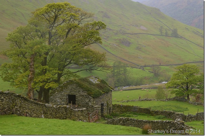 |
| The old Barn close to Pasture Bottom. |
By the time we were back on the track that we had left just hours earlier more sporadic sun spots lit up the valleys but more momentarily as it was easier just to witness them, rather than reach for the camera which by now was starting to look a little worrying given the amount of water it had taken during the last few hours.
We strike up conversation with a young lad from Bournemouth carrying a fishing pole, despite the lashing he had just taken whilst trying to fish for Trout at Hayeswater he’s in good spirits as we talk & walk all the way back into Hartsop.
Ian unlock’s his car & produces a flask of hot tea ‘no sugar’ do you want a cup Paul? I’m alright thanks Ian, you sure? ahh go on then, the jackets are taken off as the steam from wet clothing mixed with sweat escapes the base layers, we both look up at Gray Crag which by this time is free from cloud & has the start of a blue sky starting to appear over it.
Bloody typical we laughed. |
|
| |
| Back to top |
 |
|
