 |
Nab Scar |
 |
 |
Map and Photo Gallery |
 |
|
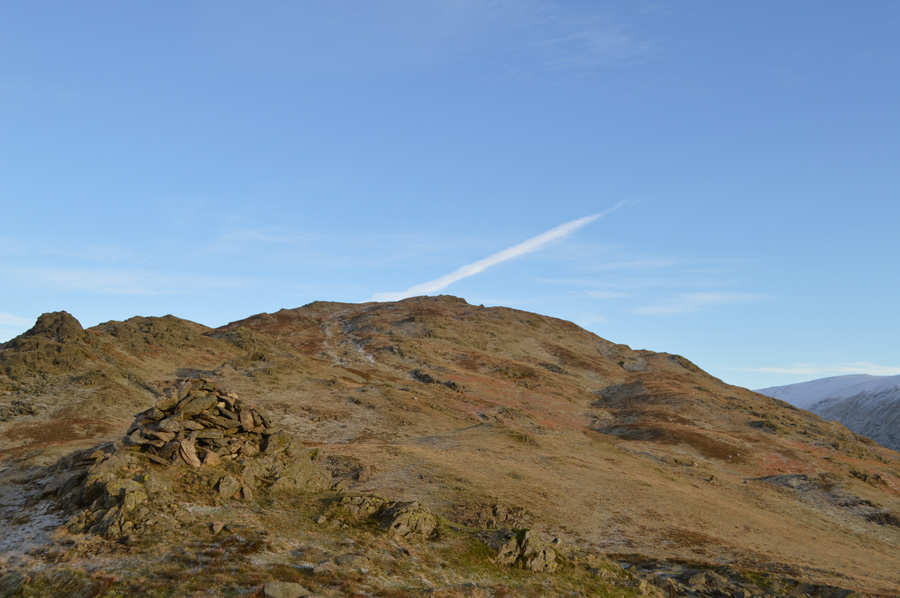 |
| Heron Pike from Nab Scar summit cairn |
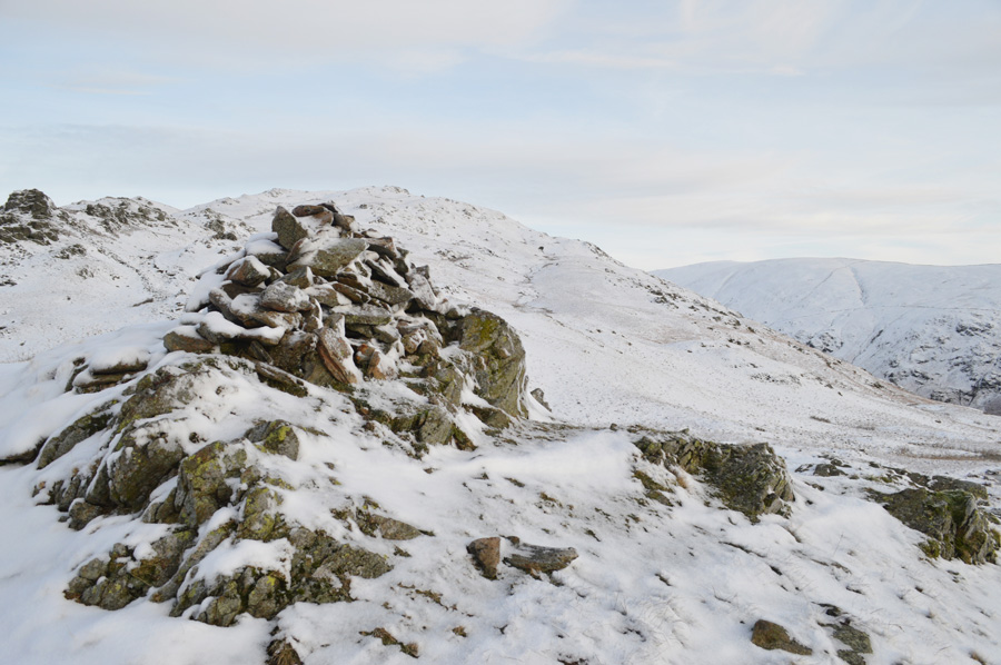 |
| Nab Scar summit cairn. |
|
| |
|
There are 12 walks to choose from including Nab Scar |
|
|
The Fairfield Horseshoe |
|
|
 |
|
13th March 2025 |
| ASCENT: |
3,356 Feet - 1,024 Metres |
| MILES: |
10 |
| WAINWRIGHTS: |
8, Nab Scar - Heron Pike - Great Rigg - Fairfield - Hart Crag - Dove Crag - High Pike - Low Pike |
| ROUTE: |
Rydal Church - Rydal Mount - Nab Scar - Heron Pike - Erne Crag - Rydal Fell - Great Rigg - Fairfield - Link Hause - Hart Crag - Dove Crag - High Pike - Low Pike - Low Sweden Bridge - Rydal Park - Rydal Mount - Rydal Church |
|
| |
|
Nab Scar to Stone Arthur from Rydal |
|
|
|
|
24th February 2024 |
| ASCENT: |
2,424 Feet - 739 Metres |
| MILES: |
6.5 |
| WAINWRIGHTS: |
4, Nab Scar - Heron Pike - Great Rigg - Stone Arthur |
| ROUTE: |
Rydal Mount - Nab Scar - Heron Pike - Erne Crag - Rydal Fell - Great Rigg - Stone Arthur - Greenhead Gill - A591 - Grasmere - A591 |
|
| |
|
The Fairfield Horseshoe |
|
|
|
|
17th April 2022 |
| ASCENT: |
3,356 Feet - 1,024 Metres |
| MILES: |
10 |
| WAINWRIGHTS: |
8, Nab Scar - Heron Pike - Great Rigg - Fairfield - Hart Crag - Dove Crag - High Pike - Low Pike |
| ROUTE: |
Pelter Bridge - A591 - Rydal Mount - Nab Scar - Heron Pike - Rydal Fell - Great Rigg - Fairfield - Link Hause - Hart Crag - Dove Crag - High Pike - Low Pike - Low Sweden Bridge - Rydal Park - Rydal Mount - A591 - Pelter Bridge |
|
| |
|
Fairfield to Nab Scar from Grasmere |
|
|
|
|
13th January 2018 |
| ASCENT: |
3,051 Feet - 930 Metres |
| MILES: |
7.6 |
| WAINWRIGHTS: |
4, Stone Arthur - Great Rigg - Fairfield - Nab Scar |
| ROUTE: |
A591 - Greenhead Gill - Stone Arthur - Great Rigg - Fairfield - Great Rigg - Heron Pike - Nab Scar - Alcock Tarn - Michael's Fold - A591 |
|
| |
|
Nab Scar, Alcock Tarn and Loughrigg Fell |
|
|
|
|
24th September 2017 |
| ASCENT: |
2,572 Feet 784 Metres |
| MILES: |
6.2 |
| WAINWRIGHTS: |
2, Nab Scar - Loughrigg Fell |
| ROUTE: |
Rydal Church - Nab Scar - Allcock Tarn - Brackenfell Wood - A591 - Loughrigg Terrace - Loughrigg Fell - Loughrigg Cave - Rydal Water - Rydal Church - Rydal Hall - Rydal Church |
|
| |
|
Walking the Wainwrights in 30 Walks - Walk 3 The Fairfield Horseshoe |
|
|
|
|
14th February 2016 |
| ASCENT: |
4,436 Feet - 1'352 Meters |
| MILES: |
13 |
| WAINWRIGHTS: |
9, Nab Scar - Heron Pike - Stone Arthur - Great Rigg - Fairfield - Hart Crag - Dove Crag - High Pike - Low Pike |
| ROUTE: |
Pelter Bridge - A591 - Rydal Mount - Nab Scar - Heron Pike - Greenhead Gill - Stone Arthur - Great Rigg - Fairfield - Hart Crag - Dove Crag - High Pike - Low Pike - Low Sweden Copice - Rydal Park - Rydal Mount - A591 - Pelter Bridge |
|
| |
|
Nab Scar, Alcock Tarn and Loughrigg Fell |
|
|
|
|
13th December 2015 |
| ASCENT: |
2,621 Feet - 799 Meters |
| MILES: |
8 |
| WAINWRIGHTS: |
2, Nab Scar - Loughrigg Fell |
| ROUTE: |
Rydal Church - Nab Scar - Allcock Tarn - Brackenfell - Old Coffin Route Rydal Church - Rydal Water - Loughrigg Terrace - Loughrigg Fell - Loughrigg Caves - Rydal Hall - Rydal Church |
|
| |
|
The Harry Griffin 2,000 footers Walk 17 -The Fairfield Horseshoe |
|
|
|
|
20th June 2015 |
| ASCENT: |
3,558 Feet - 1,085 Metres |
| MILES: |
11.3 |
| SUMMITS OVER 2,000 Ft: |
10, Dove Crag - Hart Crag - Fairfield - Great Rigg - Rydal Fell (NY 356 095) - Rydal Fell (NY 356 093) Rydal Fell (NY 356 092) - Rydal Fell (NY 356 091) - Erne Crag - Heron Pike |
| ROUTE: |
Miller Bridge – Rothay Park – Ambleside – Nook Lane - Nook End Farm - Low Sweden Bridge - Low Pike - High Pike – Dove Crag – Hart Crag – Link Hause – Fairfield – Great Rigg – Heron Pike – Erne Crag - Nab Scar – Rydal Hall – Rydal Park – Scandale Bridge – Ambleside – Miller Bridge |
|
| |
|
An alternative Fairfield Horseshoe |
|
|
|
|
29th November 2014 |
| ASCENT: |
4,500 Feet – 1,372 Meters |
| MILES: |
13.8 |
| WAINWRIGHTS: |
8, Red Screes – Little Hart Crag – Dove Crag – Hart Crag – Fairfield – Great Rigg – Heron Pike – Nab Scar |
| ROUTE: |
Miller Bridge – Rothay Park – Ambleside – Kirkstone Road – Snarker Pike – Red Screes – Scandale Pass – Little Hart Crag – Bakestones Moss – Dove Crag – Hart Crag – Link Hause – Fairfield – Great Rigg – Heron Pike – Nab Scar – Rydal Hall – Rydal Park – Scandale Bridge – Ambleside – Miller Bridge |
|
| |
|
Making the most of it, Stone Arthur to Elterwater |
|
|
|
|
21st September 2013 |
| ASCENT: |
3,097 Feet, 944 Meters |
| MILES: |
13.5 |
| WAINWRIGHTS: |
4, Stone Arthur – Great Rigg – Heron Pike – Nab Scar |
| ROUTE: |
A591 – Stone Arthur – Great Rigg – Heron Pike – Nab Scar – Rydal – Rydal Church – Rydal Water – Loughrigg Terrace – Loughrigg Tarn – Skelwith Bridge – Skelwith Force – Elterwater – Walthwaite Bottom – Hammerscar Plantation – Grasmere – A591 |
|
| |
|
Great Rigg from Rydal |
|
|
|
|
7th December 2012 |
| ASCENT: |
696 Metres, 2,283 Feet |
| MILES: |
7.3 |
| WAINWRIGHTS: |
4, Nab Scar – Heron Pike – Great Rigg – Stone Arthur |
| ROUTE: |
Rydal – Nab Scar – Heron Pike – Great Rigg – Stone Arthur – Greenhead Gill – Alcock Tarn – Brackenfell Woods – Rydal Coffin Route – Rydal |
|
| |
|
The Fairfield Horseshoe |
|
|
|
|
28th May 2011 |
| ASCENT: |
3,420 Feet |
| MILES: |
9 |
| WAINWRIGHTS: |
8, Nab Scar, Heron Pike, Great Rigg, Fairfield, Hart Crag, Dove Crag, High Pike (Scandale) & Low Pike |
| ROUTE: |
|
|
| |
| Back to top |
 |
|

