|
Walking the Wainwrights in 30 Walks - Walk 3 The Fairfield Horseshoe |
 |
 |
14th February 2016 |
 |
|
Back in the middle of January I had initially planned to kick start the project with the Fairfield Horseshoe but due to heavy snowfall I was forced to reconsider opting to complete the Greenburn Horseshoe instead hence the proximity of both starting points.
Today is a Sunday and I normally only reserve Sunday walks for those less challenging but I guess you could say that I've been left a little frustrated as of late with how the weather has altered almost every walk that I have planned throughout the winter months which I know, can be expected...with the heaps of frustration that have built up over the last few weeks I guess that you could say that I'm about to throw Sunday's caution to the wind and let my body deal with the aftermath of the Fairfield Horseshoe in work come Monday.
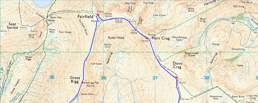
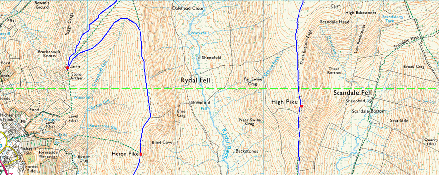
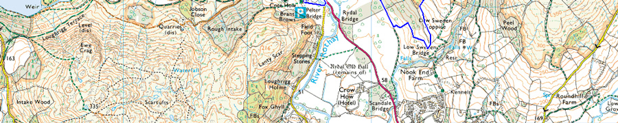
Todays route is no different to that of the conventional Horseshoe where I'll be collecting nine Wainwright summits along with Stone Arthur which I will gain soon after leaving Heron Pike by following a contour around 1,950 ft thus creating an out and back rather than a direct line for the summit. From Stone Arthur I will regain the ridge before summiting Great Rigg and Fairfield before continuing over Link Hause summiting Hart and Dove Crags then heading south along the High and Low Pike ridge closing the walk back at Pelter Bridge. |
|
| Wainwright Guide Book One |
 |
| The Eastern Fells |
-Fairfield
The whole mass constitutes a single geographical unit and the main summit Is Fairfield, a grand mountain with grand satellites in support. No group of fells in the district exhibits a more striking contrast on appearance when surveyed from opposite sides than this lofty Fairfield group. |
 |
|
|
| |
|
Overview |
|
|
| Ascent: |
4,436 Feet - 1,352 Meters |
| Wainwrights: |
9, Nab Scar - Heron Pike - Stone Arthur - Great Rigg - Fairfield - Hart Crag - Dove Crag - High Pike - Low Pike |
| Weather: |
Sunny Periods Throughout, Strong Winds Across The Summits, Some Snow Flurries. Highs of 3°C Lows of 2°C Feels Like -9°C |
| Parking: |
Car Park, Pelter Bridge |
| Area: |
Eastern |
| Miles: |
13 |
| Walking With: |
On My Own |
| Ordnance Survey: |
OL5 |
| Time Taken: |
6 Hours 30 Minutes |
| Route: |
Pelter Bridge - A591 - Rydal Mount - Nab Scar - Heron Pike - Greenhead Gill - Stone Arthur - Great Rigg - Fairfield - Hart Crag - Dove Crag - High Pike - Low Pike - Low Sweden Coppice - Rydal Park - Rydal Mount - A591 - Pelter Bridge |
|
| |
|
Map and Photo Gallery |
|
|
 |
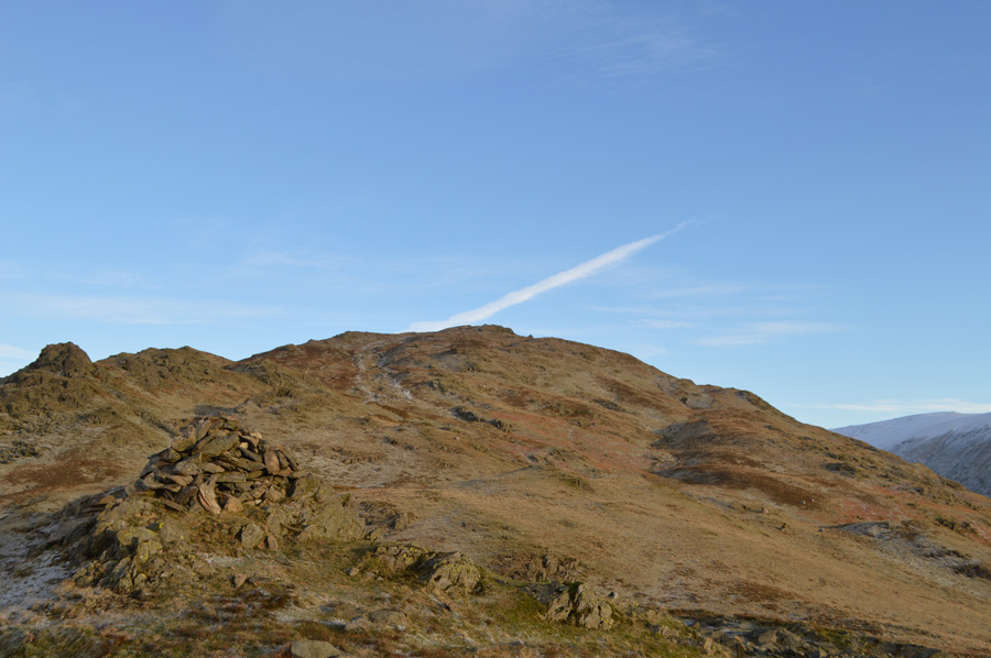
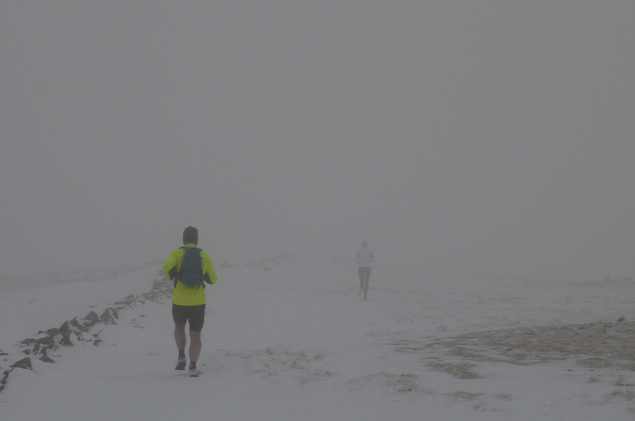
| Nab Scar 08:21am 2°C |
It had been an uneventful drive up until I passed the junction for Kentmere where I got stuck behind a Co-op wagon whose driver seemed to be taking in the scenery and not really noticing the queue of traffic backing up behind him. By the time I reached Ambleside I was running a little behind schedule but it wasn't really much to speak of by which time the sunrise sadly, had gone un-noticed once Ambleside had been left behind. Rydal was soon reached thereafter where I received a shock at witnessing a line of traffic cones which stretched the side of St Mary's Church all the way up to Rydal Mount.
A little panic had set in which I'm putting down to sheer eagerness to get boot onto fell...okay Paul think.
I drove up to Rydal Mount turning my car around at the Coach Park all the while racking my brain where the nearest place to park which would work with todays route, it had been planned to start and finish next to St Marys Church Rydal before it dawned on me that Pelter Bridge car park was only a five minute walk down the road which is where I headed next.
Having secured a parking space I was able to kit up under the watchful eye of the early morning travellers along the A591. The air was light and airy and here at valley level there wasn't a breath of wind just a cool stillness although I knew once on the ridges, all this would change.
Today, thanks to a good friend who read my plight about having to renew my Gaiters I am now sporting new ones which fit perfectly and to be honest, I was really looking forward to breaking them in. Although my boots are dry the laces still haven't completely dried out since my walk on the Shap fells last Sunday, this I found out whilst tying up, there's something quite less satisfying at having to tie up wet laces but what the hey...today, it isn't raining and for that I'm jolly thankful.
With the car locked I crossed the Rothay and took to the A591 this time on foot. I was soon at the junction for Rydal and once again I was looking up at the steady line of traffic cones along the left hand side of the road noting that any work planned here hadn't even started meaning that we could be looking at some time before anyone is allowed to park here again. The road is steady which steepens once Rydal Mount is passed and there's a thin coating of frost over the front lawns of the cottages all the while the sun is trying to break through a scattering of cloud behind me, despite the cones, it's the perfect setting for a winters walk.
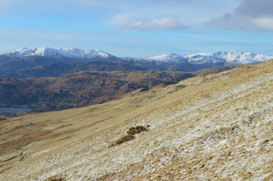
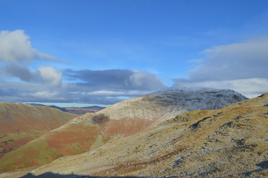
I strike out feeling the pull of the steep concrete path instantly which soon levels once Hart Farm is passed whereafter I pass through a wooden gate and onto open fell side. The ground underfoot is solid and any puddles had frozen overnight leaving this mornings ascent more than a pleasant one. Usually I would stop to admire the view but it would seem that today I am so focussed on the job in hand I only pause to look down on Rydal Water once a familiar grassy platform is reached. |
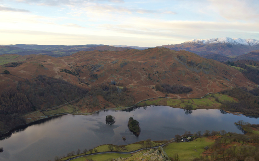 |
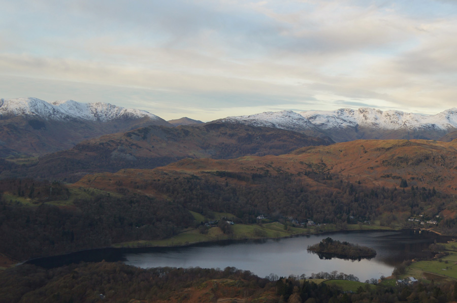
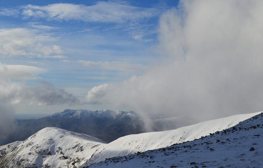
| Loughrigg Fell seen over Rydal Water from my ascent on Nab Scar while beyond...Wetherlam and the Coniston Fells. |
| |
 |
| First light over Fairfield, Hart Crag and Dove Crag. |
| |
 |
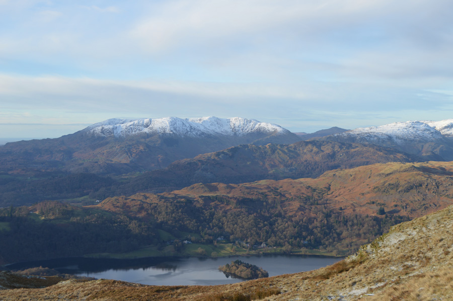
| Views over Grasmere, Silver How, Lingmoor Fells, Wetherlam, Swirl How, Great Carrs, Harter Fell (Eskdale) and Crinkle Crags. |
| |
 |
| A close up of Coniston Old Man, Wetherlam, Swirl How and Great Carrs. |
With my photo opportunities complete I turn heel and follow the narrow path steadily passing two grazing Herdies silhouetted against the morning sunrise, I pause to take a photo whilst trying to capture their attention which I managed to get, despite this, the photo never turned out the way I wanted but still a nice moment all the same.
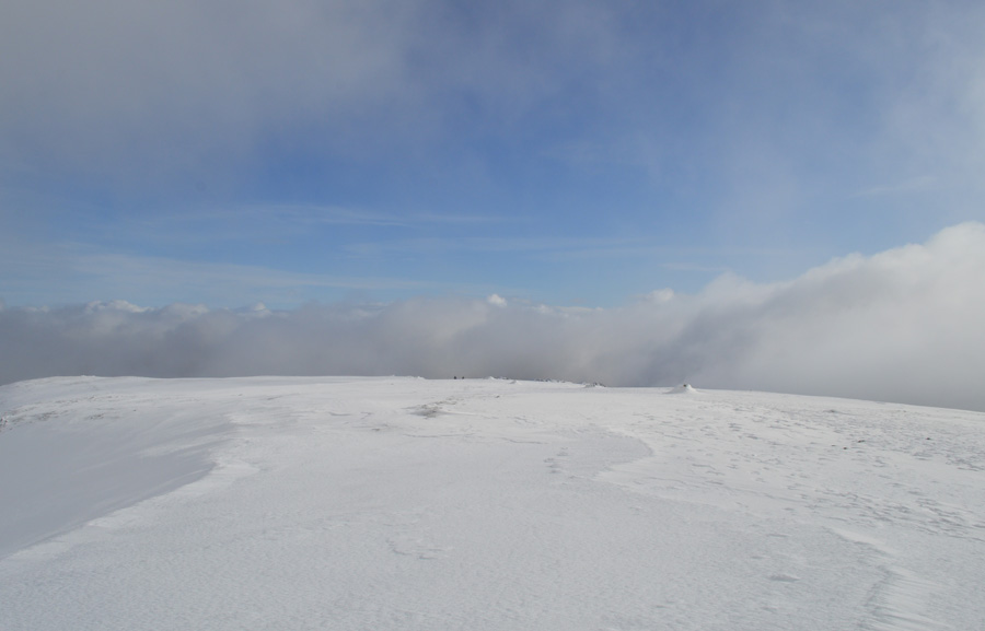
Once the summit shoulder is reached pockets of snow accumulate in the hollows of the frozen ground and it would seem there's been a light dusting overnight too but nowhere near as heavy as what I had first expected, this is good news if I'm to keep a steady pace. |
 |
| Heron Pike from Nab Scar. |
| My camera just didn't do the morning light the justice it deserved. |
 |
| There's the Coniston Fells again with a peak from Harter Fell (Eskdale) seen over Silver How and Lingmoor Fell. |
| |
 |
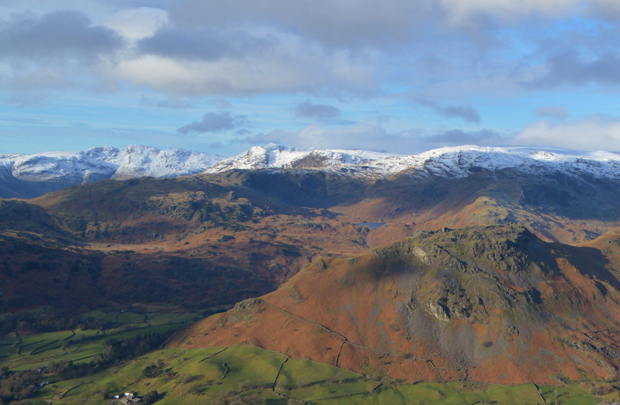
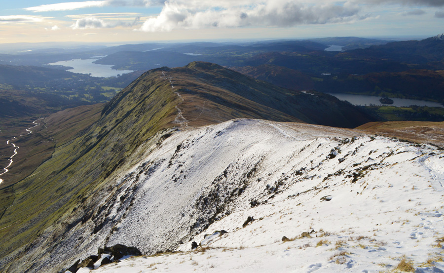
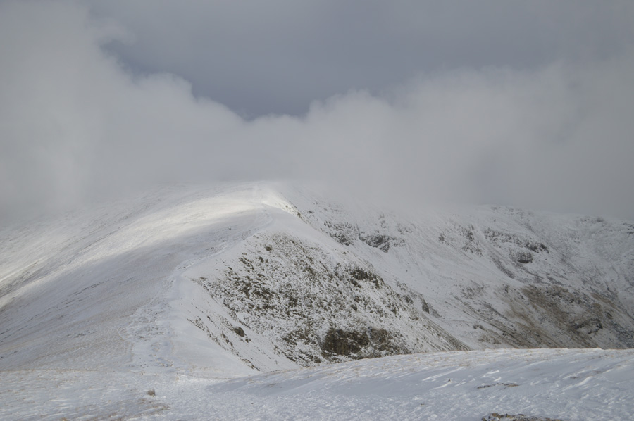
| Ridge tastic views towards Great Rigg, Fairfield, Hart Crag and Dove Crag from Heron Pike summit. |
Since leaving Nab Scar behind I took advantage of the frozen ground underfoot between the familiar 'stepped stone wall' and Heron Pike summit, it's only a short walk in comparison and it's not that steep but always hindered by notoriously boggy ground underfoot which makes the short ascent feel much more difficult than it actually is, today I didn't have that problem and claimed the summit of Heron Pike with a rather cheeky grin across my face which was soon wiped off the moment I experienced just how cold the wind chill was.
Behind me three walkers have just appeared from the direction of Alcock Tarn as I start to feel the brunt of the chill, so cold my eyes start to stream almost instantly which saw me de-shoulder and reach for extra layers in the form of my neck gaiter which I ease up every now and again to cover my chin making sure I leave a gap I can breathe through. |
 |
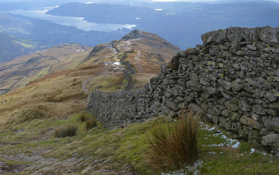
| Blowing a hoolie as I join the ridge. |
It was no use, the wind chill was mind numbingly cold and despite my wonderful views I couldn't concentrate on anything else except covering any exposed skin, my neck gaiter is risen up to my cheek bones and my hood is fastened down at all three points, still the wind bites but it's more comfortable to deal with now than that of a few moments ago.
A quick turn around sees me look towards Heron Pike summit expecting to see the three walkers but they haven't reached it yet. My plan from here is to survey a route from Heron Pike to Stone Arthur and back, getting back isn't the problem I just need to find a good lay of the land whilst not being battered by the wind, I opt to drop off the ridge slightly on the Greenhead Gill side, there's no point trying to rush this.
I drop down the ridge around twenty feet and find myself a nice fox hole from where I can pick out numerous paths which have been highlighted by a light dusting of snow, it would seem that I have options either to make a direct ascent on Stone Arthur which would include the ascent out of Greenhead Gill or be wise and navigate the head of Greenhead Gill by the lay of the land, which looks the longer way but, wont use as much energy.
With my route secured my plan is to walk to the base of Great Rigg, before swinging a left and traverse over the top of Greenhead Gill via a faint path. Okay, now that's sorted, lets get back to walking one of Lakelands finest ridge walks. |
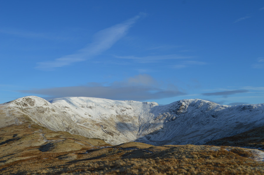 |
| Eye watering blue sky views of Great Rigg, Fairfield, Hart Crag and Dove Crag. |
| |
 |
| |
| |
 |
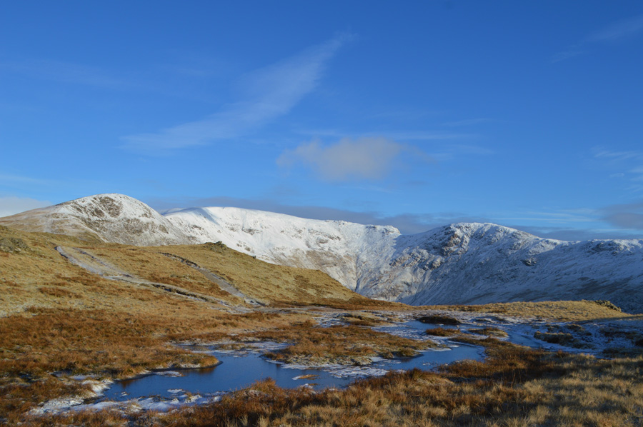
| My route over Greenhead Gill. |
I had left the ridge prematurely by a hundred yards or less if only to escape the cold wind chill, after descending around forty feet, the cold winds had been forgotten as I am blessed with warm sunshine on my back for the duration.
Ahead is Stone Arthur seen at the base Great Rigg SW ridge, initially I had planned to keep as much ascent as I could therefore I would 'drop on' the summit in order at not having to lose any height that I would later have to regain, yet, the closer I found myself within Greenhead Gill it would seem that this wouldn't be necessary as my new plan of attack followed a line just above the dark grass you see in the centre right of the photo, with this I was able to keep at the same height rounding the outcrops of rock before arriving at the summit.
Time to reach Stone Arthur from the ridge was just eighteen minutes, gaining Great Rigg thereafter, would take a little longer !! |
 |
| Views back along Greenhead Gill with Grasmere and the Coniston Fells in the distance. |
| |
 |
| Stone Arthur is just ahead. |
| Even though I hadn't made a direct ascent on Stone Arthur my new plan seemed to be working out better than expected with the exception that Great Rigg SW ridge was at times steeply flanked which caused some awkward side footings during my pathless traverse, all the while watched by around half a dozen grazing sheep. |
 |
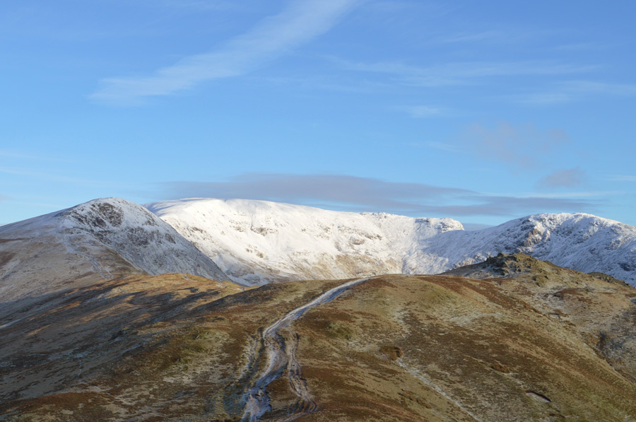
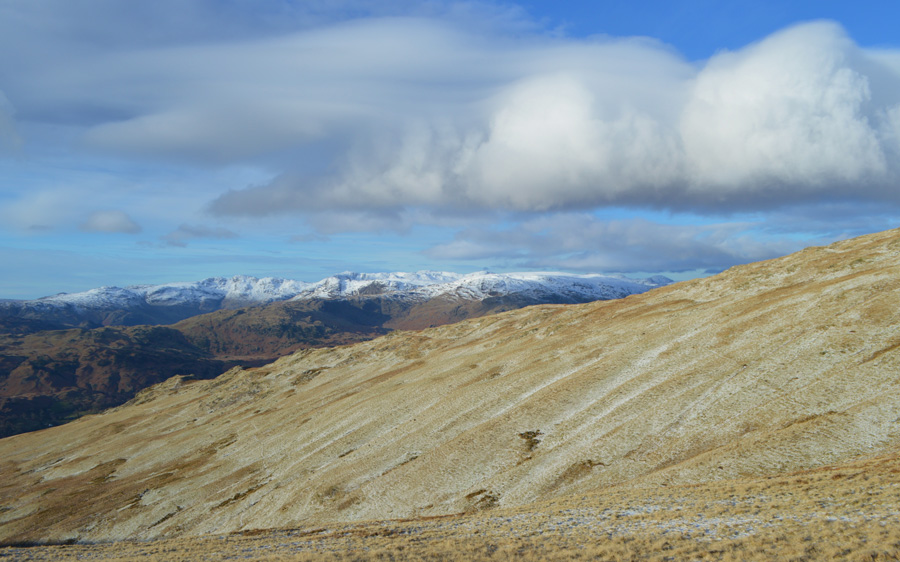
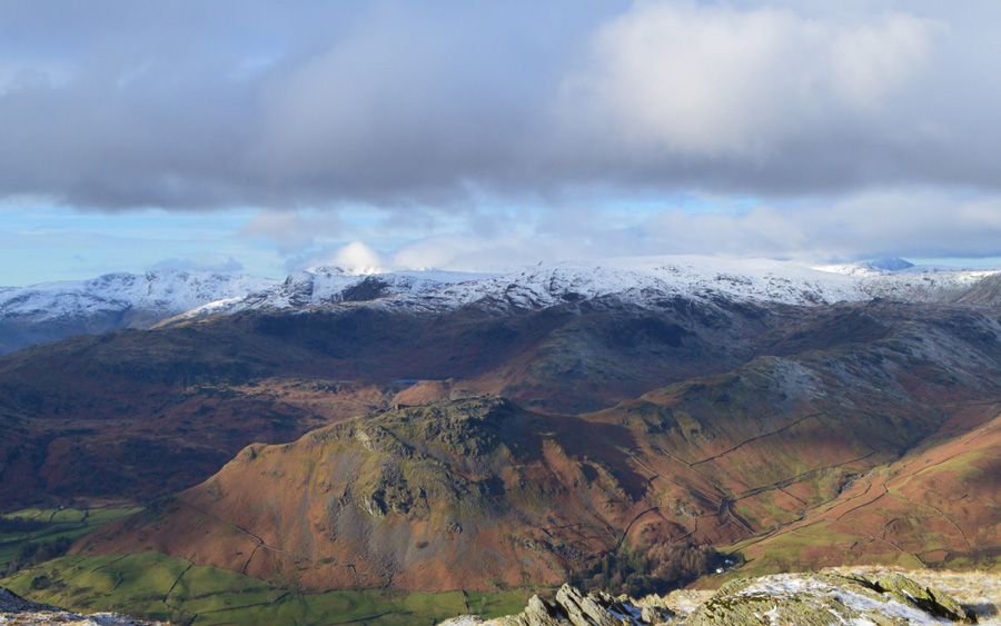
| Snow capped views of Bow Fell and Crinkle Crags seen with the Langdale Pikes, Blea Rigg Tarn Crag (Easedale) Sergeant Man, Calf Crag, Gibson Knott and finally Helm Crag in the foreground. |
| Such a wonderful day to be out on the fell tops. |
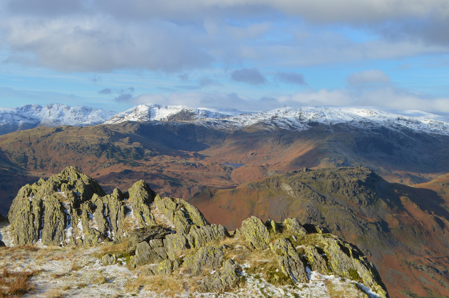 |
| And here we have the same view from Stone Arthur summit. |
| Okay, time to head back and re-join the ridge. |
 |
| Views over Steel Fell towards Ullscarth from Stone Arthur summit. |
| But not before a couple more photos... |
 |
| Seat Sandal from Stone Arthur. |
| Despite this mornings fantastic views, now really was the time to start heading back. |
 |
| That snowline. |
| |
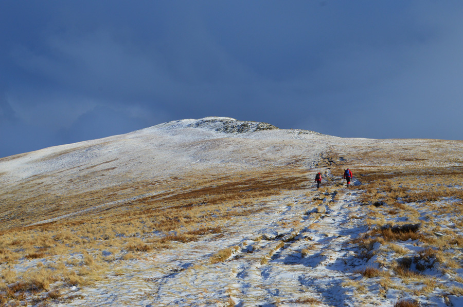 |
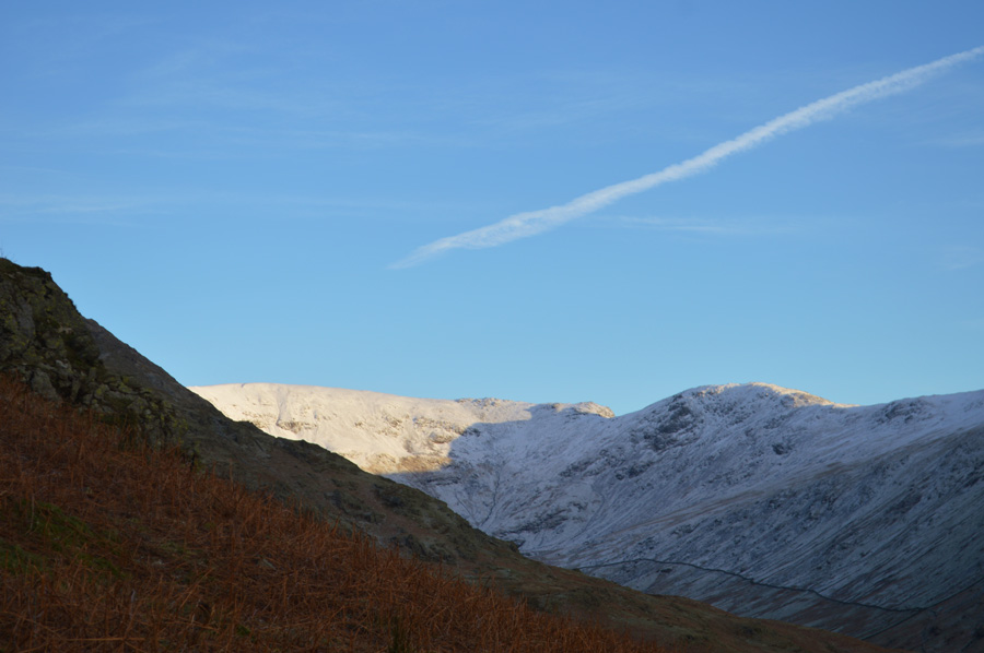
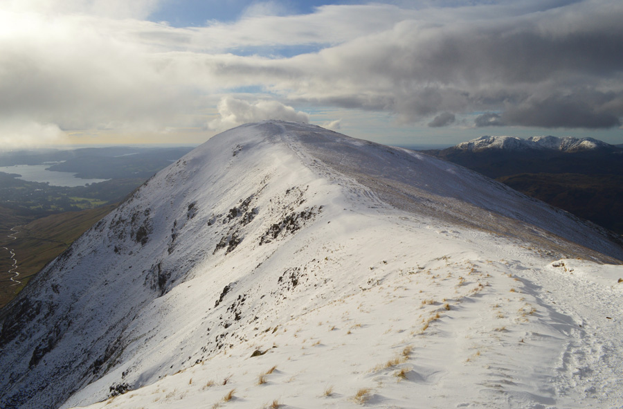
| Ascent on Great Rigg. |
I ploughed myself back into the ascent of Great Rigg reaching the snow line at 2'100 feet which was now more substantial than just a light dusting. Ahead of me two walkers pause until I am in what felt like ear shot (they actually looked like they were waiting for me) until they turned around and carried on with their ascents (perhaps they thought they knew me until they got a mug shot!) The two walkers split up just below the summit while the woman on the left made for the summit her partner opted to gain the ridge towards Heron Pike instead.
Behind me a fellow was following my trail with two Collies on leads, he had good pace and was soon catching up on me as I neared the summit only to find him too also heading towards Heron Pike, perhaps he had a taster of those cold cross winds and didn't want to put his dogs through the chill, a wise decision. |
 |
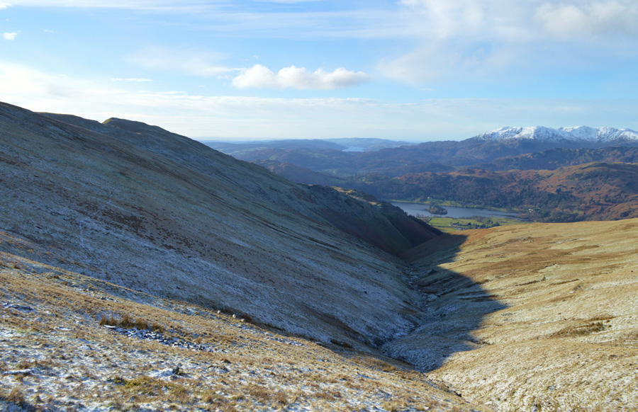
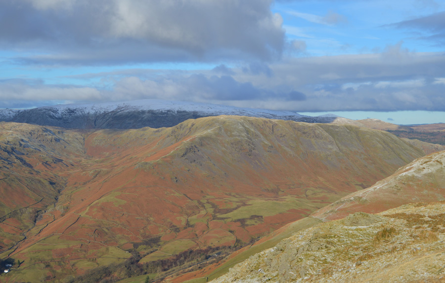
| Views over a glistening Rydal Beck taken just below the summit of Great Rigg. |
| |
 |
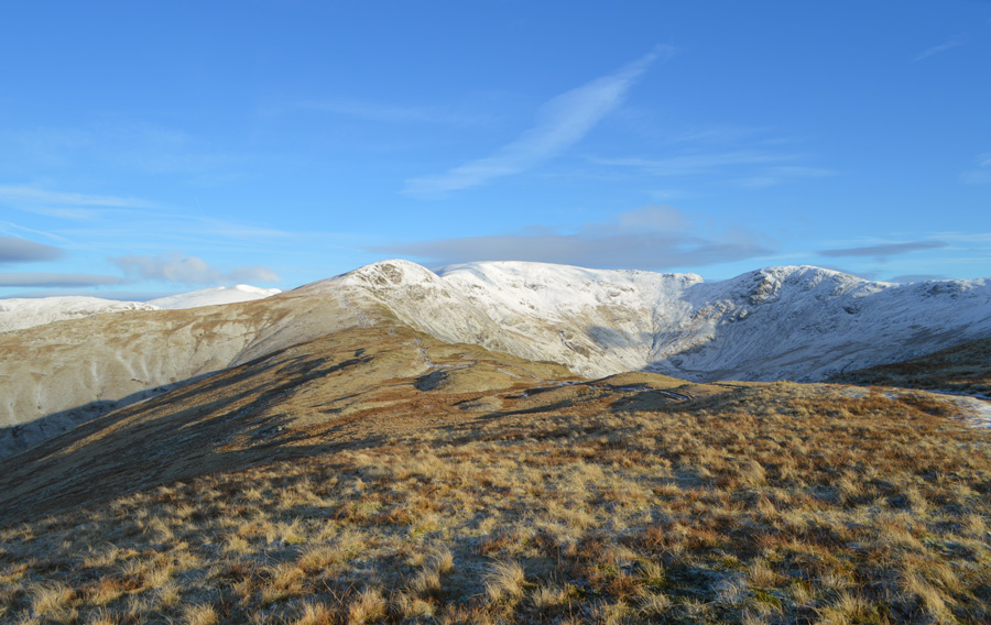
| Pausing to look back along the ridge towards Heron Pike and a distant Nab Scar with views of Windermere, Esthwaite Water and Coniston Water. |
| Conditions changed dramatically below the summit of Great Rigg despite there still being soft snow underfoot, I made the decision to add my Crampons based solely on the fact that should I continue any further I would have been left exposed to the winds, more so than I am now. I guess there's nothing worse than trying to add Crampons while being battered by 40mph winds served at minus nine windchill. |
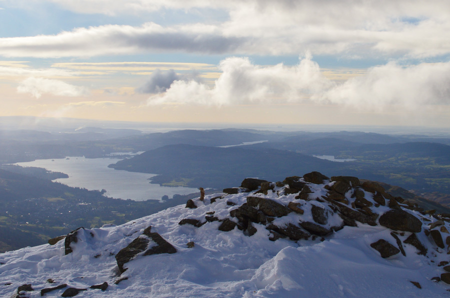 |
| Windermere from Great Rigg summit cairn. |
| |
 |
| Fleeting light over Fairfield taken shortly after leaving Great Rigg summit. |
| There's a few words to describe the light show that greeted me soon after leaving Great Rigg summit, such visions are usually spoke about but not often seen, the light which danced off the snow capped ridge caught up within the spin drift of just a few fleeting moments. |
 |
| Fairfield under brooding cloud as the sun breaks through. |
| |
 |
| Sadly the sun light didn't last long. |
| The last light for now... |
 |
| Was reserved for Great Rigg. |
| |
 |
| Ascent on Fairfield. |
The light it would seem was fading as only streaks would appear across the ridge hurried along by the powerful gust. I am thankful for the fresh snow underfoot which had layered on top of old snow which provided grip for anyone not wearing spikes which at this stage, had I not been exposed to the high winds I too would have fallen into the latter category as I'm often opposed to wearing crampons in soft snow, but it just made mountain sense to add them back on Great Rigg.
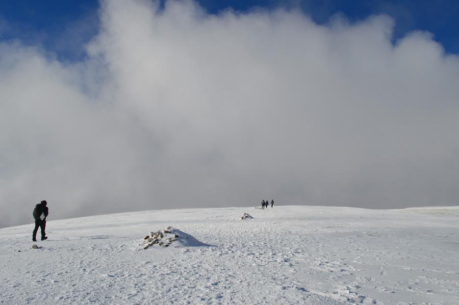
Ahead two figures appear through the cloud, it would seem that they are stopped and having a natter before they finally turn and start to walk towards me, it's two young girls all wintered up from head to toe with smiles on their faces as we pass on our hi's and hellos. |
 |
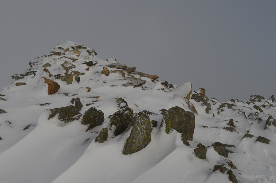
| Fairfield summit cairn. |
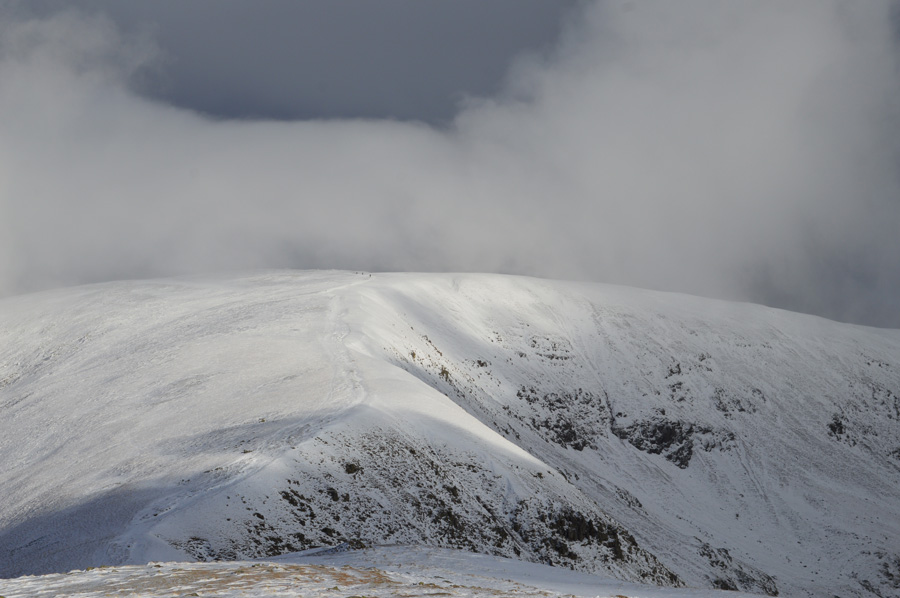
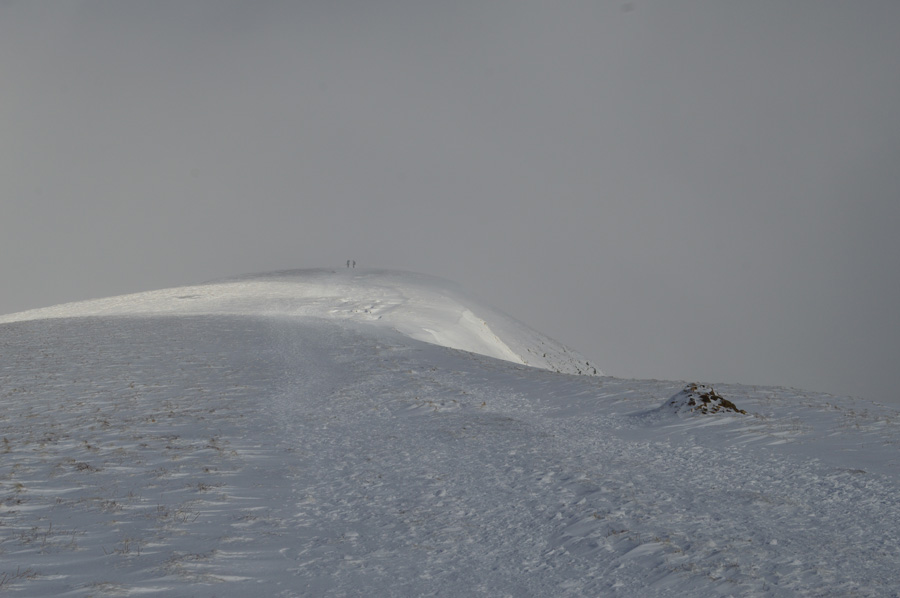
| Once on the summit plateau the cloud rolls in and visibility is reduced to around twenty feet as I use the stone cairns to guide me towards the summit cairn, only looking up every forty paces or so I soon arrive at the familiar stone shelter which was packed to the head stone in snow drift, thirty yards away the summit cairn appears through the cloud as I make my way over expecting to see other walkers but find I'm the only person on Fairfield right at this moment in time, a rarity. |
 |
| Striking out towards Link Hause feeling thankful that a gap in the cloud has just revealed my exact position. |
| I press on. |
 |
| Link Hause. |
| The cloud continued to lift revealing deep blue skies against the glistening white snow, more truly magnificent moments right about the same time fellow walkers start to appear in the opposite direction. |
 |
| Link Hause. |
| Hi, Hi, Hello ...... ...... ...... How do. |
 |
| Pausing to look back at Fairfield summit from Link Hause. |
| |
 |
| Link Hause. |
| |
 |
| Great Rigg lit up in sunlight as I pass over Link Hause. |
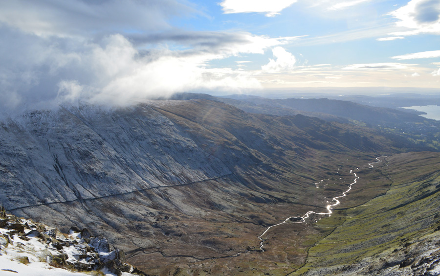
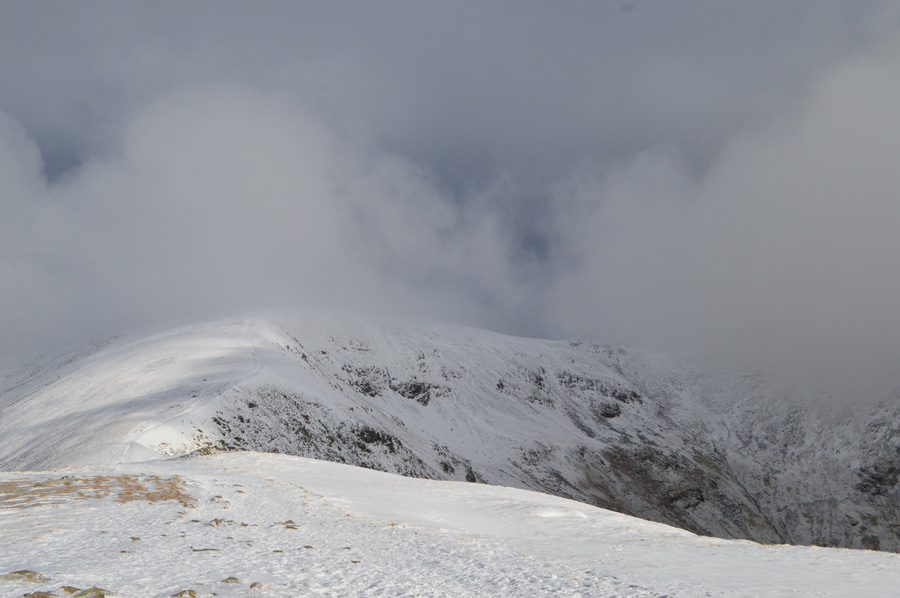
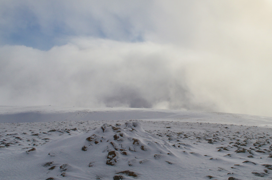
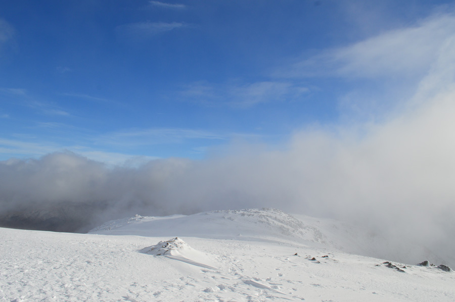
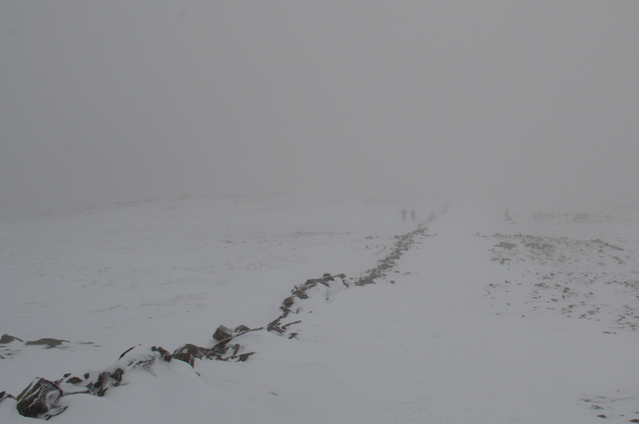
The very same wind that had been painfully biting at my exposed skin was the same wind that caused the dramatics that I witnessed whilst crossing Link Hause this morning while one minute I was looking across a wide vista of far eastern fells under bright blue skies the very next I was caught in angry black clouds which eventually faded to white out leaving visibility to around fifteen feet.
Here I use the term 'white out' loosely, the reason for this is because I have experienced total white out where I lost eye-to-feet coordination simply because I couldn't see my boots, this was far from white out but it was close, and closing in. From bright blue fleeting skies one moment to resorting to my map where I soon picked up a faint set of boot prints that hadn't been filled in by drift. I start to descend slightly noting that somewhere around here last year I screamed like a six year old girl whilst experiencing severe cramp in my calfs, I crack a smile...I just knew it was around here somewhere but I'm unable to pin point the exact position due to snow drift.
At the col between Link Hause and Hart Crag the cloud lifts momentarily once more revealing Scrubby Crag over Link Cove, but there is no contours, no out-lines for me to define a ridge like feature, just the crag through a dull grey murk. |
 |
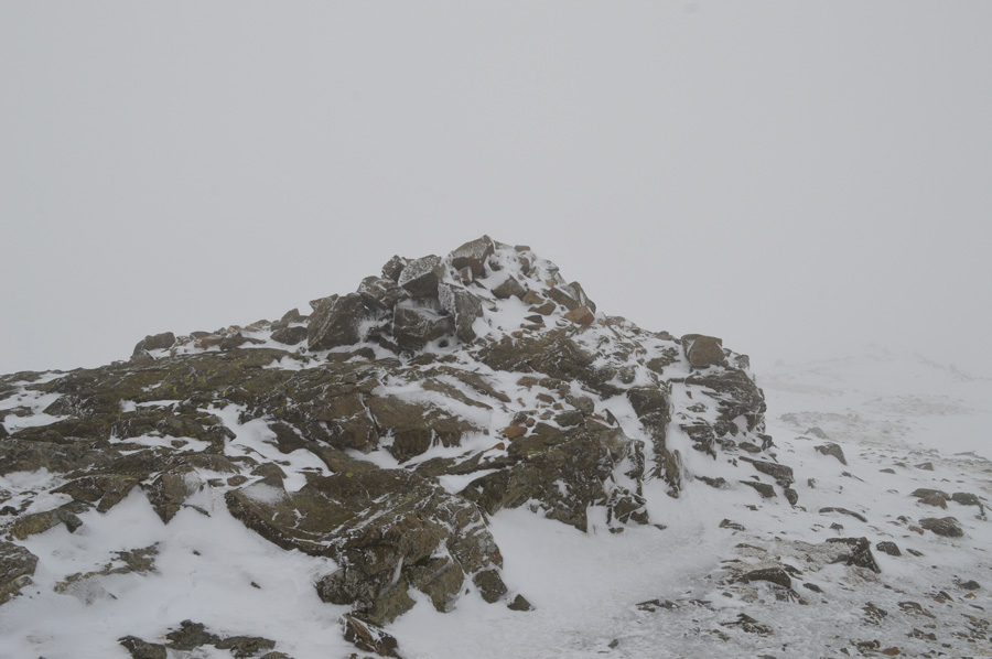
| Hart Crag summit. |
Once over the col I pick up a set of boot prints in the snow which trace their way all the way towards the summit cairn as I ponder on who made these prints and why do we take same exact steps with the same widths apart.
Ahead and slightly to my left a figure appears through the murk, we are twenty feet apart but make for each other anyway, how do you okay? fine morning to be out he replies, aye I add, you wouldn't believe how dramatic the cloud is right now would you although now, it seems to settling on the summits, still, a fine day to be out the chap replies, aye, especially I grin, after all that rain.
Have a good one...we bid each other a good day, moments later I arrive on Hart Crag summit where I am greeted by a bleep bleep from my camera, warning me that my battery is running low.
It would seem the wind chill has got to the battery, I switch the power off if only to reserve what is left not before taking this photo of course. |
 |
| Looking back along the stone wall that has a build up of snow drift between Hart Crag and Dove Crag. |
| |
 |
| Dove Crag summit cairn. |
The crossing between Hart Crag and Dove Crag was possibly the coldest I'd felt all morning yet it was also the busiest too passing walkers on both sides of the wall, there was camaraderie between walkers each asking through pure kindness 'you okay' it was just two words but for anyone who might have been feeling a little out of their depth these two words can bring strangers together during harsh days on the fells, no one I spoke too, and of course the other way around needed any guidance but it was nice to be asked all the same.
After a few fleeting conversations I knuckled down into the steady ascent feeling thankful that I had left my Crampons on at times when underfoot felt glacial, especially around the summit area of Dove Crag, there was no one there when I arrived and I had the summit to myself until two figures appeared through the cloud from the direction of High Pike.
Excuse me, excuse me they shouted. |
 |
| It's not quite Spring yet old boy. |
It turned out that the two people asking me over were in fact two fell runners who in my own opinion, should have known better "is this the Fairfeild Horseshoe" they asked? Erm no not technically, this is Dove Crag which is part of the horseshoe, Dove Crag the woman look quizzed, you sure? I thought we were further around than that...
Where's Fairfield then? I go on to explain the route ahead and what it would involve to get there. Do you think we'll make it? I replied with the shortest answer in my shortest tone.
Not dressed like that you won't.
The woman muffled something to her partner who then said we best go back, it's up to you I replied but I can tell you it's pretty brutal where exposed. I press on drawing a line under the ignorance I have just witnessed. |
 |
| Windermere glistens through a gap in the cloud. |
For the first time I descend using the stone wall to the left as a wind break which takes the bite out of the cold wind, ahead two youngsters approach, the young man is wearing shorts, his legs just like the previous fellow's are red raw, I pass with a hi and get a smile in return.
Through a break in the cloud Windermere appears and I can see around half a dozen sail boats making use of the wind, it looked a different world down there. |
 |
| Distant views of Morecambe Bay and Windermere as I approach High Pike summit. |
| |
 |
| Little Hart Crag seen over Scandale Head from High Pike summit. |
| By now I had started to pass more and more walkers, some of which were in large groups with dogs and young children in tow and I wondered what were their plans. Soon after leaving High Pike summit I am met by two women fell runners who ask on the conditions up ahead, it was pretty fierce but comfortable up there as I glance back over my shoulder to see that the cloud has lifted almost entirely from Fairfield summit, where you heading I ask? Oh just over Bakestones then back down via Red Screes and Snarker Pike...a great route I reply, have a good one. |
 |
| Descending High Pike with views of todays final summit of Low Pike. |
| |
 |
| Here, pausing to look back on High Pike as I negotiate the notorious boggy ground between High and Low Pike. |
| |
 |
| Views back along the familier twisting stone wall towards Low Pike. |
The sun was out and stayed out for the duration between both High and Low Pike summits and despite the warmth from the sun, I decided to leave my hat and gloves on until the end of the walk despite feeling clammy, for the last mile I strode down Low Pike looking for a crossing in the wall where maybe I could leave the ridge early but in the end I gave up due to the boggy bits which detoured me further and further away. Soon I was looking down on the famous 'bad step' below Low Pike as I was reminded of my last visit here whilst on a tour of the Fairfield Horseshoe during my 2'000 footer campaign back in summer, back then I was joined by Tim and despite still being below the tree line we couldn't see the hands in front of our faces.
I negotiated my way down the rock step and re joined the final part of the ridge with views over a tree filled Rydal Park before arriving at a stone wall which I had planned to use as my exit point from the ridge, the sun had disappeared behind cloud again and with it went the afternoon warmth but I didn't have to wait long until it returned by which time I had crossed the stone wall into Rydal Park and what felt like back into reality. |
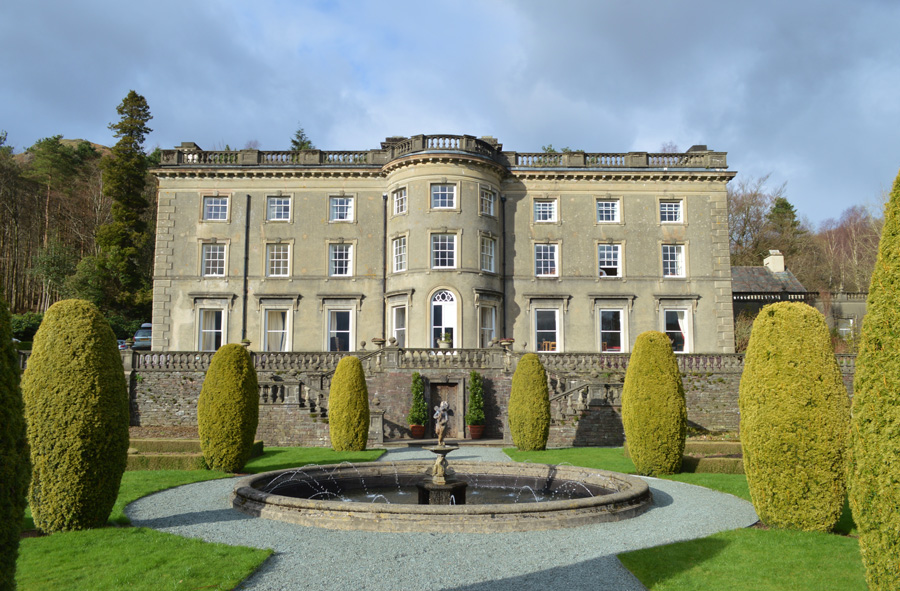 |
| Rydal Hall under winter sun. |
| |
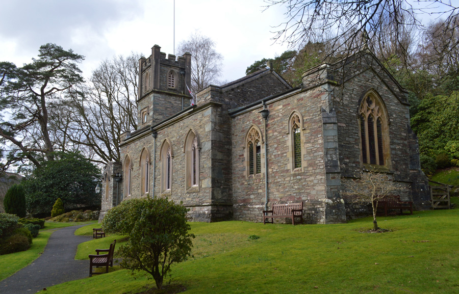 |
| St Marys Church, Rydal. |
| |
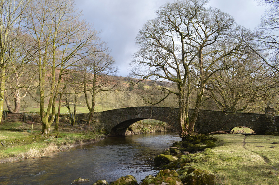 |
| Pelter Bridge. |
I took to the tarmac opting to make sure I pass through Rydal Hall and indeed the grounds of St Marys which I always feel are part of the Fairfield Horseshoe in some respects, but that's just me. By now it was closing in on two twenty in the afternoon and I was more than pleased with the walks progress adding another ten minutes off road walking before I would reach a bustling Pelter Bridge car park.
I hadn't eaten lunch and I remembered somewhere between Fairfield and Hart Crag telling myself that I'd find myself a nice spot beside the Rothay from where I'd eat lunch and indeed, take my first rest of the day. I pass my car which by now has been sandwiched between a BMW and an Ice Cream Van so tight I'd struggle to lift my boot open, but, for the next ten minutes it didn't matter because it was lunch time.
I watched the crowds come and go from the Ice Cream van and waited for the crowds to die down before quickly stuffing my lunch back into my pack 'what can I get yer the Ice Cream man asked'
You couldn't move yer van could you? aye no problem, and that's where the Fairfield Horseshoe ended. |
|
| |
| Back to top |
 |
|