|
Making the most of it, Stone Arthur to Elterwater |
 |
 |
21st September 2013 |
 |
|
Today’s walk was something completely opposite from what David & I had planned to do well over a month ago, back then we had sought to walk the whole Helvellyn ridge, however we weren’t to know that Saturday 21st September was going to be a wet one when the cloud was so low it almost clipped our ears.
David & I exchanged emails during the early part of the week, I especially noting that I wasn’t going to pay the weather reports any attention until at least Thursday, when once I did the forecast still gave us our Helvellyn green light.
All of which changed during Friday afternoon & evening when in swept a band of low pressure bringing with it drizzle & some very low cloud, something of which unusually,…didn’t clear all day.
It was up to David & I to come up with a plan B in a relatively short notice period of time when David suggested we drive further south & take on Great Rigg from just outside Grasmere, from there we can follow the ridge to Nab Scar & if the weather was still bad we could have a walk around Rydal & Grasmere lakes.
Todays walk shows the diversity of Lakeland when the cloud is down & the rain is in your face, hadn’t David suggested this route (and added to it) I may well have sat this Saturday out at home.
Instead I got to see a different side of Lakeland and walked un-walked lanes & visited never before visited Tarns.
It all started on a deserted layby besides the A591 |
|
| Wainwright Guidebook |
 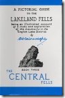 |
| The Eastern & Central Fells |
- Nab Scar:
Nab Scar is well known. Its associations with the Lake Poets who came to dwell at the foot of its steep wooded slopes have invested it with romance, and its commanding position over looking Rydal Water brings it to the notice of the many victors to that charming lake.
Nab Scar is not a separate fell, but is merely the butt of the long southern ridge of Fairfield |
 |
|
|
| |
|
Overview |
|
|
| Ascent: |
3,097 Feet, 944 Meters |
| Wainwrights: |
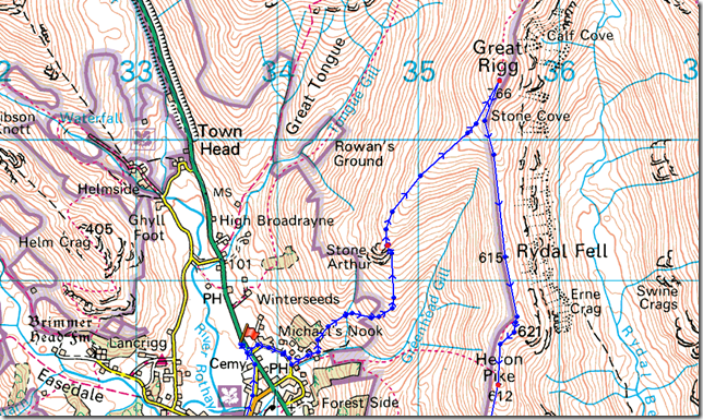
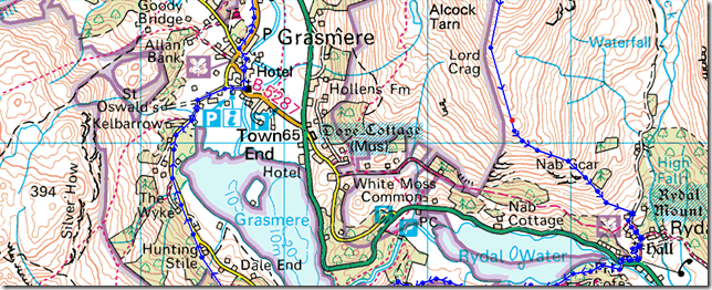
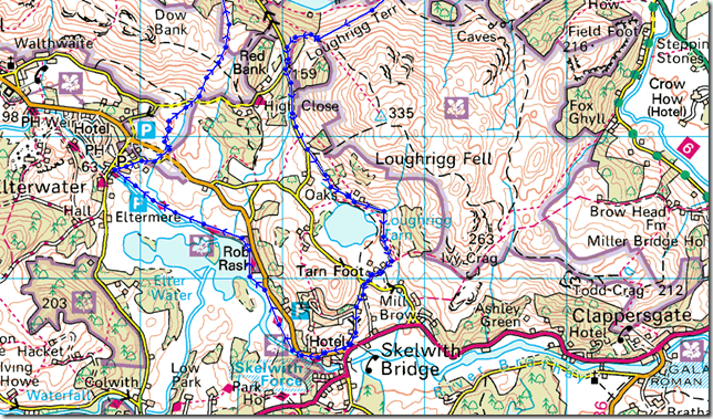
4, Stone Arthur – Great Rigg – Heron Pike – Nab Scar |
| Weather: |
Drizzle & Low Cloud The Whole Day, Mild. Highs Of 15°C Lows Of 11°C |
| Parking: |
Roadside Parking, A591 Outside Grasmere |
| Area: |
Eastern / Central |
| Miles: |
13.5 |
| Walking With: |
David Hall |
| Ordnance Survey: |
OL% & OL7 |
| Time Taken: |
7 Hours 40 Minutes |
| Route: |
A591 – Stone Arthur – Great Rigg – Heron Pike – Nab Scar – Rydal – Rydal Church – Rydal Water – Loughrigg Terrace – Loughrigg Tarn – Skelwith Bridge – Skelwith Force – Elterwater – Walthwaite Bottom – Hammerscar Plantation – Grasmere – A591 |
|
| |
|
Map and Photo Gallery |
|
|
 |
| |
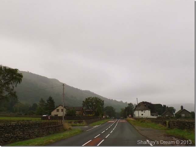
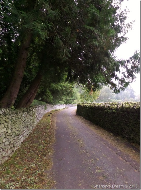
Crossing the A591 in the direction of Grasmere 07:42am 11°C
I arranged to meet David at the suggested layby around quarter to eight, the roads were almost empty with exceptions of the odd delivery van as I drove the A591 through Windermere & Grasmere.
I arrived a few minutes early when exactly at the same time so did David, in fact I let David’s car pull in the layby as we parked up one car in front of the other.
After a hearty handshake & a morning greeting we set to work getting kitted up for a wet day on the fells. This morning I had a brand new pair of Salomon Cosmic boots with me straight out of the box, these being my fourth or fifth pair (I cant quite remember!) I knew I would have no problems wearing them in…David looked unconvinced as I slid my right foot into the right boot without showing it, that bloody boot felt tight.
David however is well known for wearing as little, or less as possible when walking the fells no matter what the climate, so as I zipped up my Rab waterproof jacket David rolled the sleeves up on his midlayer, making sure that the front chest zip was as a low as it’ll go before proceeding to cross the road & pick up the tarmac track adjacent to the layby. |
 |
| |
Catching up on recent walks as we walked the narrow lanes. |
 |
| |
Grasmere… it’s out there somewhere.
The wind was silent & the air was very musky & damp as we took in the initial steep ascent under the nose of Stone Arthur, so much so that if it hadn’t have started to rain, I too would be walking sleeveless.
No point in getting wet…However, the rain/drizzle did not deter David one bit |
 |
| |
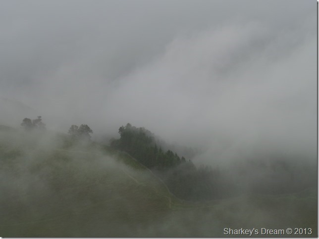
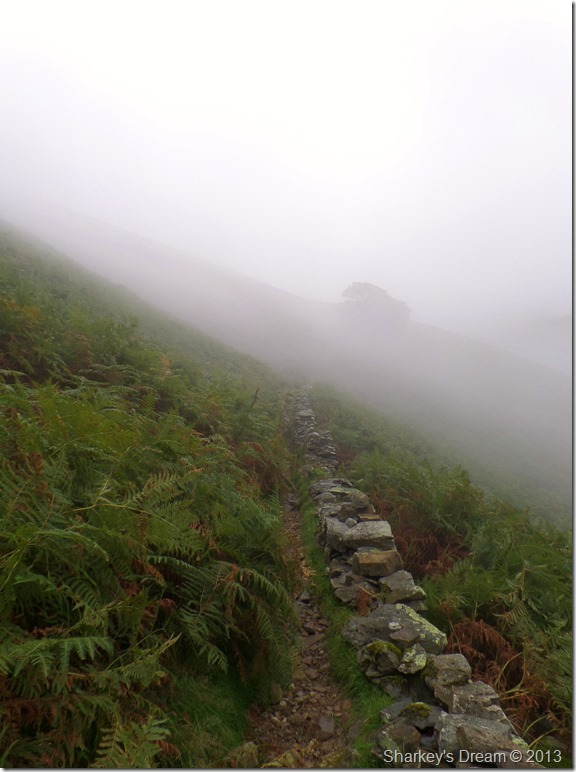
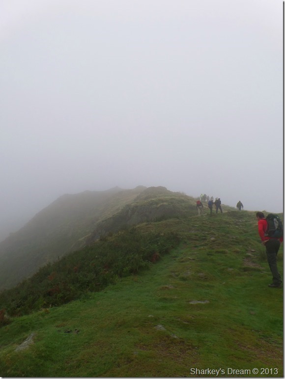
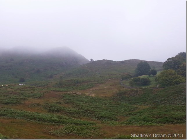
Entering the cloud base at around 380 metres.
We soon found ourselves shrouded in cloud at such an early point to the walk & accepted that these were the conditions for the duration for the rest of the day.
Conversation flared & we stopped to chat in almost ten minute intervals which set the stall for the two type of people walking here today.
Gone was the initial embarrassment of pardoning oneself after a burb or fart too! |
 |
| |
Passing this old fox trap along the ascent.
Stone Arthur was passed with just a glance from David’s walking pole as we walked through the mist, the drizzle came & went but the humidity made things very sticky, it was only once more height was gained & a slight breeze blew did your body start to cool a little.
I’ve never welcomed rain as much as I/we did today…on the same note, I’ve never walked in the rain when it was such an ambient temperature either.
At one point I contemplate on taking the jacket off, then I sissy out. |
 |
| |
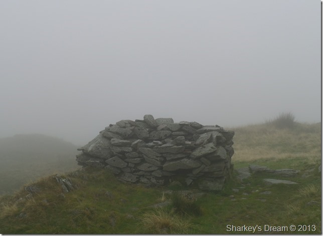
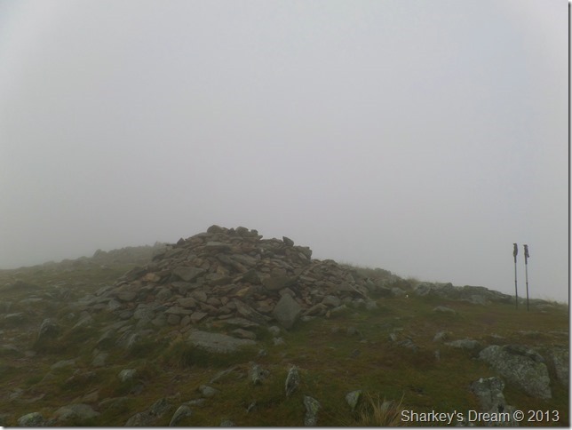
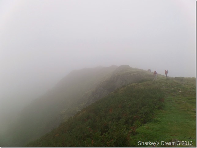
Great Rigg summit cairn together with David’s walking poles.
We soon reached Great Rigg where once onto open fellside did a cool breeze arrive, it was most welcoming depending on which way you were standing as the rain cooled our brows down a little.
Whilst at the summit David gave into the rain & threw a waterproof jacket on…once again zipping it down as much as his chest bared!
We had the great ridge walk to Nab Scar to take on next, we did so with a cool wind & head on drizzle in our faces, never letting the conversation die…I think we were talking about Indian food & even though it had just passed 9am in the morning the thought of an Indian takeaway, made my stomach growl. |
 |
| |
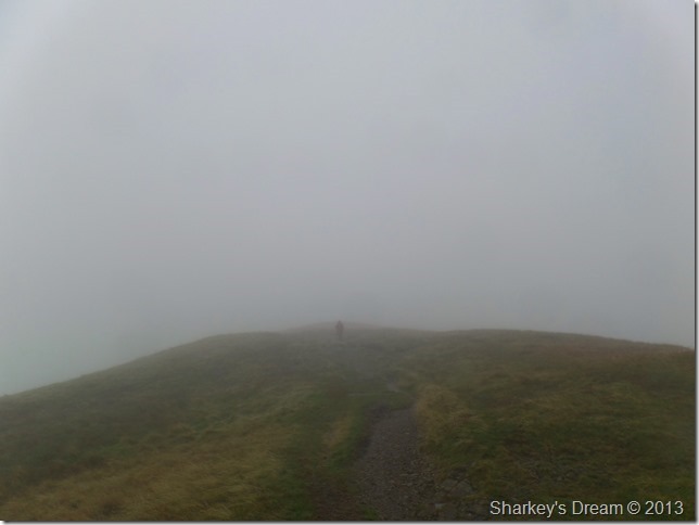
Heron Pike waits ahead.
From out of nowhere we encountered this solo walker, it looked as though he had come up via Alcock Tarn as he swept across the hill side within almost 40ft of us, he never looked back & we never saw him again.
Odd one that. |
 |
| |
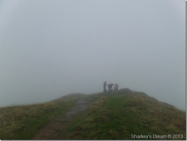
‘Right, lets have a look where we are’
Close to Heron Pike we passed these three guys all walking in T shirts (it really was T shirt weather up here this morning) We shared a joke & a good morning as we passed them, as we left one of the guys quips up ‘lets have a look where we are’ but more in a comical way rather than a ‘were lost’ kind of way.
We share a smirk as we headed for Heron Pike. |
 |
| |
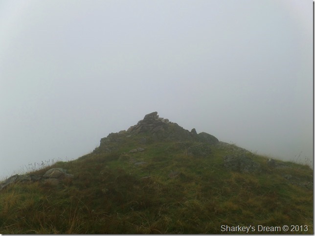
Passing Nab Scar summit cairn.
It was whilst descending Nab Scar did we witness quite a lot of groups in ascent many numbering well above ten people, some of which looked like they were having the time of their lives…others not so. |
 |
| |
This was the biggest party of people we witnessed this morning, however, there was still more to come. |
 |
| |
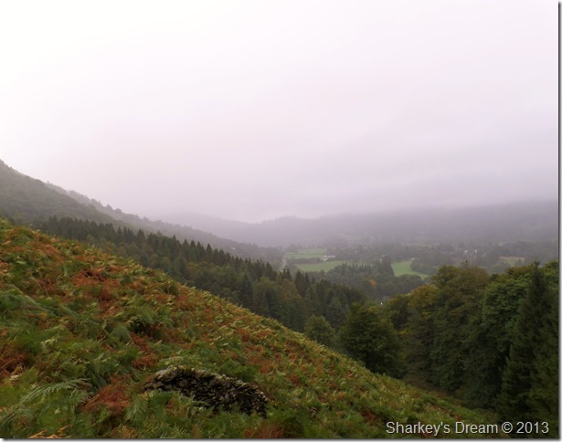
That low cloud still clinging to the fell side so low down into the valley. |
 |
| |
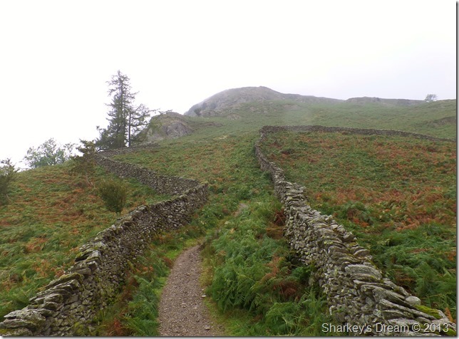
Here, looking back on Nab Scar from the twin stone walls above Rydal.
It was decision time on where to branch the walk to next. Both David & I toyed with an ascent on Loughrigg & maybe Silver How, either way, we were heading in the direction of Rydal Water & Grasmere when upon reaching them we would make our next decision.
But that’s a little while away yet. |
 |
| |
Rydal Mount.
Rydal Mount was occupied by poet William Wordsworth & his family, to this day first editions & personal belongings to William Wordsworth are still held in the building of which nothing much has changed since those days the Wordsworth’s occupied Rydal Mount.
The ‘Mount’ Mound dates from the 9th Century, when it was used as a site for a Beacon Fire to warn of coming Border Raiders. |
 |
| |
Rydal Church.
We soon arrive at Rydal Church which does not escape our attentions, here we walk the gardens as David now pauses to take of his jacket & return to his summer attire.
Me, I could do with losing a few pounds so I sweat it out & keep with the jacket. |
 |
| |
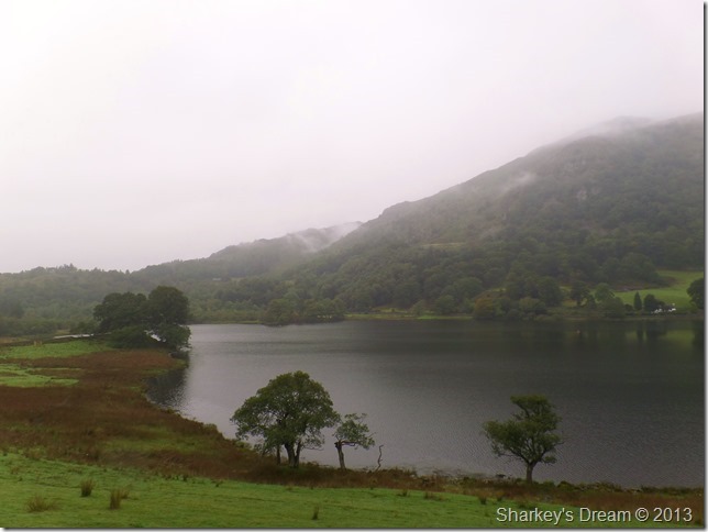
Down by Rydal Water.
The cloud still continued to dominate the walk – so conversation turned as to where to walk next, Loughrigg Fell did get a mention, yet right at this moment, at only 335 meters, we failed to see the summit through the cloud.
It was whilst we walked the shores of Rydal Water did we decide to keep the rest of the walk as low level as possible & maybe take in Loughrigg Tarn then continue on towards Skelwith Bridge & Elterwater keeping the miles up & the sights aplenty.
The walk from here took on a different affect as we left fellside behind & witnessed Lakeland from a whole new perspective. |
 |
| |
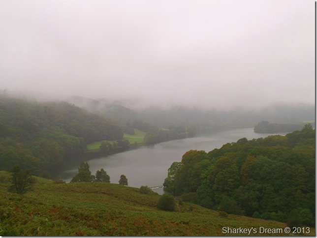
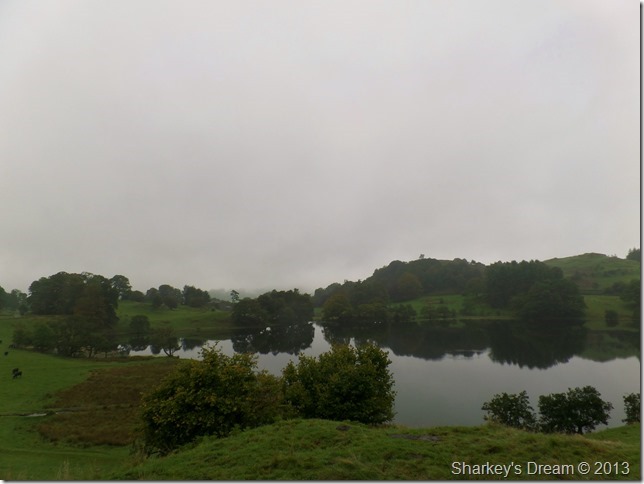
Grasmere from Loughrigg Terrace.
We soon reached Loughrigg Terrace as family’s undeterred by the drizzle & low cloud took up ascent on Loughrigg Fell, we watched as they took in the mild climb through the mist & beyond towards the summit, although once past the cloud we couldn’t see the walkers, the sound of the children laughing & shouting carried across the way.
Mmmm, wise decision to give Loughrigg a miss. |
 |
| |
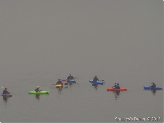
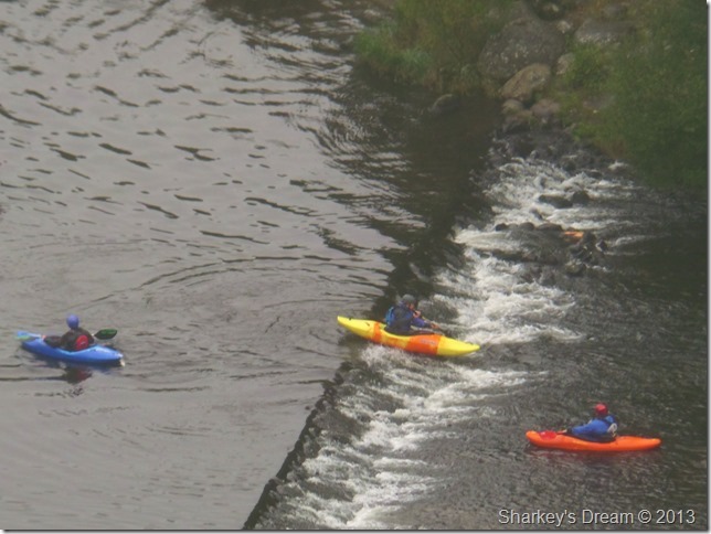
Action on the lake.
We caught the eye of these Kayaks through the mist, I must admit it looks like great fun down there…you can see in this photo it looks like the red Kayak is telling the rest where to go… |
 |
| |
If you cant beat the rain join it.
What great fun it looks like they’re having down there, after they had past the Weir I noticed the water looked no more than a couple of inch deep…oh well I guess, that’s the least of their worry’s as I also noticed a few rapids further down the outflow. |
 |
| |
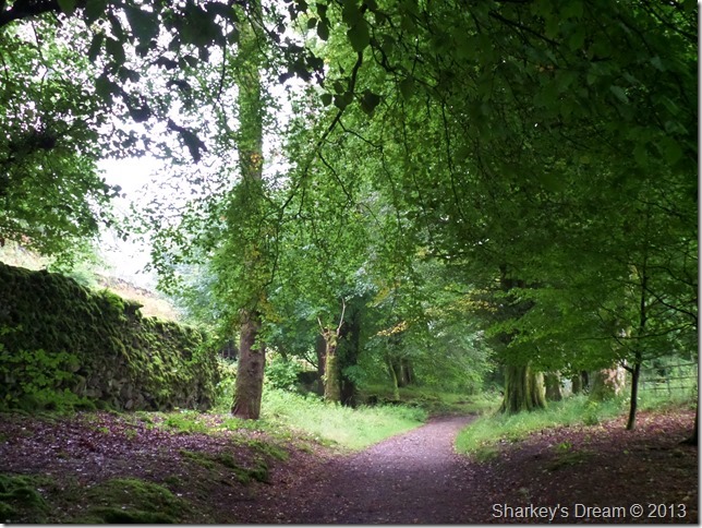
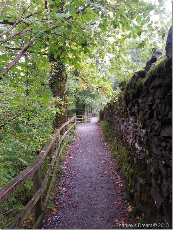
Passing through High Close, which was all new territory to myself. |
 |
| |
Loughrigg Tarn bound.
If you haven’t used this route, effectively it’s like your walking around Loughrigg Fell by road, the odd car passed us whilst here but much of this part of the walk we had pretty much to ourselves. |
 |
| |
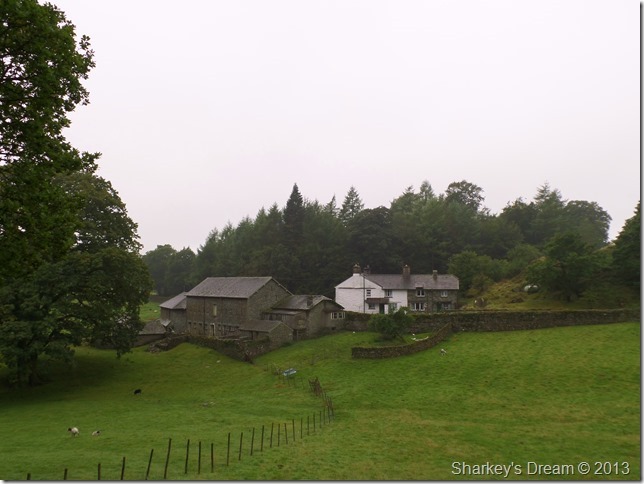
Passing this isolated Farm house along the way.
Conversation had now turned to an early lunch but seeing as everywhere was wet & we had nowhere to sit we decided to push on & see what our options where once we reached Loughrigg Tarn. |
 |
| |
Loughrigg Tarn.
As we reached Loughrigg Tarn it became apparent that not everyone had been put off by the weather, here family’s played with dogs & ate their lunches whilst sat besides the Tarn which was great for them but not for us as our belly’s were making weird & wonderful sounds. I suppose we’ll push on towards Skelwith Bridge until we feed (we had no option!) |
 |
| |
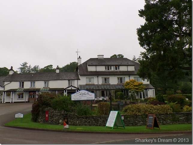
Skelwith Bridge Hotel. |
 |
| |
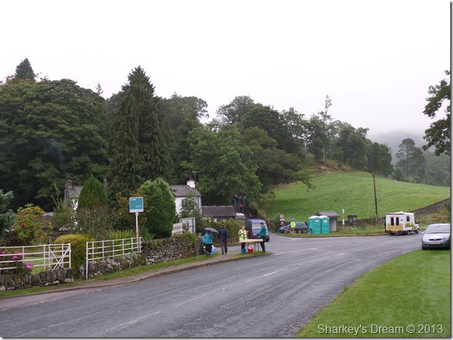
Waiting for the competitors.
Once we reached Skelwith Bridge we noticed that a fun-run of some sort was about to pass…here David jokingly took a jog-on & pretended to take a drink from the table you see at the junction…I don’t think the two volunteers knew exactly what had just happened!
David sheepishly made off with his exit. |
 |
| |
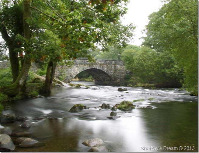
Skelwith Bridge.
We soon found ourselves a place to sit & tucked into our lunches as the competitors now started to emerge over Skelwith Bridge.
Stupidly on my behalf, this is the last photo from my camera as I had forgotten to charge the batteries the evening before, so from here on in my pictures are on behalf of my mobile phone. |
 |
| |
After lunch (and more horseplay from David!) we shouldered packs & made the short walk to Skelwith Force. |
 |
| |
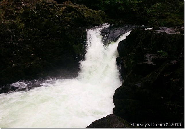
Skelwith Force.
The amount & pace of water was deafening but that didn’t stop the Dad asking his young Son to stand closer to the edge while he took his photo, here the rock was extremely greasy so much so that even David & I had to take care.
Should an adult fall here I think he/she would struggle to get out, a young boy would have no chance.
It beggars belief.
We press on towards Elterwater. |
 |
| |
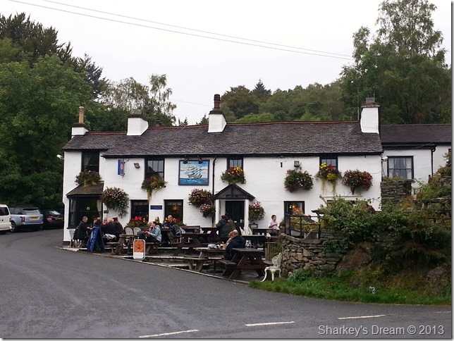
The Britannia Inn, Eltewater.
Even though there was still a slight drizzle in the air it didn’t seem to stop the family’s sitting outside enjoying the fresh air. |
 |
| |
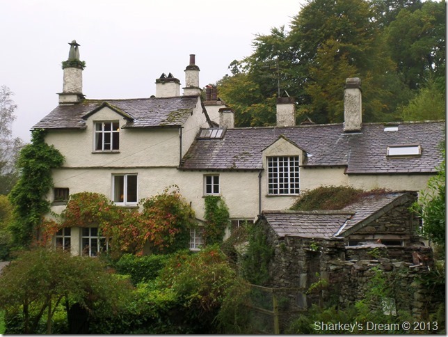
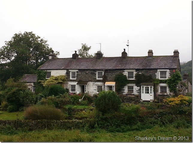
Elterwater Cottages.
The daylight seemed to be drawing more so to do with the cloud cover, as we left Elterwater we could see our route ahead via Red Bank which needed some slight ascent but first we had to cross Walthwaite Bottom. |
 |
| |
Walthwaite Bottom & Red Bank.
Red Bank can be seen as the low point besides the tree in the distance, the crossing of Walthwaite Bottom was done without obstruction after only crossing the odd boggy section.
The ascent on Red Bank was a little steep pull up which indeed is nothing that we both aren’t used too, the fact that it seemed there was no oxygen in the air made a small ascent rather tiring & most definitely sweaty.
A joke or two was passed on that section of the walk. |
 |
| |
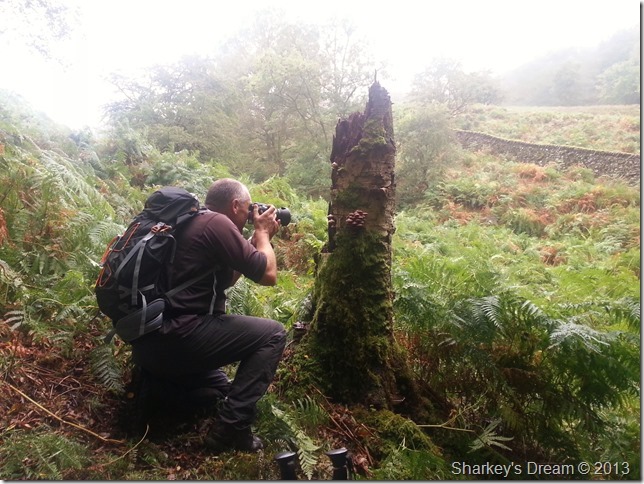
David spots & photographs fungi growing on a tree stump.
After reaching the top of Red Bank what remained of the walk was mostly downhill, here the cloud clung to the tree tops which was really quite atmospheric & what sounded like a heavy shower was actually the rain drops falling from the trees in otherwise very quiet surroundings. |
 |
| |
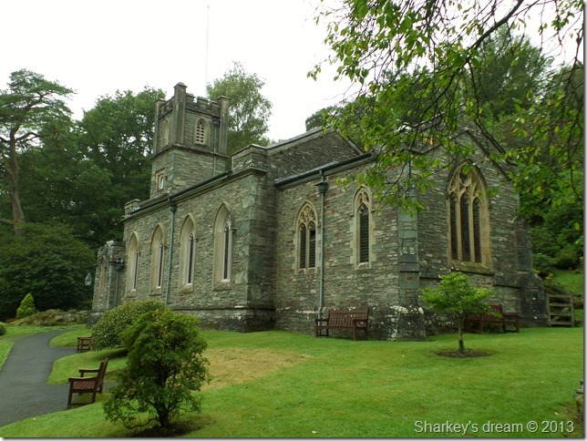
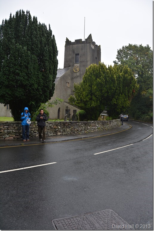
St Oswald’s Church, Grasmere.
After walking what would be considered the Old Original Road from Elter Water to Grasmere we soon arrived back at a thriving Grasmere Village. Here holiday makers went about their business as two rather damp & musky fell walkers walked the busy streets.
Shortly after taking the photo the guy in blue asked David directions for Grasmere Lake of which David obliged.
All what was needed was the short walk through the hustle of Grasmere, not before I might add David visiting one of his most beloved book shops in Sam Reads book store.
Here I waited outside in the rain as I held both David’s walking poles which gave me time to reflect on the days walk…that reflection time was special as it turned out one of the best moments throughout the day for me whilst standing there literally steaming in my own sweat while a hero of mine searched through second hand literature.
David emerged triumphant & had bought three second hand books, two of which was biography’s from a favourite author dating back to the early 1900’s
The rain got heavier as we walked the last mile back to the cars, as if it had waited for us to finish the walk, upon reaching the cars we down geared as I supped hot coffee from my flask, the day ended with another hearty handshake & a job well done, we both departed in the knowing that Helvellyn ridge walk is still waiting for us. |
|
| |
| Back to top |
 |
|