|
The Fairfield Horseshoe |
 |
 |
28th May 2011 |
 |
|
Its been a long time since I set foot on the fells in a down pour, in fact if memory serves me right I’m going right back to July last year (this I had to look up), high winds, sub zero temperatures & deep snow yes, but rain? rain that actually gets you wet? my memory doesn’t go back that far, so you can imagine the slight disappointment that greeted me & my walking pal Tim as we drove towards Ambleside leaving the grey yet high clouds of the M6 behind for this damp dull low cloud vertical downpour that greeted us on arrival at Rydal church.
Oh dear, I’ or (we) are not used to sitting in the car with the windscreen misting up, the wipers going like the clappers, the rear demister turned on, here looking like two lovers on lovers lane all fogged up ‘hey stop staring where waiting for the rain to stop’ going through my mind, but there was nothing we could do except weigh up what’s next, wait was all we had to do, a good 25 minutes if I remember rightly. Powering the window down & sensing this null in between the next band of rain was enough to get the boot open & kit up in the waterproofs, me I opted for my waterproof over trousers which in fact were more comfortable & much less restraining if I wore them like my normal walking trousers, so right next to Rydal church I striped to the boxers as quickly as I could, (quickly normally means in my case longer than ever due to the fact I’m exposed, my knackers are out & thus I stumble) ‘Morning’ I kid you not to the elderly lady walker walking past us poles in hand, ‘It looks like its in for the day’ she replied, yeah sheepishly I replied, Trust me, bloody trust me I screeched out ‘ nothing she hasn’t seen before Tim replied.
With this we head of into the muggy mist of what was hopefully the last we’d see of the rain. |
|
Wainwright Guidebook |
 |
| The Eastern Fells |
The rough triangle formed by Grisedale Pass, the Rothay valley and Scandale Pass, with the village of Patterdale as its apex, contains within its area a bulky mountain system with five distinct summits; there are subsidiary ridges and spurs of lesser altitudes, massive rocky buttresses, gloomy coves and fine daleheads. The whole mass contributes a single geographical unit and the main summit is Fairfield, a grand mountain with grand satellites in supports. |
 |
|
| |
|
Overview |
|
|
| Ascent: |
3,420 Feet |
| Wainwrights: |
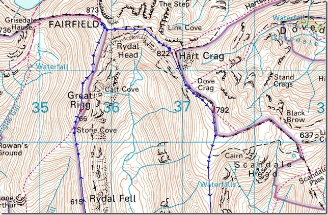
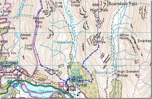
8, Nab Scar, Heron Pike, Great Rigg, Fairfield, Hart Crag, Dove Crag, High Pike (Scandale) & Low Pike |
| Weather: |
Very Muggy & Damp To Start, Turning To High Winds (40mph+) On Exposed Ridges, Heavy Down Pours To The Latter Of The Day. Highs Of 12° Lows Of 10° |
| Parking: |
Road Side Parking, Rydal Church, Rydal |
| Area: |
Eastern |
| Miles: |
9 |
| Walking With: |
Tim Oxburgh |
| Ordnance Survey: |
OL6 & OL7 |
| Time Taken: |
|
| Route: |
|
|
| |
|
Map and Photo Gallery |
|
|
 |
| |
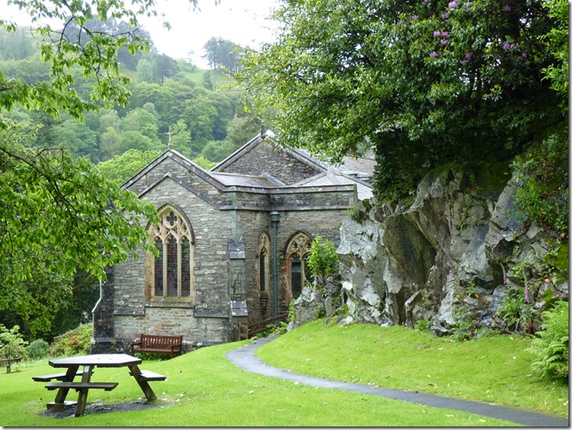
St Marys Church Rydal.
Once an orchard the poet William Wordsworth helped to choose this site to build St Marys in 1824, Rydal Mount the once home of Wordsworth is situated not 100 meters away, On a personal aspect for me St Marys is one of the most beautiful churches in Lakeland. |
 |
| |
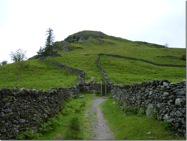
Crossing the sty as we gain ascent on Nab Scar, without altitude & protected from the wind at this point It actually did feel like summer & maybe just maybe the rain & wind will ease throughout the day. Both me & Tim are in full waterproof gear & this is way to early to be thinking of layering down not 10 minutes into the walk, the air was still & muggy & it wasn’t long before we had to stop to take of the jackets & rain covers from our packs. it was a short lived decision. |
 |
| |
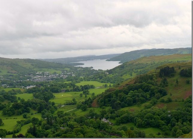
Looking over the plush green fields & trees towards Windermere. |
 |
| |
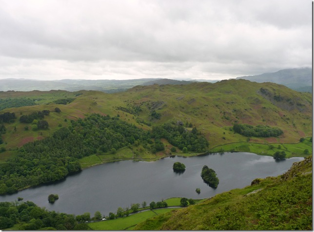
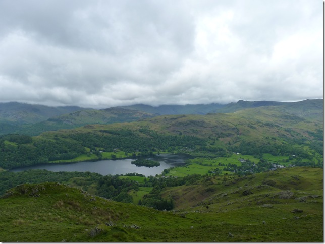
Loughrigg & Rydal Water, (see if you can spot the cave on Loughrigg) |
 |
| |
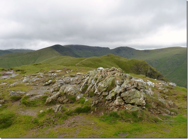
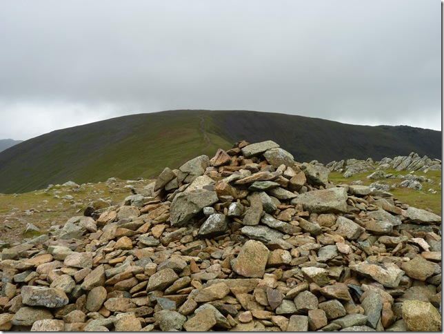
Nab Scar summit cairn.
It is generally spoke about that Nab Scar is only trodden on the ascent of the Fairfield Horseshoe, this I tend to agree with but let that not put any walker off who is in need of a late evening ramble, Nab Scar would be perfect for this should you be lucky enough to be on holiday or live close by. |
 |
| |
Views toward Helm Crag, Calf Crag & Steel Fell, the small tarn in the foreground is Allcock Tarn. |
 |
| |
Grasmere & Grasmere village, the fells behind are Silver How continuing towards Blea Rigg, the pointed outline under the cloud is that of Pavey Ark & Harrison Stickle. |
 |
| |
With leaving Nab Scar behind we are heading for Lord Crag, the conditions have changed somewhat with the little altitude gained & the feeling of exposure makes my decision to put my jacket back on. |
 |
| |
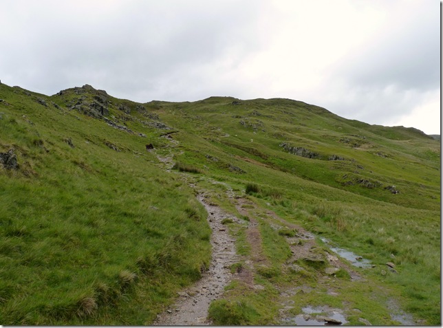
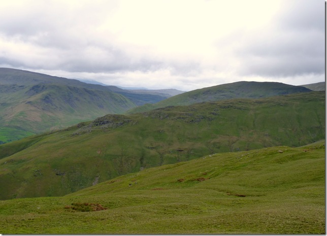
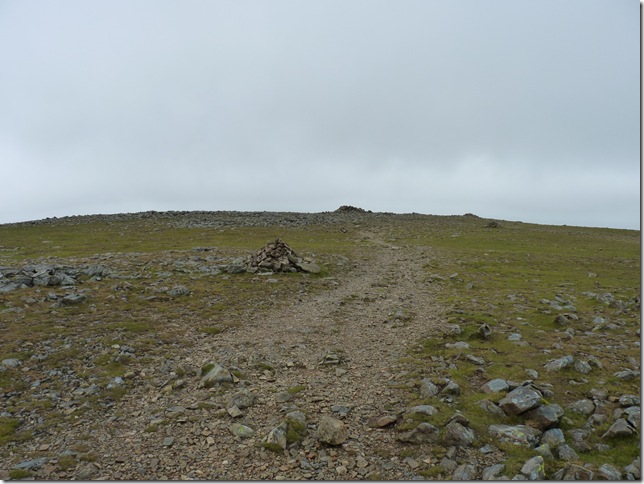
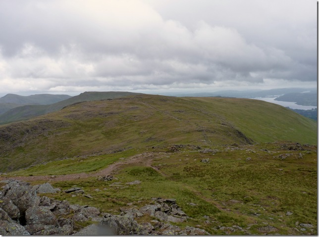
From Heron Pike summit you get the wonderful view of the ridge walk ahead, with Rydal Fell forming most of this smooth grassy ridge Great Rigg is the fell visible still yet not under cloud Fairfield however is not so lucky, but things have time to change with the strength of this wind. |
 |
| |
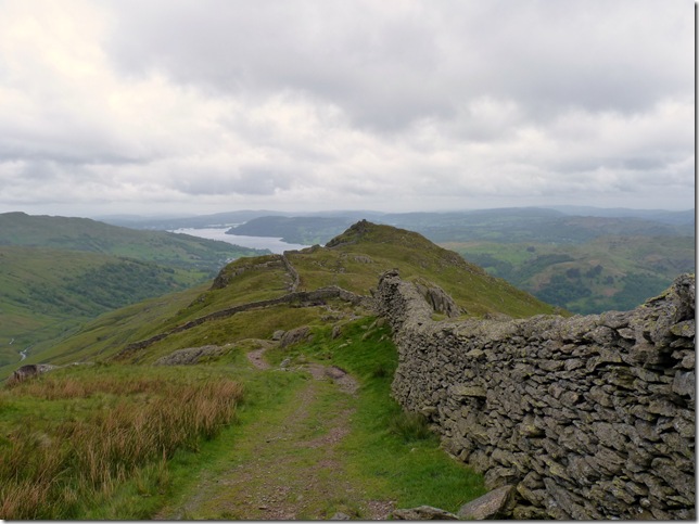
Wainwright described this ridge walk as ‘A pleasant high level traverse’ This 1.5 mile stretch of ridge is for me one of the best Lakeland has to offer. |
 |
| |
| Looking towards Stone Arthur & memories of my very first ascent of Fairfield over 3 years ago, the out crop of rock seen centre left is the scene I had my picture taken to which I used for the main picture you see on the main page of my website. ahh memories |
 |
| |
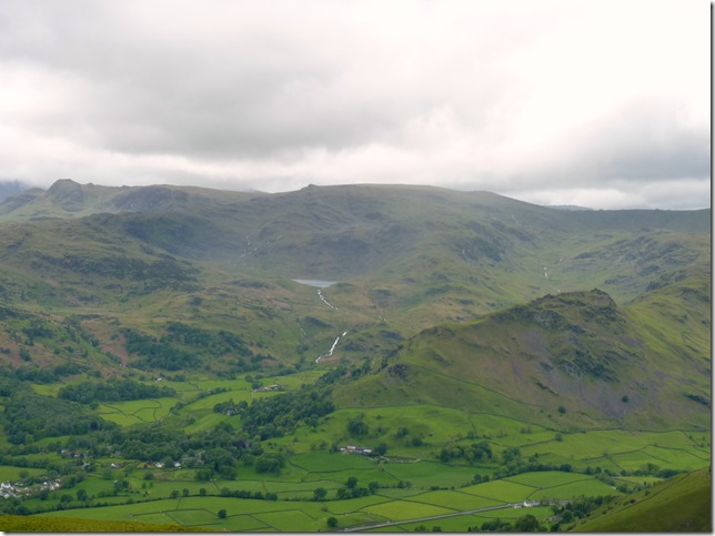
The Langdales have lost there cloud for now, with views down towards Easedale Tarn, Sour Milk Gill & Tarn Crag centre, Helm Crag dominates the right of the picture & the small pointed peak on the skyline is that of Sergeant Man. |
 |
| |
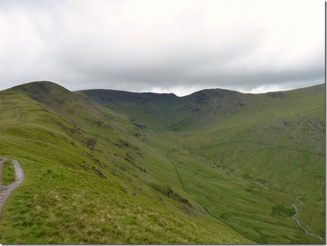
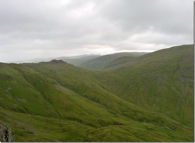
Views towards Great Rigg & Rydal Head, over towards the right is Link Hause linking Fairfiled with Hart Crag, Anybody who knows me knows I love my ridges, in fact on first sight of the walk ahead Tim looked at me & said ‘this has Paul Sharkey written all over it’ he was right this was indeed my favourite part of the walk & maybe a new contender for walk of the year. |
 |
| |
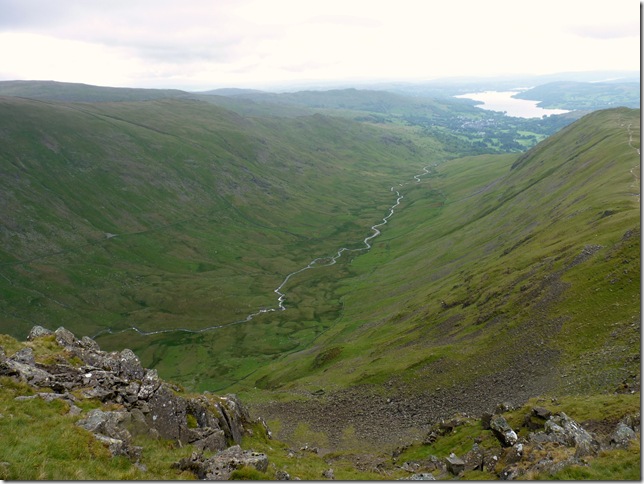
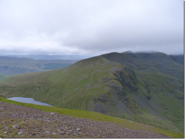
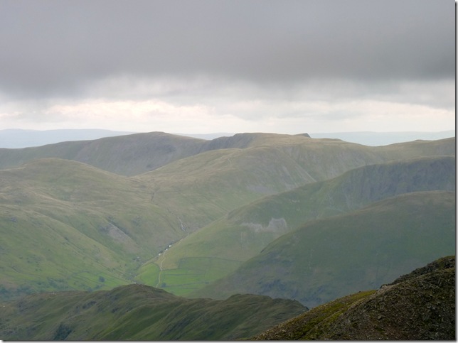
Looking back & down into the valley of Greendale with Rydal Beck snaking its way along the valley floor, as ever on this walk most of the views looking south are dominated by the vast presence of England’s longest lake, Windermere.
Windermere is a ribbon lake. (Ribbon lakes are long, narrow and finger-like.) It was formed 13,000 years ago during the last major ice age by two glaciers, one from the Troutbeck valley and the other from the Fairfield horseshoe. When the glaciers melted the lake filled with the meltwater, which was held in by moraine (rock material) deposited by the glacier. |
 |
| |
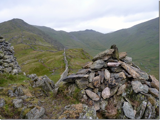
Fairfield from the summit cairn of Great Rigg , things are looking up for a cloud free ascent on Fairfield, the gusts are incredibly high & theres not much we can do about except soldier on. |
 |
| |
On the motorway like path & Fairfield’s summit is now within reach. |
 |
| |
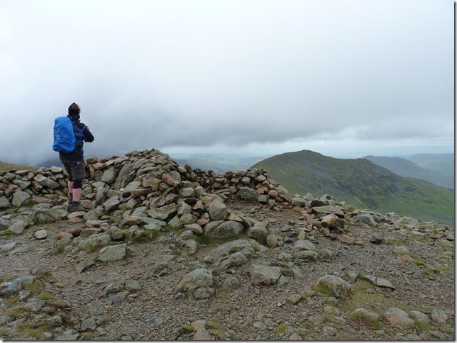
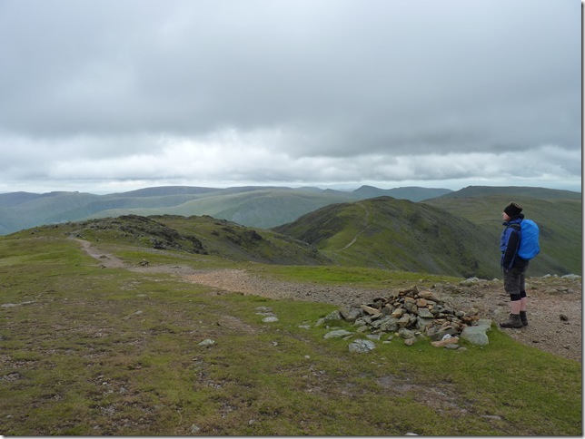
Fairfield summit cross shelter with Tim looking towards St Sunday Crag. |
 |
| |
Grisedale Tarn, Dollywagon Pike & Nerhermost Pike from the top of Grisedale Hause, the effects of the howling cold wind were beginning to freeze the tops of my fingers, a brisk walk back to the shelter out of the wind was in order. |
 |
| |
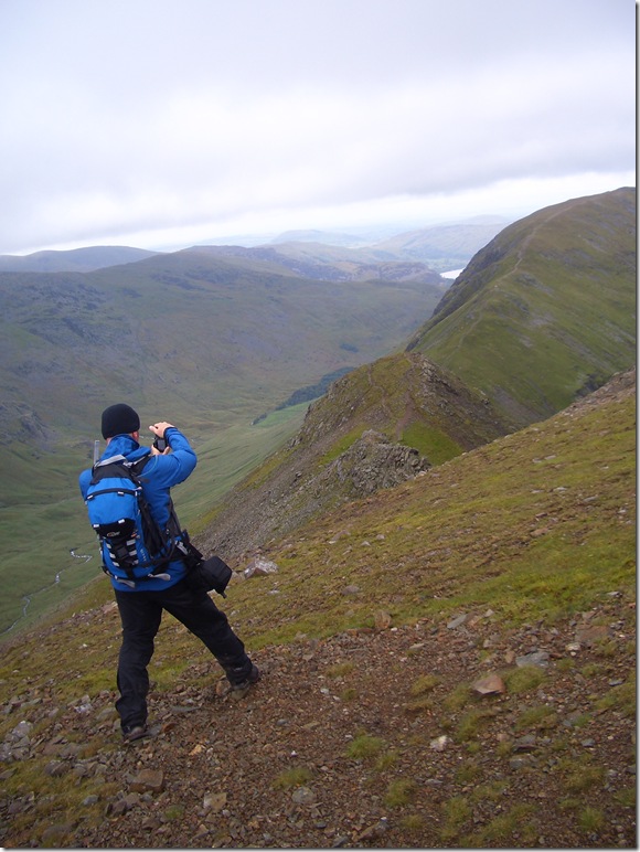
Not before a quick shot of Cova Pike & St Sunday Crag, I think the way I am holding my camera with a firm grip from my right hand & legs spread apart just shows how windy it was up here. |
 |
| |
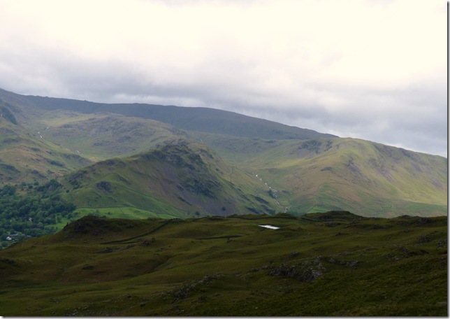
Views from the cross shelter here we have the far eastern fells, its not hard to make out Kidsty Pike’s triangular shelf like dominance forming the ridge LtoR is High Raise, Rampsgill Head, Kidsty Pike & the Straights Of Riggindale, In the foreground is The Knott, Gray Crag & Hardsop Dodd, the fell nearest to the camera is Hartsop Above How. |
 |
| |
Tim enjoying a section of the Fairfield Link Hause, the fell centre is our next target Hart Crag, we’d dropped enough ascent to get ourselves out of the main gust, another really pleasant part of this walk. |
 |
| |
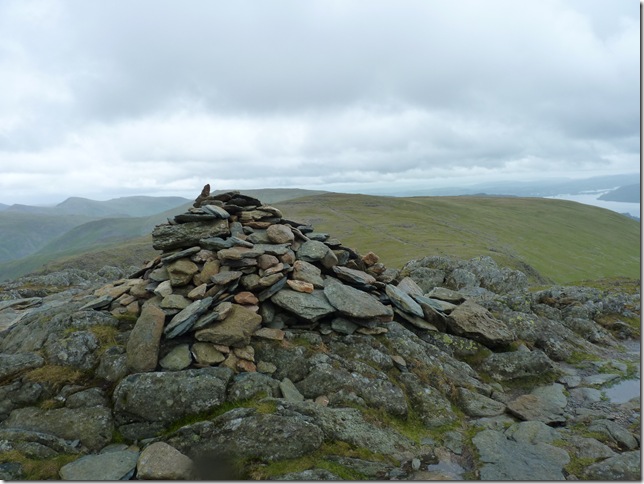
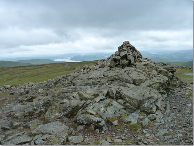
Hart Crag summit cairn. |
 |
| |
Descending Hart Crag it was here I lost Tim for a while when my mobile phone rang, most people know where I am so I’m thinking the worst ‘who’s this’ there must be a problem, It turned out it was my older brother Andy asking me was I in work, as soon as I answered he got his answer with the wind blowing a holey down the phone, we had a quick chat before I made some time up catching up with Tim. |
 |
| |
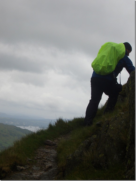
Dove Crag summit & the only shot I got, the wind was incredible here, the straps from my pack where whipping me in the face & I had to hold on for dear life to stop my snug fitting Alpine Lowe beanie doing a Dorothy, the wind as the walk progressed was getting stronger & stronger, no wonder this summit was deserted, it was inhabitable! we soon made for the stone wall to get some shelter out the wind. |
 |
| |
Now heading for High Pike, with the hard work out of the way & using the stone wall as a wind break we were now on the last legs of the tour, both me & Tim talked about how fit we felt today despite the weather which can only be good training for our Wasdale/Scafell weekend in a few weeks time. |
 |
| |
High Pike summit cairn looking back up towards Dove Crag & the wall we used as a windbreak. |
 |
| |
The plush green valley of Scandale & Scandale Head, the prominent peak at the head of the valley is Little Hartsop Dodd. |
 |
| |
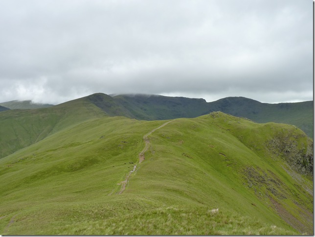
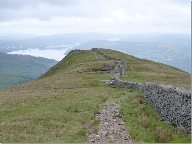
Still following this wonderful patchwork of stone wall as Low Pike comes in to view. |
 |
| |
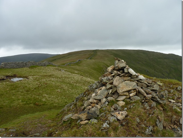
Views back up towards High Pike & Scandale from the summit of Low Pike, from here on in we knew the rain was coming, we smelt it, we felt it pelt our jackets, we had been blessed with 7 summits cloud & rain free but now it was our turn to take a soaking. |
 |
| |
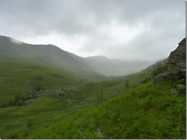
Here comes the rain..
With this is mind we cut short our route & made a right following this stone wall, more or less adjacent to Nab Scar in this picture, it was a shorter route back to Rydal however this wasn’t going to stop us getting any wetter. |
 |
| |
A rare & beautiful sight if ever I saw one, this band of rain reached us within minutes. |
 |
| |
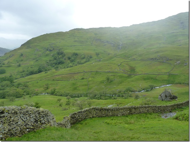
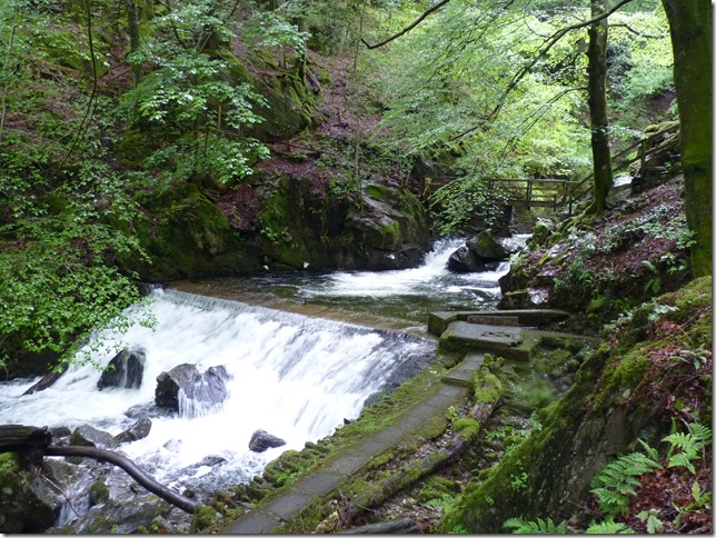
There was absolutely nothing we could do about the rain as we walked through the numerous paths traversing Rydal Park, none of whom are printed on any map, it was a case of finding our way through & listen to the roar of the waterfalls, this being the lower of two situated along Rydal Beck, We crossed the wooden bridge in the background of the picture making our way back to Rydal Mount and … |
 |
| |
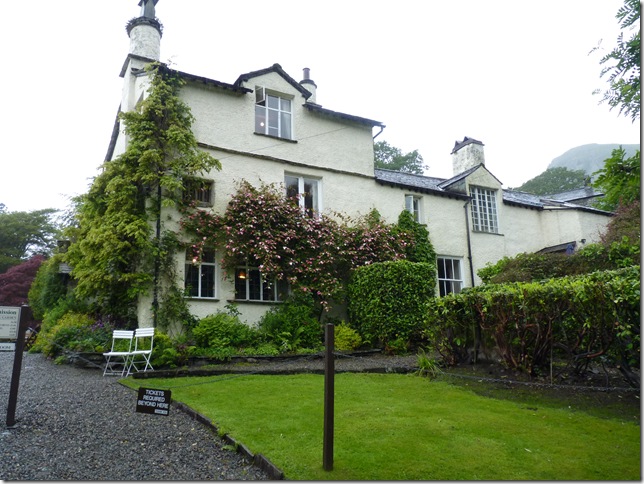
The home of one of the worlds greatest poets William Wordsworth, between the years of 1813 & 1850 Wordsworth composed most of his poems including ‘Daffodils’
I honestly don’t have an answer as to why I have waited so long to traverse the Fairfield Horseshoe, put simply it is a magnificent round capturing all that Lakeland has to offer, with lakes & tarns, top twenty peaks a plenty & not to forget the wonderful ridges along this route, I cant imagine me being away from it for to long. this walk today has been put up in my best walks this year so far & will firmly hold that position for an eternity. |
|
| |
| Back to top |
 |
|