|
Eel Crag (Crag Hill) |
 |
 |
Map and Photo Gallery |
 |
|
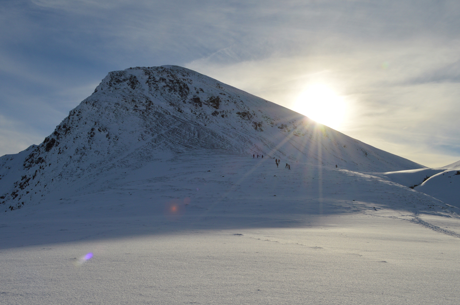 |
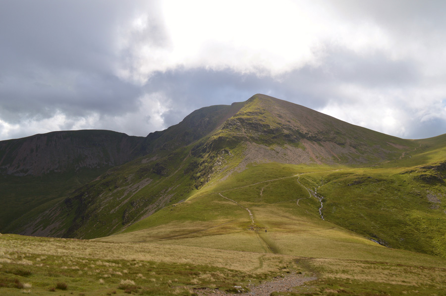
| Eel Crag (Crag Hill) over Coledale Hause. |
 |
| Eel Crag (Crag Hill) over Coledale Hause. |
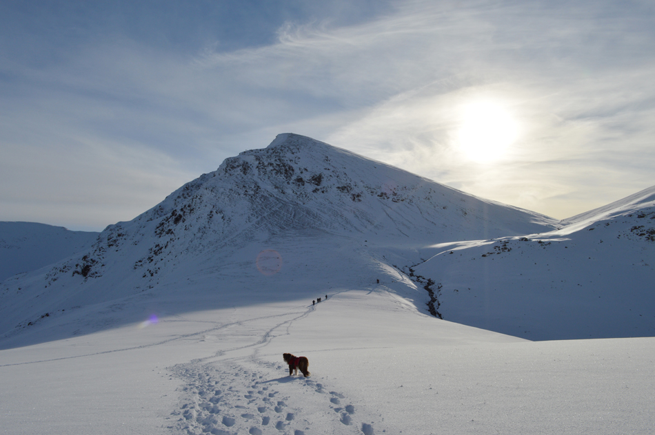 |
| Eel Crag (Crag Hill) over Coledale Hause. |
 |
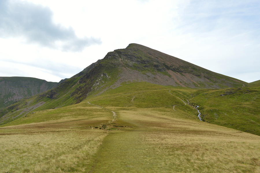
| Eel Crag (Crag Hill) and Sail from Coledale Hause. |
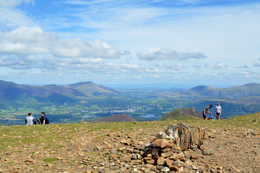 |
| Eel Crag (Crag Hill) summit Trig Point |
|
| |
|
There are 10 walks to choose from including Eel Crag (Crag Hill) |
|
|
Around Coledale Hause |
|
|
 |
|
20th December 2025 |
| ASCENT: |
3,663 Feet - 1,116 Metres |
| MILES: |
8.5 |
| WAINWRIGHTS: |
4, Grisedale Pike - Hopegill Head - Eel Crag (Crag Hill) - Sail |
| ROUTE: |
Car Park, Whinlatter Pass - Kinn - Sleet How - Grisedale Pike - Hobcarton Head - Sand Hill - Coledale Hause - Eel Crag - Eel Crag (Crag Hill) - The Scar - Sail - Sail Pass - Coledale Beck - Coledale - Car Park, Whinlatter Pass |
|
| |
|
Grasmoor & Neighbours |
|
|
|
|
7th February 2025 |
| ASCENT: |
3,900 Feet - 1,188 Metres |
| MILES: |
9 |
| WAINWRIGHTS: |
7, Whiteside - Hopegill Head - Grasmoor - Eel Crag (Crag Hill) - Wandope - Whiteless Pike - Rannerdale Knotts |
| ROUTE: |
Lanthwaite Green - Liza Beck - Whin Ben - Whiteside - Hopegill Head - Sand Hill - Coledale Hause - Grasmoor - Eel Crag (Crag Hill) - Wandope - Thirdgill Head Man - Whiteless Edge - Whiteless Pike - Low Bank - Rannerdale Knotts - Rannerdale Farm |
|
| |
|
The Coledale Horseshoe |
|
|
|
|
11th August 2022 |
| ASCENT: |
4,538 Feet - 1,384 Metres |
| MILES: |
11 |
| WAINWRIGHTS: |
9, Grisedale Pike - Hopegill Head - Wandope - Eel Crag (Crag Hill) - Sail - Scar Crags - Causey Pike - Outerside - Barrow |
| ROUTE: |
Whinlatter Pass - Kinn - Sleet How - Grisedale Pike - Hobcarton Crag - Hopegill Head - Sand Hill - Coledale Hause - Wandope Moss - Wandope - Eel Crag (Crag Hill) - The Scar - Sail - Scar Crags - Causey Pike - High Moss - Outerside - Barrow Door - Barrow - Braithwaite Lodge - Braithwaite - Whinlatter Pass |
|
| |
|
Grasmoor Direct |
|
|
|
|
22nd June 2019 |
| ASCENT: |
3,384 Feet - 1,032 Metres |
| MILES: |
6.4 |
| WAINWRIGHTS: |
4, Grasmoor - Eel Crag (Crag Hill) - Hopegill Head - Whiteside |
| ROUTE: |
Lanthwaite Green - Grasmoor North West Ridge - Grasmoor End - Grasmoor - Eel Crag (Crag Hill) - Eel Crag - Coledale Hause - Sand Hill - Hopegill Head - Whiteside East Top - Gasgale Crags - Whiteside - Whin Benn - Liza Beck - Lanthwaite Green |
|
| |
|
Walking the Wainwrights in 30 Walks - Walk 29 Rannerdale Knotts to Barrow |
|
|
|
|
27th August 2016 |
| ASCENT: |
5,898 Feet - 1,798 Meters |
| MILES: |
15.9 |
| WAINWRIGHTS: |
13, Rannerdale Knotts - Whiteless Pike - Wandope - Grasmoor - Whiteside - Hopegill Head - Grisedale Pike - Eel Crag (Crag Hill) - Sail - Scar Crags - Causey Pike - Outerside - Barrow |
| ROUTE: |
Rannerdale Farm - Rannerdale Knotts - Whiteless Breast - Whiteless Pike - Whiteless Edge - Wandope - Grasmoor - Coledale Hause - Sand Hill - Whiteside - Hopegill Head - Grisedale Pike - Coledale Hause - Eel Crag (Crag Hill) - Sail - Scar Crags - Causey Pike - High Moss - Outerside - Barrow Door - Barrow - Braithwaite |
|
| |
|
The Harry Griffin 2,000 footers Walk 23 -Around Coledale Hause |
|
|
|
|
15th August 2015 |
| ASCENT: |
5,493 Feet - 1,675 |
| MILES: |
15 |
| SUMMITS OVER 2'000Ft: |
13, Grisedale Pike - Grisedale Pike (NY 139 221) - Hopegill Head - Ladyside Pike - Whiteside - Sand Hill - Grasmoor - Whiteless Pike - Wandope - Eel Crag (Crag Hill) - Sail - Scar Crags - Causey Pike |
| ROUTE: |
Whinlatter Pass – Kin – Sleet How – Grisedale Pike – Hobcarton Crag – Hopegill Head - Ladyside Pike - Whitleside - Traverse below Hopegill Head – Sand Hill – Grasmoor North East Ridge - Grasmoor - Thirdgill Head Man - Whiteless Edge - Whiteless Pike - Whiteless Edge - Wandope – Eel Crag (Crag Hill) – Sail – Scar Crags – Causey Pike – High Moss – Barrow Door – High Coledale – Braithwaite – Whinlatter Pass |
|
| |
|
A Coledale Round |
|
|
|
|
8th June 2014 |
| ASCENT: |
4,200 Feet – 1,280 Meters |
| MILES: |
10.1 |
| WAINWRIGHTS: |
7, Grisedale Pike – Hopegill Head – Wandope – Eel Crag (Crag Hill) – Sail – Sail Pass – Scar Crags – Causey Pike |
| ROUTE: |
Whinlatter Pass – Kin – Sleet How – Grisedale Pike – Hobcarton Crag – Hopegill Head – Sand Hill – Wandope – Eel Crag (Crag Hill) – Sail – Scar Crags – Causey Pike – High Moss – Barrow Door – High Coledale – Braithwaite – Whinlatter Pass |
|
| |
|
Grisedale Pike & Eel Crag via the north ridge |
|
|
|
|
24th November 2013 |
| ASCENT: |
3,622 Feet, 1,104 Meters |
| MILES: |
8.1 |
| WAINWRIGHTS: |
4, Grisedale Pike – Crag Hill (Eel Crag) – Sail – Barrow |
| ROUTE: |
Whinlatter Pass – Kinn – Sleet How – Grisedale Pike – Coledale Hause – Eel Crag North Ridge – Crag Hill (Eel Crag) – The Scar – Sail – Sail Pass – High Moss – Barrow Door – Barrow – Braithwaite Lodge – Braithwaite – Whinlatter Pass |
|
| |
|
The Coledale Horseshoe |
|
|
|
|
6th November 2011 |
| ASCENT: |
4,200 Feet, 1,280 Meters |
| MILES: |
11.5 |
| WAINWRIGHTS: |
8, Grisedale Pike, Hopegill Head, Grasmore, Wandope, Eel Crag (Crag Hill) Sail, Scar Crags, Causey Pike |
| ROUTE: |
Braithwaite, Kin, Sleet How, Grisedale Pike, Hopegill Head, Coledale Hause, Grasmore, Wandope, Eel Cragl (Crag Hill), Sail, Scar Crags, Causey Pike, Rowling End, Uzzicar, Braithwaite |
|
| |
|
The Coledale Horseshoe |
|
|
|
|
17th July 2010 |
| ASCENT: |
1,449 Mtrs 4,100 Ft |
| MILES: |
10.25 |
| WAINWRIGHTS: |
7 Grisdale Pike, Hopegill Head, Crag Hill (Eel Crag) Sail, Scar Crags, Outerside, Barrow |
| ROUTE: |
|
|
| |
| Back to top |
 |
|