|
The Coledale Horseshoe |
 |
 |
11th August 2022 |
 |
|
I'd planned to walk the Coledale Horseshoe at the same I came up with Monday's Mosedale Horseshoe. That was a couple of weeks ago and back then there was no sign of this weeks heat wave. I coped Ok on with the heat on Monday and same again for the Cat Bells sunset walk but would it be advisable to spend close to seven hours on the hill in exposed to 29°C heat. The answer to that would probably be no.
Only you knows your body and what you can push it to. A few years ago when Tim was in training for one of his many trail marathons, events that can't be moved whatever the weather Tim told me he conditioned his body by flushing litres of water through his liver up to two weeks before the event which made sense and I've been doing the same all week.
I'll be honest I didn't want to change todays walk because it was 2014 when I last walked it, besides when I did try to think of somewhere else to walk nothing came to mind. I was that focused on walking the Coledale Horseshoe. Preparation was key and it goes without saying that I needed to keep myself focused, hydrate the best I could and protect against the sun and should it come to it, know when it's time to bail out. |
|
| Wainwright Guide Book |
 |
| The North Western Fells |
Grisedale Pike
Conspicuously in view from the environs of Keswick, it's one of those fells that compels attention by reason of shapeliness and height. |
 |
|
|
|
|
| |
|
Overview |
|
|
| Ascent: |
4,538 Feet - 1,384 Metres |
| Wainwrights: |
9, Grisedale Pike - Hopegill Head - Wandope - Eel Crag (Crag Hill) - Sail - Scar Crags - Causey Pike - Outerside - Barrow |
| Visiting: |
2, Kinn - Hobcarton Crag |
| Weather: |
Hot & Sunny With Very Clear Visibility. Light Winds At Height. Highs of 29°C Lows of 16°C |
| Parking: |
Car Park, Whinlatter Pass Just above Braithwaite |
| Area: |
North Western |
| Miles: |
11 |
| Walking With: |
On My Own |
| Ordnance Survey: |
OL4 |
| Time Taken: |
6 Hours 20 Minutes |
| Route: |
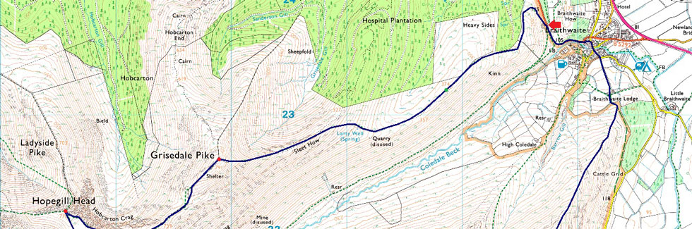
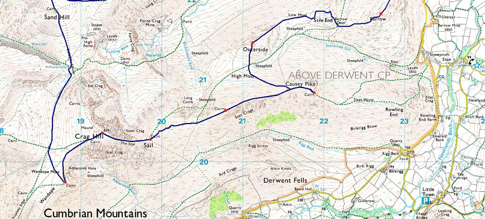
Whinlatter Pass - Kinn - Sleet How - Grisedale Pike - Hobcarton Crag - Hopegill Head - Sand Hill - Coledale Hause - Wandope Moss - Wandope - Eel Crag (Crag Hill) - The Scar - Sail - Scar Crags - Causey Pike - High Moss - Outerside - Barrow Door - Barrow - Braithwaite Lodge - Braithwaite - Whinlatter Pass |
|
| |
|
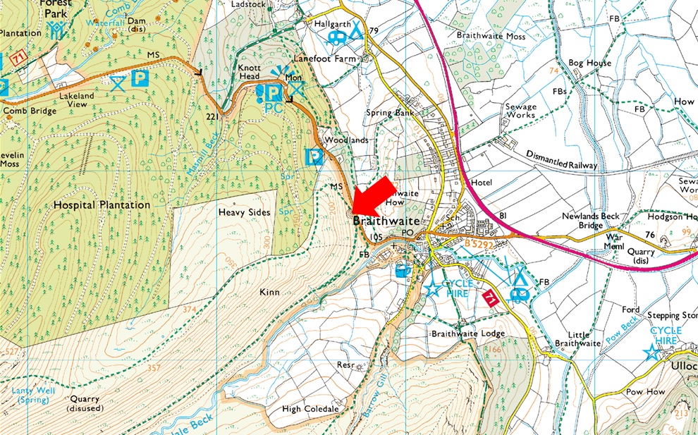
Parking Details and Map |
|
|
| Nearest Post Code: |
CA12 5TL |
| Grid Reference: |
NY 227 223 |
| Notes: |
Follow the B5292 through Braithwaite Village before joining the bottom of the Whinlatter Pass, here the road steepens after a tight right hand bend, look out for a Parking sign partially hidden by trees on the left hand side and turn left onto the car park. This car park just above Braithwaite is quite small and is very popular especially during the Summer months. The car park provides instant access to Grisedale Pike via Kinn and Force Crag mine. Parking is free. |
|
| |
|
Map and Photo Gallery |
|
|
  |
| |
| |
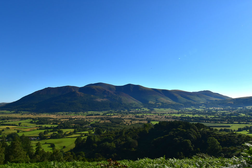 |
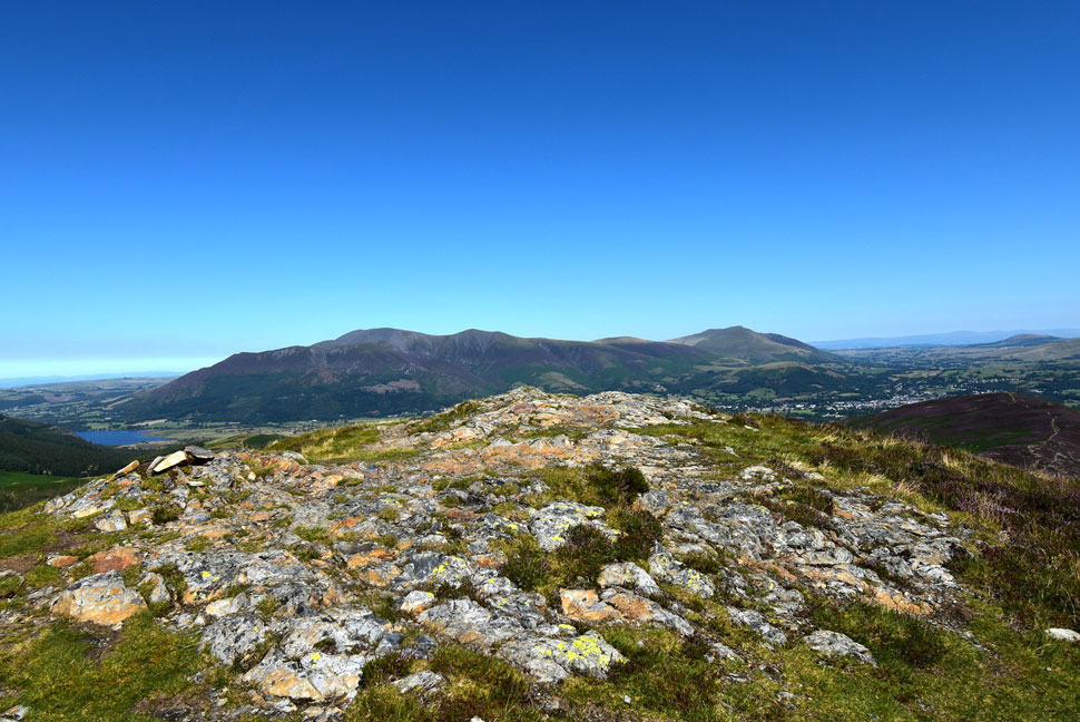
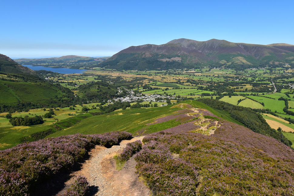
| The Skiddaw Massif, Latrigg, Lonscale Fell and Blencathra 08:30am 16°C |
Taking on as much fluid as I could carry was the key to getting through the day and after downing a litre during the drive north I finished off a 500ml bottle of Lucozade while kitting up. Alongside my 3ltr bladder pack I'm also carrying a 1ltr bottle of water plus another 500ml bottle of Lucozade which I aim to wash lunch down with. To say that my pack felt like a ton would be an understatement but it would lighten through the day. You'd think I'd be peeing for England drinking that lot but the only time I did was at the start of the walk and that was what I'd drank during the drive up, the rest I'd sweated out.
I didn't have any trouble parking although if I'd have left it any later I would have finding just two spaces left, I got one and a lady who I think I've seen before on the fells got the other "be alright there will it" referring to her car "aye no bother" I replied. She left in the direction of Braithwaite and I wondered was she doing the same route as me only clockwise, I'd soon know if I see her later I told myself. I shouldered my pack with a thud, locked my car, secured my keys and climbed the steps out of the car park before going off path to have a chat with the bracken. |
 |
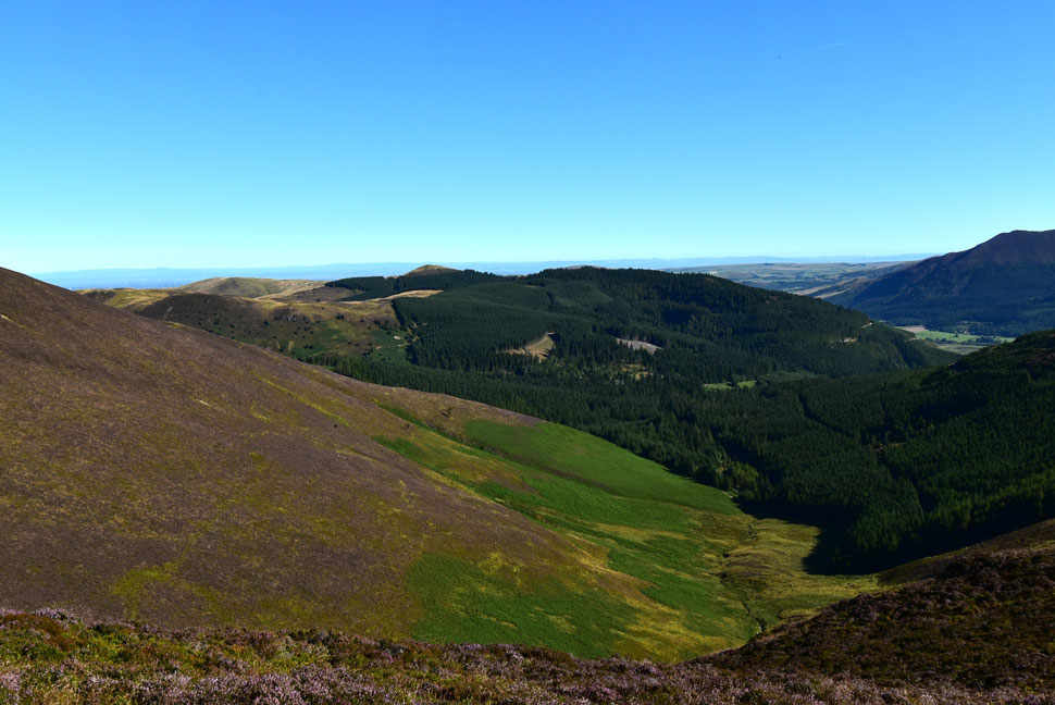
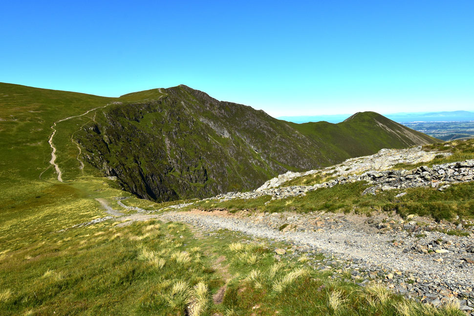
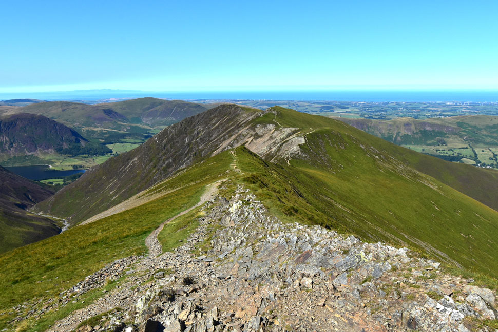
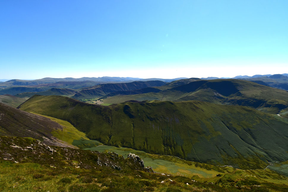
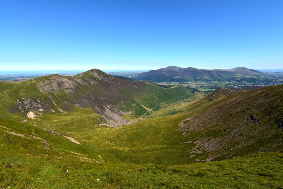
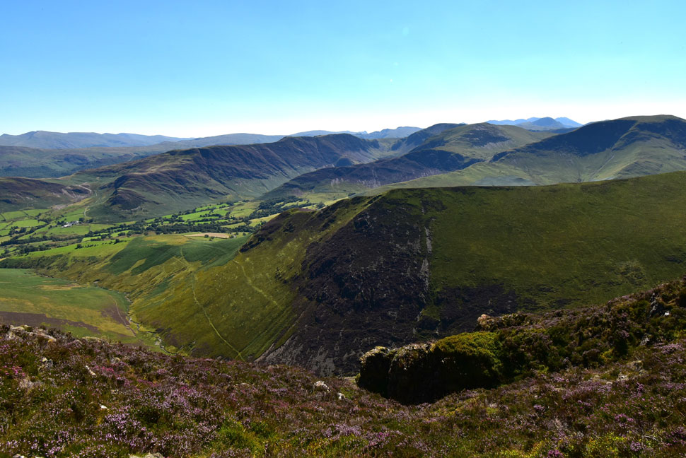
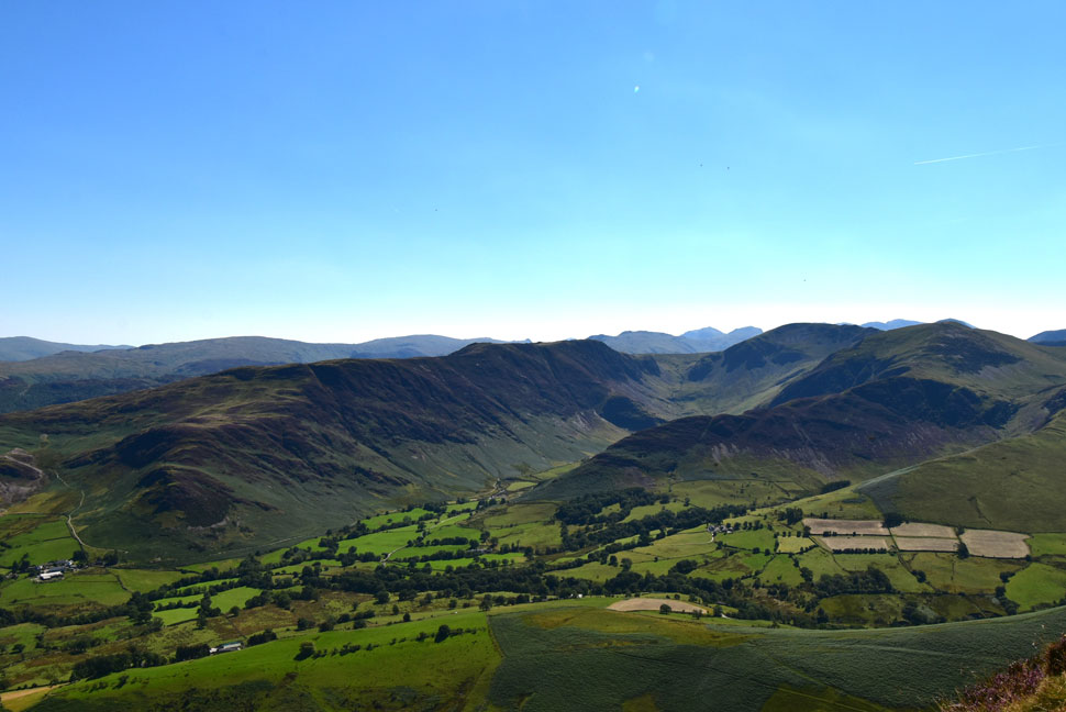
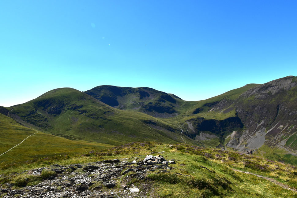
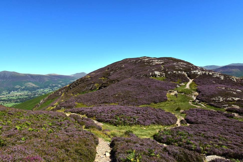
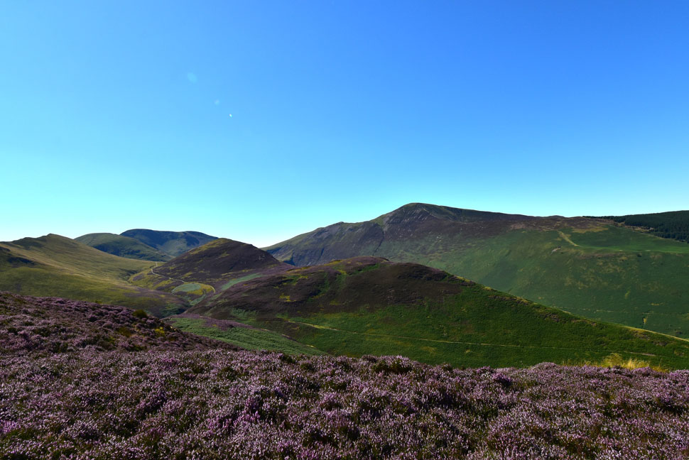
| The view over the Coledale Valley towards Stile End, Outerside, Causey Pike, Scar Crags, Sail, Eel Crag (Crag Hill) and Grasmoor. |
| It's a steep pull straight from the car park via the wooden steps then through the woodland which provided some nice shade. From the woodland the path traces towards the Kinn via another steady pull through Bracken which was showing signs of turning. If Autumn is around the corner it sure doesn't feel like it. |
 |
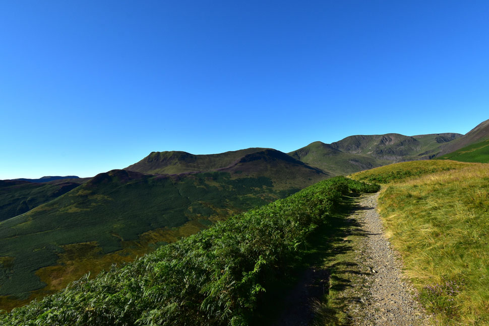
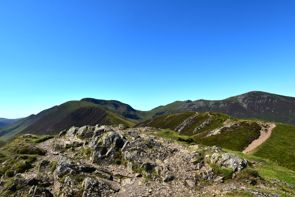
| Sail, Eel Crag, Grasmoor and Grisedale Pike from Kinn. |
| The saving grace came in the form of a very light wind which would increase with height. I'm still struggling to believe how clear it is today. |
 |
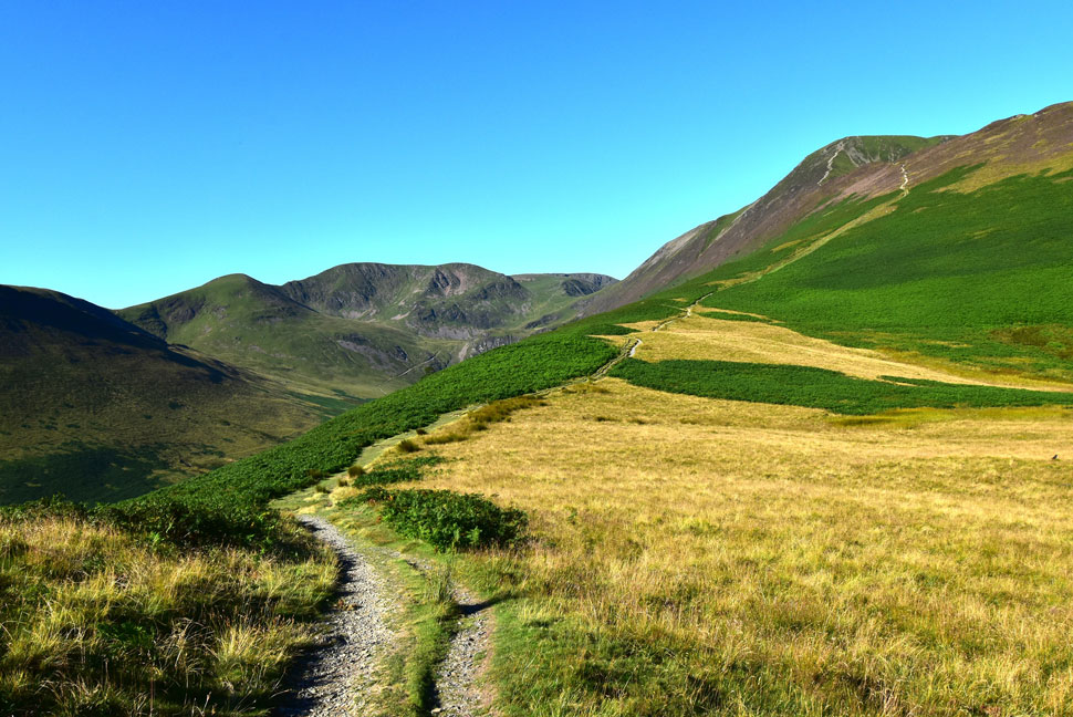
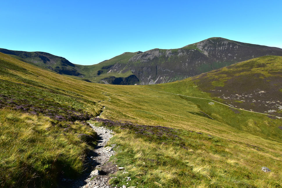
| Sleet How up ahead. |
| After passing over Kinn I overtook a family who had two young girls with them. They were very nice people but it didn't look like the two young-uns were enjoying the heat, come to think it neither did the adults. |
 |
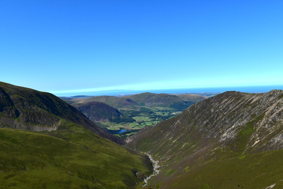
| The view over Grisedale Gill towards Broom Fell, Lord's Seat and Barf. |
| It was so clear I could see a trio of walkers on Whinlatter but too far away for the camera I'm afraid. |
 |
| Looking down on Kinn towards the Skiddaw Massif, Latrigg, Lonscale Fell and Blencathra. |
| Just like Maiden Moor on Tuesday evening I'm enjoying the heather at this time of year which gave off a wonderful scent. |
 |
| Views into the Coledale Valley. |
| With Sail, Scar Crags and Eel Crag (Crag Hill) and finally Force Crag lower right. I've been meaning to climb Tower Ridge on Eel Crag for sometime now which can be seen as the centre ridge leading onto Eel Crag summit. Hopefully before the year is out I'll be able to draw a line though it on my 'to do' list. |
 |
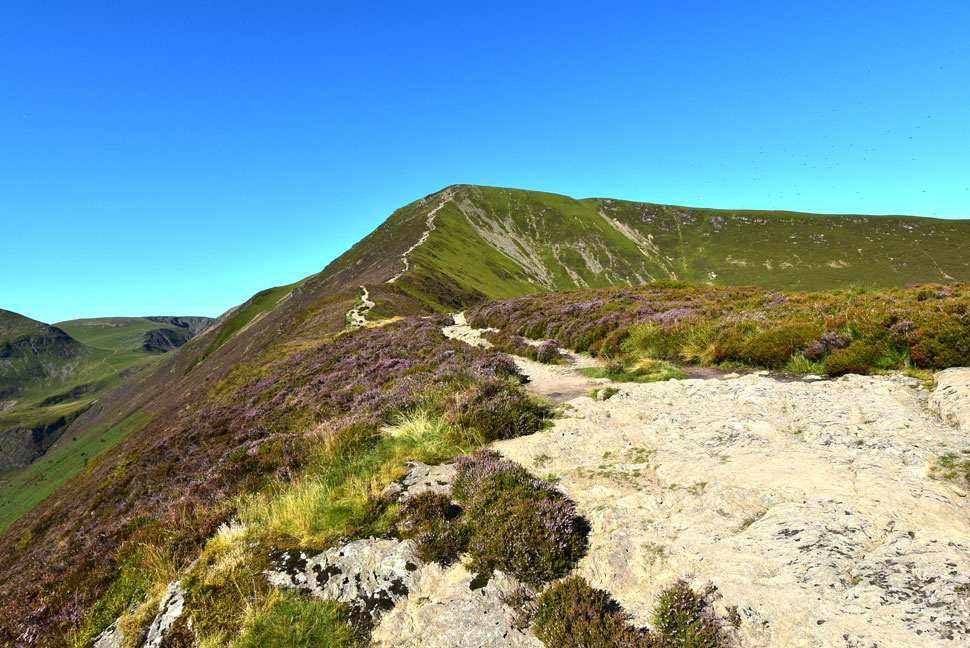
| Looking towards Hobcarton End, the Lord's Seat Fells and Binsey. |
| Here's the Lord's Seat Fells again with Hobcarton End seen at the end of Grisedale Pike north ridge. |
 |
| Eel Crag (Crag Hill) Grasmoor, Sand Hill, Hopegill Head, Hobcarton Head and Whiteside from Grisedale Pike summit. |
| I continued my climb up Sleet How and in doing so passed a young couple who told me it was so clear at the summit that you could see the Isle of Man. It was true in the distance you could see the Isle of Man but for me, it was this view which stole all of my attention. |
 |
| Grasmoor, Sand Hill, Hopegill Head, Hobcarton Head and Whiteside from Grisedale Pike. |
| I'm heading over to Hopegill Head next which is one of those summits that I'm really fond of but don't visit enough. |
 |
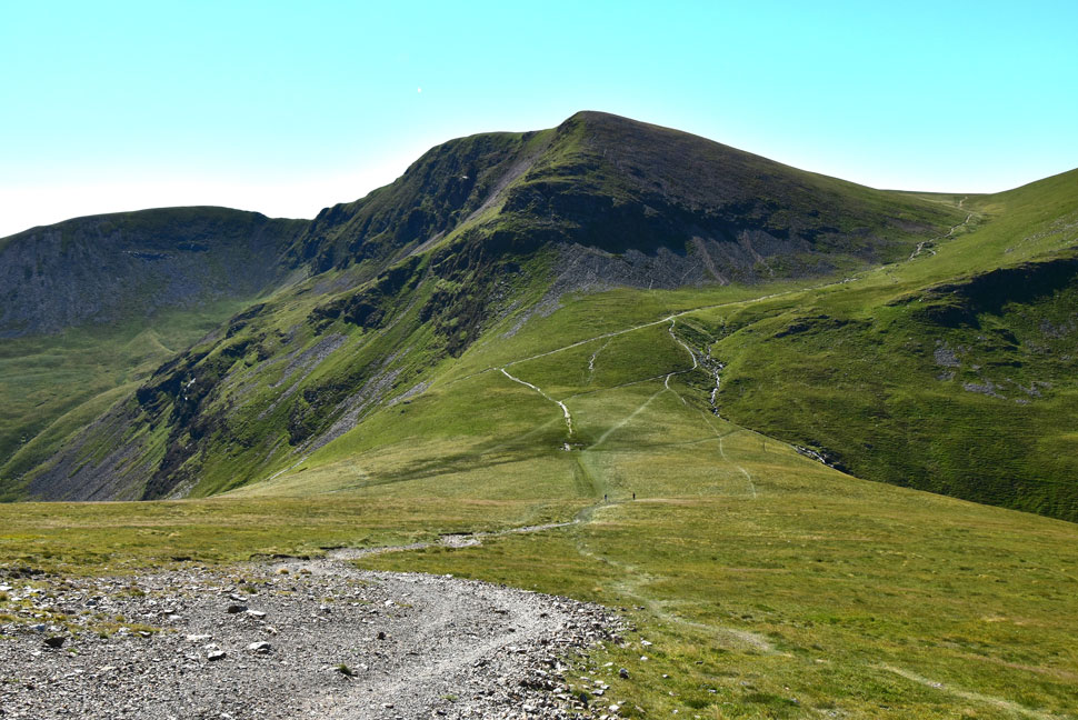
| Sand Hill, Hopegill Head and Ladyside Pike from Hobcarton Head. |
| Epic views of Hopegill Head as I cross the col over Hobcarton Head. |
 |
| Looking south... |
| ...I take in the view over Coledale Hause towards Eel Crag (Crag Hill) and Grasmoor. Tower Ridge can be seen more prominently now at a point when I'm still contemplating whether to include Grasmoor given that the temperature continues to rise. |
 |
| Hopegill Head and Ladyside Pike. |
| Despite the heat this is another ascent that I always enjoy. |
 |
| Looking back on Hobcarton Head and Grisedale Pike. |
| |
 |
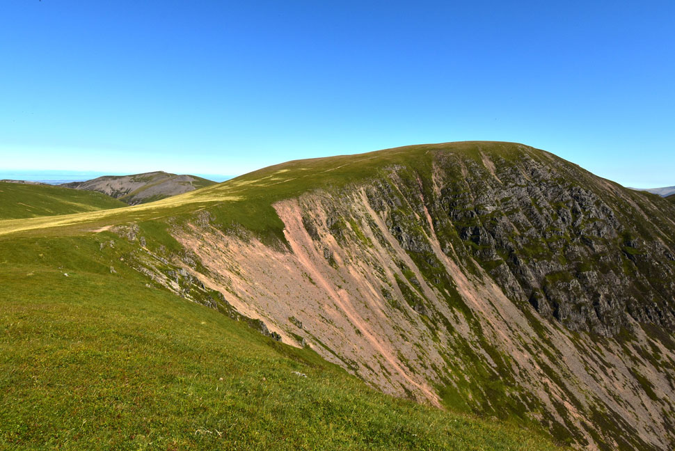
| Ladyside Pike from Hopegill Head. |
I soon reached Hopegill Head summit which was when I noticed two fell runners tailing me who by now had just ran from Grisedale Pike and were crossing Hobcarton Crag. I really don't know how they can run in such intense heat and humidity when I'm struggling to put one foot in front of the other!
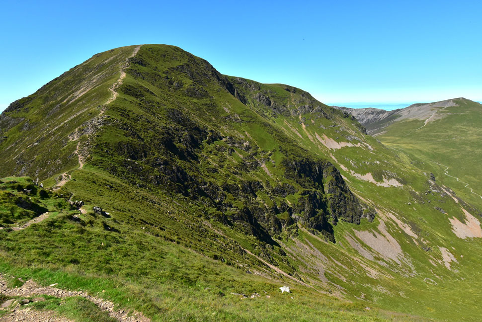
Here as I look down on Ladyside Pike I'm reminded of the precarious steep band of rock which requires some careful footings in order to reach Ladyside Pike. |
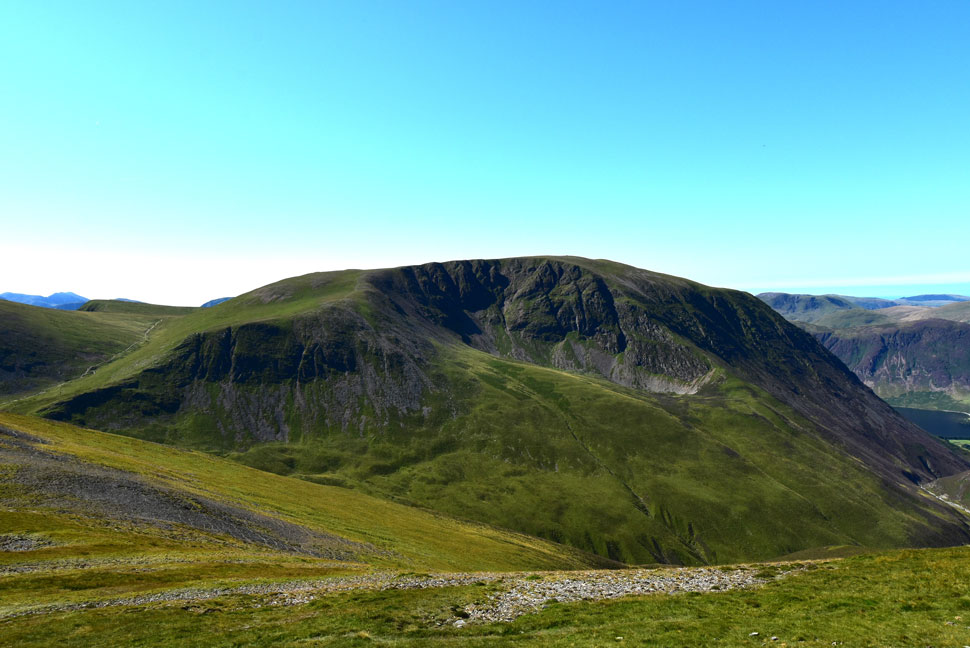 |
| Grasmoor broadside. |
| By my reckonings by the time I would have crossed Coledale Hause I'd be approaching lunchtime and with that, more increases in temperature. It's already the mid twenties by now so I decided to give Grasmoor a miss to help set me up for the return leg of the horseshoe. Incidently, that's Wandope seen far left which I summit in place of Grasmoor (I just didn't know it yet) |
 |
| The Whiteside Ridge from Hopegill Head summit. |
| With the Isle of Man seen in the distance. |
 |
| Views down into the Gasgill Valley with Grasmoor's Dove Crags seen left and Whiteside's Gasgale Crags seen right. |
| While beyond the Gasgill Valley is the northern tip of Crummock Water, Mellbreak, Gavel Fell, Blake Fell and Burnbank Fell. The latter three being three more fells that I need to visit more often. |
 |
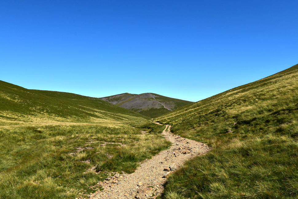
| Sail and Eel Crag (Crag Fell) from Coledale Hause. |
I left Hopegill Head and took in the views over Gasgill which extended as far as the Isle of Man from the summit Sand Hill before beginning the stony descent onto Coledale Hause.
It was during this descent was I overtaken by the fell runners who pounded past while thanking the old guy for stepping aside and letting them pass. |
 |
| Looking back on Sand Hill and Hopegill Head as I head towards Wandope. |
I'd made my mind up if I wasn't going to ascend Grasmoor (it being a fell too far in such heat) then I would make a point of visiting Wandope. I climbed out of Coledale Hause and passed the two fell runners who by now were cooling down in Liza Beck, they didn't bother to take their clothes off instead choosing to sit down minus their trail shoes. I could have joined em but thought it would be a bit on the kinky side.
Instead I continue up the path as an infant Liza Beck flowed besides me 'sod this' so I went over, removed my pack and camera and dipped my head under the water. The water was so refreshing but the longer I kept my head there I started to feel 'brain freeze' that'll do donkey. Before I left I dipped both my wrist into the water my skin felt frozen just so the cold water could get at my arteries as I did in Gatherstone Beck on Monday. The cooling off worked a treat and I didn't bother to dry my face or hair instead letting the breeze blow me dry. |
 |
| Ard Crags and Knott Rigg from Wandope Summit. |
There's also a whole host of fells in this image starting in the distance with Clough Head, Great Rigg, Stybarrow Dodd, Raise, White Side, Lower Man, Helvellyn, Nethermost Pike and Dollywagon Pike. Moving through the centre we have Bleaberry Fell, High Tove, High Seat, Cat Bells, Maiden Moor and High Spy. Staying in the centre of the photo we move to Hindscarth whose summit is obstructing Dale Head. Leaving Robinson seen right. |
 |
| Eel Crag (Crag Hill) seen over Addacomb Hole from the summit of Wandope. |
I'd completely dried off by the time I'd reached Wandope but was still feeling positively refreshed nonetheless. It was from Wandope did I spot who I thought was the lady who had parked next to my car earlier but I couldn't be entirely sure if it was her or not.
Next I'm heading up onto Eel Crag via the narrow footpath that navigates around Addacomb Hole. |
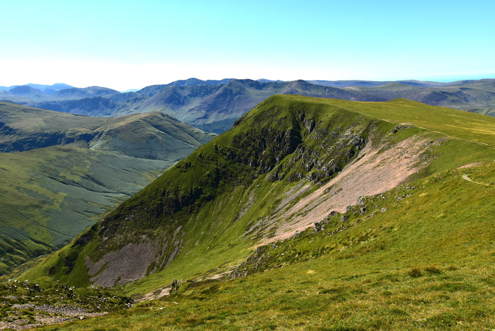 |
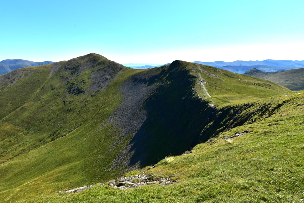
| Looking back on Wandope over Addacomb Hole. |
| The profile of Wandope steep east ridge comes into view with High Snockrigg seen left, Red Pike (Buttermere) High Stile, High Crag, Haystacks, Great Gable, Kirk Fell and Pillar. The three summits seen in the very distance are Broad Crag, Scafell Pike and Sca Fell. |
 |
| The Skiddaw Massif, Latrigg, Lonscale Fell, Blencathra and Great Mell Fell from Eel Crag (Crag Hill) |
| I followed the narrow path alongside Addacomb Hole remembering to break away as the path continues to flank the actual summit. Moments later I was stood on Eel Crag taking in the fabulous views over the Coledale Valley towards Skiddaw and Blencathra. |
 |
| A similar view looking down The Scar towards Sail, Scar Crags, Causey Pike, Outerside and Barrow. |
| It's just gone past midday, the heat is up and I'm starting to feel hungry so I decided to eat lunch on Sail and top my energy levels up with a bottle of Lucozade. |
 |
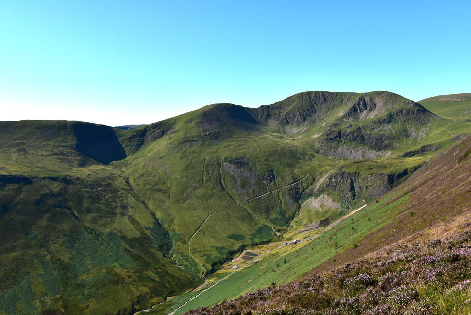
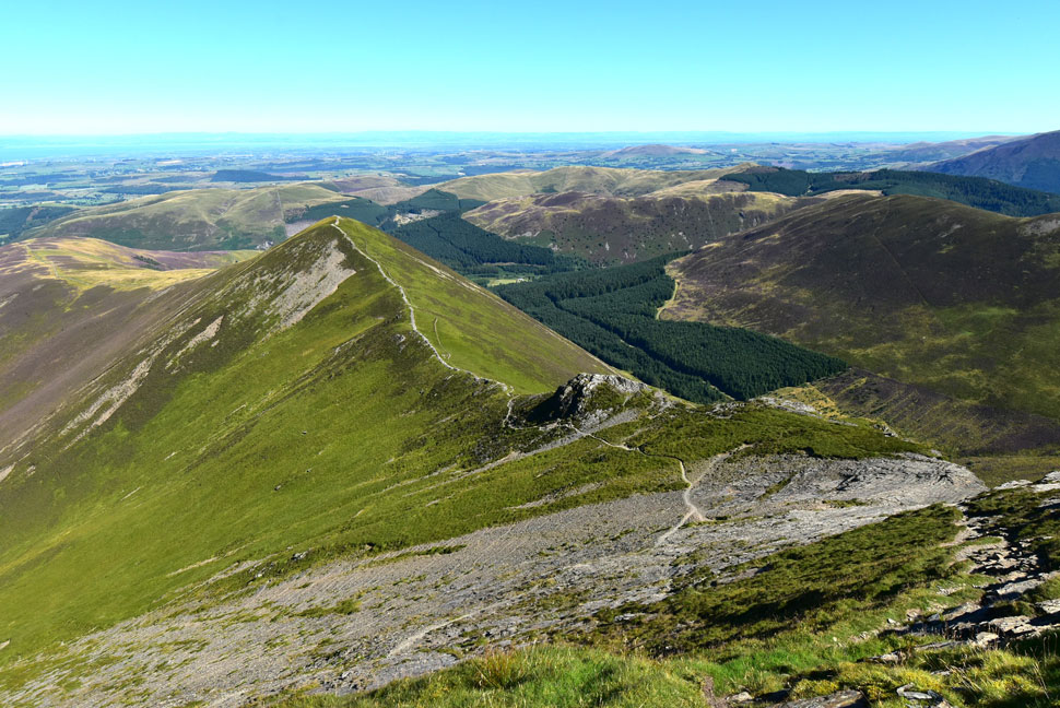
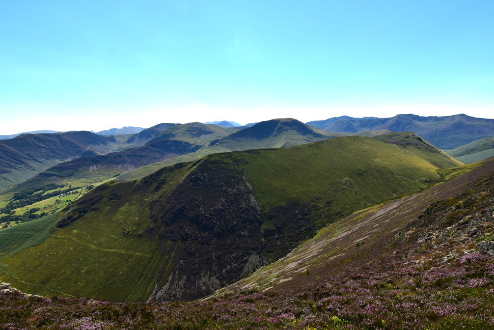
| The Coledale Valley. |
| With Force Crag, Hobcarton Crag, Grisedale Pike, Sleet How, Kinn and Outerside seen right. |
 |
| Looking back on Eel Crag (Crag Hill) The Scar, Sand Hill and Hopegill Head from The Scar. |
| In this photo you can see Tower Ridge off to the far right with the start of the ascent beginning to the right of the scree below. |
 |
| Scar Crags, Causey Pike, Outerside, Stile End and Barrow. |
I made use of a free summit on Sail summit and tucked into lunch which I'd washed down with Lucozade. groping my bladder pack it appeared I'd only drank about a 1.5ltrs leaving me with another 1.5ltrs to complete the walk with.
It was here I passed a guy at the top of the zigzags and he told me I was the first person he'd seen all day. I replied by saying I'd passed a few people mainly during the ascent of Grisedale Pike then two fell runners on Coledale Hause. He went onto say he'd also seen the fell runners running back along the mine track below. He was heading to Grasmoor then returning the same route but thought he might only make it to Eel Crag. Grasmoor in this heat certainly was the fell too far today it would seem. |
 |
| Sail and Eel Crag (Crag Hill) from Scar Crags. |
| I'd made good time descending the zigzags before the gentle ascent onto Scar Crags where I bumped into this chap who was also heading for Eel Crags before returning through the valley ending on Outerside and Barrow. We were forced to leave the summit due to flying ants which were getting everywhere. |
 |
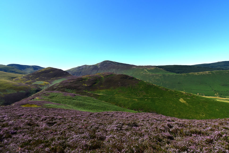
| The view beyond Ard Crags towards the Newlands Valley. |
| Not far from Causey Pike now. |
 |
| Causey Pike is just up ahead. |
| With Outerside, Stile End and Barrow towards the left. |
 |
| The fantastic Ard Crags to Knott Rigg ridge. |
| With High Spy, Dale Head, Hindscarth, and Robinson while further right Pillar, High Crag, High Stile and Red Pike (Buttermere) come into view. |
 |
| Looking back on Scar Crags. |
| Seen as I make my way towards Causey Pike. Lots of heather here too. |
 |
| The Newlands Valley. |
| Made up of Maiden Moor, High Spy, Dale Head and Hindscarth. It was only one day ago was I stood on Maiden Moor's summit looking forward to the sunset. |
 |
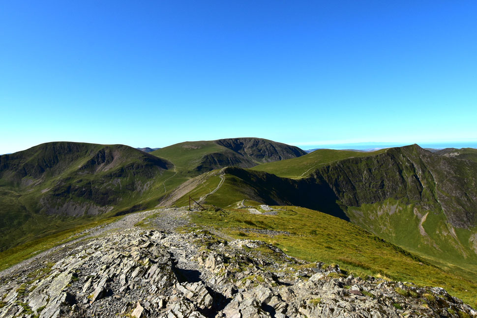
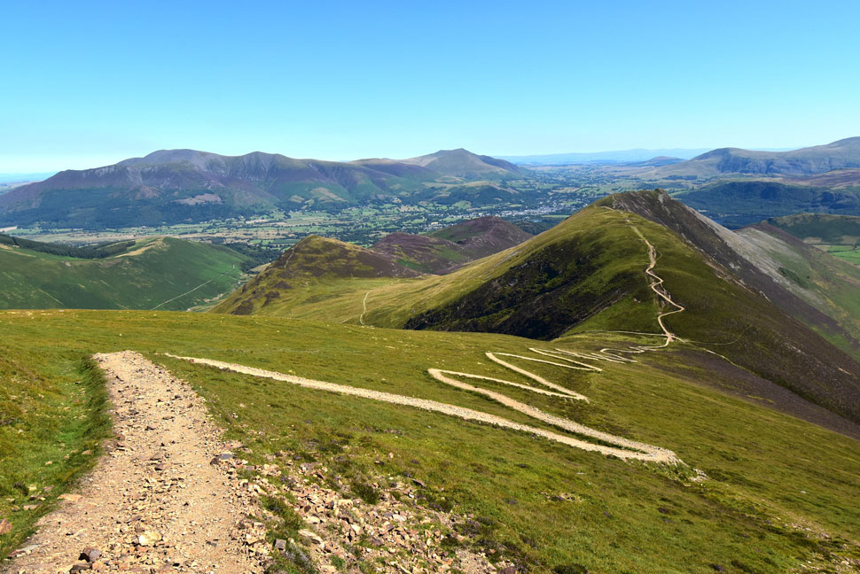
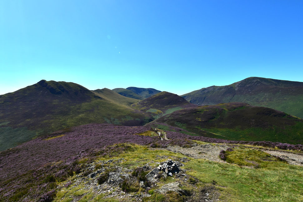
| Wandope, Scar Crags, Sail, Eel Crag (Crag Hill) Coledale Hause, Sand Hill, Hopegill Head, Hobcarton Crag and Grisedale Pike. |
| A photo that pretty much sums up todays walk. Next I return to the col (seen just above the summit) to begin my descent before todays final two summits of Outerside and Barrow. |
 |
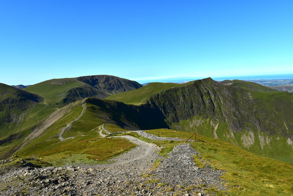
| Descending towards the top of Stony Croft Gill with views of Eel Crag (Crag Hill) Coledale Hause, Sand Hill, Hopegill Head and Grisedale Pike. |
| This handy descent will lead me straight up onto Outerside via its steep southern flank. The heat of the afternoon is getting a tad unbearable more so as I lose height and with it, any breeze that I'd encountered across the tops. |
 |
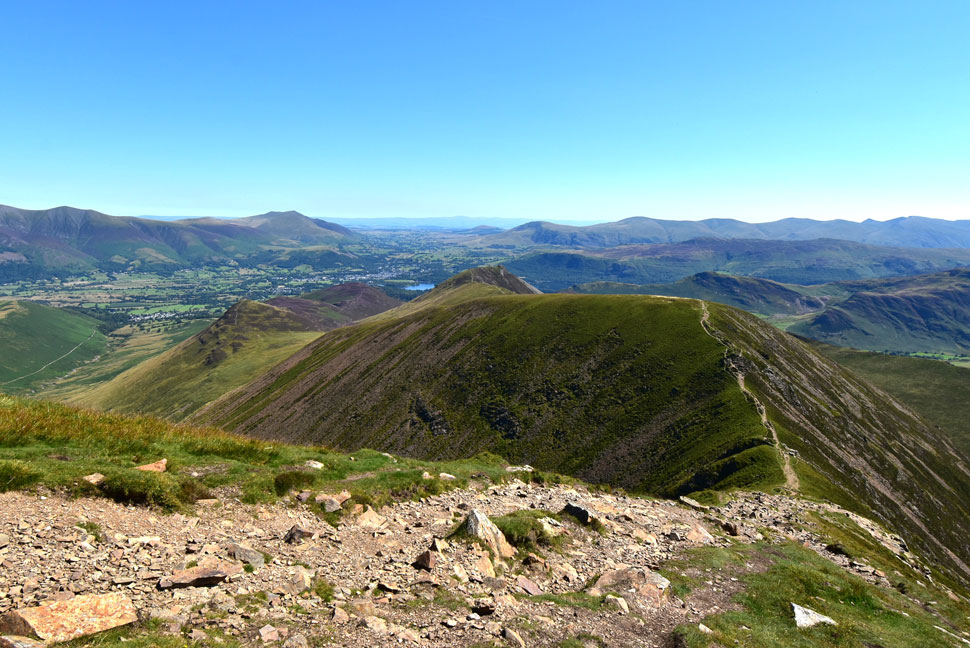
| Bassenthwaite Lake, the Skiddaw Massif, Latrigg, Lonscale Fell and Blencathra. |
| In the soaring heat it was Outerside which I thought would stop me in my tracks but with my sensible head on I took the ascent one step at a time and arrived at the summit less than ten minutes later. Adding to the joy was the folk I'd seen on the summit had left meaning I had it to myself. Did I hang around? I couldn't it was simply to hot so gotta keep moving. |
 |
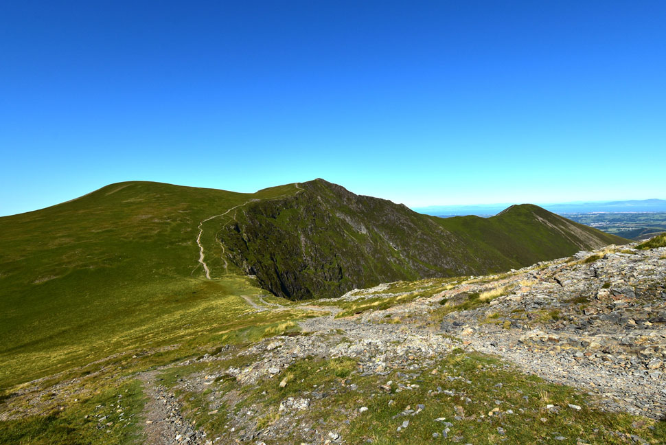
| Sail, Eel Crag (Crag Hill) Force Crag, Coledale Hause, Sand Hill and Grisedale Pike from Outerside. |
| |
 |
| Descending Outerside for Barrow Door. |
| I had the choice of steering right then rejoining the path seen over on the right or continue ahead, summit Stile End then bear right before dropping onto Barrow Door which was exactly what I did. |
 |
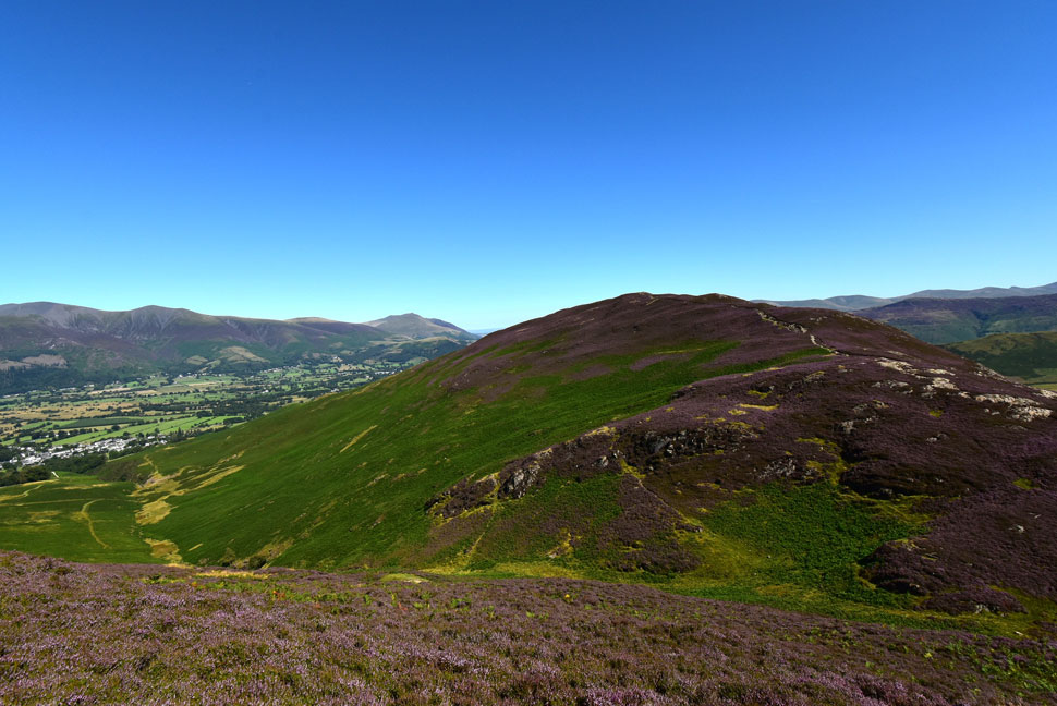
| Looking back on Outerside. |
| From a sea of heather. |
 |
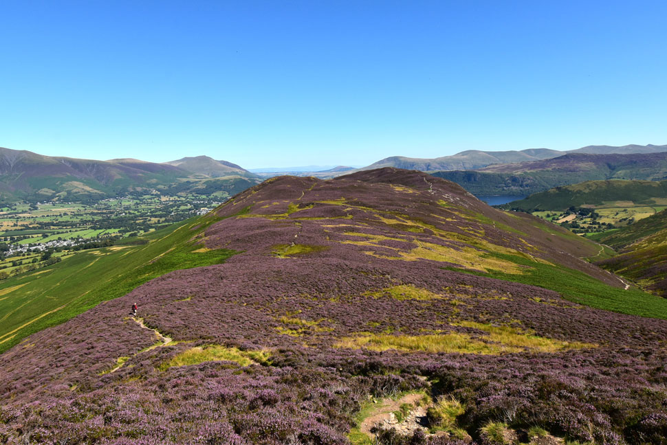
| Barrow from Stile End. |
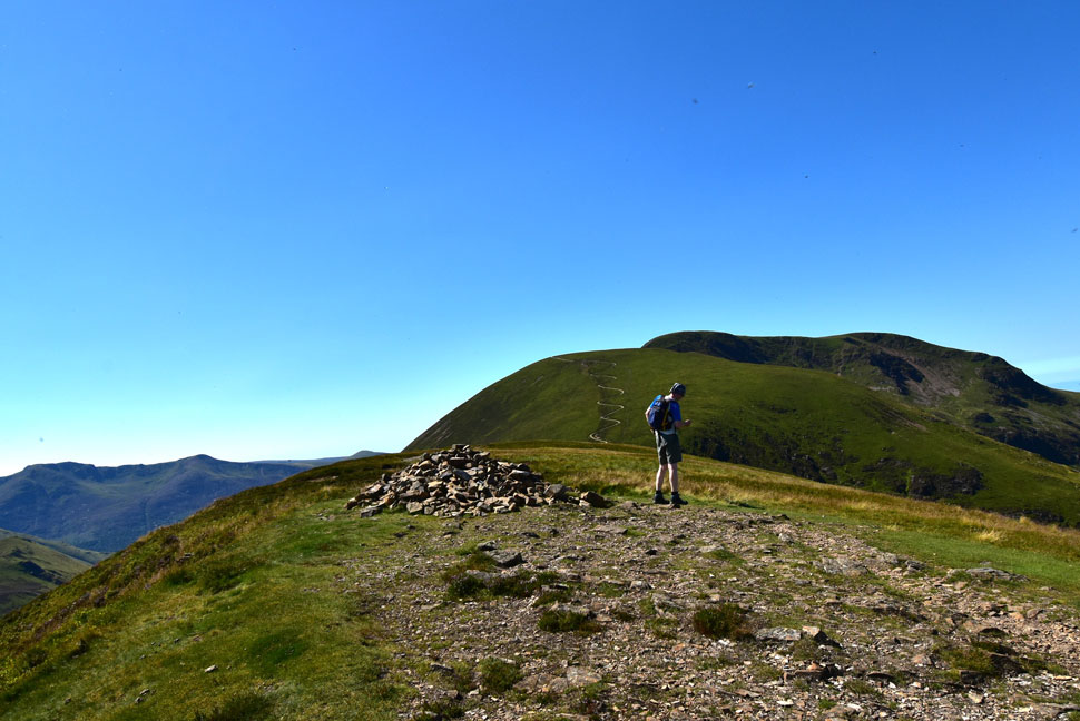
| Todays final summit. |
 |
| Barrow Door. |
| It's just a short descent from Stile End onto Barrow Door before the gentle ascent onto Barrow. |
 |
| Eel Crag (Crag Hill) Outerside, Grisedale Pike, Kinn and Stile End from Barrow. |
| |
 |
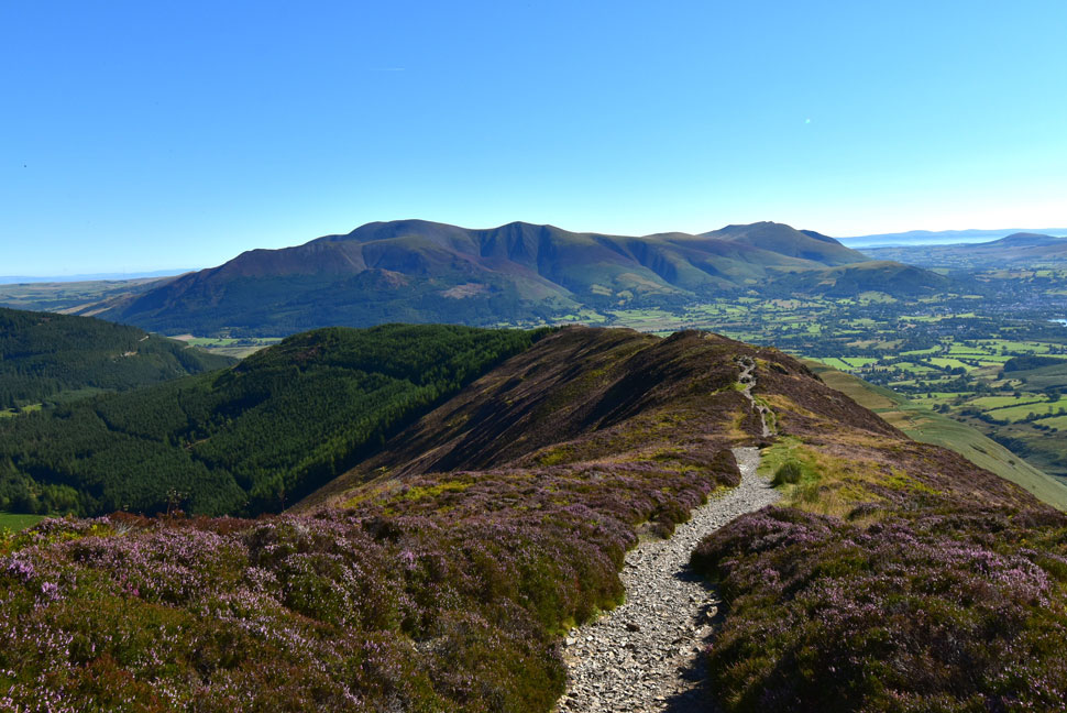
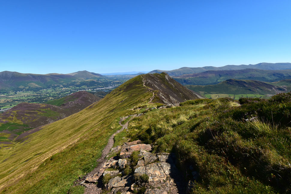
| The Coledale Horseshoe as seen from Barrow summit. |
| |
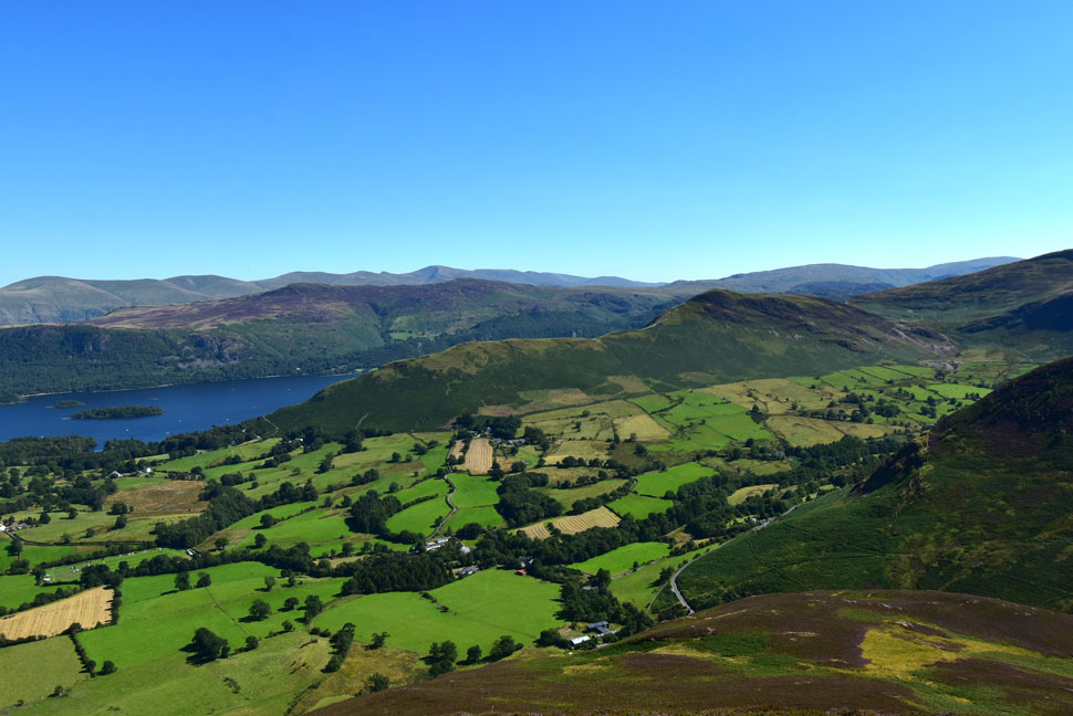 |
| Derwent Water and Cat Bells from Barrow summit. |
| With the hamlet of Stair below. |
 |
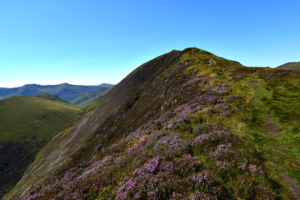
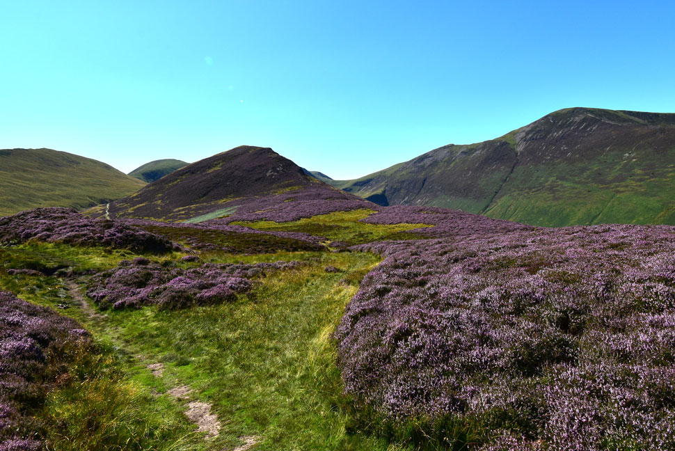
| Another image of the Coledale Horseshoe. |
| Causey Pike or heather...heather! |
 |
| Descending Barrow with Braithwaite coming into view. |
| |
 |
| Descending Barrow with Braithwaite, the Skiddaw Massif, Latrigg and Lonscale Fell. |
It was touching nearly 30°C as I made the descent from Barrow but I made sure despite the relentless heat I enjoyed the descent. By now I could hear traffic travelling along the A66 and as I descended further I could also hear the voices of children playing who seemed totally unaffected by the heat. I ran the last 200ft and passed through the little wooden gate next to Braithwaite Lodge where I kicked my feet into the backs of my boots, the shift felt heavenly. It was a busy afternoon in Braithwaite and it was nice to see the village shop doing well, sadly I can't walk through Braithwaite anymore without seeing flashbacks of the flood damage David and I witnessed after Storm Desmond back in 2015 - I still see a white Citroën Picasso in Braithwaite Beck and I still see flood damaged furniture outside flood damaged homes.
After crossing Braithwaite Beck I turn left and pass through a neat row of cottages bringing me out where the road runs alongside the beck. From here it's a steady, but short climb back to the car park which I do eyes fixed on boots without looking up. The car park was less than half full when I got back and despite the heat of the day I'd parked my car under trees meaning there was no furness to escape from. Nevertheless I put the A/C on full blast and take the last bottle of Lucozade which has also managed to stay at room temperature. Result I mutter. I down the Lucozade in two goes then catch myself in the rear view mirror looking back. I don't look as tired as I feel just a tanned reflection and a feeling of utter content. |
|
| |
| Back to top |
 |
|