|
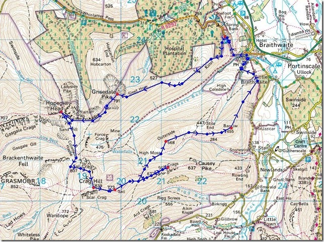
The Coledale Horseshoe |
 |
 |
17th July 2010 |
 |
|
A last minute gem of walk, when I say last minute this walk had been planed for the Sunday 18th, what I mean is this weekends walk had been cancelled due to bad weather, in July! yes I know but following the weather reports this week it looked like a washout again & I didn’t fancy another drowning like I got last weekend, so I coincided to the fact its going to be another weekend away from the fells in the aspects of me trying my hardest to be on the fells before the football seasons kicks off again, I’m fighting a losing battle here, I thought to myself, you cant fight the weather.
So came Friday evening & I’m tucked away in the study with around five different tabs open on the laptop, all weather sites (yeah I know what your thinking,..weirdo!) but here I am trying to get an average of what they are all saying, yes I know most of the UK’s weather is supplied by the Met Office & for once there all saying the same thing, Heavy showers for Saturday morning turning to light with the odd bit off sun, little gusty but I can cope with the wind then turning better as the day went on, as it goes I’m working Saturday morning, so could I get away with trusting the weather report, I mean its a big gamble isn’t it? a weather window has opened up for me & I’m going to grab it by both hands so off to work shirt & tie then change in the office into my gear & hopefully be on the M6 by 12.30.
It paid off, Jo Blyth I love you even more |
|
Wainwright Guidebook |
 |
| The North Western Fells |
|
 |
|
| |
|
Overview |
|
|
| Ascent: |
1,449 Mtrs 4,100 Ft |
| Wainwrights: |
7 Grisdale Pike, Hopegill Head, Crag Hill (Eel Crag) Sail, Scar Crags, Outerside, Barrow |
| Weather: |
Lows Of 14 Degrees, Cloudy, Patchy Heavy Showers turning to Cloud & Broken Sunshine, Highs of 16 Degrees |
| Parking: |
Car park Just Outside Braithwaith On The Winlatter Pass (F.O.C) |
| Area: |
North Western |
| Miles: |
10.25 |
| Walking With: |
On my own |
| Ordnance Survey: |
OL4 |
| Time Taken: |
5hr 30 min |
| Route: |
|
|
| |
|
Map and Photo Gallery |
|
|
 |
| |
I was lucky enough to grab the last parking space on the car park after arriving at around 2pm, & I’m thinking I’m a good few hours behind any one which can only mean I may get the summits all to myself, which is exactly what I did get, right behind the car park is the path to the start of the walk which was clearly sign posted too. |
 |
| |
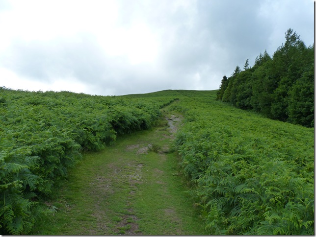
And now in a much more wider opened space, making my way up on to the Kinn. |
 |
| |
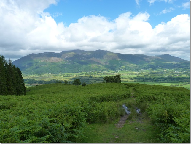
Looking back on to Skiddaw from the Kinn. |
 |
| |
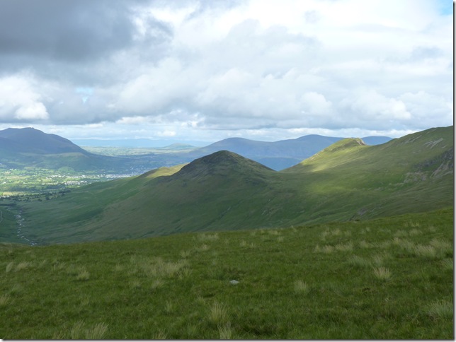
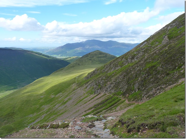
Once I crested the grassy inclines you get this view of Sleet How & Grisdale Pike, its warm & very muggy at this point which for me personally isn’t the most comfortable of walking conditions, even though there’s gust’s of wind I’m going to layer down to a happy medium mid layer hat & sunglasses. |
 |
| |
Sleet How, & I’ve just had my first soaking of the day after layering down not ten minutes previous, just a casual shower but enough for me to think about sliding my waterproof trousers on, although my trousers today are light & airy there not fully waterproof so out they came & before I could even get them on over my boots the rain had stopped & I was soaked.. ok we’ll just forget that just happened .. |
 |
| |
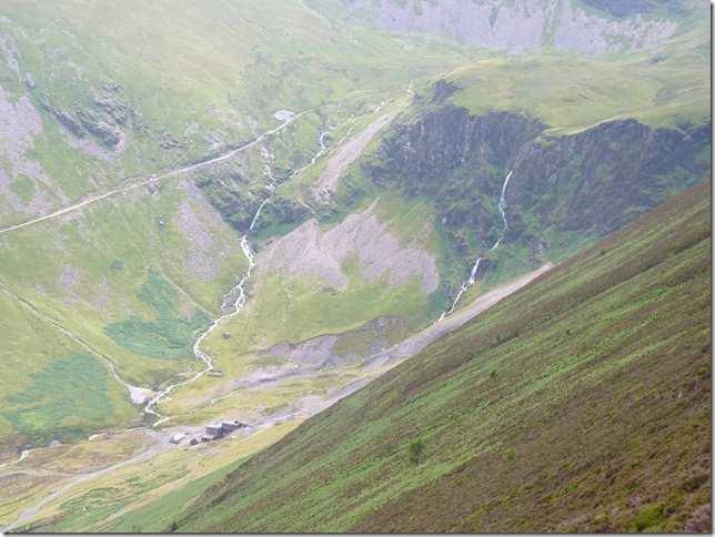
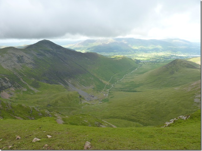
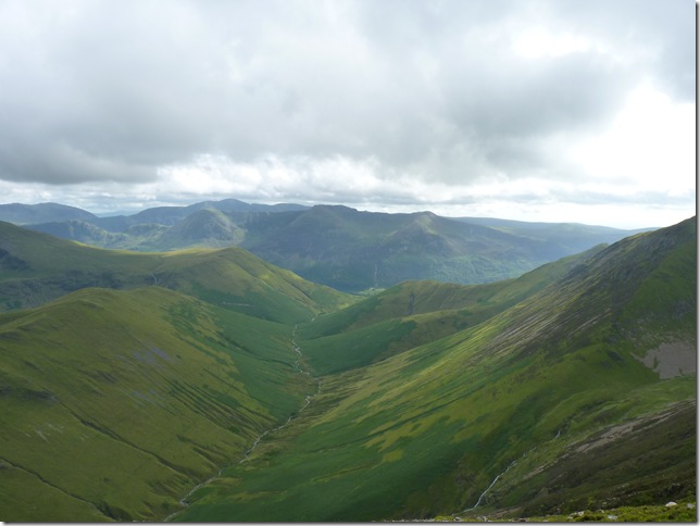
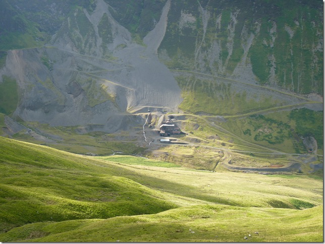
Views into Coledale, Force Crag & Force Crag mine. |
 |
| |
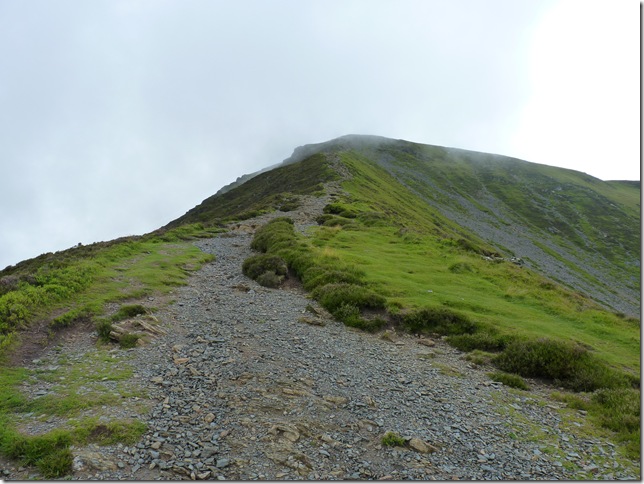
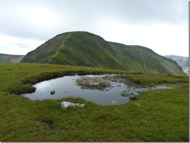
Sleet How, it looks a lot steeper than it actually is. |
 |
| |
Outerside, & behind Causey Pike. |
 |
| |
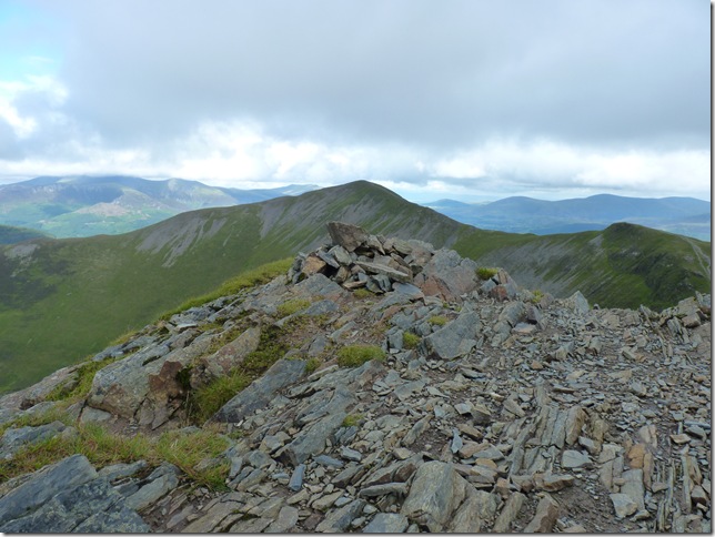
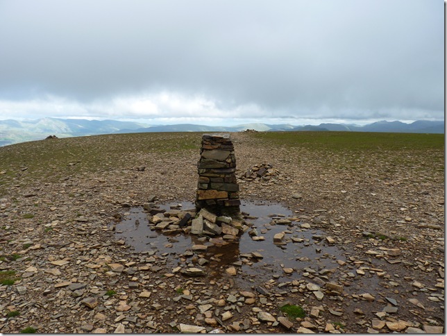
Grisedale Pike summit Cairn & sadly what’s left of the Trig Point, the cloud did come in thick & fast but briefly, so nothing too much to worry about. |
 |
| |
My next destination is the prominent peak on the skyline centre right, Hopegill head, here taken from the shelter on Grisdale Pike. |
 |
| |
Looking back on Grisedale Pike from Hobcarton Crag. |
 |
| |
Ladyside Pike far right & Hopegill Head centre. |
 |
| |
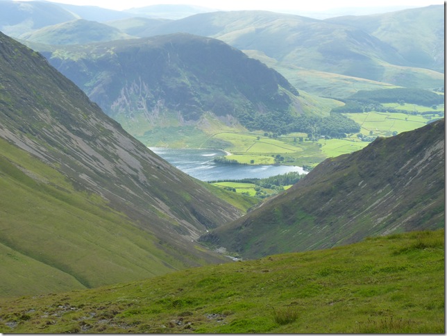
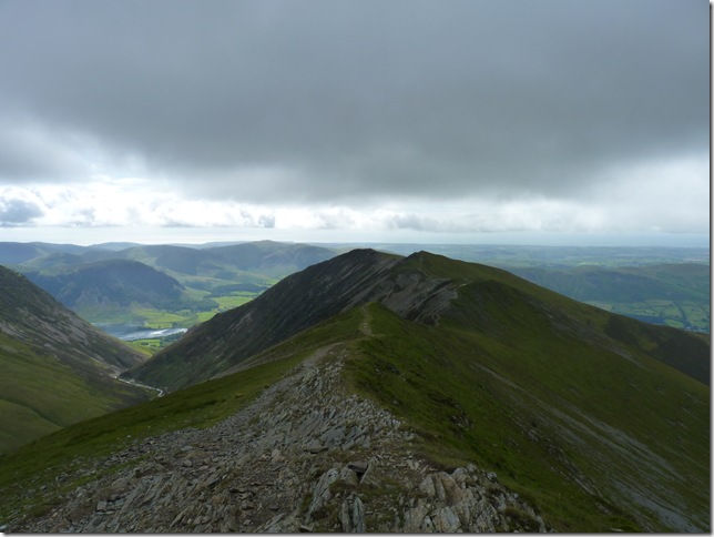
Peering down the valley at the head of Crummock Water & Mellbreak. |
 |
| |
Hopegill Head summit cairn with Grisdale Pike in the background. |
 |
| |
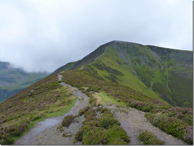
And looking down the ridge on to Whiteside & Gasgale Crags from the summit of Hopegill Head. |
 |
| |
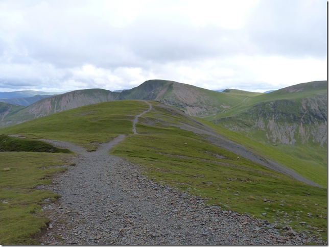
A clear view ahead over Sand Hill & my next fell Crag Hill (Eel Crags) |
 |
| |
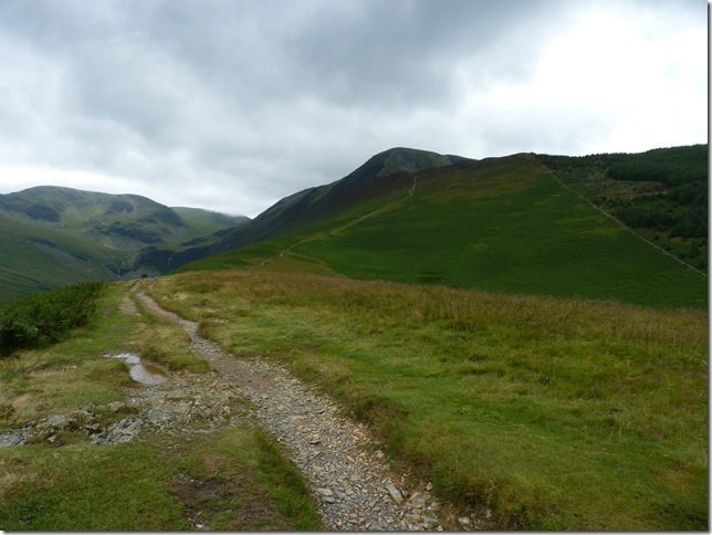
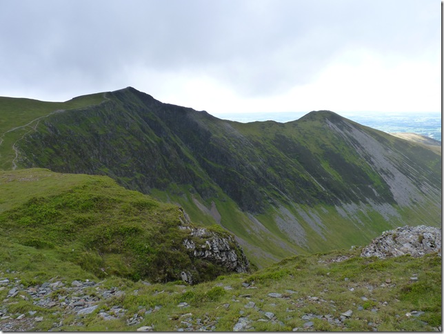
Heading down into Coledale Hause with Crag Hill (Eel Crags) centre & sail far left. |
 |
| |
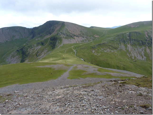
Outerside & Causey Pike far right from Coledale Hause. |
 |
| |
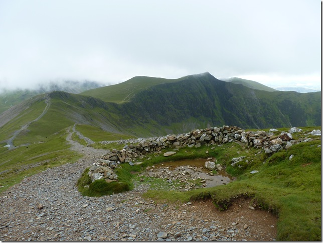
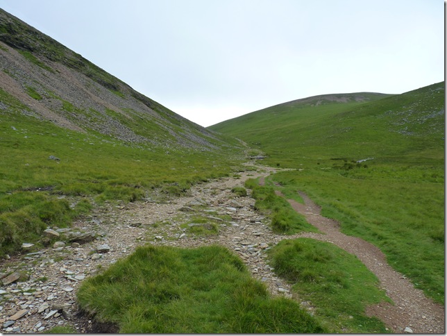
Now on the Sail Pass & the path flanks Eel Crags for some time so what I decided to do was hit the fell just after you see the path veering off to the left. |
 |
| |
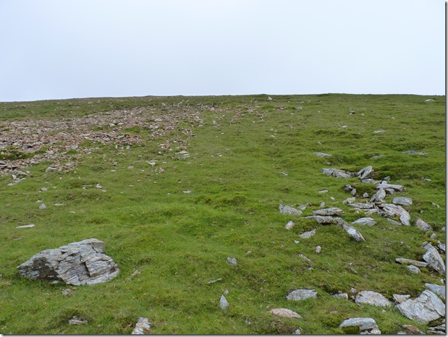
I’d picked a spot where I can see has been used before, although steeper it is also a quicker route up. |
 |
| |
Crag Hill summit plateau & I can just make out the Trig Point ahead. |
 |
| |
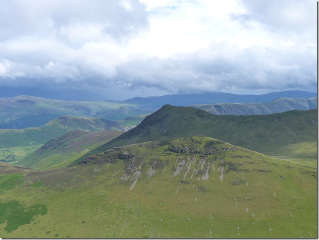
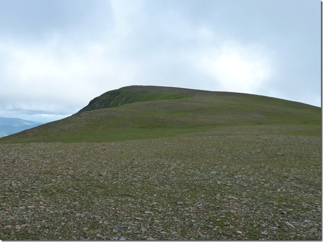
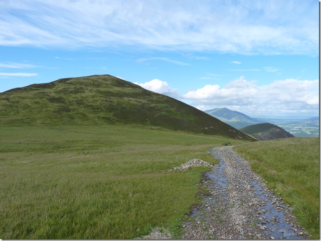
Looking down on the Coledale valley with Grisdale Pike on the left & Outerside the right & although Outerside is on my descent route I’ve got three more Wainwrights to peak before I get there, next one being.. |
 |
| |
Crag Hill (Eel Crag) summit Trig Point, I figure I’m just over half way at this point which should mean I should be overdue for a rest stop but I’m not too hungry just yet & as I’m taking in fluids as I go along I think ill press on. |
 |
| |
Looking along the ridge to Sail & Causey Pike. |
 |
| |
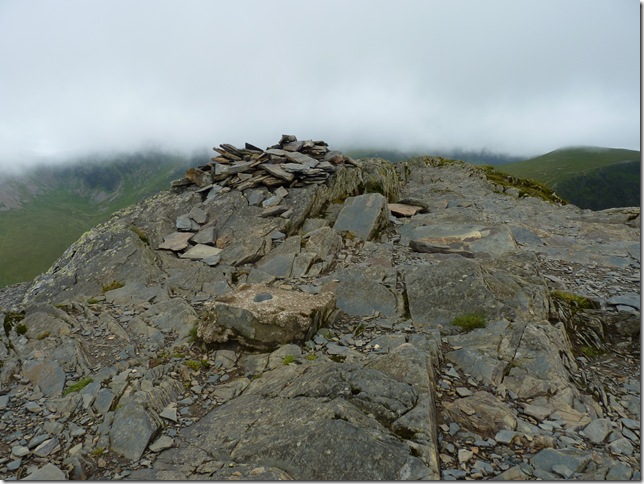
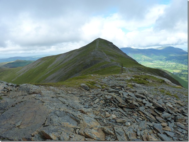
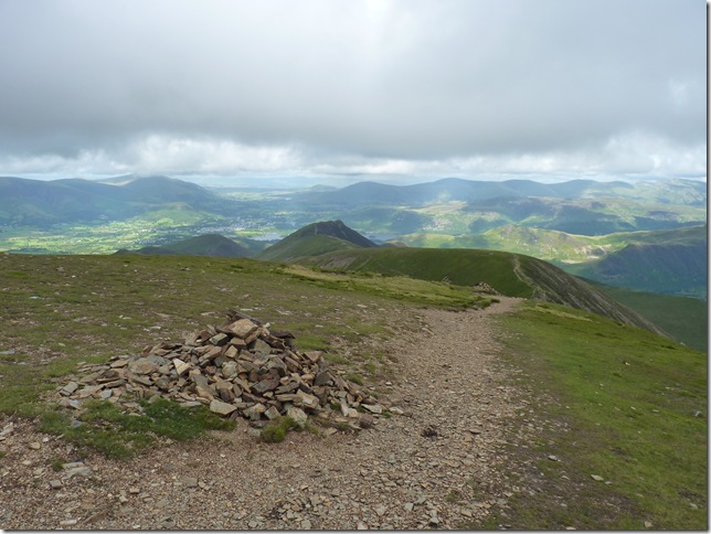
Looking back up to Crag Hill from the less impressive Sail Summit cairn, now to follow the ridge towards Scar Crags. |
 |
| |
Looking Westwards, Knott Rigg & the High Stile ridge. |
 |
| |
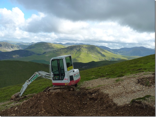
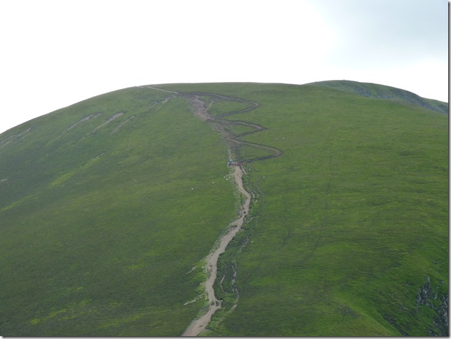
Heading down the brand newly constructive zig zag path (the old path being to the right) towards my next Fell, Scar Crags. |
 |
| |
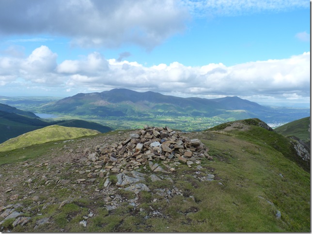
Scar Crags summit cairn with Skiddaw & a distant Blencathra. |
 |
| |
Looking back on the new path,.they make it look so easy.. |
 |
| |
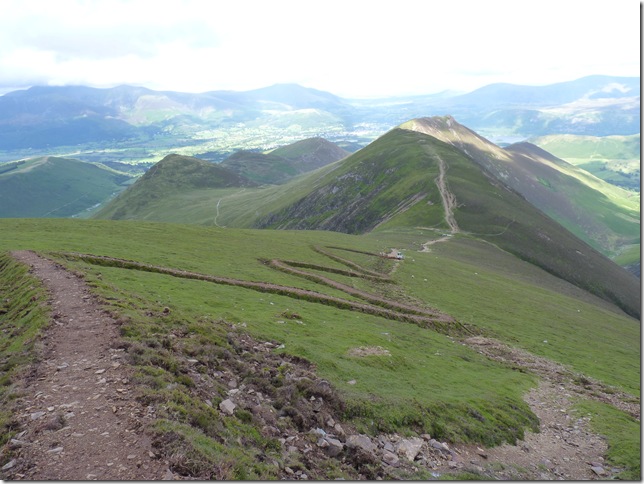
Back in the valley following the path that flanks Scar Crags & heading towards my sixth Fell of the day Outerside. |
 |
| |
A close up of the Force Crag Mine, still in use until the mid 80’s |
 |
| |
Following the path towards the cairn where i’ll hook a left across some very wet bog land & Outerside. |
 |
| |
| Outerside summit cairn with my final fell behind, Barrow. & I think i’ll have my lunch (at 6.20pm in the evening!) in all seriousness I don’t really eat when hiking & at this point I’m only eating to keep my energy levels up as I’m still not too hungry, now the day after is another thing, ill scoff all day long |
 |
| |
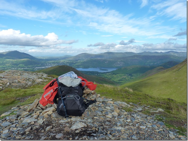
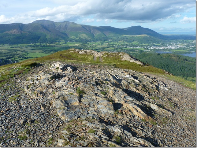
And after a not too long walk of descent & ascent my final Fell of this classic round, Barrow here with Skiddaw Blencathra in the background, if ever your going to put trust in the weather men today was that day, just look how nice its turned out, now to make my way back down into High Coledale. |
 |
| |
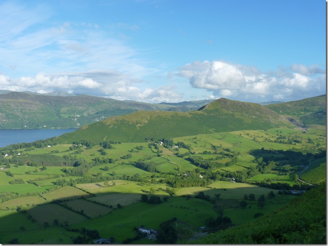
Catbells & the Derwent Valley. |
 |
| |
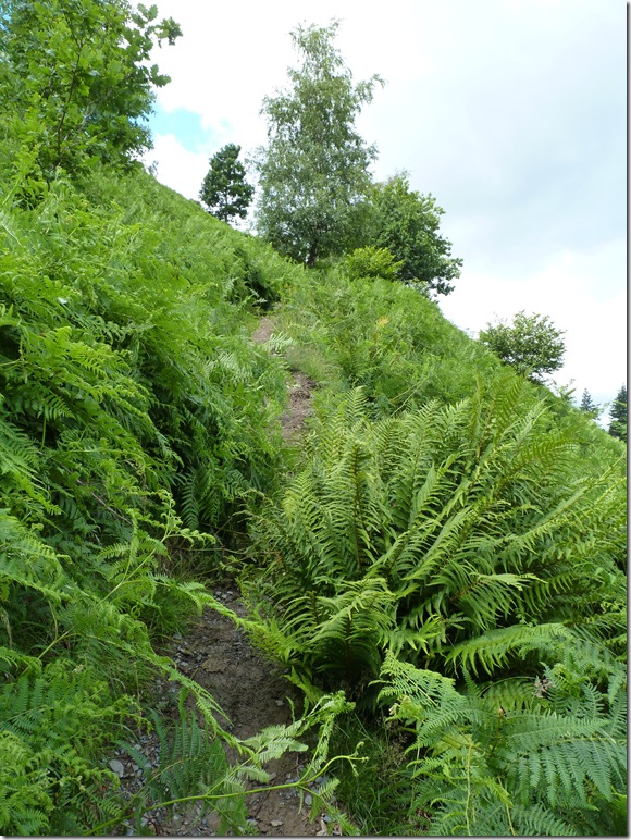
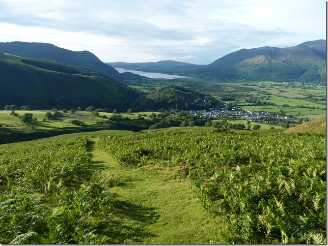
Making my way through the bracken into Coledale. |
 |
| |
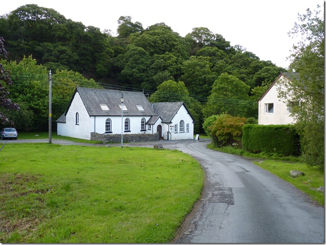
Coledale Methodist church. |
 |
| |
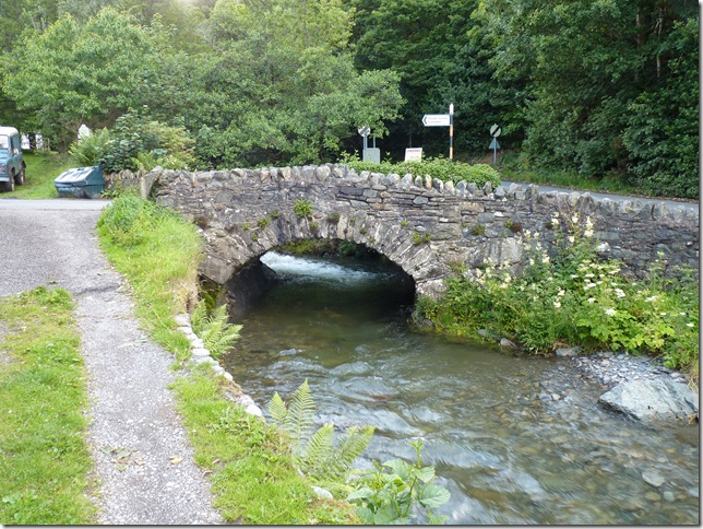
| And High Bridge crossing Coledale Beck with the car park following the road sign I honestly feel like I’ve challenged the weather gods & got away with it, what a weather window, what a classic Lakeland walk if there ever was one,.now back to Wigan for a few beers & a good meal |
|
| |
| Back to top |
 |
|