 |
A Coledale Round |
 |
 |
8th June 2014 |
 |
|
It’s been almost one year to the day that Shaun & I last got together to do a walk, last year we spent an evening on Dow Crag where we explored the South Rake, this years walk will not require the technical skills that the South Rake commanded but it will require a little more stamina more so from Shaun I guess as he had already been out on the fells almost daily claiming new Wainwrights mostly in & around the north western fells during his week long holiday held up in the beautiful hamlet of Braithwaite.
During the previous week Shaun & myself had kept in touch with a proposed route of either the Coledale or Lord’s Seat fells, which route chosen came down as always to a weather forecast, I mentioned that both these routes would be fantastic for myself as I hadn’t visited the Lord’s Seat fells for a number of years, in contrast to a tour of the Coledale Fells which I kinda set routinely as the Coledale Round ranks amongst my favourite of Lakeland rounds.
The weather held off for us & seeing as the last email I received from Shaun the night previous read that Shaun had visited the Lord’s Seat fells the day before set the precedent for a days walking in & amongst some of my favourite north western fells, not to mention seven new Wainwrights for Shaun. |
|
Wainwright Guidebook Six |
 |
| The North Western Fells |
-Grisedale Pike
All visitors to Lakeland who come to walk on the hill turn their footsteps in due course to Grisedale Pike. It is seldom a prime objective, being little out of the way, but the graceful peak piercing the western sky is a nagger of conscience and cannot be ignored. Nor should it be. Conspicuously in view from the environs of Keswick, it is one of those fells that compels attention by reason of its shapeliness and height. |
 |
|
| |
|
Overview |
|
|
| Ascent: |
4,200 Feet – 1,280 Meters |
| Wainwrights: |
7, Grisedale Pike – Hopegill Head – Wandope – Eel Crag (Crag Hill) – Sail – Sail Pass – Scar Crags – Causey Pike |
| Weather: |
Overcast With Sunny Spells, Very Muggy, Highs Of 21°C Lows Of 16°C |
| Parking: |
Car Park, Whinlatter Pass, Braithwaite |
| Area: |
North Western |
| Miles: |
10.1 |
| Walking With: |
Father Shaun Church |
| Ordnance Survey: |
OL4 |
| Time Taken: |
7 Hours |
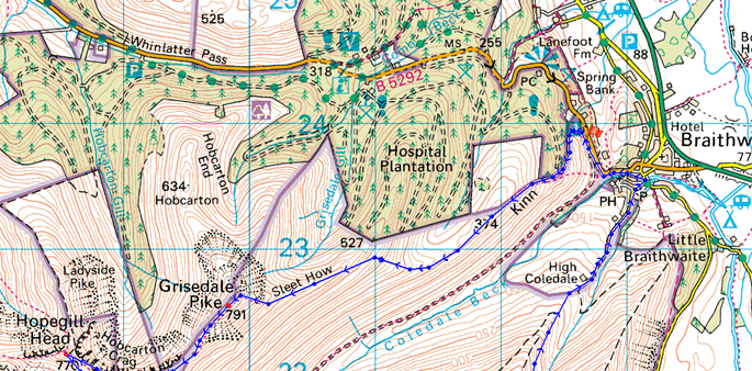
| Route: |
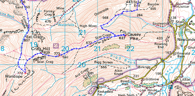
Whinlatter Pass – Kin – Sleet How – Grisedale Pike – Hobcarton Crag – Hopegill Head – Sand Hill – Wandope – Eel Crag (Crag Hill) – Sail – Scar Crags – Causey Pike – High Moss – Barrow Door – High Coledale – Braithwaite – Whinlatter Pass |
|
| |
|
Map and Photo Gallery |
|
|
  |
| |
| |
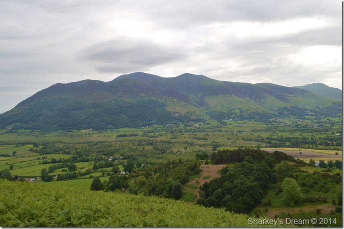 |
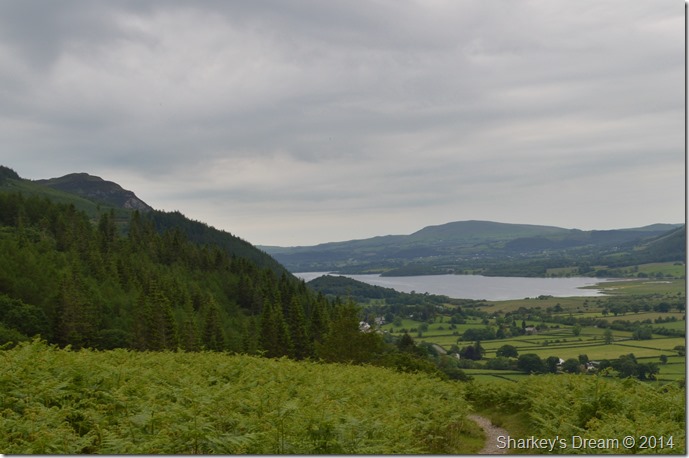
| Skiddaw as we make our morning ascent on Kin 08:15am 16°C |
Shaun & I had arranged to meet at the car park at the bottom of the Whinlatter Pass at 08:00am I was slightly late after having to make a rather un-scheduled stop at Westmoorland Services to clean up the mess made after spilling the coffee from my travel cup, yep, the thought on how I missed my mouth eluded me too, nevertheless I had a bit of a major clean up to do before I could carry on to Braithwaite.
I was a little late but Shaun called it dead on time with a handshake a smile on arrival at the car park, which, was surprising empty for that time of a morning. We chatted as I kitted up. With it being almost twelve months since we last walked together we had a lot to catch up on more so on the fells that Shaun had already climbed during the week, at this point we both knew that we where in for an arduous day on the fells but Shaun never let the thought bother him which preceded his fitness level during the whole entirety of the day, all except those niggling blisters that formed on the end of Shaun’s toes, but I’ll get to that later.
After forgetting to lock the car twice! such the banter between us both, we turned boot heels & took the steep track out of the car park onto fell side. |
 |
| Bassenthwaite Lake & Binsey as we approach Kin. |
With a real mugginess about the air we took in the first initial steep out from the car park where the views opened up quite quickly mostly over towards Bassenthwaite & the Skiddaw fells which where clear to see as the white cloud predicted held high above.
I couldn’t help but remark on how quickly the Bracken had grown over my two week absence from the fells, which back then was no more than a stem growing from the ground, today the Bracken is at its usual waist height which is a pretty strange & fast transformation & buts a whole new ‘summery’ look to the fell side. The light conditions made the greens of the tress, grasses & bracken almost mould together with the only exception of the grey white cloud above marking any sort of contract stand out. |
 |
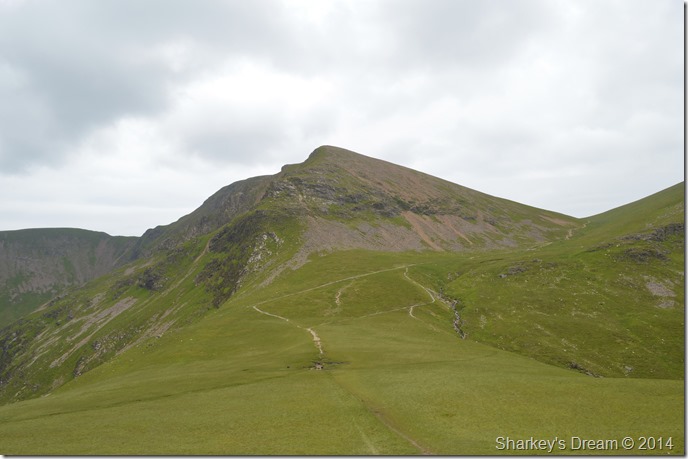
| Grisedale Pike from Kin. |
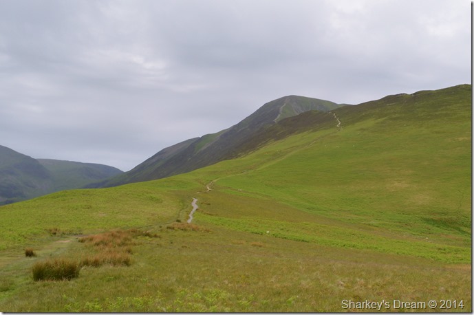
After a steep march up Kin we bottomed out on its grassy plateau where Sleet How & Grisedale Pike stood out ahead. Ahead of us were two walkers who had passed Shaun back at the car park while he waited for me to arrive, we seemed to trail them the whole day as I made a short mental note that there was no way of playing catch up, not in this heat.
The grassy plateau of Kin gave time for the legs to return to normal before the steep ascent of Sleet How before reaching Grisedale Pike’s summit, Sleet How is one of those kind of ascents as I explained to Shaun which is steep, but hugely enjoyable at the same time. |
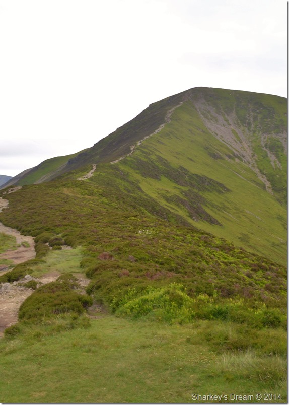 |
| Grisedale Pike from Sleet How. |
| We both agreed that todays walk was just that, a walk & one where we should take our time on if not only to take in the scenery & surrounding fells which were partially obscured by haze. Here before we took on the ridge towards the summit we sat down for five minutes & took in the peacefulness of our surroundings. |
 |
| Here, looking back on Kin from Sleet How. |
| |
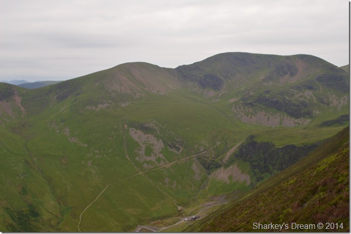 |
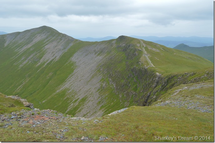
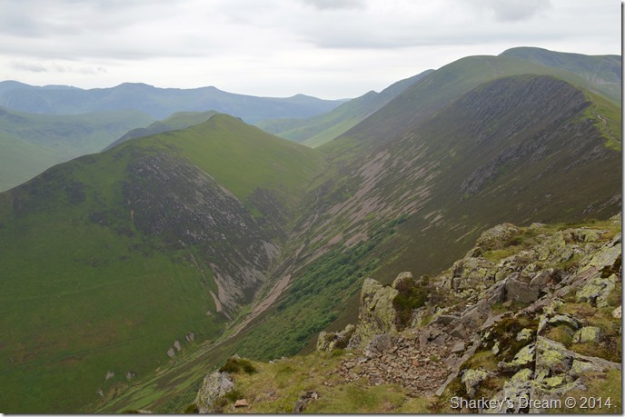
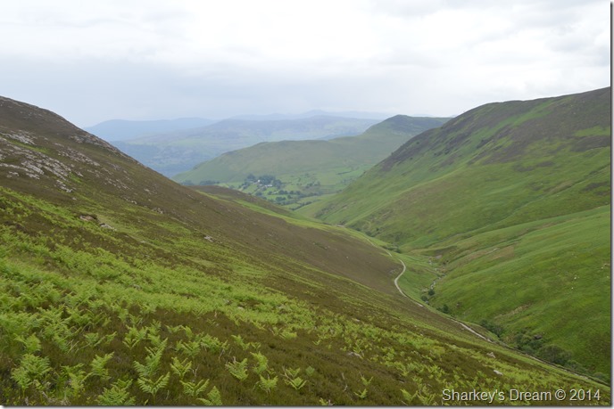
| Sail & Eel Crag (Crag Hill) seen with Force Crag & Force Crag mine. |
| From the start of our ascent Force Crag & Force Crag mine dominate our left flanks, clarity still rendered our view a mix a light & dark greens mixed in with the scree forming down the fellside, sadly not a day for the camera. |
 |
| Kin & Sleet How taken just beneath the summit. |
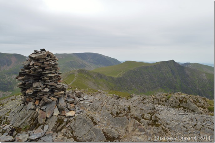
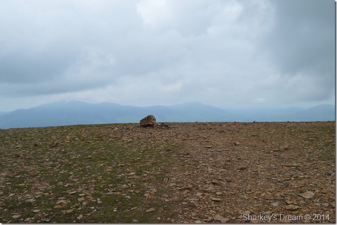
| Sometime earlier I had mentioned to Shaun that we were in for a bit of a treat in that Grisedale Pike now boosts a brand new cairn, I know it might seem silly but I was getting pretty excited about seeing the new cairn. |
 |
| Hopegill Head & Grasmoor seen from the new summit cairn on Grisedale Pike. |
After taking in the ridge from Sleet How we soon reached the summit as the sight of the new cairn lay there before us. The new cairn had a slight lean to it as Shaun remarked was the centre meant to be hollow? I couldn’t answer his question & I only hoped that the centre hadn’t began to fall away on itself, never the less it was still great to see a new cairn at the summit.
Time spent at the summit was again hampered by more midges that just seemed to swarm in from nowhere from which no crevice escaped a good itch or slap from the hand.
Time to exit once more. |
 |
| Hopegill Head, Grasmoor & Sand Hill once the summit was left behind. |
Trailing our own ascent this morning was another walker who caught us up after we left the summit where topic of conversation was the pestering midges & the bites they left behind, I took a look at the guy dressed only in shorts & vest & thought he must of faired much worse than Shaun & myself although going by the look of red blotches that covered our arms & legs you’d have mistaken us all for having a dose of the black death!
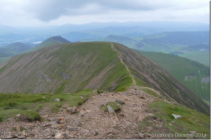
We itch on past one of the finest ridges from Grisedale Pike to Hopegill Head, despite our frailties spirits & conversation was still high. |
 |
| Grisedale Pike as we pass over the top of Hobcarton Crags. |
I can’t make my mind up whether the view from Grisedale Pike to Hopegill Head is one of my favourites or this one looking back from Hopegill Head to Grisedale Pike…
It’s such a pity the light is so low this morning. |
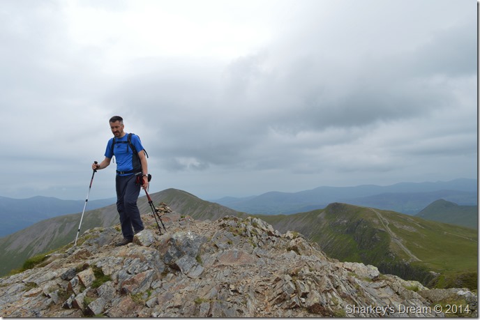 |
| Shaun touches down on Hopegill Head. |
After the short pull from the ridge we arrived at the summit, of which was thankfully free from midges. An elderly gent met us at the same time who held a map case around his neck, we swapped our good mornings before he proceeded to take in the ridge himself back towards Grisedale Pike.
I asked Shaun how did his legs feel & he replied good, with that we left the summit & made for the short ascent over Sand Hill, not before taking one more photo of another of Lakelands best ridge walks.
The Hopegill Head to Whiteside ridge, seen here under the duress of more low light & a hint of haze. |
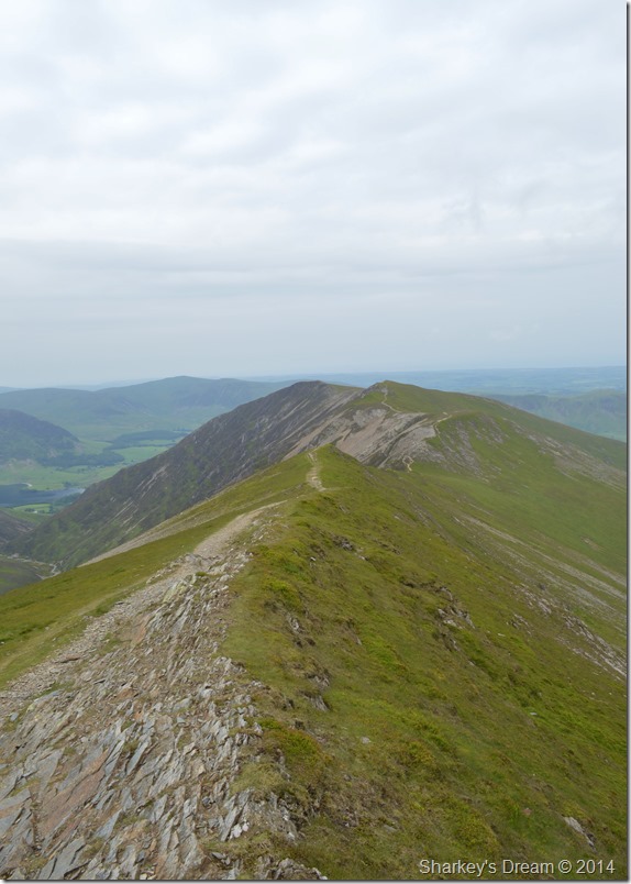 |
| The Hopegill Head to Whiteside ridge. |
| Splendid ridge walking what ever the weather. |
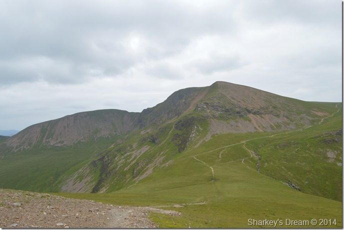 |
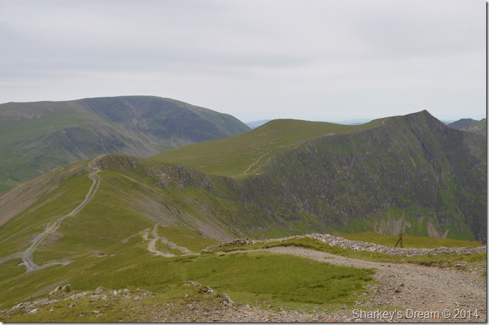
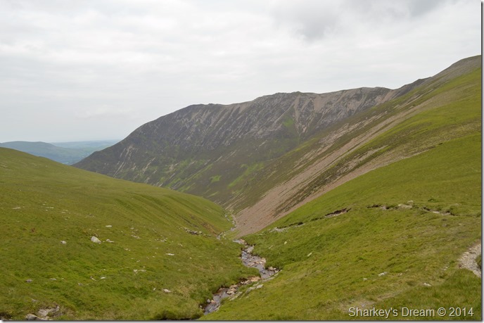
| Eel Crag (Crag Hill) & Sail seen as we descend to Coledale Hause. |
After leaving Sand Hill behind I noted to Shaun that the next descent over broken loose stone with numerous branch off paths that zig-zagged the descent down to Coledale Hause. What we actually found was a new lone path with no sign of the ugly branch off paths that used to line this descent.
It looks like fix the fells have been fixing the fells.
Well done that man! |
 |
| Eel Crag (Crag Hill) from Coledale Hause. |
| |
 |
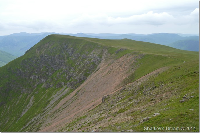
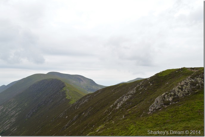
| Whiteside & Gasgale Crags seen shortly after leaving Coledale Hause behind. |
After a little ascent we reached the stone cairn beneath Eel Crags where we stopped to take five minutes. Ahead of us were two guys who continued up the path towards the crossroads, shortly afterwards we soon caught the pair up who were looking a little puzzled while looking at their GPS and Map, we’re looking for Gasgale Gill they asked? ahh behind you I replied pointing back towards Coledale Hause, with that & a thank you the pair were on their way.
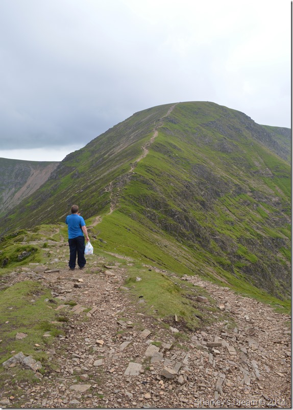
Both Shaun & I had spoke about this route & we both agreed that it would probably be best to leave out Grasmoor given Shaun’s weekly outing claiming more new Wainwrights, what about Wandope I asked Shaun? |
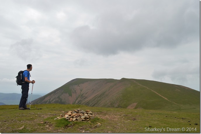 |
| A fell too far, Shaun digresses Grasmoor from the comfort of Wandope. |
We soon reached the crossroads & made the easy decision to carry on towards Wandope via a faint pathway cut through the grass.
Wandope always leaves such a pleasant aftertaste, with that we take on the narrow path that navigates Addacomb Hole, onwards & upwards towards Eel Crag (Crag Hill) |
 |
| Views over Addacomb Hole & Wandope, in the distance, Thirdhead Gill Man. |
| |
 |
| Eel Crag (Crag Hill) summit Trig has finally toppled over. |
The assent via rim of Addacomb seemed slow & most certainly sticky given the fact that we were now approaching midday, what we didn’t expect was to see the sad sight of the precarious Trig Point had finally been toppled & lay in a sorry heap at the summit of Eel Crag (Crag Hill)
I do hope a new summit Trig will be built, the proud summit of Eel Crag almost looked lost & certainly naked without its Trig Point.
Lunch Time.
We decided before taking on the next leg to Sail to find a place to sit & eat lunch, had we known we were going to be the victims of the cannibalistic midges once more we might have given our lunch spot more thought.
We press on with our descent towards Sail. |
 |
| Sail from our descent from Eel Crag (Crag Hill) |
This descent can be a little tricky & care must always be taken more so when wet, today we had the pleasure of the ground underfoot dusty dry which almost made for an effortless & quite enjoyable descent.
More walkers were met all of whom commented in just how muggy and ‘still’ the air felt, I added that the least taste of wind we had was back at the summit of Grisedale Pike, and that, was brief to say the least. I don’t think I’ve ever wished for ‘more wind’ whilst fell walking, today I would have greeted it with open arms.
This next guy however… |
 |
| Was packing light… |
| I always stand like that when I’ve lost my car too! |
 |
| Has anyone lost a giant shoe lace? |
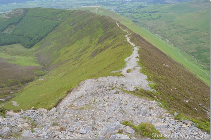
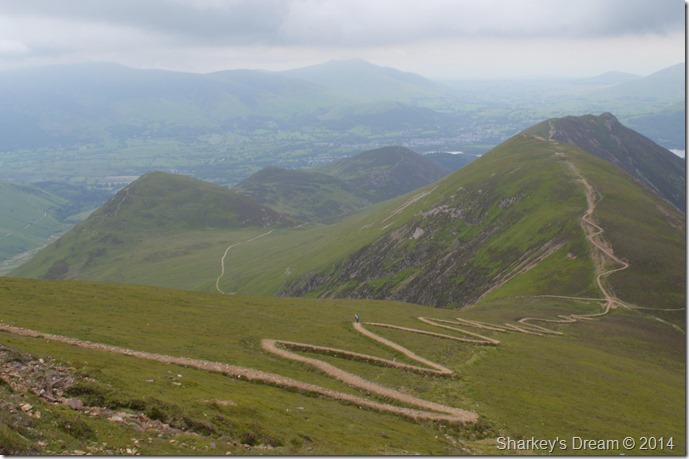
| I pre-warned Shaun about the ‘new path’ from Sail to Scar Crags yet I was still shocked to see Shaun’s reaction when he first witnessed the path with his own eyes, we had a joke about it as most people do, then we set about the logic of how & why the path was made in such a way which when logic is applied I personally don’t think the planners had much choice in replacing the path, but their creativeness & imagination leaves a little to be desired. |
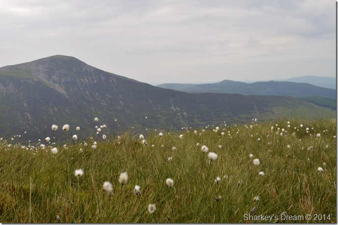 |
| From the Cotton Grasses, Grisedale Pike. |
| |
 |
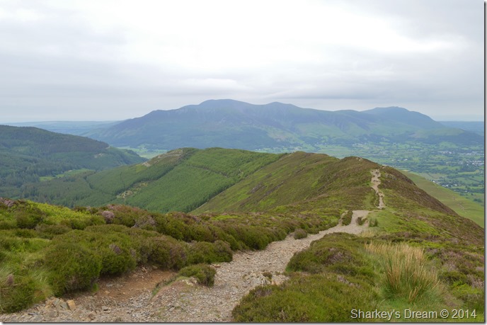
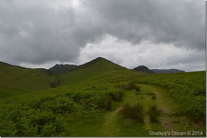
| Causey Pike from Scar Crags. |
During our ascent on Scar Crags we experienced a few drops of rain which really lead to nothing, it seemed our position here on Scar Crags was missing out on a few rain showers that were now developing on what looked like over Keswick ahead of us & behind us to the west over Buttermere.
The wind that we longed for earlier was keeping those showers at bay so we at least were a little thankful that we didn’t take a soaking along the ridge to Causey Pike. |
 |
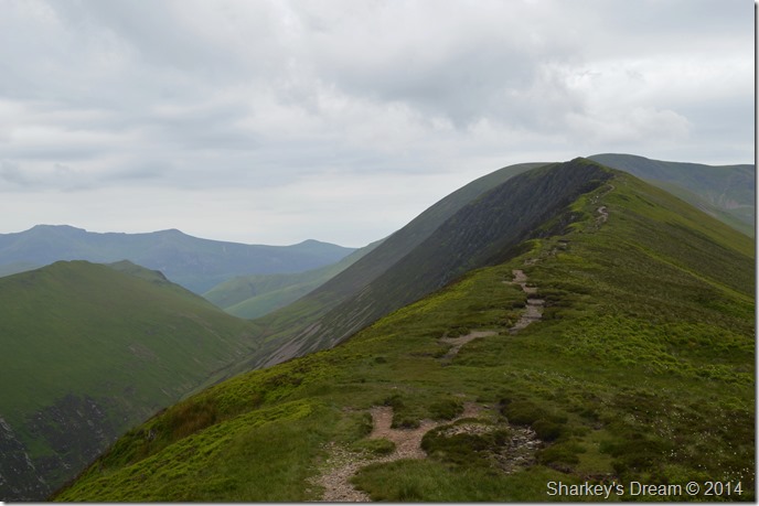
| Ridge walking at its best. |
| |
 |
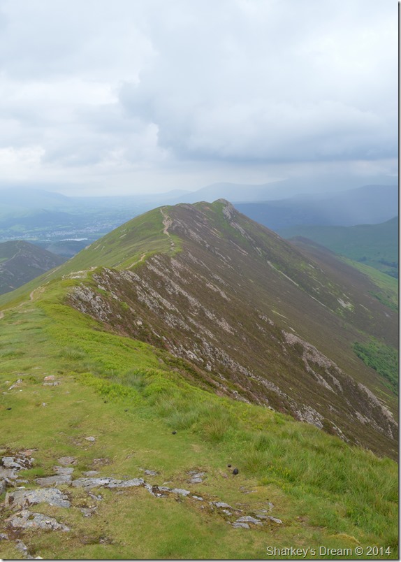
| And looking back towards Scar Crags. |
| |
 |
| Rigg Beck, Ard Crags & the Scar Crags ridge from Causey Pike summit. |
After taking in the delightful ridge of Scar Crags we soon reached the summit of Causey Pike, along the ridge we had witnessed many a walker summit Causey Pike thus leading us to believe that we were going to arrive at a crowded summit, once we clambered up the final crags we were both surprised to find that we had the summit to ourselves.
Well not entirely to ourselves, the midges had once more took residence & despite wanting a quiet five minutes if not to take in the views we had no choice other than to retreat batting at our necks, faces & legs once more. |
 |
| Scar Crags seen shortly after leaving Causey Pike summit. |
| |
 |
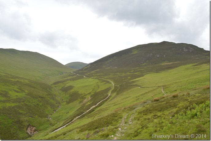
| Heading for Stonycroft Gill shortly after leaving Cause Pike. |
We re-treated our steps back to a col where we picked up a narrow path down the fell side, for the first time during the whole walk our boots squelched on our way down passing a couple on their ascent who if I was to be brutally honest, both looked liked they didn’t want to be there.
Seeing as Shaun had already summited both Outerside (far left) & Barrow (Far Right) we decided that there was no need to summit them again twice in one week which paved the way for our descent via Barrow Door & Stile End seen in the centre, a route that I was looking forward to as I hadn’t used before. |
 |
| Here, looking back on Sail (centre) as we take in Stonycroft Gill with Outerside over on the right. |
| Shaun never spoke of his troubled toes until I asked him again around about here when he said that they were starting to hurt, an injury that he had picked up since doing the C2C a couple of years ago. |
 |
| A rather murky Cat Bells seen from Stonycroft Gill. |
| |
 |
| Causey Pike dominates the head of Barrow Door with Stile End & Outerside seen over on the right. |
The plush descent via Barrow Door was not just welcomed by Shaun’s feet but mine too (I think it’s time for new socks) The cloud seemed to gather above our previous summits which felt like pretty good timing. Both Barrow & Outerside, indeed Stile End are the types of fells that can be enjoyed in ones own company if not only to let off some steam after work, these are the fells that always spring to mind whenever stress threatens.
We stroll back into Braithwaite passing many a cottage that the likes of myself can only dream of if it not be for a lottery win, we soon pass the Coledale Inn where locals enjoy an afternoon meal with a red wine or a cold pint of lager. |
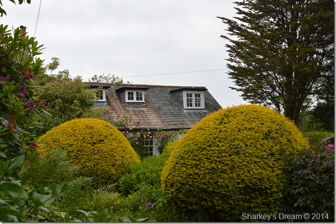 |
| High Coledale cottages. |
Once the temptation of a cool beer was passed Shaun offers me a lift ‘back up the hill’ in his car but first we have to make our way back to Shaun’s holiday cottage, he shows me a few shortcuts through the village passing locals who tend to their gardens & brighten up their windows.
Within moments we are driving through Braithwaite & over the stone hump back bridge that crosses Coledale Beck, after a hearty handshake & farewell till next time I am left at the car park where I open a bottle of ritual Diet Pepsi.
All the while dreaming a cold pint whilst sat people watching back at the Coledale Inn, with that thought I let all the windows down in the car & make for home. |
|
| |
| Back to top |
 |
|
