|
Walking the Wainwrights in 30 Walks - Walks 29 Rannerdale Knotts to Barrow |
 |
 |
27th August 2016 |
 |
|
Walk 29 takes in both the Grasmoor and Coledale fells collecting a total of 13 Wainwrights summits starting in the Buttermere Valley and ending on the other side of the Whinlatter Pass in Braithwaite. It's fair to say that this route isn't without its challenges which seemed to quadruple when carrying a foot injury on a route that comes close to gaining 6,000ft of total ascent over 17 miles.
Initially I had split this walk into two with the Grasmoor fells on one walk and the Coledale on another yet with the experience of summiting all of Lakelands 2,000ft summits in Harry Griffin's footsteps which gained me the mental ability to deal with the more challenging of walks which I guess, also attributed to why I set this challenge up in the first place despite picking up a rather worrying foot injury along the way.
After a weeks rest I'm feeling back up to full strength and my heel, well it's coping as best it can helped along by a constant flow of anti-inflammatories, pain killers and stretches along with a niggling fear that I maybe causing it more damage but for now and as I write this the morning after, it's fairing well as long as I keep up the treatment.
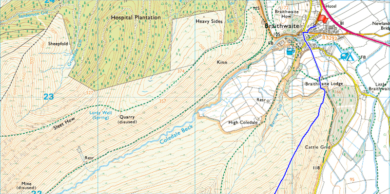
A good weather day was required to complete a walk such as todays which is exactly what we got, it all started around 07:45am outside Braithwaite Primary School. |
|
| Wainwright Guide Book Six |
 |
| The North Western Fells |
-Eel Crag
Unlike Grasmoor, Eel Crag is supported by ridges. Unlike Grasmoor, it stands in the midst of a group of satellites. Unlike Grasmoor, it commands an excellent all-round view. It is the centre of things. It is an obvious objective. |
 |
|
|
| |
|
Overview |
|
|
| Ascent: |
5,898 Feet - 1,798 Meters |
| Wainwrights: |
13, Rannerdale Knotts - Whiteless Pike - Wandope - Grasmoor - Whiteside - Hopegill Head - Grisedale Pike - Eel Crag (Crag Hill) - Sail - Scar Crags - Causey Pike - Outerside - Barrow |
| Weather: |
Dry Warm and Sunny With a Cool Breeze Across The Summits, Highs of 22°C Lows of 13°C |
| Parking Using x2 Cars: |
Parking Spaces Braithwaite School - Car Park, Rannerdale Farm, Buttermere |
| Area: |
North Western |
| Miles: |
15.9 |
| Walking With: |
David Hall and Rod Hepplewhite |
| Ordnance Survey: |
OL4 |
| Time Taken: |
9 Hours 25 Minutes |
| Route: |
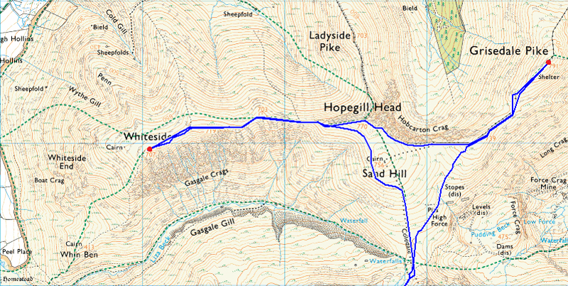
Rannerdale Farm - Rannerdale Knotts - Whiteless Breast - Whiteless Pike - Whiteless Edge - Wandope - Grasmoor - Coledale Hause - Sand Hill - Whiteside - Hopegill Head - Grisedale Pike - Coledale Hause - Eel Crag (Crag Hill) - Sail - Scar Crags - Causey Pike - High Moss - Outerside - Barrow Door - Barrow - Braithwaite |
|
| |
|
Map and Photo Gallery |
|
|
  |
| |
| |
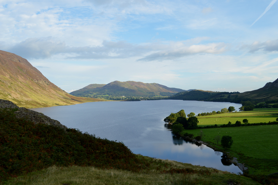 |
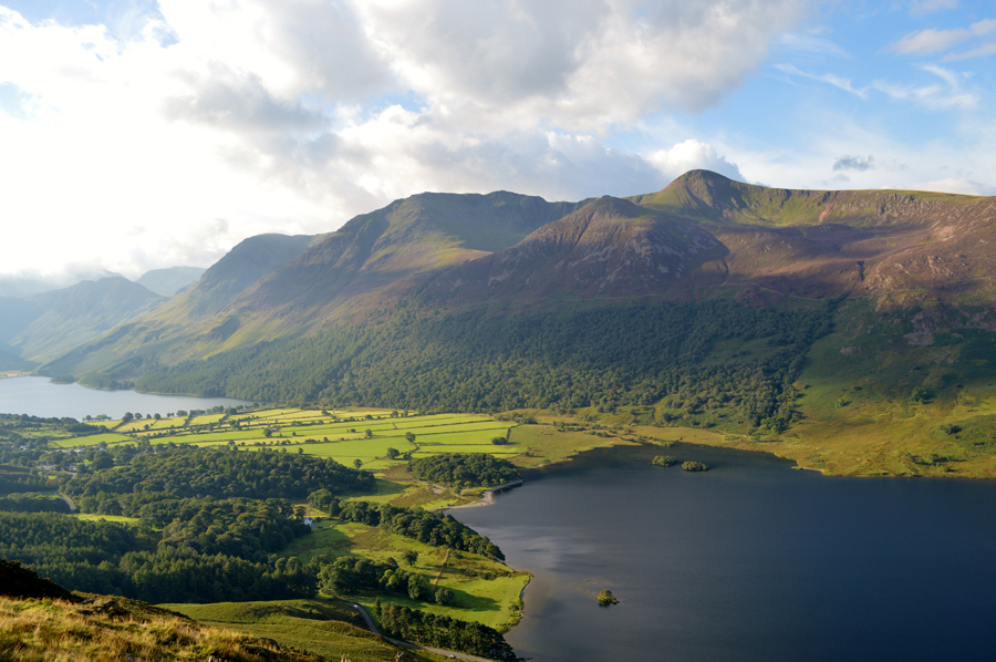
| Looking back on the Loweswater Fells over Crummock Water 08:00am 12°C |
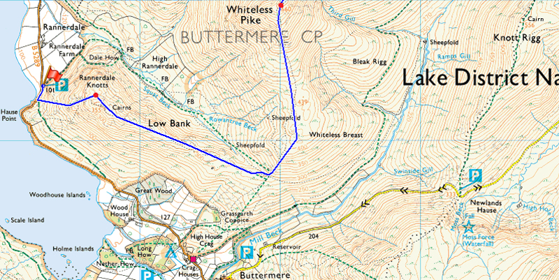
Todays walk was planned around the use of two cars one of which would be left in Braithwaite and the other close to Rannerdale Farm on the Buttermere side of Whinlatter. It made sense to meet Rod first in Braithwaite at the agreed meeting time of 07:45am who arrived early as we left his car parked up by the Primary School before driving over the Whinlatter Pass in my car to meet David who was waiting at the parking spaces just below Rannerdale Knotts.
After parking my car next to David's (who I might add hasn't been kidnapped by aliens) due to his Website not being updated based purely on the fact that he's walking far more than he is updating these days and somewhere in between all that, David also picked up a niggling knee injury which I'm pleased to report, is on the mend.
We greet with handshakes and comment on how good the weather looked which actually turned out much better than forecasted. We kitted up in the shadow of Rannerdale Knotts during which time we are passed by an old tractor travelling towards Buttermere as we all commented, " there's not many of them left on the road these days" Kitted up we lock our cars and pick up the path just a few yards away from the car park and begin to climb steeply towards our first summit as views open up over Crummock Water and beyond.
It certainly was a morning for fine views. |
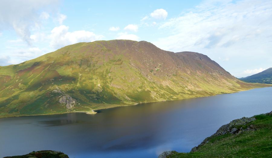 |
| Mellbreak and Crummock Water from our ascent on Rannerdale Knotts. |
| |
 |
| Buttermere, High Crag, High Stile, Red Pike and Crummock Water from Rannerdale Knotts summit. |
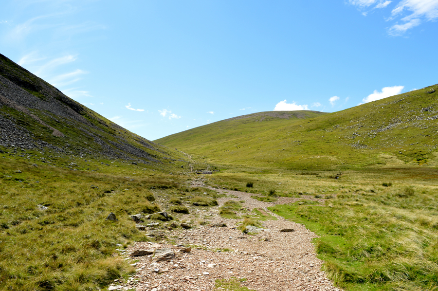
It's easy to forget just how steep the ascent on Rannerdale Knotts can feel as we acquaint ourselves with the path, I think it's fair to say after having the conversation that we had just had about various knocks and injuries we all sounded like we should be at home with our feet up rather than setting ourselves up for a grueling seventeen miler.
We pick up the familiar stone staircase and rise steadily towards a grassy platform watched on by a trio of grazing sheep as we stop to admire our views while feeling cool under the shade of the summit. The bright morning light illuminates the High Stile ridge on the opposite side of the valley yet despite this just up ahead, the summit of Fleetwith Pike, Grey Knotts and Brandreth has a covering of localised cloud which shouldn't be around too long once the morning temperatures start to rise. |
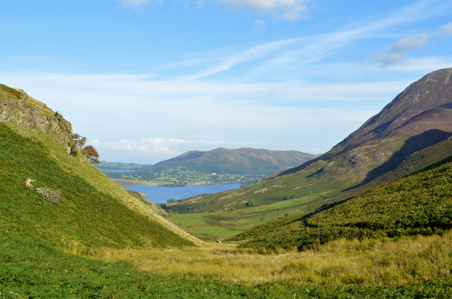 |
| Crummock Water and the Loweswater fells seen over High Rannerdale. |
| We spend a few moments admiring the views which are expected to get clearer as the day went on. After leaving the summit behind we descended slightly and followed the ridge headlong into a strong sun passing a solo walker with a 'morning' along the way. Now, on the far end of the ridge David heads through a short cut of Bracken only to find that it's still wet with morning dew, thanks for the alert David as Rod and I go around. |
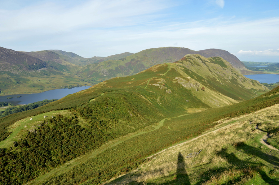 |
| Views over Rannerdale Knotts towards Great Borne, Hen Comb, Mellbreak, Crummock Water and a distant Loweswater. |
| |
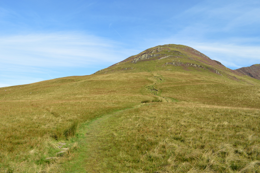 |
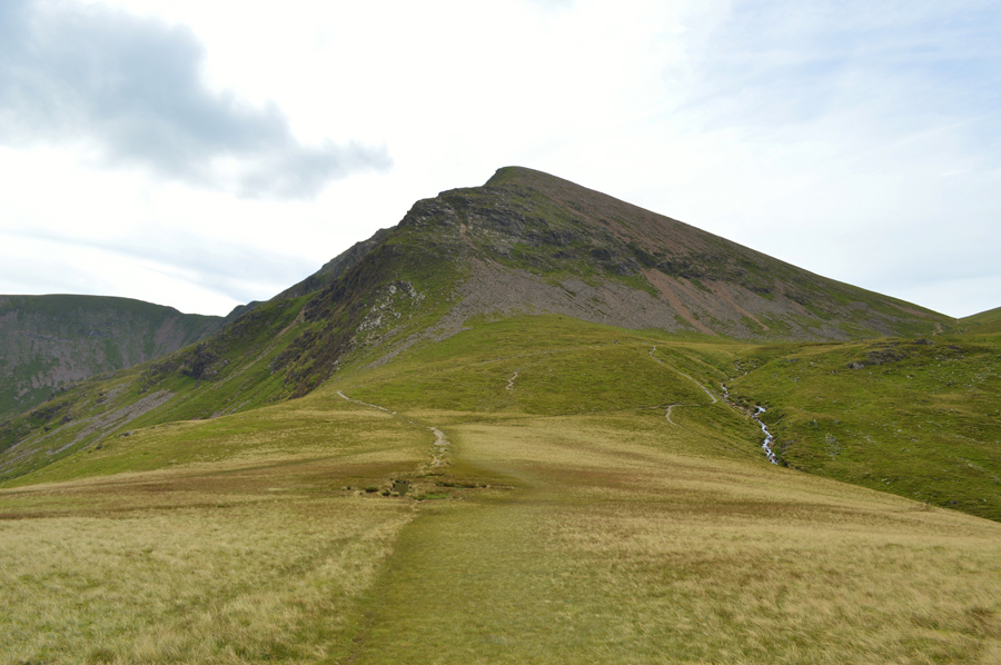
| Whiteless Pike from Whiteless Breast. |
| Having crested the shoulder of Whiteless Breast we continued towards Whiteless Pike seen up ahead via a grassy path underfoot which steadily rises towards the summit, while over to our right... |
 |
| Sail Beck flanked by Whiteless Pike, Wandope and Eel Crag (Crag Hill) |
| Flanked by Whiteless Pike and Wandope on the left, and Ard Knotts and Knott Rigg on the right, up ahead Causey Pike is looking some distance away according to Rod, we tend to agree...best not think that far ahead just yet. |
 |
| Grasmoor seen alongside Whiteless Edge from Whiteside Pike summit cairn. |
We followed the grassy path in conversation until we reached a section of the path found just below the summit which now has turned to gravel and stone underfoot with familiar rock steps to negotiate until we crested the summit top where views of Grasmoor and Whiteside Edge opened out before us. Rod went onto say that Wandope still looked quite a distance away not helped by the gradient of Whiteside Edge when I recalled thinking the same during my Lakeland two thousanders when I summited Whiteside as a 'out and back' and vividly remember thinking exactly the same.
I also remembered that by the time I had reached the top of the ridge 'it weren't so bad' and passed this onto Rod," I'll remind you of that half way up" Rod smiled. |
 |
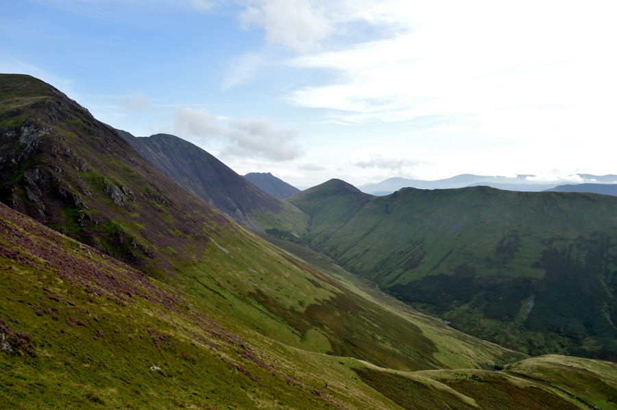
| Whiteside Edge seen alongside Third Gill. |
I don't quite know why it was brought up, I guess it was something to do with how impressive Third Gill looked as we spied various paths which ran alongside the ravine as David went onto say "can you just imagine how much water was running down there during the storms last year" which then prompted a few seconds silence as we gazed over.
It doesn't bear thinking about, but I guess no one was up here to witness it, the destruction of course was evident in the adjoining valleys. |
 |
| Pausing to look back on Whiteless Pike as we start our ascent on Whiteless Edge. |
| |
 |
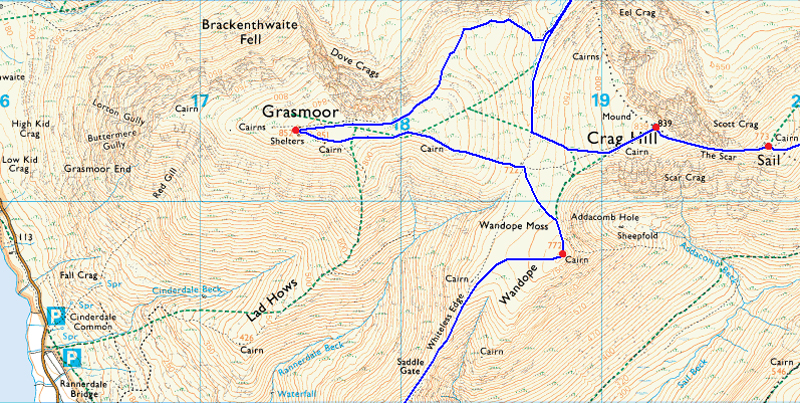
| Eel Crag (Crag Hill) Sand Hill and Hopegill Head from Wandope summit. |
It was debateable whether we summited Wandope before we summited Grasmoor and collected Wandope on route to Eel Crag sometime later but given the choice, I choose to claim Wandope as todays second summit. Here we pause to work a route out (although it had already been worked out) it felt more practical to talk it through before hand.
As David is still recovering from a knee injury it was agreed that after summiting Grasmoor together just Rod and myself will take on the next three summits of Whiteside, Hopegill Head and Grisedale Pike before meeting David back on Eel Crag.
I would say that there is close to seventy years joint fell experience here and we assumed it would only take both Rod and myself just one hour to summit all three fells before meeting David back on Eel Crag.
We couldn't have mis timed our three summit excursion if we had tried which went onto be a long standing joke during the rest of the walk, but more on that later... |
 |
| Crossing over the top of Wandope Moss as we head towards Grasmoor. |
| |
 |
| Rannerdale Knotts, The Lad Hows ridge (foreground) Whiteless Breast and the High Stile Ridge from Grasmoor summit. |
We eased ourselves over the shoulder of Grasmoor summit plateau and followed the cairns (why so many) towards the summit and came to a stop close to the summit shelter. Back in ascent we had noticed that cloud had started to spill over the top of Coledale Hause and was rising over the top of Eel Crags, and, as earlier the cloud although thick in expanse was localised to the valley and no sooner had we looked it had started to lift which came as good news.
We deservingly spent a few moments taking in the views from the summit as I glanced down on the carpark where we had left our cars just a few hours earlier, once I turn my back it's going to be the best part of seven hours before we see those cars again.
From the summit we had a clear view of Sand Hill over Coledale Hause and the shortcut on the Gasgill flank that I wanted to take in order to gain the Whiteside Ridge, from afar it was clear which route we wished to take, all that was needed was to descend Grasmoor's north east ridge and cross Coledale Hause before hand.
Before we said goodbye 'for now' to David we once again agreed on how long we thought it would take us to reach Eel Crag after summiting, Whiteside, Hopegill Head and Grisedale Pike, again we all agreed it was one hour, I mean, just whose legs did we think we had! I was semi-conscious about the decision as I just wanted to get underway, it was now 11:30am "we'll see you back on Eel summit at 12:30pm David"
We didn't say which 12:30pm though... |
 |
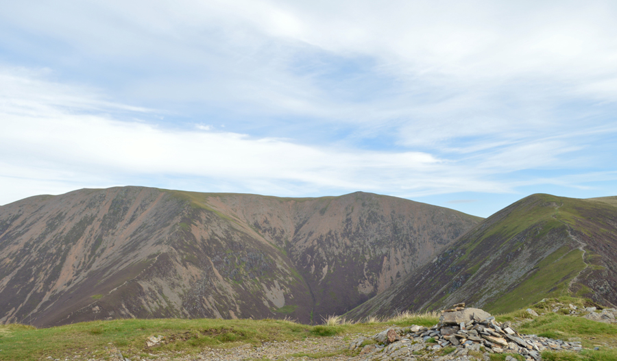
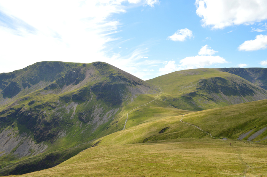
| Whiteside and Gasgale Crags from Coledale Hause. |
| The time is 11:20am...it was at this point so early into our route did we realise we were going to over shoot our meeting time with David, best pick our pace up. |
 |
| Eel Crag (Crag Hill) from Coledale Hause. |
Rod and I started our descent first drawn in by Grasmoor's impressive Dove Crags before finding ourselves at Coledale Hause, alarmingly twenty minutes had already passed and this was with a slight jog down the north east ridge before crossing the top of Coledale Hause fast approaching Sand Hill.
It was the ascent of Sand Hill mixed in the high humidity that slowed our pace down as we picked our way through the ascent, part of which is split into two with the first tier approaching we started to steer off path over the loose scree which makes up western flank of Sand Hill summit. |
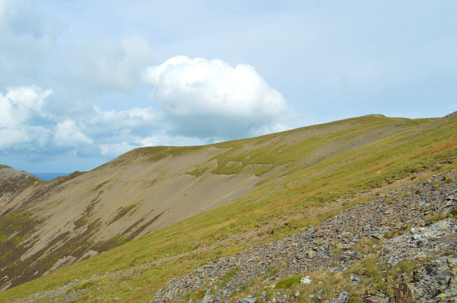 |
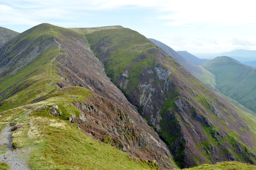
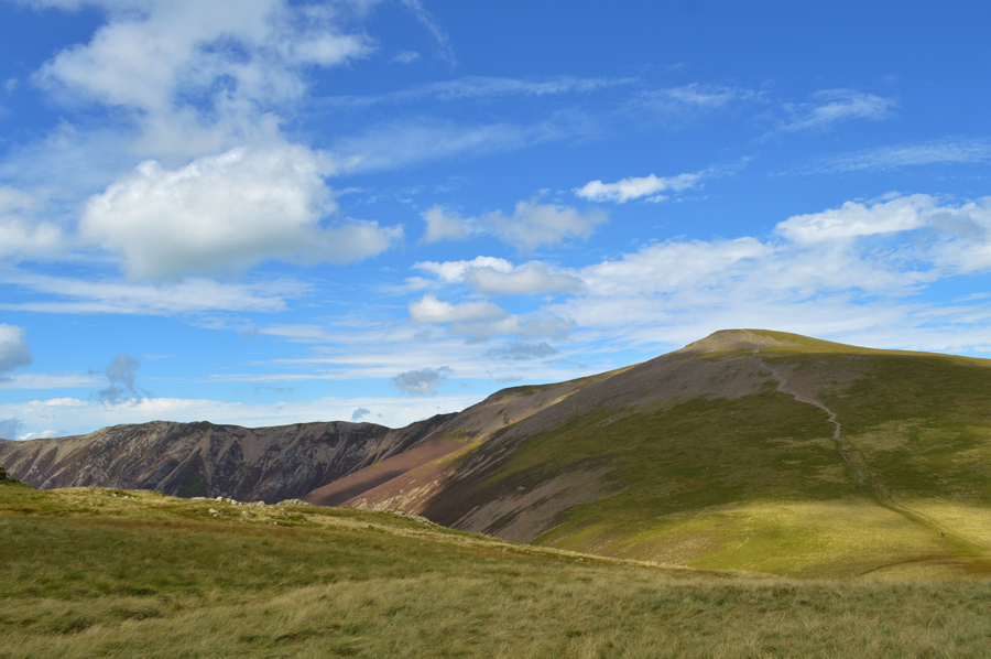
| Hopegill Head (right) as we head for the col along the ridge. |
We had left the ascent of Sand Hill just shy of the summit before starting our traverse across the scree which would see us out flank Hopegill Head which we would collect on the way back. Initially we had set a course for the lowest point of the Col seen in the far left of the photograph but as we rounded the head of the valley we found this would be impossible due to rough scree and menacing heather, something that wouldn't normally stop us in our tracks if it wasn't for the steep gradient.
I followed a contour steering above the grassy section seen half way across before picking up a sheep trod which saw us emerge just above the arete east of Hopegill Head summit. |
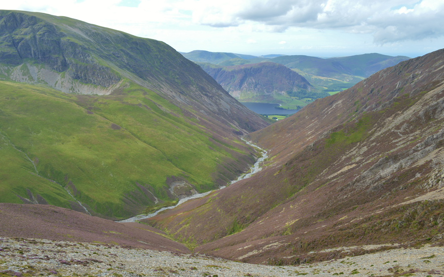 |
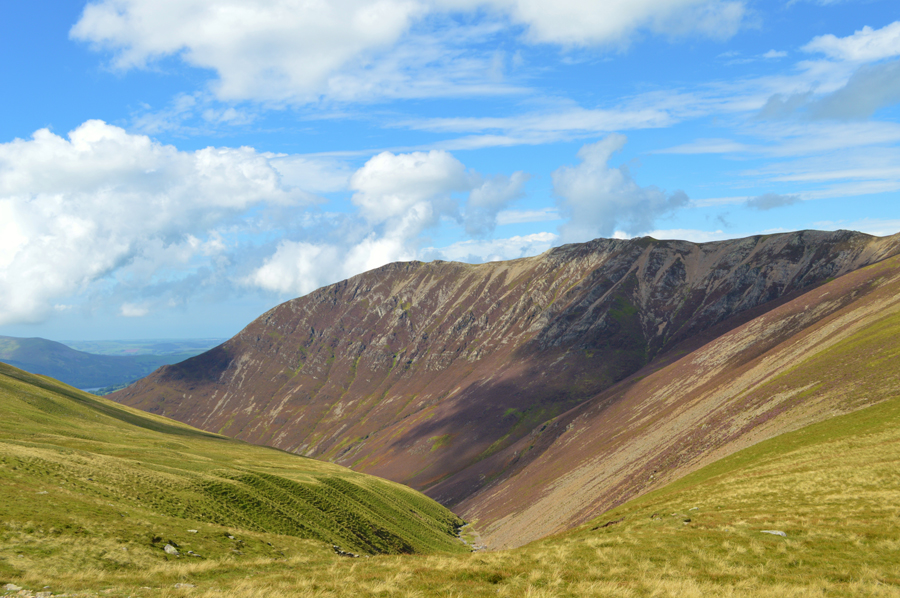
| Views over Liza Beck, Gasgale Gill and Gasgale Crags. |
| That's Crummock Water seen with Mellbreak and in the distance, the Loweswater fells. |
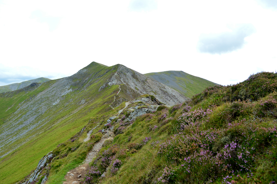 |
| Looking back on Hopegill Head, Sand Hill and a distant Grisedale Pike. |
| It wasn't spoke of just yet but around this point besides a quickening pace, a slight worry dawned over us, there was no way we would make it back to Eel Crag by 12:30pm, all we could do was try to enjoy the extended route while maintaining pace. |
 |
| Hopegill Head and a distant Grisdale Pike from Whiteside summit cairn. |
We had found the ridge quite busy as we headed towards Whiteside summit where on arrival we found a family sun bathing and who could blame them, it was a glorious day even if the sun had gone in it was still ridiculously warm. We stop for the shortest of moments if only to snap a few photos before turning heel and retracing our footsteps back towards Hopegill Head summit which was reached right about the same time three chaps arrived, the same three we had passed half way along the ridge which just goes to show how much our pace had picked up.
Despite the ridge-tastic views there was no time to hang around and once we had summited Hopegill Head and, after a tap from my walking pole, we strode out over the top of Hobcarton Crag feeling as prepared as can be, for the steady ascent on Grisedale Pike. |
 |
| Grisedale Pike seen over Hobcarton Crag. |
| |
 |
| Hopegill Head and Ladyside Pike seen from Hobcarton Crag. |
We pass over the top of Hobcarton Crags with impressive views over the Hobcarton Valley all the while passing many a walker, and a fell runner who were all heading for Hopegill Head summit, it was only myself and Rod heading for Grisedale Pike and not the latter.
I think it's fair to say that the pace we showed while gaining Whiteside and Hopegill Head summits started to show a little as we started our ascent towards the top of Hobcarton Crags where we gave those in descent a wide berth if only to keep up and maintain our pace. |
 |
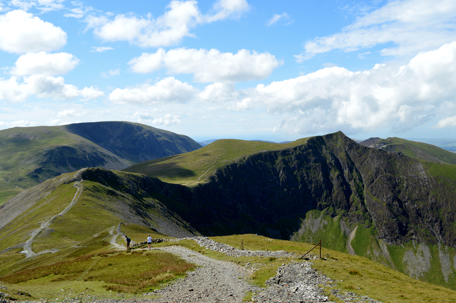
| Eel Crag (Crag Hill) Coledale Hause, Grasmoor, Sand Hill, Whiteside and Hopegill Head from Grisedale Pike summit. |
Despite there being just the two people in the photo there was quite a few behind, and to the sides of the summit cairn all enjoying lunch while under a scorching sun.
Much like our two previous summits sadly we didn't have the time to enjoy the summit which was kinda sad as Rod had mentioned how Grisedale Pike was one of his favourite summits, after a few moments spent, together with a couple of photos we left the summit and its fantastic views and started our descent back to Coledale Hause |
 |
| Eel Crag (Crag Hill) Coledale Hause, Grasmoor, Sand Hill, Whiteside and Hopegill Head from Grisedale Pike summit. |
| We were on the home stretch or so we called it and felt the pressure lift knowing we were now on our way back to David who I imagined, was starting to get a little worried why we had over shot our meeting time. |
 |
| Descending towards Coledale Hause with views of Eel Crag (Crag Hill) and Grasmoor. |
| This view shows Grasmoor north east ridge more clearly which we had to used to descend from the summit earlier. |
 |
| Coledale Hause with views of Eel Crag (Crag Hill) and Grasmoor. |
| After leaving Grisedale Pike we had managed once again to pick up a slight jog if only to save on time and also, it was easier on the knees as Rod demonstrates in the foreground of the photo, for myself I didn't want to cause no further damage to my heel and decided to back off a little, and caught Rod up after crossing Pudding Beck. |
 |
| The clearest of views over Gasgale Gill towards Whiteside from Coledale Hause. |
| |
 |
| We follow the path with Eel Crag to our left and Grasmoor to our right. |
| An ascent on Eel Crag via the north east ridge known as Tower Ridge was briefly spoken of and had time been on our side we would have most certainly gained Eel Crag this way yet seeing as we are kind of in a rush, we thought it best to play it safe and reserve our energy for the ascent found further up the path at the familiar crossroads. |
 |
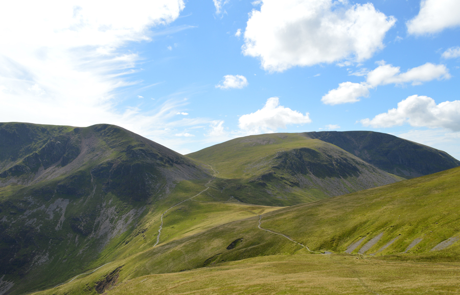
| Sand Hill and Whiteside from upper Coledale Hause. |
| |
 |
| Wandope and Addacomb Hole from our ascent on Eel Crag (Crag Hill) |
| |
 |
| Finally, Eel Crag (Crag Hill) summit. |
Had we not have walked with such pace the ascent on Eel Crag wouldn't have felt nearly half as brutal as it did, even so and I don't know how but we still managed to overtake a couple of walkers as we crested the summit shoulder, as for David he was sat without a care in the world in the exact spot we had arranged to meet him, well I say without a care in the world, he was slightly worried but after witnessing myself and Rod cross the head of Gasgale Gill he then; even though at times he couldn't see us managed to time how long it would take us to reach our respective summits, we arrived back fifteen minutes later than he had guesstimated and a whole lot longer than the hour we had originally predicted.
Our excuses came thick and thin and a laugh was shared together with quite a bit of sarcasm before we made our way towards the summit before we de-shouldered and eased ourselves down over dry grass and broke out lunch.
The sun shone down and we were able to stare down on the Coledale valley and its ajoining summits which we would grace that afternoon, I didn't let on too much at this point as there was still quite a way to go, but my heel was starting to trouble me and there was still quite a few hours left before I was ready for another dose of pain killers so I decided to stretch the foot tendon as often as I could which I must add, did help me forget about the pain, if only for a short while. |
 |
| Grisedale Pike seen towering over Force Crag, Force Crag Mine and the Coledale Valley from Eel Crag (Crag Hill) summit. |
| |
 |
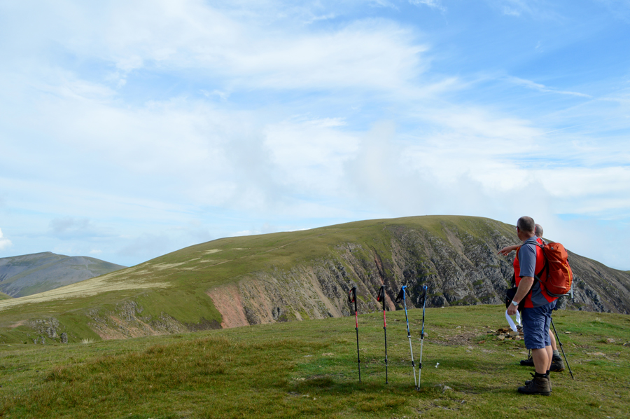
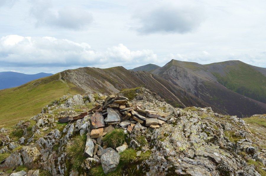
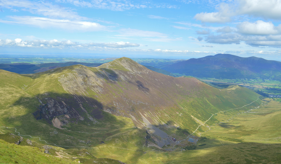
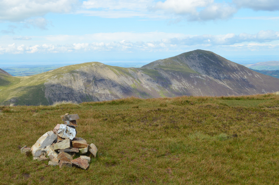
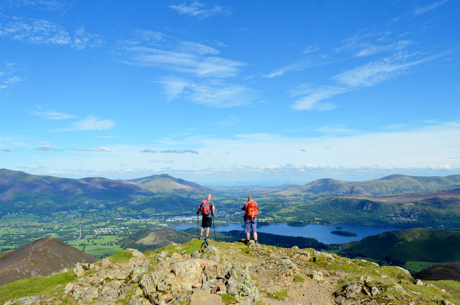
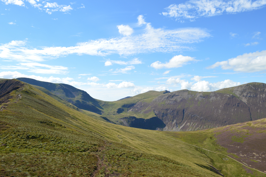
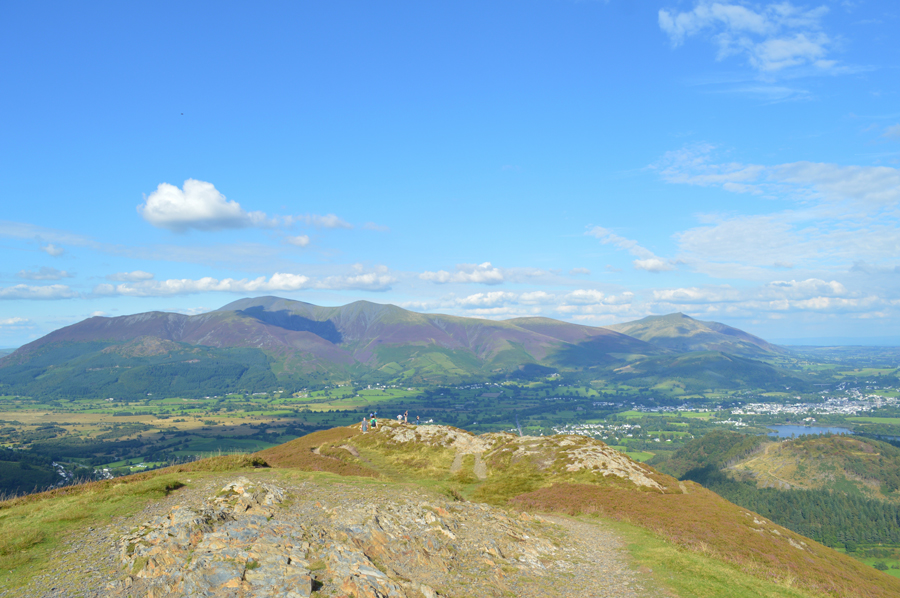
| Views over Scar Crags, Causey Pike, Outerside, Stile End and Barrow from Eel Crag (Crag Hill) summit. |
| The air as predicted seems to be getting much clearer with distant views of Blencathra, Clough Head and Great Mell Fell in the distance. |
 |
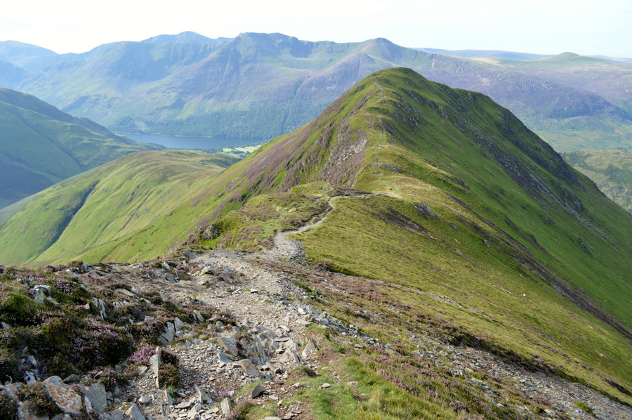
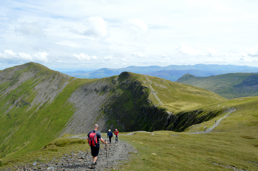
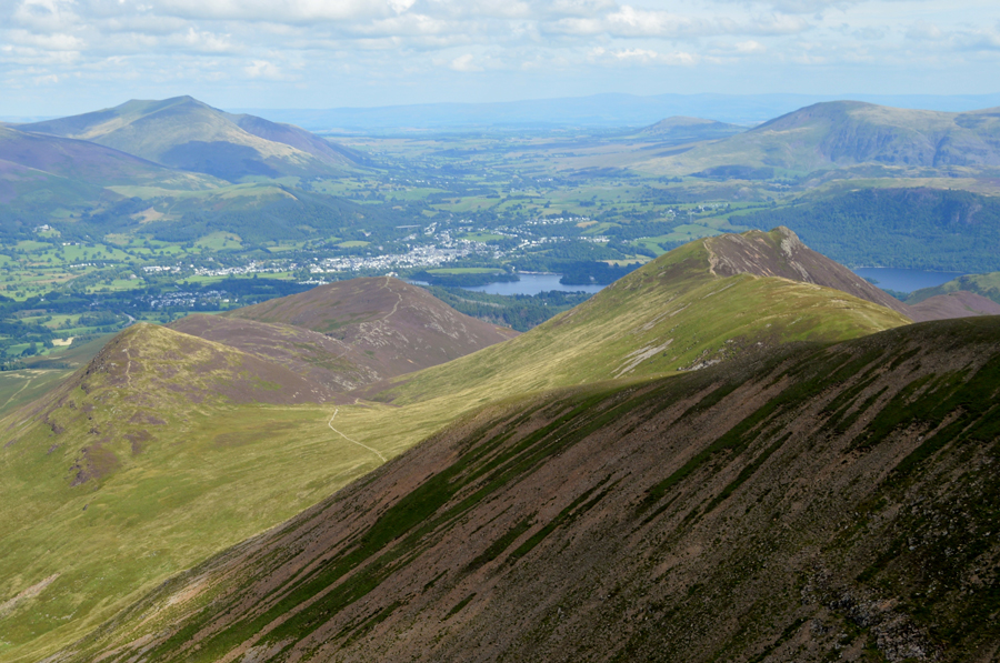
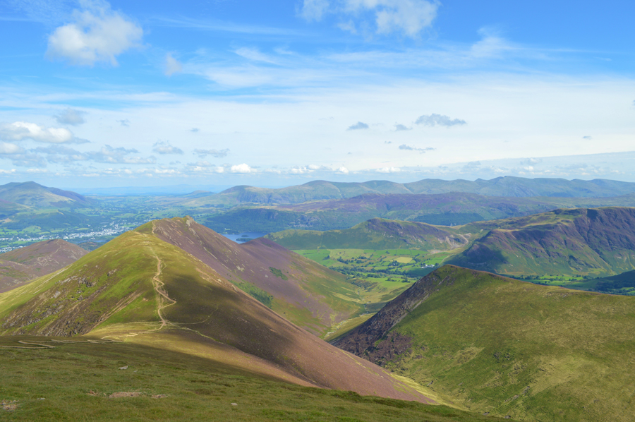
| Descending Eel Crag (Crag Hill) towards Sail while beyond, Scar Crags and Causey Pike. |
| |
 |
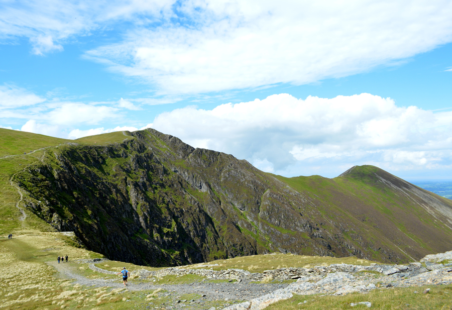
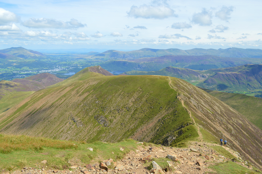
| Pausing before we take on the ascent of Sail to look back on Wandope, Addacomb Hole and Eel Crags (Crag Hill) |
| |
 |
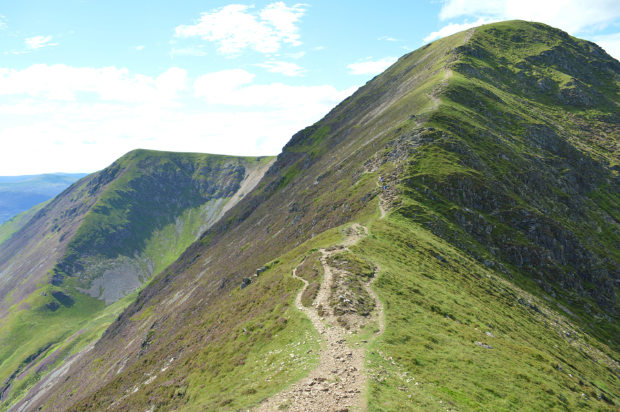
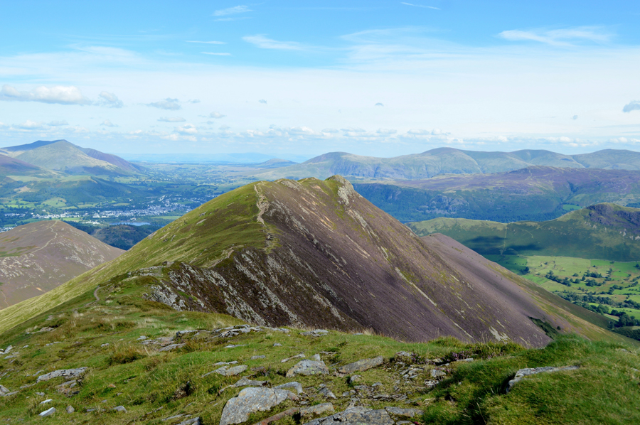
| Grisedale Pike from Sail summit. |
| It was Rod who pointed out that the summit cairn had been moved from the middle of the familiar pool of water to more firmer ground a few feet away, without getting my ruler out I couldn't tell you if this was the highest point or not !! |
 |
| Descending Sail on-route to Scar Crags. |
| Via the path which I refer to as the giants shoe lace, while others may not be as sympathetic in how they would refer to this path. |
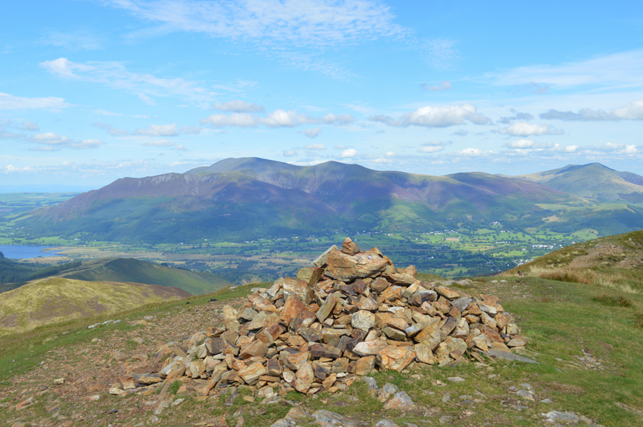 |
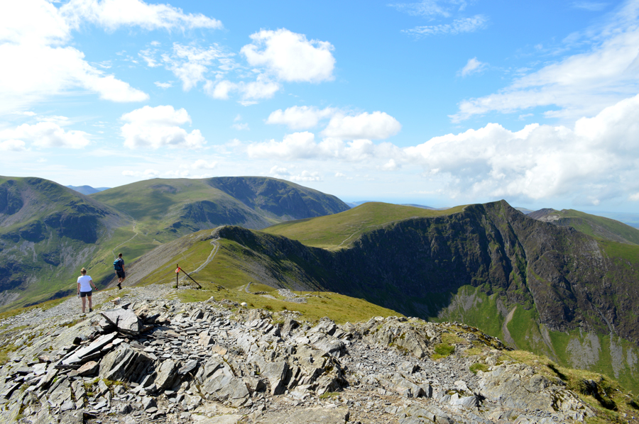
| Skiddaw and the Ullock Ridge from Scar Crags summit. |
| Instead of using the giants shoe lace to descend we opted for a grassy trod which had been carved out alongside (most probably via fell runners) as a quicker means of descent and so too did the young couple who were following us, and the group who were following them before we crossed the Col from where we made the short, yet steady ascent on Scar Crags, by which time the views just kept getting clearer and clearer. |
 |
| Causey Pike is just ahead. |
| |
 |
| David and Rod admire the view over Derwent Water from Causey Pike summit. |
We traversed the last part of the ridge and gained Causey Pike summit which we had to ourselves for the few moments we spent there. By now however, I couldn't keep it in any longer that my heel was troubling me by which time I was ready for another two pain killers and topped those off with more foot stretches.
In discomfort or not, there was no way I wasn't going to enjoy this view and the final two summits of the walk, soon we are joined by a young couple and smiles are shared before as we left the summit and started our descent over High Moss, but just before we leave, there was time for a few photos of our amazing views. |
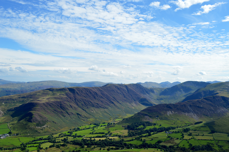 |
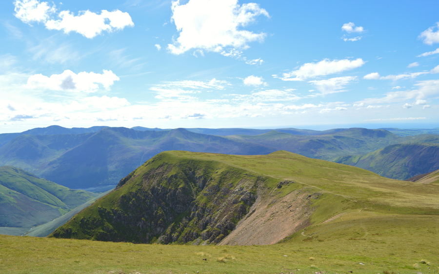
| Views into Newland towards Maiden Moor, High Spy, Dale Head and Hindscarth. |
| |
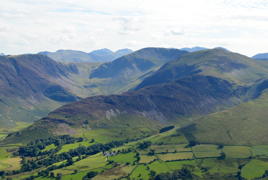 |
| High Spy, Dale Head and Hindscarth seen with the Scope End ridge. |
| |
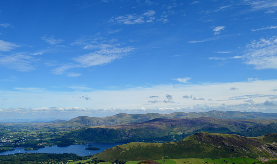 |
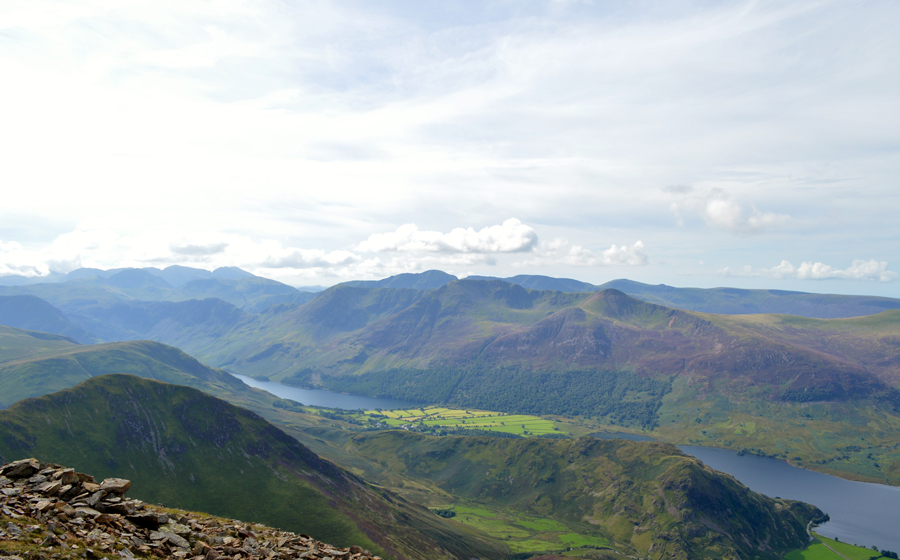
| As good as views get, here's our view over Cat Bells and Derwent Water towards the Central and Eastern ridge. |
| |
 |
| Descending towards High Moss with views over Force Crag, Coledale Hause, Eel Crag (Crag Hill) and Grisedale Pike. |
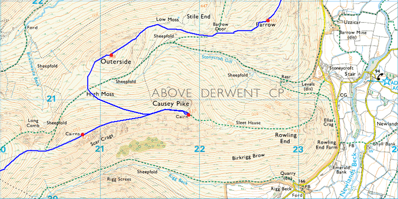
| Despite there being a lack of rainfall over the last few days High Moss lived up to its name and gave our dusty boots a good soaking, we're heading for the lowest point just above the top of Stonycroft Gill where we pick up a narrow yet steep path which leads through Heather all the way to Outerside summit. |
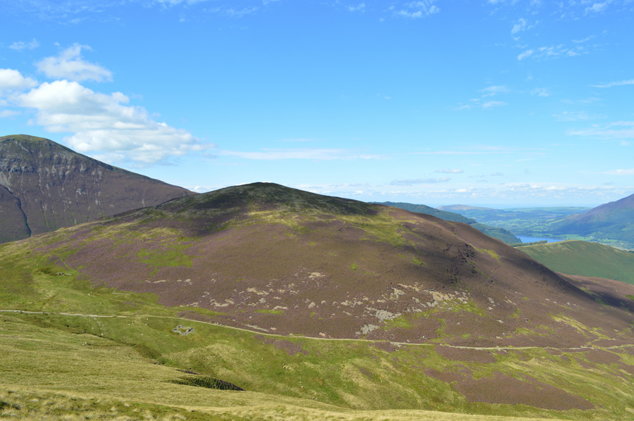 |
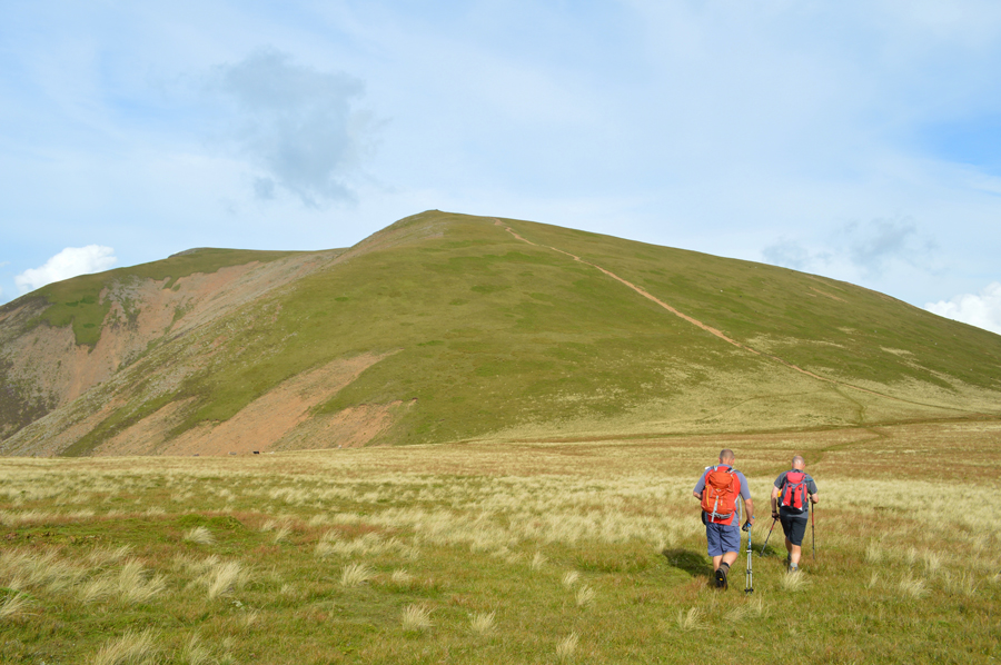
| Outerside over High Moss. |
| I couldn't but help be reminded that down there next to the sheepfold was the spot I went airborne on our first walk after last Decembers devastating storms, it would seem that the wind hadn't quite finished with Lakeland as the wind picked me up off the path and seconds later I landed right next to the sheepfold, I can laugh now but at the time it was bloody scary! |
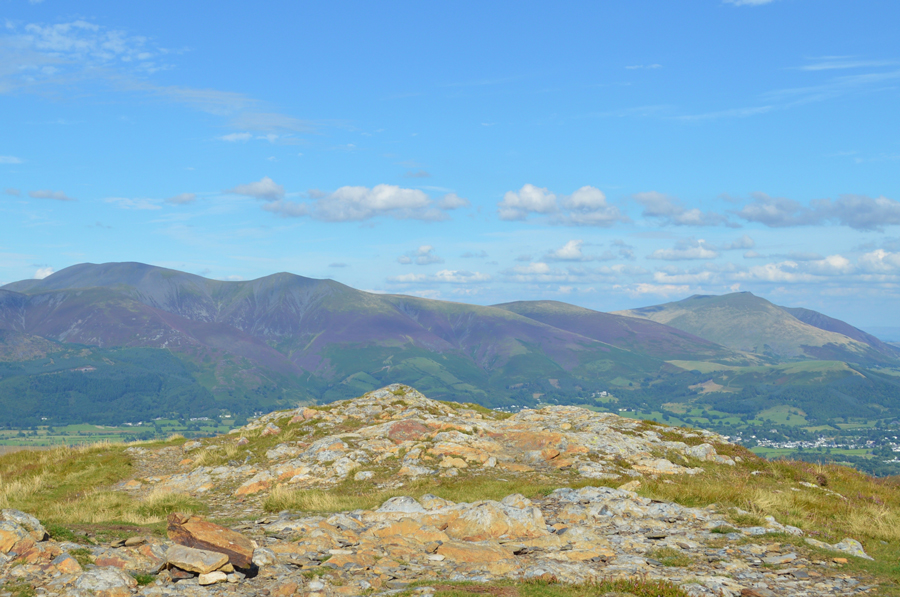 |
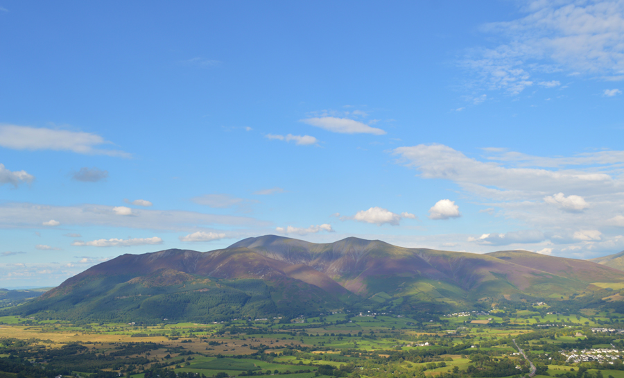
| Skiddaw and Blencathra from Outerside summit cairn. |
With the descent of Causey Pike behind us we stopped and gathered strength before starting the steep yet rather short ascent of Outerside, it was at a point when we were all kinda looking at one another to make the next move before Rod took off without a word, gathering momentum with every step it was clear Rod wasn't stopping until he had reached the summit, well done that man.
I went next and David soon after, if there is one thing I have found out during these arduous walks its that usually the smallest or shortest summit towards the end is the one where you have to dig the deepest and walk 29, was no different.
Rod arrived first and was taking summit photos shortly followed by myself and David. Skiddaw looked so elegant as I gazed over and her cloudless summit, a rarity even on a good day.
We ummed and ahhed about following a route over Stile End which is found in between Outerside and Barrows respective summits but I went against the flow and steered the lads through heather via a narrow track which came within a whisker of Stile End anyway which made me think we should have gone over as suggested, I held my hand up on that one. |
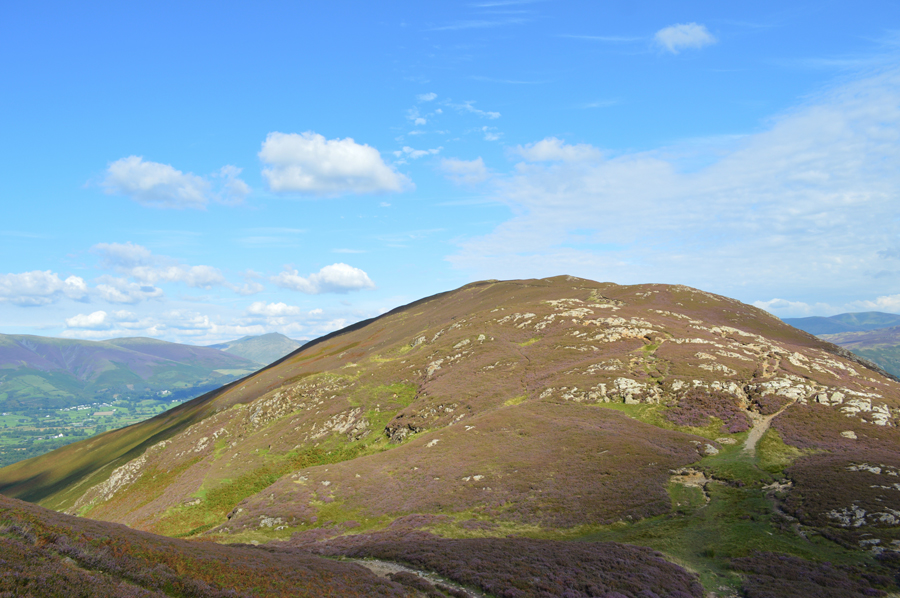 |
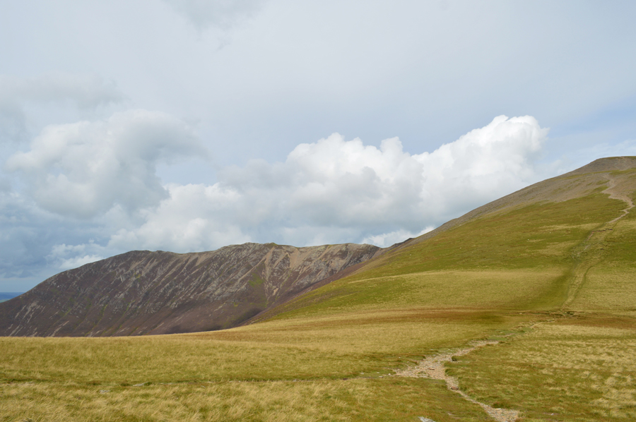
| Barrow seen over Barrow Door. |
| |
 |
| Skiddaw and Blencathra from a busy Barrow summit. |
After following a narrow path through heather we arrived at Barrow Door and began the short and steady (or at least it felt much steadier than it should) ascent towards Barrow summit where on arrival quite a few walkers had just started to leave. The air was as clear as we had seen it all day yet still incredibly warm at a point when I had sucked the last few drops out of my hydration tube back on Outerside, it was only a short distance between summits but in that time my neck felt as if it was closing in such the dryness of my mouth, it was at this point did I ask David would he mind he share me a mouthful of his water "aye no bother Paul, its warm though" It didn't matter it was wet and I swilled the water around my mouth before swallowing it.
It was approaching around four thirty in the afternoon and to be honest, it felt much later which we could only put down to just how much time we had spent walking, nevertheless, this time of day for me always feels special,
It's now time to soak up the last mile back to Braithwaite. |
 |
| Skiddaw. |
| |
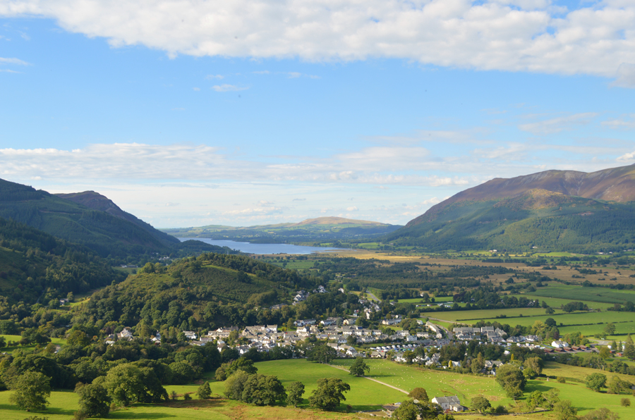 |
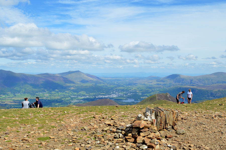
| Late afternoon views over Braithwaite. |
We are passed by a teenager who strides confidently down the ridge as he catches up to his friends at a time when we are kicking sore feet back into the backs of our boots "he hasn't walked from Rannerdale Knotts to Causey Pike" says David with a hint of sarcasm. We soon catch up the groups behind Braithwaite Lodge while at the same time passing a young local family who are about to make a late afternoon ascent on Barrow.
We walk through Braithwaite village stepping aside to let the cars go by passing the Village Store which has a host of teenagers sat outside heads in hands waiting on refreshments.
The Royal Oak is passed with its tiny beer garden and I couldn't but help stare down on its two occupants who were enjoying a late afternoon pint, the temptation came and went and before we knew it we were walking towards Braithwaite Primary School ready to be driven back to Rannerdale Knotts in Rod's baking hot car.
I sit in the back and as we each drop our windows as Rod begins to drive us back to Rannerdale via the Whinlatter Pass, the feeling of the air rushing in felt comforting as I let the air shoot up my left sleeve while hanging my arm on the window, all the while I am able to enjoy the views as we pass through Lanthwaite Green as Grasmoor and its gullies attract my attention when set against a deep blue sky, it is here I grab my mobile phone and take a photo of Grasmoor which I later shared the next evening on my Facebook Page while waiting for our meal to arrive during an evening out with my wife.
What are you looking at? as my wife catches me looking at my mobile phone during which time I get a sudden rush of memories...It's Grasmoor I replied. |
|
| |
| Back to top |
 |
|