|
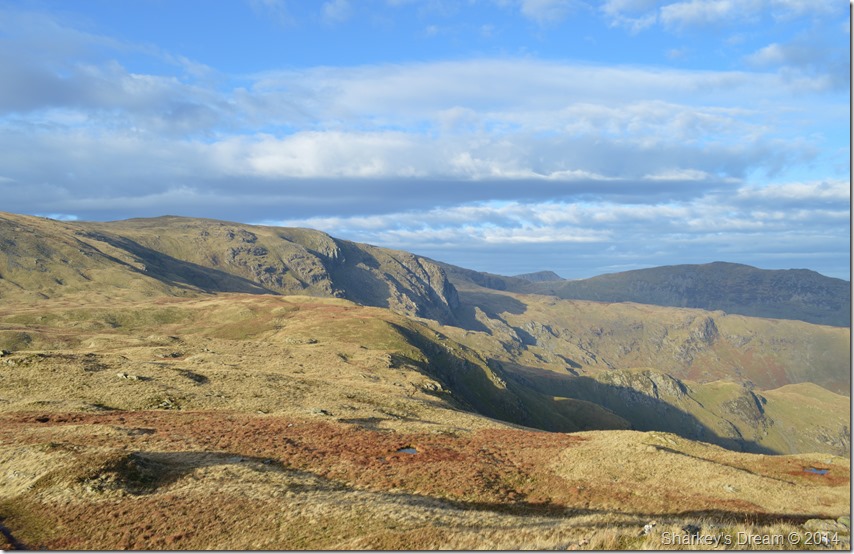
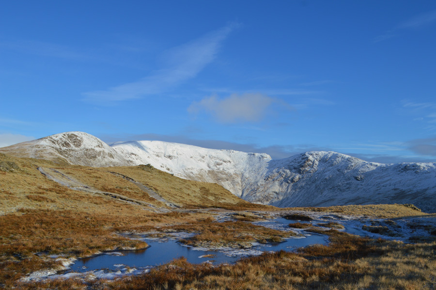
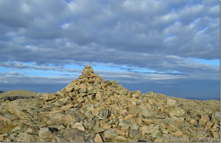
Dove Crag |
 |
 |
There are 13 walks to choose from including Dove Crag |
 |
|
Kirkstone Pass to Dunmail Raise |
|
|
 |
|
5th April 2025 |
| ASCENT: |
3,052 Feet - 930 Metres |
| MILES: |
7.5 |
| WAINWRIGHTS: |
6, Red Screes - Little Hart Crag - Dove Crag - Hart Crag - Fairfield - Seat Sandal |
| ROUTE: |
Top of Kirkstone Pass - Red Screes - Top of Scandale Pass - Little Hart Crag - Bakestones Moss - Dove Crag - Hart Crag - Link Hause - Fairfield - Grisedale Hause - Seat Sandal - Raise Beck - Dunmail Raise |
|
| |
|
The Fairfield Horseshoe |
|
|
|
|
13th March 2025 |
| ASCENT: |
3,356 Feet - 1,024 Metres |
| MILES: |
10 |
| WAINWRIGHTS: |
8, Nab Scar - Heron Pike - Great Rigg - Fairfield - Hart Crag - Dove Crag - High Pike - Low Pike |
| ROUTE: |
Rydal Church - Rydal Mount - Nab Scar - Heron Pike - Erne Crag - Rydal Fell - Great Rigg - Fairfield - Link Hause - Hart Crag - Dove Crag - High Pike - Low Pike - Low Sweden Bridge - Rydal Park - Rydal Mount - Rydal Church |
|
| |
|
Hartsop above How, Dove Crag & Stangs |
|
|
|
|
23rd September 2023 |
| ASCENT: |
2,659 Feet - 810 Metres |
| MILES: |
8.1 |
| WAINWRIGHTS: |
3, Hartsop above How - Hart Crag - Dove Crag |
| ROUTE: |
Deepdale Bridge - Gale Crag - Harstop above How - Hart Crag - Dove Crag - Bakestones Moss - Hunsett Cove - Stand Crags - Stangs - Dovedale Beck - Dovedale - Hartsop Hall - Brothers Water - Cow Bridge - Low Wood - Deepdale Bidge |
|
| |
|
Dove Crag via the Dovedale Valley |
|
|
|
|
24th September 2022 |
| ASCENT: |
2,583 Feet - 787 Metres |
| MILES: |
7 |
| WAINWRIGHTS: |
3, Dove Crag - Little Hart Crag - High Hartsop Dodd |
| ROUTE: |
Cow Bridge - Brothers Water - Hartsop Hall - Dovedale - Houndshope Cove - Dove Crag - High Bakestones - Bakestones Moss - Little Hart Crag - High Hartsop Dodd - Hartsop Hall - Brothers Water |
|
| |
|
The Fairfield Horseshoe |
|
|
|
|
17th April 2022 |
| ASCENT: |
3,356 Feet - 1,024 Metres |
| MILES: |
10 |
| WAINWRIGHTS: |
8, Nab Scar - Heron Pike - Great Rigg - Fairfield - Hart Crag - Dove Crag - High Pike - Low Pike |
| ROUTE: |
Pelter Bridge - A591 - Rydal Mount - Nab Scar - Heron Pike - Rydal Fell - Great Rigg - Fairfield - Link Hause - Hart Crag - Dove Crag - High Pike - Low Pike - Low Sweden Bridge - Rydal Park - Rydal Mount - A591 - Pelter Bridge |
|
| |
|
Dove Crag via the Dovedale Valley |
|
|
|
|
2nd October 2019 |
| ASCENT: |
2,583 Feet - 787 Metres |
| MILES: |
7 |
| WAINWRIGHTS: |
3, Dove Crag - Little Hart Crag - High Hartsop Dodd |
| ROUTE: |
Cow Bridge - Brothers Water - Hartsop Hall - Dovedale - Houndshope Cove - Dove Crag - High Bakestones - Bakestones Moss - Little Hart Crag - High Hartsop Dodd - Hartsop Hall - Brothers Water |
|
| |
|
Dove Crag via the Dovedale Valley |
|
|
|
|
8th October 2017 |
| ASCENT: |
2,583 Feet - 787 Metres |
| MILES: |
7 |
| WAINWRIGHTS: |
3, Dove Crag - Little Hart Crag - High Hartsop Dodd |
| ROUTE: |
Cow Bridge - Brothers Water - Hartsop Hall - Dovedale - Houndshope Cove - Priest Hole - Dove Crag - High Bakestones - Bakestones Moss - Little Hart Crag - High Hartsop Dodd - Hartsop Hall - Brothers Water - Cow Bridge |
|
| |
|
Walking the Wainwrights in 30 Walks Walk 28 - A Scandale Skyline from Cow Bridge |
|
|
|
|
18th August 2016 |
| ASCENT: |
4,932 Feet - 1,504 Meters
|
| MILES: |
12.5 |
| WAINWRIGHTS: |
9, Hartsop Dodd - Caudale Moor (Stony Cove Pike) - Red Screes - Middle Dodd - Little Hart Crag - High Hartsop Dodd - Dove Crag - Hart Crag - Hartsop above How |
| ROUTE: |
Hartsop - Hartsop Dodd - Caudale Moor (Stony Cove Pike) - John Bell's Banner - St Raven's Edge - Kirkstone Pass - Red Screes - Smallthwaite Band - Middle Dodd - Top of Caiston Beck - Scandale Pass - Little Hart Crag - High Hartsop Dodd - Black Brow - Bakestones Moss - Dove Crag - Hart Crag - Hartsop above How - Gale Crag - Low Wood - Cow Bridge - Hartsop |
|
| |
|
Walking the Wainwrights in 30 Walks - Walk 3 The Fairfield Horseshoe |
|
|
|
|
14th February 2016 |
| ASCENT: |
4,436 Feet - 1'352 Meters |
| MILES: |
13 |
| WAINWRIGHTS: |
9, Nab Scar - Heron Pike - Stone Arthur - Great Rigg - Fairfield - Hart Crag - Dove Crag - High Pike - Low Pike |
| ROUTE: |
Pelter Bridge - A591 - Rydal Mount - Nab Scar - Heron Pike - Greenhead Gill - Stone Arthur - Great Rigg - Fairfield - Hart Crag - Dove Crag - High Pike - Low Pike - Low Sweden Copice - Rydal Park - Rydal Mount - A591 - Pelter Bridge |
|
| |
|
The Harry Griffin 2,000 footers Walk 17 -The Fairfield Horseshoe |
|
|
|
|
20th June 2015 |
| ASCENT: |
3,558 Feet - 1,085 Metres |
| MILES: |
11.3 |
| SUMMITS OVER 2,000 Ft: |
10, Dove Crag - Hart Crag - Fairfield - Great Rigg - Rydal Fell (NY 356 095) - Rydal Fell (NY 356 093) Rydal Fell (NY 356 092) - Rydal Fell (NY 356 091) - Erne Crag - Heron Pike |
| ROUTE: |
Miller Bridge – Rothay Park – Ambleside – Nook Lane - Nook End Farm - Low Sweden Bridge - Low Pike - High Pike – Dove Crag – Hart Crag – Link Hause – Fairfield – Great Rigg – Heron Pike – Erne Crag - Nab Scar – Rydal Hall – Rydal Park – Scandale Bridge – Ambleside – Miller Bridge |
|
| |
|
An alternative Fairfield Horseshoe |
|
|
|
|
29th November 2014 |
| ASCENT: |
4,500 Feet – 1,372 Meters |
| MILES: |
13.8 |
| WAINWRIGHTS: |
8, Red Screes – Little Hart Crag – Dove Crag – Hart Crag – Fairfield – Great Rigg – Heron Pike – Nab Scar |
| ROUTE: |
Miller Bridge – Rothay Park – Ambleside – Kirkstone Road – Snarker Pike – Red Screes – Scandale Pass – Little Hart Crag – Bakestones Moss – Dove Crag – Hart Crag – Link Hause – Fairfield – Great Rigg – Heron Pike – Nab Scar – Rydal Hall – Rydal Park – Scandale Bridge – Ambleside – Miller Bridge |
|
| |
|
The Fairfield Horseshoe |
|
|
|
|
28th May 2011 |
| ASCENT: |
3,420 Feet |
| MILES: |
9 |
| WAINWRIGHTS: |
8, Nab Scar, Heron Pike, Great Rigg, Fairfield, Hart Crag, Dove Crag, High Pike (Scandale) & Low Pike |
| ROUTE: |
|
|
| |
|
The Dovedale Horseshoe |
|
|
|
|
15th August 2010 |
| ASCENT: |
2,760 Ft 841 Mtrs |
| MILES: |
7 |
| WAINWRIGHTS: |
5, Hartsop Above How, Hart Crag, Dove Crag, Little Hart Crag High Hartsop Dodd |
| ROUTE: |
|
|
| |
| Back to top |
 |
|