|
Walking the Wainwrights in 30 Walks Walks 28 - A Scandale Skyline from Cow Bridge |
 |
 |
18th August 2016 |
 |
|
Today I'm back at Cow Bridge repeating a project walk that I was forced to abandon back in March due to bad weather which at the time and still to this day, cuts deep. I can't quite answer why I let walks that I have abandoned affect me the way they do, I guess you could say I take the decision personal when really it all comes down to it, It was purely based on keeping myself safe.
To mix things up it was suggested that I do the route in reverse which I thought was a good alternative but the original route penned won mainly because I wanted to absorb the Hartsop above How ridge after a long day on the fells, a fitting end to a grand yet arduous walk.
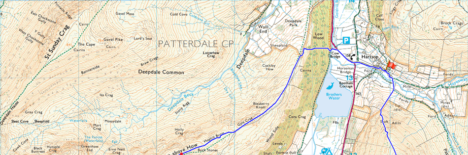
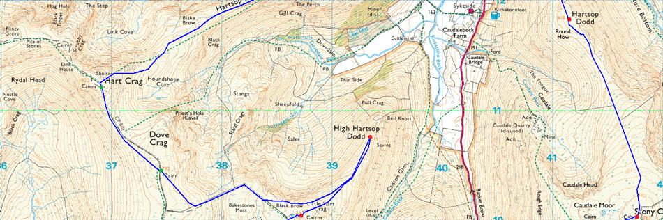
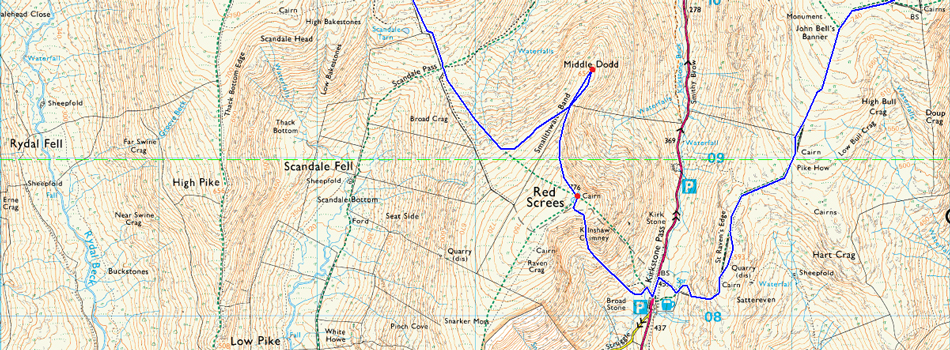
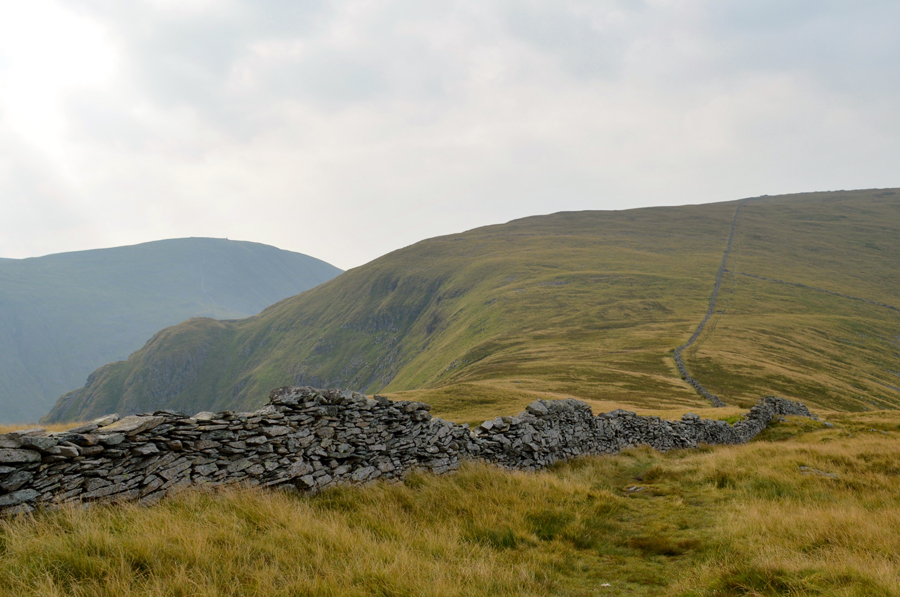
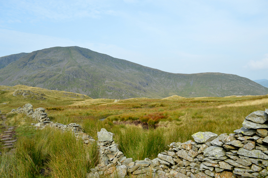
Todays walk summits nine Wainwrights but only seven will be 'collected' which I had marked on the map below in Red; the two summits of Dove Crag and Hart Crag marked in Green were collected during the Fairfield Horseshoe back in February and are the only two repeat summits within the whole project so let me take you around the route which starts from Cow Bridge just outside the village of Harstop from where I'll gain Hartsop Dodd before continuing south along the ridge to collect Caudale Moor (Stoney Cove Pike) then trek south west via St Raven's Edge before crossing the top of the Kirkstone Pass from where I'll start the steep ascent ascent on Red Screes.
The summit of Middle Dodd is next gained via Smallthwaite Band before I descend the Caiston Beck flank of Red Screes towards the top of Scandale Pass before summiting Little Hart Crag which is where I'll gain High Hartsop Dodd from before returning to summit Dove Crag via Black Brow and Bakestones Moss. After summiting Dove Crag I join the Fairfield Horseshoe in an anti-clock wise direction and summit Hart Crag although I did have the choice not to but as the saying goes, I went there anyway. From Hart Crag I would enjoy the remainder of the walk back to Cow Bridge via the Hartsop above How ridge after digging deep more times than I was comfortable with. |
|
| Wainwright Guide Book One |
 |
| The Eastern Fells |
-Red Screes
Red screes, although in the midst of high country, contrives to appear more isolated from its fellows than any other of the eastern fells. It is independent and is unsupported, not buttressed by its neighbors: to this extent, it may be said to have the purest mountain form among the eastern fells. |
 |
|
|
| |
|
Overview |
|
|
| Ascent: |
4,932 Feet - 1,504 Meters
|
| Wainwrights: |
9, Hartsop Dodd - Caudale Moor (Stony Cove Pike) - Red Screes - Middle Dodd - Little Hart Crag - High Hartsop Dodd - Dove Crag - Hart Crag - Hartsop above How |
| Weather: |
Overcast With Sunny Spells, Light Winds Across The Summits, Humid, Highs of 25°C Lows of 16°C |
| Parking: |
Car Park, Cow Bridge, Hartsop |
| Area: |
Eastern |
| Miles: |
12.5 |
| Walking With: |
On My Own |
| Ordnance Survey: |
OL5 |
| Time Taken: |
7 Hours 40 Minutes |
| Route: |
Hartsop - Hartsop Dodd - Caudale Moor (Stony Cove Pike) - John Bell's Banner - St Raven's Edge - Kirkstone Pass - Red Screes - Smallthwaite Band - Middle Dodd - Top of Caiston Beck - Scandale Pass - Little Hart Crag - High Hartsop Dodd - Black Brow - Bakestones Moss - Dove Crag - Hart Crag - Hartsop above How - Gale Crag - Low Wood - Cow Bridge - Hartsop |
|
| |
|
Map and Photo Gallery |
|
|
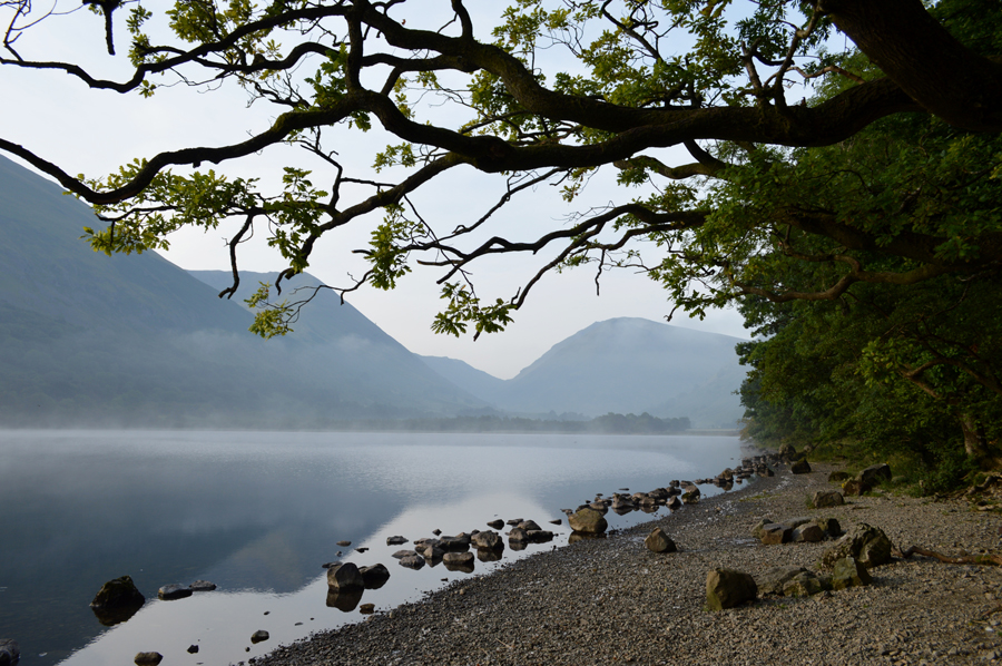 |
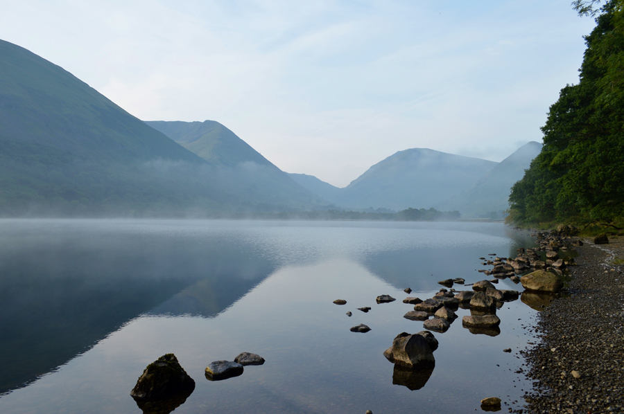
| Brothers Water 07:12am |
| Just before I arrived at Cow Bridge I spotted Brothers Water looking so still and majestic through the car window and decided before I headed out to Harstop I'd take it all in for a few moments. |
 |
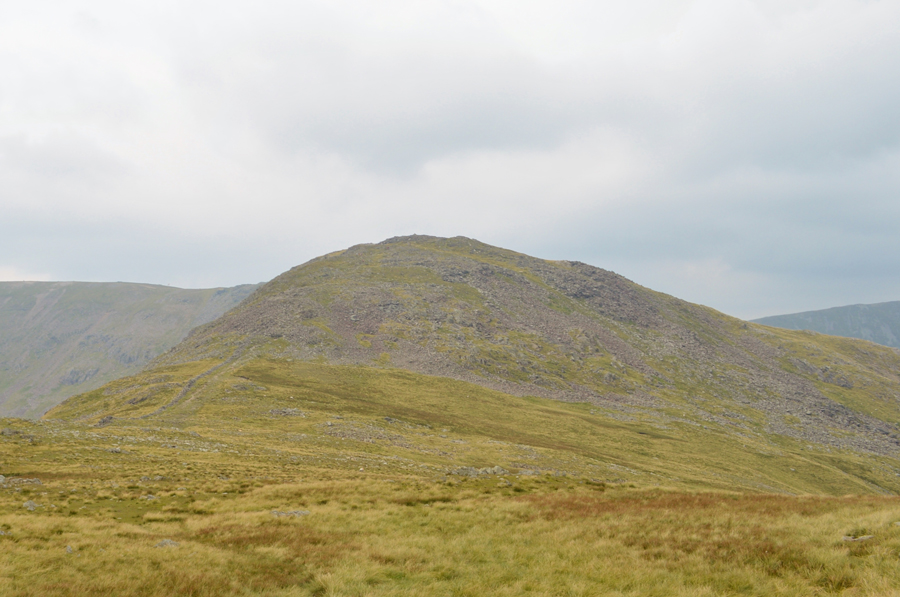
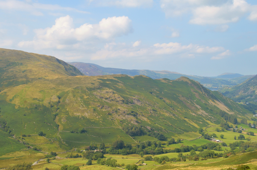
| Caudale Moor, Red Screes, Middle Dodd (not very clear) and High Hartsop Dodd from Brothers Water |
| Just four of the nine summits that feature in todays walk. |
 |
| Misty views over The Knott, Gray Crag and Hartsop Dodd from Goldrill Beck / Brothers Water. |
| |
 |
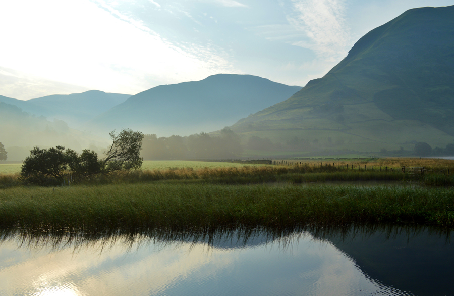
| Gray Crag, Hartsop Dodd and Caudale Moor from Cow Bridge. |
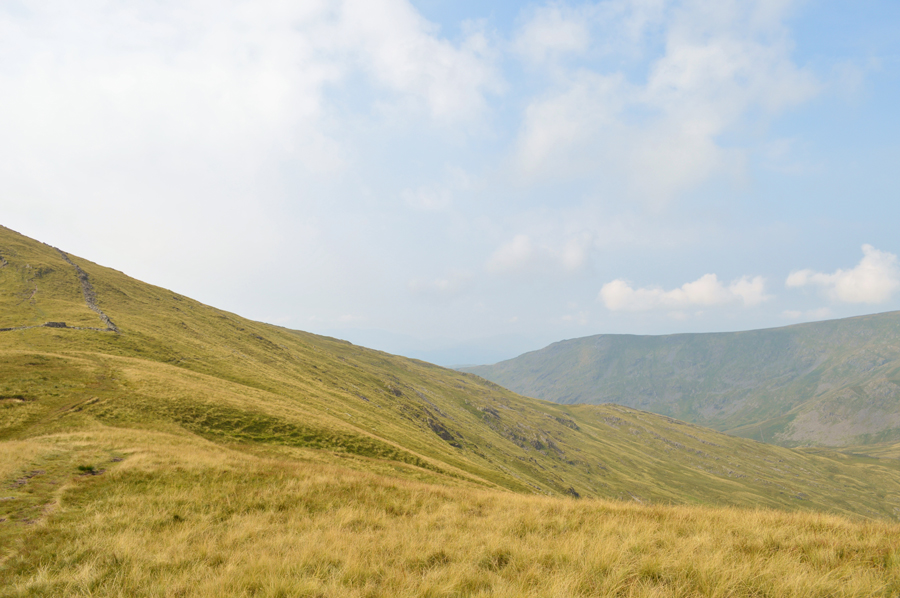
After spending a few minutes on the bank of Brothers Water I returned to Cow Bridge where I passed my car once again before crossing the bridge where a youthful Goldrill Beck meandered below, up ahead the first objective of todays walk in Hartsop Dodd followed by the second, Caudale Moor seen in the distance.
Soon I'll be making my ascent on Hartsop Dodd from where my view will open out over Patterdale and Ullswater where I can see a cloud inversion has formed. |
 |
| The Knott and Hartsop Dodd seen above Hartsop Village. |
From Cow Bridge I head out along Kirkstone Pass where I can hear the distant sound of a quad bike coming from the direction of Hartsop Farm which appears louder once I pass Langton Adventure Centre seen here in the photo. Through the trees which line the lane I can see the movement of a farmer who is returing to what I thought was a quad bike, but is in actual fact one of those four wheel drive 'golf buggies'
He drives away and the noise from the engine fades into the distance although it's not the last I'll hear or see of the farmer, the morning's peace returns before two white vans pass me heading towards the car park at the end of the end of the village, one driver gives me the thumbs up for standing aside as I take note that he doesn't look like your regular walker which I'll get back to in a moment.
Close to the car park glimpses of Hartsop Dodd steep north ridge appears over the roof tops and as the sun start starts to cast its light over the ridge, up ahead the two white vans are now heading towards Hayeswater Gill at the site of the old mine where I can see construction vehicles working on the Hayeswater Hydro Scheme sadly, the light is so low it won't alow me to take a photograph of the site which is explained below by Beckside Construction.
The Hayeswater Hydro Scheme is one of the highest head schemes that Beckside Construction have been involved in to date. One of the first tasks before construction on the hydro scheme could begin was to widen the access track to the intake site to allow access by 20 tonne excavator. An excavator fitted with a steel wrist attachment was utilised to re grade the banking to widen the track and replace the original turf on the freshly dug banking to reduce the visual effect on the landscape. To date the tank for the intake structure has been formed and work is currently taking place to install the Ductile Iron Penstock.
Nope, they definitely weren't walkers. |
 |
| Up ahead, Harstop Dodd north ridge. |
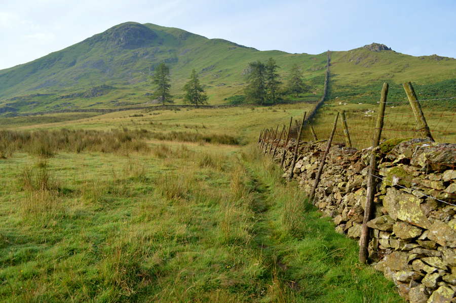
| Once I had crossed the car park where an elderly walker is reversing his car as close to the stone wall as he can get, nods are exchanged before I pass through the wooden gate and cross the old Packhorse Bridge over Pasture Beck, up ahead my views open out onto open fell side and Hartsop Dodd steep north ridge, it's just a case of following the stone wall until I reach the ridge. |
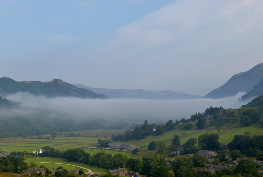 |
| There's that Cloud Inversion over Patterdale and Ullswater. |
| It's such a pity that the sun is now hidden behind cloud leaving the morning light looking faded, dull and grey and nothing like it was just half an hour ago. |
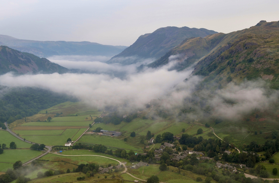 |
| Above the Cloud Invesrion now as it starts to break up, here, looking towards Angletarn Pikes and Place Fell. |
| |
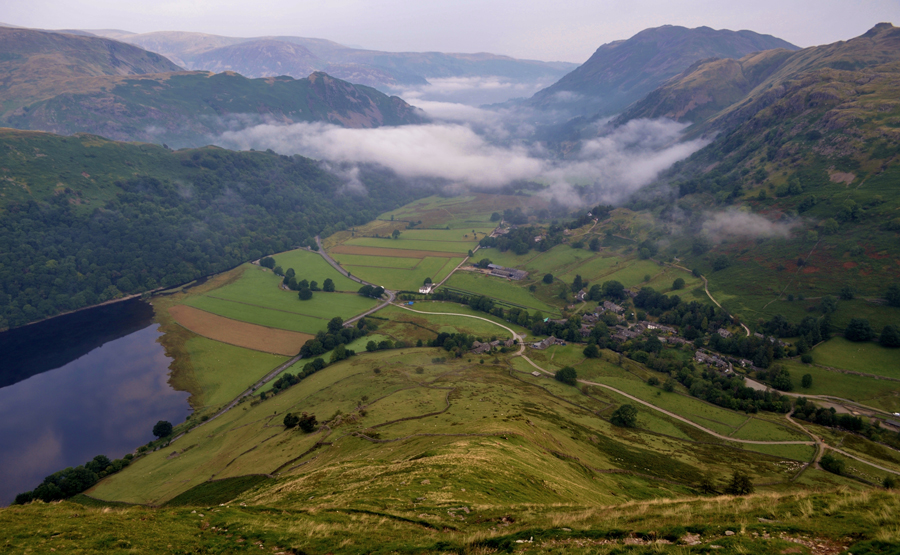 |
| Views looking down Hartsop Dodd North Ridge towards Hartsop with Brothers Water on the left and Ullswater in the distance. |
Hartsop Dodd north ridge is steep enough to fool even the prepared and today no matter how prepared I actually was, I still had stop to get my breath back on more than one occasion, I'm not quite sure if it was due to the medication that I've been taking lately or the general fact that it's just so humid I am unable to breathe, either way, the ascent seemed much more like hard work than it should have done.
I press on. |
 |
| Harstop Dodd summit. |
I arrived at Hartsop Dodd summit exactly one hour after leaving the car where I was able to get my breath back and adjust my mid layer, that had once again ridden up my back! grrrr.
The light seems to be fading even more leaving distant fells virtually nonexistent only the outline of the Scandale Fells that I'll be visiting today through a thickening haze but I remained optimistic that the views would get better once the day had progressed, the main thing is, I have visibility and there is no thick thawing snow underfoot like my previous attempt back in March.
Feeling rejuvenated I strike out with walking poles stretched behind me feeling quite safe in the knowledge that for now it's plain walking all the way to Caudale Moor summit. |
 |
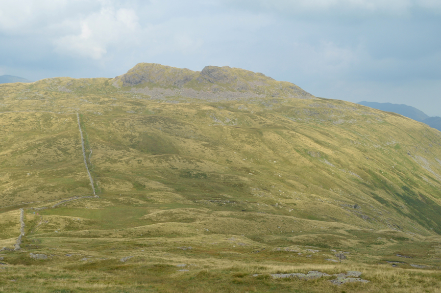
| Caudale Moor (Stoney Cove Pike) seen with Thornthwaite Crag over the top of Raven Crag. |
| Well, I say plain walking, there is a steady ascent up ahead but it's very pleasant underfoot and usually goes unnoticed. |
 |
| Views back down to Hartsop Dodd summit during a brief show of sun. |
| |
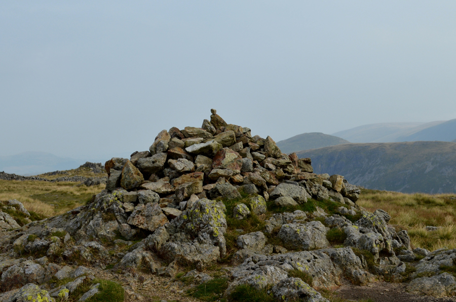 |
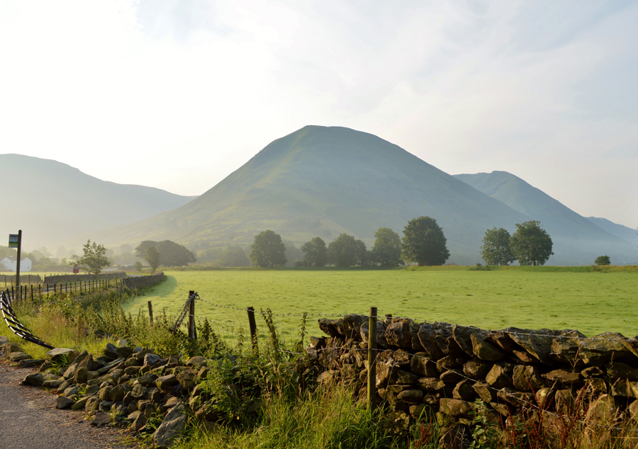
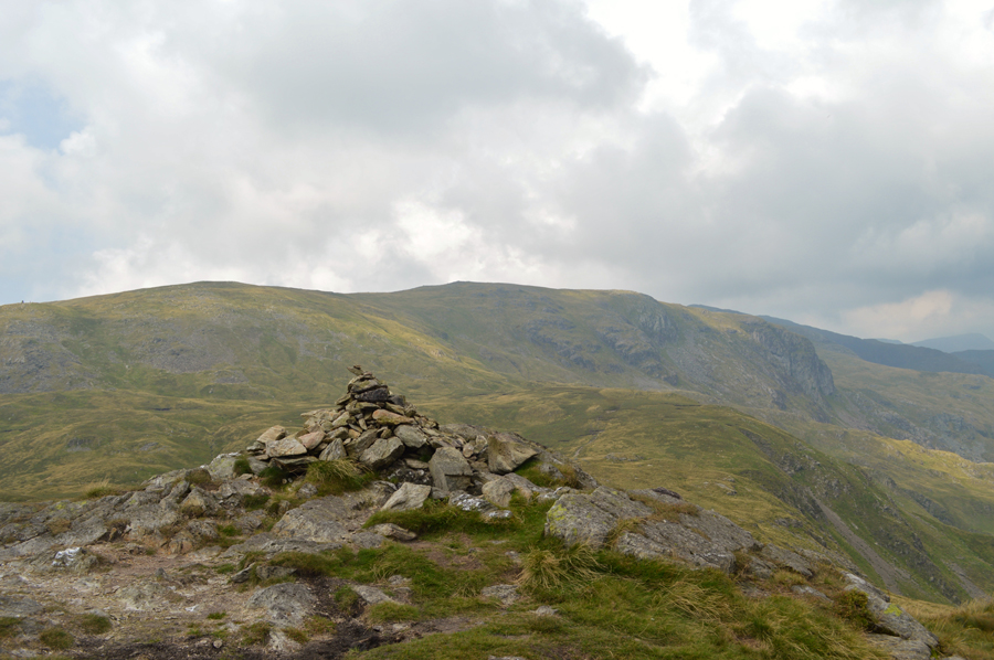
| Caudale Moor (Stoney Cove Pike summit) |
With walking poles still stretched behind me I follow the stone wall to the summit where I was reminded of certain times and features from my last visit when the thought of abandoning the walk started to creep into my mind. Thankfully this wasn't the case today as I spot a solo walker on Caudale Moor who has found somewhere to sit close to the summit Tarn, at one point he was close enough to wave but the chap never looked up.
I spend a few moments taking in the views over towards the III Bell ridge which appear nothing more than dark knuckles in the distance, it was the same over High Street and beyond towards Kidsty Pike, all my surrounding summits seem to fade into a browny grey ink with a pale sky just above, still I was thankful it wasn't raining and it's pretty dry underfoot too. |
 |
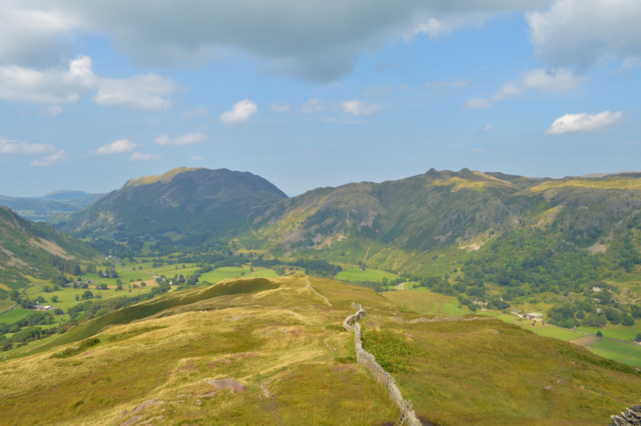
| St Raven's Edge. |
| From the summit of Caudale Moor I opt to head for the Tarn instead of using the path by the familiar wall where once again I spot the solo walker who I pass without so much of a nod. From the Tarn I pick up the path on the south west corner of the summit known as John Bell's Banner from where I begin the long descent towards St Raven's Edge where I can see some large groups have gathered. |
 |
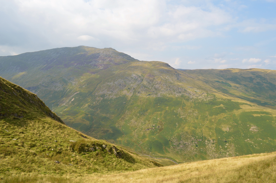
| Red Screes and Middle Dodd come into view from St Raven's Edge. |
| Both of which feature as my third and fourth summits in todays walk, but first I need to descend over Kirkstone Pass. |
 |
| Red Screes and Middle Dodd as I start my descent on Kirkstone Pass. |
The large groups I had mentioned turned out to be a group of kids lead by three Guides from the National Trust, I only managed a smile from one or two of the kids as most of them looked too upset at having a mobile phone signal, lets hope that fell walking and everything it brings gets through to at least one of the teenagers because lets face it, when I was a teenager all I wanted to do was jump off things on my BMX at a time when if I asked my mum could I use the one and only phone in our house I usually got the answer no!
How times have changed eh. |
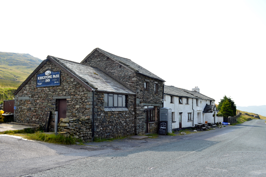 |
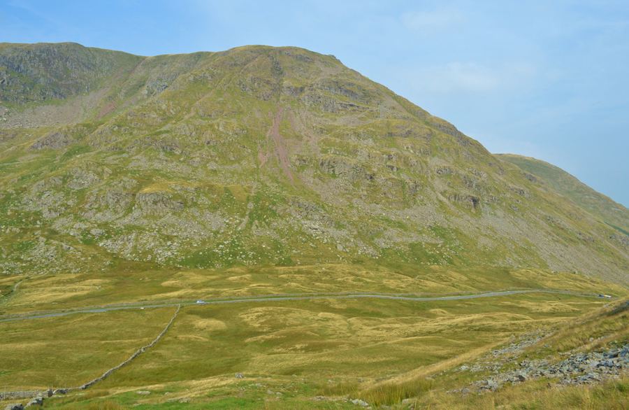
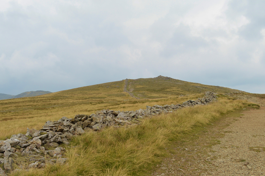
| Passing the Kirstone Inn at the top of Kirkstone Pass. |
It may not appear it but it's quite busy with plumbers un blocking a blocked pipe, buses stopping to let off walkers who all head up St Raven's Edge and not to mention a bustling car park where I pass a solo young girl kitting up while up ahead a chap is starting his ascent on Red Screes dressed in jeans and plaid shirt.
I had mentally prepared for this ascent much like I had Hartsop Dodd steep north ridge and, the ascent on Dove Crag and Hart Crag which are still yet to come, but even after all the preparation in the world if it suddenly dawns on you that your legs don't want to move, and that it feels like your carrying an adult on your back and the humidity is so humid it leaves you breathless.
It's time to dig the deepest you've ever had to dig. |
 |
| Ascent on Red Screes. |
With walking poles stretched back until I started the ascent I could see the chap in jeans up ahead who I gain on quite quickly, down below me I can hear the traffic along the Kirkstone Pass and even the voices of the tourists who have stopped to chat on the car park, The girl I had passed has started her own ascent right about the same time I felt the burn dawn down on me.
I'm not quite sure why I was affected so much by this ascent, maybe the fact that it was on Red Screes last February that I officially called off the my last attempt or maybe it was that within the space of a few days I'd climbed just under 10,000 feet over 40 miles, combine this with my medication...I'm not sure... but whatever happened during this ascent I had to kick my backside all the way towards the summit in what felt like 100% humidity.
It's fair to say that I struggled not helped by the fact that almost half of the hard work was done for me as I had started the ascent from the top of Kirkstone Pass which teased, and played on me.
Incidently, the girl who I had passed back at the car park has just passed me and by now, is making good ground towards the summit. There's plenty of things that I'd like to change about myself but the main one is how I often beat myself up over things that I cannot change.
I press on. |
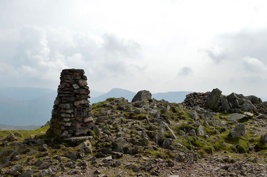 |
| Red Screes summit Trig Point. |
The young girl had long gone by the time I reached Red Screes and I was thankful to get some summit time alone if only to take a rest where I was met by a cool summit breeze, for whatever reason I now had a headache and I could feel the blood thumping around my head along with the heart in my chest, something of which I had never experienced whilst out on the fells. After what felt like minutes the headache eased and so did my heart rate, after sitting it out for a few moments before an elderly couple arrived from the direction of Middle Dodd.
We pass on our hello's and I put the whole episode behind me, had I not it would have proved impossible to continue, right at the spot where I abandoned last February's walk.
I guess fatigue can still affect the most regular of fell walkers, the last half hour proved I am no different. |
 |
| Descending Smallthwaite Band towards Middle Dodd shortly after leaving Red Screes summit. |
| |
 |
| Red Screes and Smallthwaite Band from Middle Dodd summit |
The descent over Smallthwaite Band allowed me to prepare and adjust for the remainder of the walk as over to my left flank the summits of Little Hart Crag, High Hartsop Dodd, Dove Crag and Hart Crag shimmered through a thickening haze. At the summit of Middle Dodd I pass two walkers, a mother and son who strike out across the back of Red Screes and descend towards the top of Scandale Pass, meanwhile on Middle Dodd summit I am met by this elderly lady who smiles at me warmingly as I approached the summit cairn.
I could have spent more time at Middle Dodd summit even just a few moments while I absorbed my surroundings, however it was now time to say goodbye to the Kirkstone Fells and hello to the Scandale Skyline. |
 |
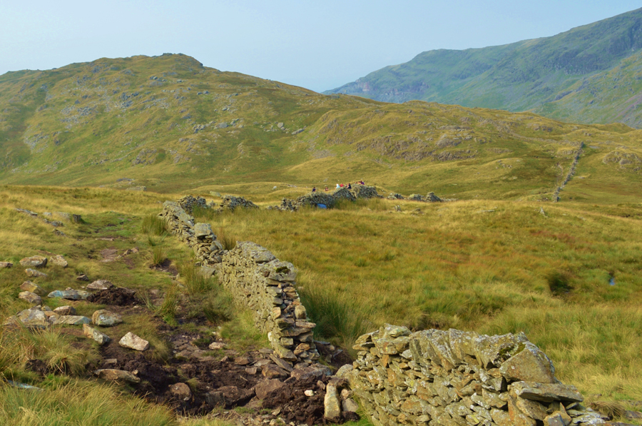
| The path I will use to descend towards the top of Scandale Pass. |
| You may be able to make out a faint path just below the stone wall up ahead, this path navigates along the Caiston Beck flank of Red Screes and can be quite tricky in places as much of the path is ledge like and quite boggy in places with a few craggy out crops to negotiate. I'm heading towards the lowest point in the right of the photograph which is just above the top of Scandale Pass. |
 |
| Little Hart Crag seen over the top of Scandale Pass. |
Even though it wasn't quite lunchtime I decided to stop after realising that I hadn't had much in the way of breakfast (just a breakfast bar during the drive up) which may be the reason for my lack of energy when on medication for my heel which incidently, seems to be coping well.
The mother and son duo have just reached the path behind me after they opted to 'keep ascent' rather than descend the same way as I did who soon pass while I'm eating lunch, we pass on our hello's once more. With my pack de-shouldered my back is getting a cool down as a light breeze passes over the top of the pass which is most welcoming before I decide to leave half my lunch for later as I didn't want to fill up too much with still quite a lot of ascent yet to come. |
 |
| Little Hart Crag summit. |
Re-shoulderd, fed and watered I start to feel much better as I pass over the top of Scandale Pass from where I observe a group of walkers heading up from the Scandale Valley, up ahead I can see the mother and son making an ascent also on Little Hart Crag who I pass just below the summit, the mother opts out of a summit and instead starts to head out towards High Hartsop Dodd as her son, and myself summit almost together.
By which time the light is on the decrease once again leaving the surrounding summits looking dull and sometimes, unattractive. The cool wind helps with the humidity as I descend from the summit passing the remains of a dead sheep close to the path below, it lies on the junction which I will use upon my return after summiting High Harstop Dodd which is sadly, not the best feature to look out for. |
 |
| It's low light all the way as I head out towards High Hartsop Dodd. |
| Taking note of the conditions underfoot for my return. |
 |
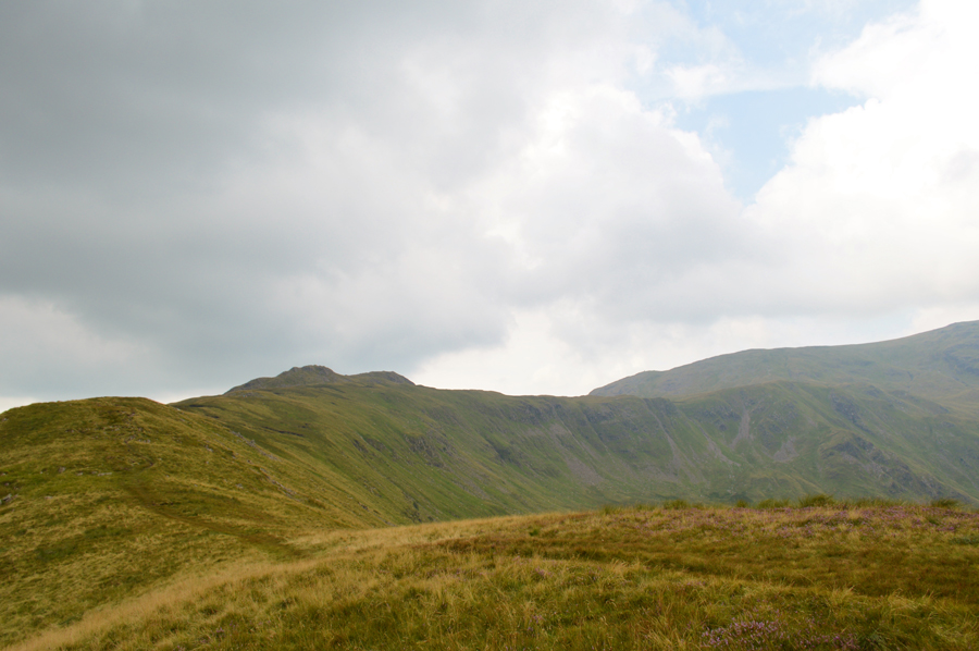
| Little Hart Crag from High Hartsop Dodd. |
I seemed to enjoy gaining High Hartsop Dodd which could only mean I was feeling back to A1 again as I stabbed my walking poles into the ground before taking this picture looking back towards Little Hart Crag and Black Brow which is the area of ground below the Little Hart Crag.
I take in the views which were quite limited given the low light but I was thankful when presented with conditions like this that it wasn't raining. Im not sure why the ground attracted my attention the way it did, maybe it was because it appeared to moving when on closer inspection the ground was moving with thousands of flying ants just about everywhere I looked, time to get out of here before I disturb them. |
 |
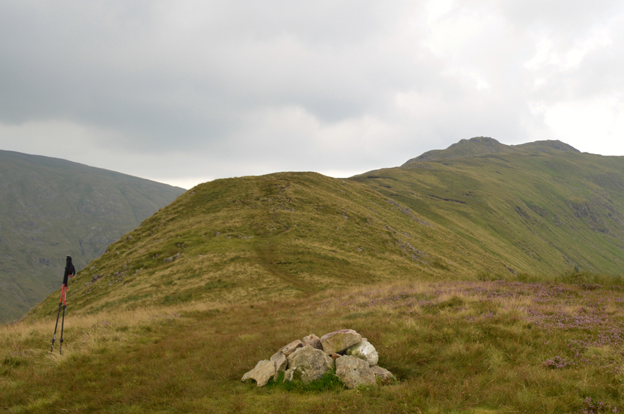
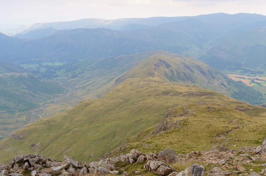
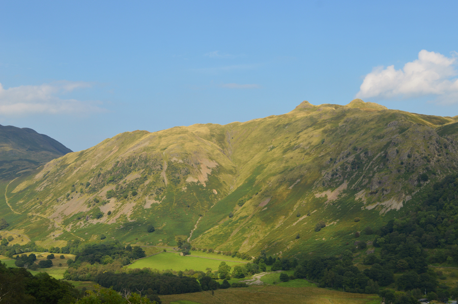
| Little Hart Crag, Black Brow, Bakestones Moss and Dove Crag from High Hartsop Dodd. |
| The mother and son have just left Little Hart Crag and were by now heading towards High Hartsop Dodd as I had done, as we pass for the last time the mother smiles and says "now this is the last time we will see each other, we shan't see one another anymore" In a rather posh voice, I smile and reply with, enjoy the rest of your day. |
 |
| Distant views over Bakestone Moss towards Little Hart Crag and High Hartsop Dodd. |
Perched somewhere below Little Hart Crag a large group of walkers were resting as I pass by then pass two more, an elderly couple further along the path before starting my ascent on Dove Crag.
I feel in good spirits but I am still reduced to an almost crawl in my ascent on Dove Crag as I feel I'm still being affected by the humidity, up ahead I can see figures on Dove Crag summit two of whom I pass on route with a smile and ey-up. |
 |
| Dove Crag summit is just up ahead now. |
| |
 |
| Hart Crag with Fairfield behind seen shortly after descending Dove Crag. |
The low light continued, in fact coupled along with the high humidity I could have sworn we were in for a thunderstorm but thankfully (very thankfully) the rains were due this evening.
I had made my way to Dove Crag summit which I tap with my walking pole as I walk by, there was no reason to stop as the views were still being affected by the haze and low light and with this, I made my way down the other side where I effectively joined the Fairfield Horseshoe in a anti-clockwise direction.
The thought had occurred to me not to summit Hart Crag as I had already collected both Dove and Hart Crag(s) as part of the project back in February and with this my thoughts turned to a detour which would see me outflank the summit altogether via a narrow path which I spotted which ran below the scree from the centre to far right of the photo, this I contemplated much before remembering the words of Harry Griffin who famously wrote about the summits he needn't have visited by writing "but I went there anyway"
Which kinda got my ar#e into gear. |
 |
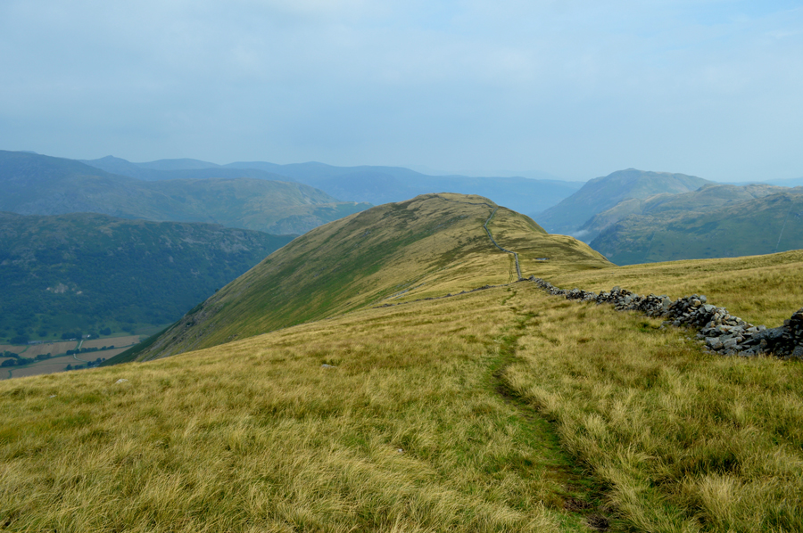
| Descending Hart Crag for the Hartsop above How ridge. |
It's fair to say that due to the humidity I started to overheat and any thoughts of a downpour were most welcoming. It's a steep and tricky descent with quite a few rock step challenges where I would often slip from the grips on my walking poles which by now, are saturated in sweat.
The one main reason why I chose to collect Hartsop above How last was to take in this fabulous ridge walk slightly marred by the haze...and not to mention the millions of flying ants. |
 |
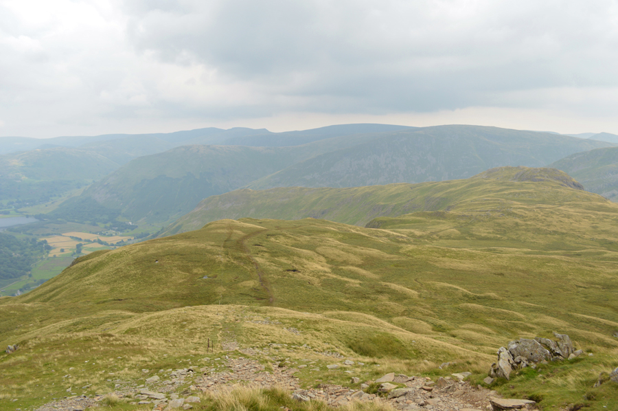
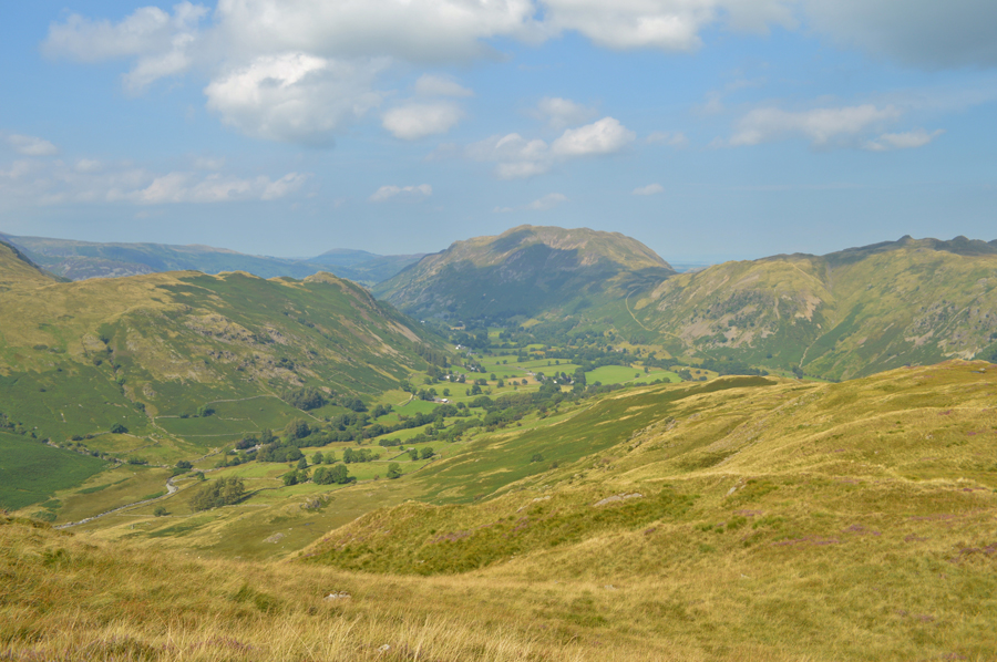
| Hart Crag, Link Hause, Fairfield and Greenhow End from Hartsop above How summit cairn. |
| Those of you with a keen eye may just be able to spot Cofa Pike peaking over in the right of the photo. |
 |
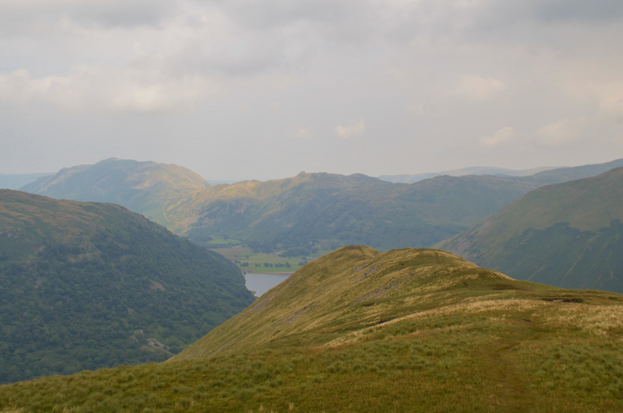
| St Sunday Crag and Gavel Pike seen over the Deepdale Valley. |
| |
 |
| Birks, Place Fell, Boredale Hause and Angletarn Pikes as I start to descend the Hartsop above How ridge. |
| Would you adam and eve it! the sun has come out for the remainder of the walk. |
 |
| Birks and Arnison Crag from Gale Crag / Hartsop above How. |
| |
 |
| Place Fell, Boredale Hause and Angletarn Pikes. |
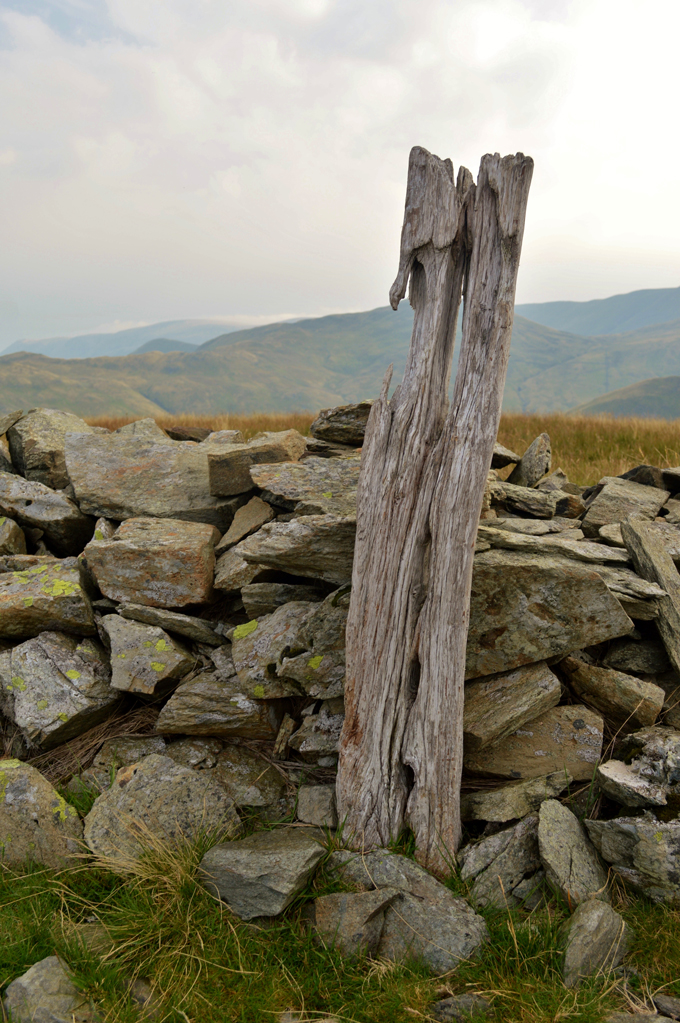
| It's now time to leave the ridge using the wooden sty in the foreground which descends steeply all the way back to Cow Bridge. |
 |
| Late afternoon sun over Angletarn Pikes. |
| |
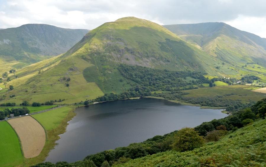 |
| Gray Crag, Hartsop Dodd, Caudale Moor and Brothers Water from Low Wood. |
I was at least blessed in afternoon sun during the steep descent back to Cow Bridge from where it was decided that I would finish the remainder of my lunch whilst on the banks of Goldrill Beck. It's a steep descent and feet are kicked back into boots once I reach Cow Bridge as I open the gate while passing a family out for a afternoon bike ride.
My car is reached and the car park is busy with walkers as I kit down at the back of my car remembering that all afternoon I had looked forward to wading into the beck where once again this week I'll cup handfuls of water over my face, soon feeling positively refreshed, I climb back onto the bank where I had left my lunch box and dangle my feet over the edge and watch the world go by not knowing that in 48 hours time this exact spot were I'm sitting will be almost underwater after 24 hours of heavy rainfall.
I was startled to see the News this morning and the You Tube clips which showed my lunch spot during the deluge, but I was more saddened that after all the hard work the councils and communities of Cumbria have done seem to have no affect after prolific rainfall, further down stream Glenridding Beck was close to breaking its banks and travel was affected due to flooding across the region bringing chaos and more localised flooding to the counties roads.
This walk will be remembered for many reasons but mainly the day, I had to dig deep but got my reward in those five minutes back at Cow Bridge. |
|
| |
| Back to top |
 |
|