Tarn Crag (Easedale)

Overview
Height: 1,801 Feet - 550 Metres
Grid Ref: NY 303 093
Area: Central
Group: W-LAN
Ordnance Survey: OL4 - OL6
Wainwright Guidebook: Three

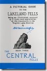
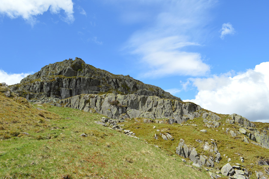
Easedale Tarn has a popular venue for visitors: a romantic setting, inured in bracken-clad moraines with a background of craggy fells, and easy accessibility from Grasmere, have combined this a favourite place of resort. The dominant feature in the rugged skyline around the head of the tarn is the arching curve of Tarn Crag, above a wild rocky slope that plunges very steeply to the dark waters at its base.

Easedale Tarn is not the only jewel in Tarn Crags lap. A smaller sheet of water, Coledale Tarn, occupies a hollow on the higher shelf; beyond, indefinite slopes climb to the top of the parent fell, High Raise.


Map and Photo Gallery


Looking back upto Tarn Crag (Easedale)

Tarn Crag (Easedale) seen from Easedale Tarn.


There are 6 walks to choose from including Tarn Crag (Easedale)

Blea Rigg to Tarn Crag from Grasmere

View this walk

29th July 2023
ASCENT: 2,428 Feet - 740 Metres
MILES: 9.2
WAINWRIGHTS: 3, Blea Rigg - Sergeant Man - Tarn Crag (Easedale)
ROUTE: A591 - Butharlyp How - Easedale Road - Goody Bridge - New Bridge - Easedale Tarn - Blea Rigg - Sergeant Man - Codale Head - Tarn Crag (Easedale) - Tarn Crag East Ridge - Far Easedale - New Bridge - Goody Bridge - Butharlyp How - A591
 

Silver How to Tarn Crag from Grasmere

View this walk

3rd December 2022
ASCENT: 2,265 Feet - 690 Metres
MILES: 9
WAINWRIGHTS: 3, Silver How – Blea Rigg – Tarn Crag (Easedale)
ROUTE:

Grasmere – Kelbarrow– Silver How – Brigstone Moss – Langhow Tarn – Blea Rigg – Belles Knott – Codale Tarn – Tarn Crag (Easedale) – Tarn Crag East Ridge – Easedale Tarn – Sourmilk Gill – Easedale Beck – Easedale Road – Grasmere


Walking the Birketts, Tarn Crag East Ridge to Sergeant Man

View this walk

7th October 2018
ASCENT: 2,165 Feet - 660 Metres
MILES: 7.5
BIRKETTS: 3, Tarn Crag - Codale Head - Sergeant Man
ROUTE: A591 - Grasmere - Easedale Road - Goody Bridge - Sourmilk Gill - Tarn Crag East Ridge - Tarn Crag - Codale Head - Easedale Tarn - Sourmilk Gill - Easedale Road - Grasmere - A591
 

Walking the Wainwrights in 30 Walks - Walk 14 The Langdale Pikes from Grasmere

View this walk

22nd May 2016
ASCENT: 3'440 Feet - 1,092 Meters
MILES: 13
WAINWRIGHTS: 9, Silver How - Blea Rigg - Harrison Stickle - Loft Crag - Pike O'Stickle - Thunacar Knott - Pavey Ark - High Raise (Langdale) - Tarn Crag (Easedale)
ROUTE: Grasmere - Kelbarrow - Silver How - Lang How Tarn - Blea Rigg - Stickle Tarn - Harrison Stickle - Harrison Combe - Loft Crag - Pike O'Stickle - Harrison Combe - Thunacar Knott - Pavey Ark - High Raise (Langdale) - Codale Head - Lang Crag - Tarn Crag (Easedale) - Easedale Tarn - Sourmilk Gill - Goody Bridge - Easdale Road - Grasmere
 

Silver How, Blea Rigg & Tarn Crag


2nd February 2014
ASCENT: 2,041 Feet, 622 Meters
MILES: 8.1
WAINWRIGHTS: 3, Silver How – Blea Crag – Tarn Crag (Easedale)
ROUTE: Grasmere – Allan Bank – Wray Gill – Silver How – Brigstone Moss – Langhow Tarn – Blea Rigg – Belles Knott – Codale Tarn – Tarn Crag (Easedale) – Tarn Crag East Ridge – Easedale Tarn – Sourmilk Gill – Easedale Beck – Easedale Road – Grasmere
 

Silver How & Tarn Crag (Easedale)

View this walk

19th June 2011
ASCENT: 1,774 Feet, 541 Meters
MILES: 8.1
WAINWRIGHTS:

3, Silver How, Blea Crag & Tarn Crag (Easedale)

ROUTE:  
 

Back to top