 |
Walking the Wainwrights in 30 Walks Walk 14 - The Langdale Pikes from Grasmere |
 |
 |
22nd May 2016 |
 |
|
After two weeks away climbing Pillar Rock and after work walks I find myself back into my campaign which today will see me collect nine Wainwright summits starting from Grasmere. It's been quite a while since I last planned a walk from this Lakeland hamlet going as far back before the floods hit back in December. The walks within this project are still very much weather reliant as the forecast still can't cusp those prolonged periods of dry weather that we are very much on the verge of and because of this, walks are still being planned around the forecast but hopefully not for much longer once summer settles in.
Todays route had been slightly altered due to collecting Sergeant Man back in January in favour of High Raise which back then, I simply couldn't summit due to deep snow and the shortened daylight hours, I had the thought of shall I just summit Sergeant Man anyway but I thought this may just confuse matters so I by-passed it under the watchful eyes of a few fellow walkers before traversing over the top of Coledale Head but before I get to that let me talk you through the route which today starts in the centre of Grasmere before heading out through Kelbarrow from where I'll gain my first summit of Silver How then continuing towards Blea Rigg via the Lang How ridge. From Blea Rigg I'll descend towards Stickle Tarn in full view of Pavey Ark and Jack's Rake, it's a steep but rewarding ascent towards Harrison Stickle with fine views back out over Great Langdale before continuing to collect both Loft Crag and Pike O'Stickle from where I had the choice to summit Pavey Ark or Thunacar Knott first, Thunacar won due to its workable logistics.
High Raise was next which was collected easily after leaving Pavey Ark first skirting the upper contours of Bright Beck with fine views opening up over the Langstrath Valley. Bowfell and Great End. From High Raise and with most of the hard work behind me all that was left was to collect Tarn Crag which over looks Easdale Tarn which before hand I had the idea of gaining its summit from Codale Head instead of the tried and tested route of Coledale Tarn, a decision which was equally rewarding before returning to Grasmere via Sourmilk Gill and the Easedale Road under what felt like a blazing afternoon sun, a walk that turned out to exceed expectations far better on foot than it did on paper. |
|
| Wainwright Guide Book Three |
 |
| The Central Fells |
-Harrison Stickle
But let nothing derogatory be said of Harrison Stickle. The majesty of masculine strength of the Langdale front is itself quite enough to establish the fell as a firm favourite with all, even with those admirers who are content to stand on the road below and gape upwards. |
 |
|
|
| |
|
Overview |
|
|
| Ascent: |
3'440 Feet - 1,092 Meters |
| Wainwrights: |
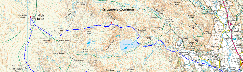
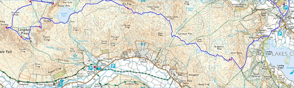
9, Silver How - Blea Rigg - Harrison Stickle - Loft Crag - Pike O'Stickle - Thunacar Knott - Pavey Ark - High Raise (Langdale) - Tarn Crag (Easedale) |
| Weather: |
Overcast to Start With Some Light Showers, Turning Warm Dry and Sunny. Highs of 19°C Lows of 13°C |
| Parking: |
Parking Spaces, Broadgate, Grasmere |
| Area: |
Central |
| Miles: |
13 |
| Walking With: |
On My Own |
| Ordnance Survey: |
OL7 |
| Time Taken: |
7 Hours 15 Minutes - 07:30am to 14:45pm |
| Route: |
Grasmere - Kelbarrow - Silver How - Lang How Tarn - Blea Rigg - Stickle Tarn - Harrison Stickle - Harrison Combe - Loft Crag - Pike O'Stickle - Harrison Combe - Thunacar Knott - Pavey Ark - High Raise (Langdale) - Codale Head - Lang Crag - Tarn Crag (Easedale) - Easedale Tarn - Sourmilk Gill - Goody Bridge - Easdale Road - Grasmere |
|
| |
|
Map and Photo Gallery |
|
|
  |
| |
| |
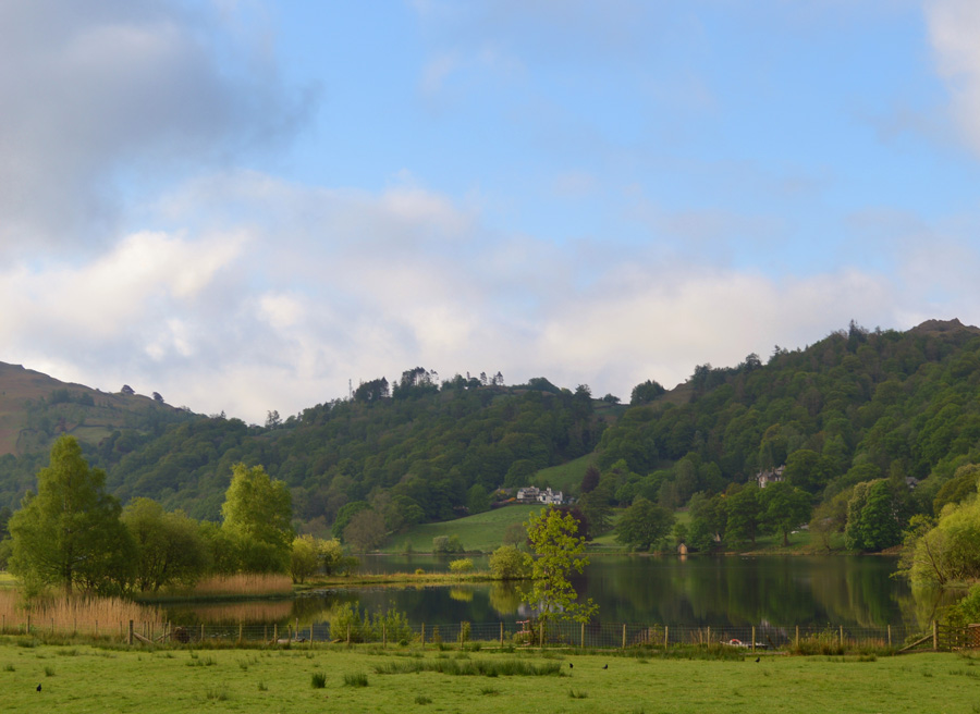 |
| Grasmere Lake 07.35am 13°C |
Grasmere is only an hour and a half drive away from my house which meant I could allow myself a lie in setting my alarm for 05:30am and not the usual 04.45am, it's only three quarters of an hour I know but I sure benefited from the extra time in bed. I had been texting Tim the evening before and from the Motorway Services during this mornings drive up as Tim was competing in the Salomon 50k Ultra which started from Keswick's Crow Park at 06:00am
Besides wishing Tim good luck and the usial text chat Tim also gave me a weather forecast which was reported as still a bit gloomy but showed promise, by the time I reached Grasmere my sunglasses were out although I could see where Tim was coming from as the cloud, despite the warm temperatures was still clinging to surrounding summits around Grasmere, but this was not to last.
Grasmere was as quiet as expected and I parked easily at the top of Broadgate not far from its junction with the A591 and kitted up in the mild morning air, I don't know why I decided to throw my jacket on, perhaps just to take the bite away soon after leaving a warm car but I did anyway but my decision to do so was short lived soon opting to ditch it upon reaching a wooden gate at the Kelbarrow Plantation.
With my jacket rolled under the lid of my pack and feeling much more comfortable I head off through the gate not before stopping to look back on Grasmere where the surface looked just like a mill pond. |
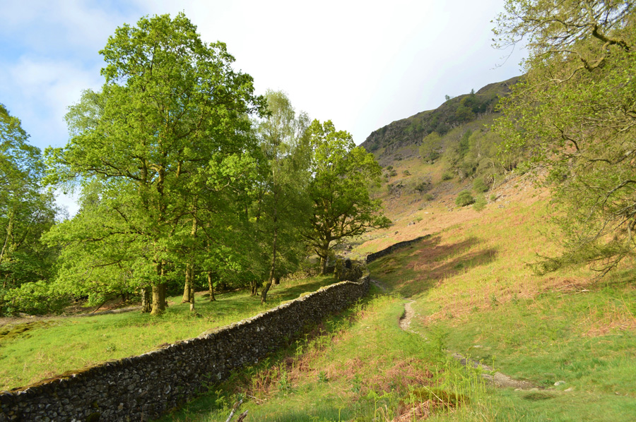 |
| Kelbarrow. |
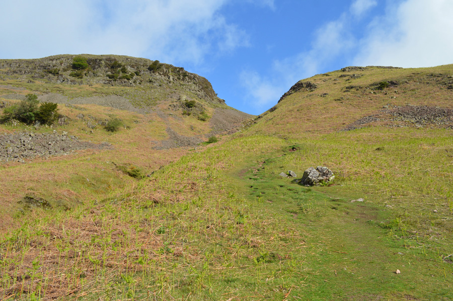
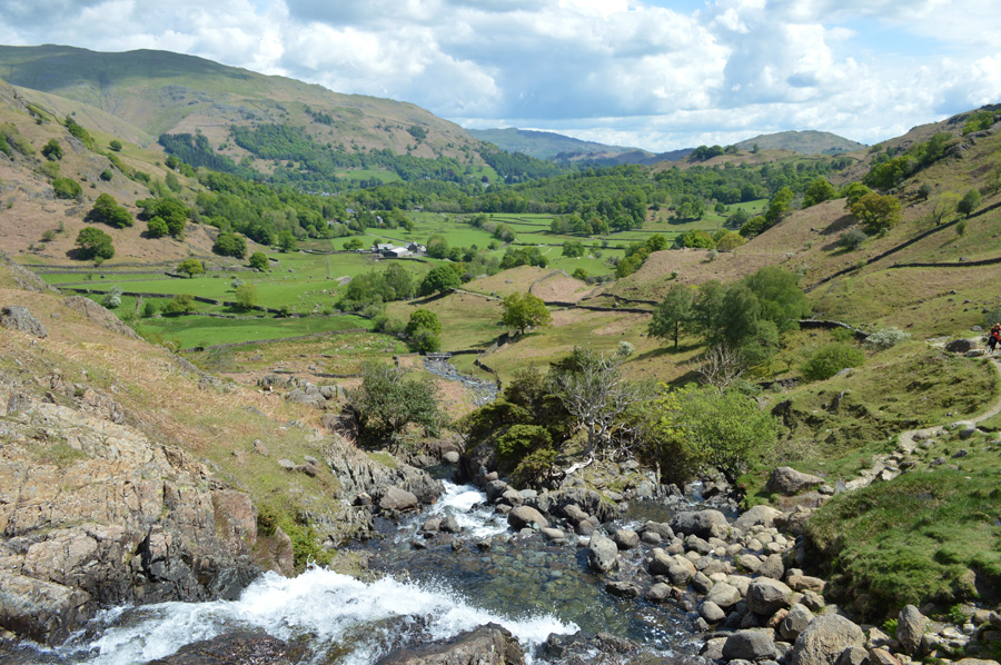
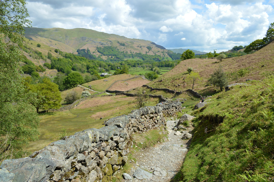
Once I had passed through the wooden gate the path rises steadily flanked by two stone walls before opening out onto open fell side, here the path is still prominent with views towards the first summit of the day in Silver How just up ahead.
It would seem that Spring and indeed Summer has well and truly sprung with the trees looking magnificent in all their glory, even the Bracken is starting to grow which I would imagine by this time next week is going to transform the look of the fell side all over Lakeland. |
 |
| Stunning views back over Kelbarrow towards Helm Crag. |
| |
 |
| Views over the Wyke Plantation towards Grasmere Lake and Loughrigg Fell. |
| Despite the warming temperatures there's still some cloud dramatics going on overhead as the morning cloud starts to make way for clearer skies. |
 |
| Dow Bank from Kelbarrow. |
Todays route in order to gain Silver How is a first for me as in previous ascents I have always gained the summit via Wray Gill which first passes Allan Bank before a steady pull towards the summit, however, I thought I would try a different route which really appealed to me when I first penned the walk. |
 |
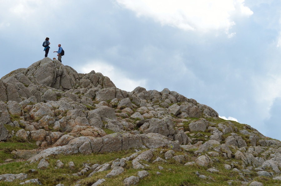
| Silver How summit is just ahead. |
| I don't mind admitting due to this being my first visit using this way of ascent I wasn't quite sure when the summit path would break away from the path which skirts around the lower flanks of the fell side, although after studying my map the evening before I was on the look out for some type of Gyll or Gully which soon presented itself as this grassy Ravine which separates the summit on the left from the bulk of the fell side on the right, it's a pretty steep haul helped by a good path underfoot which changes from grass to stone further into the ascent and with hardly a false summit insight, it's pretty direct too. |
 |
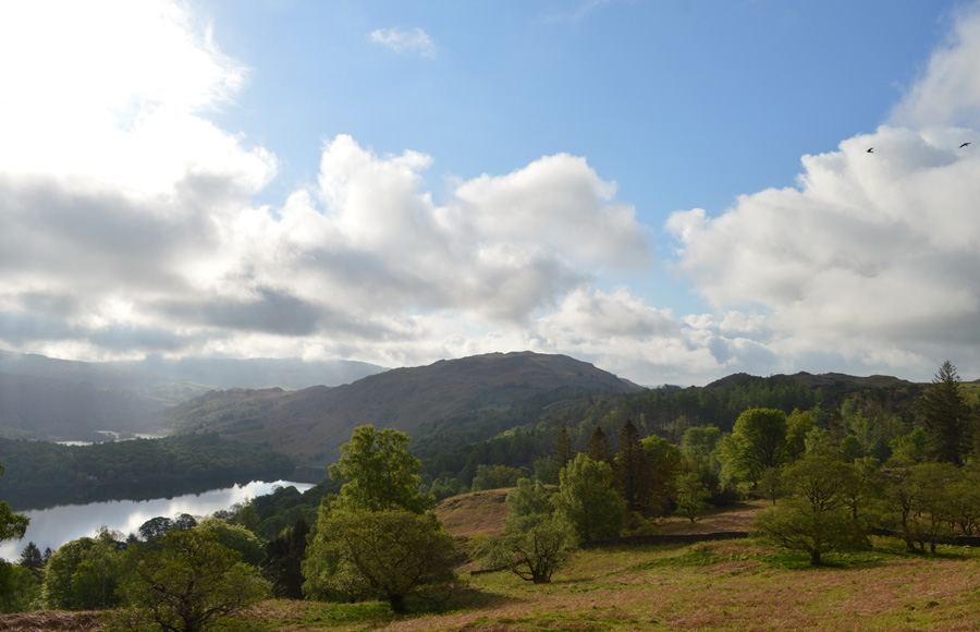
| Grasmere Lake, Rydal Water and Loughrigg Fell. |
| It maybe a steep ascent but the views more than make up for it. |
 |
| Just stunning. |
| Taking more breather stops than I probably had to. |
 |
| Lang How from Silver How summit. |
I'm not quite sure how long it took me to reach the summit from the foot of the path but it's been around an hour since I left the car and in that time I've experienced a warm sun with great views albeit within my proximity but it looks like for now I'm about to lose some light, and with it, that warm sun too.
On a clear day I should be able to see the Langdale Pikes up ahead but due to it being still relatively early the morning mist hasn't quite lifted which gives me a reason to knock it down a gear in order to allow the cloud to lift, after all just look at what I have ahead between here and Blea Rigg, it looks as good as it gets to me. |
 |
| Silver How from Lang How. |
| Despite the ground being pretty wet underfoot any boggy areas are easily avoidable enabling for some pacey conditions without actually realising it. |
 |
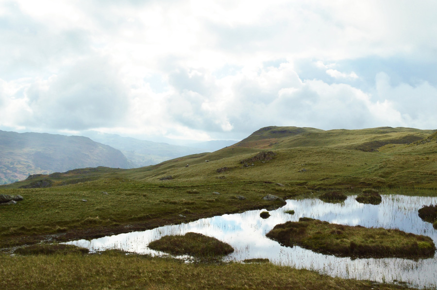
| Cloud topped views of Crinkle Crags from Lang How Tarn. |
| However on a positive note, the cloud is starting to peel away by now and it won't be long now until summits are seen. |
 |
| Views over Great Langdale towards Lingmoor Fell and Pike O'Blisco |
| While beyond, Wetherlam and the Coniston Fells as I traverse below Raw Pike. |
 |
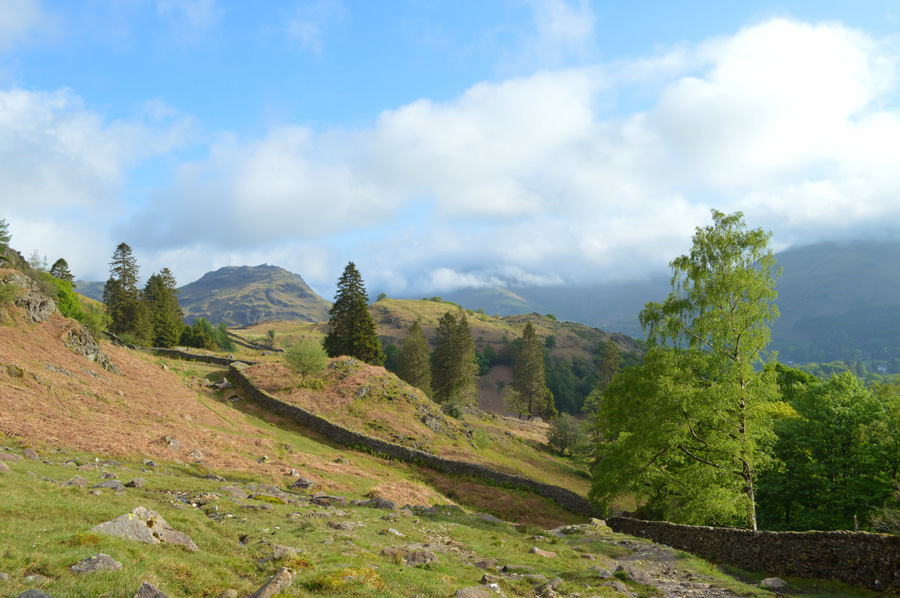
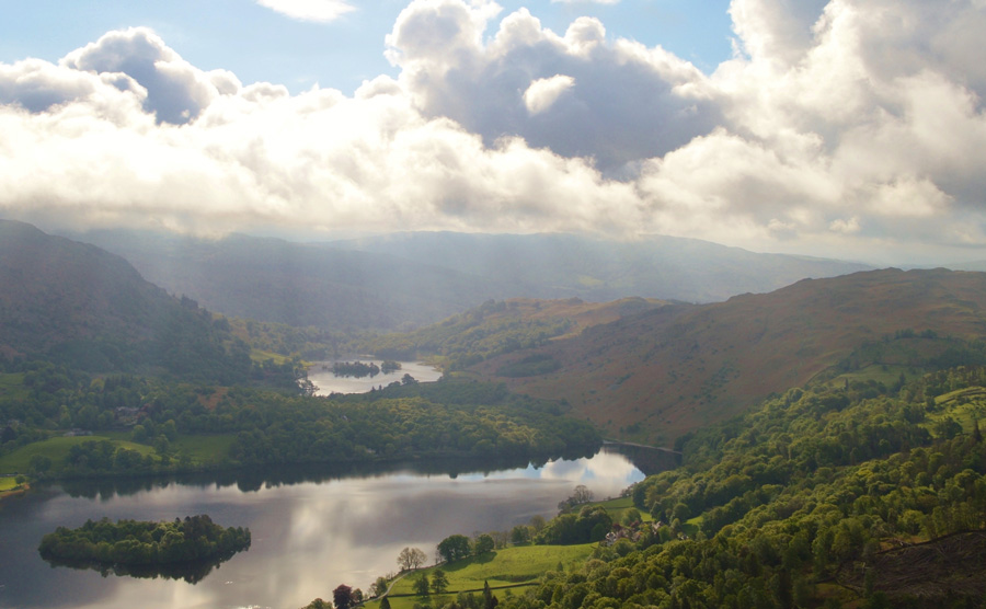
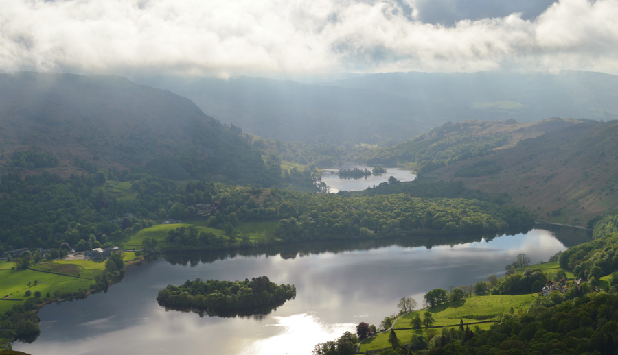
| Ascending Blea Rigg with views opening out over Tarn Crag and Easedale Tarn. |
| My path had seen me flank Swinescar Pike and Little and Great Castle How which if I had chosen to summit wouldn't have required much effort but I opted to pass the grassy outcrops while keeping focused on the route ahead - all the while maintaining a bearing for Blea Rigg which soon came into view as I descended Great Castle How. |
 |
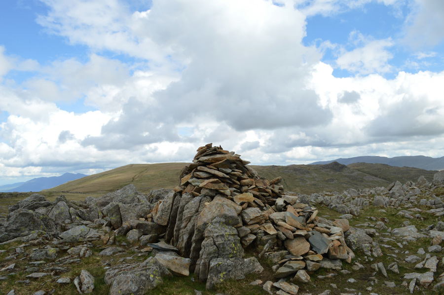
| Blea Rigg summit cairn. |
| After a short and steady plod I reached the summit of Blea Rigg around about the same time the sun came back out which helped lift the cloud from my surrounding summits, up until just moments ago I could just make out the summit of Harrison Stickle as the cloud broke through although right now the summit is out of sight and I'm keeping my fingers crossed that by the time I reach Stickle Tarn the cloud will have completely lifted. |
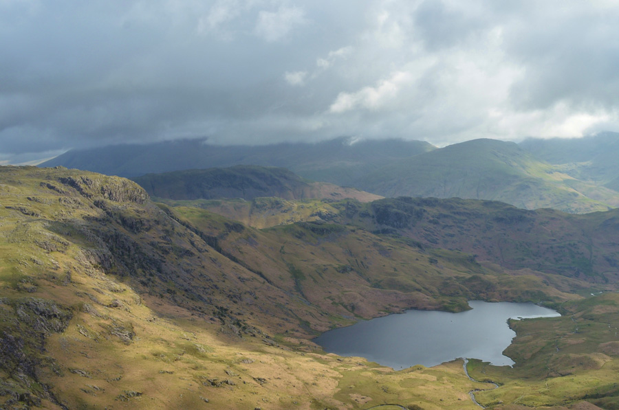 |
| Views over Slapestone Edge, Tarn Crag and Easedale Tarn from Blea Rigg. |
| |
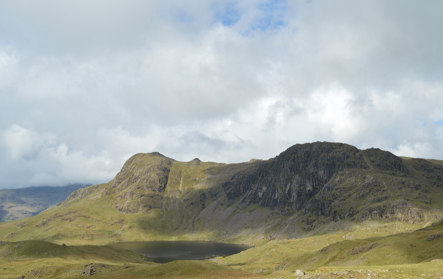 |
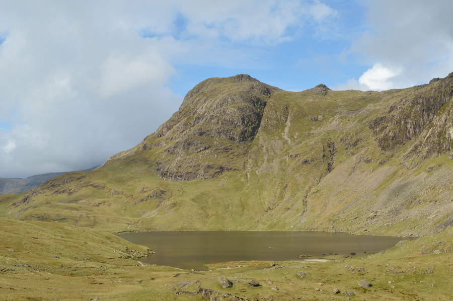
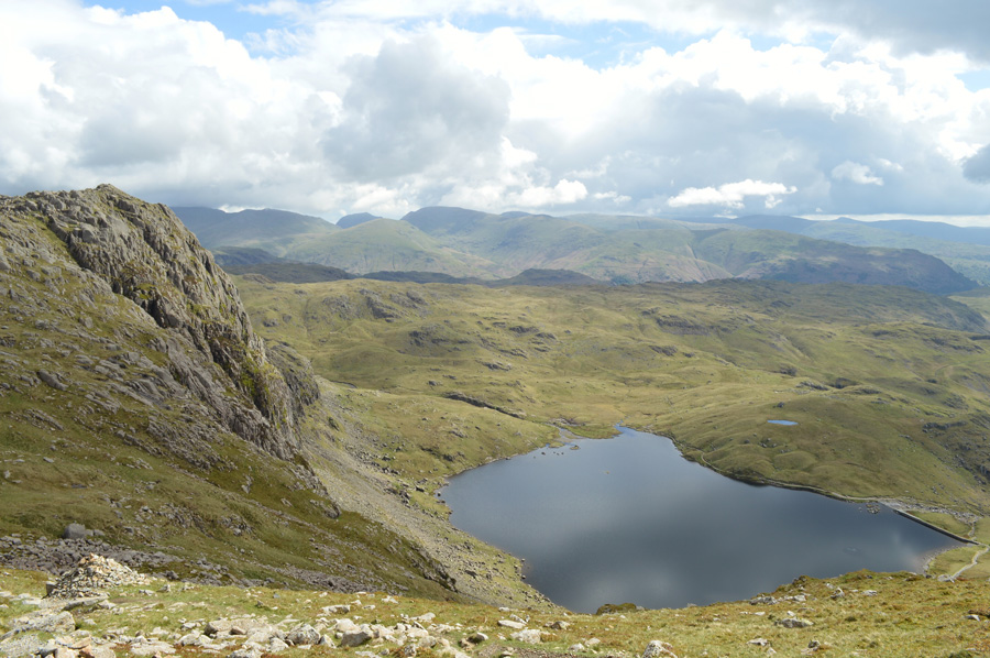
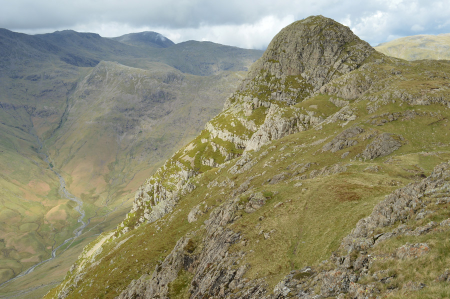
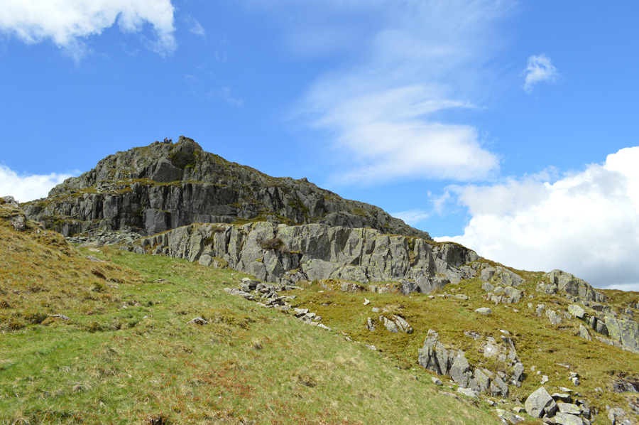
| Harrison Stickle, Pavey Ark and Stickle Tarn. |
| To say I was over the moon would have been an understatement by the time I started my descent towards Stickle Tarn where I was treated to fine views over Harrison Stickle and Pavey Ark, despite still being a reasonable distant away I can hear voices coming from the base of Jack's Rake which is seen just above the scree slope heading up from Stickle Tarn, as it so happened the voices weren't walkers heading up the Rake but climbers preparing their ascents on the Pavey Ark East Buttress. |
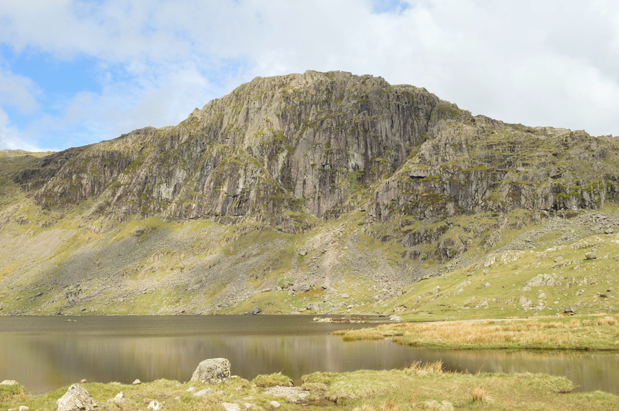 |
| Pavey Ark seen over Stickle Tarn. |
I had to talk my way out of an ascent via Jack's Rake despite only attempting it just the once the lure as I passed Stickle Tarn almost got the better of me, in fact, had today been a Saturday and tomorrow wasn't a school day I'm confident I would have gone for it, oh well never mind, as mentioned best stick to the job ahead.
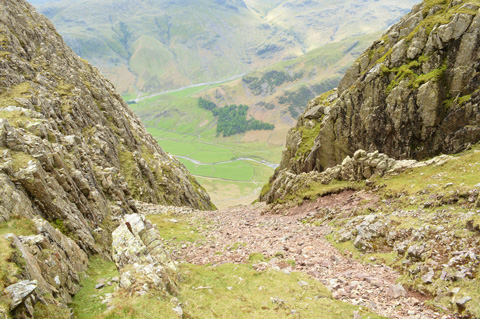
When views from Stickle Tarn a distinctive 'Y' can be made out from the scree path just above the Tarn, if you follow the path to the left it is here you will find the start of Jack's Rake, a walkers route who isn't afraid of a little exposure, in the centre is East Buttress and to the right is Easy Gully which is also accessible to walkers with the exception that the top of Easy Gully is blocked by chock stones which can be negotiated by experienced scramblers, keeping further right and out of view (seen in the last photograph) is the North Rake which is accessible to most walkers who like to keep their feet on the ground without getting into technical matters. |
 |
| Harrsion Stickle over Stickle Tarn. |
| I'm heading for the path at the far end of the Tarn seen below the mass of crag that forms the summit of Harrison Stickle. |
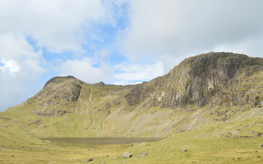 |
| Harrison Stickle, Pavey Ark and Stickle Tarn. |
| I'm almost at the waters edge now, right about the same time the sun has come back out and the crowds start to arrive from Great Langdale, however most are ascending by the North Rake path and pass me on route. |
 |
| Harrison Stickle. |
| More and more walkers are passed most of which rest at the Dam and outflow of Stickle Tarn, I take my time crossing the outflow as most of the rocks are greasy and care is needed especially if I want to keep socks dry! I've had the luxury of descent over the last twenty or so minutes followed by a morning stroll as I walked along the waters edge but it looks like my luxury time is about to end. |
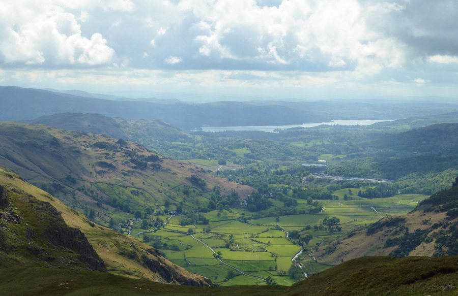 |
| A distant Windermere seen over Great Langdale. |
| The path from Stickle Tarn starts off steady over stone staircase which progressively steepens into a steep and steady plod, pausing to get ones breath back becomes less of an option and more of a necessity with more height gained although the views more than make up for this. |
 |
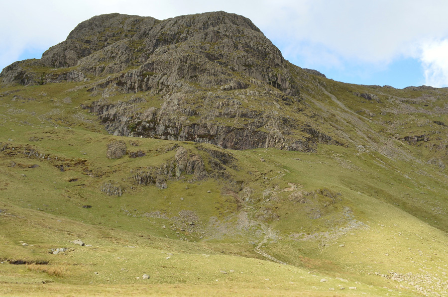
| Pavey Ark seen towering over Stickle Tarn. |
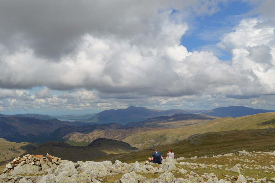
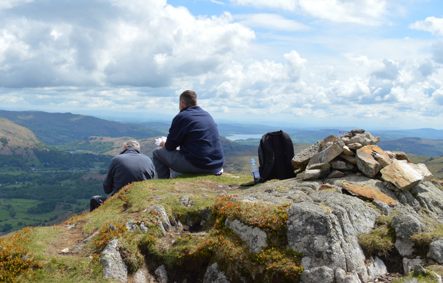
| There's quite a gathering at the dam below now as voices are carried over the stillness of Stickle Tarn, it's quite possible that I will see most of those people when I get to summit Pavey Ark after summiting Harrison Stickle, Loft Crag and Pike O'Stickle, I admit it sounds like I've got much more work to do but in actual fact, once I reach Harrison Stickle summit, Loft Crag and Pike O'Stickle come quite easy, but I have to get to the summit so less talking to yourself and more walking! |
 |
| Great Langdale from Harrison Stickle summit cairn. |
| Lungs huffed and puffed as the warmth from mid morning sun began to set in causing quite a sweat by the time I reached Harrison Stickle summit. Two walkers, a man and wife occupy the summit and 'mornings' are passed before I start my descent into Harrsion Combe, it wasn't the last time I would stop to chat with the couple but more on that later. |
 |
| Descending Harrison Stickle with views over Harrison Combe, Loft Crag and Pike O'Stickle. |
| Well, that sun was short lived wasn't it. |
 |
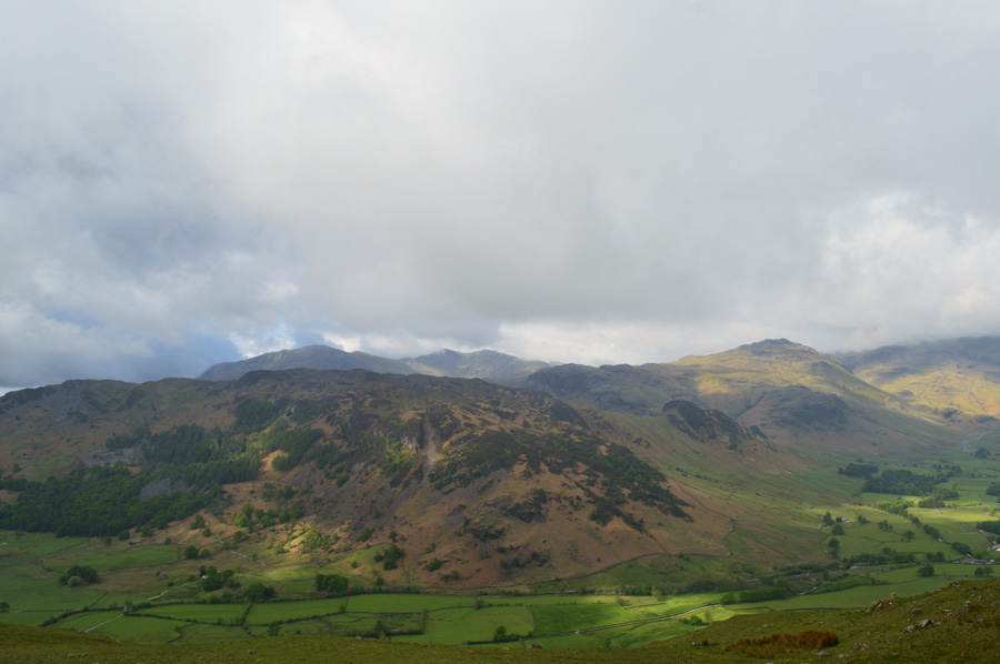
| Views over Great Langdale towards Lingmoor Fell, Blea Tarn, Blake Rigg and the Coniston Fells from Loft Crag summit. |
| |
 |
| Pike O'Stickle from Loft Crag summit. |
| I had descended Harrison Stickle easily managing to avoid the greasy rock that hadn't seen the morning light, descent was swift and I soon found myself crossing Harrison Combe with widening views over the top of Dungeon Ghyll which I don't stop to admire, instead I persevere to the summit of Loft Crag while at the same time passing a walker who had just made his descent from Loft Crag summit. |
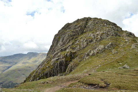 |
| Pike O'Stickle or Pike of Stickle to be correct. |
|
|
 |
| The south scree also known as the Stone Axe Factory. |
|
 |
| Views back towards previous summits of Loft Crag and Harrison Stickle. |
| It seemed as if I had rattled off my last two summits of Loft Crag and Pike O'Stickle at which point I decided that I had earned myself a five minute break as I de-shoulder my pack before finding myself a nice rock to sit upon whilst watching the cloud lift from surrounding summits. |
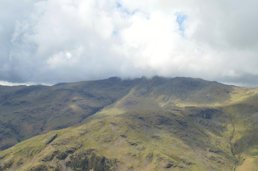 |
| Cloud is still clinging to the summits of the Crinkles seen over The Band but it won't be for long. |
| |
 |
| And Bowfell too. |
| Whilst I'm here I might as well tuck into that Snickers Bar I've got hiding in the lid of my pack. |
 |
| Views back over Stake Pass and the Langstrath Valley with the summit of Glaramara under shade. |
| |
 |
| Here's a close up of the mighty Great End with Allen Crags on the right, Rossett Pike and Esk Hause seen centre. |
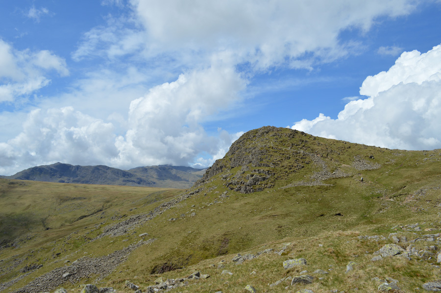
Despite wanting to soak up the unfolding scenery it was time to re-shoulder and make my way over the top of Harrison Combe from where I'll gain my next summit of Thunacar Knott. Three young chaps and a dog were waiting at the foot of the path and I thanked them for their patience as I made the sometimes tricky descent, ahead the upper contours of Harrison Combe which I found to be sponge like, it was here my dust coated boots took a soaking from the bogs which I did manage to leave behind, not before a few pathless negotiations mind.
Ahead, Thunacar Knott as I take one last look back over a cloud covered Harrison Combe. |
 |
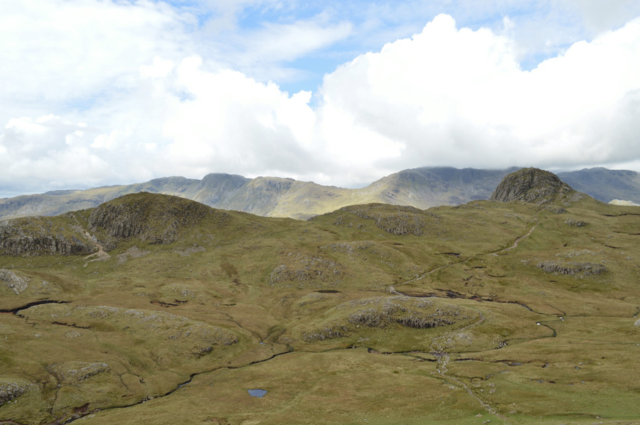
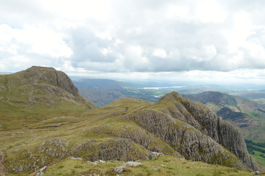
| High Raise from Thunacar Knott summit cairn. |
The couple who I had spoken to whilst at the summit of Harrison Stickle had just reached Thunacar Knott at exactly the same time as I did, the fellow did most of the talking in a Lancashire accent which I recognised to be from around the Preston area of Lancashire, he had previously visited Pavey Ark after Harrison Stickle and was on route to what he called High Stile, oh sorry you mean High Raise I smiled, yes that's it he replied, I got the feeling he was collecting his Wainwrights too but not in the same way as I was.
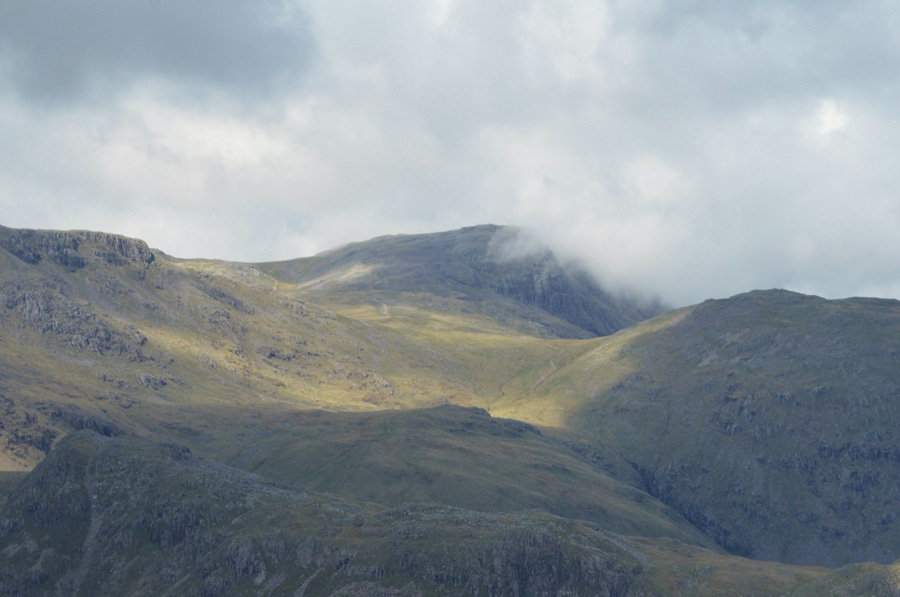
I quickly changed the subject to the weather and how fine it had been before glancing back at Bowfell...Will have to keep an eye on that though as the summit had been taken over by cloud once again from the direction of the south, bloody hell where did that come from we laughed it was clearing a moment ago!
We part with an 'enjoy the rest of your day' and shared our routes, his High Raise and mine, Pavey Ark. |
 |
| Pavey Ark summit. |
I was again tested by the familar bogs that line the area below Thunacar Knott and Pavey Ark, these I had anticipated and tried to not let them bog me down too much...sorry for the pun there.
Next is High Raise and from just below the summit of Pavey Ark I can see my fellow walkers are gaining good ground on High Raise. |
 |
| High Raise seen as I traverse the top of Bright Beck. |
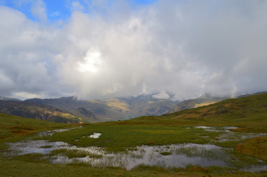
| Well, my boots aren't going to get any wetter now, by-eck this was a boggy area even by its familiar standards, maintaining a high line in order to not lose height was the best plan of action, this I thought may even deter me away from any underlying water but I was proved wrong as it didn't matter where I trod, it was simply wet underfoot the whole crossing. |
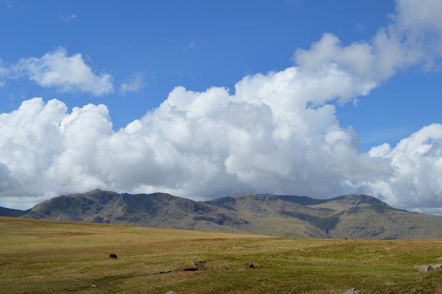 |
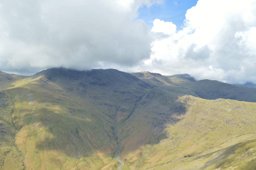
| Bowfell, Esk Pike, Allen Crags and Great End. |
| The stunning views under airy skies more than took my mind away from that sinking feeling underfoot. |
 |
| Crinkle Crags, Bowfell, Rossett Pike and Esk Pike. |
| The contrast of light is now really starting to show, what a day it's turning out to be. |
 |
| Bowfell, Rossett Pike, Esk Pike, Great End and III Crag. |
| |
 |
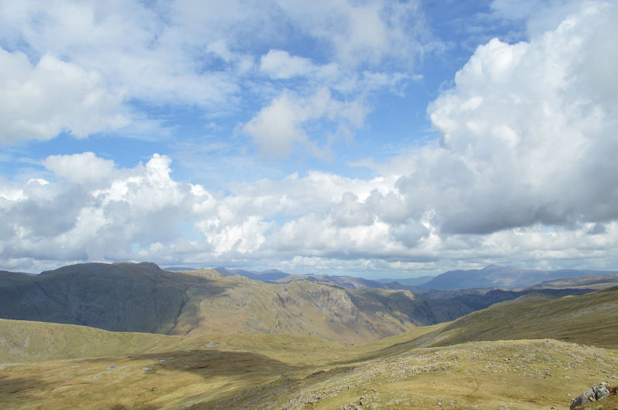
| The North, and North Western Fells seen from High Raise summit. |
| The couple who I had seen last at Thunacar Knott where by now tucking into their lunches within the stone shelter as I raised my hand to say 'Hi' as I walked passed "it's lifted now" the guy laughs, yeah! I know! I laughed and soon after I found myself a rock to perch upon and de-shoulder once more as I tuck into lunch, but not all of it mind, the rest I had planned to finish back in Grasmere so I only eat half. |
 |
| The Langstrath Valley. |
| You may just be able to make out Stake Pass Tarn marking the top of Stake Pass in the centre left of the photo. |
 |
| Cloud rolling views over the Central and Northern Fells with Skiddaw and Blencathra under shadow. |
| It's time to pack up lunch now but not before one last photo looking towards Ullscarth, Skiddaw and Blencathra. |
 |
| Passing Sergeant Man on route to Codale Head. |
| I had made bearing for Sergeant Man and could soon see a host of walkers stopped at the summit eating lunches and enjoying the views, I felt compelled to give the little fella a summit, after all the short plod was right there before me but the more I thought about it the more I thought it might confuse matters within the campaign, not even the words of the late great Harry Griffin who would often state "but we went there anyway" could persuade me. |
 |
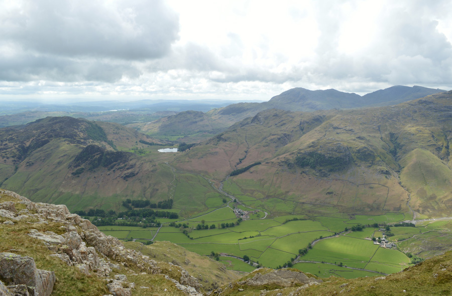
| Here stopping to look back on Pavey Ark, Harrison Stickle and Pike of Blisco while in the distance, the Coniston Fells. |
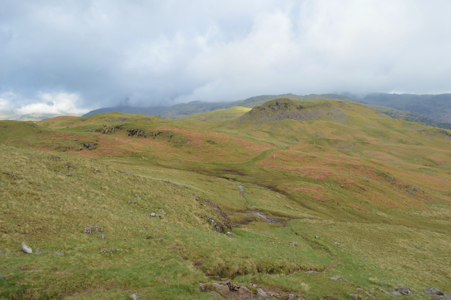
It was only after flanking Sergeant Man did options open up in how I would gain my last summit of Tarn Crag by either the familiar route where I would descend towards Bell Knotts and Codale Tarn or, take the alternative route over the top of Coedale Head and descend via the Lang Crag ridge, the latter of which won.
There was no need for map or compass, not in these conditions anyway as I traversed the flat yet boggy ground of Coledale Head, it was tempting to stray closer to the edge but I knew I still wouldn't get a glimpse of Codale Tarn due to the layout of Slapestone Edge which kinda descends in what can only be described as 'tile roof' with its many rock ledges, instead, I pick up a narrow grass trod and follow it sometimes steering further away from what is considered to be the best line of descent, the reason for this is the steep crags that form at the top of the ridge, I was diverted but soon read the lay of the land which saw me retrace my way back to the path. |
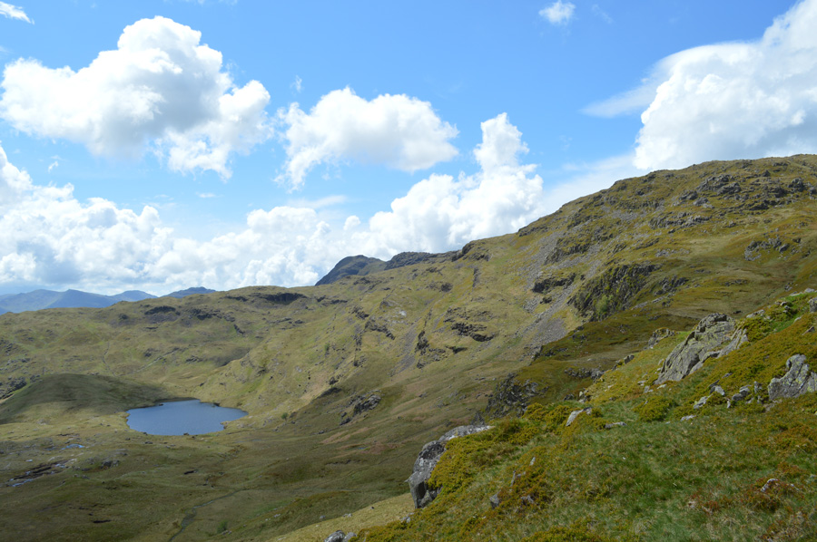 |
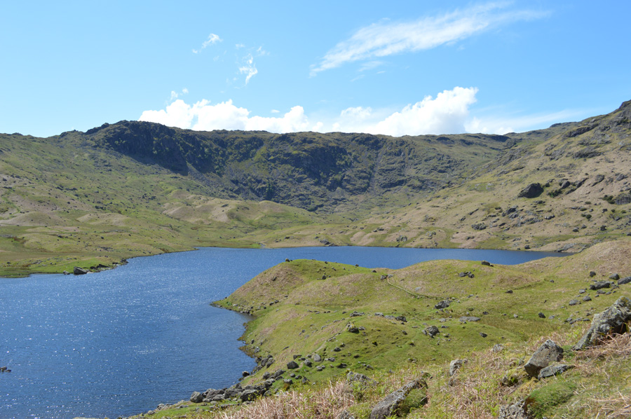
| Views over Codale Tarm and Slapestone Edge. |
With the ridge descent now behind me I stopped to admire the views over Codale Tarn and then back up the ridge and spotted a wide grassy path to the far right, by the looks of things I had descended the steeper route via a grass trod when I got to asking myself "why didn't I spot that path earlier" oh well never mind.
The couple who were in the last photo before I left High Raise summit must have decided to follow my footsteps (never a good option!) and were caught out above the steep crags, at one point I felt like waving my hand towards the right in the direction of the prominent path but it was too late and they had started the same descent as I had, the woman looked a little concerned as she paused above the crags but they both negotiated the crags and like me, were soon on route to Tarn Crag. |
 |
| Tarn Crag (Easedale) |
| I steered towards Tarn Crag whilst witnessing a group of walkers who were stood at the summit cairn for quite some time before I lost sight of them due to the lay of the land, however, I soon found myself approaching the summit and the walkers who had been stood there had gone and in replacement a young lad and his father who were in Lakeland on Holiday from Devon. We had a brief chat about how well the weather had turned out but truth be told they looked so relaxed and had obviously come a long way I left them to it before making my descent towards Easedale Tarn. |
 |
| Stopping to look back on Tarn Crag (Easedale) |
| |
 |
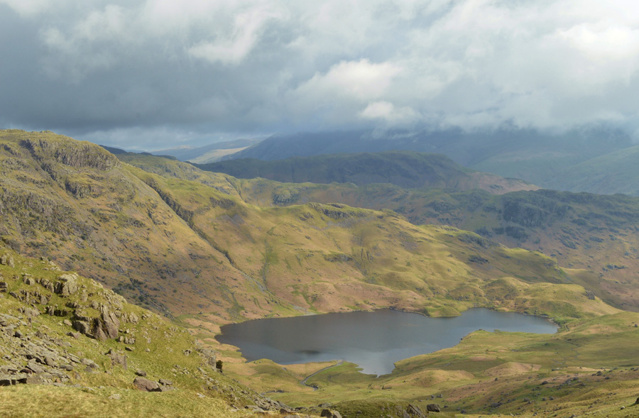
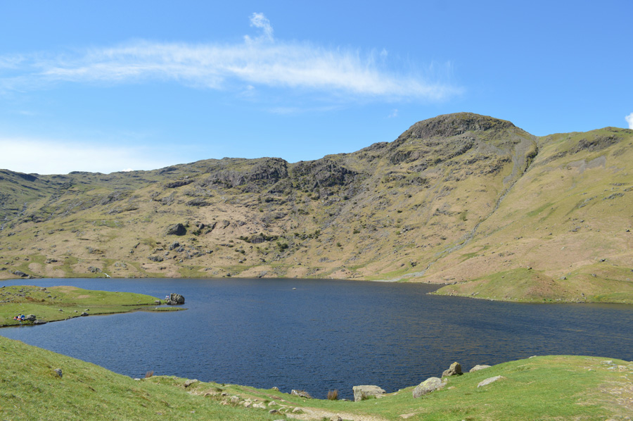
| Blea Rigg from Easedale Tarn. |
I had full intentions of finishing my lunch on the village green in Grasmere, I don't know why it was just something that I had decided upon during the round, however, once I had descended towards the waters edge I had second thoughts, de-shouldered and ate the rest of my lunch as the water lapped over the rocks at the waters edge.
Just bliss. |
 |
| Tarn Crag (Easedale) from Easedale Tarn. |
| |
 |
| Views over Easedale from the top of Sourmilk Gill. |
| |
 |
| Heading back to Grasmere in beautiful afternoon sunshine. |
| |
 |
| Sourmilk Gill. |
| |
 |
| Helm Crag. |
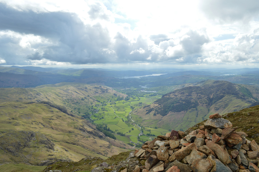
Easedale Tarn was starting to feel like the tourist hot spot it is and it was great to see families old and young enjoying Lakeland especially on such a beautiful afternoon. Goody Bridge is soon reached after losing count on how many hi's hello's or afternoons I had passed and soon cross Goody Bridge from where I felt the cushion of the Easedale Road underfoot, however instead of walking back into Grasmere via the road I opted to take the bridle path with views over Allan Bank and Silver How, my first summit of the day.
Lambs bleated over the screams of children playing and I was soon brought back in reality as the path ended in the afternoon heat of a bustling Grasmere, on the village green young couples eat ice creams and picnicked leaving me thinking that my decision to finish my lunch on the shore of Easedale Tarn was perhaps the best one, after all there's now't like the smell of a good day on't fells.
A scurry left saw me pass the familiar red phone box and I was pleased to see that Sam's Book shop had people waiting outside to get in. I am the only walker around as I walk pass the hustle of the shops opting to keep out the way of the shoppers on the other side of the road but before I reach the car I glance back at Silver How whose view is obscured through telephone lines, trees and buildings, smile and say thank you for a wonderful day on the fells. |
|
| |
| Back to top |
 |
|
