|
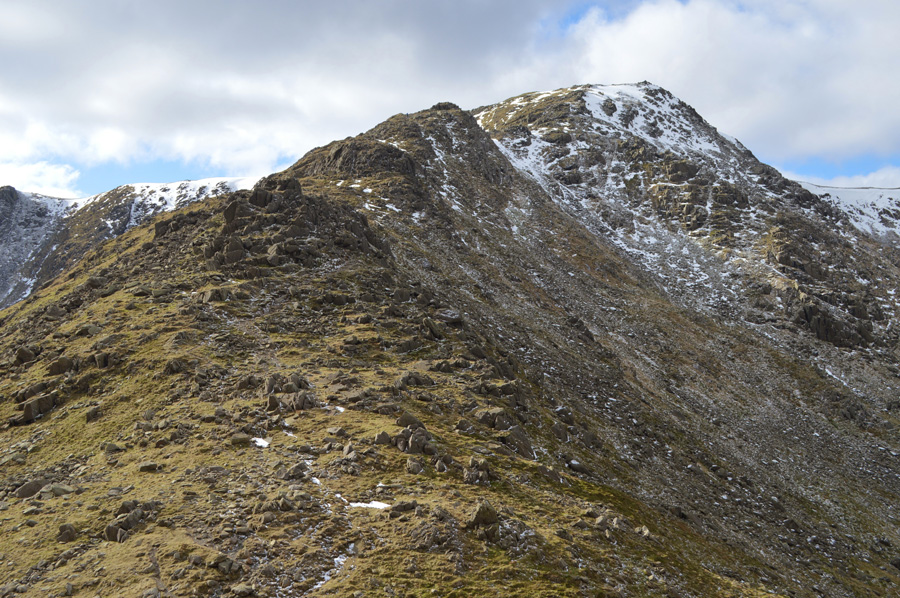
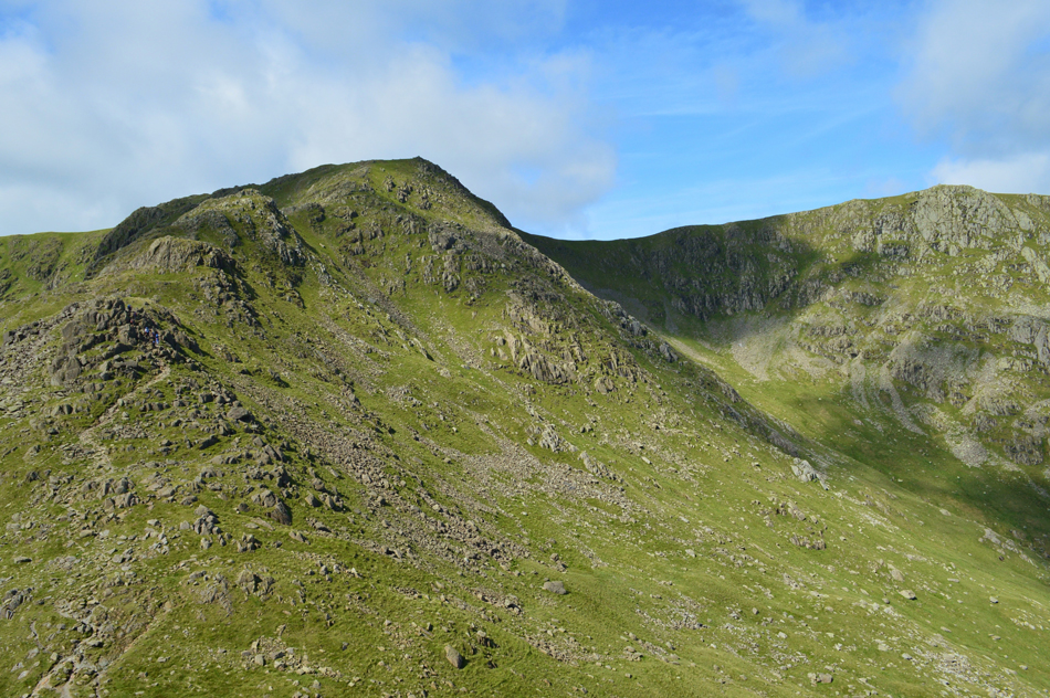
Swirl How |
 |
 |
There are 15 walks to choose from including Swirl How |
 |
|
The Coniston Ridge North to South from Seathwaite |
|
|
 |
|
13th September 2024 |
| ASCENT: |
3,426 Feet - 1,044 Metres |
| MILES: |
10.1 |
| WAINWRIGHTS: |
6, Grey Friar - Great Carrs - Swirl How - Brim Fell - Coniston Old Man - Dow Crag |
| ROUTE: |
Walna Scar Road - Tongue House - Seathwaite Tarn - Grey Friar - Fairfield - Great Carrs - Top of Broad Slack - Swirl How - Great How Crags - Levers Hawse - Brim Fell - Coniston Old Man - Goat's Hawse - Dow Crag - Buck Pike - Brown Pike - White Maiden - White Pike - Walna Scar Road |
|
| |
|
Steel Edge, Wetherlam & Wet Side Edge from Tilberthwaite |
|
|
|
|
1st May 2023 |
| ASCENT: |
2,946 Feet - 897 Metres |
| MILES: |
9 |
| WAINWRIGHTS: |
3, Wetherlam - Swirl How - Great Carrs |
| ROUTE: |
Tilberthwaite – Above Tilberthwaite Gill – Steel Edge – Wetherlam – Swirl Hawse - Prison Band – Swirl How – Top of Broad Slack – Great Carrs – Wet Side Edge – Greenburn Beck – Low Hall Garth - Slater Bridge (Little Langdale) – Moss Rigg Wood – Tilberthwaite Farm – Tilberthwaite |
|
| |
|
A Coniston Round from Church Beck |
|
|
|
|
17th September 2022 |
| ASCENT: |
3,279 Feet - 999 Metres |
| MILES: |
8 |
| WAIMWRIGHTS: |
3, Swirl How - Brim Fell - Coniston Old Man |
| ROUTE: |
Church Beck - Miners Bridge - Coppermines - Levers Water - Black Sails - Swirl Hawse - Prison Band - Swirl How - Swirl Band - Great How Crags - Levers Hawse - Brim Fell - Coniston Old Man - Coppermines - Miners Bridge - Church Beck |
|
| |
|
Remembrance Day on Great Carrs |
|
|
|
|
10th November 2019 |
| ASCENT: |
3,300 Feet - 1,006 Metres |
| MILES: |
8.7 |
| WAINWRIGHTS: |
4, Grey Friar - Great Carrs - Swirl How - Brim Fell - Dow Crag |
| ROUTE: |
Bottom of Walna Scar Road, Seathwaite - Tongue House - Seathwaite Tarn - Grey Friar - Fairfield - Great Carrs - Top of Broad Slack - Swirl How - Levers Hawse - Brim Fell - Goat's Hawse - Dow Crag - Buck Pike - Brown Pike - Walna Scar Road back to Seathwaite |
|
| |
|
A Coniston Round |
|
|
|
|
6th April 2019 |
| ASCENT: |
3,450 Feet - 1,052 Metres |
| MILES: |
9.3 |
| WAINWRIGHTS: |
3, Swirl How - Brim Fell - Coniston Old Man |
| ROUTE: |
Ruskin Museum - Church Beck - Miners Bridge – Coppermines Valley – Simons Nick – Levers Water – Black Sails – Prison Band - Swirl How - Swirl Band - Levers Hawse - Brim Fell - Coniston Old Man - Low Water - Coppermines Valley - Miners Bridge - Church Beck - Ruskin Museum |
|
| |
|
Walking the Birketts, Carrs, Swirl How and Grey Friar from the Three Shire Stone |
|
|
|
|
3rd March 2019 |
| ASCENT: |
1,804 Feet - 550 Metres |
| MILES: |
4.6 |
| BIRKETTS: |
5, Hell Gill Pike - Little Carrs - Great Carrs - Swirl How - Grey Friar |
| ROUTE: |
Three Shire Stone - Wet Side Edge - Hell Gill Pike - Little Carrs - Great Carrs - Top of Broad Slack - Swirl How - Fairfield - Grey Friar - Fairfield - Wether How - Hell Gill Pike - Wet Side Edge - Three Shire Stone |
|
| |
|
Steel Edge, Wetherlam and a Cathedral Cave |
|
|
|
|
16th July 2017 |
| ASCENT: |
2,768 Feet - 844 Metres |
| MILES: |
9 |
| WAINWRIGHTS: |
3, Wetherlam - Swirl How - Geat Carrs - Grey Friar |
| ROUTE: |
Tilberthwaite – Above Tilberthwaite Gill – Dry Cove Bottom – Steel Edge – Wetherlam – Prison Band – Swirl How – Top Of Broad Slack – Great Carrs – - Wet Side Edge – Greenburn Beck – Slater Bridge (Little Langdale) – Cathedral Quarry – Moss Rigg Wood – Pierce How Beck – Tilberthwaite |
|
| |
|
Raven Tor and Black Sails from Fell Gate |
|
|
|
|
2nd October 2016 |
| ASCENT: |
3,500 Feet - 1,067 Meters |
| MILES: |
8.2 |
| WAINWRIGHTS: |
3, Coniston Old Man - Brim Fell - Swirl How |
| ROUTE: |
Fell Gate - Crowberry Haws - Boulder Valley - Levers Water - Raven Tor - Brim Fell - Coniston Old Man - Brim Fell - Levers Hawse - Swirl Band - Swirl How - Prison Band - Swirl Hawse - Black Sails - Levers Water - Boulder Valley - Crowberry Haws - Fell Gate |
|
| |
|
Walking the Wainwrights in 30 Walks - Walk 4 The Coniston Fells |
|
|
|
|
28th February 2016 |
| ASCENT: |
4,500 Feet - 1,372 Meters |
| MILES: |
12.5 |
| WAINWRIGHTS: |
7, Dow Crag - Coniston Old Man - Brim Fell - Grey Friar - Great Carrs - Swirl How - Wetherlam |
| ROUTE: |
Fell Gate - Walna Scar Road - Cove Bridge - Brown Pike - Buck Pike - Dow Crag - Goat's Hawse - Coniston Old Man - Brim Fell - Levers Hawse - Swirl Band - Grey Friar - Fairfield - Great Carrs - Top of Broad Slack - Swirl How - Prison Band - Swirl Hawse - Red Dell Moss - Wetherlam - Black Sails Ridge - Levers Water - Boulder Valley - Walna Scar Road - Fell Gate |
|
| |
|
A Coniston Round |
|
|
|
|
14th October 2015 |
| ASCENT: |
3'967 Feet - 1,209 Meters |
| MILES: |
10.1 |
| WAINWRIGHTS: |
5, Wetherlam - Swirl How - Great Carrs - Brim Fell - Coniston Old Man |
| ROUTE: |
Ruskin Museum - Church Beck - Miners Bridge – Coppermines Valley – Simons Nick – Levers Water – Black Sails – Red Dell Head Moss – Wetherlam – Prison Band - Swirl How - Top of Broad Slack - Great Carrs - Top of Broad Slack - Swirl Band - Levers Hawse - Brim Fell - Coniston Old Man - Low Water - Coppermines Valley - Miners Bridge - Church Beck - Ruskin Museum |
|
| |
|
The Harry Griffin 2,000 footers Walk 3 -The Coniston Fells |
|
|
|
|
13th March 2015 |
| ASCENT: |
4,084 Feet - 1,245 Meters |
| MILES: |
14.1 |
| SUMMITS OVER 2,000 Ft: |
Wetherlam - Wetherlam south cairn - Black Sails - Swirl How - Great Cars - Grey Friar - Brim Fell - Coniston Old Man - Dow Crag - Brown Pike - Walna Scar - White Maide |
| ROUTE: |
Coniston - Sun Hotel - Miners Bridge - Lad Stones - Wetherlam - Black Sails - Swirl Hawse - Prison Band - Swirl How - Great Carrs - Grey Friar - Fairfield - Levers Hawse - Brim Fell - Coniston Old Man - Goats Hawse - Dow Crag - Buck Pike - Brown Pike - Walna Scar - White Maiden - Walna Scar Road - Cove Bridge - Little Arrow Moor - Fell Gate - Sun Hotel - Coniston |
|
| |
|
Wetherlam, Steel Edge & the Cathedral Cave |
|
|
|
|
1st November 2013 |
| ASCENT: |
3,018 Feet, 920 Meters |
| MILES: |
10.2 |
| WAINWRIGHTS: |
4, Wetherlam – Swirl How – Great Carrs – Grey Friar |
| ROUTE: |
Tilberthwaite – Above Tilberthwaite Gill – Dry Cove Bottom – Steel Edge – Lad Stones – Wetherlam – Prison Band – Swirl How – Top Of Broad Slack – Great Carrs – Fairfield – Grey Friar – Fairfield – Wet Side Edge – Greenburn Beck – Slater Bridge (Little Langdale) – Cathedral Quarry – Moss Rigg Wood – Pierce How Beck – Tilberthwaite |
|
| |
|
The Coniston Fells Part II |
|
|
|
|
19th October 2012 |
| ASCENT: |
3,612 Feet, 1,101 Metres |
| MILES: |
8.1 |
| WAINWRIGHTS: |
6, Wetherlam – Swirl How – Great Carrs – Grey Friar – Brim Fell – Coniston Old Man |
| ROUTE: |
Silver Bank – Miners Bridge – Lad Stones – Red Gill Head Moss – Wetherlam – Prison Band – Swirl How – Great Carrs – Grey Friar – Fairfield Col – Swirl Band – Levers Hawse – Brim Fell – Coniston Old Man – Low Water – Boulder Valley – Miners Bridge – Silver Bank |
|
| |
|
Wetherlam & The Old Man Of Coniston |
|
|
|
|
22nd January 2012 |
| ASCENT: |
3,720 Feet |
| MILES: |
7.9 |
| WAINWRIGHTS: |
4, Wetherlam, Swirl How, Brim Fell & The Old Man Of Coniston |
| ROUTE: |
Silver Bank – Miners Bridge – Coppermines Valley – Red Gill – Red Gill Head Moss – Wetherlam – Prison Band – Swirl Hawse – Swirl How – Brim Fell Rake – Brim Fell – The Old Man Of Coniston – Low Water – Boulder Valley – Miners Bridge – Silver Bank |
|
| |
|
A Furness Epic |
|
|
|
|
13th November 2010 |
| ASCENT: |
3,600 Ft, 1,097 Mtrs |
| MILES: |
9.5 |
| WAINWRIGHTS: |
6, Dow Crag, Coniston Old Man, Brim Fell, Swirl How, Great Cars & Grey Friar |
| ROUTE: |
|
|
| |
|
Wetherlam, Swirl How & Great Carrs |
|
|
|
|
31st May 2010 |
| ASCENT: |
2,499 Ft 762 Mtrs |
| MILES: |
7 |
| WAINWRIGHTS: |
3, Great Carrs, Swirl How & Wetherlam |
| ROUTE: |
|
|
| |
| Back to top |
 |
|