|
Raven Tor and Black Sails from Fell Gate |
 |
 |
2nd October 2016 |
 |
|
During the summer I started to put together a shortlist of walks that I wanted to complete once my Wainwright project was over and Raven Tor was always high on the list so much I feel I've lost count at the amount of times I've stood on the shores of Levers Water and almost changed my route once under the steep craggy outcrops that make up Brim Fell prominent east buttress.
It was also during a project walk did I mention while out with David and Rod about my Raven Tor plans where it would seem that Rod had also expressed an interest in an ascent on Raven Tor East Ridge ending the conversation with the words "just let me know when you've got Raven Tor planned, I'd love to join you"
It was late Thursday evening by the time my own plans had been confirmed for the forthcoming Sunday that I'd be ascending Raven Tor and although Rod changed his plans from an ascent on Skiddaw sadly David could not make it due to a pre-arranged walk with his wife Jennifer.
The forecast no matter were you was walking was looking increasingly better and by the time Sunday came, it was wall to wall sunshine which is pretty unseasonable for October, a day no less, fit for the fells. |
|
| Wainwright Guide Book Four |
 |
| The Southern Fells |
-Raven Tor
...but the east face, craggy everywhere and narrowing quickly to the confluence of Low Water Beck and Levers Water Beck is full of interesting detail, the best feature being the prominent buttress of Raven Tor. |
 |
|
|
| |
|
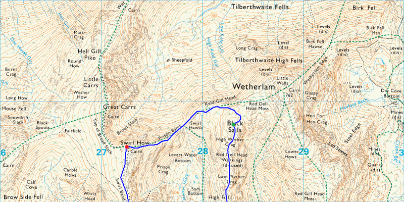
Overview |
|
|
| Ascent: |
3,500 Feet - 1,067 Meters |
| Wainwrights: |
3, Coniston Old Man - Brim Fell - Swirl How |
| Weather: |
Sunny Throughout, Cool Wind Across The Tops. Highs of 17° Lows of 6°C |
| Parking: |
Car Park, Fell Gate, Coniston |
| Area: |
Southern |
| Miles: |
8.2 |
| Walking With: |
Rod Hepplewhite |
| Ordnance Survey: |
OL6 |
| Time Taken: |
5 Hours 40 Minutes |
| Route: |
Fell Gate - Crowberry Haws - Boulder Valley - Levers Water - Raven Tor - Brim Fell - Coniston Old Man - Brim Fell - Levers Hawse - Swirl Band - Swirl How - Prison Band - Swirl Hawse - Black Sails - Levers Water - Boulder Valley - Crowberry Haws - Fell Gate |
|
| |
|
Map and Photo Gallery |
|
|
 |
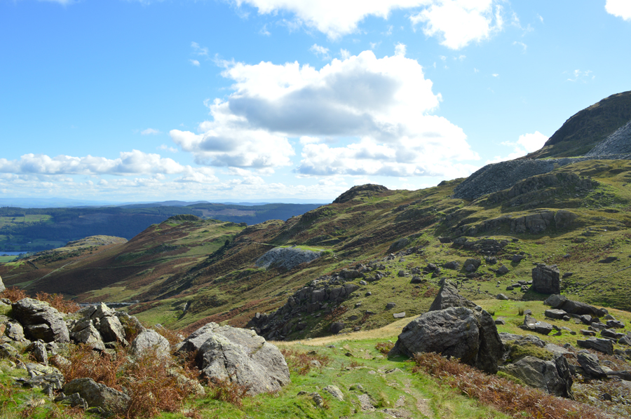
| The Bell, Black Sails and Wetherlam from Fell Gate 07:50am 7°C |
The Coniston Fells are quite possibly some of the most easily accessible fells for myself which is why I always favour them during the long summer days after a morning in work, well, it may not be Summer but it sure feels like it as I arrived at Fell Gate in around an hour and twenty minutes later since leaving Wigan. I had arranged to meet Rod at 08:00am at Fell Gate on the Coniston side of the Walna Scar Road and I was running around twenty minutes ahead of schedule by the time I arrived at the familiar metal gate which I stopped to open.
I wasn't surprised to see that Rod had already arrived and was kitting up at the back of his car. I propped the gate open choosing a large slate slab and drove through closing the gate behind me. The last time I was back here was in February and I had remembered about the disrepair that the car park was in and nothing had changed except the fact that the car I am in today rides much lower than my last car and extra care was taken negotiating the ruts that could cause some serious damage to an oil sump.
This is the same car park who's owners, Rydal Estate have applied for permission to charge for parking and I have often wondered how long it would take until you had to pay to park at Walna Scar and I guess maybe now, I have my answer, they say it's to stop Camper Vans from parking overnight but Im guessing were there's money to be made an all that...
We greet as always with a handshake and the conversation instantly turns to the fine forecast we now find ourselves under. Up ahead there isn't a cloud in sight just a strong sun over the shoulder which illuminates the fell side grasses in a array of deep greens and vivid reds. Despite the brightness there is also a nip in the air as I add a soft shell almost straight from getting out of the car, Rod too.
A brief coversation took place about the long trousers we were both wearing and the possible fact, that we might have said goodbye to our shorts until next summer but as we we're about to find out, we might have been a little hasty covering up although nowt was said after that. |
 |
| The Black Sails Ridge seen over Coppermines Valley with Wetherlam in the distance. |
Four or five guys had arrived at Fell Gate from the direction of Little Arrow Moor, possibly after a wild camp some of whom took to their tooth brushes on arrival back at their cars and 'mornings' are shared. I found it odd that they were more bothered about cleaning their teeth rather than their car which they must have known had a flat battery before leaving it the night before, blazingly one lad said "I'll get the gate while you lot push" we watched the lads push the car towards an open gate only to find a car on the other side was now waiting to pass through, you just couldn't make that sort of bad luck up, who backed up we don't know, we were soon on our way blazing a trail towards Crowberry Haws walking poles fixed horizontally, for now. |
 |
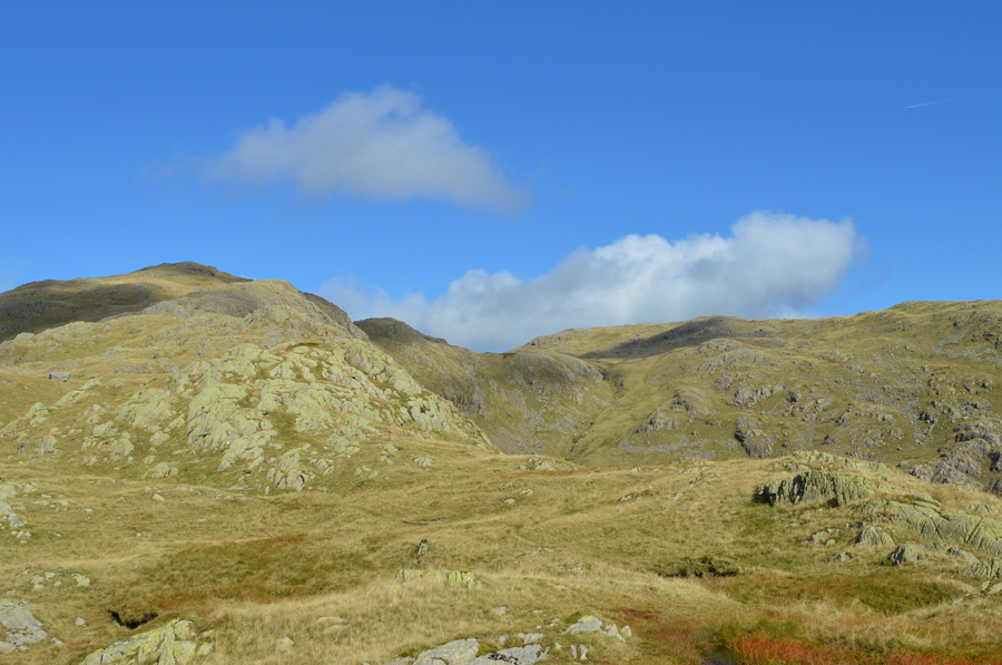
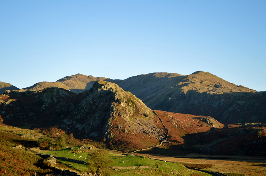
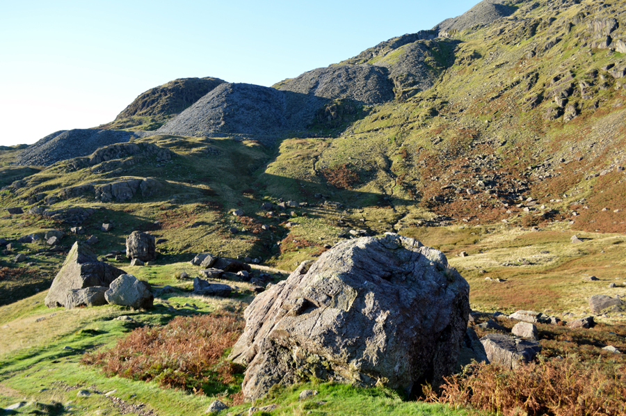
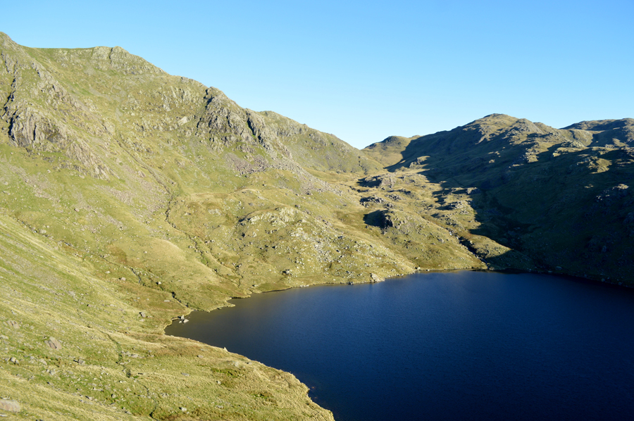
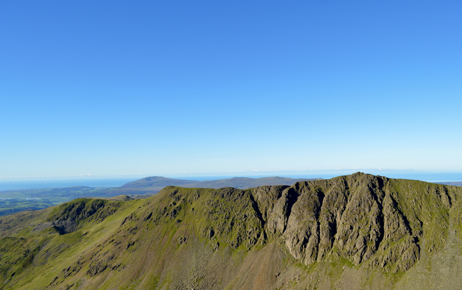
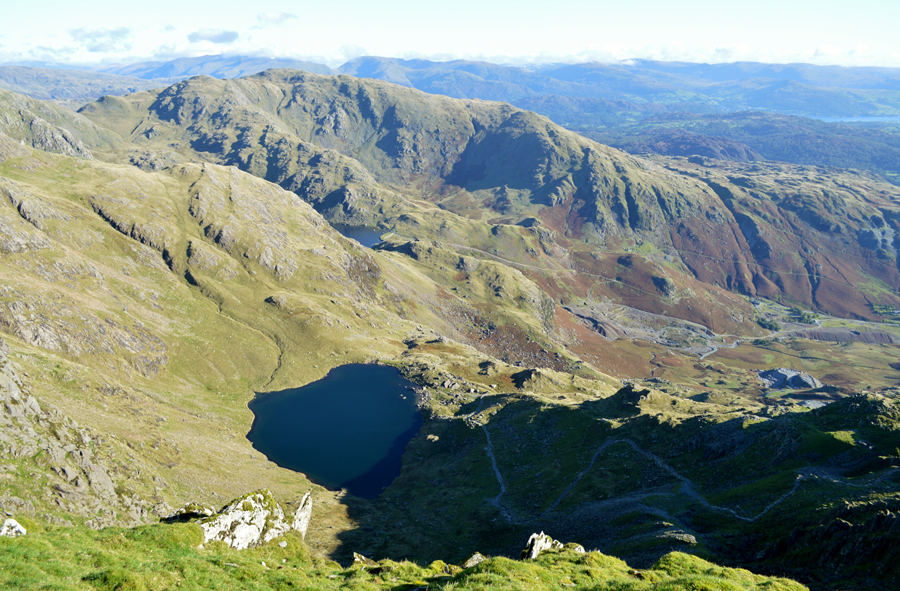
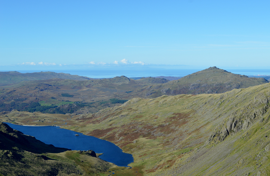
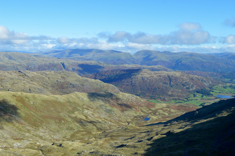
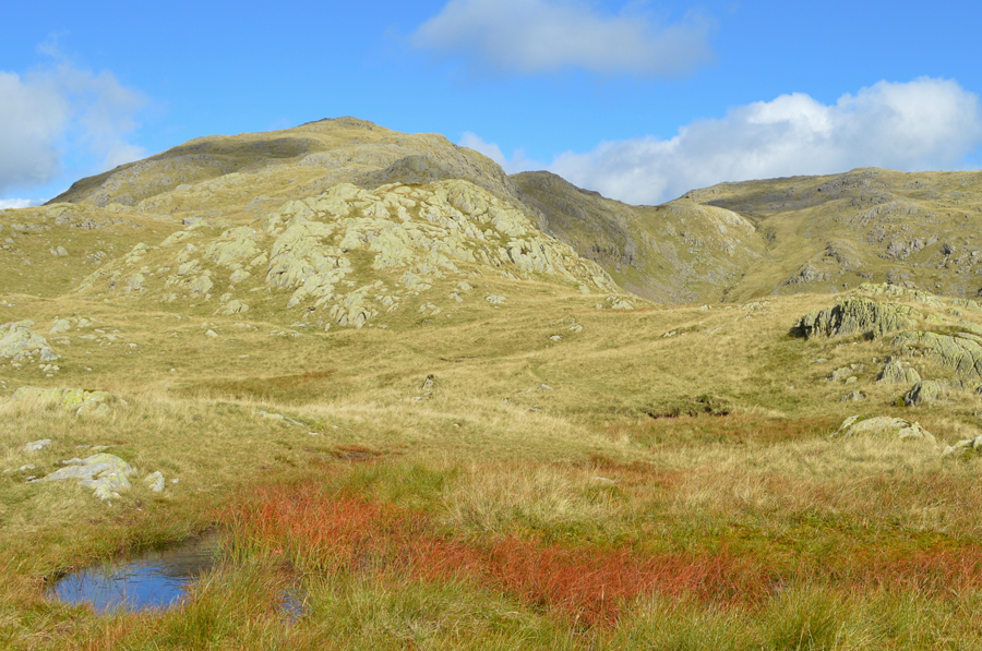
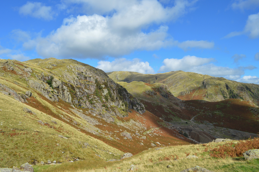
| Raven Tor and Brim Fell End from Crowberry Haws. |
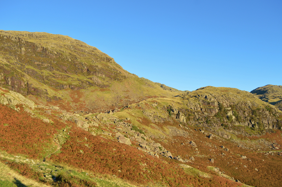
| It had rained heavily the night before and the fell side reflected this with the sound of flowing water never far from ear shot. Our path eases in ascent soon passing The Bell before the path dog legs where we hook left, a few feet ahead then right. Continuing ahead here would take you towards Low Water and eventually the Old Man but our route would see us continue towards Boulder Valley as our views open out over the Coppermines Valley where a camper van was spotted at the entrance to the mine track, an odd place to park up although they too, had probably heard of the proposed parking fee's back at Fell Gate. |
 |
| A distant Brim Fell from the Pudding Stone. |
| With a strong sun on our backs we trace through Boulder Valley soon passing the Pudding Stone before crossing Low Water Beck at the familiar narrow wooden footbridge all the while being accompanied by the sound of the waterfalls gushing from Low Water Beck in the distance. |
 |
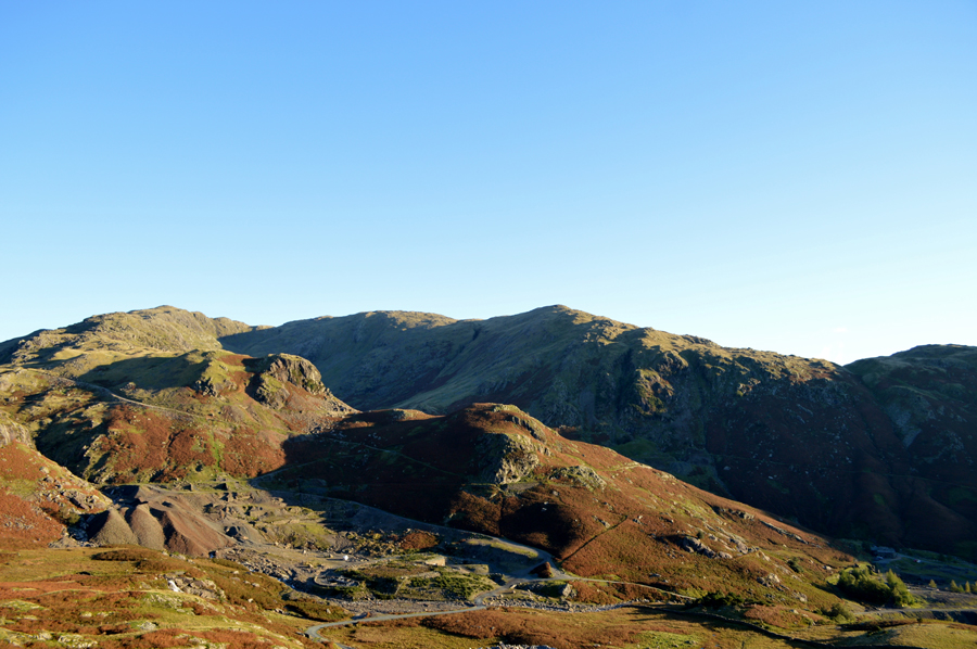
| Boulder Valley below the disused Quarry. |
| It's not the first time Rod and I will stop at this spot but more on that later. |
 |
| Continuing towards Levers Water. |
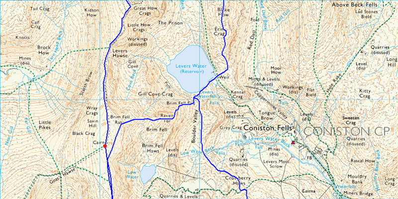
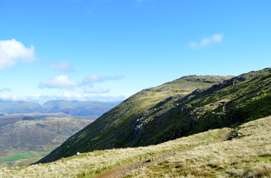
| We had gained easy ascent on Levers Water since leaving Boulder Valley behind as the grassy southern 'flank' of Raven Tor appeared to tower above us, an ascent here would be steep, yet too easy and doesn't have the same appeal, nor spark of the East Buttress. I mentioned to Rod would he mind we take the slight descent down to Levers Water where we could get a proper look on the East Ridge, and indeed the route we were about to take. |
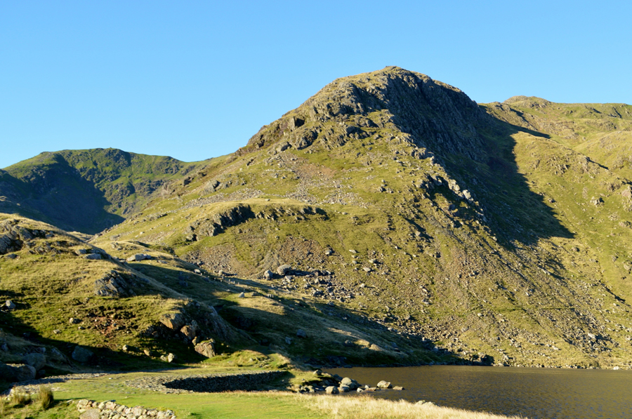 |
| Raven Tor and Coniston Old Man from Levers Water Dam. |
After passing the open shafts just above Levers Water we strode out along the Dam wall towards the outflow where we stopped to plot our ascent, this easier said than done with a strong sun overhead. It was agreed that we would first head left, then right over the grassy terrace as we didn't see any point at starting right on Levers Water shoreline, instead opting to get the best out of the ridge at its craggy base.
Okay, time to head back. |
 |
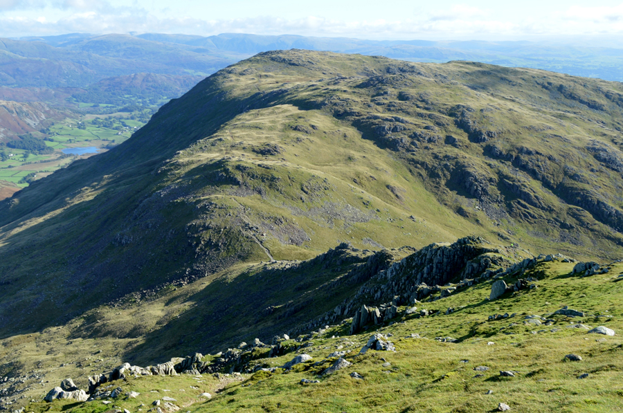
| The Black Sails Ridge and Wetherlam seen over Levers Water from the start of the ascent. |
| Our plan of descent later will be via the Black Sails Ridge... talk about a walk that has it all. |
 |
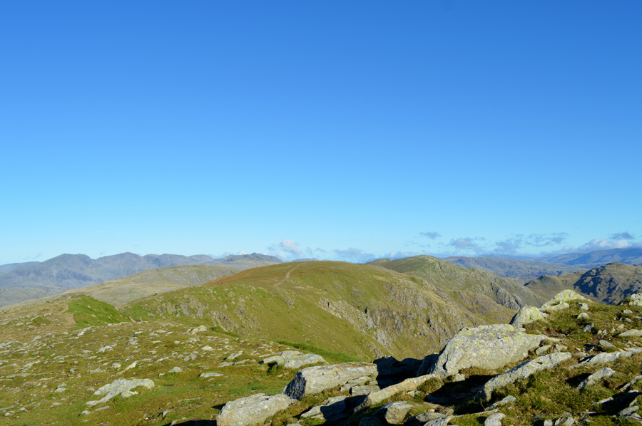
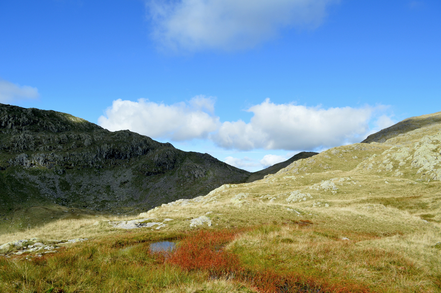
| Views towards Great How Crags, Prison Band, Swirl Hawse and Black Sails. |
| We're almost at the base of the East Ridge now and the views over Great How Crags, Prison Band and Black Sails are striking to say the least. |
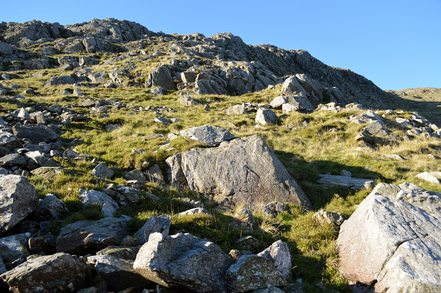 |
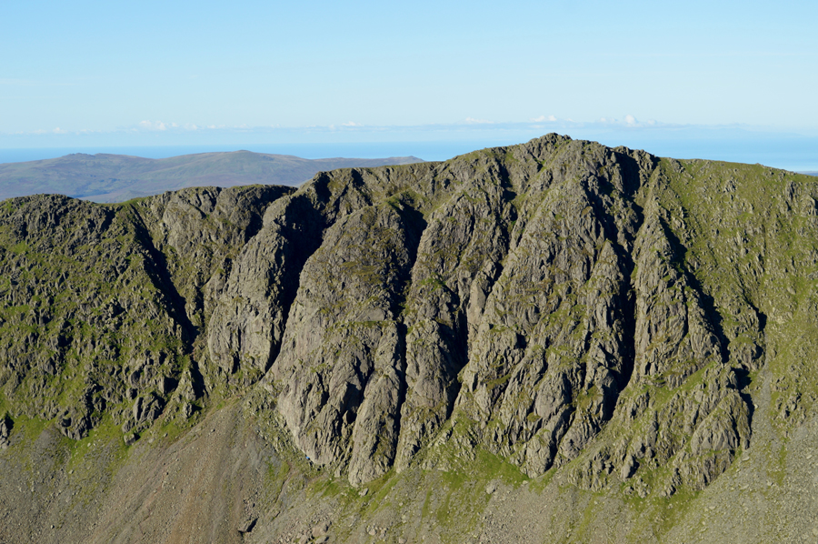
| Ascent on Raven Tor. |
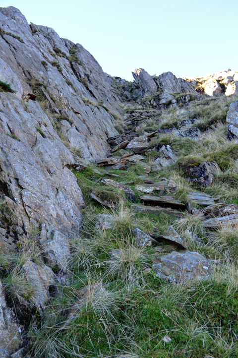
| It was soon noted just how steep the ascent was starting to get with walking poles coming up to our shoulders, we picked our way over rough boulder although at times we were surprised to trod on a firm path underfoot which would fade in with the rough grasses. We had each blazed our own trails despite the paths as I opted to keep as far right as possible if only to get that ridge experience while Rod enjoyed the rough stone underfoot but we were both stopped by the same craggy outpost seen in the top of this photo, centre left. |
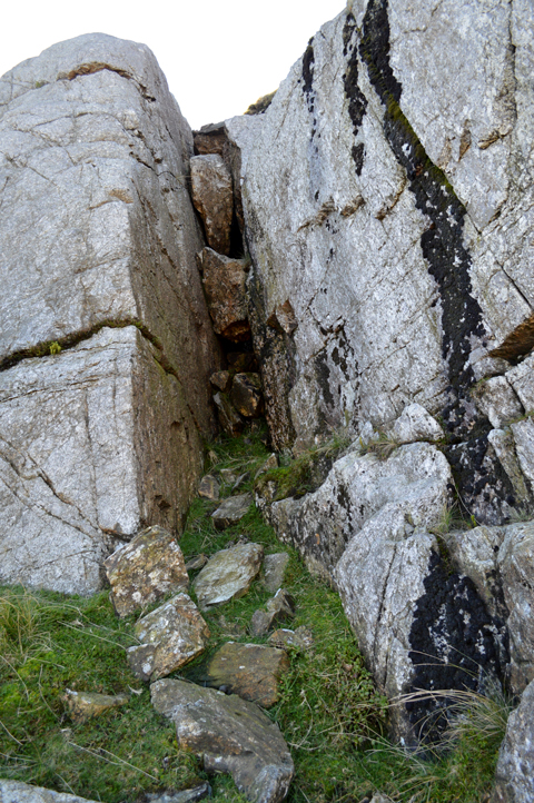 |
| The only way is up. |
There might have been possible options to get around our first scramble of the morning but we didn't bother to look for them instead opting to climb over this crevice which was probably around twenty feet in height, Rod, went first, not before we both shortended our walking poles ahead of the climb, in my own experience I should have packed them away completely.
The crevice I would imagine is largly in shadow resulting in moss covered rock which didn't offer anything in the way of grip which became apparent almost immediatly, it was a simple case of plotting your route before carrying it out, not a place to 'wing it'
Rod eased his way not putting a foot wrong and was soon looking down on me as it became apparant my walking poles as collapsed as they were, are getting in the way, with this I de-loop them from my wrist and throw them up before hoisting myself up easily to where Rod awaited me, why I just didn't pack my poles away in the first place I just didnt know. |
 |
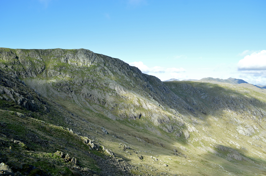
| The base of the Stone Rake we had seen from Levers Water earlier. |
| Earlier, while back at Levers Water Dam we had spotted a cleft of rock which was in the shade "be great if we could get in there" I told Rod, Rod agreed and I guess throughout the climb, this cleft of rock was where we had been ascending towards, it was only as we got closer we discovered that the cleft of rock was much wider than it had looked and took on the form of a steep stone rake, shielded on the left side by an almost vertical wall which as you can see, is currently being used as a viewing platform. |
 |
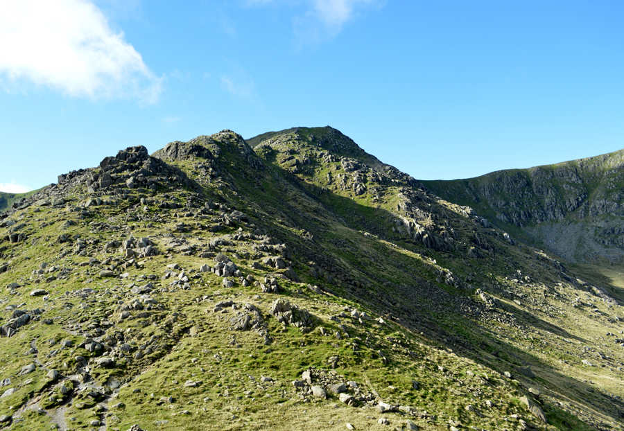
| The Stone Rake extends towards the shoulder of Raven Tor. |
| It's steep, loose and quite damp underfoot and care was taken during the ascent of the Stone Rake. |
 |
| But the steep ascent was worth it as our views extend over Levers Water towards Black Sails, the Red Dell Valley and Wetherlam. |
| We had reached the top of the Stone Rake and soon felt the warmth from the sun again both panting and smirking at the same time, I don't think we had realised just how steep it was but the pure enjoyment we took from the ascent somehow masked over this. Up ahead we could make out the summit beyond a long and steady grassy ridge, I guess we aren't quite there just yet. A faint path would often lead the way which we might use, but more often than not we blazed our own trail sighting the summit cairn sometime later. |
 |
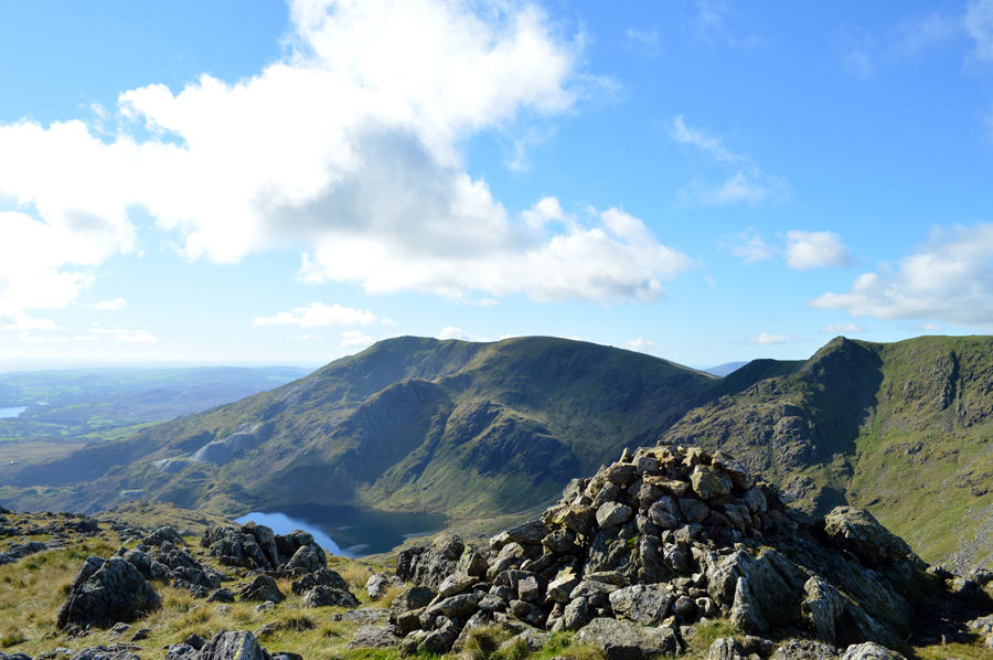
| Great How Crags, Prison Band and Black Sails from Raven Tor summit. |
Although I have stood here a few times today was Rod's first time at the summit cairn despite being within a whisker of it on many occasions which gave us the reason just to absorb our surroundings while at the same time, get our breaths back.
After plotting an ascent on Great How Crags, which I might add got added to a very lengthening 'to do list' we strode out leaving the summit behind before taking on the steady ascent towards Brim Fell passing the top of Brim Fell Rake along the way, our plan is to head straight to Coniston Old Man from where we can collect Brim Fell summit while on the return. |
 |
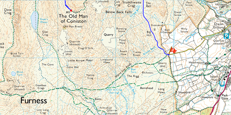
| Before we summited Brim Fell we head to the Old Man first. |
I guess I didn't quite know it at the time but for one reason or another I would often return to the Coniston Fells over and over, in fact they are among my most walked fells and when I look back I've found that simply without knowing a bond had been forged and like a love sick teenager, I do get that special yearning in the pit of my stomach after time and it's all because of views like this.
Okay, thats enough nostalgia, we press on. |
 |
| Dow Crags, Buck Pike, Blind Tarn and Black Combe from Coniston Old Man. |
| |
 |
| A close up of Dow Crag and Dow Crag South Rake seen far left. |
| |
 |
| Views over Buck Pike, Blind Tarn, Brown Pike towards a Black Combe and the Duddon Estuary. |
| |
 |
| Brim Fell, Grey Friar and the Scafells from Coniston Old Man summit. |
| By the time we arrived at Coniston Old Man the summit area was getting quite busy with walkers and dogs alike, some were leaving and some like Rod and myself, just arriving. A few walkers had taken residence in the summit shelter while others mingled around the trig point until photos were taken before moving on which was when I took this photo while a strong sun casted a dark shadow from the trig point. Rod had a walk around the summit shelter then came back to the trig before we both moved off and started to back track towards Brim Fell. |
 |
| Views from the summit looking down on Low Water and The Coppermines Valley with Black Sails and Wetherlam in the distance. |
| |
 |
| Brim Fell seen with Swirl How taken shortly after leaving the Trig Point. |
| |
 |
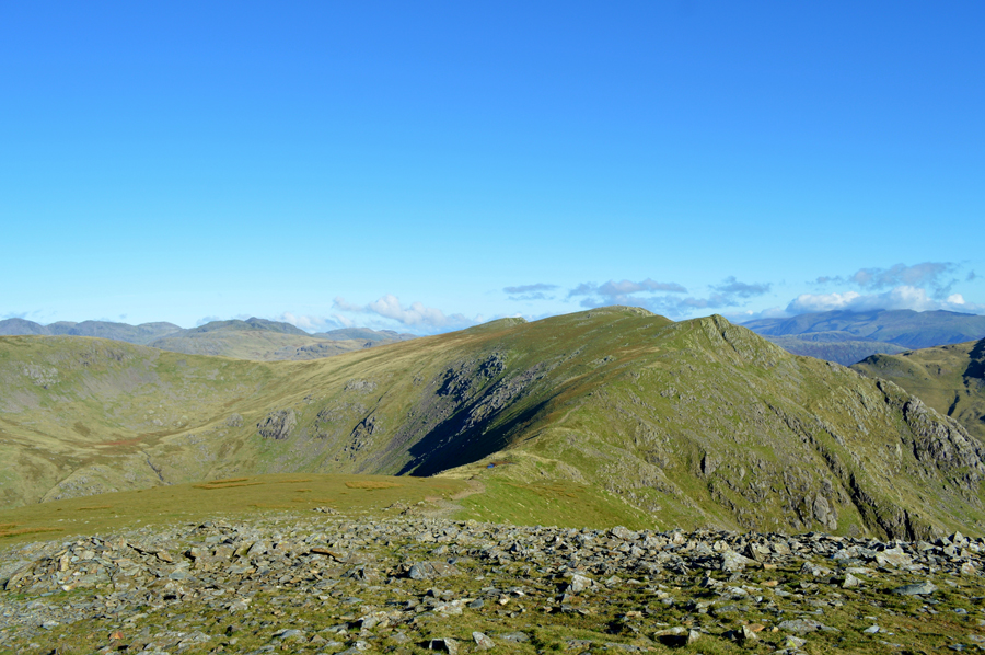
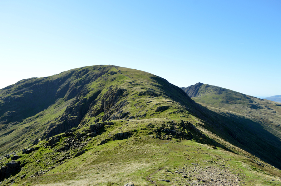
| Swirl How and Great Carrs from Brim Fell summit cairn. |
We trailed the walkers who had left the Old Man shortly before us who by now were most probably making a descent over Levers Hawse by the time we reached Brim Fell summit with the exception of the chap you see in the right of the photo who was making his way back to the Old Man after also visiting Brim Fell. It's a cracking ridge walk which always feels to me like it's never long enough.
We press on towards Levers Hawse. |
 |
| Swirl How, Great Carrs and Prison Band seen over Levers Hawse while over on the left, Grey Friar. |
| Sadly we won't be walking as far as Great Carrs seen at the end of the ridge although had this been on a Saturday where we would of had more time on our hands I've no doubt we would have included both Great Carrs and Grey Friar into todays walk. |
 |
| Harter Fell (Eskdale) seen with Green Crag and Crook Crag while below, Seathwaite Tarn along side Grey Friar South West ridge. |
| It isn't very clear to see but what summit winds we could speak of up here on the ridge are a lot less than what was blowing over the top of Seathwaite Tarn as we could see the white wash of the waves being churned up whilst passing over Levers Hawse. |
 |
| The unmistakable Brim Fell and Dow Crag from Levers Hawse. |
| We had been trailing two walkers who by now had dropped off either to descend down to Levers Water from the top of the Hawse or to simply stop and take in the grand views. We are passed by more walkers and fell runners all heading for Brim Fell and beyond while Rod made a slight detour to the summit of Great How Crags from where he confirmed a route of ascent from Levers Water which is in the bag, until we decide to open it that is. |
 |
| The distant Langdale Pikes seen with a host of Eastern fells from Swirl How summit cairn. |
I can't help but be reminded of the time I saw my first broken spectre some years ago while at Swirl How summit, back then it was also October yet the contrast between the years couldn't have been further apart, while here today it feels Spring like, back then, it most definitely felt within the depths of Winter. |
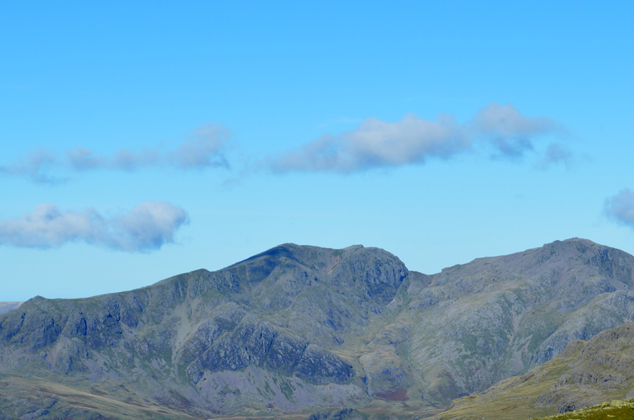 |
| A close up of Scafell Pike, Mickledore, Cam Spout Crag, ScaFell and Slight Side from Swirl How summit |
| |
 |
| Here, views extend over the Greenburn Valley towards Great Langdale, Lingmoor Fell and the distant Eastern Fells |
| |
 |
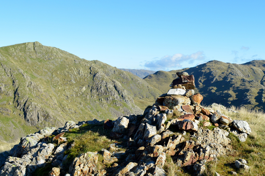
| Prison Band and Wetherlam, and Black Sails from Swirl How summit. |
| After taking in the views and observing some deviant low cloud which had clung to the summit of Helvellyn for much of the morning we started our descent on Prison Band which even in the fantastic conditions as we have today, can be a quite a slow descent due to how steep, and sometimes rocky the path can get underfoot, it was agreed there is no point rushing the descent of Prison Band. |
 |
| Swirl How from the descent of Prison Band. |
| |
 |
| Stopping to look back on Prison Band as we pass over Swirl Hawse. |
Photograph opportunities are always few and far between when descending Prison Band as concentration is needed for much of the descent, it's the kind of descent which lets you forget about the camera, but in a good way. |
 |
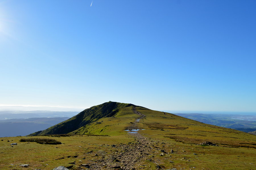
| Wetherlam is just ahead but sadly it's time to divert towards Black Sails Summit. |
After a short yet steady ascent from Swirl Hawse the path now levels for a while as views open out towards Wetherlam whose summit was starting to look rather over crowded. I stop and say to Rod you reckon this is a good spot to start our ascent on Black Sails from? Aye it's as good as any, I guess that's what the cairn is for (which I had failed to see)
Well, at least we're thinking on the same wave length I grunted. A narrow grassy trod now ascends steadily over sometimes swollen ground from where we spotted a large group of walkers who were just leaving Black Sails summit. Despite not spotting the cairn earlier I was feeling more than pleased with the path which may have been steep, but it was also direct, on other occasions I had previously followed the path below too far in the direction of Wetherlam only to back track over bog and not to mention, two of Black Sails false summits.
There was one of that today. |
 |
| Levers Water, Coniston Old Man, Brim Fell and Great How Crags from Black Sails summit. |
| |
 |
| While looking in the other direction we have Pike O'Blisco, Red Tarn, Cold Pike, Crinkle Crags and Bow Fell |
| Allen Crags can just be seen behind Bow Fell with the Glaramara ridge extending further north, it certainly was a day for grand views. |
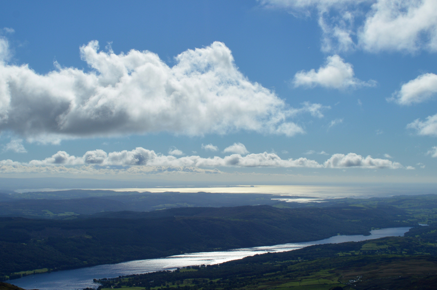 |
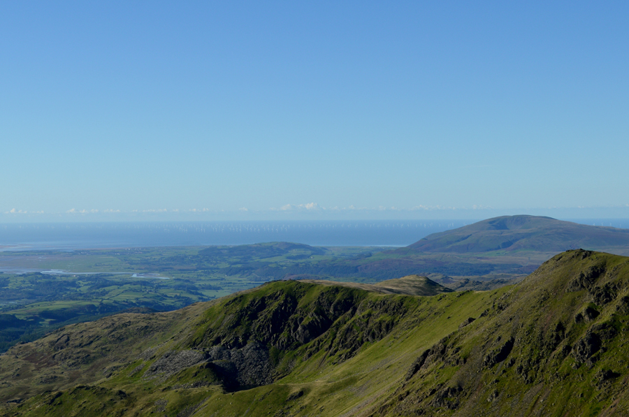
| Distant sunlit scenes over Coniston towards Morecambe Bay with Heysham Power Station seen centre right. |
| We had agreed to take five and while Rod ate his apple I sat down and performed stretches in my boot if only to relax my foot tendon which had reared up over the last hour or so. It was still morning but quite close to lunch and it was agreed after a snack on Black Sails summit we would save our lunch until we reached Levers Water from where we'll be able to look back on our mornings work. |
 |
| Views back up the Black Sails Ridge with Wetherlam summit on the far right. |
| Since the first time I walked the Black Sails ridge it has always felt special to me and today was no different, there was a threat of cloud which had actually been forecasted meaning much of our descent had been done in shade although every now and again the sun would burst through the cloud illuminating the wild grasses all the way back to to Black Sails summit. |
 |
| Almost from the exact same spot, Prison Band over Swirl Hawse. |
| Now in the same shade as we was just moments earlier. |
 |
| Raven Tor over Levers Water. |
| Despite expecting to be walking back to Levers Water under cloudy skies it was quite the opposite feeling more Summer like as we progressed into early afternoon, lets just hope the brightness continues over lunch. |
 |
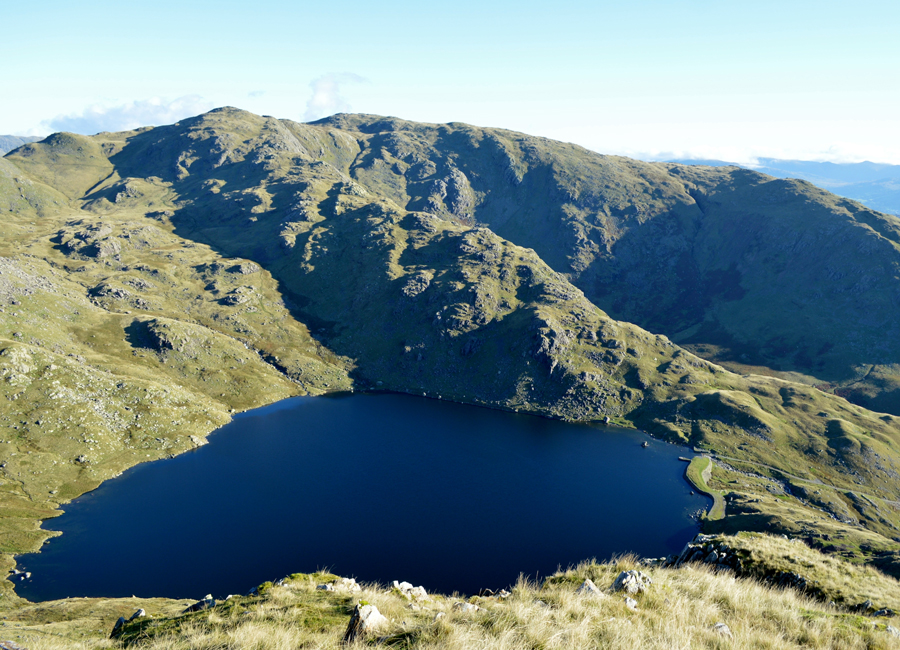
| Prison Band and Swirl Hawse from Levers Water. |
We were beaten to the small beach on the East side of Levers Water by a young couple who we saw arrive just moments earlier, this however wasn't a problem and we decided to eat lunch whilst sat with our legs dangling over the water from the Dam edge, soon we are joined by more people who also take five whilst sitting on the dry grass along the Dam wall, before long more walkers had arrived and what felt like quite a secluded spot was starting to feel like Blackpool sea front, but we couldn't blame anyone for wanting to enjoy the tranquilness.
As soon as lunch was eaten we didn't hang around and re-shouldered before striding out under the gaze of our mornings conquest by which time we are joined by two young girls who stopped to ask where they going the right way to get up there/ or words to that effect whilst pointing towards Brim Fell and Coniston Old Man.
Well, that's a tough question and I guess unless you have come this way intentionally you're quite off the path if your wanting to summit the Old Man today, the young girls weren't particularly dressed for fell walking and didn't appear to be carrying maps or know where they needed to be with the exception that they wanted to get high. I asked them did they need to summit or would a visit to Low Water be an option to which they politely replied, we just want to get up there pointing at Coniston Old Man.
Okay, we're heading part of the way if you like you can follow us as Rod went onto explain where the path splits close to Crowberry Haws which didn't seem to phase them one bit, okay they said, and that was the last we saw of them until about fifteen minutes later. |
 |
| Heading back to Fell Gate via Boulder Valley. |
| That's the Pudding Stone which we passed earlier this morning in the middle right of the photo. |
 |
| Coppermines Valley from Crowberry Haws. |
We started to re-trace the same route as earlier soon passing through a rather busy Boulder Valley whilst every now and again, glancing over our shoulders to see if the girls had decided to follow us and soon after they appeared over the top of Boulder Valley, the good samaritan in Rod reared as they looked a little helpless stood there contemplating which path they would need as Rod went onto say, I'll track back and point them towards the right path.
Whilst Rod tracked back I told him I'd wait on the other side of Low Water Beck which is where I took this photo whilst sat lazing on a large rock waiting for Rod to catch me up...
Sorted Rod? aye they're okay now. |
 |
| Grand afternoon views over The Bell, Raven Tor, Great How Crags, Black Sails and Wethelam from Fell Gate. |
| The car windscreens shimmered under an October sun and in the distance, Morecambe Bay sparkled in a rosy pink, The puddles of this morning had started to dry up as quickly as the temperatures had risen they would start to drop but for now mother nature is playing tricks on us whilst gently reminding us that Autumn is still just around the corner. |
|
| |
| Back to top |
 |
|