|
A Coniston Round |
 |
 |
6th April 2019 |
 |
|
It's been a busy month work wise and I'll be the first to admit the Lakeland fells have been far from my mind due to my heavy work load. Feeling the strain of an evening I'd usually spend a few hours planning for the weekend but my head, which was still in work mode, wouldn't allow. As the weekend neared my thoughts reverted to a handful of walks I never tire of, walks where a tired mind can take in the scenery while at the same time the stress of a working week disappears without even noticing, those fells today came in the form of the Coniston Round.
With Rod returning from a week in Lakeland I left it until the last minute to ask David would he mind joining me on my mini Coniston Round and David snapped at the chance having last walked these fells back in January 2018 where we had to fight through thigh high snow, although our efforts were rewarded that day with a fine cloud inversion.
We arranged to meet outside Coniston just up the road from the Ruskin Museum alongside Church Beck and we were treated to sunshine straight from the off. You can do all sorts of things to relieve stress but my cure doesn't come over the counter, nor from a bottle, it comes from those fells that lay dormant until required. |
|
| Wainwright Guide Book Four |
 |
| The Southern Fells |
| Swirl How although not quite the highest of the Coniston Fells, is the geographical centre of the group, radiating splendid ridges from a peaked summit to the four points of the compass. |
 |
|
|
|
| |
|
Overview |
|
|
| Ascent: |
3,450 Feet - 1,052 Metres |
| Wainwrights: |
3, Swirl How - Brim Fell - Coniston Old Man |
| Weather: |
Warm Dry & Sunny With Little To No Wind. Highs of 15°C Lows of 5°C |
| Visiting: |
2, Black Sails - Great How Crags |
| Parking: |
Roadside Parking, Ruskin Museum |
| Area: |
Southern |
| Miles: |
9.3 |
| Walking With: |
David Hall |
| Ordnance Survey: |
OL6 |
| Time Taken: |
6 Hours |
| Route: |
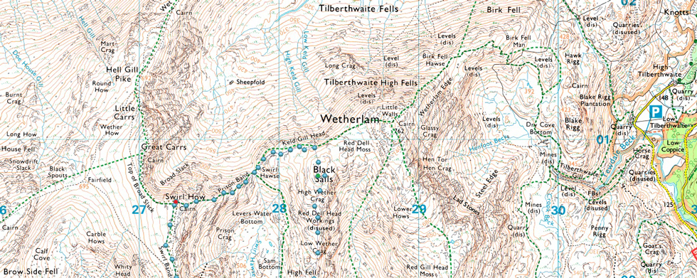
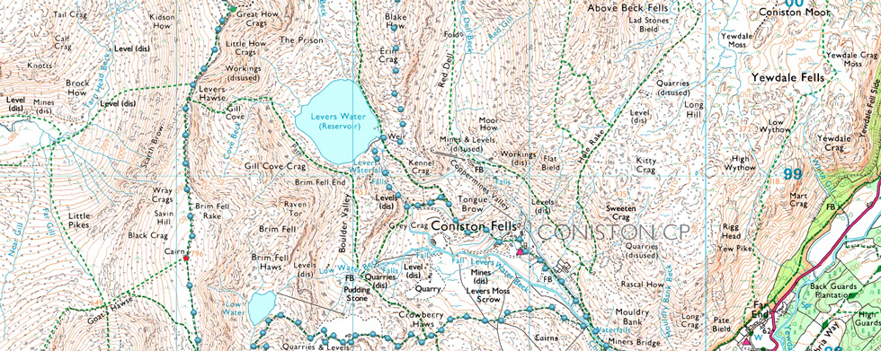
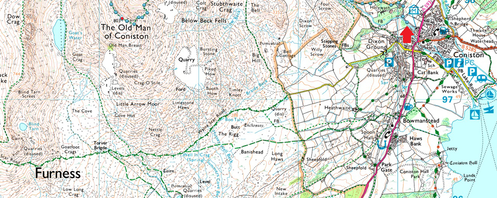
Ruskin Museum - Church Beck - Miners Bridge – Coppermines Valley – Simons Nick – Levers Water – Black Sails – Prison Band - Swirl How - Swirl Band - Great How Crags - Levers Hawse - Brim Fell - Coniston Old Man - Low Water - Coppermines Valley - Miners Bridge - Church Beck - Ruskin Museum |
|
| |
|
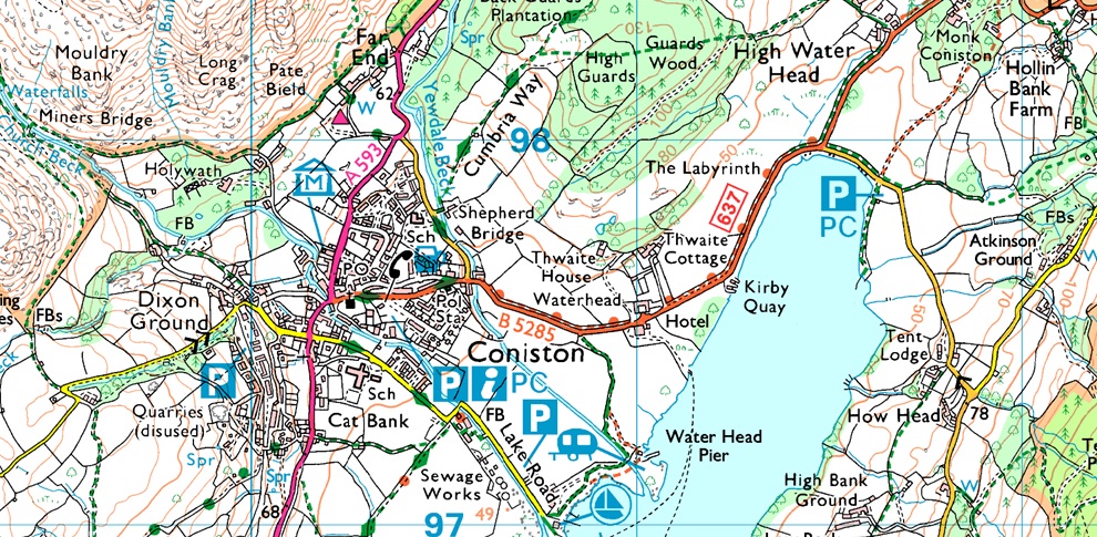
Parking Details and Map |
|
|
| Nearest Post Code: |
LA2 18DW |
| Notes: |
Coniston is a very popular village providing access to the ever popular Coniston Fells, below is a list of car parks found within the village with exceptions of the roadside parking that I tend to use close to Ruskin Museum where parking is free. Coniston Tourist Information Centre (Pay and Display) Ruskin Avenue Coniston LA21 8EH SD 303 597 ~ Car Park (Pay and Display) Old Furness Road, Coniston LA21 8HU SD 299 897 ~ Lake Road Car Park (Pay and Display) Lake Road, Coniston LA21 8EW SD 307 097 ~ Roadside Parking, Ruskin Museum, Coniston, Parking is Free LA2 18DW SD 301 597 ~ Car Park, Coniston Sports and Social Centre, Charges Apply LA21 8AL SD 305 397 |
|
| |
|
Map and Photo Gallery |
|
|
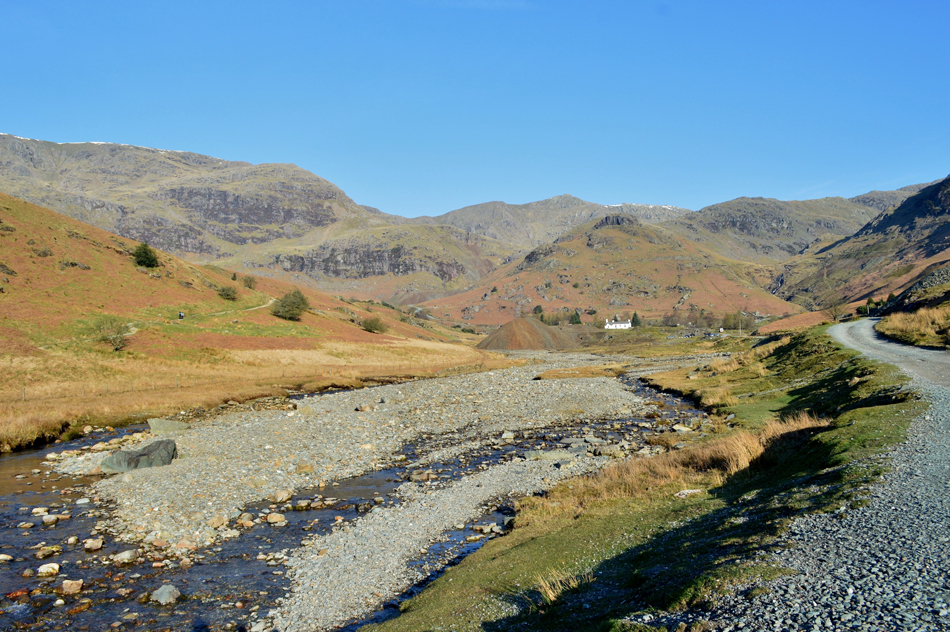 |
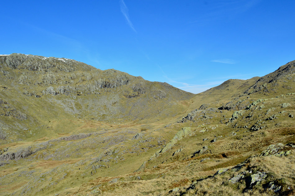
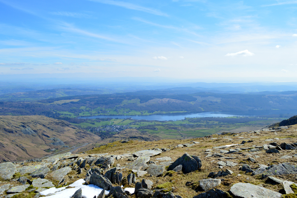
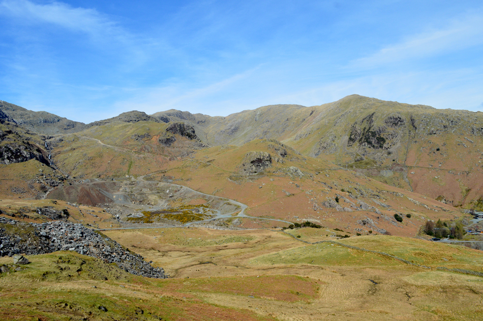
| Coppermines, Coniston 08:47am 5°C |
David and I had arranged to meet at 08:30am and by coincidence we meet just outside the village and arrived together both commenting at what a wonderful morning it was and what a great day we had in store. Snow had fell in Lakeland all week most of which has already thawed and what hasn't is confined to the highest summits in and around the Scafell, Bowfell and Helvellyn groups, should the higher temperatures continue by next weekend what is left of the snow could be all but gone with the exception of a few pockets here and there. Despite the obvious sunshine the morning air had a slight nip to it so for now we add Soft Shell jackets, they don't stay on long. With the cars locked we head out towards Miners Bridge and the Coppermines Valley, the track underfoot climbs steadily then levels as Church Beck flows through a steep ravine over to our left. Miners Bridge is soon reached where we are overtaken by two ladies who had kitted up further down the road from us and 'mornings' are exchanged.
A few cars come and go leaving dust plumes in their wake and we notice group of cars which had parked opposite the large spoil heap seen in the centre of the photo and comment on "how we had never seen these parking spaces before" and if the cars should be parked there at all. We continue towards YHA Coppermines which is seen as the white building up ahead. It's turning into an absolutely gorgeous day and soon any extra layers that were added back at the cars were removed. |
 |
| Coniston Old Man and Brim Fell from Levers Water Beck, Coppermines. |
| Taken after passing YHA Coppermines. |
 |
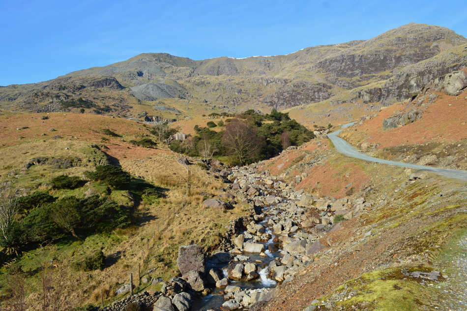
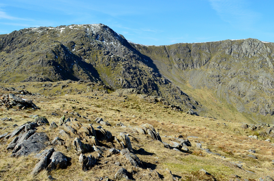
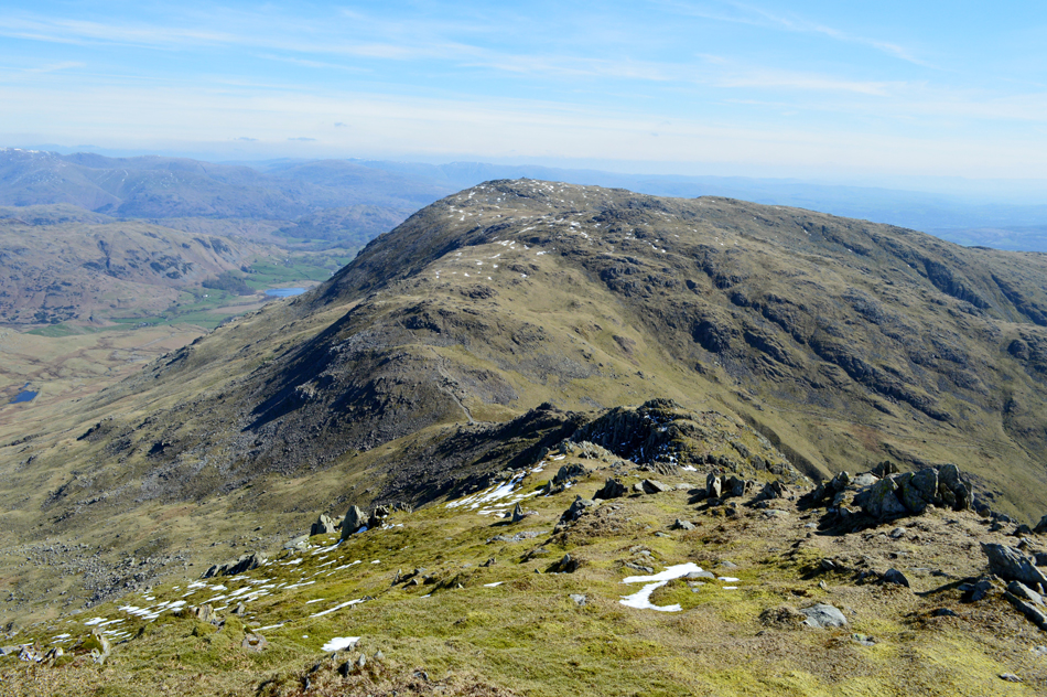
| Swirl How and Grey Crag (Simons Nick) |
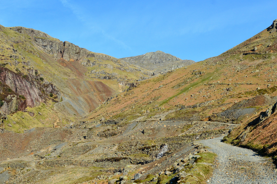
Levers Water Beck breaks away widely to our left as we climb through the very industrious Coppermines mine which has been mined for the last 400 years. It's hard to imagine that we are probably walking over thousands of feet of sunken veins below our feet. Today, even though the mine still extracts copper on a less grander scale this area is still eye wateringly beautiful.
The name Simons Nick derives from an old folklore legend when Simon, a poor miner extracted vast amounts of Copper Ore from the seam above Levers Water Beck, when asked (under the influence of alcohol) about how he knew there would be so much Copper he told the authorities that the Fairies had told him where to dig, his good fortune was instantly ceased.
|
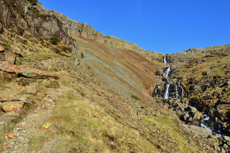 |
| Rising alongside Levers Water Beck (Falls) |
| With Simons Nick seen as the cleft of rock centre left. |
 |
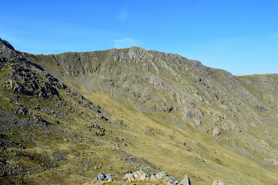
| Great How Crags, Swirl How and Prison Band from Levers Water. |
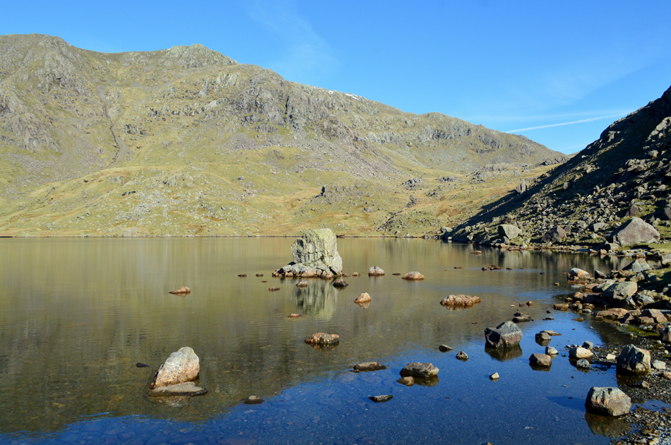
| After crossing the footbridge over Levers Water Beck we ascended steadily as Levers water Beck (Falls) fell steeply below commenting that it was here we added our crampons during our last visit in January 2018. We continued to follow the track and decided to cross the beck below the last set of falls (seen in the previous photo) where a little care had to be taken in order to avoid a dunking. It isn't always necessary to cross the falls as the path continues all the way towards Levers Water, the main reason we crossed today was because we were unsure on how much water was flowing from the outflow which can be tricky to cross if in spate, however, on reaching the outflow we found less than a trickle but it's always best to act on the side of caution I guess. |
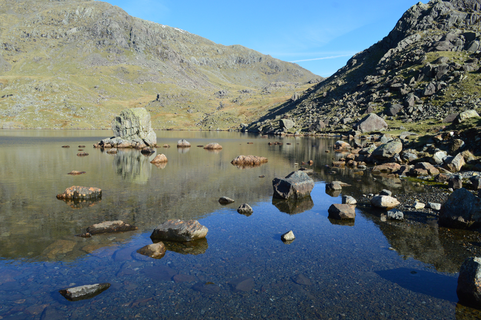 |
| Serene Levers Water. |
| That's Prison Band (Swirl How) in the distance with Great How Crags over on the left. Geez we could have stayed here all morning!! |
 |
| High above Levers Water. |
| With superb views over Raven Tor, Coniston Old Man and Brim Fell. |
 |
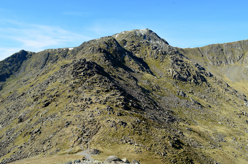
| The Black Sails ridge. |
| Today we went off-piste and linked up with the path just below Erin Crag then ascended towards the start of the ridge route which always offers the finest views of the fabulous Black Sails ridge with Red Dell Head and Wetherlam seen over on the right. |
 |
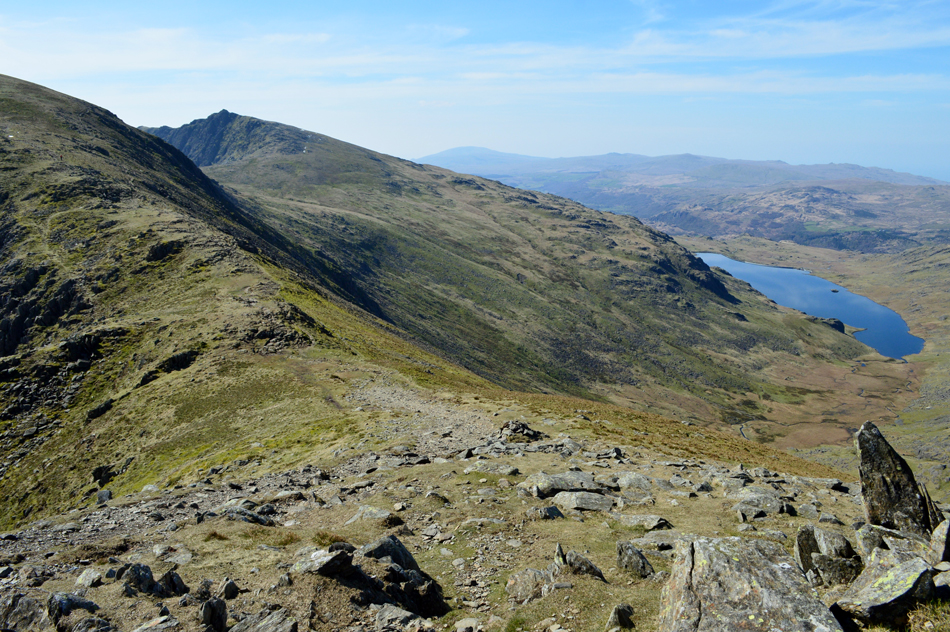
| The view over Levers Water Bottom towards Swirl Hawse, Prison Band and Swirl How. |
| |
 |
| The Black Sails ridge. |
| We stop at a favoured spot of mine to take in the view towards High Fell with the summit of Black Sails seen beyond. |
 |
| Wetherlam and Red Dell Head Moss as we close in on Black Sails summit. |
| A drop in temperature causes my baselayer sleeves to be rolled down as we approach Black Sails summit. |
 |
| Coniston Old Man, Raven Tor, Brim Fell and Levers Water from Black Sails summit. |
| The ridge route deviates to the right before the final pull onto the summit from where we took in fabulous views towards the snow capped Scafells then eastwards through a slight haze towards the Helvellyn range, strangely it was only the shoulder of Helvellyn which had a covering of snow. |
 |
| Swirl How, Broad Slack and Great Carrs seen as we approach Swirl Hawse. |
| That dip in temperature remained and from the summit of Black Sails we scout around sighting one chap stood at the summit cairn on Wetherlam then another below us who is also heading towards Swirl Hawse, views towards the Old Man and Brim Fell reveal nothing for now but all that would soon change. |
 |
| The view over Broad Slack towards Great Carrs. |
| Which brought memories flooding back from our visit to the Halifax Bomber wreckage in Broad Slack back in September last year, more so as David identifies a large part of the wreckage as we pass over Swirl Hawse. |
 |
| Prison Band and Swirl How seen from Swirl Hawse. |
| I always enjoy the ascent of Swirl How via Prison Band, it really is a rugged and sometimes scrambly ascent which can also be steep in places. |
 |
| Looking back into Greenburn and Wet Side Edge with distant views of a snow capped Helvellyn. |
| While in the not so distance we find Pike O'Blisco, Lingmoor Fell and the Langdale Pikes. |
 |
| Here we break to look back on Prison Band towards Black Sails and Wetherlam. |
| David was right when he mentioned "the higher we're climbing the hotter it's getting" David wasn't referring to body temperature but the actual air temperature which was heating up the higher we climbed. |
 |
| Brim Fell, Coniston Old Man and Dow Crag from Swirl How summit. |
| It was during the ascent of Swirl How did we start to pass more and more walkers, two chaps, a couple, a young lady with her spaniel and a fell runner who was making light work of the descent, during our ascent we also spotted more walkers heading from Swirl How towards the Old Man, it's fair to say it's looking very busy indeed. |
 |
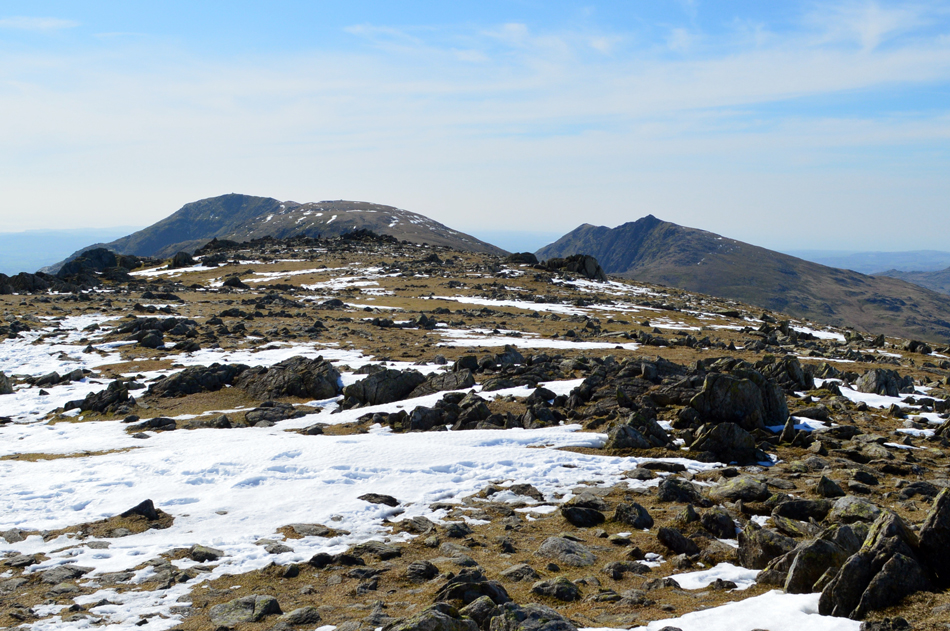
| Great How Crags, Brim Fell, Coniston Old Man and Dow Crag. |
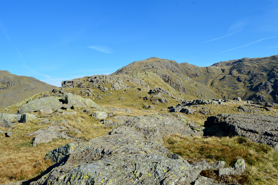
| Happen we'll pay a visit to Great How Crags (seen foreground) whilst we are passing. |
 |
| Brim Fell and Dow Crag from Great How Crags summit. |
| Gaining Great How takes little to no effort and seeing as I've only ever been here a few times before today I thought I'd include it into the route, the next time I'll be here will be when I walk Birketts full Coniston Round which I'm planning to walk this Summer. |
 |
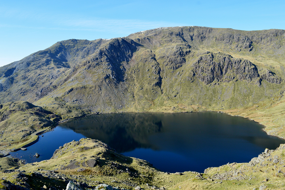
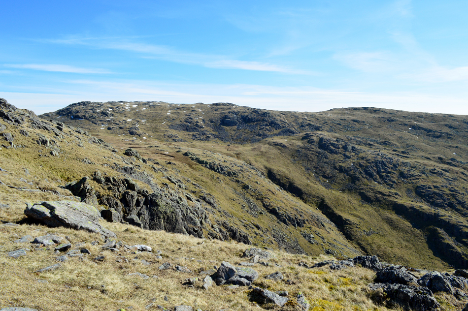
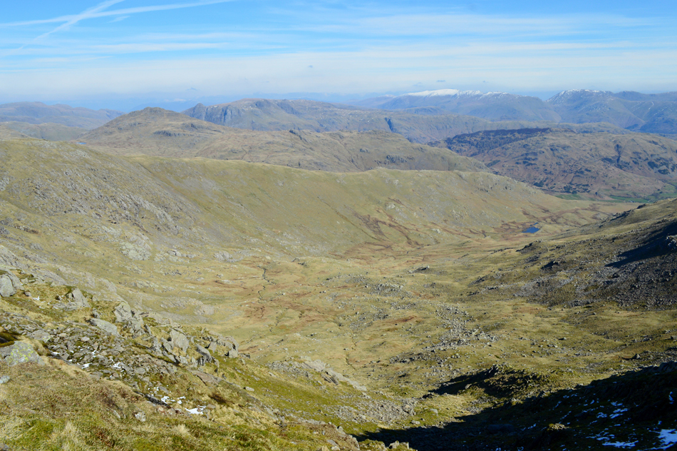
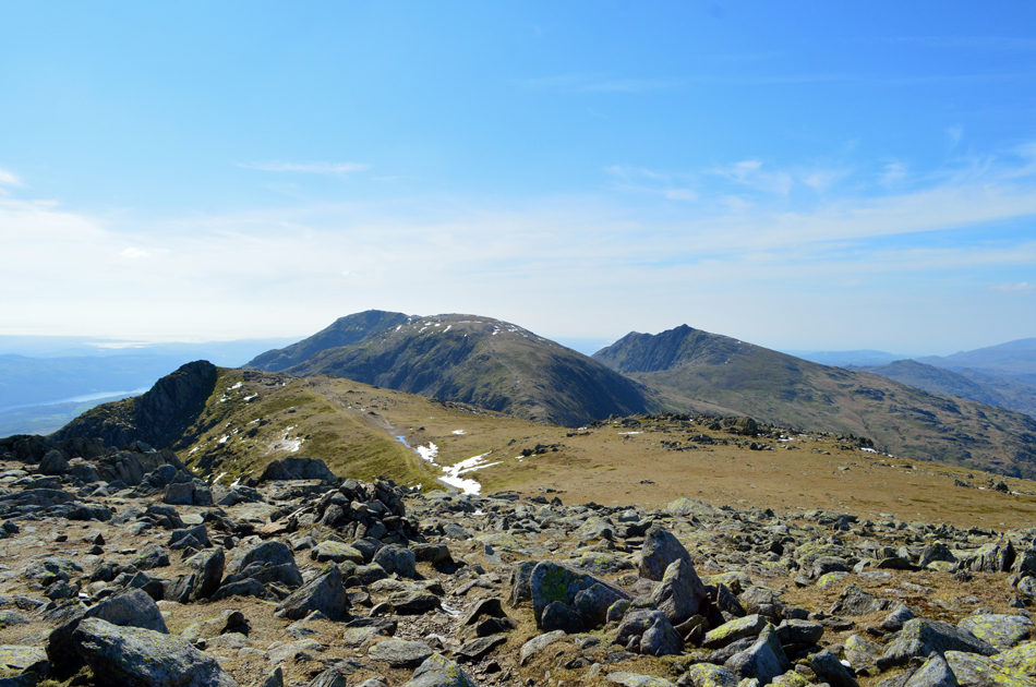
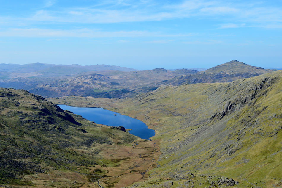
| Brim Fell and Dow Crag seen over Levers Hawse. |
| That's Seathwaite Tarn down there but you didn't need me to tell you that while in the distance, the unmistakable profile of Black Combe. |
 |
| Seathwaite Tarn seen here with Green Crag (L) and Harter Fell (Eskdale) (R) |
| |
 |
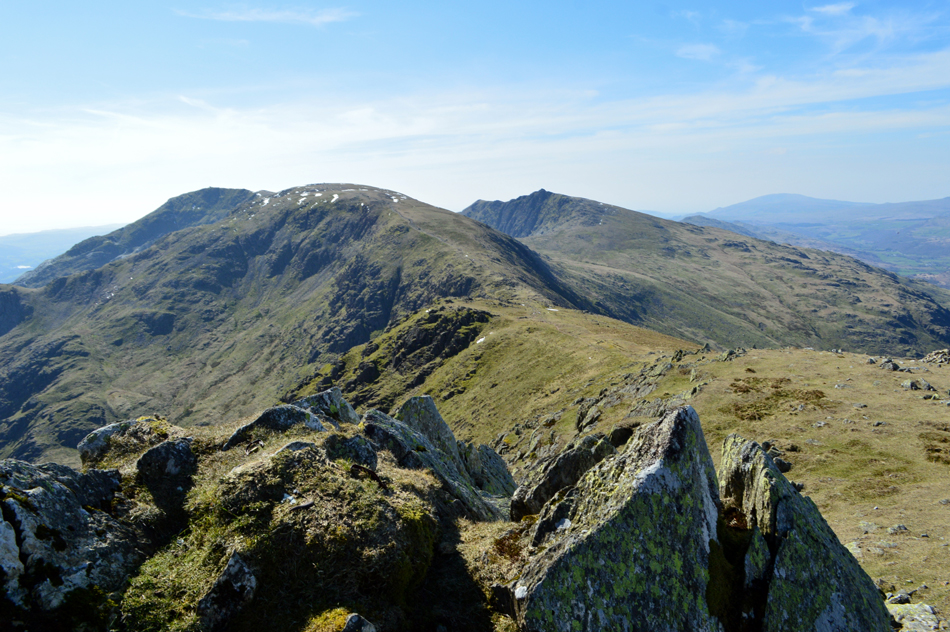
| From Levers Hawse we take in the view over Black Sails and Wetherlam. |
| With Levers Water below and Windermere in the distance.. |
 |
| The view over Levers Hawse towards Great How Crags, Swirl How and Great Carrs. |
| Squint and you might be able to make out Crinkle Crags and Bowfell in the distance with Hellvellyn, Nethermost Pike, Dollywagon Pike and Fairfield towards the right. |
 |
| Lunch with a view of Coniston Water. |
| Brim Fell shouldn't have felt as hard as it did but with a midday sun bearing down on us we kicked back a gear then decided to break for lunch after finding no standing room at Brim Fell summit. There might have been pockets of snow here and there but boy did it feel warm and very Spring like sat here. |
 |
| Approaching Coniston Old Man. |
| Along one of Lakelands best half miles, it looks busy mind. |
 |
| We counted seven at the summit of Dow Crag. |
| No climbers on any of the Buttresses nor in the South Rake (Walkers Gully) |
 |
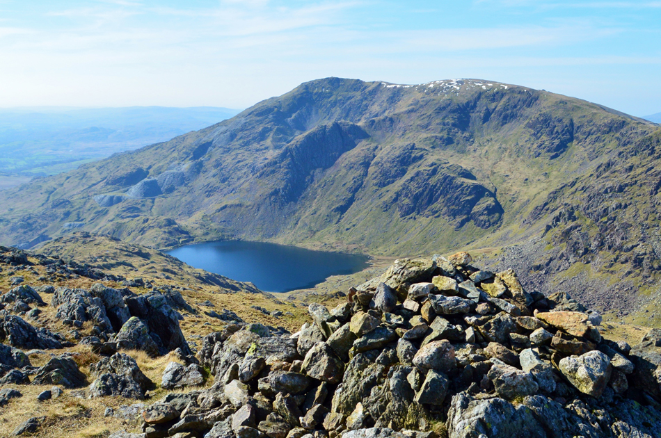
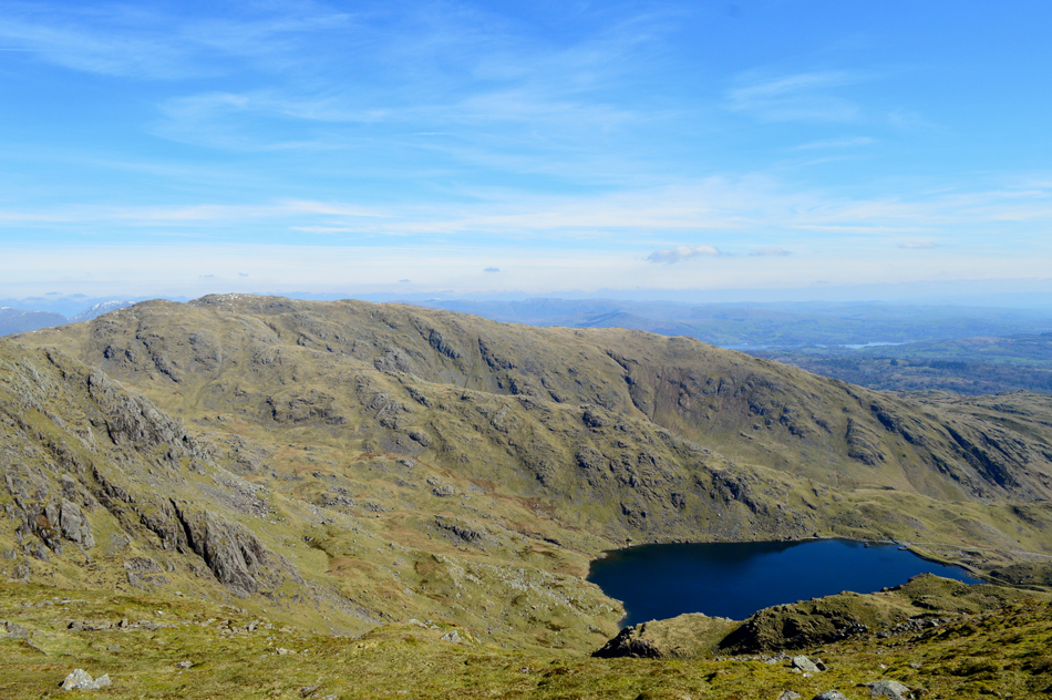
| Low Water, Raven Tor, Levers Water, Black Sails, Wetherlam, Boulder Valley and Coppermines from Coniston Old Man summit. |
| Given the little to no time spent at Brim Fell we knew that on a day as such as today the Old Man would be equally busy and we weren't wrong finding the summit as busy as we've ever seen it, which is great for tourism and local businesses but I couldn't help feeling saddened at the fact that it also felt like a bit of fairground. |
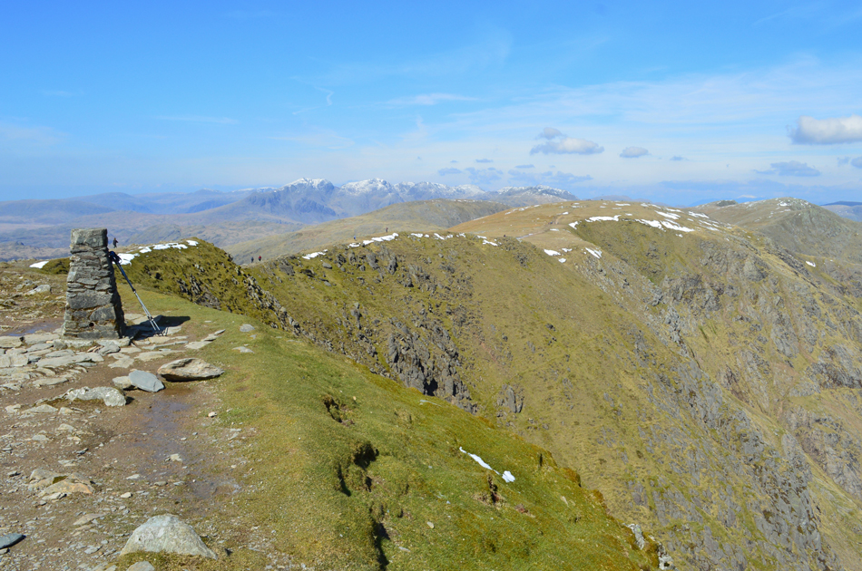 |
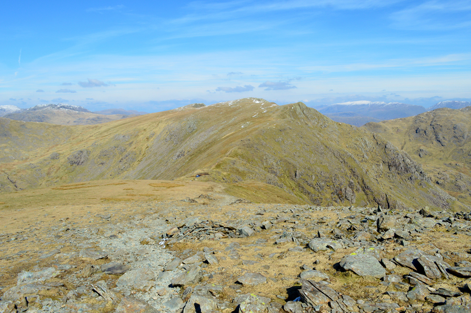
| Here we look back on Brim Fell, Swirl How, Great Carrs and Grey Friar from Coniston Old Man summit. |
| We hung around a while and patiently waited for the few who were gathered around the trig point to move on before taking this shot. Okay, time to descend we thinks. |
 |
| Black Sails and Wetherlam as we make our way back towards Miners Bridge. |
Having left the summit and were fortunate enough to witness a hand glider take off who descended rapidly over Walna Scar Road landing in the fields opposite the lines of cars parked at Fell Gate whose windows glimmered in the afternoon sunshine. It was a warm descent choosing an 'off-piste' route in order to avoid the masses some of whom were ill-equipped and struggled with the young ones. The surface of Low Water appeared as stark emerald green and we stopped to take in the view muttering "I could go for a swim right about now" happen' we laughed, the water would feel sub zero due to recent melt water. We passed through the mine workings below still not quite believing the amount of walkers and tourists still on their way up, we hoped the ones in trainers were only going as far as Low Water.
We arrived at the Crowberry Haws crossing and found it just as busy at the Old Man summit, we shuffled our way through and continued along the path in glorious sunshine while our view is occupied by the Miners Cottages straight ahead and the Black Sails ridge over to our left. Miners Bridge is crossed where we saw a group of Gill Scramblers taking on the rapids of Church Beck below. With the sunlight streaking through a canopy of budding leaves above our heads walking poles are collapsed and waist clips are unfastened bringing todays walk to an end as we kit down to the sound of Church Beck on t'other side of a stone wall. |
|
| |
| Back to top |
 |
|