 |
Steel Edge, Wetherlam and a Cathedral Cave |
 |
 |
16th July 2017 |
 |
|
After my last weeks holiday where I spent days on the fells I promised myself that I'd have a relaxing weekend but that was before my boss rang me to inform me that I didn't need to work this weekend (wow what a phone call) that's four weekends on the run can I really let this one go by? after all the next time I'm available to walk the weather may not be in my favour.
So I had my green light from my boss and my other boss, yes Paula too was fine with me walking but unfortunately as it usually is when presented with such good fortune the forecast on Sunday was much better than Saturday's which was gloomy and wet.
So I hatched up a plan to walk from Helm Crag to Steel Fell from Grasmere but later that evening while ogling over Memory Map I spotted Wet Side Edge and started to think back when was my last time over that way, as it turns out it's three years since I was last here which then sparked this route and the rest as they say is history.
|
|
| Wainwright Guide Book Four |
 |
| The Southern Fells |
-Great Carrs
The airy summit of Great Carrs follows at once, a splendid perch on the edge of the profound abyss of Greenburn. |
 |
|
|
|
| |
|
Overview |
|
|
| Ascent: |
2,768 Feet - 844 Metres |
| Wainwrights: |
3, Wetherlam - Swirl How - Geat Carrs |
| Weather: |
Dry and Sunny Throughout, Cool Wind Across The Summits. Highs of 21°C Lows of 14°C |
| Parking: |
Car Park, Tilberthwaite |
| Area: |
Southern |
| Miles: |
9 |
| Walking With: |
On My Own |
| Ordnance Survey: |
OL6 |
| Time Taken: |
5 Hours 15 Minutes |
| Route: |
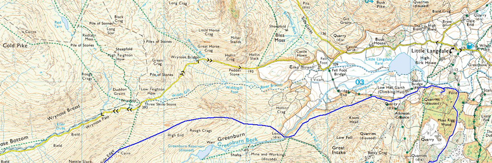
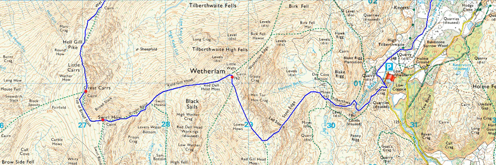
Tilberthwaite – Above Tilberthwaite Gill – Dry Cove Bottom – Steel Edge – Wetherlam – Prison Band – Swirl How – Top Of Broad Slack – Great Carrs – - Wet Side Edge – Greenburn Beck – Slater Bridge (Little Langdale) – Cathedral Quarry – Moss Rigg Wood – Pierce How Beck – Tilberthwaite |
|
| |
|
Map and Photo Gallery |
|
|
  |
| |
| |
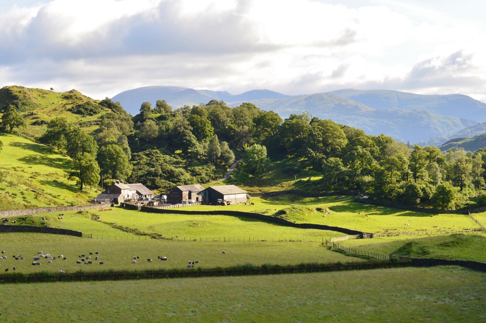 |
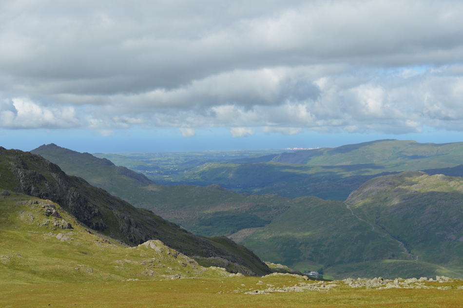
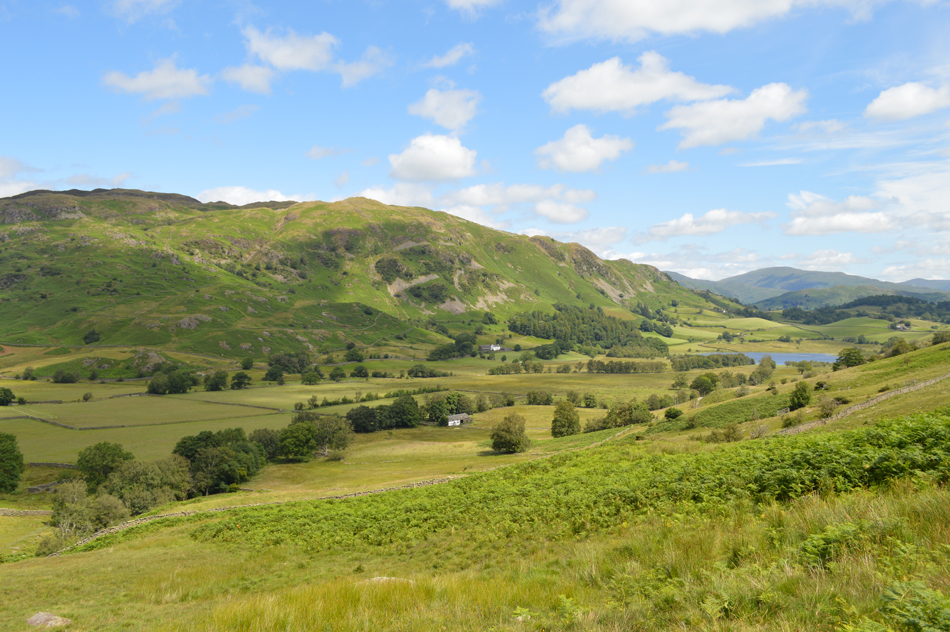
| Looking back on High Tilberthwaite Farm 08:15am 14°C |
Despite having the whole weekend off I took advantage of Sundays brighter forecast and used Saturday as a rest day sleeping in until gone 09:00am which was just the ticket and was just about how much my body clock could take. I used my down time to plan two walks one of which this walk and the other was the Greenburn Round from Grasmere, it was only during the drive north did I realise that I would be circling the Greenburn valley (Little Langdale) did I see the coincidence which just shows how slow my penny drops sometimes. The roads are still wet from yesterdays rain leaving rain water trickling over the tarmac as I drove through Skelwith Bridge towards Yew Tree Tarn and I could see bright sunlight through the branches of the trees overhead which showed real promise. After the steep turn right at the sign posted Tilberthwaite I arrived at the car park which had two large transit type mini buses parked up, their occupants I would pass later on the fell. With my car neatly reversed up against the grass bank I kitted up in just shorts and a short sleeve base-layer leaving my soft-shell tucked under the lid of my pack should I need it later.
With my car locked I'm just about to head over the spoil heaps towards Tilberthwaite Gill when another car arrives and a 'morning nod' is shared through the car window. A series of steps rises over the spoil heaps before the disused levels and quarries are passed which always sparks interest, but I'm keen to get into the open sunshine so I leave the quarries behind as the old mine track begins to rise steadily alongside Tilberthwaite Gill which falls steeply to my right, the sound of which fills my ears. |
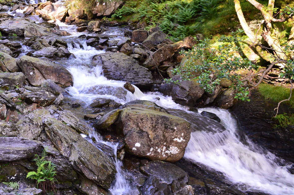 |
| Tilberthwaite Gill. |
The sound of gushing water accompanied my descent down into the Gill which just appeared louder and louder, had I have been with someone else today I'm sure the sound of the water would have drowned out both voices. Sunlight starts to spill through the thick canopy of trees leaving little patches of light along the river bank and to be honest I could have spent a lot more time here than I actually did, it was so tranquil.
After crossing the wooden footbridge a steep path rises back out of the Gill through shoulder height bracken, oh crap, it's still damp so I use my walking poles to give the bracken a brush before I walk through. |
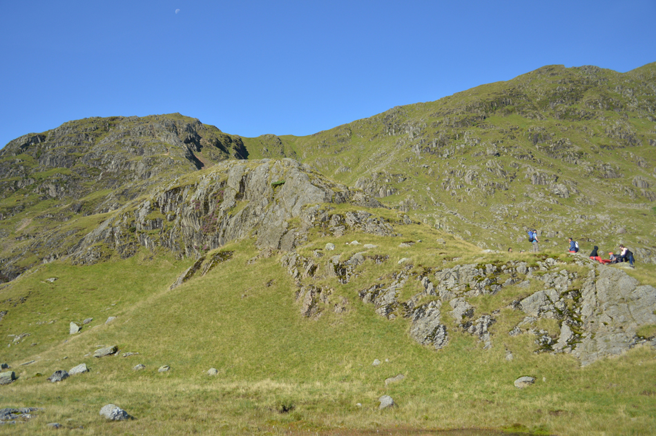 |
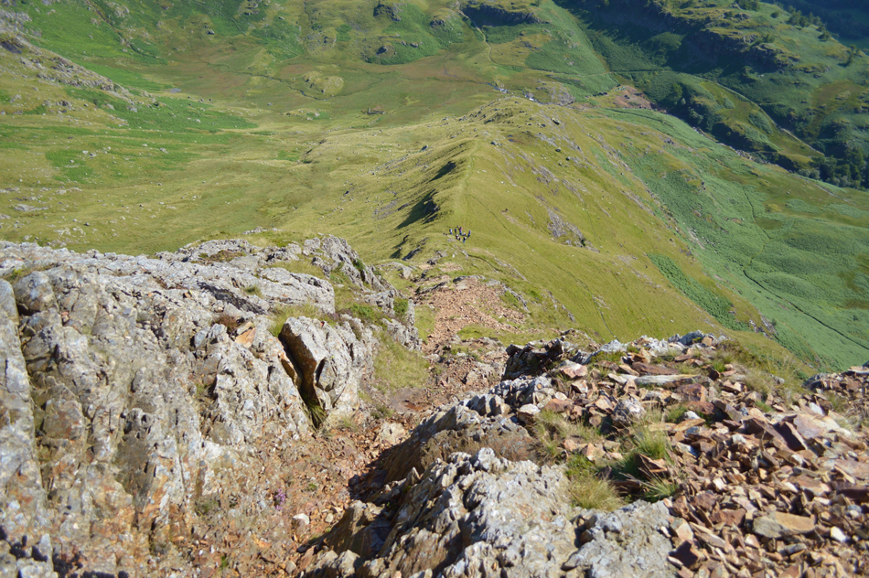
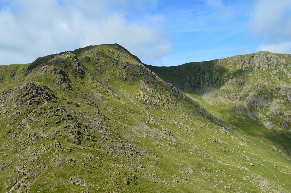
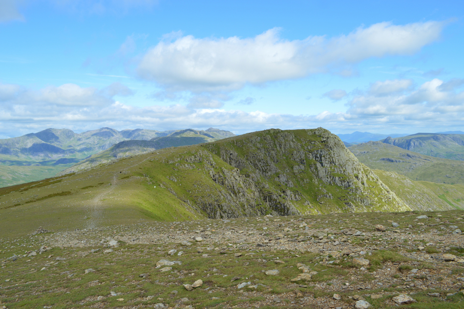
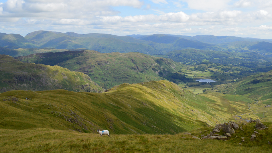
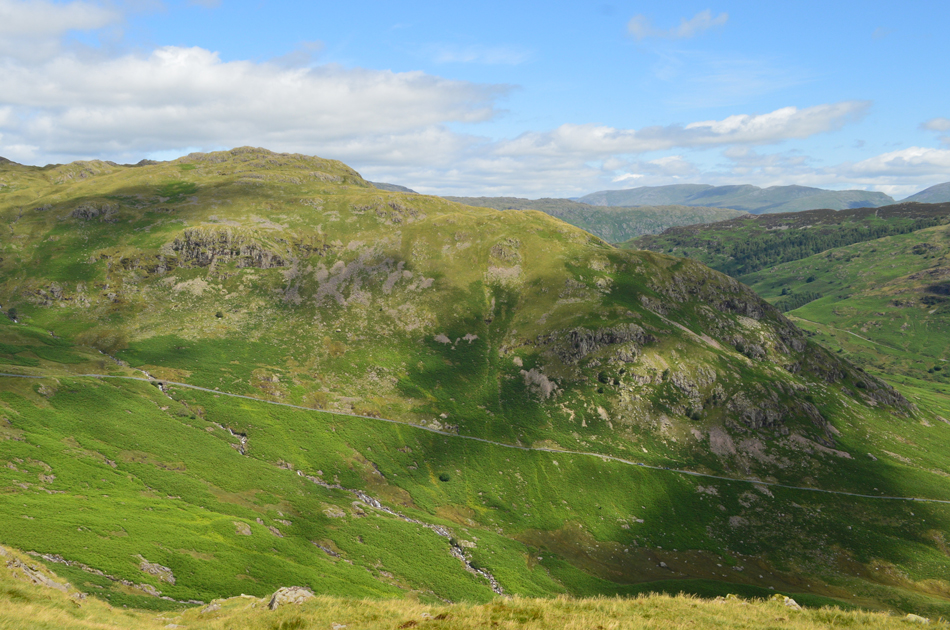
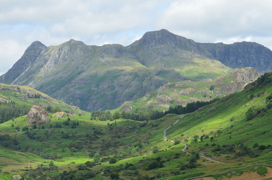
| Steel Edge, Wetherlam. |
I continued to follow the path with Tilberthwaite Gill now on my left flank after crossing the footbridge earlier, I'm especially fond of this high level path which overlooks the Gill, so high in fact the path is almost in line with the tree tops with steep drops back down into the Gill thrown in. Soon the path leads out onto open fell side where I have the option to continue towards Dry Cove Bottom and Wetherlam Edge or ascend slightly over Tilberthwaite Gill once again via narrow wooden footbridge, I cross the Gill as views open out over Steel Edge.
After crossing the footbridge I take in my surroundings spotting a large campsite opposite Penny Rigg and another one behind me below Blake Rigg, now I know why the mini buses are parked back at Tilberthwaite. The group over towards Penny Rigg are putting tents down but the other group are up ahead and are starting to make a ascent on Steel Ridge , I have a good view of their ascent but I'm still quite far behind but I'm hoping I'll be able to close the gap.
I step up my pace which admittedly was difficult ascending the various grassy knolls before the spine of the ridge was met but after a lot of huffing an puffing I pass the group soon after and receive 'mornings' from all of the group members, by which time I could hardly breathe but I daren't show it to the youngsters! |
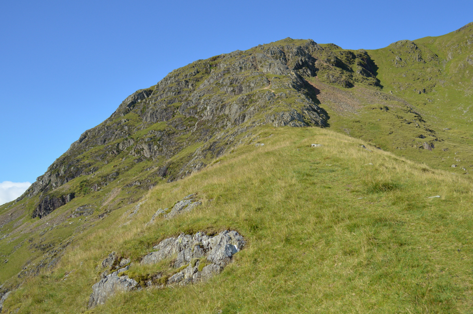 |
| Steel Edge is just up ahead. |
| From the base of Steel Edge a steady grassy ascent over the lower slopes is required before getting into the nitty gritty of the crags up ahead. |
 |
| Stopping to look down on Steel Edge towards Hawk Rigg and Blake Rigg. |
| A rocky path zigzags through the lower half of the ascent before arriving at one of two rock grooves, both of which are easily ascended taking care and time to manoeuvre around the rock which at times was still wet in places. |
 |
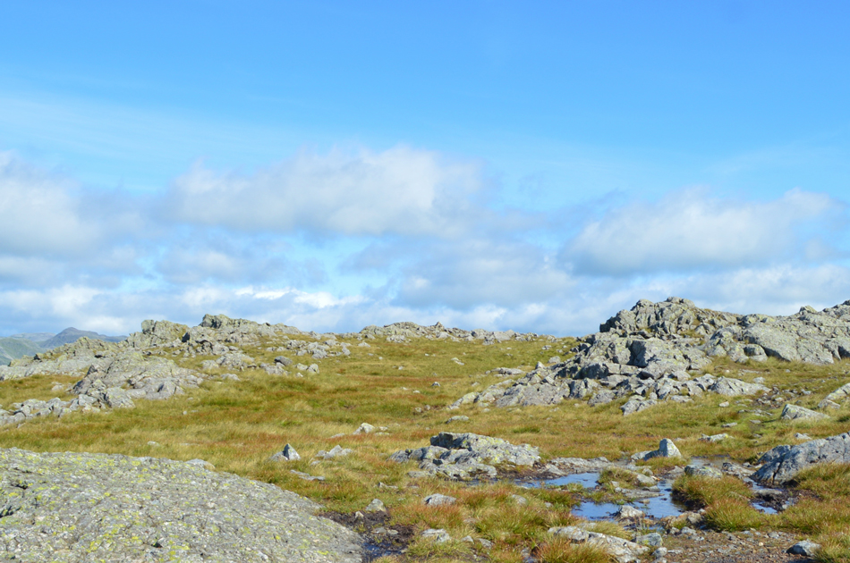
| Views over Dry Cove Bottom towards Wetherlam Edge. |
| |
 |
| Taken from the upper rock grove, not far to go until the shoulder of the ridge is reached. |
| |
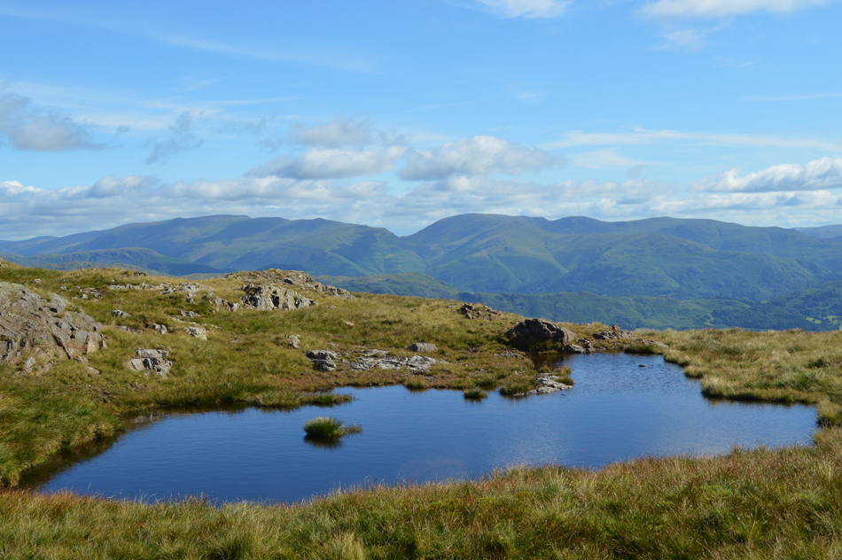 |
| The Helvellyn and Fairfield Groups from the un-named Tarn at the top of Steel Edge. |
| Well, that was an absolutely fantastic ascent and was over way too quickly for my liking. |
 |
| Coniston Old Man, Brim Fell and Raven Tor as I make my way towards Wetherlam summit. |
Despite the glowing sunshine I was ascending into a cool summit breeze, so cool in fact that at times I could see my own breath which was one of those fantastic moments yet the goose bumps over my arms weren't agreeing, I think it's time to add the jacket.
I de-shoudler at the nearest boulder and instantly feel the fresh breeze over the sweat on my back,, it's definitely one of those Marmite moments, you either love it or hate, I love it especially as I'm about to throw another layer on. |
 |
| Views over Wetherlam Edge towards Birk Fell Man. |
| Any cloud that was lingering over the summits soon cleared leaving Helvellyn and its satellite summits completely cloud free, tis a good day to be out on the fell. |
 |
| Wetherlam summit approaches. |
| Despite the numerous summits here at Wetherlam I never fail to feel the excitement of reaching the summit cairn, especially the first one of the day under such clear conditions. |
 |
| Views towards Cold Pike, Great Knott, Crinkle Crags, Bow Fell and Esk Pike from Wetherlam summit. |
| It's still a little patchy overhead but the clearing skies show promise, meanwhile I'll have to put up with the large shadows created by the shifting cloud for now. |
 |
| Swirl How and Great Carrs as I make my way towards Swirl Hawse. |
| |
 |
| Swirl How and Great Carrs. |
| That's more like it, those skies are really starting to clear up now. |
 |
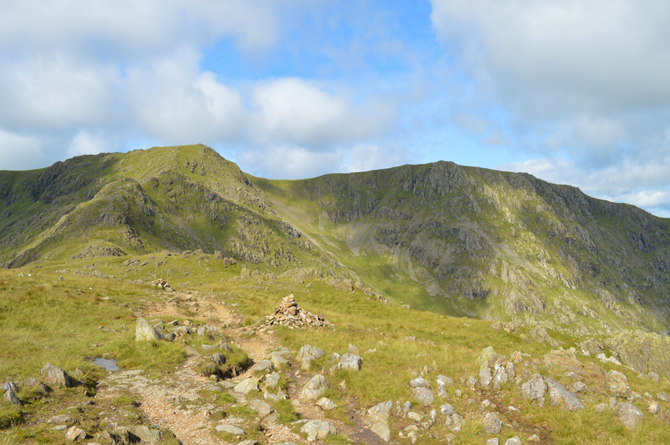
| Prison Band, Swirl How and Great Carrs from Swirl Hawse. |
| Having just passed my first three fell walkers of the day who were heading towards Wetherlam I began my descent towards Swirl Hawse which was when I spotted another large group ascending Prison Band where I must admit the chances of passing them were pretty grim given the head start they had on me, oh well it looks like it's going to be quite busy by the time I get to the summit. |
 |
| Views over Coniston Old Man, Great How Crags, Levers Water, Coniston and a distant Morecambe Bay from Prison Band. |
| |
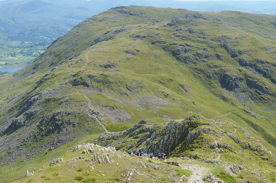 |
| Here looking down on Prison Band towards Black Sails and Wetherlam after passing the large group. |
| I'm now thinking that those two Bananas I had for breakfast this morning must have had some secret rocket fuel in them. |
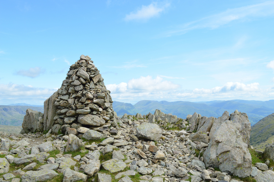 |
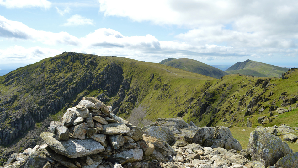
| Swirl How spectacular summit cairn. |
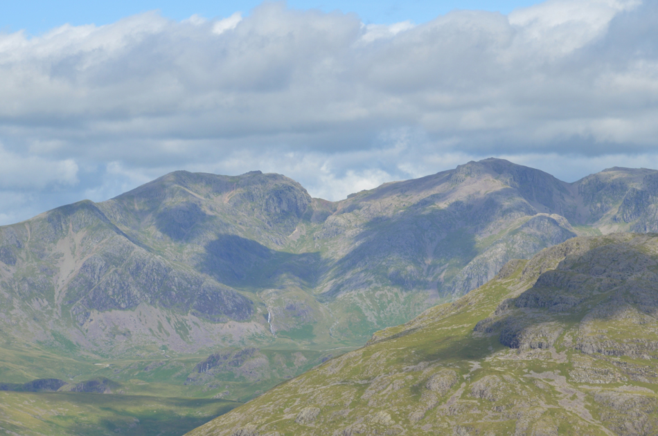
| Which appears to have received some T.L.C since the last time I was here. The cool wind strikes once more but this time I am in favour of it as I take in my surroundings, I reckon I've got a good few minutes before the group behind me catch up, meanwhile the view south towards the Old Man and Dow Crag is completely under shade and for now, so too is Grey Friar. My view north west towards the Scafell Group is for now much the same but the way those clouds are hurrying across the sky I won't have to wait long until the scenery changes. |
 |
| The Scafell Group seen with the Langdale Pikes as I head over the Top of Broad Slack towards Great Carrs summit. |
Well the cloud didn't take long to clear leaving my surrounding summits completely cloud free but those large shadows over the fells remained constant leaving sunbursts like this one over the top of Broad Slack great highlights throughout the walk.
It was now time for a little investigative work as I peer down from the Top of Broad Slack before locating the wreckage of LL505 |
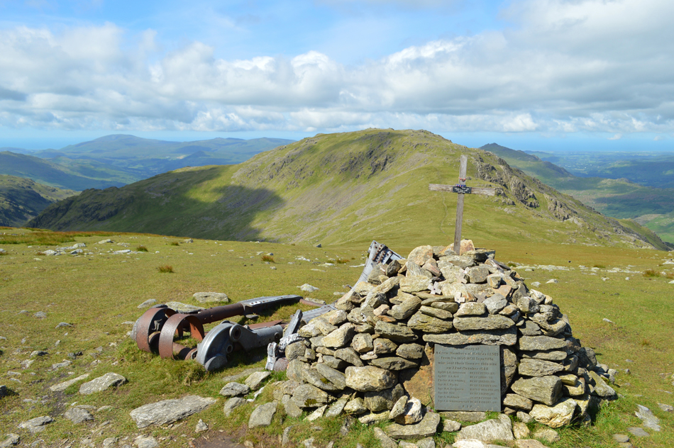 |
| LL505 Codename S for Sugar. |
After leaving Swirl How summit I found my way down to the Memorial of the British Halifax Mk V Bomber which crashed here after hitting the steep crags over Broad Slack during bad weather in October 1944 All eight crew members including seven Canadians and one Scotsman the youngest of which was just nineteen years of age died instantly.
The undercarriage still remains along side the Memorial parts of which still bear the part numbers as clear as if you were looking at them on the shelf whereas one of the Rolls Royce Merlin engines was recovered and remains at the Ruskin Museum in Coniston. |
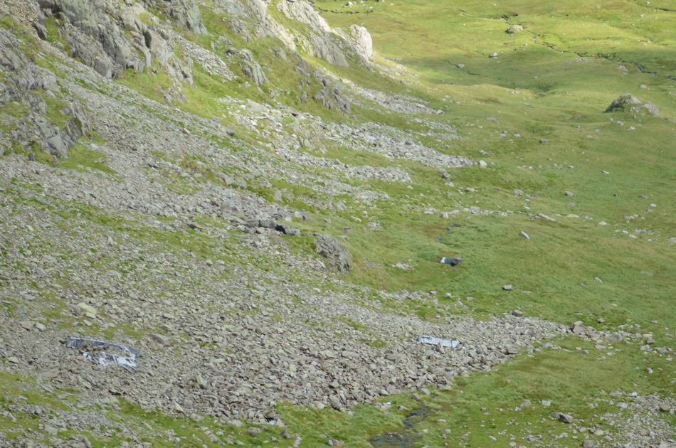 |
| Parts of the wreckage from LL505 can still be seen in Broad Slack. |
| Parts of the wreckage after being stripped of munitions was pushed over the Top of Broad Slack where it remains to this day. I spare a few moments. |
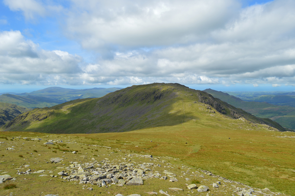 |
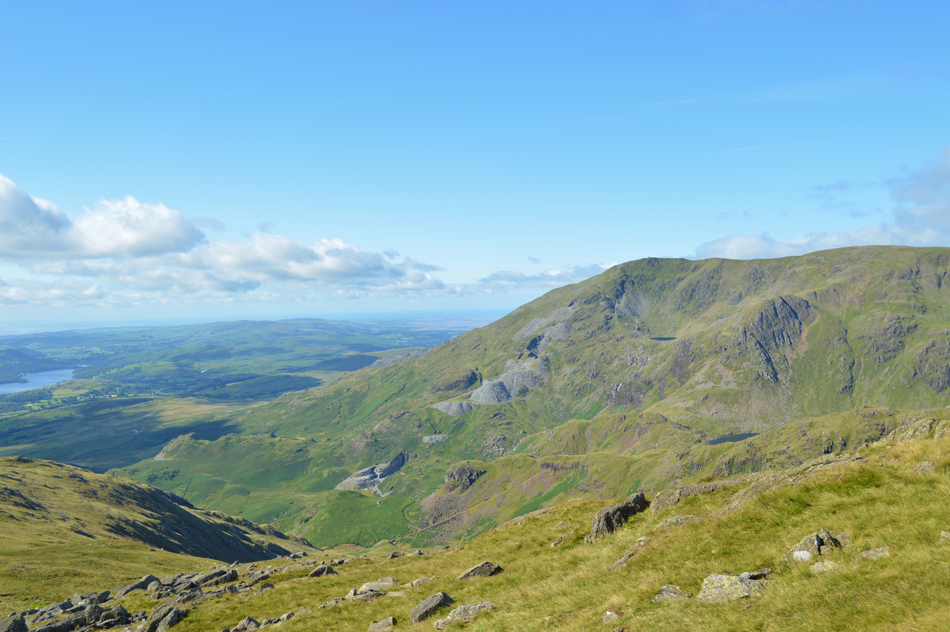
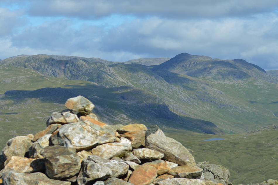
| Grey Friar from the Top of Broad Slack. |
| Grey Friar was the summit too far today but all is not lost as I plan to summit Grey Friar from Eskdale later in the year. |
 |
| Views over the top of Hard Knott Pass with Harter Fell (Eskdale) over on the left and Border End (Hard Knott) over on the right. |
| While further right Whin Rigg and the Irish Sea. |
 |
| Views towards Cam Spout Crag, Sca Fell, Mickledore, Scafell Pike, Broad Crag Col and Broad Crag seen beyond Great Moss and Little Stand. |
| |
 |
| Swirl How, Brim Fell, Coniston Old Man and Dow Crag seen from Great Carrs summit cairn. |
| It really was one of those days when one minute you could be baking in sunshine and the next under complete cloud cover and billowing warm air into cupped fists, is this really July!! |
 |
| Views over Little Stand this time including Cold Pike, Crinkle Crags and Bow Fell. |
| I think it's fair to say that everyone enjoying the fells today are in for a real treat, the light is just fantastic. |
 |
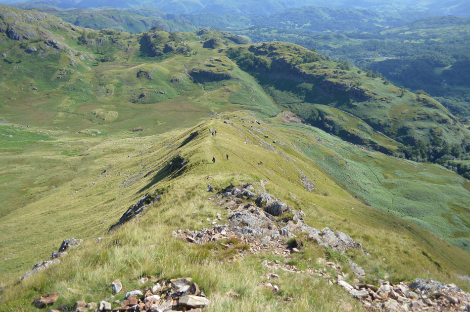
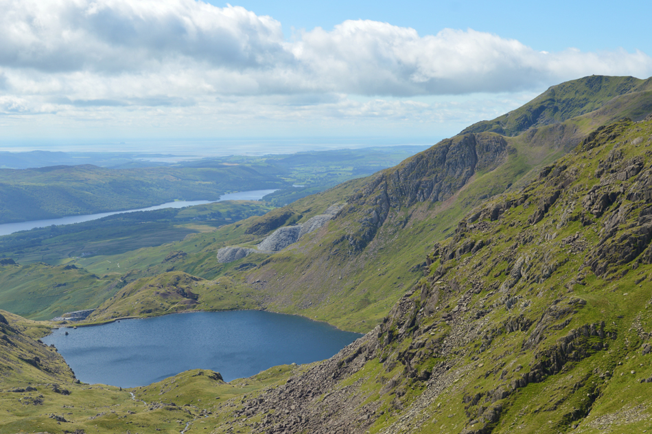
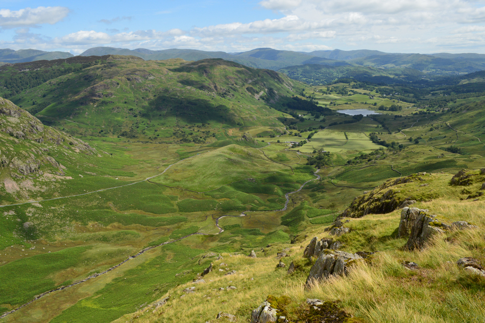
| Wet Side Edge, Lingmoor Fell and Little Langdale Tarn. |
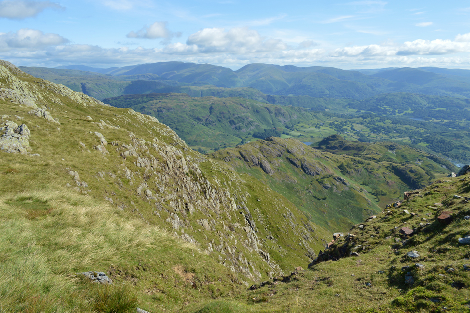
Wet Side Edge was the main reason which persuaded me from the walking Greenburn Horseshoe (Grasmere) today mainly because It's been around three years since I last descended back into Little Langdale and the pull on this particular day just got the better of me.
Incidently that's the Greenburn Valley (Little Langdale) over on the right and not to be confused with the one just outside Grasmere. |
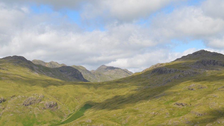 |
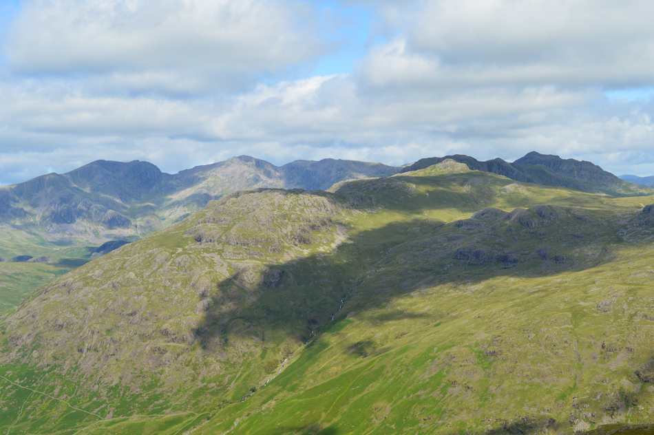
| A classic view over Pike O'Blisco, Cold Pike, Great Knott, Crinkle Crags and Bow Fell from Wet Side Edge. |
| |
 |
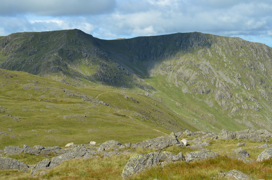
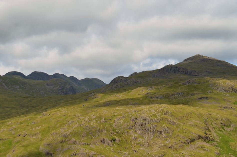
| Looking into Greenburn with Swirl How, Broad Slack and Great Carrs domineering the head of the valley. |
| |
 |
| Pike O'Blisco, Great Knott, Crinkle Crags and Bow Fell from Wet Side Edge. |
| It looks like the sun has gone in again but it won't be for too long. |
 |
| Blake Rigg seen over the Wrynose Pass. |
| It was at this point did I leave the path to have a closer look over Little Langdale. |
 |
| Little Langdale, Lingmoor Fell and Little Langdale Tarn from Wet Side Edge. |
| It was well worth the detour...Im heading for Little Langdale Tarn and Slater Bridge next but before that I must descend Wet Side Edge first and cross Greenburn Beck directly below Great Intake so after time spent ogling the view I made my way back over to the path and started the rather steep descent towards Greenburn Beck soon passing half a dozen walkers all heading up Wet Side Edge, one of whom asked as he wiped his forehead with his sleeve, what's it like up top? a bit fresh "had to wear the jacket" I replied. We parted with enjoy the rest of your day before I crossed Greenburn Beck via the narrow wooden footbridge, feeling quite content I take in the fantastic views over Lingmoor Fell as I head towards Little Langdale Tarn. |
 |
| Lingmoor Fell. |
| What a view! |
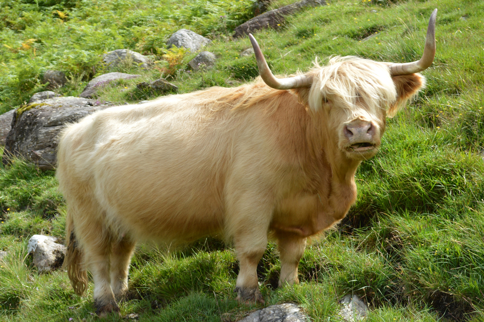 |
| Yellow Highland Cow. |
| Up ahead, a herd of yellow and red Highland Cows graze just away from the path which told me they were probably domesticated and are used to people walking by. |
 |
| Lingmoor Fell seen with Little Langdale Tarn. |
| |
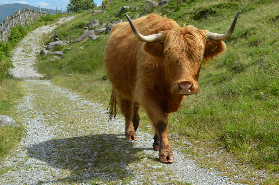 |
| Red Highland Cow |
| Blimey it's a good job they're friendly, what a beast. |
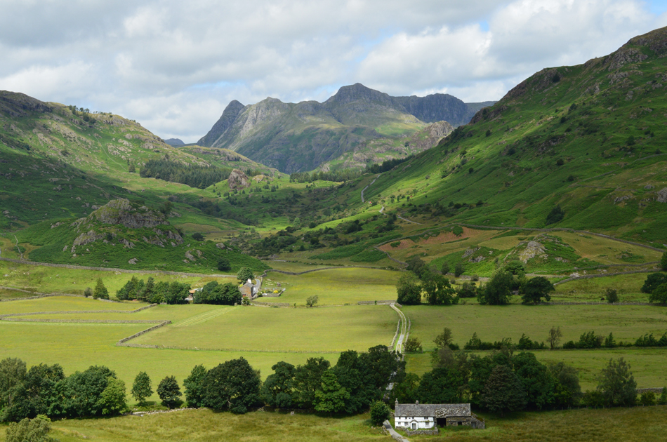 |
| The Langdale Pikes seen over Little Langdale. |
| Such was the fantastic view I couldn't leave with just the one photograph. |
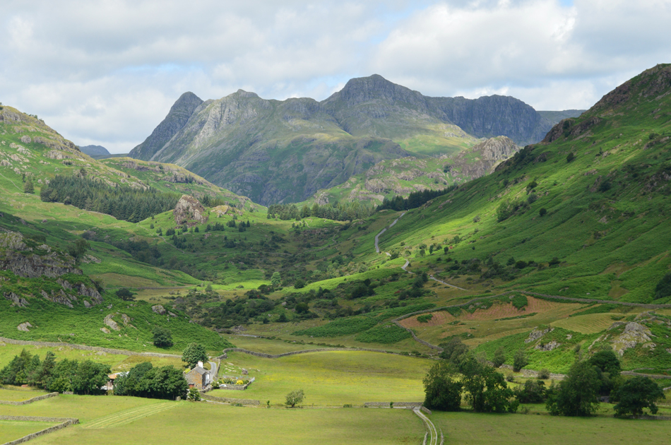 |
| The Langdale Pikes. |
| ...so I picked out. |
 |
| The Langdale Pikes. |
| The best three that I liked. |
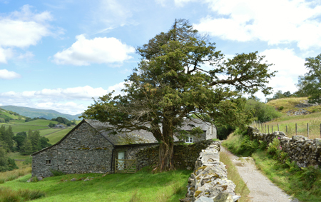 |
High Hallgarth.
The track continues first passing through the picturesque High Hallgarth Farm. |
|
|
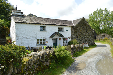 |
Low Hallgarth.
Soon followed by Low Hallgarth which if you look closely you might spot the table where you could buy slices of homemade cake from. |
|
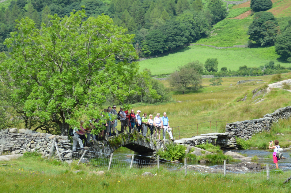 |
| Slater Bridge Little Langdale. |
I had all intentions of stopping at Slater Bridge today but after one large group had left another one was waiting to have their picture taken so I just left them to it.
Next stop Cathedral Cave. |
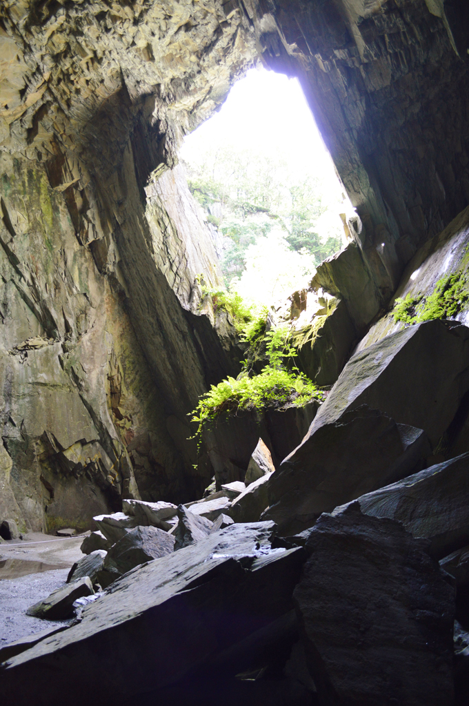 |
| Cathedral Cave. |
Having left Slater Bridge feeling a tad disappointed I next headed for Cathedral Cavern or Cathedral Cave as it is more commonly known, I had to wait to let two or three bikes ride through the tunnel and I am thanked by each rider even though they had to duck so low it might have been easier just to walk the bikes out. Inside the cavern I get lucky and soon realise that I now had the place to myself.
Spooky. |
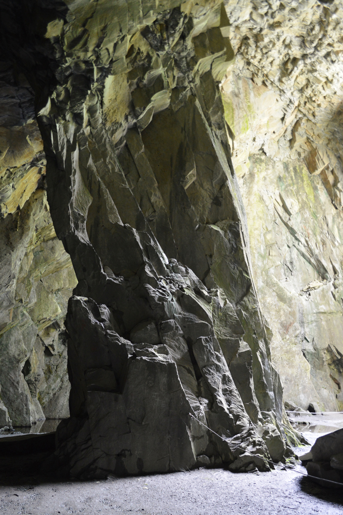 |
| Cathedral Cave. |
| The main attraction besides the huge gaping opening on the far side of the cavern is this stand alone central slate pillar, it's a truly magnificent sight when captured in the right light. |
 |
| Moss Rigg Wood. |
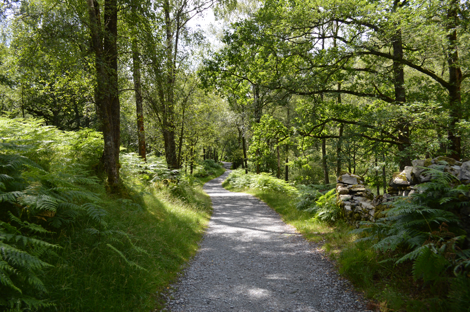
After spending time back at Cathedral Cave I picked up the track again soon arriving at large wooden bridge where young children splash in the water while mothers read on the river bank. Here the path heads through Moss Rigg Wood which will eventually lead me back to Tilberthwaite not before passing more and more families all enjoying the sunshine before I realise hang on, I haven't had my lunch yet, well that's a first my stomach's alarm clock must be on the blink.
I arrive back at Tilberthwaite after passing through the High Tilberthwaite Farm where a herd of just sheared sheep graze under a hot afternoon sun. Further up the lane the quiet car park that I had left this morning is starting to look like Tesco on a Saturday afternoon but I hatch up a plan in order to avoid all of this by first throwing my gear into the back of my car before breaking out lunch under a canopy of trees as Yewdale Beck trickles by beneath my feet. |
|
| |
| Back to top |
 |
|
