|
Causey Pike |
 |
 |
Map and Photo Gallery |
 |
|
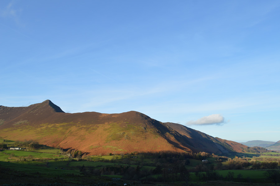 |
| Causey Pike and Rowling End from Newlands. |
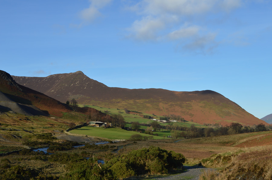 |
| Causey Pike above Newlands. |
 |
| Causey Pike is ahead soon after descending Scar Crags. |
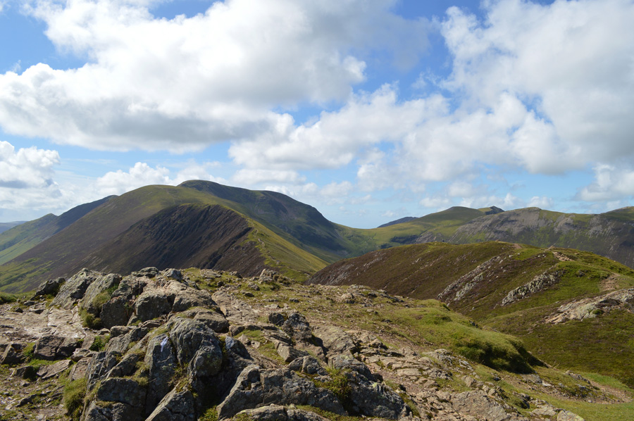 |
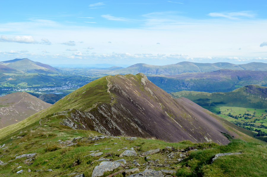
| Looking back on Scar Crags, Sail, Eel Crag, Coledale Hause and Hopegill Head from Causey Pike summit. |
|
| |
|
There are 8 walks to choose from including Causey Pike |
|
|
Stonycroft Gill Round |
|
|
 |
|
14th January 2024 |
| ASCENT: |
2,211 Feet - 673 Metres |
| MILES: |
5.5 |
| WAINWRIGHTS: |
3, Causey Pike - Outerside - Barrow |
| ROUTE: |
Stair - Rowling End - Sleet Hause - Causey Pike - High Moss - Outerside - Low Moss - Stile End - Barrow Door - Barrow - Newlands Pass - Stair |
|
| |
|
The Coledale Horseshoe |
|
|
|
|
11th August 2022 |
| ASCENT: |
4,538 Feet - 1,384 Metres |
| MILES: |
11 |
| WAINWRIGHTS: |
9, Grisedale Pike - Hopegill Head - Wandope - Eel Crag (Crag Hill) - Sail - Scar Crags - Causey Pike - Outerside - Barrow |
| ROUTE: |
Whinlatter Pass - Kinn - Sleet How - Grisedale Pike - Hobcarton Head - Hopegill Head - Sand Hill - Coledale Hause - Wandope Moss - Wandope - Eel Crag (Crag Hill) - The Scar - Sail - Scar Crags - Causey Pike - High Moss - Outerside - Barrow Door - Barrow - Braithwaite Lodge - Braithwaite - Whinlatter Pass |
|
| |
|
Ard Crags to Barrow via Rigg Beck |
|
|
|
|
18th November 2017 |
| ASCENT: |
2,980 Feet - 884 Metres |
| MILES: |
8.4 |
| WAINWRIGHTS: |
5, Ard Crags - Scar Crags - Causey Pike - Outerside - Barrow |
| ROUTE: |
Newlands Valley - Rigg Beck - Birk Rigg - Ard Crags - Rigg Beck - Scar Crags - Causey Pike - High Moss - Outerside - Low Moss - Stile End - Barrow Door - Barrow - Newlands Valley |
|
| |
|
Walking the Wainwrights in 30 Walks - Walk 29 Rannerdale Knotts to Barrow |
|
|
|
|
27th August 2016 |
| ASCENT: |
5,898 Feet - 1,798 Meters |
| MILES: |
15.9 |
| WAINWRIGHTS: |
13, Rannerdale Knotts - Whiteless Pike - Wandope - Grasmoor - Whiteside - Hopegill Head - Grisedale Pike - Eel Crag (Crag Hill) - Sail - Scar Crags - Causey Pike - Outerside - Barrow |
| ROUTE: |
Rannerdale Farm - Rannerdale Knotts - Whiteless Breast - Whiteless Pike - Whiteless Edge - Wandope - Grasmoor - Coledale Hause - Sand Hill - Whiteside - Hopegill Head - Grisedale Pike - Coledale Hause - Eel Crag (Crag Hill) - Sail - Scar Crags - Causey Pike - High Moss - Outerside - Barrow Door - Barrow - Braithwaite |
|
| |
|
The Harry Griffin 2,000 footers Walk 23 -Around Coledale Hause |
|
|
|
|
15th August 2015 |
| ASCENT: |
5,493 Feet - 1,675 |
| MILES: |
15 |
| SUMMITS OVER 2'000Ft: |
13, Grisedale Pike - Grisedale Pike (NY 139 221) - Hopegill Head - Ladyside Pike - Whiteside - Sand Hill - Grasmoor - Whiteless Pike - Wandope - Eel Crag (Crag Hill) - Sail - Scar Crags - Causey Pike |
| ROUTE: |
Whinlatter Pass – Kin – Sleet How – Grisedale Pike – Hobcarton Crag – Hopegill Head - Ladyside Pike - Whitleside - Traverse below Hopegill Head – Sand Hill – Grasmoor North East Ridge - Grasmoor - Thirdgill Head Man - Whiteless Edge - Whiteless Pike - Whiteless Edge - Wandope – Eel Crag (Crag Hill) – Sail – Scar Crags – Causey Pike – High Moss – Barrow Door – High Coledale – Braithwaite – Whinlatter Pass |
|
| |
|
A Coledale Round |
|
|
|
|
8th June 2014 |
| ASCENT: |
4,200 Feet – 1,280 Meters |
| MILES: |
10.1 |
| WAINWRIGHTS: |
7, Grisedale Pike – Hopegill Head – Wandope – Eel Crag (Crag Hill) – Sail – Sail Pass – Scar Crags – Causey Pike |
| ROUTE: |
Whinlatter Pass – Kin – Sleet How – Grisedale Pike – Hobcarton Crag – Hopegill Head – Sand Hill – Wandope – Eel Crag (Crag Hill) – Sail – Scar Crags – Causey Pike – High Moss – Barrow Door – High Coledale – Braithwaite – Whinlatter Pass |
|
| |
|
The Coledale Horseshoe |
|
|
|
|
6th November 2011 |
| ASCENT: |
4,200 Feet, 1,280 Meters |
| MILES: |
11.5 |
| WAINWRIGHTS: |
8, Grisedale Pike, Hopegill Head, Grasmore, Wandope, Eel Crag (Crag Hill) Sail, Scar Crags, Causey Pike |
| ROUTE: |
Braithwaite, Kin, Sleet How, Grisedale Pike, Hopegill Head, Coledale Hause, Grasmore, Wandope, Eel Cragl (Crag Hill), Sail, Scar Crags, Causey Pike, Rowling End, Uzzicar, Braithwaite |
|
| |
|
Causey Pike |
|
|
|
|
7th May 2009 |
| ASCENT: |
637Mtrs 2089Ft |
| MILES: |
xxx |
| WAINWRIGHTS: |
1, Causy Pike |
| ROUTE: |
xxxx |
|
| |
| Back to top |
 |
|