 |
Catstye Cam |
 |
 |
Map and Photo Gallery |
 |
|
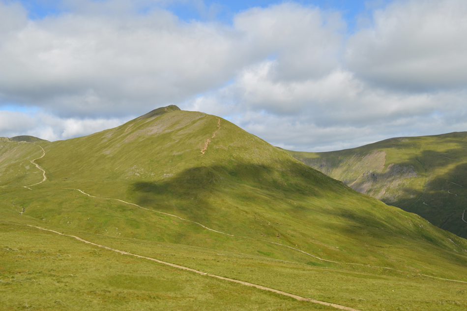 |
| Catstye Cam from Hole-in-the-Wall. |
 |
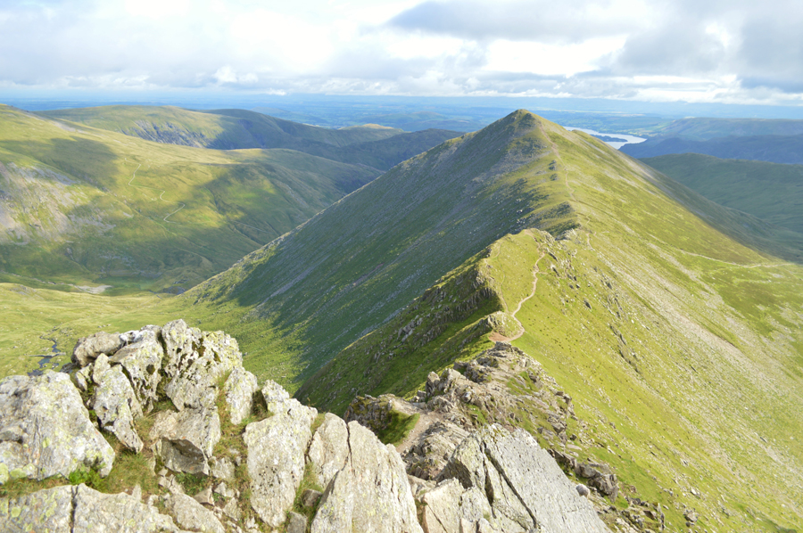
| Catstye Cam from the top of Swirral Edge. |
 |
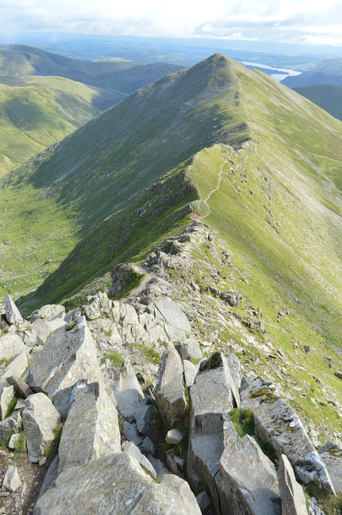
| Catstye Cam from Swirral Edge. |
 |
| Catstye Cam from the col between Swirral Edge. |
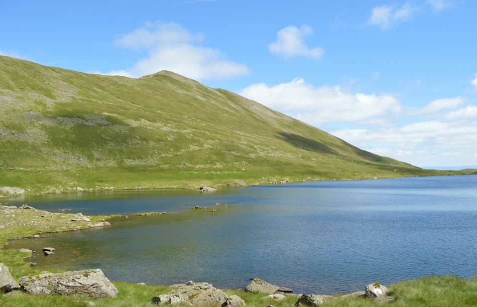 |
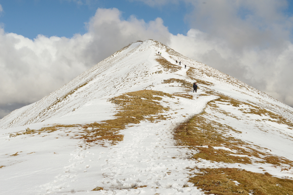
| Catstye Cam from Red Tarn (Helvellyn) |
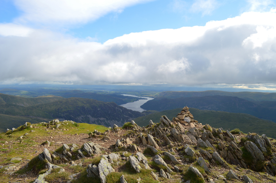 |
| Ullswater from Catstye Cam summit. |
|
| |
|
There are 11 walks to choose from including Caststye Cam |
|
|
Glenridding Circuit |
|
|
 |
|
6th June 2025 |
| ASCENT: |
4,293 Feet - 1,308 Metres |
| MILES: |
12 |
| WAINWRIGHTS: |
9, Birkhouse Moor - Catstye Cam - Helvellyn - White Side - Raise - Stybarrow Dodd - Hart Side - Sheffield Pike - Glenridding Dodd |
| ROUTE: |
Glenridding - Rattlebeck Bridge - Mires Beck - Birkhouse Moor - Red Tarn - Catstye Cam - Swirrel Edge - Helvellyn - Helvellyn Lower Man - White Side - Raise - Top of Sticks Pass - Stybarrow Dodd - White Stones - Hart Side - Glencoyne Head - Nick Head - Sheffield Pike - Glenridding Dodd - The Rake - Greenside Road - Glenridding |
|
| |
|
Catstye Cam from Glenridding |
|
|
|
|
11th March 2023 |
| ASCENT: |
2,560 Feet - 780 - Metres |
| MILES: |
7.5 |
| WAINWRIGHTS: |
2, Birkhouse Moor - Catstye Cam |
| ROUTE: |
Stybarrow Crag - Glenridding - Rattlebeck Bridge - Mires Beck - Birkhouse Moor - Red Tarn - Catstye Cam - Red Tarn Beck - Greenside Mine - Greenside Road - Stybarrow Crag |
|
| |
|
Catstye Cam from Glenridding |
|
|
|
|
3rd March 2020 |
| ASCENT: |
2,496 Feet - 761 -Metres |
| MILES: |
6.5 |
| WAINWRIGHTS: |
2, Birkhouse Moor - Catstye Cam |
| ROUTE: |
Glenridding - Rattlebeck Bridge - Mires Beck - Birkhouse Moor - Red Tarn - Catstye Cam - Red Tarn Beck - Rattlebeck Bridge - Glenridding |
|
| |
|
Catstye Cam from Glenridding |
|
|
|
|
31st January 2019 |
| ASCENT: |
2,496 Feet - 761 -Metres |
| MILES: |
6.5 |
| WAINWRIGHTS: |
2, Birkhouse Moor - Catstye Cam |
| ROUTE: |
Glenridding - Rattlebeck Bridge - Mires Beck - Birkhouse Moor - Red Tarn - Catstye Cam - Red Tarn Beck - Greenside Road - Glenridding |
|
| |
|
Walking the Birketts, Helvellyn by Striding Edge (HEL2) |
|
|
|
|
5th September 2019 |
| ASCENT: |
3,000 Feet - 915 Metres |
| MILES: |
7.5 |
| BIRKETTS: |
3, Birkhouse Moor - Helvellyn - Catstye Cam |
| ROUTE: |
Glenridding - Mires Beck - Hole-in-the-Wall - Striding Edge - Helvellyn - Swirral Edge - Catstye Cam - Red Tarn Beck - Glenridding Beck - Greenside Road - Glenridding |
|
| |
|
Catstye Cam North West Ridge from Glenridding |
|
|
|
|
4th March 2017 |
| ASCENT: |
3,250 Feet - 992 Metres |
| MILES: |
8 |
| WAINWRIGHTS: |
2, Catstye Cam - Birkhouse Moor |
| ROUTE: |
Glenridding – Blea Cove on Birkhouse Moor – Keppel Cove – Brown Cove – Catstye Cam North West Ridge – Red Tarn – Birkhouse Moor – Miresbeck - Little Cove – Glenridding |
|
| |
|
Walking the Wainwrights in 30 Walks - Walk 25 A Grisedale Horseshoe |
|
|
|
|
30th July 2016 |
| ASCENT: |
4,879 Feet - 1,488 Meters
|
| MILES: |
13.1 |
| WAINWRIGHTS: |
9, Birkhouse Moor - Catstye Cam - Helvellyn - Nethermost Pike - Dollywagon Pike - Seat Sandal - St Sunday Crag - Birks - Arnison Crag |
| ROUTE: |
Glenridding – Mires Beck - Birkhouse Moor – Red Tarn - Catstye Cam - Swirral Edge – Helvellyn - Nethermost Pike - High Crag - Dollywagon Pike - Seat Sandal - Grisedale Hause - Deepdale Hause - St Sunday Crag - Birks - Trough Head - Arnison Crag - Grisedale Bridge – Glenridding |
|
| |
|
The Harry Griffin 2,000 footers Walk 18 -Helvellyn Days |
|
|
|
|
27th June 2015 |
| ASCENT: |
6,468 Feet 1,972 Metres |
| MILES: |
16.2 |
| SUMMITS OVER 2,000 Ft: |
15, Birkhouse Moor (NY 365 163) - Birkhouse Moor (NY 363 159) - Birkhouse Moor (NY 361 158) Birkhouse Moor (NY 360 157) - Helvellyn - Catstye Cam - Helvellyn Lower Man - White Side - Raise - Nethermost Pike - High Crag - Dollywagon Pike - Seat Sandal - St Sunday Crag - Gavel Pike |
| ROUTE: |
Patterdale - Glenridding - Birkhouse Moor North East Ridge - Hole-in-the-Wall - Striding Edge - Helvellyn - Swirral Edge - Catstye Cam - Swirral Edge - Helvellyn Lower Man - White Side - Raise - White Side - Helvellyn Lower Man - Helvellyn - Nethermost Pike - High Crag - Dollywagon Pike - Seat Sandal - Grisedale Tarn - Deepdale Hause - St Sunday Crag - Gavel Pike - Thornhow End - Grisedale Lane - Patterdale |
|
| |
|
Catstye Cam north west ridge, Swirral Edge and Hard Tarn |
|
|
|
|
30th May 2015 |
| ASCENT: |
4,500 Feet - 1,373 Metres |
| MILES: |
12.6 |
| WAINWRIGHTS: |
4, Catstye Cam - Helvellyn - Nethermost Pike - Dollywagon Pike |
| ROUTE: |
Glenridding - Greenside Road - Glenridding Beck - Brown Cove- Brown Cove Tarn - Catstye Cam north west ridge - Catstye Cam - Red Tarn - Swirral Edge - Helvellyn - Nethermost Pike - Dollywagon Pike - The Tongue - Ruthwaite Cove - Hard Tarn - Nethermost Cove - Nethermost Beck - Grisedale - Lanty's Tarn - Glenridding |
|
| |
|
Catstye Cam via the North West Ridge |
|
|
|
|
4th May 2013 |
| ASCENT: |
3,678 Feet, 1,121 Metres |
| MILES: |
9.8 |
| WAINWRIGHTS: |
6, Catstye Cam – Helvellyn – White Side – Raise – Sheffield Pike – Glenridding Dodd |
| ROUTE: |
Stybarrow Crag – Lake Path – Greenside Road – Greenside Mine – Glenridding Beck – Keppel Cove Dam – Catstye Cam North West Ridge – Catstye Cam – Swirral Edge – Helvellyn – Helvellyn Lower Man – White Side – Raise – Sticks Pass – Green Side – Nick Head – Sheffield Pike – Heron Pike – South East Ridge – Glenridding Dodd – Stybarrow Crag |
|
| |
|
Making It Up On The Eastern Fells |
|
|
|
|
9th May 2010 |
| ASCENT: |
3,118Ft 950 Mtrs |
| MILES: |
11.8 |
| WAINWRIGHTS: |
7, Catstye Cam, Helvellyn, Nethermost Pike, Helvellyn(Lower Man), Whiteside, Raise, Stybarrow Dodd |
| ROUTE: |
|
|
| |
| Back to top |
 |
|

