|
Catstye Cam north west ridge, Swirral Edge and Hard Tarn |
 |
 |
30th May 2015 |
 |
|
I can remember the exact moment David told me he was planning on visiting all of the Lake District Tarns, we were taking advantage of a weather window during early November keeping low below the cloud whilst on an ascent on Gowbarrow Fell. Even though David would only plan to start his Tarns challenge in January 2015 he had already drafted up much of the routes that he had planned to take.
During that blustery morning David mentioned to me amongst others this route which although only collects a relatively small number of Tarns, to reach them in their respective orders would command a fine day on the Helvellyn ridge which would also take in exploration of Ruthwaite Cove, a place many among us peer over but never really venture into, this walk would change all that.
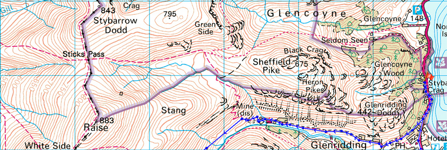
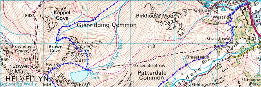
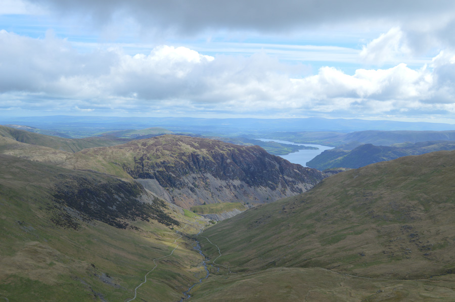
Today's route would see us start from just outside Glenridding before heading up the Greenside Road where grand views would open up over Birkhouse Moor and Catstye Cam north east ridge, but before the steep climb David's first Tarn would be collected in Brown Cove, once at the summit of Catstye Cam most of our high level route over the Helvellyn range can be viewed but not before a visit to Red Tarn, then an ascent on the Helvellyn via Swirral Edge.
From Helvellyn summit we only had two more summits to visit in Nethermost Pike and Dollywagon Pike before our descent into Ruthwaite Cove via The Tongue, from where after negotiations on how to best reach Hard Tarn we would then cross Nethermost Pike's east ridge into Nethermost Cove which which we all took as a highlight from the day. From Nethermost Cove David's last Tarn is a three and half mile trek through the valley of Grisedale where we were met by a warm afternoon sun.
Last week I passed my half way mark within my own project of completing the Lakeland two thousand foot summits, David was anxious about breaking my routine once I was in the flow of things, six months has almost passed since that November day as myself Rod and David can now look back on as one of those most 'memorable walks of 2015' |
|
| Wainwright Guidebook Two |
 |
| The Eastern Fells |
Walkers with red blood in their veins should give their attention to the north west ridge. This looks formidable (from White Side it looks impossible) but is actually an easy uphill walk without any difficulty other than steepness. The finish is delightful, the cairn remaining hidden until the last moment. The best approach to the ridge is by the bridle path as far as the dam; cross the beck here and slant along a natural terrace to the base of the ridge. |
 |
|
|
| |
|
Overview |
|
|
| Ascent: |
4,500 Feet - 1,373 Metres |
| Wainwrights: |
4, Catstye Cam - Helvellyn - Nethermost Pike - Dollywaggon Pike |
| Weather: |
Overcast with sunny intervals. Brisk over the summits, Highs of 14°C Lows of 5°C |
| Parking: |
Parking spaces, Stybarrow Crag |
| Area: |
Eastern |
| Miles: |
12.6 |
| Walking With: |
David Hall and Rod Hepplewhite |
| Ordnance Survey: |
OL5 |
| Time Taken: |
8 Hours |
| Route: |
Glenridding - Greenside Road - Glenridding Beck - Brown Cove- Brown Cove Tarn - Catstye Cam north west ridge - Catstye Cam - Red Tarn - Swirral Edge - Helvellyn - Nethermost Pike - Dollywaggon Pike - The Tongue - Ruthwaite Cove - Hard Tarn - Nethermost Cove - Nethermost Beck - Grisedale - Lanty's Tarn - Glenridding |
|
| |
|
Map and Photo Gallery |
|
|
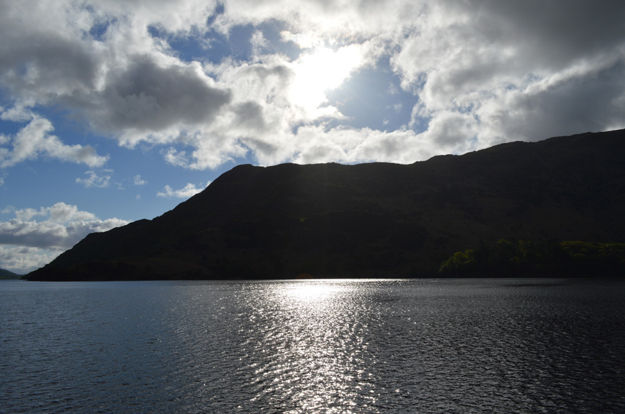 |
| Birk Fell silhouettes from Stybarrow Crag 07:45am 5°C |
Our starting point today would be the car park found on the shores of Ullswater at Stybarrow Crag, a large free car park that can fill up relatively quickly, more so during the summer months. David and Rod were already there by the time I arrived even though we had arranged to meet at 08:00 we were all a good ten or fifteen minutes early. Rod was glancing over a map with a young fellow who had a mountain bike in the back of his camper van who wanted to get up on the Helvellyn ridge but didn't know the best way of doing it, Rod advised him that seeing he was biking it in Rod's own opinion he was best to start from High Row and pick up the Coach Road, then, off the guy went.
By which time the three of us were almost ready, after a few photos from our starting point we were soon on our way. Both David and Rod had packed for summer and were wearing shorts, I however chose not to after reading the forecast of cool winds once at the summits, however I must say we needn't of been any higher than the shores of Ullswater to feel just how chilly it was, none of us said nowt but I'm sure we were all thinking it. |
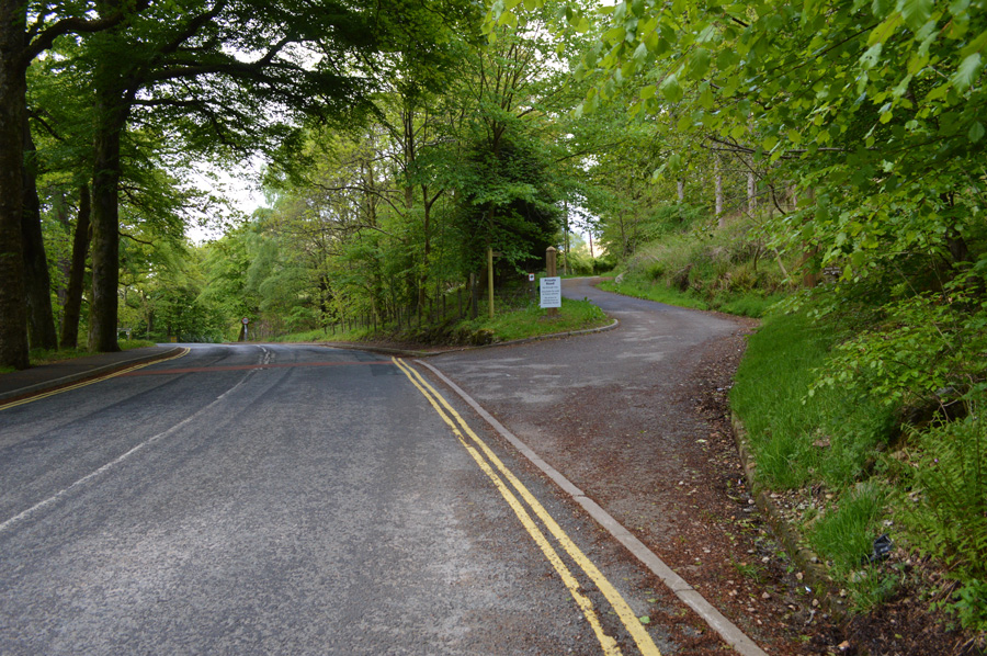 |
| Leaving the A592 for the Greenside Road. |
| Before arriving at the crossing for Greenside Road we would follow the Lake path for a short while due to there being no pavement on either side of the road, this would only take us the best part of five minutes which also gave us the chance to take in the Lakeside scenery as we caught up in chat. |
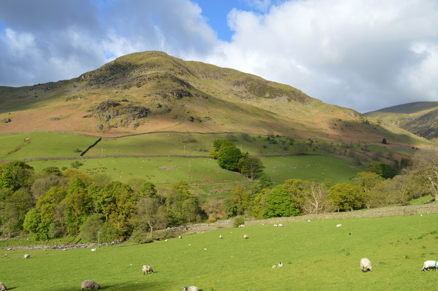 |
| Birkhouse Moor north and east ridges. |
| From Greenside Road both the north and east ridges of Birkhouse Moor can be seen, it was here I take time out to decifer a future route up the east ridge seen left - as this marks the start of a challenging day on the Hellvellyn fells within my Harry Griffin project, walking away satisifed that I have found my route we head up towards Greenside Mines. |
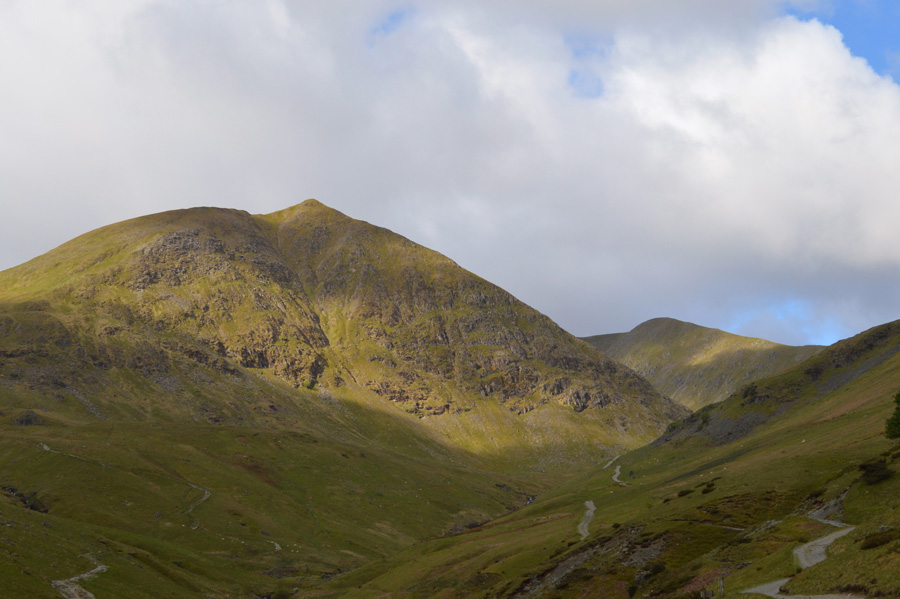 |
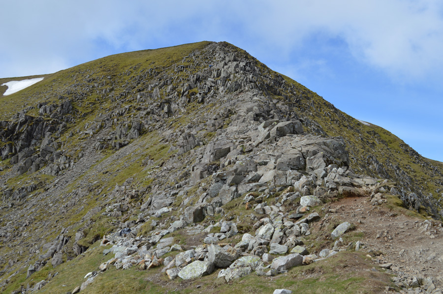
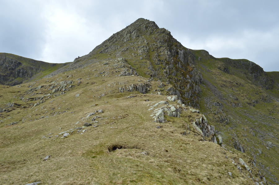
| Catstye Cam and Catstye Cam north east ridge seen with Helvellyn Lower Man. |
| After passing Greenside Mines we follow the sign posted Keppel Cove as we follow the course of Glenridding Beck, to our left and on the other side of Glenridding Beck is the Red Tarn approach path for Catstye Cam. |
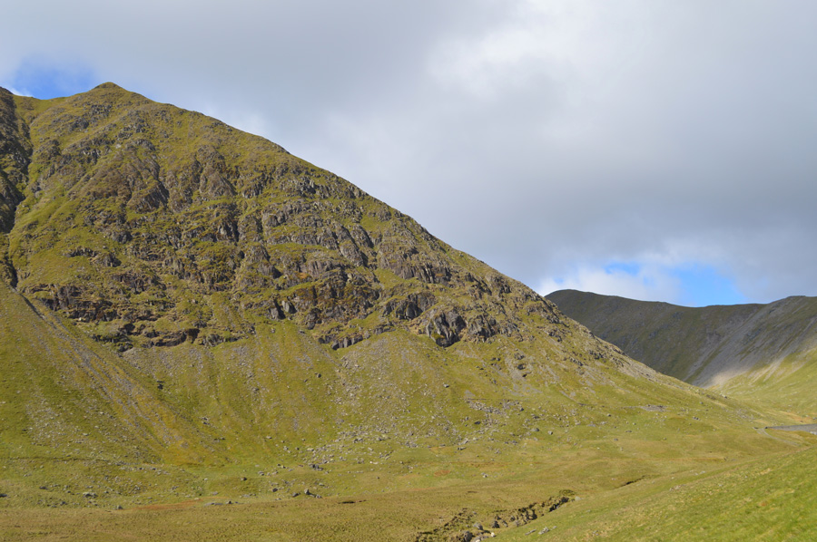 |
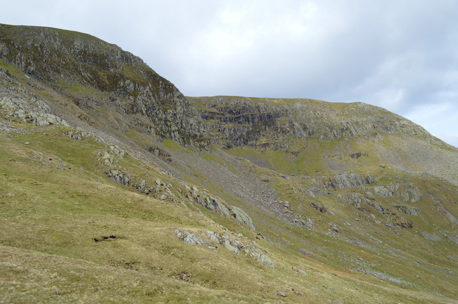
| Catstye Cam north east ridge. |
| It's only my second visit to climb Catstye Cam via the north east ridge and I must say that the last time I was here visibility was down and my view of the north east ridge was almost down to nothing, today however I have the full glory of what awaits, which, I'm not sure is a good or a bad thing! |
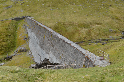 |
| Keppel Cove Dam built in 1860 |
|
Breached during a fierce storm on 29th October 1927
The resulting wave flooded the village of Glenridding damaging buildings causing extensive damage. |
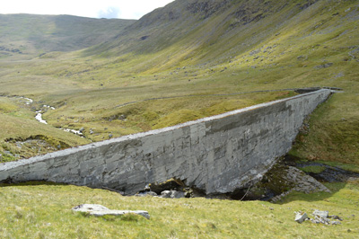 |
| As part of the Greenside Hydro Electric Scheme. |
|
 |
| Heading for Brown Cove. |
| We first flank Keppel Cove and Catstye Cam north east ridge before rising steadily towards Brown Cove where David will collect his first Tarn of the walk in Brown Cove Tarn,. From here we get a good view of the route up the north east ridge, however as we will only be joining the main path around a quarter of the way up we also get a good feel for the lay of the land from the Brown Cove side. |
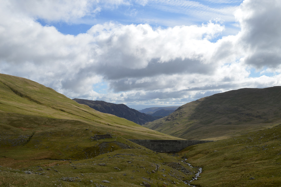 |
| Here, looking back on Keppel Cove Dam with views towards Birkhouse Moor and Shefield Pike. |
| |
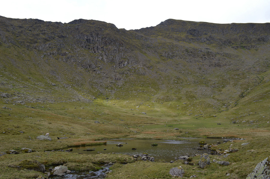 |
| Brown Cove and Brown Cove Tarn. |
| We soon reached Brown Cove Tarn under the watchful eye of the north east ridge. Brown Cove Tarn is made up of two Tarns with a substantial Stone Dam unlike the concrete Dam found a little lower down at Keppel Cove. It was whilst here in Brown Cove did we get a real feel at just how cold the wind was as it blew in from over the top of Brown Cove, needless to say it certainly didn't feel like the end of May by a long shot, so much so Rod and David added gloves, me, I was my own usual stubborn self as I thought I'd wait a while longer safe in the knowledge that we was bound to work up a sweat on the steep ascent on the north east ridge. |
 |
| Looking down Catstye Cam north east ridge. |
We had eyed up our route from Brown Cove Tarn all agreeing that we would join the main path sometime later during the ascent which worked out well. Despite the ascent being devilishly steep we hit the ascent hard making good time over the steep ground, by the time we had found the path our ascent seemed to move much quicker as we zig zagged our way up the ridge. Rod would soon gain ground on myself and David as we would stop to take photos. Further ahead Rod would stop below the only false summit and waited for myself and David to catch up, it was no use though I was beaten, despite the hard work more layers had to be added. |
 |
| Raise seen over Keppel Cove and Keppel Cove Dam. |
| |
 |
| Distant views of Ullswater, Birkhouse Moor and Sheffield Pike. |
| |
 |
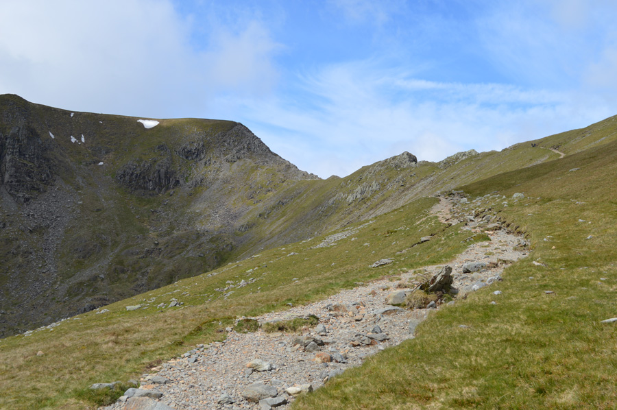
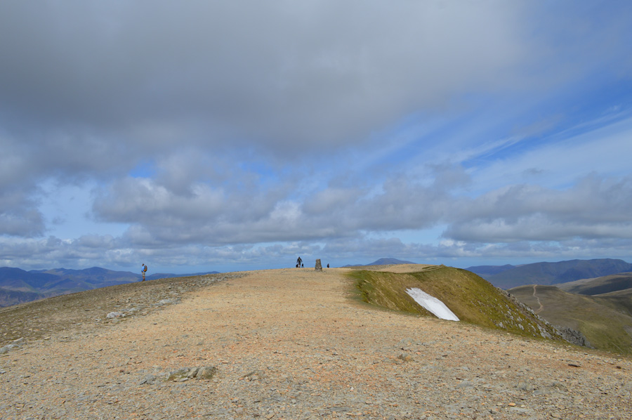
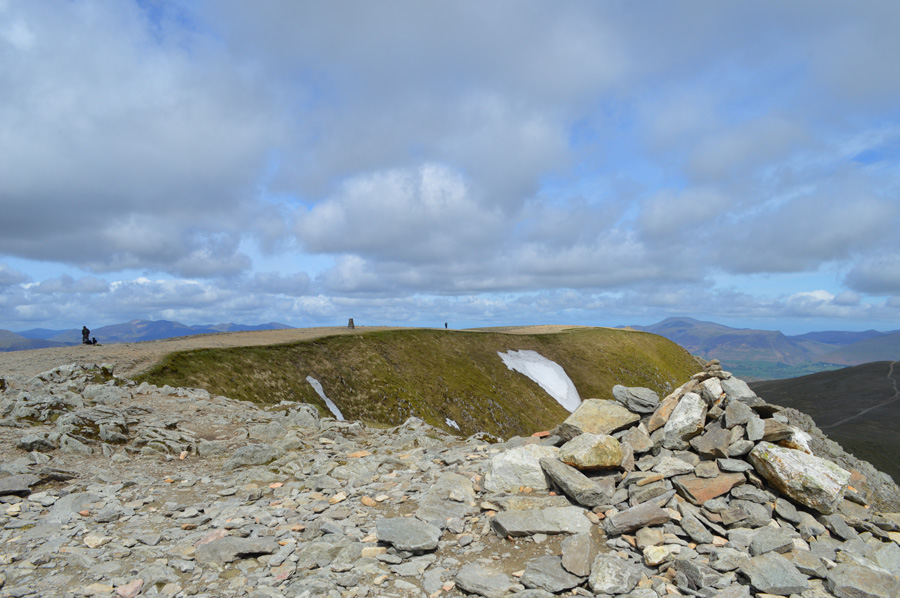
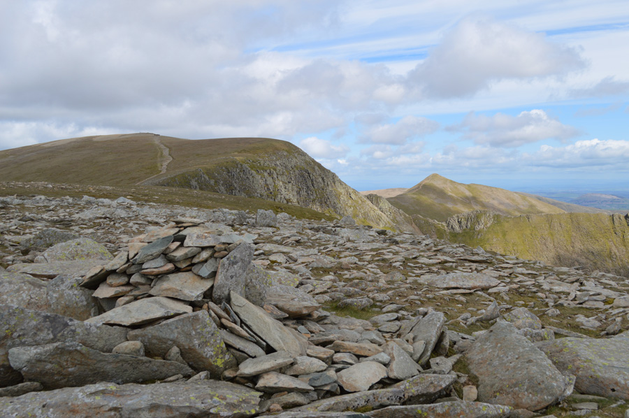
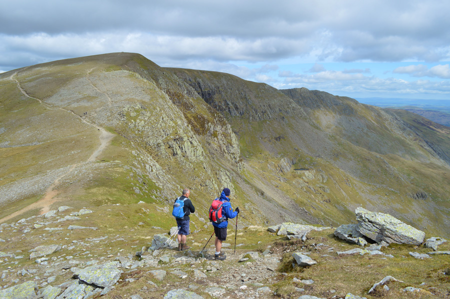
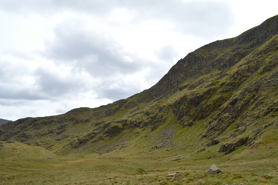
| Helvellyn and Swirral Edge seen from Catstye Cam north east ridge. |
Rod had waited for us to catch him up as we would all gain the summit together. At the summit we found a fellow walker hanging around, we passed on our good mornings as I hastily rummaged around in my pack for my hat, in doing so it completely slipped my mind to take a photo of the summit cairn. From the summit we would follow the Red Tarn path for a short distance before leaving it for a more direct descent on Red Tarn. |
 |
| Crossing the path for Swirral Edge as we head down to Red Tarn first. |
| It looks like the sun is coming out again. |
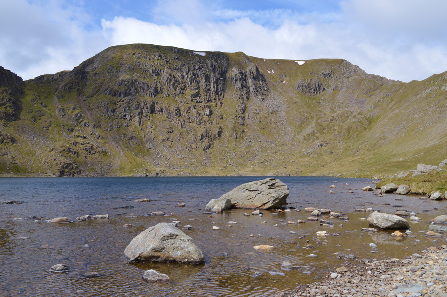 |
| Helvellyn eastern head wall from Red Tarn. |
After the steep pathless descent we soon found ourselves on the shores of Red Tarn where we were greeted by bright sunshine, we all agreed our timings couldn't have been more perfect. Around us walkers approach Striding Edge and Swirral Edge from Hole-in-the-Wall all eager to get boot onto ridge. As we glance up at Striding Edge a small number of walkers are tackling the route as are walkers heading towards Swirral Edge. Despite wanting to spend more time at Red Tarn we figure we best get in amongst the pack before a queue starts to form.
With this, we overtake a solo walker who had stopped for a rest close to the start of Swirral Edge, from below we can make out a couple of walkers heading down from the summit while behind us walkers are appearing, it's going to get a little congested if we don't press on which was just what we did. |
 |
| Swirral Edge. |
I guess this is where the fun begins. We had stopped to pack away our walking poles as scrambling over rock with poles strapped to your wrist can be more of a hinderance and potentially dangerous when scrambling. I offer to go first and use the path to the right of the main ridge only crossing over once to the left once the bulkier of the crags are reached up ahead.
|
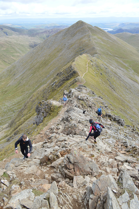 |
| Looking down on Swirral Edge. |
| |
 |
| Living on the edge. |
| A mornings work in one view. |
 |
| Helvellyn summit. |
No sooner than we knew it we soon found ourselves on the summit plateau having left the exhilarating ascent on Swirral Edge behind which, seemed to be getting quite busy.
We all agreed no matter how many times you visit Helvellyn they always seem more special than the last, and today was no different. |
 |
| Looking back at Helvellyn's trig point as we head for the main summit cairn. |
| |
 |
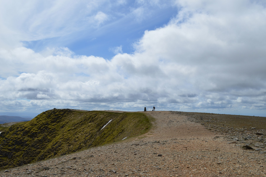
| Helvellyn summit cairn. |
| We grace each other with our own Helvellyn stories, the ones you might scare you grand kids with later in life befor heading for the summit cross shelter. |
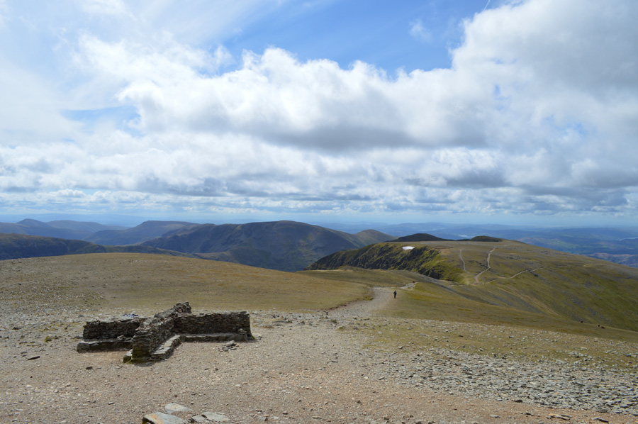 |
| Fairfield and Nethermost Pike from the cross shelter. |
Despite the clear and dry weather we were all a little surprised to find just how deserted Helvellyn looked today, yes of course it isn't even midday yet but even so, no one at the cross shelter, surely that's unheard of.
With our walking poles firmly fixed to wrist again we head of in the direction of Nethermost Pike engaging views over the Wythburn Fells and Harrop Tarn which seems to be getting less and less smaller over the years. |
 |
| Here, looking back on Helvellyn, Catstye Cam and Striding Edge from our ascent on Nethermost Pike. |
| |
 |
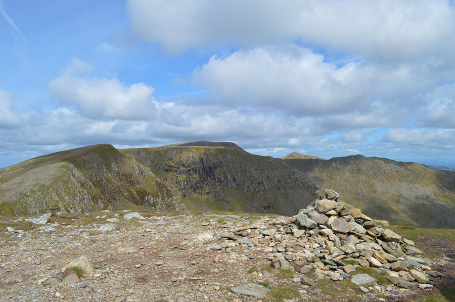
| Helvellyn and Catstye Cam from Nethermost Pike. |
| Nethermost Pike was soon reached in conversation, so much so we seemlessly walked past by the cairn only having to back track a little to make the summit. |
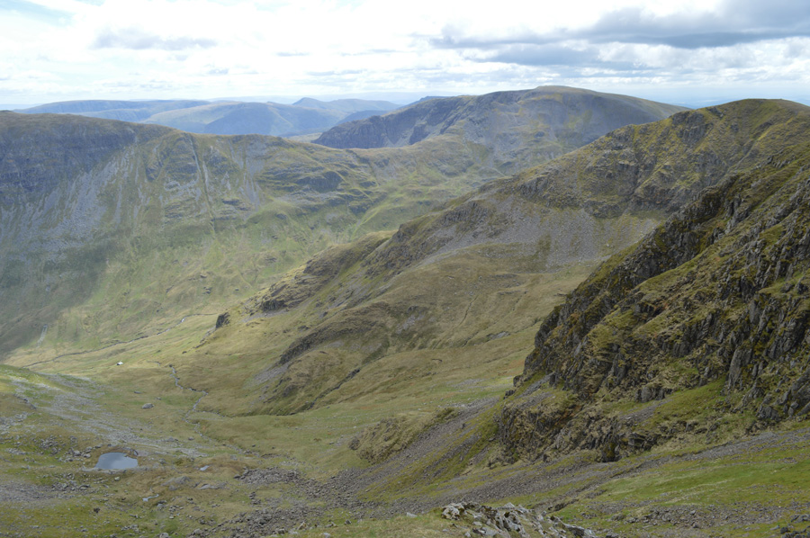 |
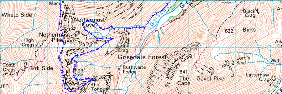
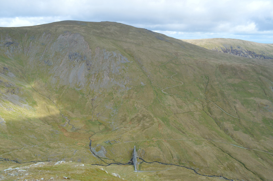
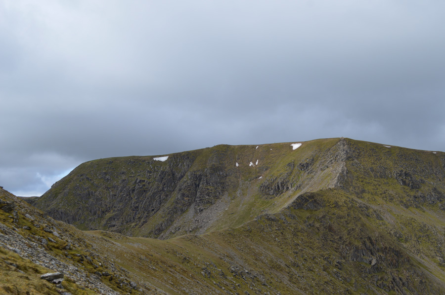
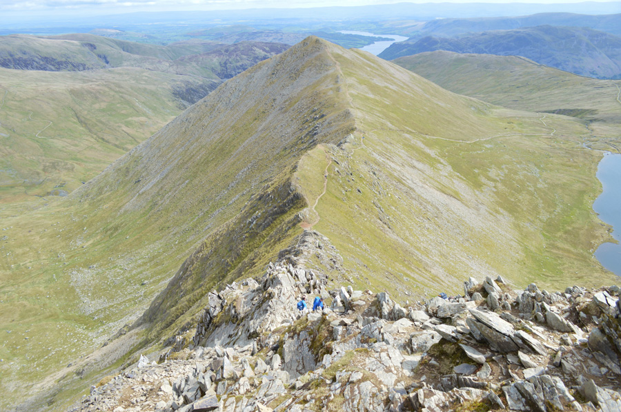
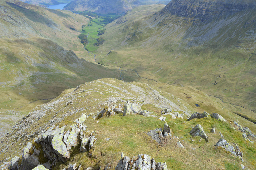
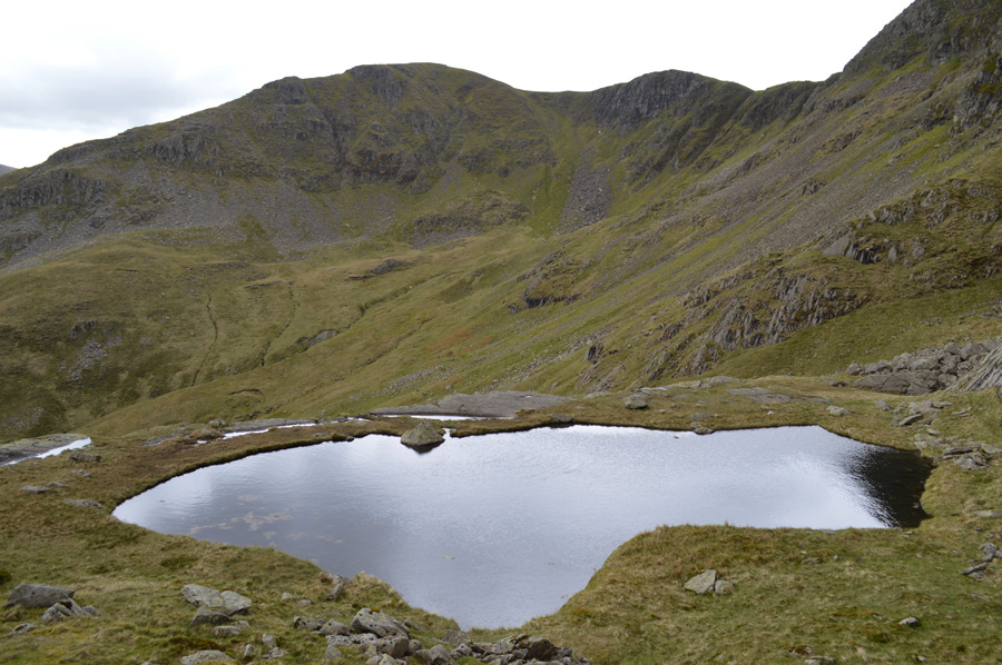
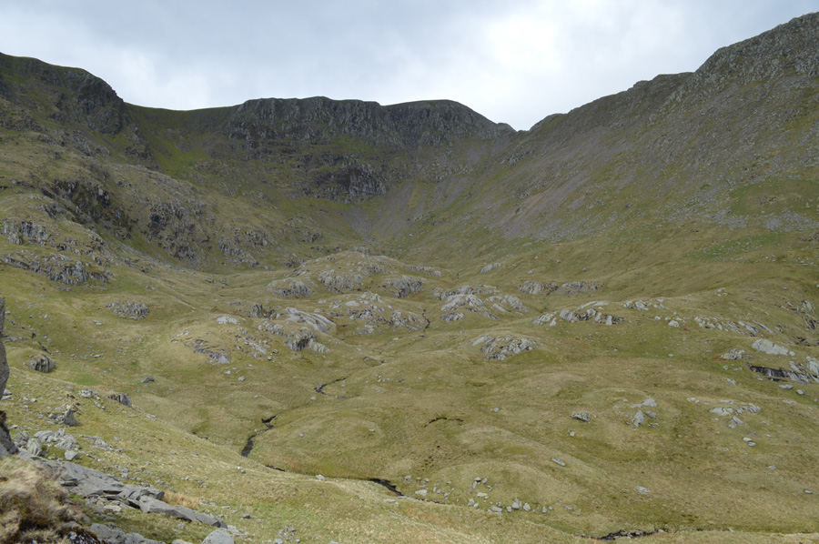
| Dollywaggon Pike Hard Tarn and The Tongue seen over Ruthwaite Cove. |
Our view over Ruthwaite Cove, logistically, was probably the most important of the day as we plotted a route from The Tongue into Ruthwaite Cove, then by keeping to the highest ground we would plot our route towards Hard Tarn. I have gained Hard Tarn from Nethermost Pike east ridge but never from The Tongue, it all looks pretty simple if you have a keen eye for the lay of the land which is important as losing valuable height when you needn't have is time consuming and tiring.
With three heads we have a agreed a route, lets hope the lay of the land lets us stick to it. |
 |
| Views over Grisedale, Hard Tarn and St Sunday Crag over Ruthwaite Cove. |
| |
 |
| Dollywaggon Pike seen over Ruthwaite Cove after descending High Crag. |
| |
 |
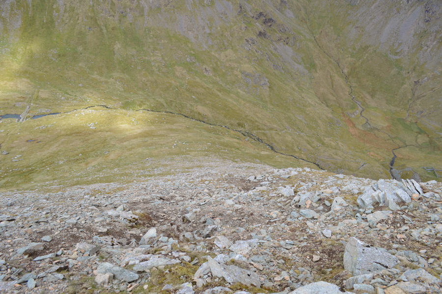
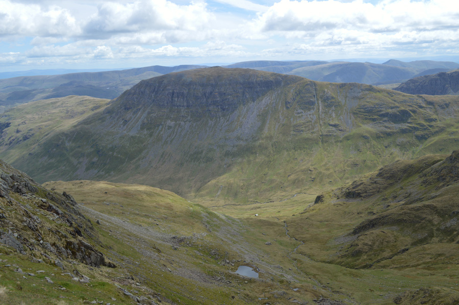
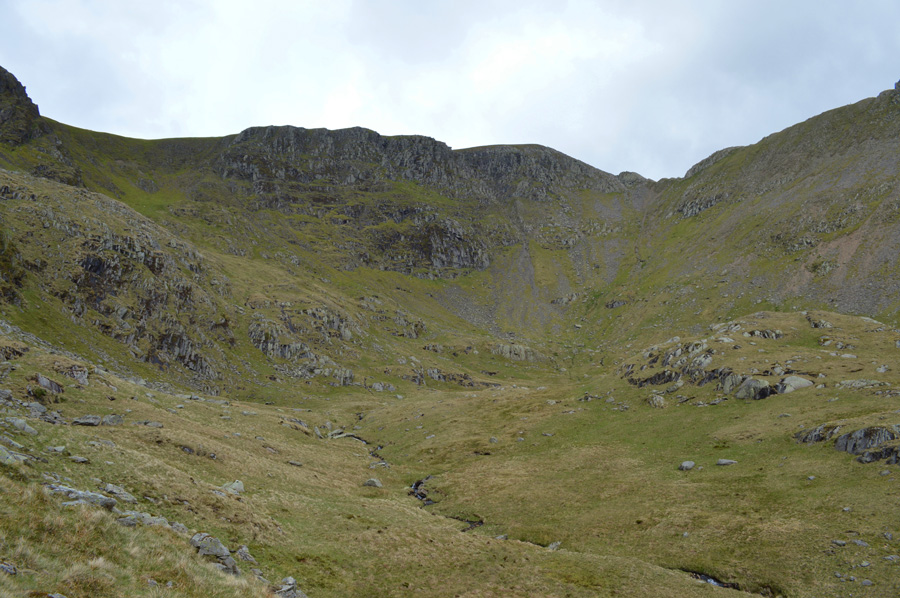
| Looking back on High Crag over Ruthwaite Cove. |
| As we round our way over the ridge views again open out onto Hard Tarn, here we pause again to evaluate our route, as you can see in the photo, gaining Hard Tarn from within Ruthwaite Cove is much steeper than it looked previously, with this, we stick to our original plan. |
 |
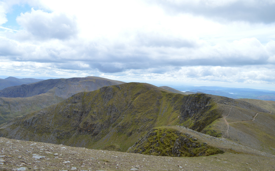
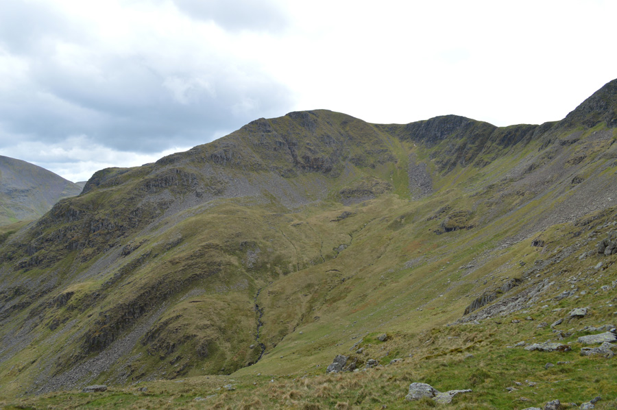
| High Crag, Nethermost Pike, Helvellyn and Catstye Cam seen from Dollywaggon Pike summit. |
| To lighten the mood we were met by a rather odd character on Dollywaggon Pike summit who seemed to be dressed in full fell running gear including head cam and two one litre bottle holders strapped to his chest, we passed on our 'mornings' we soon left the summit behind before taking in the steep descent down The Tongue. |
 |
| Descending The Tongue. |
| I guess it's fair to say that conversation died a little more so because of the concentration needed to find ourselves at exactly the right spot where we needed to leave the ridge. We picked our way over grass and crag until we thought we had reached our spot which turned out to be a little higher than where we needed to be, with this we continue a little further down the ridge until we were exactly sure we'd found our exit point. Even so as David would explain, if this isn't it, this is the place we needed to leave, we simply cant afford to continue any further, moments later a grassy ridge was spotted which descended into scree, this was our spot. |
 |
| Heading into Ruthwaite Cove. |
| After leaving the grass ridge behind we soon found ourselves negotiating a scree run which was done without incident, the photo really doesn't depict the lay of the land as most of the descent had to be done by side step which evened out once we had got over the scree. David points out three high spots on which we are aiming for with his walking pole, the first of which we are heading for in this photo seen as a small outcrop of rock in the centre of the photo. |
 |
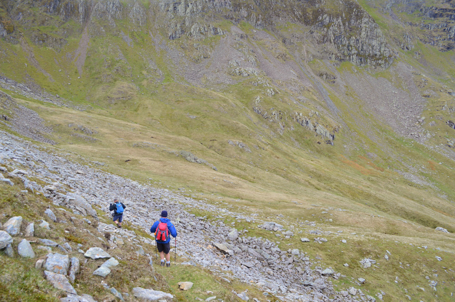
| Negotiating Ruthwaite Cove. |
| After quickly gaining high ground we now had no choice but to lose a little height as we trace our way towards the bottom of the scree seen in the centre of this photo. We are now well below Hard Tarn seen to the right of the scree (out of sight) below the rock shelf. This is the ascent we were looking on from the top of Ruthwaite Cove earlier. Ground is covered steadily and carefully more so as we track single file in order to maintain height and until we reached the bottom of the scree, from where we head further right in order to climb up onto Hard Tarn rather than drop on to it. |
 |
| Dollywaggon Pike and The Tongue from Hard Tarn. |
Sadly we had lost light as the cloud thickened above our heads by the time we had reached Hard Tarn, however this wasn't going to spoil our lunch as we all downed packs and picked our spots before tucking into well deserved lunches.
Despite the calmness of Hard Tarn our time spent here was chilled to say the least as David noted by saying this time of year we should be cooling down here not complaining how cold it is, nevertheless as we all agreed, cold or not, Hard Tarn is still a fantastic place to find yourself. |
 |
| Views over Ruthwaite Cove and The Tongue. |
| From our lunch spot it was easy to depict our route after descending The Tongue and keeping to the higher ground over Ruthwaite Cove. It was no use though, allthough we could have stayed here all afternoon we re-shouldered packs, wiped our damp backsides and headed out towards Nethermost Pike east ridge, this was done by tracing a faint path over boulder and scree before the main east ridge path was met where views opened up into Nethermost Cove and Striding Edge. |
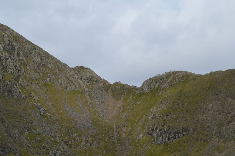 |
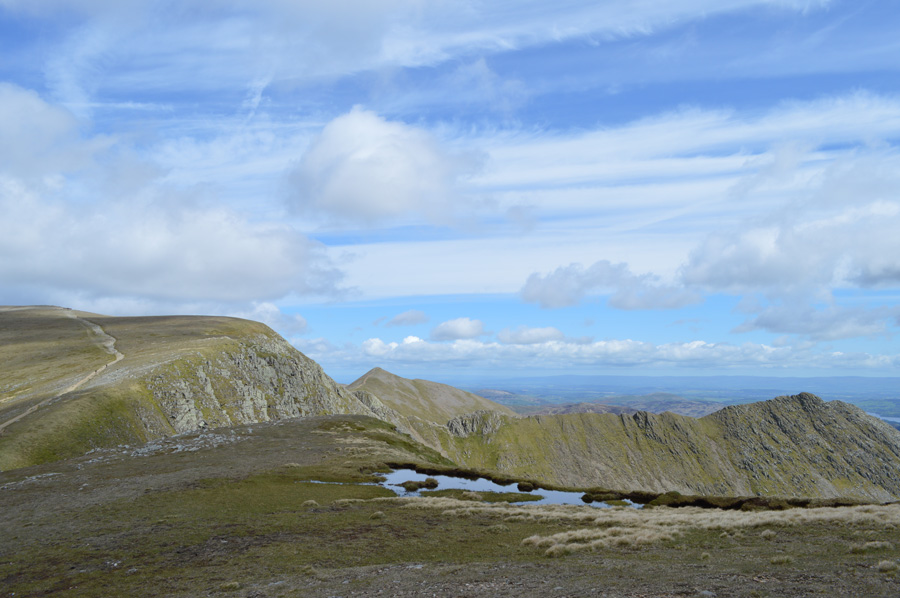
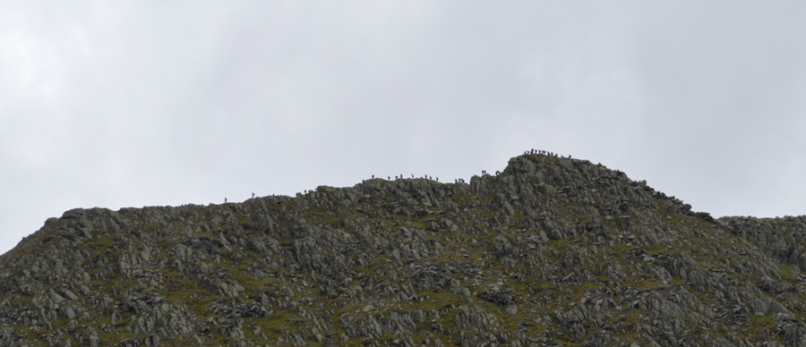
| A close up of High Spying How and Striding Edge. |
After re-joining the east ridge path our views opened up over Striding Edge as I let out a 'flipping eck' or words to that affect, here we stood and watched walkers counting between twenty and thirty at a time queuing to descend High Spying How, it was no different all along the ridge, it looked liked madness, more so when walkers turned around against the flow of traffic to walk back, when really, all that was needed was for them to use the lower path on the left of High Spying How. |
 |
| Fabulous views back up Nethermost Pike east ridge. |
| We walk and watched our way off the east ridge more so at the walkers congregating along Striding Edge, it was unbelievable to see so many people on one of the countrys most dangerous ridges, you can only guess the topic of conversation which switched suddenly as David asked, how do you fancy a walk through Nethermost Cove, as none of us had done this before and time was on our hands, we jumped at the chance. |
 |
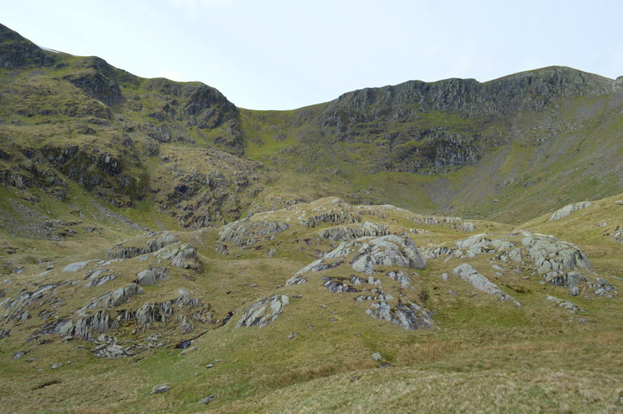
| Helvellyn and Striding Edge seen domineering over Nethermost Cove. |
| Our plan is to circulate Nethermost Cove as we first flank Nethermost Pike east ridge, then pass 'loosely' below Helvellyn, then a return below Striding Edge. |
 |
| Nethermost Cove cirques. |
| We define a route around Nethermost Cove mostly by sticking to a young Nethermost Beck which at times disappears below ground into wells large enough to swallow a mans body, these were to be avoided at all costs! The feeling is surreal as we pass Nethermost Pike's east ridge as it domineers our left flank, ahead Swallow Scarth and Lad Crag form the huge bulk of wall between Helvellyn and Nethermost Pike respected summits. |
 |
| Striding Edge. |
| 'Paul' yes Rod? I dare you do one of your out and backs onto Helvellyn summit! You'd get there a lot quicker than those guys, joking aside, I don't think Rod would be far wrong. |
 |
| Nethermost Pike east ridge from Nethermost Cove. |
| |
 |
| Nethermost Cove. |
| A young lamb bleats loudly calling for its mother as we pass beneath Striding Edge, this is a special place which captures the imagination as one of Englands sharpest aretes rises steeply to our flanks, so close we can hear the conversations between the walkers who we would imagine, are still waiting to make their crossing. |
 |
| Grisdale and Place Fell seen from Nethermost Cove. |
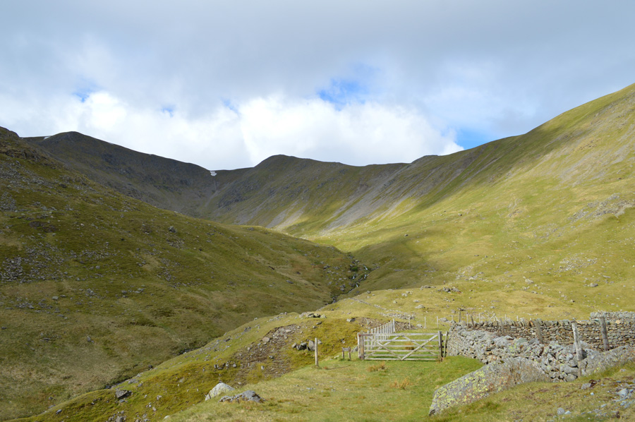
| Our time exploring Nethermost Cove was over as we follow the course of Nethermost Beck, over our heads the queues would grow along Striding Edge yet sadly this was our time to leave and make descent on the valley of Grisedale. Two paths flank Nethermost Beck both as substantial as each other but we opt for the one off the right of Nethermost Beck as it will leave us in good stead for the stone wall we have to cross when we reach the valley floor. |
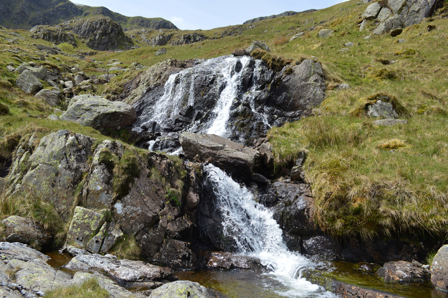 |
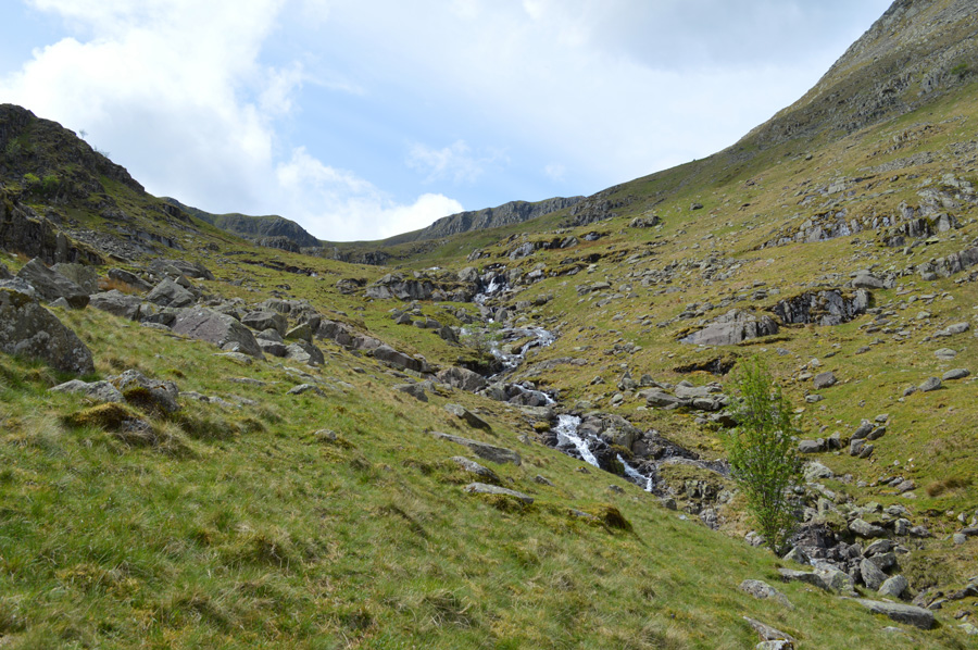
| Nethermost Beck waterfalls. |
| After a hard day on the fells there's nothing like a good waterfall to cool you down, should the weather have been any warmer today I'm sure a good swill around the face and neck would have been more than appropriate, but not today. |
 |
| Looking back up towards Nethermost Cove. |
| |
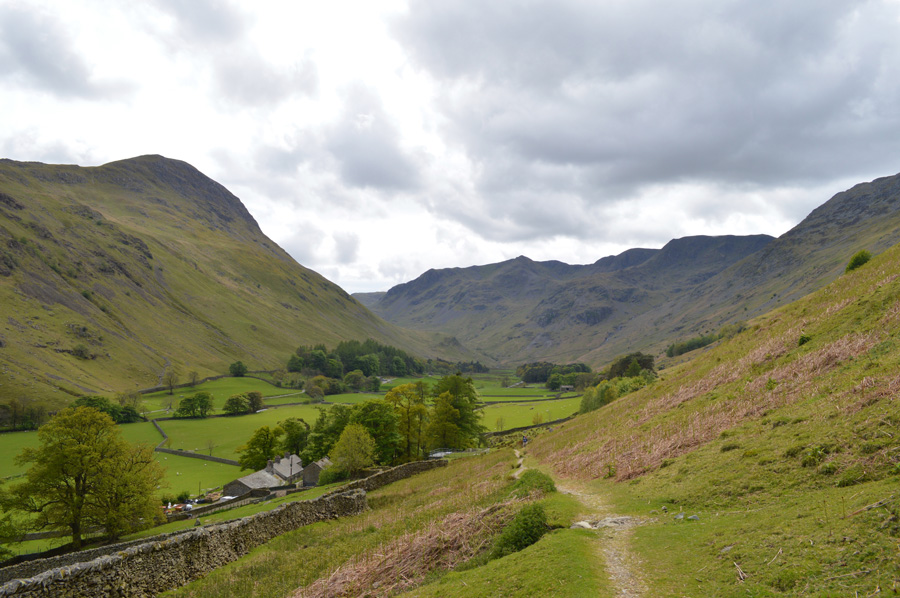 |
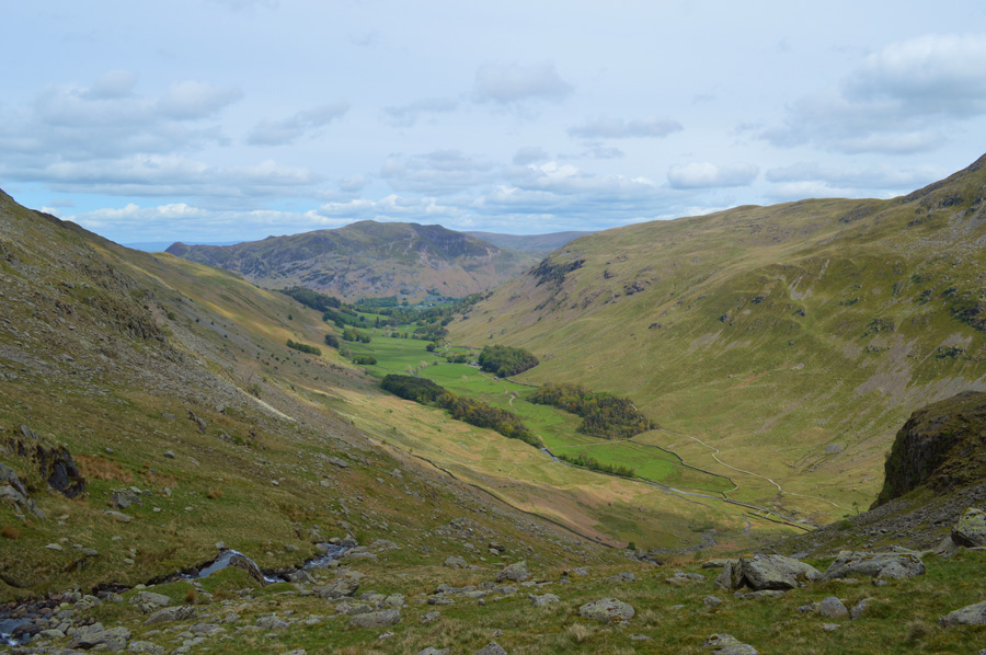
| St Sunday Crag, Dollywagon Pike and Nethermost Pike seen domineering the head of the Grisedale Valley. |
| After leaving Nethermost Cove we still had a good deal of miles (three and a half to be exact) before we would reach David's final Tarn of the route in Lantys Tarn found at the lower end of the valley between Grisedale and Glenridding. The time spent wondering through Grisedale offered some great reflection time on highlights of the day which we all agreed on had to be the hidden twist of including a tour of Nethermost Cove into the walk, closley followed by gaining Hard Tarn and the ascent on Swirral Edge, well, that was mine anyway! |
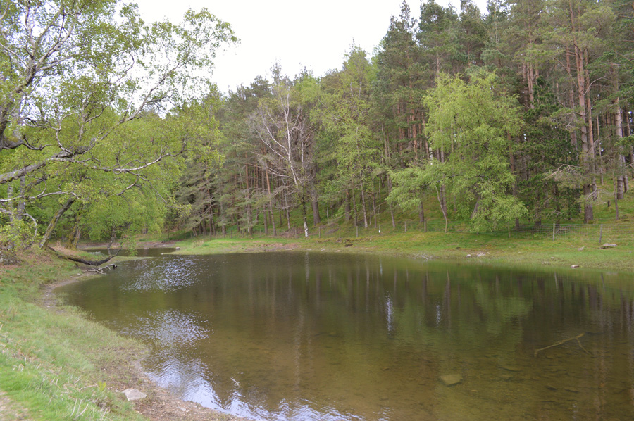 |
| Lanty's Tarn. |
| We had enjoyed a sunny exit through Grisedale yet by the time we had reached Lanty's Tarn cloud had gathered and it had grew dull again, although on the plus side temperatures had reached the mid teens. Despite the odd couple or group of walkers that we had passed we had Lanty's Tarn to ourselves after which, we started our descent back into Glenridding. |
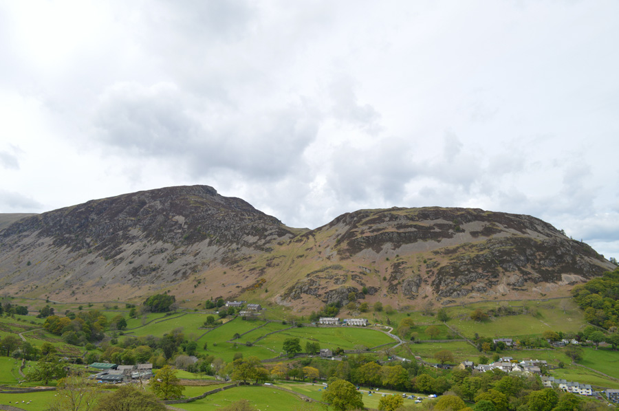 |
| With views of Sheffield Pike and Glenridding Dodd. |
| |
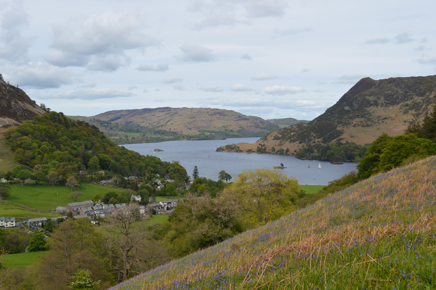 |
| Blue Bells line the fellside as our views extend over Glenridding, Gowbarrow Fell and Ullswater. |
| |
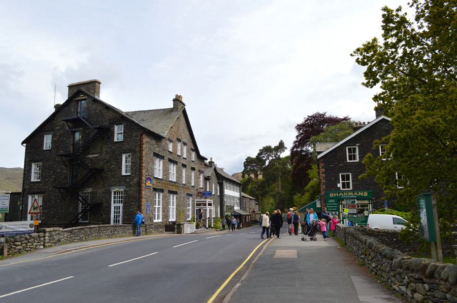 |
| Glenridding. |
After leaving fell side our route would see us back in Glenridding where tourist's sit outside cafes sipping on tea or eating ice creams. I couldn't remember seeing any other walkers during the time we spent passing through the village but it was nice to see the place bustling with tourist and activity, the car park for now was full and no doubt those walkers are still queuing on Striding Edge awaiting their turn, for us it's a road walk back to reality dodging traffic and road bikes, once Stybarrow Crag is reached we bring our walk to an end as we unlace at the back of our cars, a joke is shared and hands shake as we all depart our separate ways.
Me, I opt to drive back over the Kirkstone Pass where for a fleeting moment one of Harry Griffin's walks enters my head, it's early and I still have at least four hours daylight light where I'm sure I would complete said route, then I take a look in the rear view mirror and spot my tired face, who you kidding yer daft bugger. |
|
| |
| Back to top |
 |
|