|
Catstye Cam via the North West Ridge |
 |
 |
4th May 2013 |
 |
|
Today is my Birthday, the day I turn 39 & get ever closer to that dreaded 40 But what’s all the fuss about? I’m probably fitter now than I was when I was in my 20’s (who you kidding) well you know what I mean.
Around two weeks ago during a wet spell I undertook around five A4 size pages full of new routes & walks that I’d either read about, forgotten about or were just plain new to me the day I penned them.
On page 4/5 I’d carefully hand written this route, Catstye Cam via the north west ridge with a descent via Striding Edge & a further descent via Birkhouse Moor north ridge, in all, a four or five hour round trip tops, then back in time for Birthday celebrations.
Although my intended route never came off, I still managed to partake on one of thee finest ascents that Lakeland has to offer, it’s just a pity I didn’t get to see it! (more on that in a little while) |
|
Wainwright Guidebook |
 |
| The Eastern Fells |
-Catstye Cam; The North West Ridge:
Walkers with red blood in their veins should give their attention to the north west ridge. This looks formidable (from White Side it looks imposable) but is actually an easy uphill walk without any difficulty other than steepness. The finish is delightful, the cairn remaining hidden until the last moment. The best approach to the ridge is by the bridle path as far as the dam; cross the beck here and slant along a natural terrace to the base of the ridge. |
 |
|
| |
|
Overview |
|
|
| Ascent: |
3,678 Feet, 1,121 Metres |
| Wainwrights: |
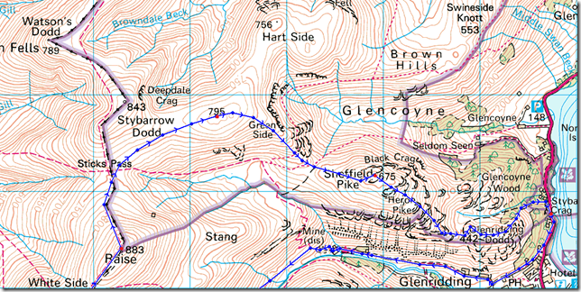
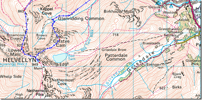
6, Catstye Cam – Helvellyn – White Side – Raise – Sheffield Pike – Glenridding Dodd |
| Weather: |
Low Cloud & Drizzle to Start, Turning Bright & Sunny, Highs Of 14°C Lows Of 6°C |
| Parking: |
Parking Spaces, Stybarrow Crag, Ullswater (F.O.C) |
| Area: |
Eastern |
| Miles: |
9.8 |
| Walking With: |
On my own |
| Ordnance Survey: |
OL5 |
| Time Taken: |
6Hrs 40 Minutes |
| Route: |
Stybarrow Crag – Lake Path – Greenside Road – Greenside Mine – Glenridding Beck – Keppel Cove Dam – Catstye Cam North West Ridge – Catstye Cam – Swirral Edge – Helvellyn – Helvellyn Lower Man – White Side – Raise – Sticks Pass – Green Side – Nick Head – Sheffield Pike – Heron Pike – South East Ridge – Glenridding Dodd – Stybarrow Crag |
|
| |
|
Map and Photo Gallery |
|
|
 |
| |
Ullswater,Gowbarrow Fell & Place Fell from Stybarrow Crag 07:20 6°C
The promise of starting my walk today without getting wet wasn’t looking too good, even as I drove along the Lake Road sporadic showers kept me on my toes, I lift off the gas figuring this might bide me some time for the showers to pass, this works.
I kit up alone in at a empty car park as the cyclist that I passed earlier rides by at full speed, I get a faint morning nod & I return the same.
My pack is re-packed after my Crown Round episode last week of which I only carried food & hydration, as a result my pack is heavier this morning. Also laden is my elastic-bandaged right ankle where I picked up some hefty blisters & scarring last week, the blisters are high around my ankle & I’m hoping they wont cause me too much trouble other than a niggling itch.
Pack shouldered I make for the Lake Path. |
 |
| |
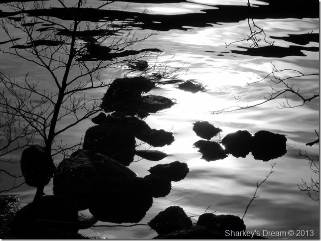
Down by the lakeside.
|
 |
| |
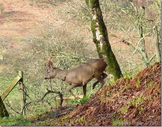
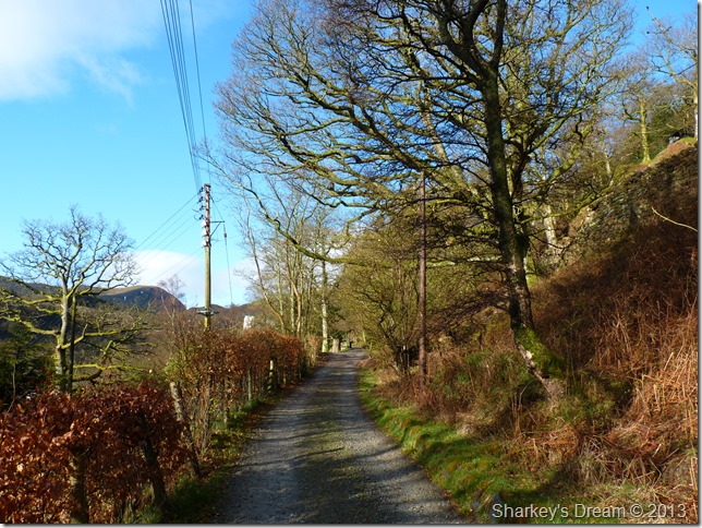
The start of the Greenside Road.
Rouge young Deer flank the hedge rows as I take on the delights of what now looks to be a promising day on the fells. |
 |
| |
Birkhouse Moor dominates the initial start of the walk.
Here I can clearly see my intended descent via Birkhouse Moor & its north ridge, I eye up a rather worrying bull-nose crag of which I would have to negotiate along the top of the ridge but other than that, its an unusual exit on an otherwise alternative days fell walking. |
 |
| |
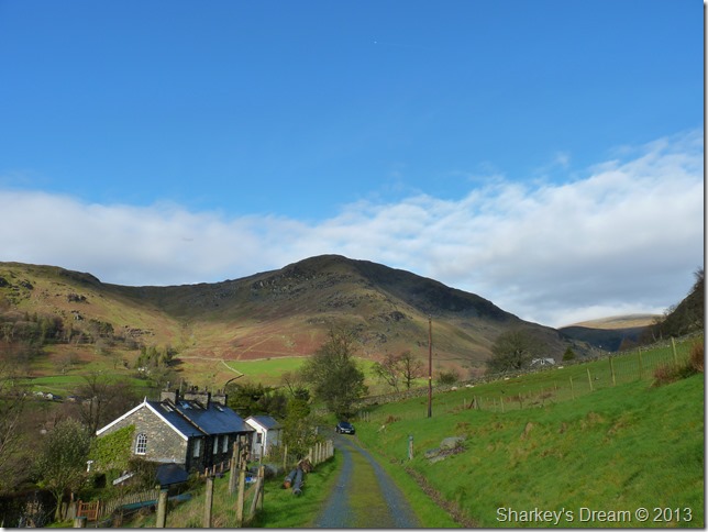
Striding Edge Hostel.
I take in Greenside Road with great expectations of what is to lie ahead, a niggle from my blister on my right ankle sticks in the back of my mind but as you would say…I try to walk it off.
Here the Hostel is busy with a car park full to brimming, morning walkers kit up outside as I pass through a gate & follow a path marked Sticks Pass Kepple Cove & Helvellyn. |
 |
| |
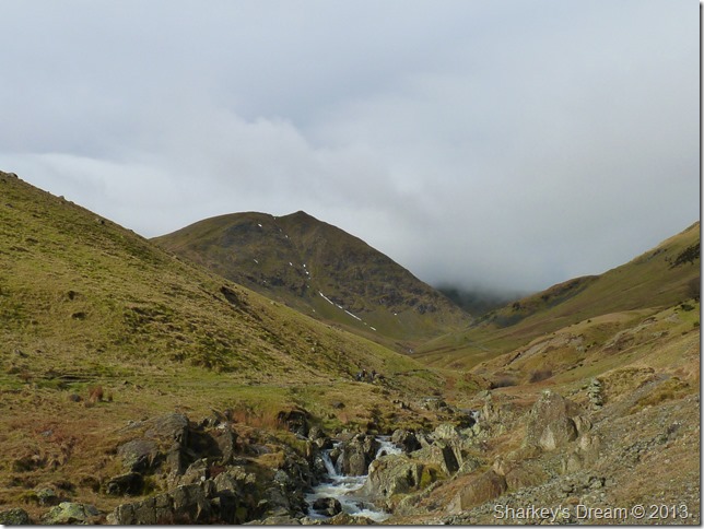
Catstye Cam from Glenridding Beck.
This was my first proper view of Catstye Cam & indeed its north west ridge (right) the ridge from here looks pretty steep & formidable so I try to psych myself up for the ascent between here & reaching Kepple Cove.
It was only until the last minute did I change my route to reach the base of the north west ridge, you can gain the ridge as I did here by following the path that runs into Kepple Cove (keeping right) or you can cross Glenridding Beck & follow the course of Red Tarn Beck, then flank the lower reaches of Catstye Cam via a faint path & an old disused water leat (L to R) & pick up the ridge there. |
 |
| |
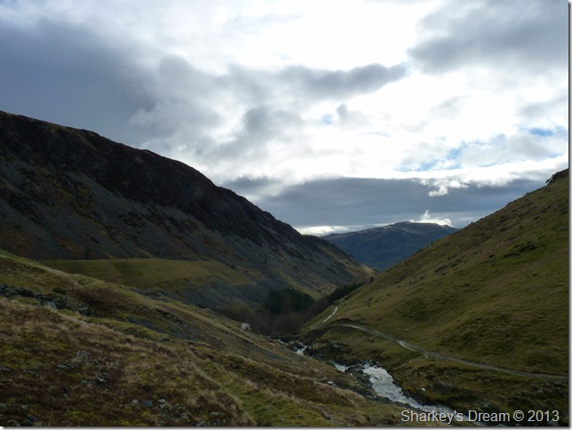
Looking back on Glenridding Screes & a distant Place Fell from the track.
It all goes dark from here on in. |
 |
| |
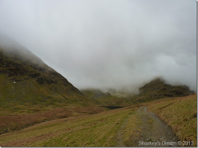
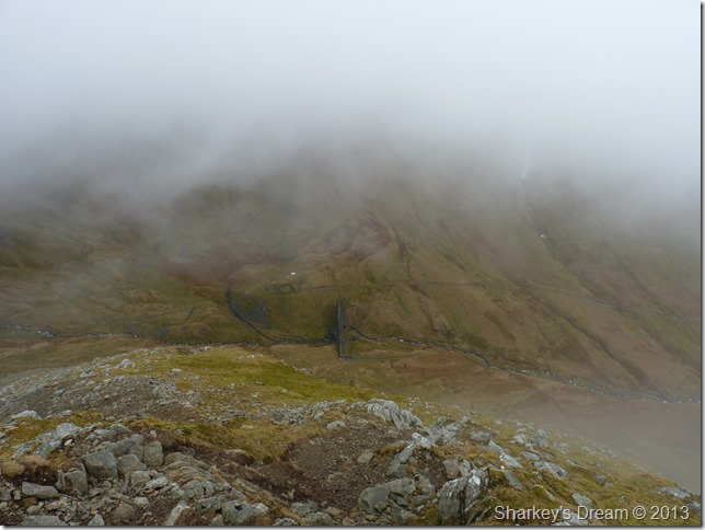
The approach to Kepple Cove.
My scenery was changing dramatically & with it went the view of my ascent via the north west ridge (left) Although the cloud came in quickly & was mesmorising to watch, I couldn’t help but feel gutted that my ascent was going to be under thick mist. |
 |
| |
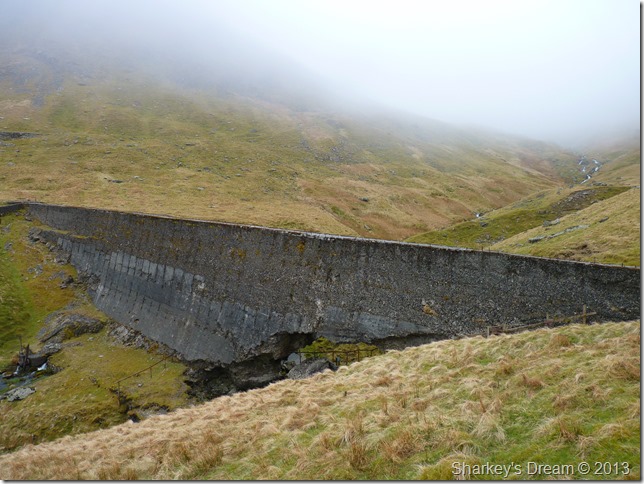
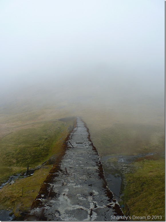
Kepple Cove Dam (Breached)
Kepple Cove dam sits close to the site of a much older dam which lies on the embankment of what now is known as Kepplecove Tarn (Dry) then a reservoir in 1927 when it collapsed during a freak cloudburst flooding the valley of Glenridding causing great damage, subsequently creating a new ravine along its course.
A new dam was built which later breached in 1931, it has never been repaired. |
 |
| |
Kepplecove Dam wall.
I took this photo after reading a warning sign displaying not to go near the un-sound structure. I figured after all these years the dam wall was safe enough to cross, this is not something that I condone nor recommended after my own personal crossing of which exposure, wind & rain nearly got the better of me. |
 |
| |
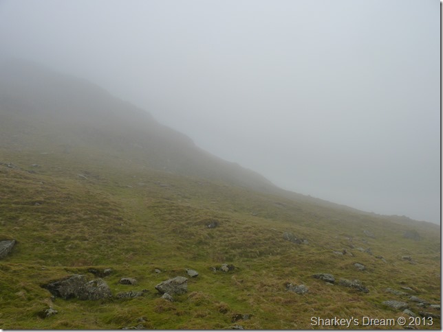
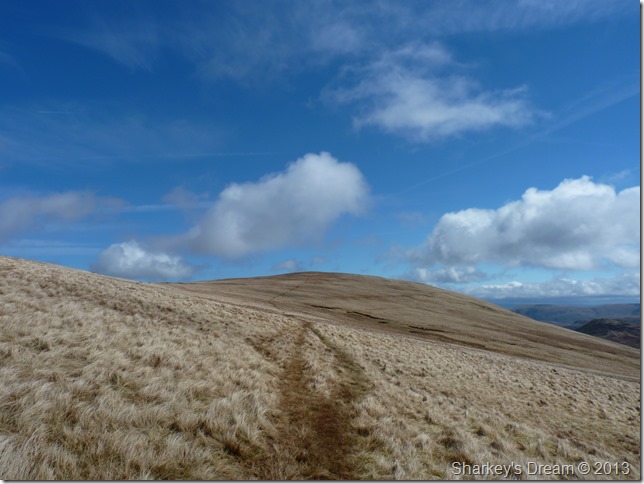
A faint path leads the walker across a grassy terrace to the bottom of the ridge & the start of the ascent.
Here even in conditions as I had today the path was easy to follow to the base of the ridge, here is evidence of more faint paths that lead up the steep ascent, try as I did to stick to one path which makes the ascent less conflicting & confusing than trying to follow more fainter paths. |
 |
| |
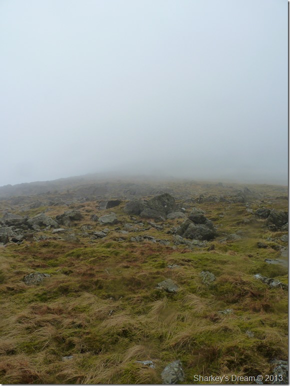
Steep but manageable. |
 |
| |
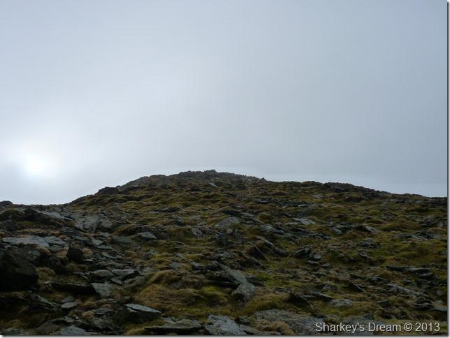
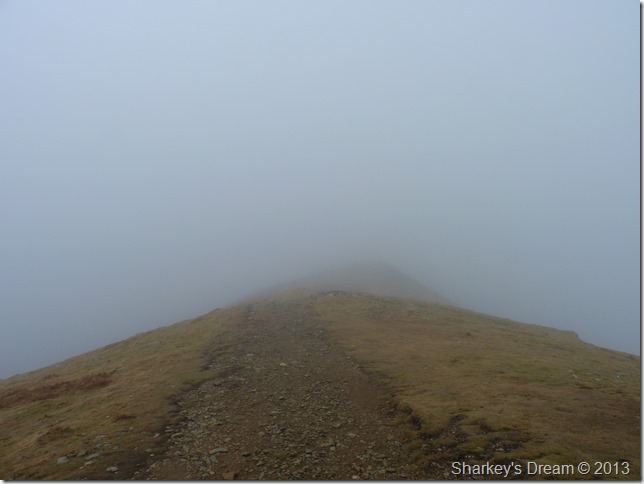
Is that the summit?
Here I fix myself a target, say a large boulder forty or so yards away, all I had to do was find the easiest way to get between me & it…I found this worked out better than to keep looking up the daunting ascent.
Talking about daunting…if your a newbie to the north west ridge as I was, it may come with great pain that there are two false summits along the ascent, this one being the first! |
 |
| |
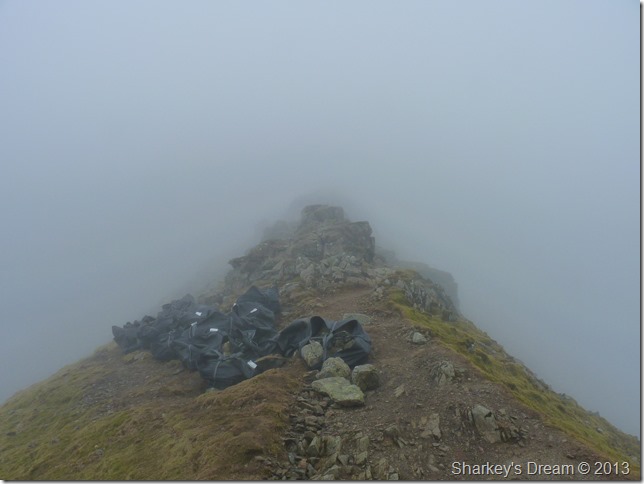
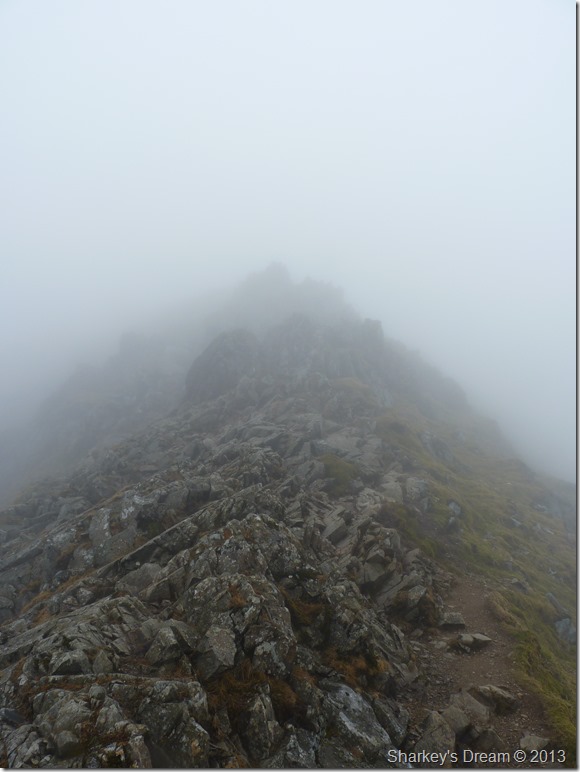
A brief break in the mist reveals the steepness of the climb along with Kepplecove Dam.
I pick up a well divined path after the first false summit & follow it onto the next one, after this the main summit is revealed almost through the rain & mist.
Although I would of preferred to have made my assent in finer weather the mist & light drizzle offered a different kind of feel to my ascent, its something that the walker will experience nowhere else. |
 |
| |
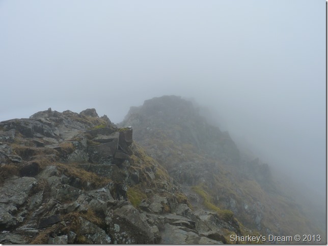
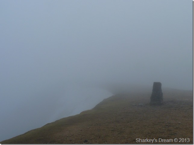
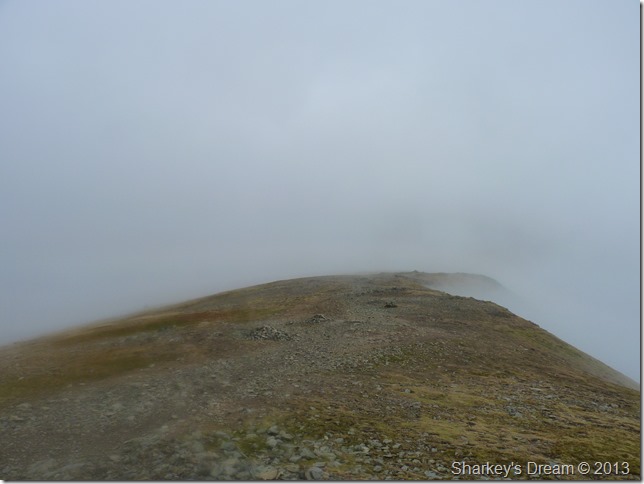
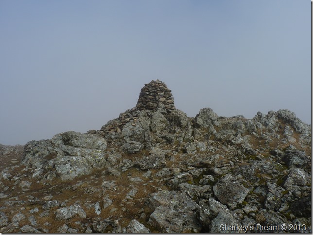
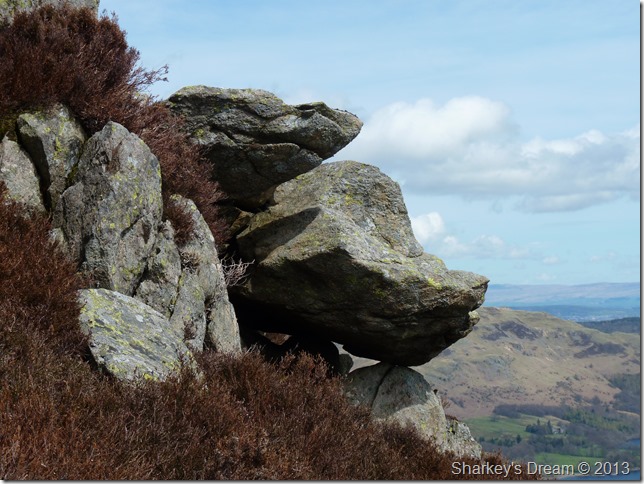
The cairn remaining hidden until the final moment A.W
Here I lay my claim to the cairn by adding a stone before leaving along a drizzle covered path & Swirral Edge bound. |
 |
| |
Leaving Catstye Cam summit for Swirral Edge.
With Red Tarn to my left & Brown Cove to my right I take on the path as a fierce wind bites at my exposed skin, this is to last for the next hour or so. |
 |
| |
Fix the fells, Swirral Edge.
As I approach the start of Swirral Edge I am confronted by bag loads of stone used to mend the pathways, it is here I am reminded about a notice that I had read attached to a gatepost back on Glenridding Common – that there were three sites used for Helicopter drops to bring in the stones by.
The map used was vague to say the least but I think I’ve just stumbled upon said site.
On any other given time I would always traverse Swirral Edge by the Red Tarn side or (left side) of the edge, here I am given no option other than to tackle Swirral Edge via the right path, on a personal note I figure this is the more adventurous route with plenty of four point contact & crags to climb, not something I am wholly comfortable with given the conditions. |
 |
| |
Swirral Edge…its out there somewhere. |
 |
| |
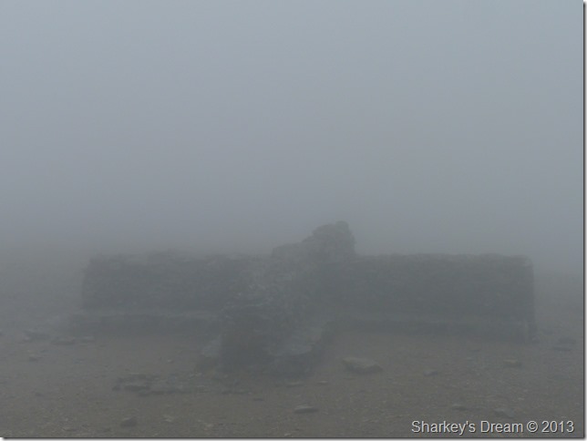
Helvellyn summit trig point.
The climb was exhilarating to say the least & I was glad to find myself at the summit, the wind is biting at my skin so I make my way over to the summit cross shelter to try & get on the cold wind. |
 |
| |
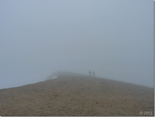
Helvellyn summit cross shelter.
Here I tuck in & make myself confortable as the wind billows above my head, I was in search of breakfast as it had only just gone 10:00am so I take out three pieces of Soreen spread with butter. I am soon joined by two fell runners competing in the GL3D (The Great Lakeland Three Dayer) We chat briefly as they explain that they are on their way to Grasmere, meanwhile I type in a status into my Facebook account ‘Is sat in a very blustery Helvellyn summit cross shelter eating birthday Soreen for breakfast’
From here on in my walk itinerary has changed, my intended traverse of Striding Edge was clearly not advisable given the conditions, so I make with my plan B route; descent via Sticks Pass (Given my erratic mind this route could change between here & there…and it did) |
 |
| |
Looking back on Helvellyn summit as more fell runners brave the bitter cross winds. |
 |
| |
Helvellyn Lower Man summit cairn complete with the GL3D waypoint marker. |
 |
| |
Whilst on route to White Side I got this brief break in the clouds, it shows just how much the wind is doing up here today & was the first view I had seen in the past hour, could this be the start of things to come I wonder. |
 |
| |
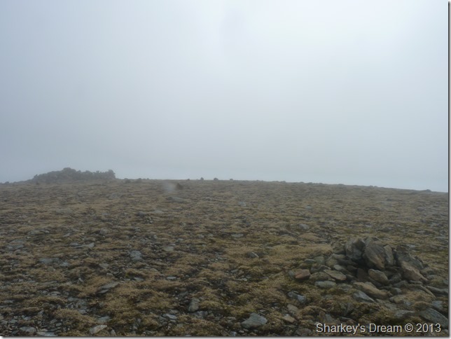
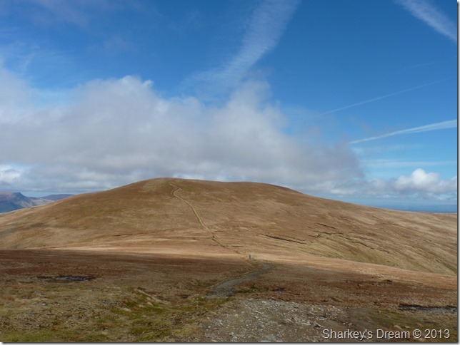
Not quite yet, but were getting there.
Here there wasn’t much to see as I reached White Side summit cairn & shelter, I soon press on towards Raise where my prospects seemed to becoming clearer. |
 |
| |
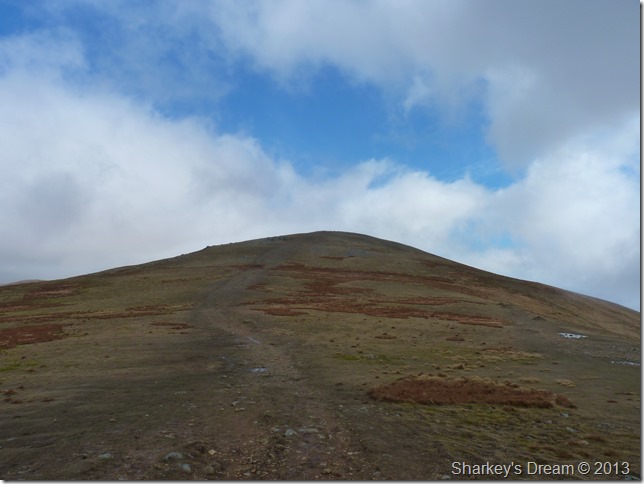
Raise beckons.
The cloud lifted in what seemed like seconds, It was roughly around forty or so minutes since leaving Helvellyn’s summit & well over an hour since leaving Catstye Cam, if only I had set off an hour later eh.
Never mind…I fear another change of plan is coming on. |
 |
| |
Raise summit cairn.
I had opening views to my north & east although again I am cloaked by low cloud briefly while at the summit of Raise, thankfully it was momentarily & as quickly it came, it went. |
 |
| |
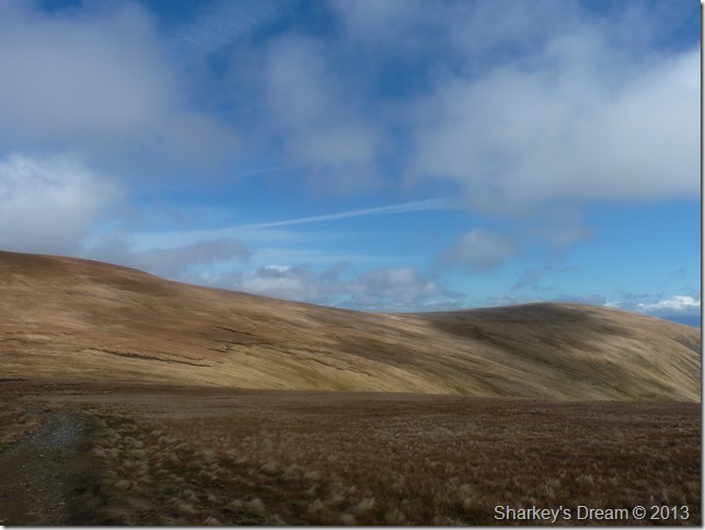
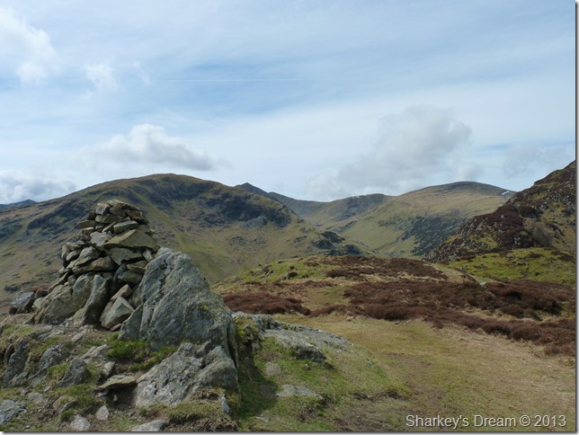
Stybarrow Dodd & Sticks Pass as I leave Raise behind.
It was here my change of route occurred, firstly I planned to take on Stybarrow Dodd then descend via Green Side, then I thought maybe this would take up too much of my time, then I spotted the diagonal path that flanks Stybarrow Dodd heading east. |
 |
| |
Green Side as I approach Sticks Pass.
Leaving the path for Green Side was the best decision of the whole day (more on that later) |
 |
| |
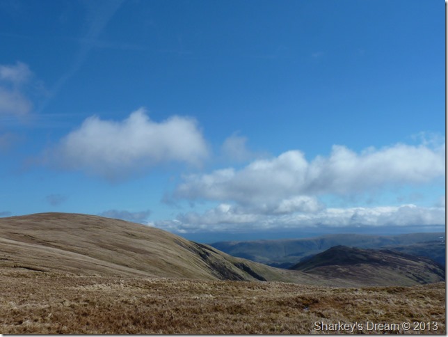
Green Side & Sheffield Pike from Sticks Pass.
I had that slight belly wobble in that within the last few moments I had re-jigged my descent route taking in Green Side, Sheffield Pike & hopefully given good time, Glenridding Dodd, thereafter will then drop me almost on top of Stybarrow Crag car park.
The day can only get better…And it does. |
 |
| |
Green Side ahead.
The walk from leaving Sticks Pass to Green Side was really pleasant & inviting, yes it was a little wet underfoot but just look at how the weather has panned out. |
 |
| |
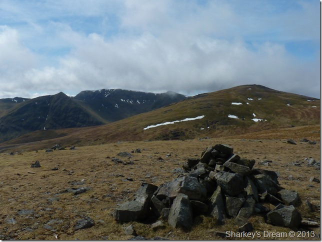
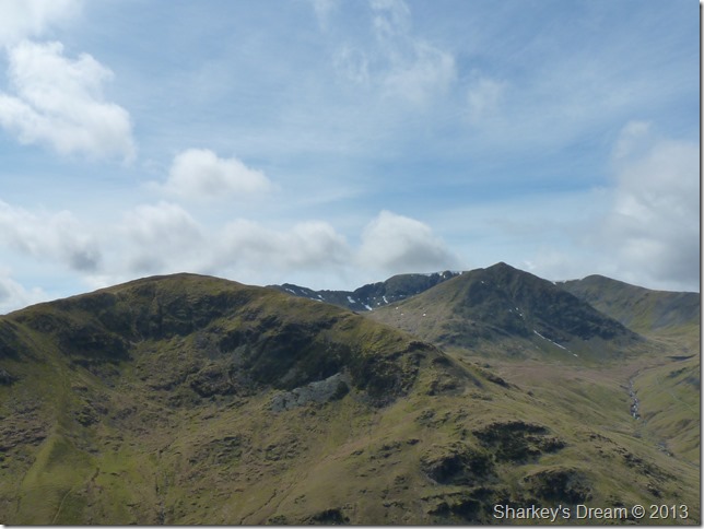
Raise, Catstye Cam & Helvellyn from Green Side summit cairn.
The razor edge of Catstye Cam can clearly be seen now that the cloud has lifted. |
 |
| |
Bearing down on Sheffield Pike via Glencoyne Head. |
 |
| |
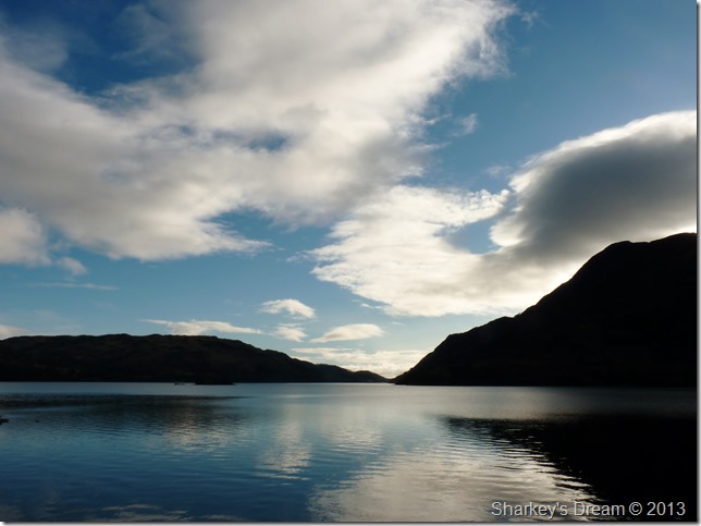
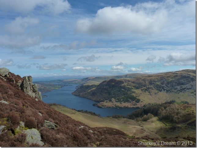
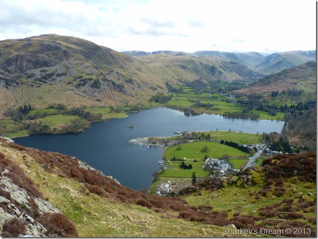
The Glencoyne Valley with a deep blue Ullswater beyond.
What happens next just made my birthday even greater as I stumble upon… |
 |
| |
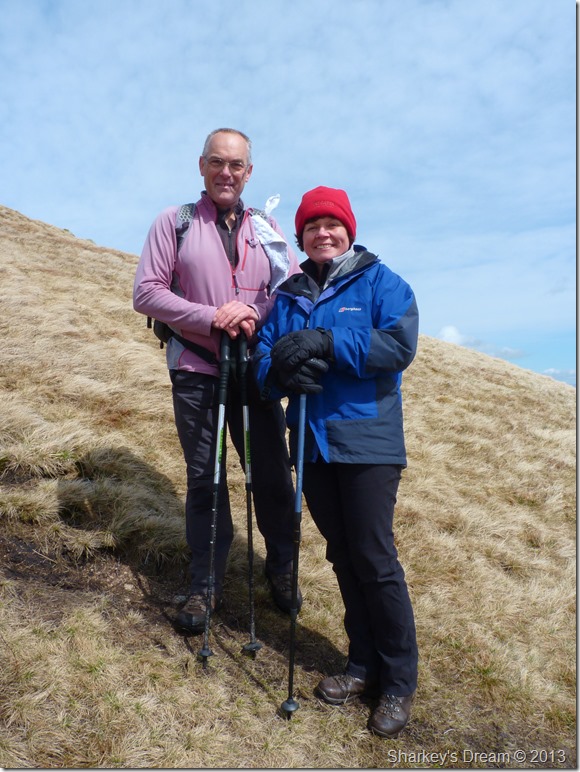
David & Jennifer Hall.
For those who do not live on planet earth David Hall is to Lakeland Fells what David Beckham is to the English game of football, and what Muhammad Ali is to boxing.
As I left Greenside for Nick Head I spot two walkers heading up towards me, I am head down concentrating on a steep grassy descent so I only lift my head to pass on an Hello…Is that…is that David Hall I ask myself? Behind the two walkers was a woman in blue wearing a red hat.
This confirms it because the woman in blue is Jennifer Hall who is more commonly seen on David’s website than David himself.
I cannot let this moment pass as I politely stop Jennifer & ask her, excuse me, is that David Hall? yes, yes it is…David, David Jennifer Shouts, David retreats down the grassy slope hand aloft as I reach out my hand & proceed to tell David that I owe my walking career to him, without David Hall & others like him, I simply would not be where I am today.
How can you thank a man for that?
Nervous conversation proceeds on my behalf, we chat for a few moments on our routes & so on as David comments on my ascent, are you local, you sound local? No sorry, I’m just a broad Wiganer!
We pass more comments before shaking hands & a quick photo, at the age of 39 I have just been made to feel like a young boy who has just met his childhood hero.
David, if you do read this I couldn’t help but wonder after me telling you about this blog where I got the name for my blog from as Sharkey’s Dream sounds as detached from Lakeland as it possibly could.
Sadly David has had to take away his contact email address on his website due to overwhelming popularity, I just needed to confirm one thing so David if you read this…
Sharkey is my surname, the Dream part came from my dream of completing all 214 Wainwright’s as I never thought I could have accomplished this.
Without the help of you & your website, I simply wouldn’t have. |
 |
| |
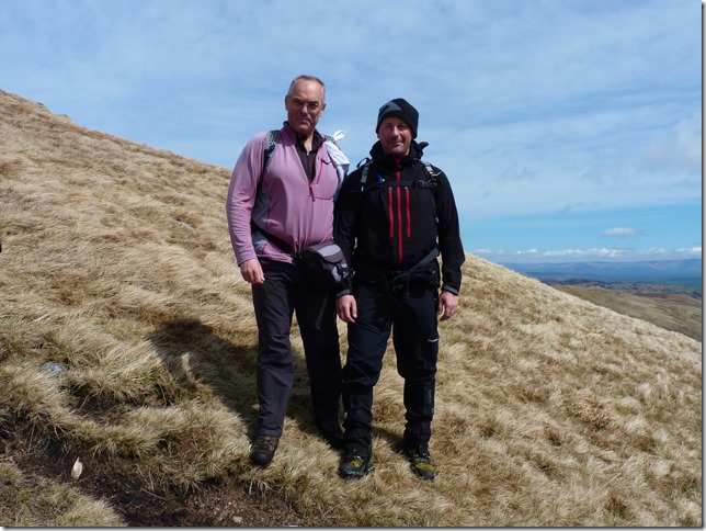
| Me & David Hall. |
 |
| |
Looking back on ground covered from Sheffield Pike summit, taking centre is the unmistakable Catstye Cam now completely cloud free. |
 |
| |
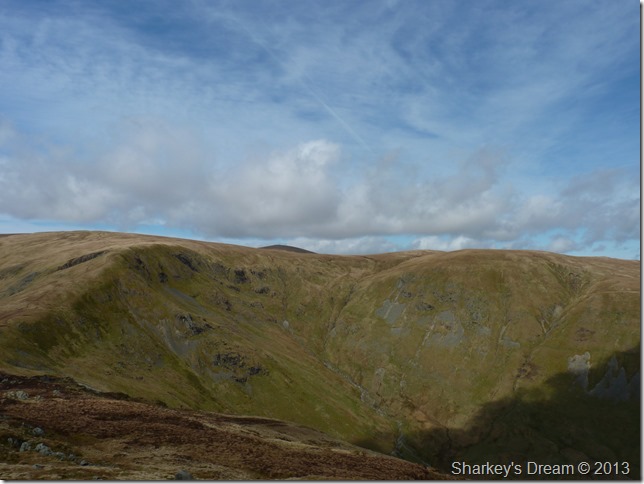
Glencoyne Head with Hart Side (centre right & David’s next fell) The dark fell in the background is that of Great Dodd. |
 |
| |
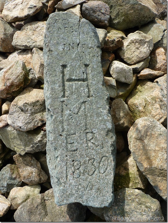
The iconic summit boundary stone marker.
Sadly the stone was lying flat on its back & in danger of being buried within the stone cairn itself, I really wish I would of had the time to stand the marker upright but time was not on my side today.
Maybe next time.
I press on towards my last summit of the day under glorious midday heat. |
 |
| |
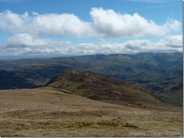
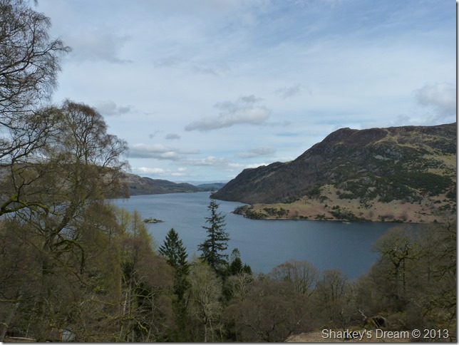
Ullswater from Heron Pike’s south east ridge. |
 |
| |
A close up of the bulk of Birkhouse Moor, Catstye Cam, Striding Edge (far left) & Helvellyn, the peak to the right of Catstye Cam is Helvellyn Lower Man. |
 |
| |
| The Rhinoceros & the Shark |
 |
| |
Birkhouse Moor & a glimpse from Catstye Cam from Glenridding Dodd summit cairn. |
 |
| |
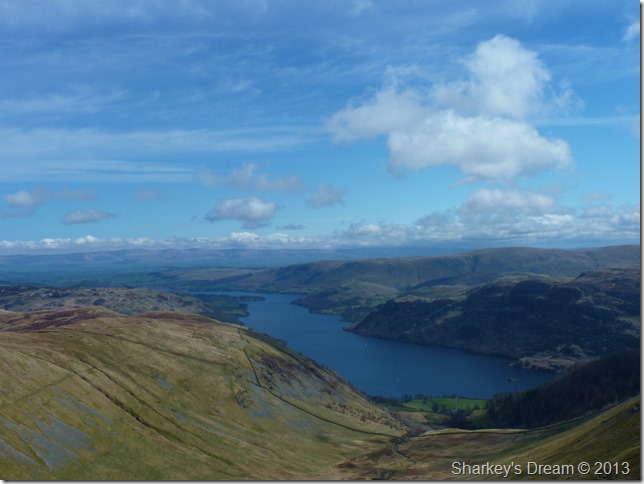
You get great views of Glenridding & the south end of Ullswater from the summit of Glenridding Dodd, here taking in the far eastern fells with Place Fell in the foreground.
My next issue is which way to descend Glenridding Dodd, I have more than three options two of which are available, I could track back the way I came & drop down onto Glenridding Common & skirt myself back around the fell to Stybarrow Crag, or I could try a route that I have never tried before.
I leave the summit with views of the whole length of Ullswater taking on a steep descent through wood & marshland, the path looks old & in parts I’m in fear of losing it as it is scattered with dead wood & fallen trees, to my amazement a woman walker is heading up my route down, we pass on our hello’s as I continue to negotiate the steep path, it’s not the best path in the world but it will lead me all the way back to Stybarrow Crag car park.
The path offers fine views too. |
 |
| |
Ullswater from my wooded descent.
The car is less than ten minutes away where I am greeted by the hustle of the A592, cars are stacked & badly parked, motorbikes roar in succession as kids laugh & play on the shores of Ullswater.
This is summertime in Lakeland yet not ten minutes away the mind can escape beyond a windscreen or an ice cream van into open fell land & beauty beyond the wildest imagination, lets hope not every transition takes place.
None of which can take away such a memorable Birthday walk. |
|
| |
| Back to top |
 |
|