|
Catstye Cam from Glenridding |
 |
 |
11th March 2023 |
 |
|
Despite Spring being just around the corner the Lakeland fells are in full Winter condition non more so than Helvellyn and its neighbours. Snow had fallen Wednesday evening into Thursday morning, affecting the midlands before spreading north east and west causing travel disruptions that caused Rod to pull out of today's walk after the snow gates were dropped along the A66 at Bowes Moor.
David and I kept an eye on the roads, which by Friday lunchtime for the north west at least looked like they were returning to normal, which gave us our green light for the walk. It was another day when the forecasters got it wrong, forecasting a bright morning before more snow would arrive by evening, but at least the cloud remained high and it stayed dry for us.
Catstye Cam from Glenridding is a route I've returned to a few times now, it's a walk I always reserve for winter where you get to experience Helvellyn and its edges in their prime. |
|
| Wainwright Guide Book One |
 |
| The Eastern Fells |
| Catstye Cam is a true peak, and its small shapely summit is the finest in the eastern fells, if it were rock and not mainly grass it would be the finest in the district. |
 |
|
|
|
| |
|
Overview |
|
|
| Ascent: |
2,560 Feet - 780 - Metres |
| Wainwrights: |
2, Birkhouse Moor - Catstye Cam |
| Weather: |
Limited Sunshine, High Level Cloud With Light Winds Across The Summits. Highs of 5°C Lows of -3°C Feels Like -2°C |
| Parking: |
Parking Spaces, Stybarrow Crag, Ullswater |
| Area: |
Eastern |
| Miles: |
7.5 |
| Walking With: |
David Hall |
| Ordnance Survey: |
OL5 |
| Time Taken: |
5 Hours |
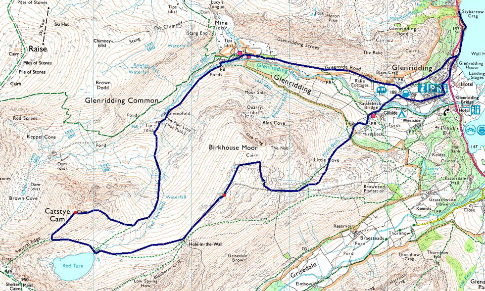
| Route: |
Stybarrow Crag - Glenridding - Rattlebeck Bridge - Mires Beck - Birkhouse Moor - Red Tarn - Catstye Cam - Red Tarn Beck - Greenside Mine - Greenside Road - Stybarrow Crag |
|
| |
|
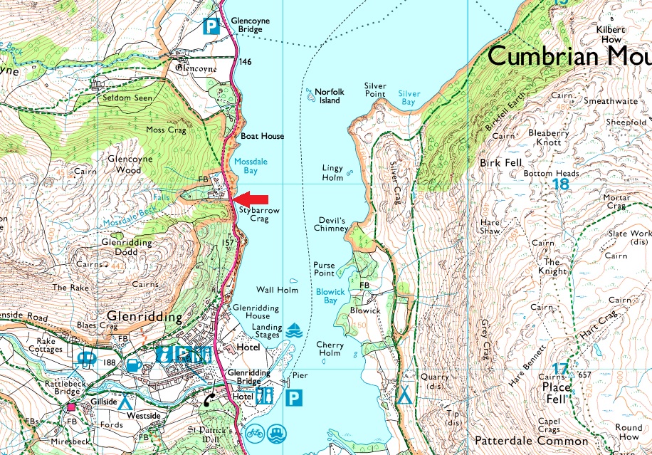
Parking Details and Map |
|
|
| Nearest Post Code: |
CA11 0NG |
| Grid Reference: |
NY 387 117 |
| Notes: |
The parking spaces at Stybarrow Crag are perfectly positioned for walks into and Glenridding, the Helvellyn range or even just a short walk up Glenridding Dodd. If travelling from the north the parking spaces will appear on the right as a long layby right opposite Ullswater or from the south they will appear on the left after leaving Glenridding. Despite the popularity of the surrounding fells and villages you would only have trouble parking here if left late into the day during Summer. Parking is free. |
|
| |
|
Map and Photo Gallery |
|
|
 |
| |
| |
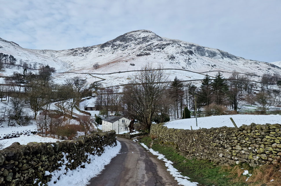 |
| Birkhouse Moor and Mires Beck 08:00am -3°C |
| We had arranged to meet at 8:00am for a 08:15am start at Stybarrow Crag but I arrived early shortly followed by David, and by 7:45am we were kitted up and ready to go. The sun was up and climbing into a cloudy sky, and it certainly wasn't the clear skies we'd been promised. I'd packed my spikes, but for good measure, we both packed crampons adding extra weight to already laden packs. I was in the same position as I was last week regarding which camera I use: my DSLR or mobile phone. Due to the cloudy skies, it looks like I'll be using my mobile phone again. We left the ice-covered car park and crunched our way across the A592, then dropped down to take the Ullswater shore path as far as the bottom end of Greenside Road before following the A592 into Glenridding.
It was here we were stopped by a couple walking their dog who asked us for some advice: "Excuse me, we're thinking of climbing High Street later from Mardale; do you think it'll be ok on a day like today?" "It would" we replied, "but if you were thinking of setting off from Mardale now is the time you should be doing it; you'll struggle to park gone 09:00am plus I wouldn't recommend it anyway as the road through the valley wouldn't have been gritted. Best if you go from Hartsop via Hayeswater Gill plus it's only down the road."
The couple politely thanked us before we crossed the A592, where David reminded me, "Blimey, we could have parked on the narrow road facing the car park; you can park here between October and March free of charge" I could have bloody kicked myself for forgetting, but I was in a work Teams meeting whilst trying to organise the walk between emails and I'd totally forgot about the free parking. |
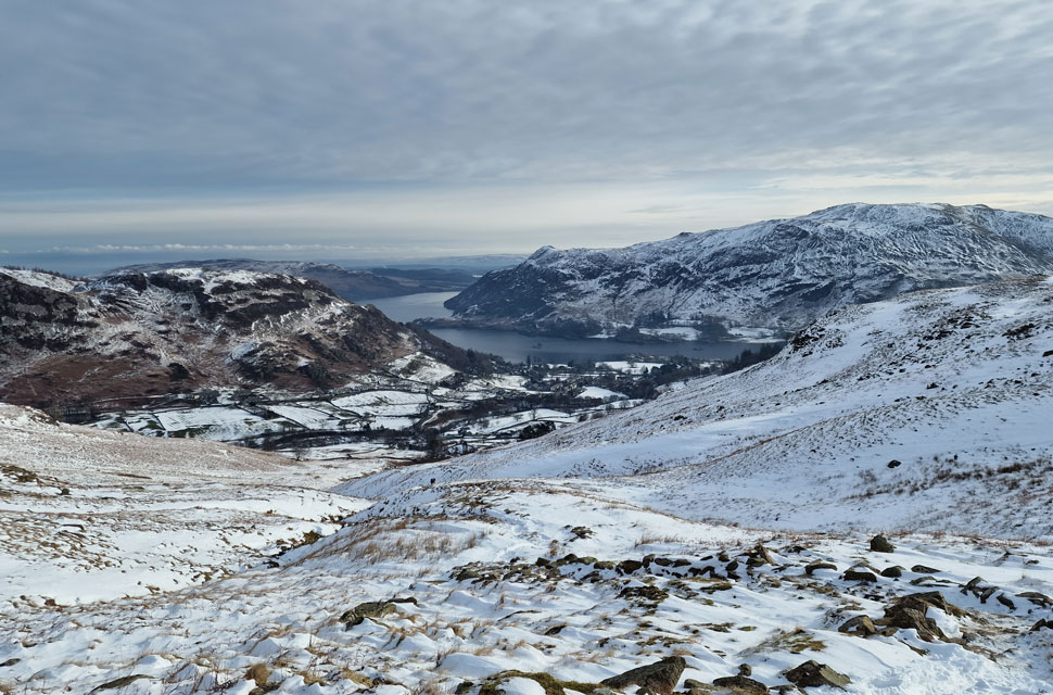 |
| Looking back on Glenridding Dodd, Glenridding, Ullswater and Place Fell from Mires Beck. |
| Still kicking myself about the parking, we passed through a sleepy Glenridding, then crossed Rattlebeck Bridge while peering across to Gillside Campsite, which for the beginning of March was quite busy with motorhomes. Snow was down to valley level, which we didn't really notice until we began our ascent alongside Mires Beck finding the path under a couple of inches of snow, which for now wasn't really causing any issues. |
 |
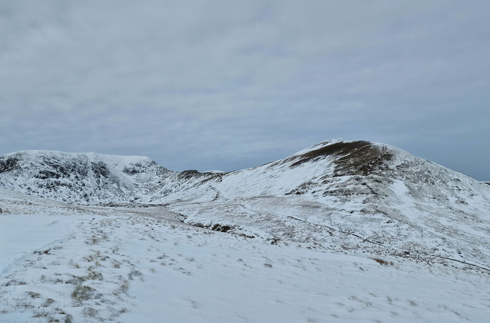
| Striding Edge, Helvellyn, Swirral Edge and Catstye Cam from Birkhouse Moor. |
| David was the first to remove a layer in the form of his jacket, closely followed by myself, who removed my hat and gloves. The climb alongside Mires Beck is a great ol' slog, where briefly the sun broke through the clouds and we started to feel the heat exerted by the climb. At the top of Mires Beck, the path swerves right and continues to climb towards Birkhouse Moor, which is where we were passed by three walkers who looked like they'd been up for the sunrise (headtorches but no signs of tents) I couldn't but help feel sorry for them after missing out on the sunrise due to cloud cover. |
 |
| Striding Edge, Helvellyn, Swirral Edge and Catstye Cam from Birkhouse Moor summit. |
| Despite encountering drifts as we rounded the shoulder of Birkhouse Moor as we approached the summit the path for now at least was relatively snow free. |
 |
| Dollywagon Pike, Nethermost Pike East Ridge and Nethermost Pike from Birkhouse Moor. |
| Looking almost mono in the flat light. |
 |
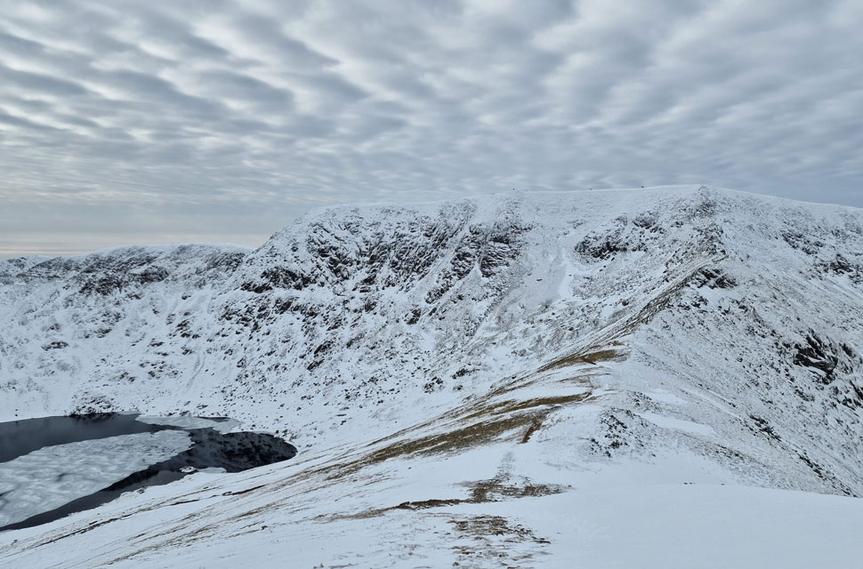
| Helvellyn, Swirral Edge and Catstye Cam. |
| With Red Tarn Beck seen in the foreground. |
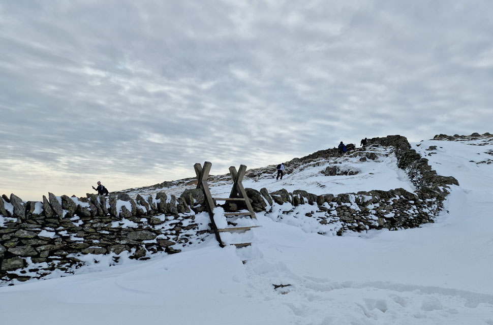 |
| Hole-in-the-Wall. |
| We were passed by a young couple who had been on our tail for much of the ascent who made their way towards Striding Edge as were most walkers who had ascended via the Grisedale valley. |
 |
| Helvellyn, Swirral Edge and Catstye Cam. |
| |
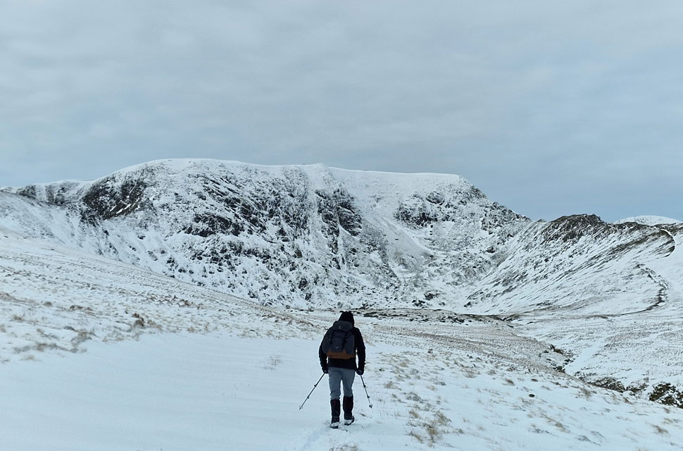 |
| David leads the way... |
| ...as we head towards Red Tarn. |
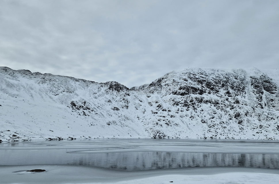 |
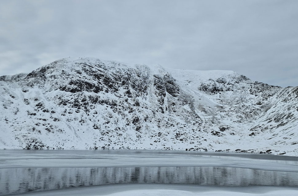
| High Spying How on Striding Edge and Helvellyn from Red Tarn. |
| We blazzed through drift to reach a semi frozen Red Tarn where we spent a few moments soaking it all in. |
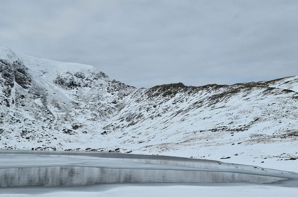 |
| Swirral Edge from Red Tarn. |
| You can just about see walkers who were gathered around the summit trig point. |
 |
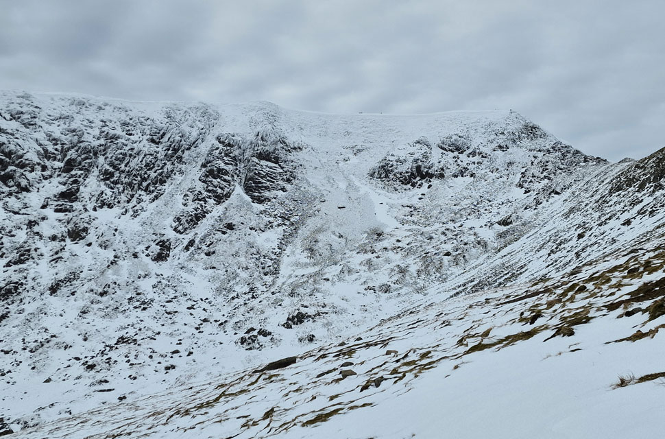
| Helvellyn East face from Red Tarn. |
| |
 |
| Leaving Red Tarn for the col linking Swirral Edge with Catstye Cam. |
| During our ascent towards the col, we watched a climber climb alongside the patch of snow in an area known to climbers as the Snow Bowl. The climber then traversed below the large crag over on the right known as Pear Buttress, after which we lost sight of him or her. |
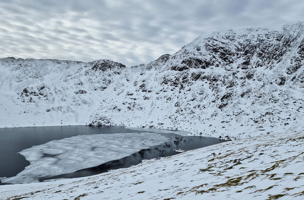 |
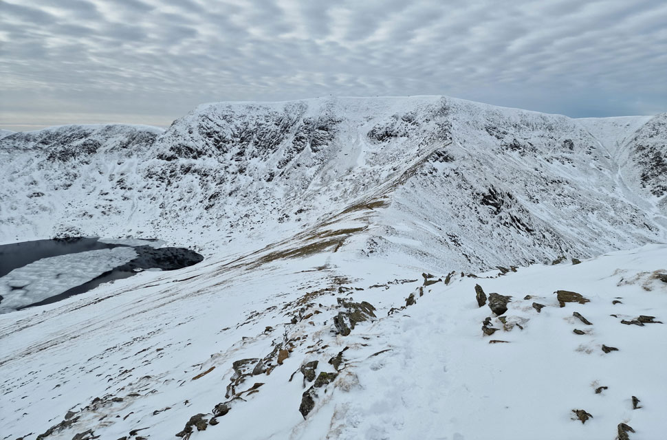
| Striding Edge and Helvellyn seen across Red Tarn. |
| |
 |
| Arriving at the col. |
| We first took in the view over Brown Cove towards Lower Man. |
 |
| The Striding Edge. |
| Capturing some lovely light in the distance. |
 |
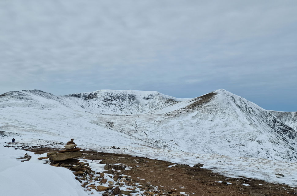
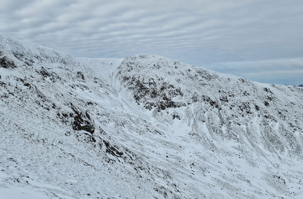
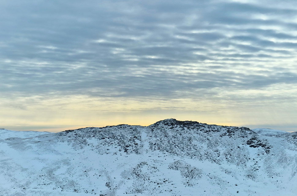
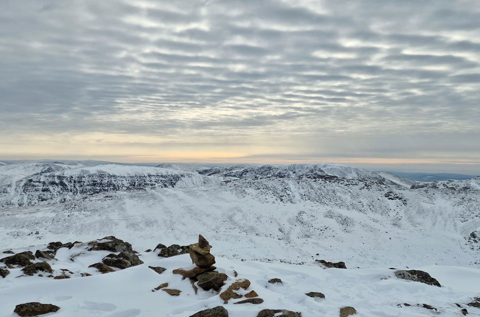
| Nethermost Pike and Helvellyn from the ascent of Catsye Cam. |
| Note how the Cirrocumulus cloud above is creating a ripple effect. |
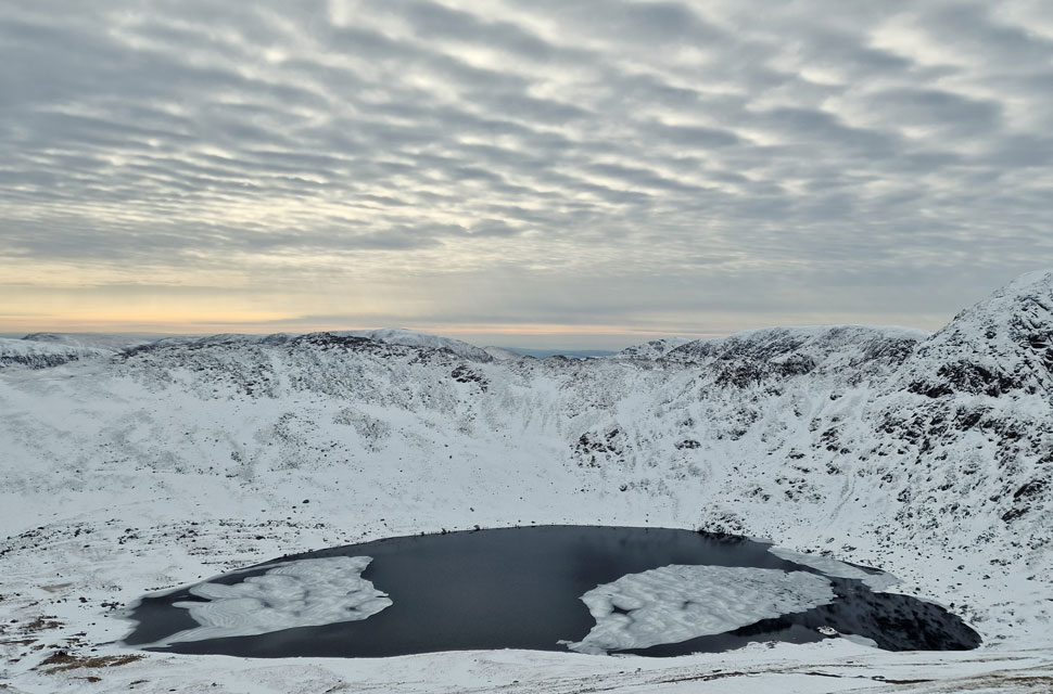 |
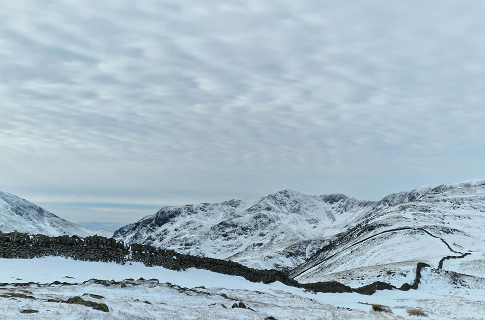
| Red Tarn and Striding Edge. |
| With Nethermost Pike, Dollywagon Pike, Fairfield and St Sunday Crag seen beyound. |
 |
| Nethermost Pike and Helvellyn from Catstye Cam. |
| Almost at the summit now. |
 |
| St Sunday Crag and the Fairfield range from Catstye Cam summit. |
| Admiring the views I arrived at the summit a little after David, where we were surprised to feel how calm it was. With little to no wind, the summit felt really peaceful, however four hours later, all that would change when the Fell Top Assessor took readings from the exact same spot, recording 18.7mph wind with a -10.8°C windchill. |
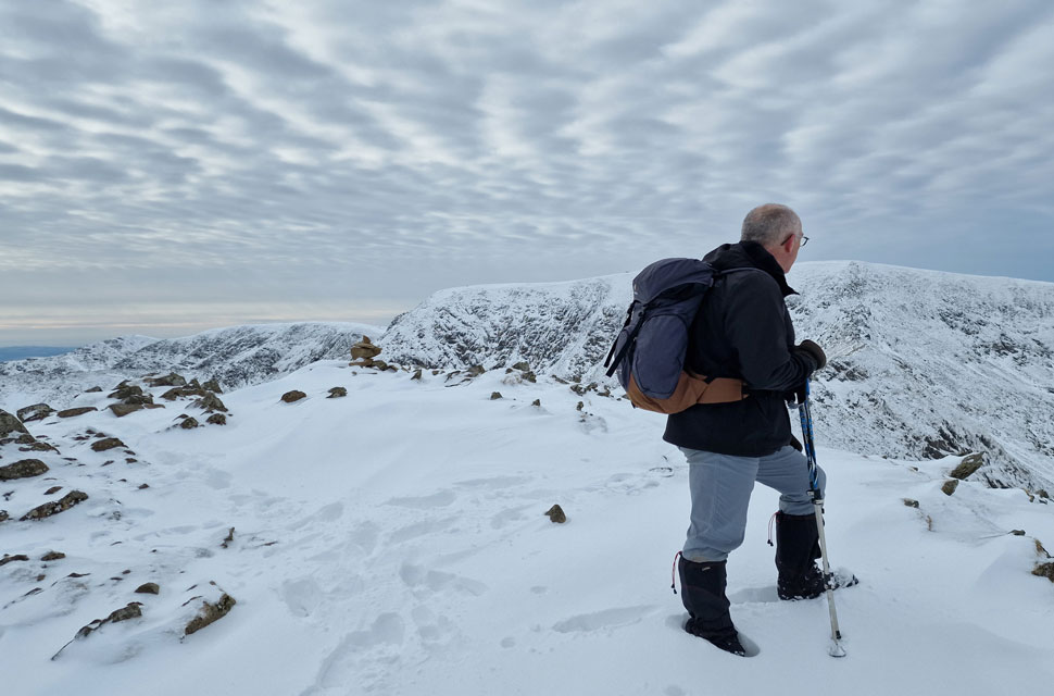 |
| Surveying. |
| |
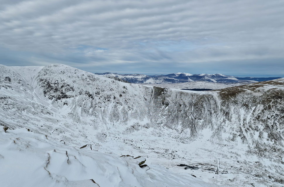 |
| Views over Brown Cove towards Lower Man and a distant Grasmore group. |
| With the ruins of Browncove Dam below. |
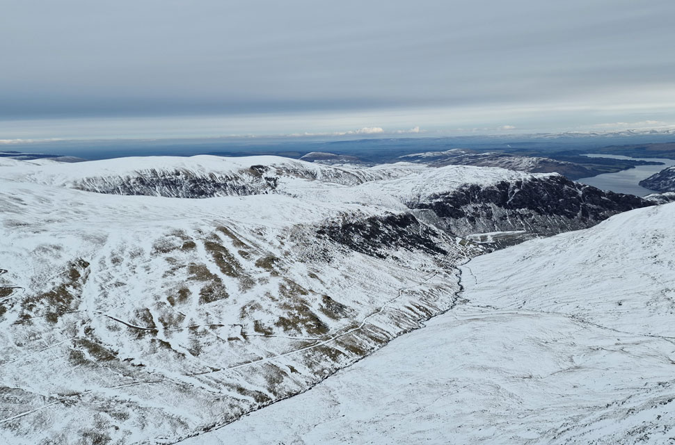 |
| Looking down on Glenridding Beck with a long distant view of Ullswater. |
| Not forgetting Stang, Sheffield Pike and Hart Side. |
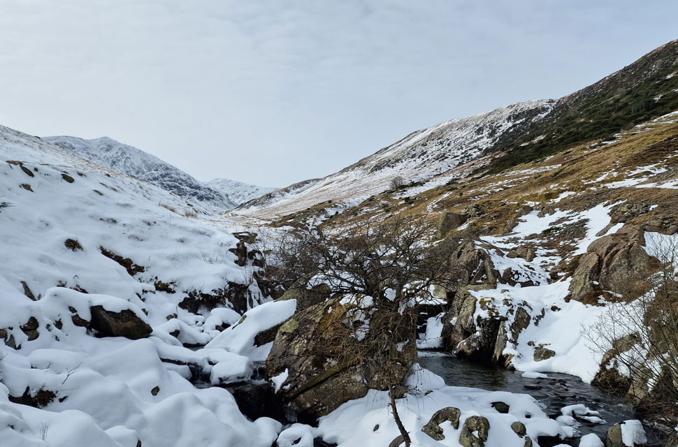 |
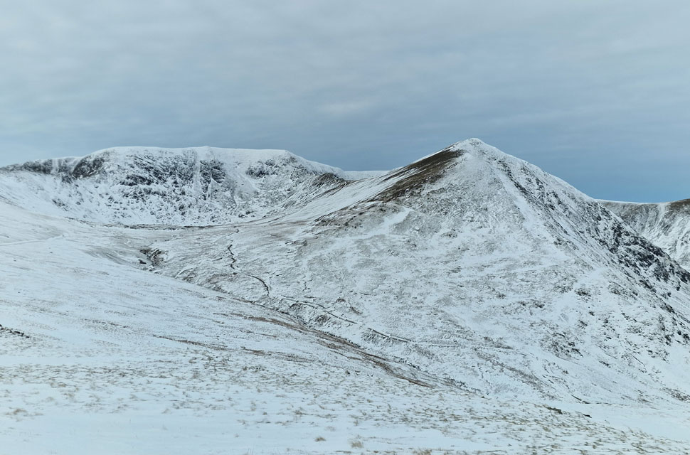
| The view from Glenridding Beck towards Catstye Cam and Lower Man. |
| From the summit of Catstye Cam we decsend steeply east then south to meet up with the path alongside Red Tarn Beck. Given the snow underfoot, the descent is slow due to the thawing snow underfoot. |
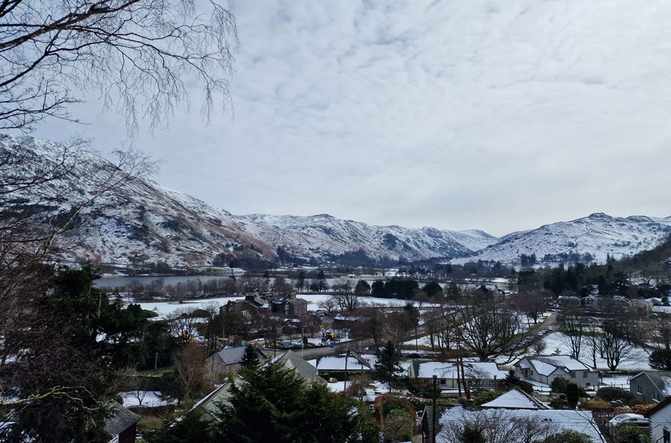 |
| Glenridding roof tops. |
| Continuing our descent alongside Red Tarn Beck passing walkers in ascent, most of whom are equipped for the edges and some, not. The path had a good covering of snow, sometimes no more than a couple of centimeters, and others the snow had drifted calf deep. The sun was trying to break through the cloud layers and when it did it felt warm and Spring like. David delayered at the footbridge where Red Tarn Beck flows into Glenridding Beck.
Glimpses of blue sky appeared between the grey only for it to cloud over again, but the mildness of the afternoon remained. With Greenside Road reached pace quickened whilst taking in the views of Birkhouse Moor and, further along, Glenridding. Above the road lost in the woodland properties old and new overlooked Ullswater and Place Fell, views you could only dream of owning. We crossed the A592 and dropped down onto the shore path just as we had this morning; its few ascents pulled on the calf muscles before a glorious view of Stybarrow Crag emerged overlooking Ullswater. Surprisingly, there were still places to park as I passed a young girl who was getting ready to take her kayak onto Ullswater. The ice had thawed in the warmth of the afternoon, leaving David and I planning future walks, noting that today might have been the last snow day until next winter arrives. |
|
| |
| Back to top |
 |
|