|
A Round of Marchlyn Mawr |
 |
 |
6th April 2026 |
 |
|
|
| |
|
Overview |
|
|
| Ascent: |
2,149 Feet - 655 Metres |
| Summits Over 3,000ft: |
Elidir Fawr |
| Visiting: |
3, Elidir Fach - Mynydd Peredd - Carnedd y Filiast |
| Weather: |
A Cold & Overcast Start, Cloud Clearing Leaving Intermittant Sunshine. Strong Winds throughout. Highs of 14°C Lows of 6°C Feels Like -3°C |
| Parking: |
Roadside Parking, Access Road Marchlyn Mawr Reservoir, Deiniolen |
| Area: |
Eryri National Park (Snowdonia) |
| Miles: |
6 |
| Walking With: |
On My Own |
| Ordnance Survey: |
OL17 |
| Time Taken: |
3 Hours 50 Minutes |
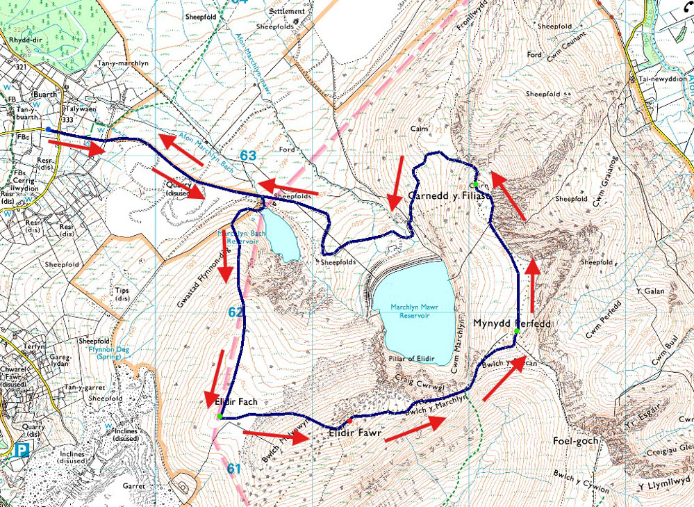
| Route: |
Access Road Marchlyn Mawr Reservoir - Marchlyn Bach Reservoir - Elidir Fach - Elidir Fawr - Bwlch y Marchlyn - Mynydd Perfedd - Carnedd y Filiast - Marchlyn Mawr Reservoir - Access Road Marchlyn Mawr Reservoir |
|
| |
|
Parking Details and Map |
|
|
| Nearest Post Code: |
LL55 3NA |
| Grid Reference: |
SH 596 630 |
|
| |
|
Map and Photo Gallery |
|
|
 |
| |
| |
 |
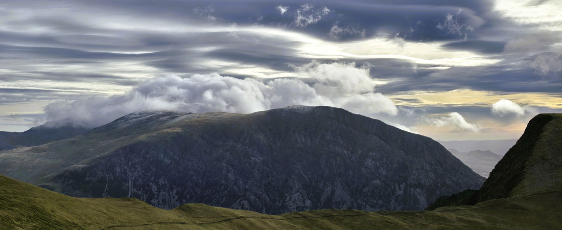
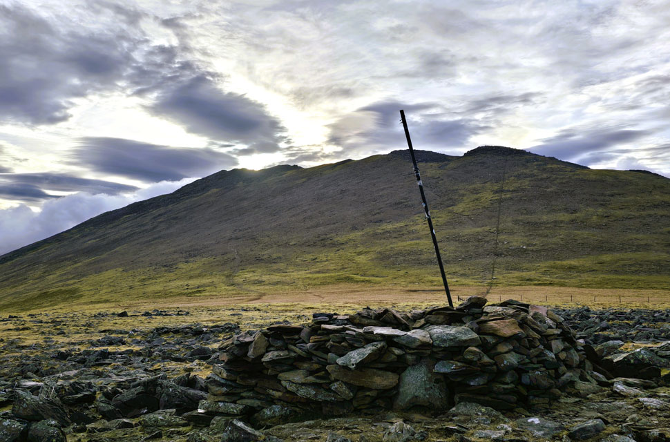
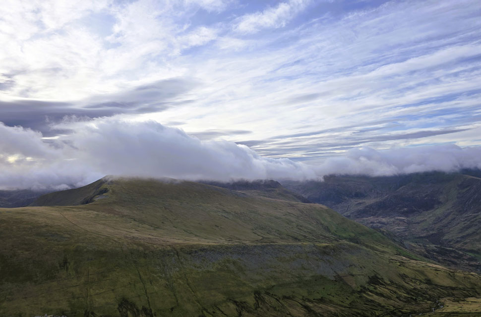
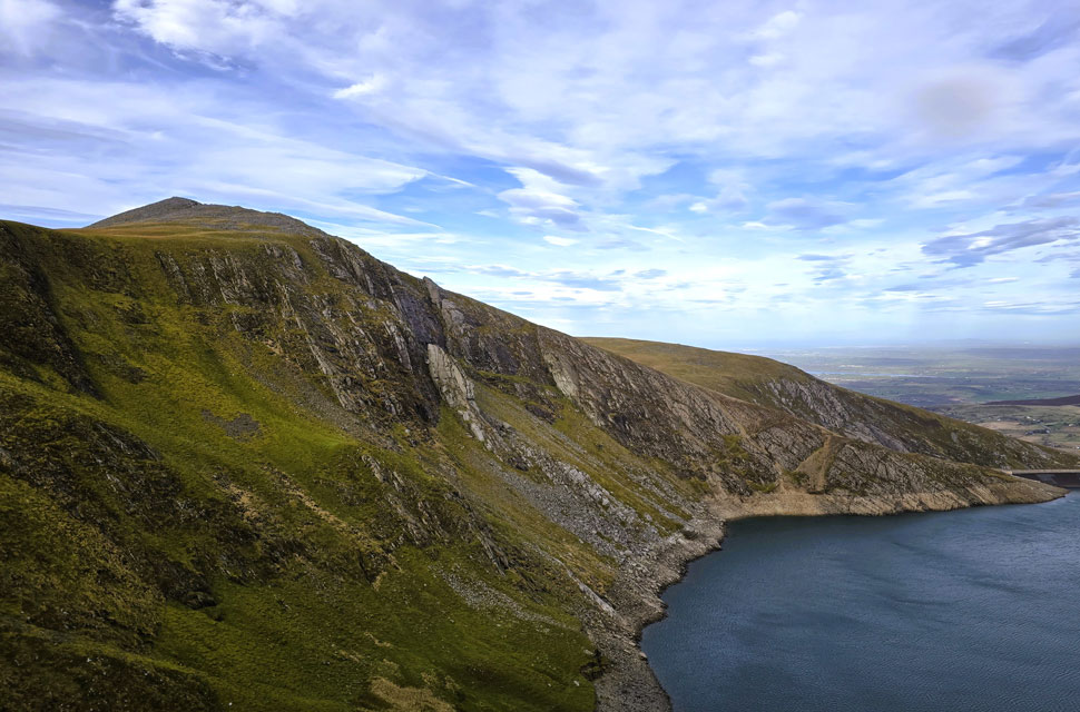
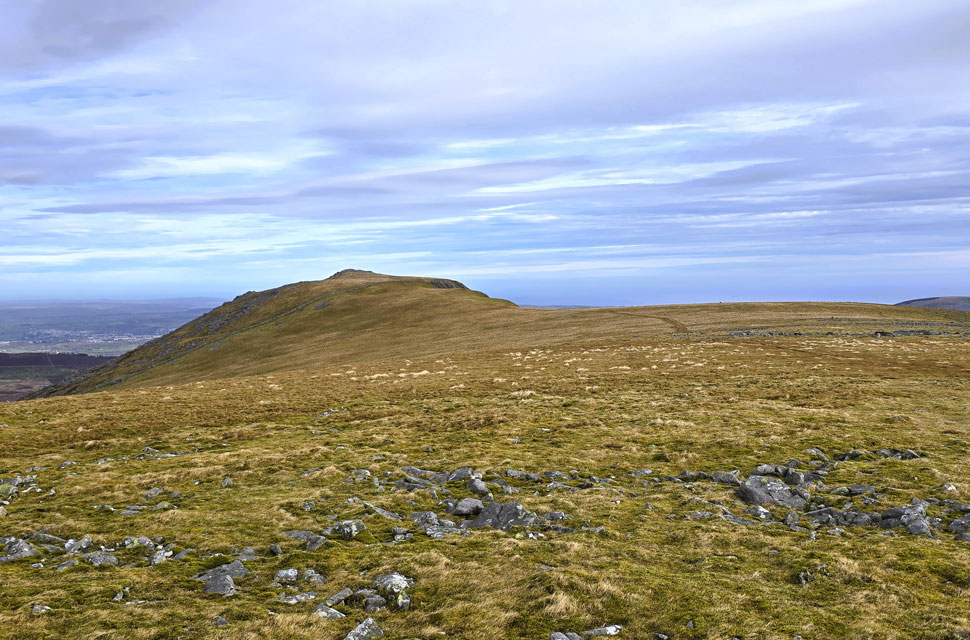
| Views beyond the cliffs of Elidir Fach towards Elidir Fawr 7:13am 6°C |
| Now that my gear had dried out, I started thinking about heading back to Lakeland to tackle a walk that's been on my to-do list for some time: Great Calva from Mosedale, maybe even tagging on Knott and Coomb Height. But the forecast favoured Snowdonia and, after the soaking David and I took on Saturday, I felt I deserved a bit of spring sunshine for a change. After defrosting the car, I left home at 4:30am under starry skies and a moon so bright it seemed to punch straight through any cloud that crossed its path. It took a few minutes for the heater to thaw me out, but the clear skies felt like a good omen for what awaited in Snowdonia National Park. Except… or so I thought.
I arrived to more cloud than I'd have liked more than had certainly been forecast with strong winds battering the car for good measure. At 6:30am I was early so I reclined the seat, stretched out, folded my arms and shut my eyes for a few minutes. Dawn began to break through the windscreen, turning the underside of the cloud a fiery red, only for more low level cloud to appear in from the east. Jeez, I thought, what on earth happened to the forecast.
It wasn't all doom and gloom. In the rear view mirror I had Caernarfon Bay sitting under clear blue skies. Perhaps I should have gone sailing, I muttered to myself. After a few minutes watching dawn unfold, I started kitting up: boots laced, jacket on at the back of the car, then back into the driver's seat to add hat and gloves. By now it was 6:44am, the wind was still howling outside the window, and truth be told this wasn't the start I'd been expecting. But there was no point moaning about something I couldn't change. So I got out, locked the car, and set off up the Reservoir Access Road. |
 |
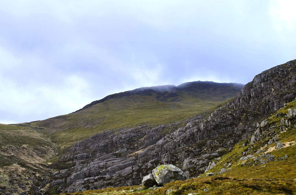
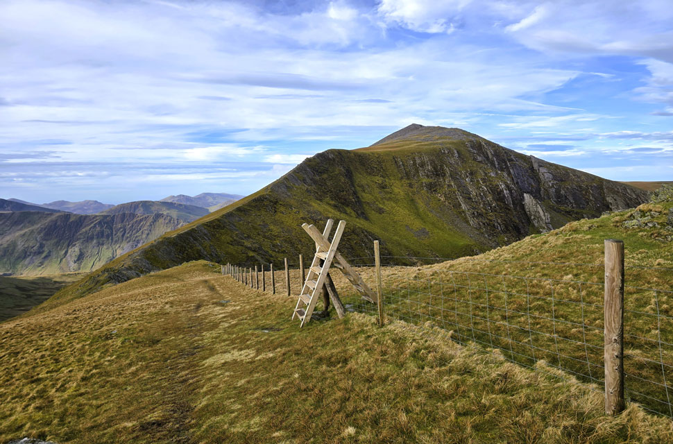
| Elidir Fawr from Elidir Fach summit. |
| The walk up the access road felt more like October than April. Low light, a howling wind without a hint of warmth. I didn't stop until I reached Marchlyn Bach Reservoir, where I turned right and passed through a large metal gate. The gate dropped as I opened it, and when I lifted it to slide the bar back across, I somehow managed to tangle my walking pole strap in the mechanism. I had to unloop my hand before I could retrieve the pole and I swear the two ravens circling over-head are now fluent in the F-word.
Dawn had broken by now, and my view east towards Carnedd Filiast and Mynydd Perfedd showed layers of cloud stacked at summit height and above, with hazy blue showing through in places. I was still too low to get a proper sense of what was happening up top, so I decided to crack on with the ascent fully exposed to the easterly wind that kept buffeting me side on. I'd worked up a sweat on the access road, but with height gained the temperature dropped and the wind strengthened. Despite being zipped to the chin, the cold wind was somehow finding its way down the back of my neck. I pulled my hoodie over my beanie, wiped my watering eyes with a gloved finger, and got stuck back into the climb. The shoulder finally neared, and the ground began to ease off with Elidir Fach summit a ten minute buffet away. |
 |
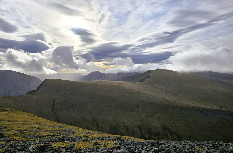
| Looking back on Elidir Fach from the ascent of Elidir Fawr. |
| By the time I reached the summit of Elidir Fach I was fully exposed to the wind and the bite of its windchill. With the height came a clearer sense of what was happening above: the surrounding tops sat tucked beneath summit cloud, while beyond them small gaps of blue sky were beginning to open. Two main paths climb Elidir Fawr from Elidir Fach. The first follows the fence (seen near the pool below) steep but direct, reaching the summit on its western edge. The second and preferred is a delightful, horizontal line with steep zigzags from about halfway up arriving at a more central summit position. The total ascent time between the two summits was sixteen minutes. |
 |
| Looking across the Llanberis Valley towards a cloud topped Snowdon. |
| I had been sheilded from the wind by the very mountain I had been climbing and I was bracing myself for the strong summit winds that awaited me but on the contrary, the wind seemed to have dropped and was much less of a handful than it was back on Elidir Fach just twenty minutes ago. |
 |
| Views back along the summit spine. |
| With Moel Elio, Moel Gron, Foel Goch, Moel Cynghorion and Llyn Dwythwch (tarn) in the distance. |
 |
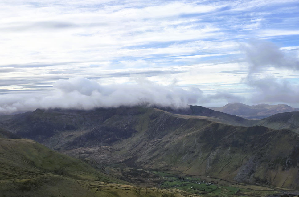
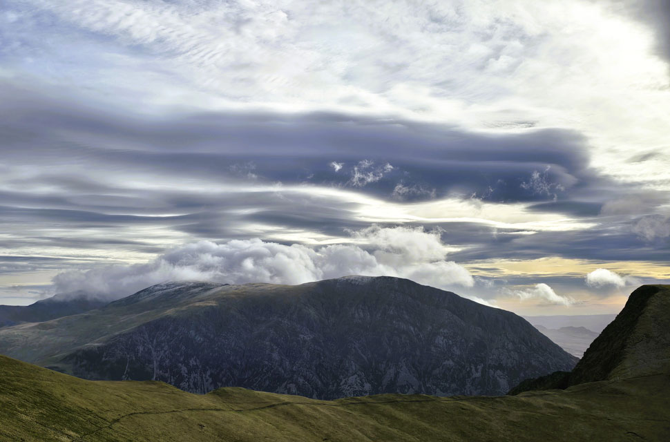
| Y Garn didn't escape the low cloud either. |
| I hold a lot of fondness for Y Garn it was the second three-thousand-footer I ever climbed in Snowdonia but it's also a very popular mountain, rivaling Helvellyn or Skiddaw in footfall. The best times to visit are during the week, when it's quieter and not on Bank Holidays like today. |
 |
| Views towards Mynydd Perfedd, Pen yr Ole Wen, Carnedd Dafydd, Carnedd Llewelyn, Yr Elen and Foe-goch. |
| From my centralised summit position I followed the ridge in a north easterly direction, the substantial summit shelter still hidden beyond an elevated boulder that had to be negotiated. I often trace left here, 'rock hopping' between the largely static boulders, but this time I headed right for a change, wanting to keep an eye on the ever changing skyline.
This line was less boulder some; instead I scaled and wormed my way over coffin sized blocks, often stacked in places, which meant less hopping and more hands on scrambling. The summit shelter soon appeared, and I was pleased to have it to myself for the brief minute I spent there taking in the views across the Ogwen Valley where summit and stratocumulus cloud dominated from above. |
 |
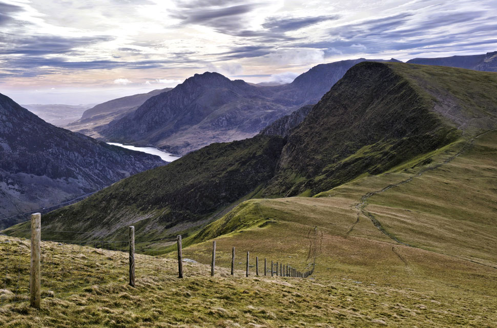
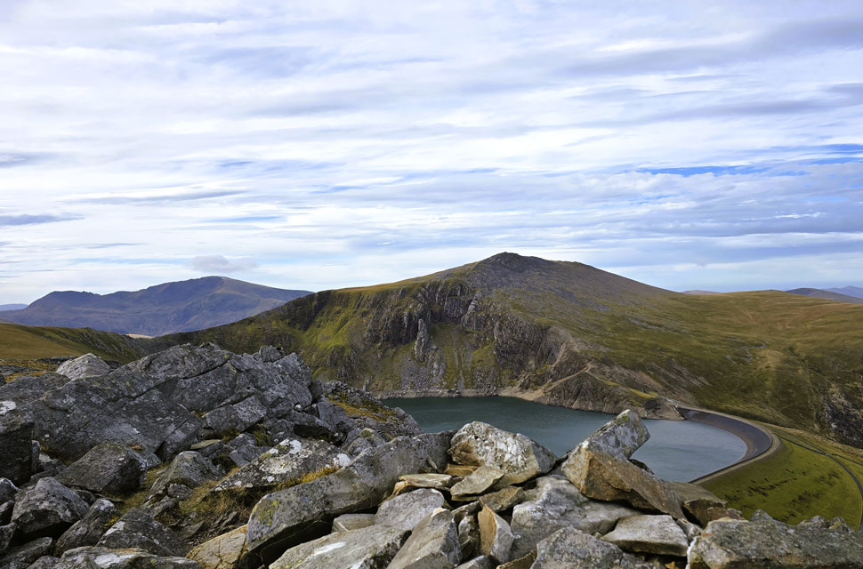
| Looking down on Marchyln Mawr Reservoir from Bwlch y Marchlyn ridge. |
| With Carnedd y Filiast and Y Fronllwyd seen over on the right. |
 |
| Views towards Foel goch and Y Garn from Bwlch y Marchlyn ridge. |
| With the sillouette of Tryfan and the Glyders (below cloud) seen beyond. |
 |
| Descending Bwlch y Marchlyn ridge. |
| With Mynydd Perfedd (left) Pen yr Ole Wen (centre) and Foel-goch (right) |
 |
| Pen yr Ole Wen. |
| Seen beyond Bwlch y Brecan and Foel-goch. |
 |
| Pillar of Elidir from Bwlch y Marchlyn ridge. |
| With a little exposure the walker can follow the spine of the Bwlch y Marchlyn ridge, but with today's wind I kept well back. I did, however, manage to reach the start of the ridge to take in the view of the Pillar of Elidir, seen centre. |
 |
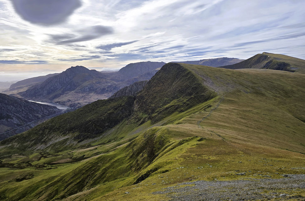
| Looking across the Bwlch y Marchlyn ridge towards Elidir Fawr. |
| It was at this point that I crossed paths with a solo walker who had ascended from Llanberis and, after descending Elidir Fawr, went on to scale Mynydd Perfedd. I watched him make his way across Bwlch y Brecan to take on Foel-goch, an impressive round, I must say, and one I happily shelved for another day. |
 |
| Dramatic views beyond Foe-goch towards Tryfan, the Glyders and Llyn Ogwen below. |
| |
 |
| As I said to the bloke who joined me from Mynydd Perfedd summit... |
| "It's hard to imagine a better mountain view anywhere in the UK." |
 |
| Elidir Fawr and Elidir Fach from Mynydd Perfedd. |
| Both myself and the elderly walker who had joined me retraced our steps back towards the summit cairn, chatting as we went. He explained that his knees could no longer take the strain of the 'big walks', and that he was content to head back via Carnedd y Filiast but not before a quick sit‑down in the summit shelter to enjoy his flask of coffee.
As I walked away, my heart sank a little by both joy and sadness. One day this will be me. It's something I've thought long and hard about; the only real advice I suppose, is in how I manage the change. And in that moment, I felt this fellow showed an outstanding example. |
 |
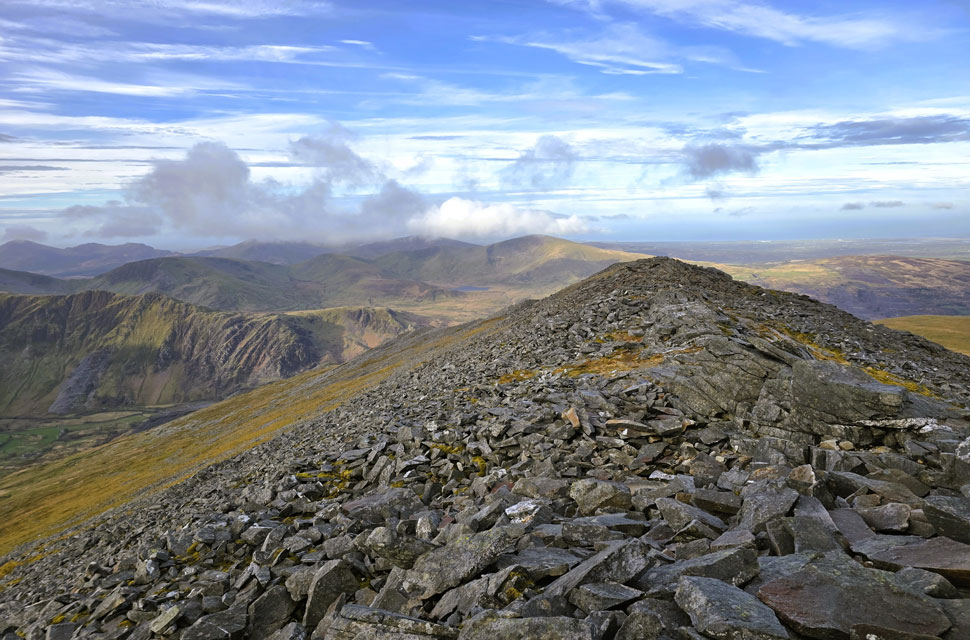
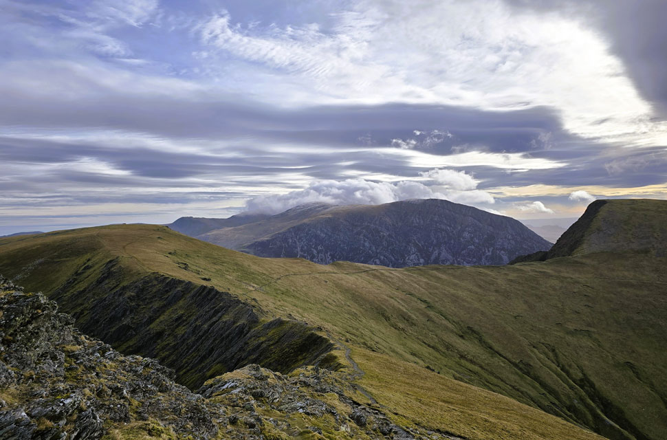
| Carnedd y Filiast ahead. |
| |
 |
| Garnedd Ugain, Snowdon, Elidir Fawr and Elidir Fach from Carnedd y Filiast summit. |
| I left Mynydd Perfedd summit behind and about half way in between it and Carnedd y Filiast I span around to see if I could see the elderly walker sighting nothing but after a few minutes on the third spin I spotted what looked looked like him to be twisting the lid back onto his flask. He had been only the fourth person I'd seen all morning which spoke volumes why I keep returning to do this round. I traced right and left the plateaued path to a trod above the Atlantic Slab, a 500 million year old slab of gritstone that once belonded the atlantic seabed now re-recognised as a popular Grade 3 scramble, there was no takers today.
Veering back onto the path I climbed over the wall via the ladder stile and once over the top spotted the eldery walker leaving the shelter, bloody good on him I thow't. From the wall it was a short walk then a hobble over boulder to reach the summit cairn its shelter now occupied by a young couple de-shouldering thier packs. I retraced my route over boulder back to the grassy plateau, turned north and began my descent. |
|
| |
| Back to top |
 |
|