A Scandale Round

9th May 2024

From as far back as last year, David and I had planned to spend three days wild-camping in Dartmoor National Park this week, and after putting a full itinerary into place, including the purchase of new gear, the forecast didn't just have to be right; it had to be perfect. I'm sure you'd agree if we were to take the 'lets see what happens' attitude we'd been rained on for the best part of three days.

All is not lost. David is back in Dartmoor next week on holiday with Jennifer, and there's no doubt he'll be doing a good reckie while he's there, ready for our next stab at Dartmoor in July.

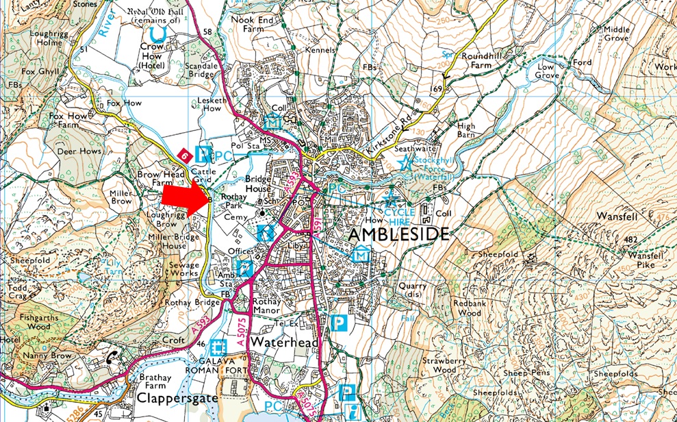
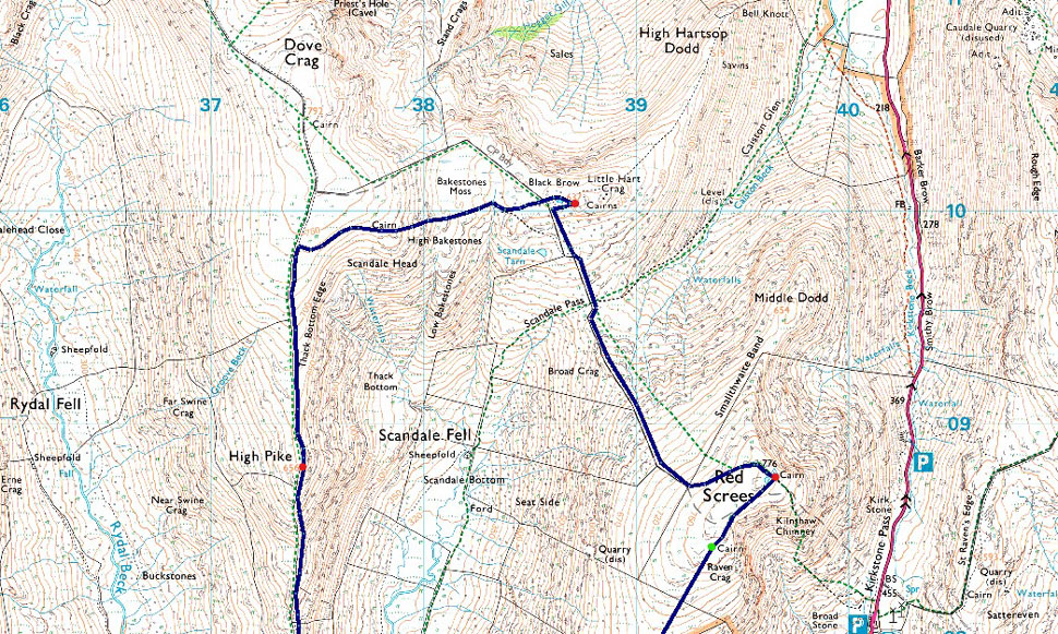
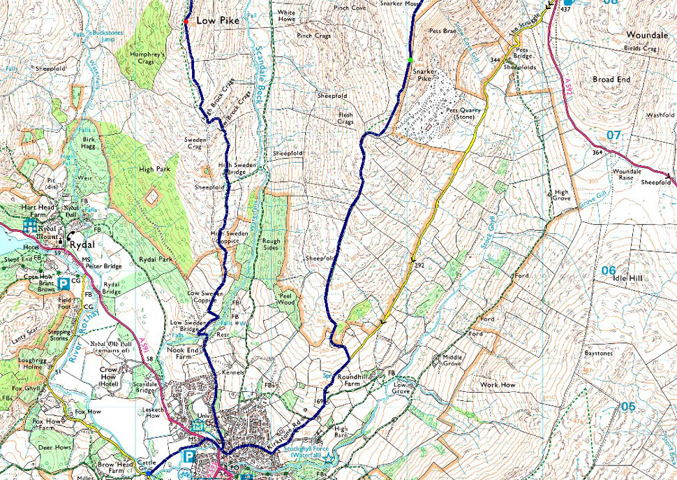
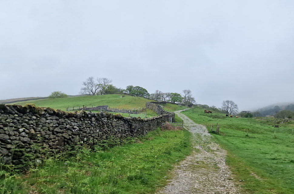
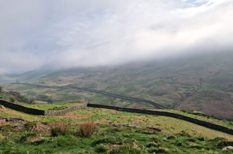
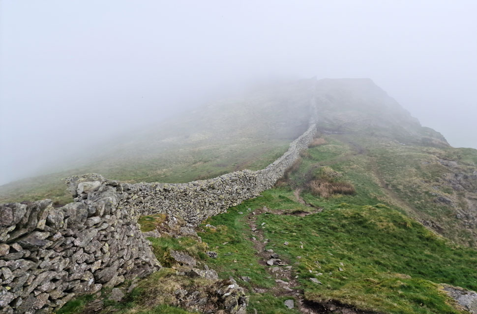
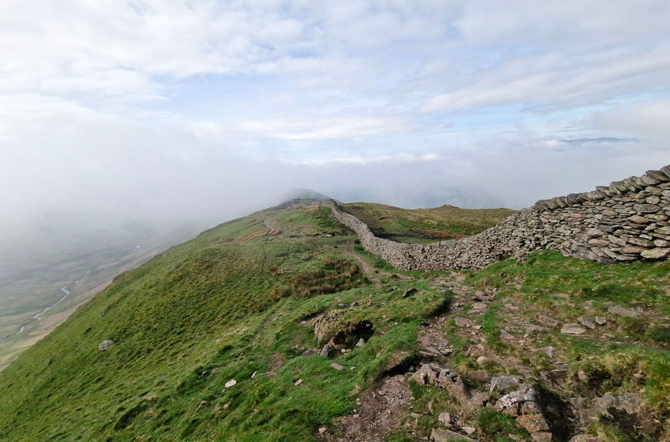
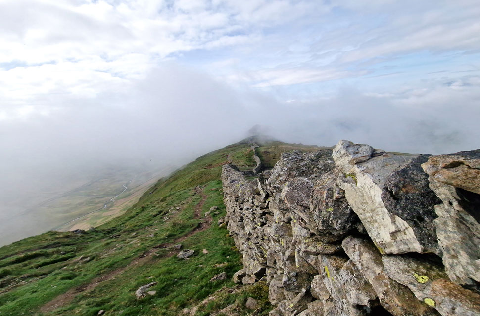
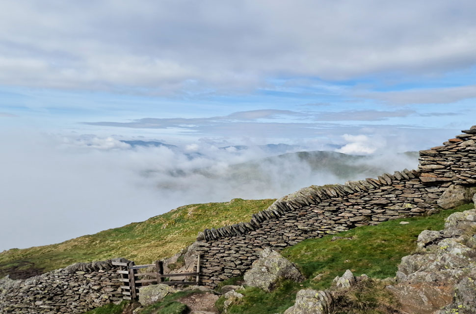
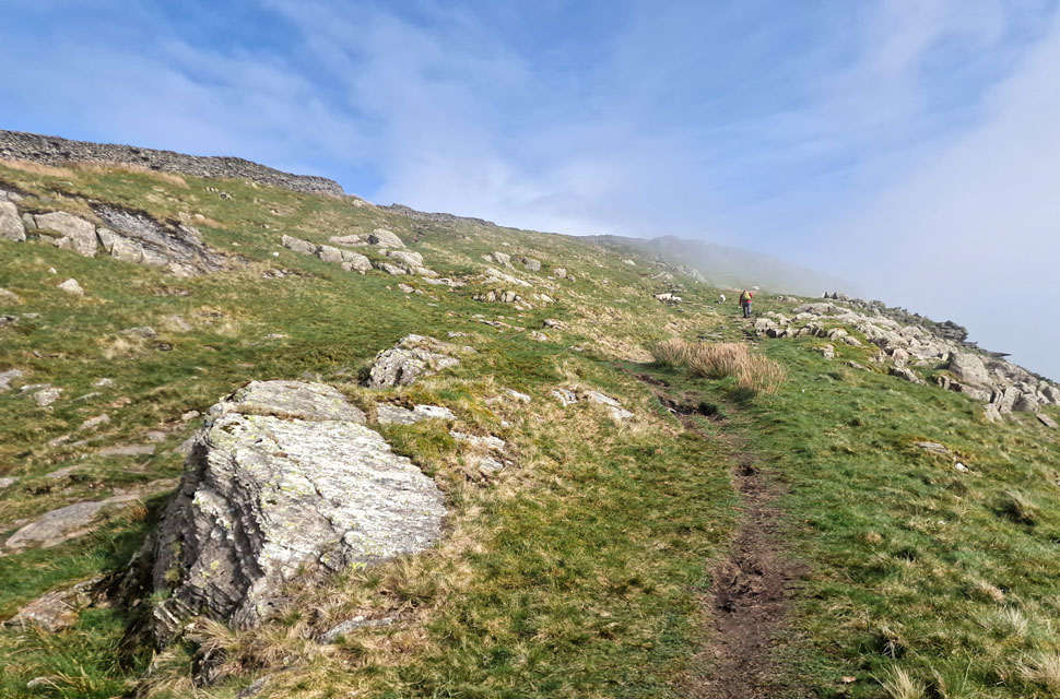
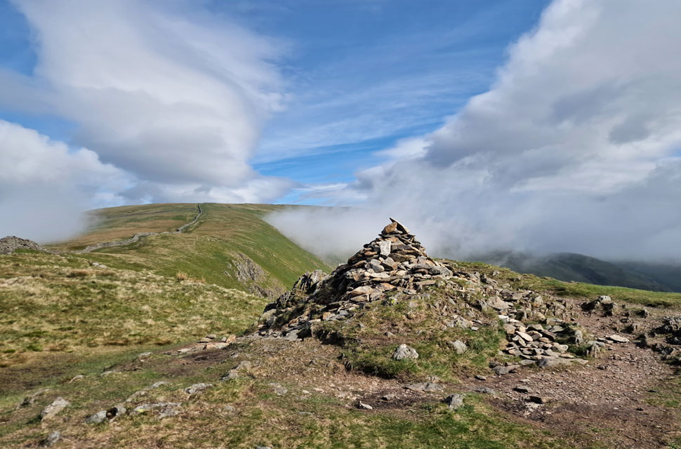
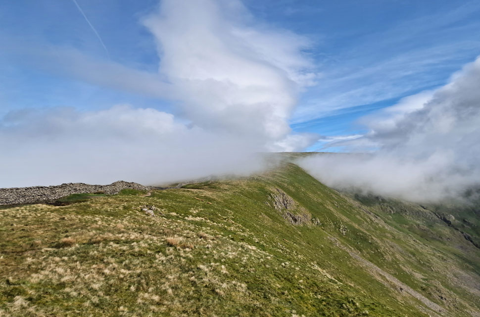
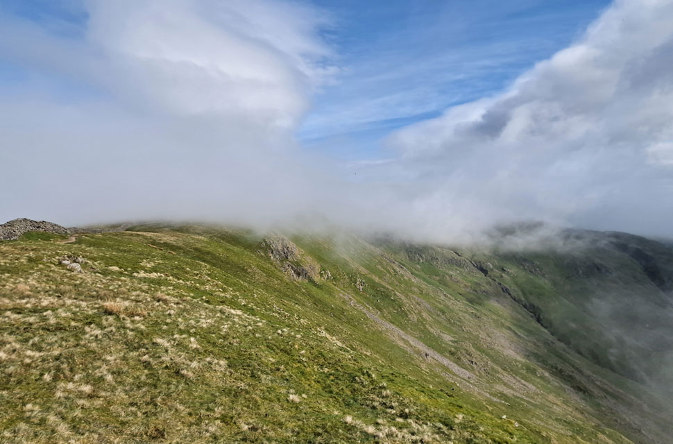
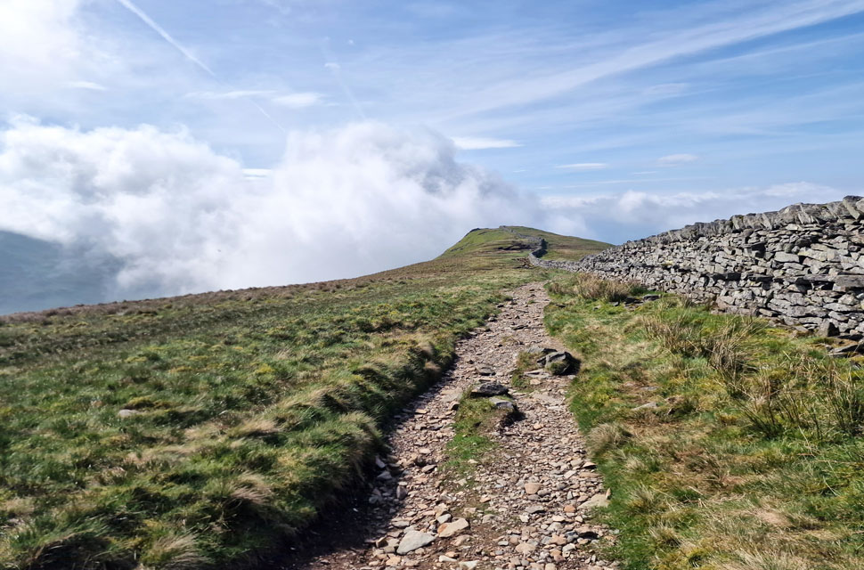
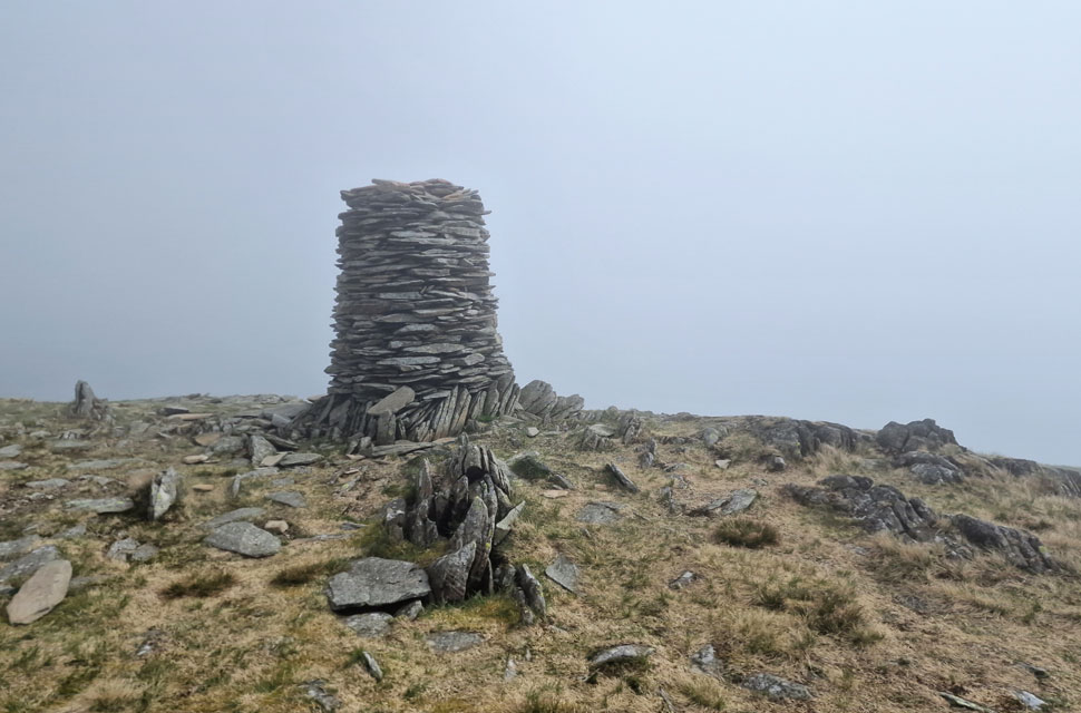
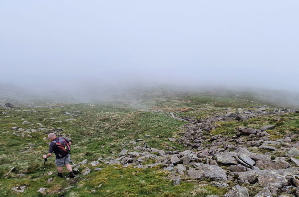
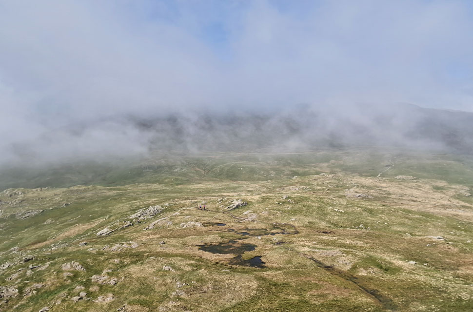
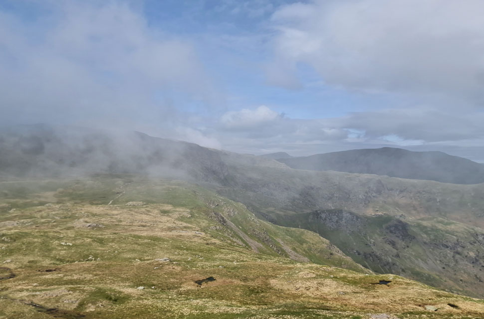
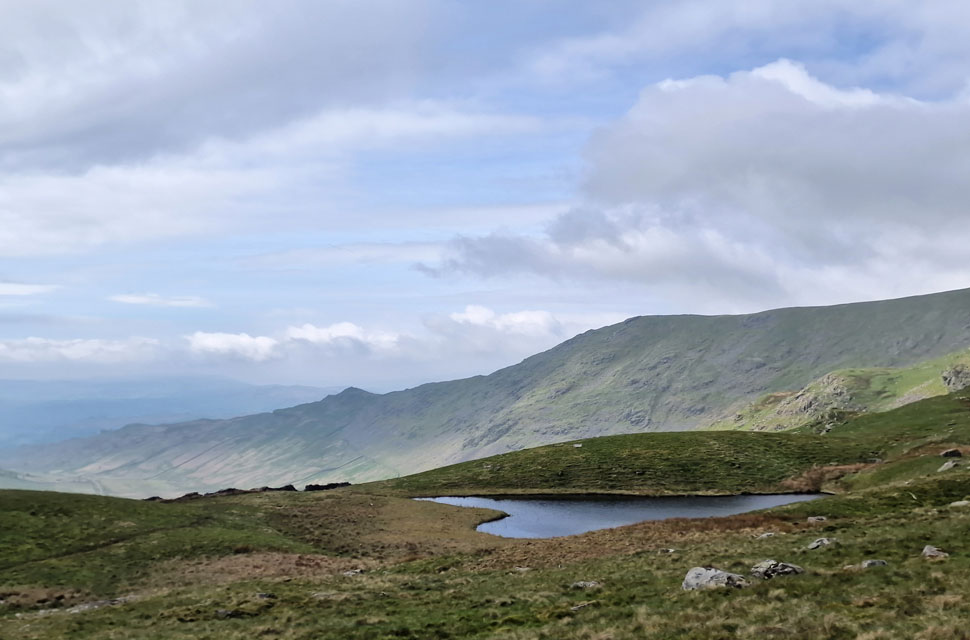
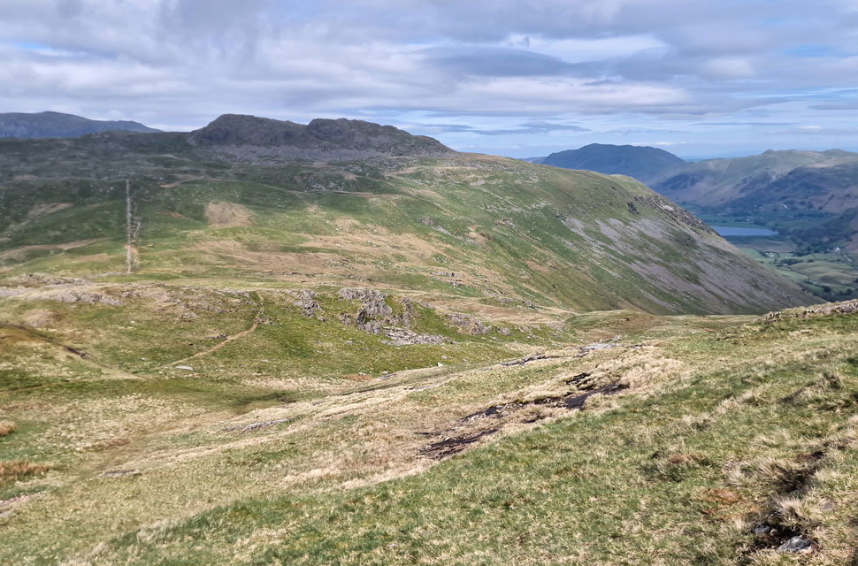
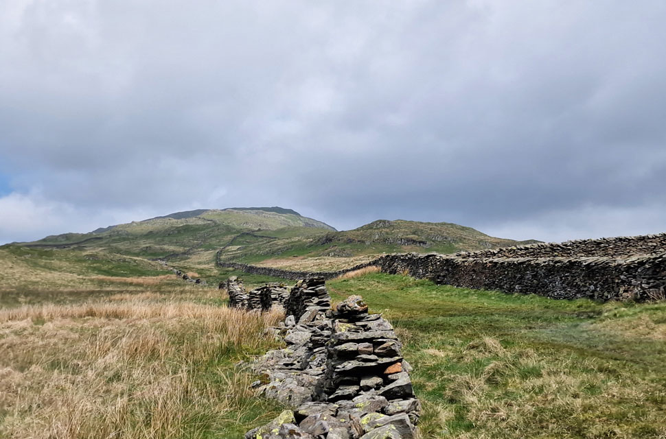
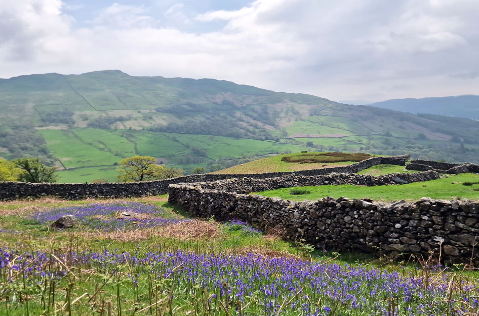
We spoke last week about whether the forecast was good enough in the Lakes that we'd perhaps wild camp here instead, and, as you've guessed, it wasn't, so David came up with the idea of walking the Scandale Round from Amblelside. If you're thinking, "That's a great alternative to the Fairfield Horseshoe," then you'd be exactly right. The Fairfield Horseshoe is of similar mileage and only tops its counter part by about eighty feet in total ascent, plus as we found out today, it's less busier too.

 
Wainwright Guide Book One
The Eastern Fells
Red screes, It is independent and is unsupported, not buttressed by its neighbours: to this extent, it may be said to have the purest mountain form among the eastern fells.
 

Overview
Ascent: 3,280 Feet - 999 Metres
Wainwrights: 4, Low Pike - High Pike - Little Hart Crag - Red Screes
Visiting: 2, Raven Crag - Snarker Pike
Weather: A Cloudy Humid Start, Cloud Soon Lifting Off The Summits.Highs of 19°C Lows of 12°C Feels Like °C
Parking: Roadside Parking, Miller Bridge Ambleside
Area: Eastern
Miles: 10
Walking With: David Hall
Ordnance Survey: OL5 -OL7
Time Taken: 6 Hours 15 Minutes
Route: Miller Bridge - Rothay Park - Ambleside - Nook Lane - Nook End Farm - Low Sweden Bridge - Low Pike - High Pike - Scandale Head - Bakestones Moss - Little Hart Crag - Red Screes - Raven Crag - Snarker Pike - Kirkstone Road - Ambleside - Rothay Park - Miller Bridge
 

Parking Details and Map
Nearest Post Code: LA22 9LJ
Grid Reference: NY 371 104
Notes:

Please note that parking at Miller Bridge, Ambleside is no longer possible due to yellow line restrictions (updated 12/05/18)


Map and Photo Gallery


Miller Bridge, Ambleside 8:00am 12°C

We had arranged to meet at 8:00am at Miller Bridge and I arrived early around 7:30am. I managed to park close to the bridge leaving about three or four spaces left to park. At one point double yellow lines were installed but these have been lifted from the bridge back up the lane for approximately 150 yards allowing space for around 10 cars. It was a mild morning and I kitted up while waiting for David to arrive.

Within five minutes David had parked up and conversation turned to the low cloud which was clinging to the lower slopes of the surrounding fells which was forecast to lift throughout the morning or at least we'd hope so. With the cars locked we crossed Miller Bridge and walked through Rothay Park passing the odd dog walker and jogger before arriving at the main street where shop keepers were opening up for the day. Turning left onto Rydal Road we passed the Bridge House before crossing the road where we took a left onto Nook Lane.


Misty views ahead after passing over Low Sweden Bridge.
At the end of Nook Lane was Nook Farm from where we left tarmac in favour of this stone track. The track wound its way up the fell side while views slowly opened out into the Scandale valley over on our right.

Views over Scandale towards Red Screes.
The cloud was beginning to lift before our eyes first over Scandale as we continued to climb towards Low Pike. It didn't take long for us to start losing layers.

The view from Low Pike summit.
Cloud continued to break the higher we climbed only for it to roll back in again. In between these breaks we could see blue sky overhead meaning we must have been right on top of the cloud layer, fingers crossed we'll start to climb out of it.

Perfect.
With Low Pike behind us we continued to climb mopping our brows such the humidty until we finally broke through the cloud layer which extended as far south as the Coniston and Langdale fells. Trouble was the heat was burning through the cloud so quickly, blink and we'd miss it.

Looking back down the ridge towards Low Pike.
Taken not far from High Pike summit.

Breaking through.
The sun was hot now, possibly into the late teens and humidity showed as the sweat dried across my forehead. We're almost on top of High Pike now.

A bit of an odd character, High Pike.

We soon reached High Pike summit and had noticed that a solo walker was gaining on us so we hung around for a chat. As it turns out this guy was on his second attempt of the Fairfield horseshoe after failing his first attempt last week due to high winds but managed to summit Nab Scar and Heron Pike.

I thought okay, I don't blame you for mixing it up a bit by coming back and attempting the route in an anti-clock wise direction but his reason wasn't to mix it up he simply didn't want to 'tick off' the same two summits again referring to this as 'wasted energy' A bit odd we thought.


High Pike (Scandale) summit.
It felt like we were racing against time wanting to arrive at High Pike just above the cloud layer which which was still present but breaking up under warm sunshine. Besides the chap ealier we hadnt seen no-one and had been blessed to witness a cloud inversion. I think I can speak for David when I say this is what fell walking is all about.

Ahead, Hart Crag hidden from view.
Despite being within the proximity we decided against a summit of Hart Crag opting to visit Little Hart Crag Crag instead.

Cloud thinning.
Over Scandale Head.

Before making our way towards High Bakestones.
We stop to admire the view back on High Pike.

High Bakestones cairn.

The same cloud we were looking at from High Pike remained stagnant over High Bakestones and with it came a drop in temperature. Hopes remained high as we began our descent onto Bakestones Moss.


Descending towards Bakestones Moss.
Its only 270 feet of descent but slow due to the narrow path and loose boulders.

Bakestones Moss from Little Hart Crag summit.
We followed one of many paths over Bakestones Moss making sure to continue ahead where the path forks right for Scandale Tarn. Half the way across Little Hart Crag appeared through the cloud with two walkers stood at its summit cairn silhouetted against the cloud. The closer we got the more the cloud broke and by the time we were ascending the summit the cloud had almost cleared as the two walkers are passed.

The view over the Dovedale Valley.
Towards Hart Crag, Dove Crag, St Sunday Crag and Helvellyn in the distance.

Low Pike and High Pike from Scandale Tarn.
Scandale Tarn takes the shape of a heart and could have been named Little Hart Tarn had it not been at Scandale Head ...

Looking back over the top of Scandale Pass towards Little Hart Crag.
With Brothers Water, Angletarn Pikes and Place Fell over in the distance.

Red Screes summit.

We left Little Hart Crag in broken sunshine as the cloud developed above Scandale and indeed Red Screes summit. Visibility wasn't a problem but again, the temperature had dropped aided by a cool summit wind. It was suggested that we stop for lunch but we arrived at the same time a trio of two women and a chap arrived with their dogs who made their way to the summit then let their dogs cool off at the nearby summit tarn.

Being the gents that we were we watched on to see if they'd return to the summit and if so, we'd let them have the shelter having already agreed we could have lunch at the summit wall at Snarker Pike but they continued down the ridge so we made ourselves comfortable and had lunch.


Descending Snarker Pike.
We were joined by a mother and daughter soon after who also continued down the Snarker Pike ridge and about five minutes later, layered up we followed them.

Looking back up Snarker Pike.
The cloud broke and the sun came back out bringing with it warm sunshine but I cant pin-point where this exactly happened as we were in conversation. Who cares, what a view!

Wansfell as we descend towards Kirkstone Road.

The heat was hitting those 'oven door' moments, the kind you get in the heat of summer. We continued to follow the twin walls as we left the views of the Scandale Valley behind for those of Wansfell. We passed the trio and then the mother and daughter, who had stopped to eat lunch about a quarter of a mile apart. The ground was still wet underfoot but drying in places under the heat of the afternoon sun. Descending further, we passed a pocket of bluebells, where I stopped to take this photo. The smell of lavender filled our nostrils well before we spotted them. The sound of distant cars descending Kirkstone Road broke the silence, as did a field of lambs between us and the road. It was an afternoon I didn't want to end. 

We finally left the twin walls behind and dropped onto the tarmac; cars passing by it took a few seconds to adjust. Flanked by fields of lambs on one side and cows on the other. Ambleside was just moments away now. The Golden Rule Pub looked inviting, but we swung the other way and arrived in a bustling Ambleside which felt like we'd just gate crashed a stranger's party. Car horns, traffic lights beeping, crowds of shoppers - we headed back down the main street and crossed between the stationary traffic. The smell of fish and chips brought a smile, as did the sight of our cars, which hadn't been clamped afterall.


Back to top