|
Scar Lathing & Hard Knott from Jubilee Bridge |
 |
 |
7th May 2024 |
 |
|
To celebrate turning 50 last weekend I'd booked the week off to do some fell walking but the forecast was having non of it with more cloud than blue skies which is unusual for this time of year. The forecast didn't really improve until mid-week onwards but I couldn't afford to sit on my hands any longer while the Mrs dream't up jobs for me to do around the house.
Todays forecast was slightly better, dry but cloudy and not that fancy high level cloud but grey tops of the trees cloud. Okay, I'm exaggerating but I did have to wait until Lunchtime to begin the walk to allow the cloud to clear.
The afternoon forecast was meant to turn brighter with temperatures increasing into the late teens which gave me the green light to stop weather watching and drive to the south of the District on a walk that looked like the fells were still in Autumn but felt like Spring. |
|
| Wainwright Guide Book Four |
 |
| The Southern Fells |
| While on the top it is worth while making the short detour to Border End for a glorious prospect of Eskdale |
 |
|
|
|
| |
|
Overview |
|
|
| Ascent: |
2,040 Feet - 621 Metres |
| Wainwrights: |
Hard Knott |
| Visiting: |
Scar Lathing - Border End |
| Weather: |
Predominantly Cloudy, Feeling Very Humid With Some Bright Spells Towards Late Afternoon. Highs of 18°C Lows of 16°C |
| Parking: |
Parking Spaces, Jubilee Bridge |
| Area: |
Southern |
| Miles: |
6.7 |
| Walking With: |
On My Own |
| Ordnance Survey: |
OL6 |
| Time Taken: |
4 Hours 10 Minutes |
| Route: |
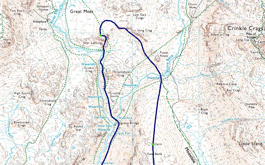
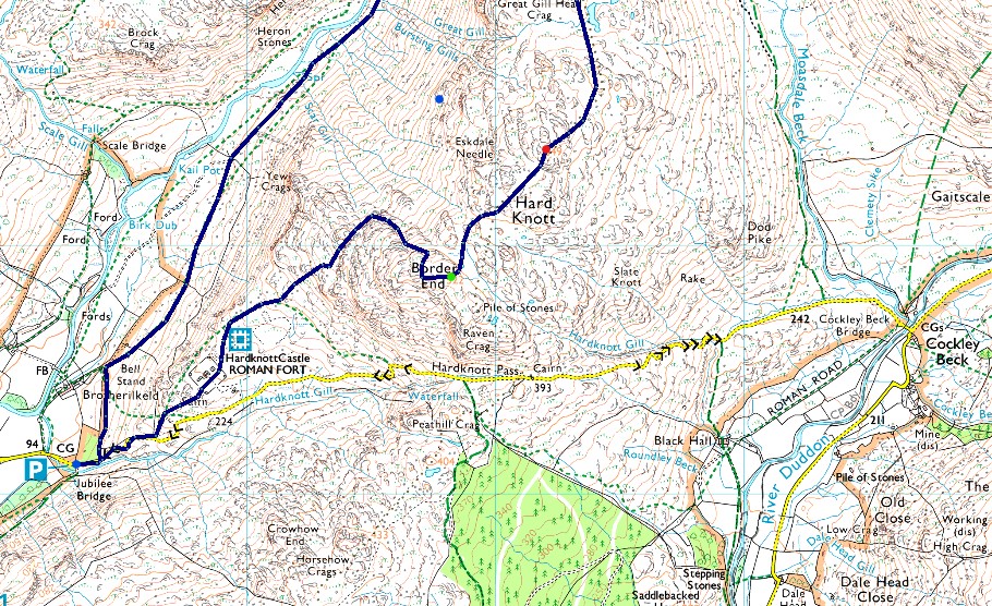
Jubilee Bridge - Brotherilkeld - River Esk - Lingcove Bridge - Scar Lathing - Lingcove Beck - Yew Bank - Hard Knott - Border End - Hard Knott Roman Fort - Jubilee Bridge |
|
| |
|
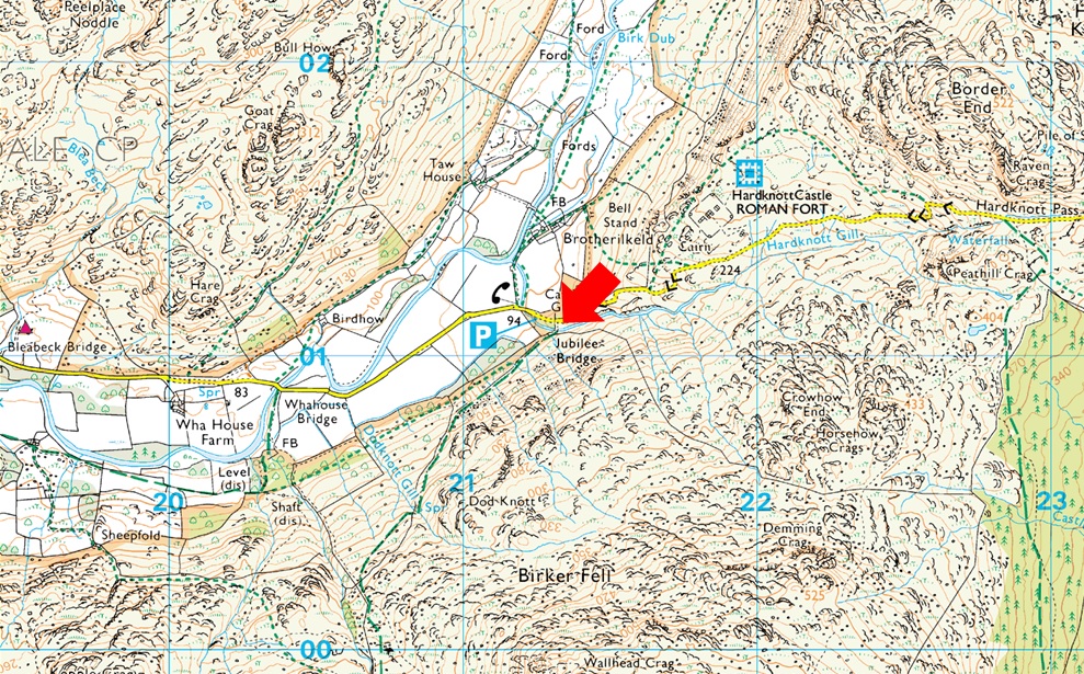
Parking Details and Map |
|
|
| Nearest Post code: |
CA19 1TH |
| Grid Reference: |
NY 212 801 |
| Notes: |
There is room for around eight well parked cars at Jubilee Bridge with further off road spaces found between Jubilee Bridge and Whahouse Bridge. The parking spaces are perfectly postponed to get into upper and lower Eskdale whether you aim for a walk up Harter Fell, Bowfell or the Scafells these spaces during summer are at a premium and my advise is to arrive early should you want to secure a parking place. Parking is free. |
|
| |
|
Map and Photo Gallery |
|
|
  |
| |
| |
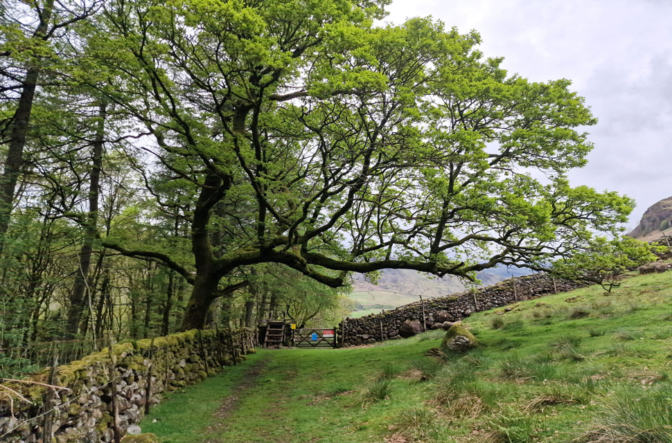 |
| Wooden ladder sty just up the road from Jubilee Bridge, Eskdale 16°C 12pm |
The experts were right when they said the west of the district would see the most brightness as I took in the view over Black Combe basking in morning sunshine in favour of Eskdale which looked like a scene from a Lord of The Rings movie where every shade of grey mingled into one mass of cloud over Upper Eskdale so much so I input 'Whicham' into the car satnav just to see how long it would take it to drive back to the coast, 16 miles, about twenty five was the answer but I stubbornly stuck to my plan, after all it was forecast to turn brighter later anyway. Feeling the relief as I passed empty parking spaces ahead of the narrow tree lined lane I pass over the cattle grid at Brotherilkeld before driving my car into one of two remaining spaces.
With Hardknott Gill flowing below I began my kit up were despite the lack of sunshine it was mild enough to wear just shorts and a technical-T. Just as I was about to leave the last parking space was filled by two lads in their twenties and a girl of similar age. I was ready to leave and I nodded a smile as I passed the back of their car as I made my way up the pass to the corner of the wall where access is gained into Upper Eskdale by the ladder sty ahead. |
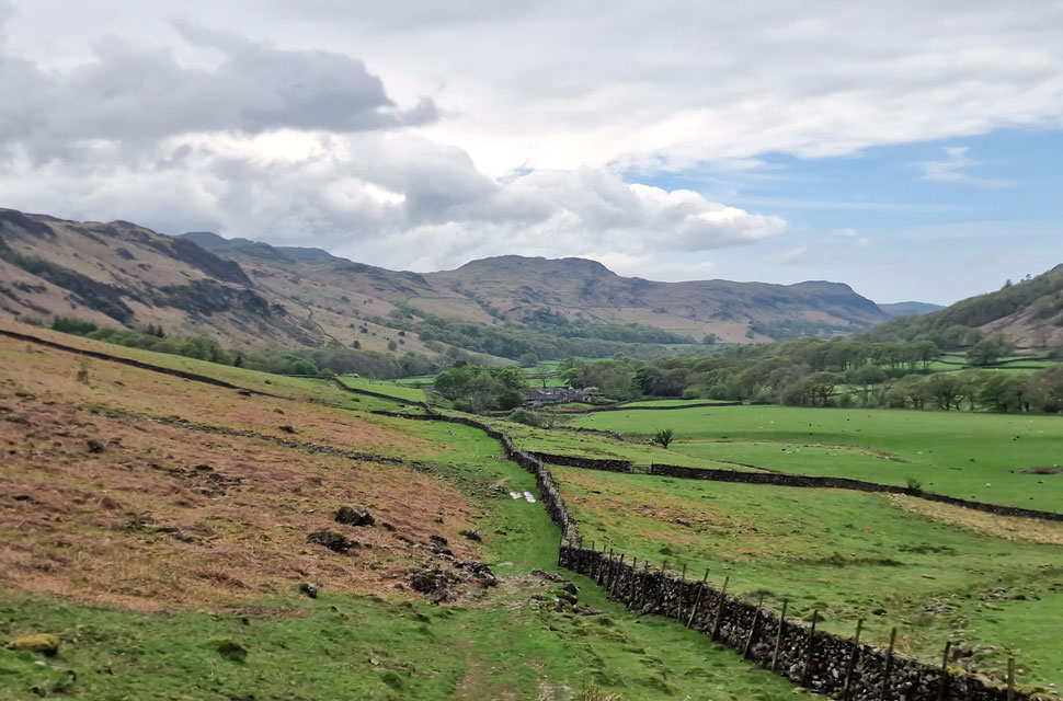 |
| Looking back on Brotherilkeld Farm and Green Crag as I make my way towards the River Esk. |
| Once over the ladder sty its just a case of the following the wall into the valley. Despite midday having past there was no-one about other than the lambs baa-ing, the cows mooing and even the sound of a woodpecker...woodpeckering! |
 |
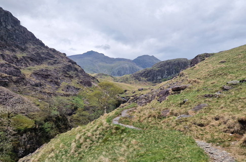
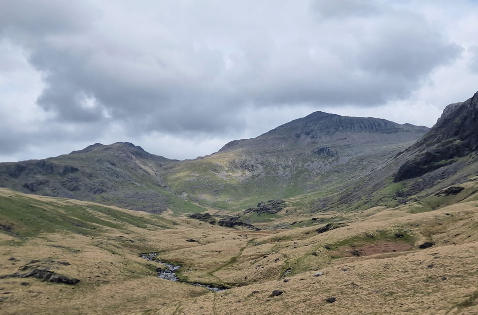
| That's Bow Fell lost in cloud in the distance. |
| The path maintains a constant contour above the Esk and below the steep flanks of Border End and the Eskdale Needle or, there's the option to descend to the river bank through the area of greenery below. |
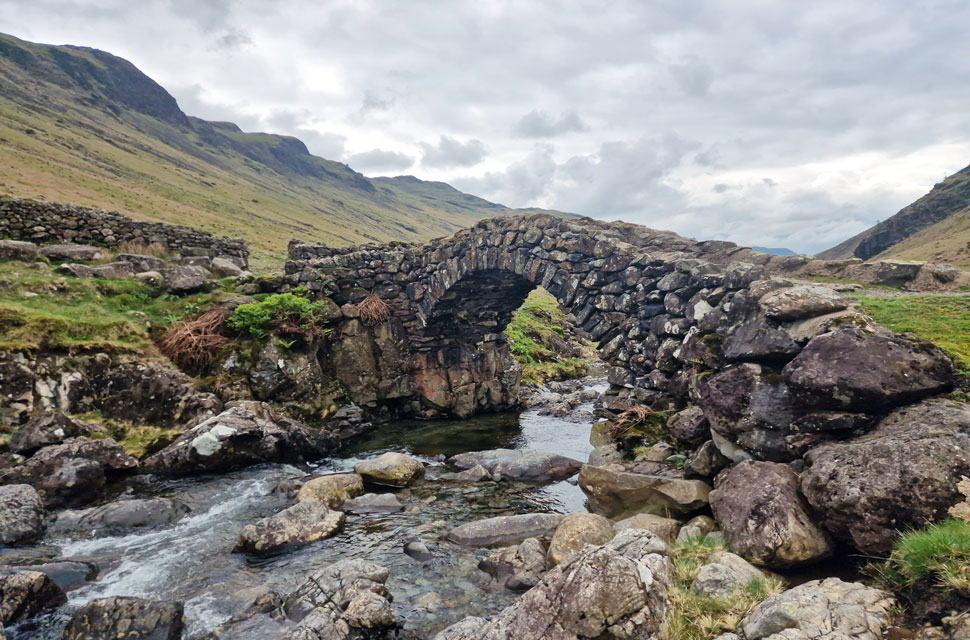 |
| Lingcove Bridge. |
The mildness of the afternoon ramped up the humidity and despite walking the level path towards Lingcove Bridge I was beginning to sweat so much so I felt like joining the wild swimmers who were enjoying the crystal waters in Tongue Pot below.
I know many friends who can take or leave social media and after deleting my Facebook account some six months ago I can take or leave it too but I am shocked at how many post I see advertising the pools here in Upper Eskdale the popularity of which has risen ten-fold over the last few years to the point paths are eroding much quicker and even new paths are appearing at hot-spots around waterfalls which simply weren't there a few years ago. |
 |
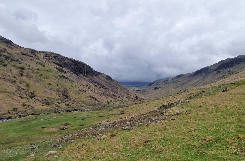
| Gaining height. |
| As I climb alongside the ravined Esk into Upper Eskdale. |
 |
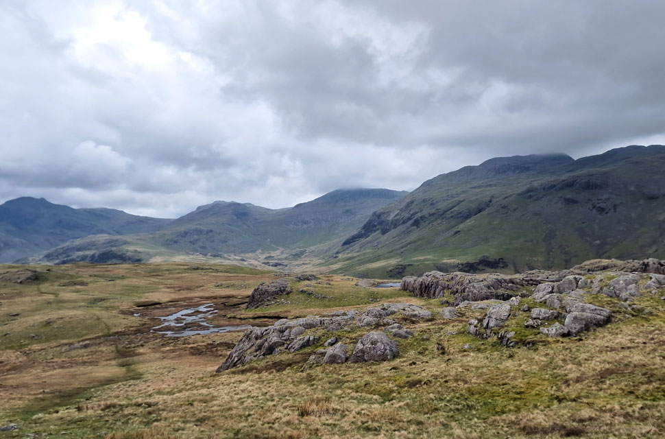
| Looking back on Hard Knott and Border End. |
| With Harter Fell (Eskdale) seen in the distance. |
 |
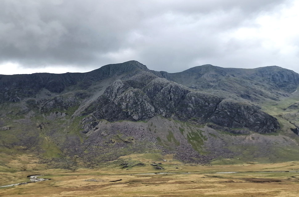
| Scafell Pike, Broad Crag, III Crag and Scar Lathing (foreground) come into view. |
No matter how many times I have climbed this path this view never fails to take my breath away, here the giants of Lakeland appear as the path levels alongside the deepest section of the ravine. I'm quite taken back followed by a momentary stomach drop. |
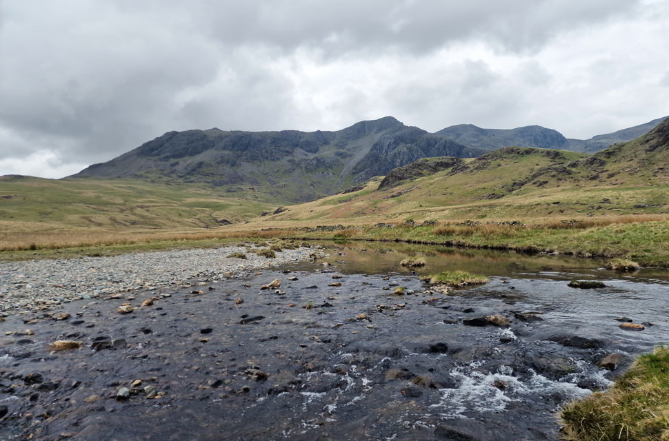 |
| Slight Side, Cam Spout Crag and Sca Fell from the familiar bend in the River Esk. |
| I pause to take in the views from the first of two 'familiar' bends in the River Esk the second being at Great Moss below the Sampson's Stones. Time to head up Scar Lathing now following Birketts suggested route via the steep grass rake. |
 |
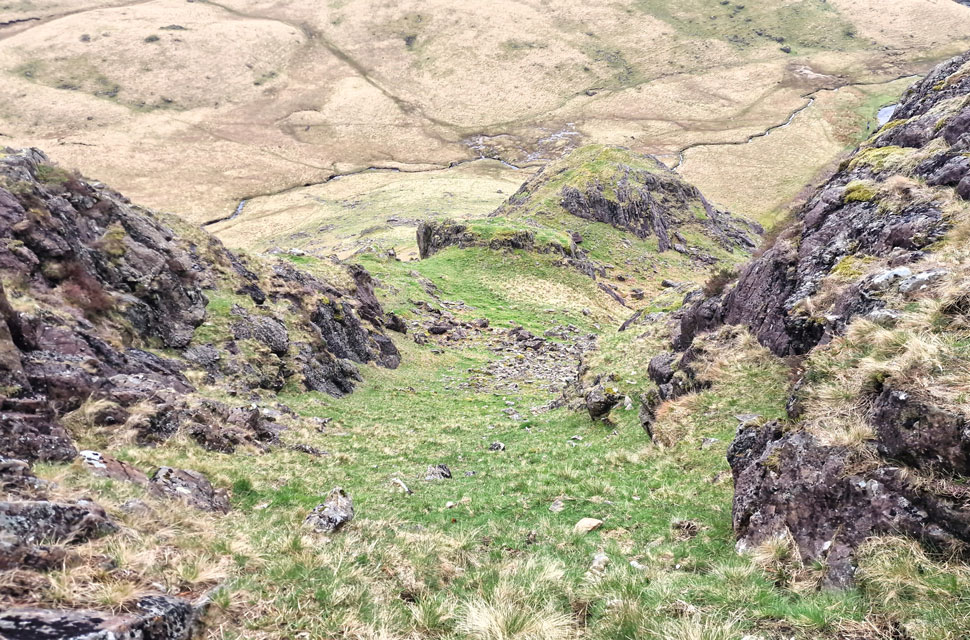
| Looking down the rake. |
| The rake is actually in two sections the first starting above the boulder field below before levelling out somewhat then bearing left to join the second, steeper rake. |
 |
| Looking down the second rake. |
| It's a pretty steep ascent but over very quickly. |
 |
| Cam Spout Crag and Sca Fell from Scar Lathing summit. |
| Please forgive the grainy images even my mobile phone was struggling in the low light, but with that aside, it was very peaceful up here. |
 |
| Here looking towards Esk Buttress, Pen, Scafell Pike, Broad Crag and III Crag. |
| With Esk Hause seen far right. |
 |
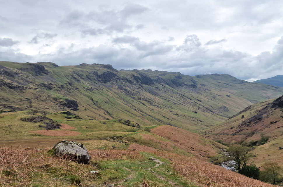
| Lunch with a view. |
| I decided to stop for one half of my sandwich while taking in the view over Long Crag, Bow Fell and Crinkle Crags. My path passes below Long Crag before linking up with Lingcove Beck (out of shot far right) |
 |
| My view back towards Scar Lathing, Slight Side, Cam Spout Crag and Scafell Pike. |
| The path is faint but easy to follow as seen in the foreground here. |
 |
| Views into Green Hole with Pike de Bield and Esk Pike to the left and Bow Fell to the right. |
Lingcove Beck was heard before it was seen my boots just about keeping the damp, squelchy ground out I sighted the path directly opposite Lingcove Beck bound for the slopes of Yew Bank but the river was either too deep or fast flowing to cross.
Up stream looked slightly better with more rock to use as stepping stones which, on closer inspection were covered in slime, oh-eck. More tramping up stream I found the river narrowed, deep at the edge from where I jumped onto a bank of shale in the middle of the river before balancing my way over semi-submerged boulders onto the opposite bank. Time to track back to my original position. |
 |
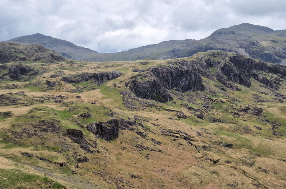
| High Ground. |
| After a relatively steep haul I spotted the path and quickly joined it, spits of rain in the air now as cloud begins to descend on the Scafells beyond crag and moss. |
 |
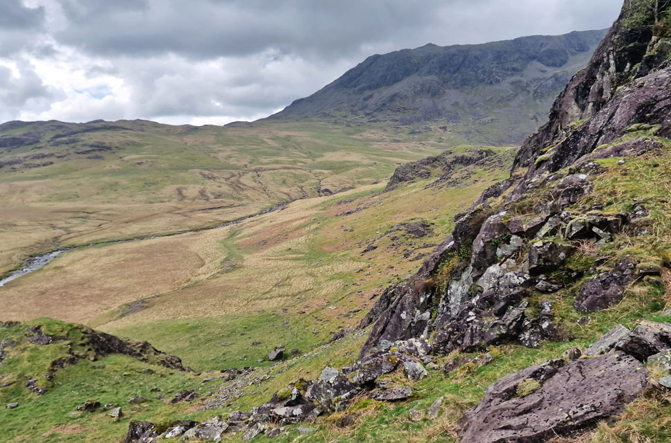
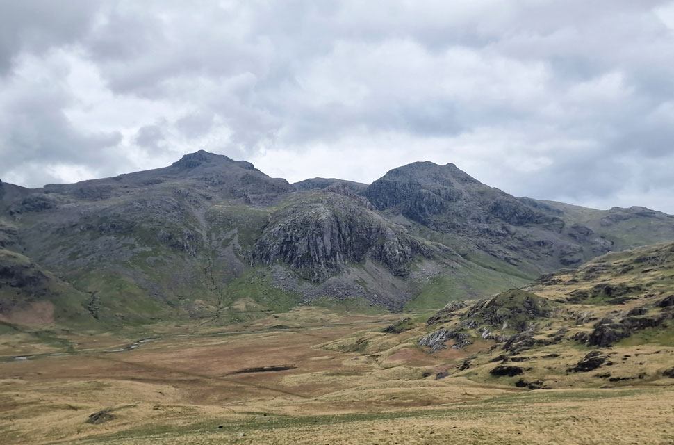
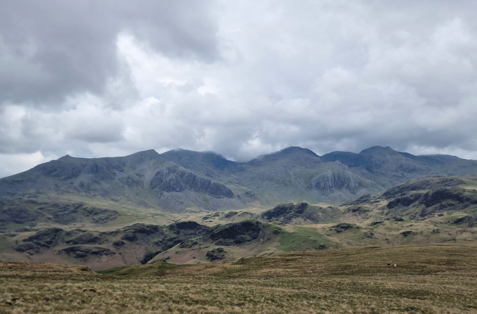
| Looking back on Yew Bank, III Crag, High and Low Gait Crags, Pike de Bield, Esk Pike, Bow Fell, Crinkle Crags and Adam-a-Crag. |
| The walk took on a different feel as rain threatened and the wind picked up. I was still wearing my T-shirt and feeling the breeze now as the goose bumps on my arms got goose bumps. |
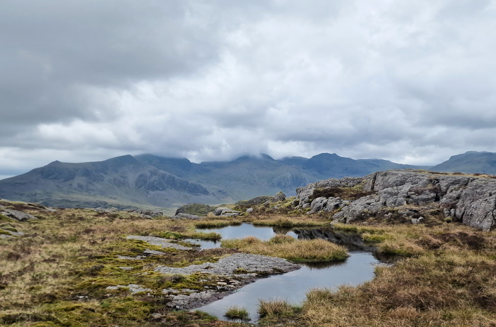 |
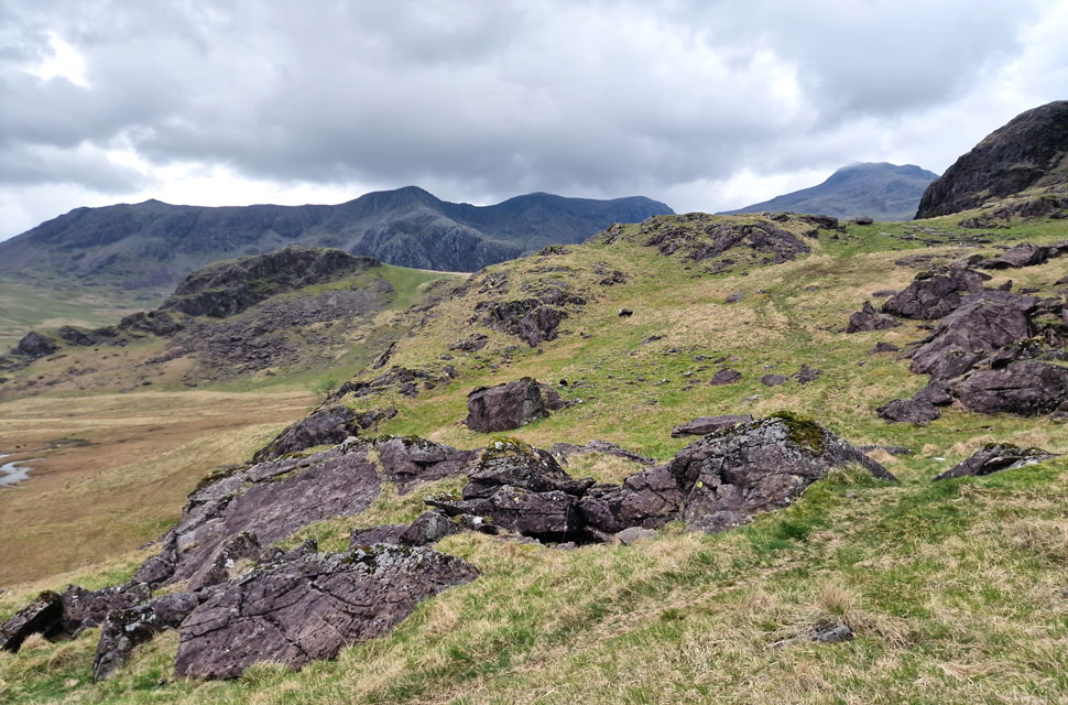
| Slight Side, Cam Spout Crag, The Scafells, Broad Crag, III Crag, Esk Pike and Esk Hause from Hard Knott. |
| With Yew Bank well and truly behind me I gained more height flanked by crag on both sides, adding to the unfamiliarity I have never gained Hard Knott from the north before but instantly knew my surroundings each time I turned back with the words repeating "yep, yep yep" spinning around in my head. |
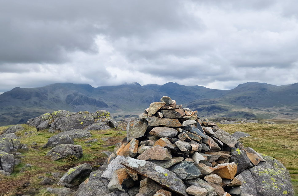 |
| Cold and breezy, Hard Knott summit. |
| I could have swore I heard voices during my approach to the summit but found I had the summit to myself on arrival, after a quick look around there was no one else around. I must be going mad! |
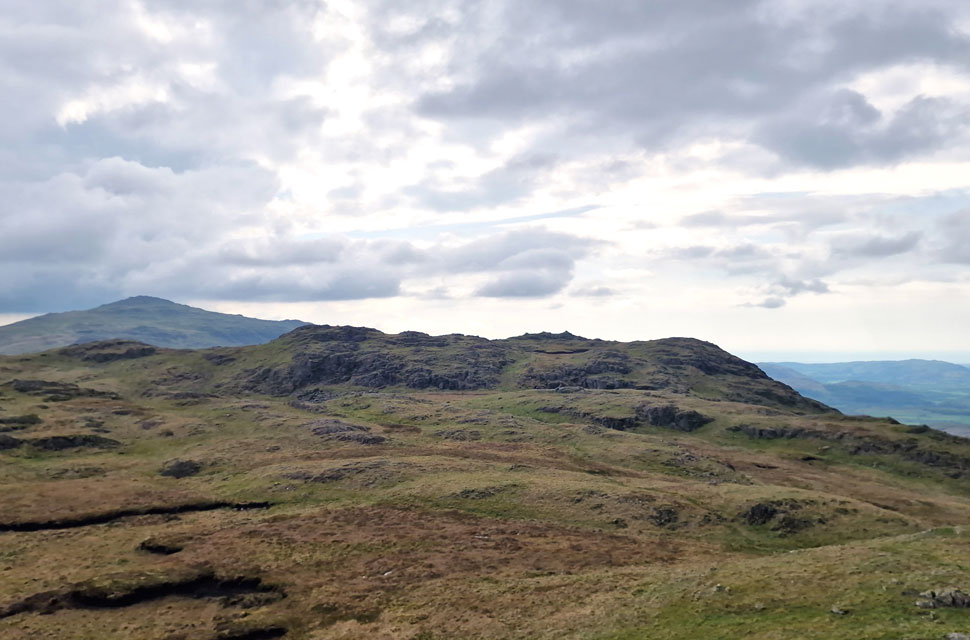 |
| Border End is next with Harter Fell (Eskdale) seen left. |
| It's just a ten minute walk from Hard Knott to Border End with hardly any height required to reach its summit. Add a few minutes to avoid the bogs as I did. |
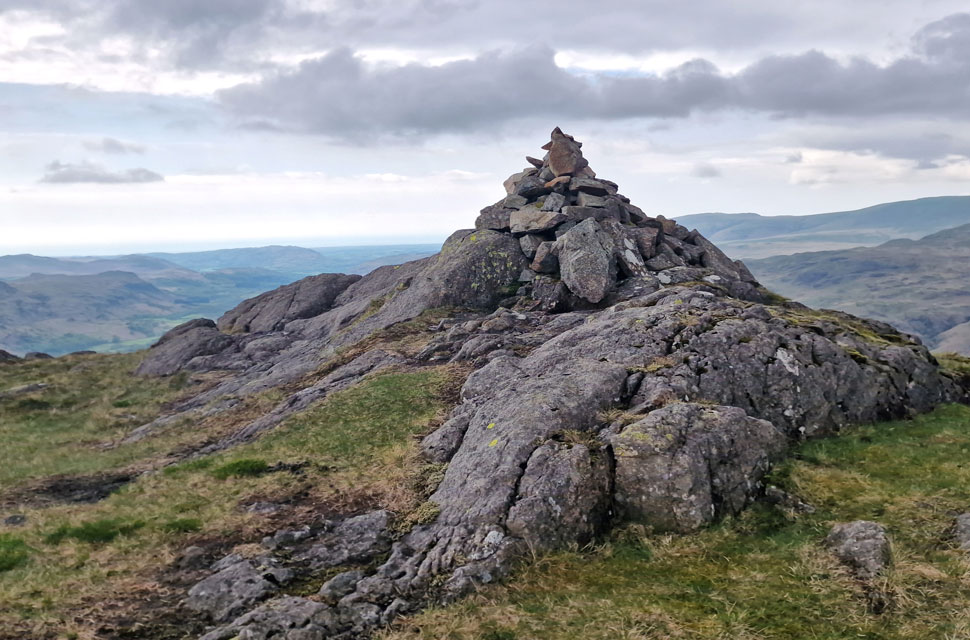 |
| Border End summit cairn. |
| With Border End summit reached I attempted to take in the views over the Scafells which by now had a layer of cloud across their summits, scanning round, poor light across to Harter Fell, goose bumped arms I figured it was time to leave. |
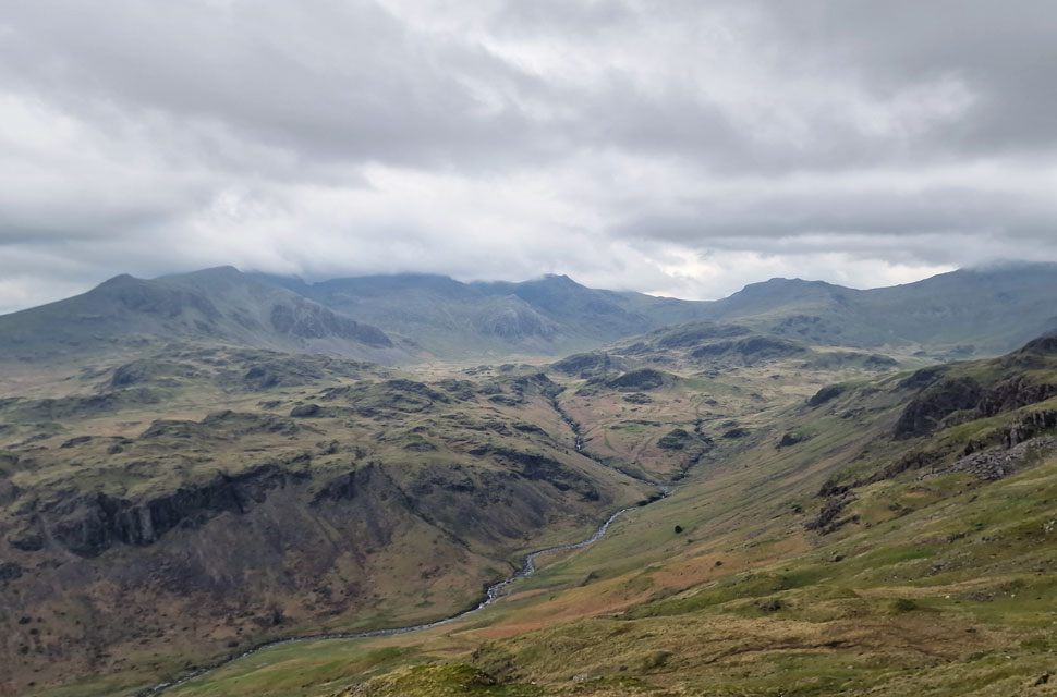 |
| Grand views during my descent of Border End. |
| |
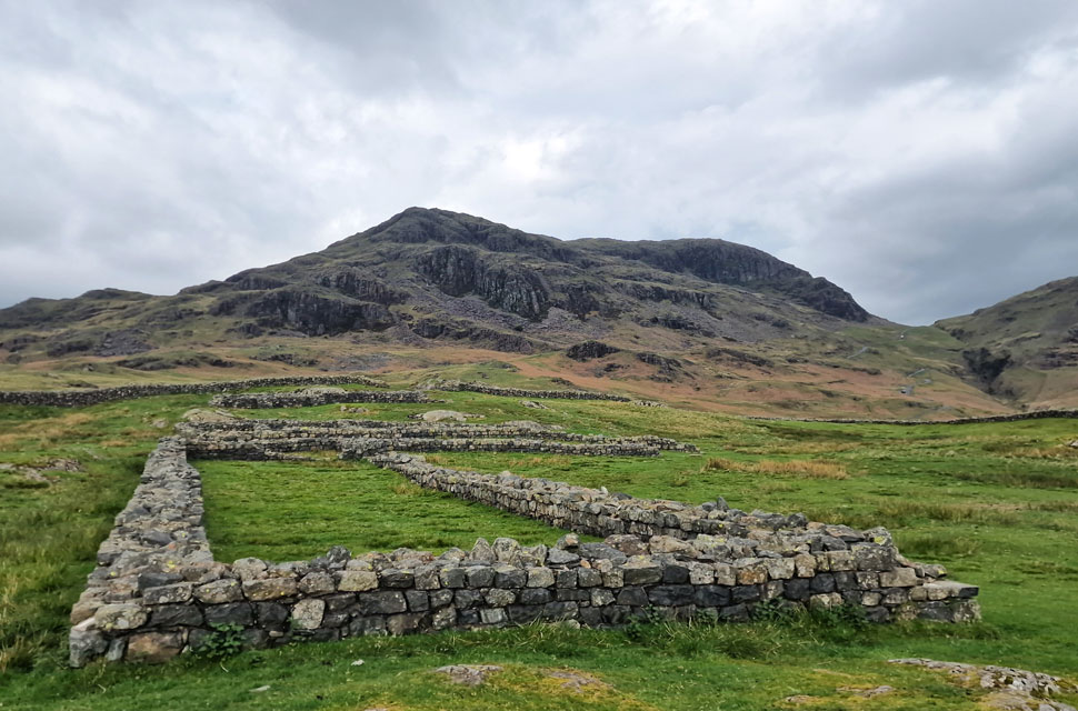 |
| Border End from Hardknott Roman Fort. |
I made quick time during my descent before taking one last look back at the Scafells which despite the early hour, appeared to be turning in for the night. Milder now as I squelched my way towards the Roman Fort. Behind me, two families are making their way down the pass as well as a group of motorbikes who's gears kick down in recession.
If that wasn't going to bring me back to reality nothing would. By the time I'd left the Fort the motorbikes were passing WHA Eskdale while over head blue skies were appearing. I joined the pass at its last two zigzags which can be outflanked by crossing a grassy bank to the left. Hardknott Gill again this time ravined below while further up the fell side sheep baah'd in harmony in so many numbers you could hardly make the grass out in between. |
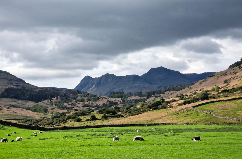 |
| The Langdale Pikes from the bottom of Wrynose Pass. |
| Sunshine for the drive home! |
|
| |
| Back to top |
 |
|