|
St Sunday Crag via Grisedale |
 |
 |
26th January 2024 |
 |
|
Storms Isha and Jocelyn have left high winds in their wake, in particular on the high fells, with gusts averaging over the last week 40mph, with some summits exceeding wind speeds of 80mph. Most, if not all, of the snow that fell has thawed, leaving streams and rivers in spate, yet above 700 metres, the freeze thaw continues. It's fair to say that Lakeland has been licking its wounds for some weeks now.
The trio were meant to get back together this weekend, but I had to duck out due to having a new stair carpet fitted, meaning I was needed around the house on Saturday. I managed to wrangle a day off without checking the forecast, which, as it turns out, didn't look too bad on paper despite the high winds, which were forecast at between 30 and 40 mph, and that was at valley level. No matter where I walked today, I was in for a fight.
The forecast predicted that the east of the park would be the brightest, and after checking my mapping software, one place stood out: the Grisedale valley. You might remember that I attempted this walk at the beginning of December but was forced to turn around due to snow. Despite the wind, an attempt on St Sunday Crag looked manageable. If I walked westerly into the headwind, I would walk through the Grisedale valley first and have the wind on my back for the mile between Deepdale Hause and St Sunday Crag's summit. |
|
| Wainwright Guide Book One |
 |
| The Eastern Fells |
Every walker who aspires to high places and looks up at the remote summit of St Sunday Crag will experience an urge to go forth and climb up to it, for its challenge is very strong. Its rewards are equally generous, and altogether this is a noble fell. |
 |
|
|
|
| |
|
Overview |
|
|
| Ascent: |
2,560 Feet - 781 Metres |
| Wainwrights: |
2, St Sunday Crag - Birks |
| Weather: |
A Cloudy Start Turning Brighter PM - Winds Between 35mph - 42mph Highs of 6°C Lows of -1°C Feels Like -12°C |
| Parking: |
Layby, Opposite The White Swan Pub, Patterdale |
| Area: |
Eastern |
| Miles: |
8 |
| Walking With: |
On My Own |
| Ordnance Survey: |
OL5 |
| Time Taken: |
4 Hours 50 Minutes |
| Route: |
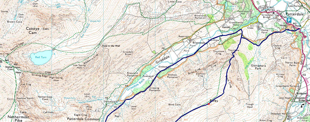
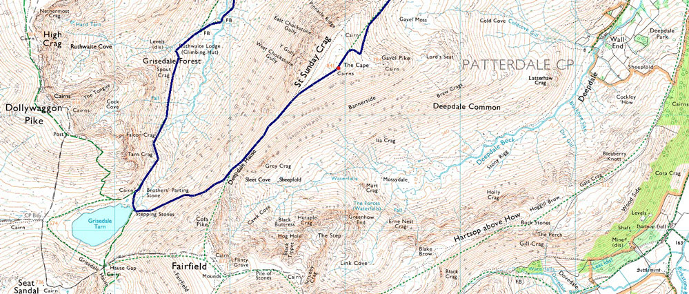
Patterdale - Glenamara Park - Hag Beck - Grisedale - Thornhow - Elmhow - Ruthwaite Lodge - Grisedale Tarn - Deepdale Hause - St Sunday Crag - Birks - Thornhow End - Hag Beck - Glenamara Park - Patterdale |
|
| |
|
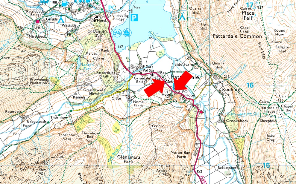
Parking Details and Map |
|
|
| Nearest Post Code: |
CA11 0NW |
| Grid Reference: |
White Lion Hotel - NY 395 315 - Patterdale Primary School NY 394 516 |
| Notes: |
Patterdale alongside Glenriddging acts as a hub for the eastern and far eastern fells yet unlike Glenridding Patterdale doesn't have a centralised car park. With this said parking in Patterdale, especially during the height of Summer can be a problem with only two main sites to leave your car. The first is very popular with fell walkers which is just opposite the White Lion Hotel, here you will find a short layby with room for up to five parked cars. Parking is free. The second place to park is found just outside Patterdale Primary School where you can park on the kerb right outside the School, here you will find spaces for around three to four well parked cars. Parking is free. |
|
| |
|
Map and Photo Gallery |
|
|
  |
| |
| |
 |
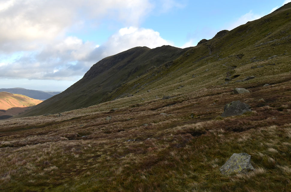
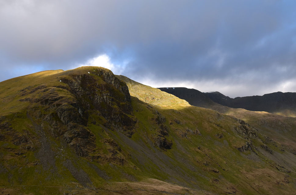
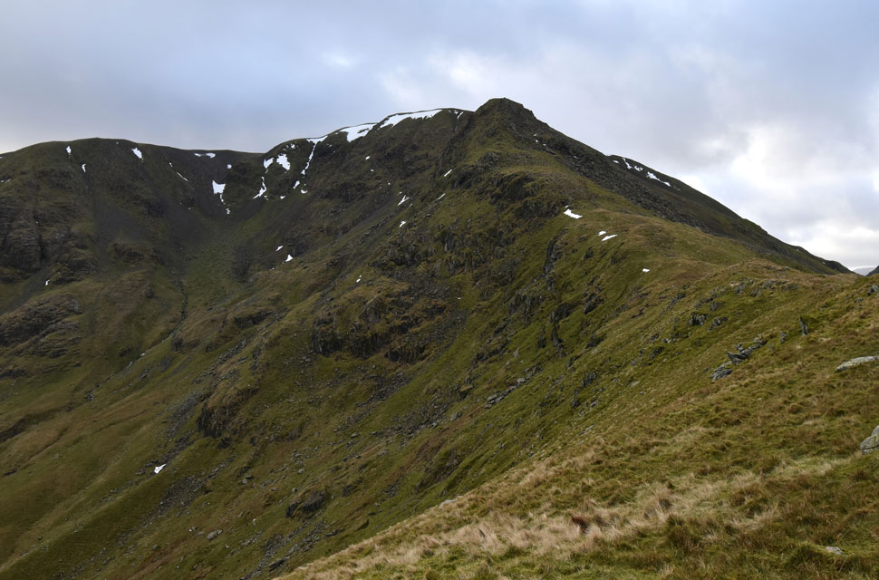
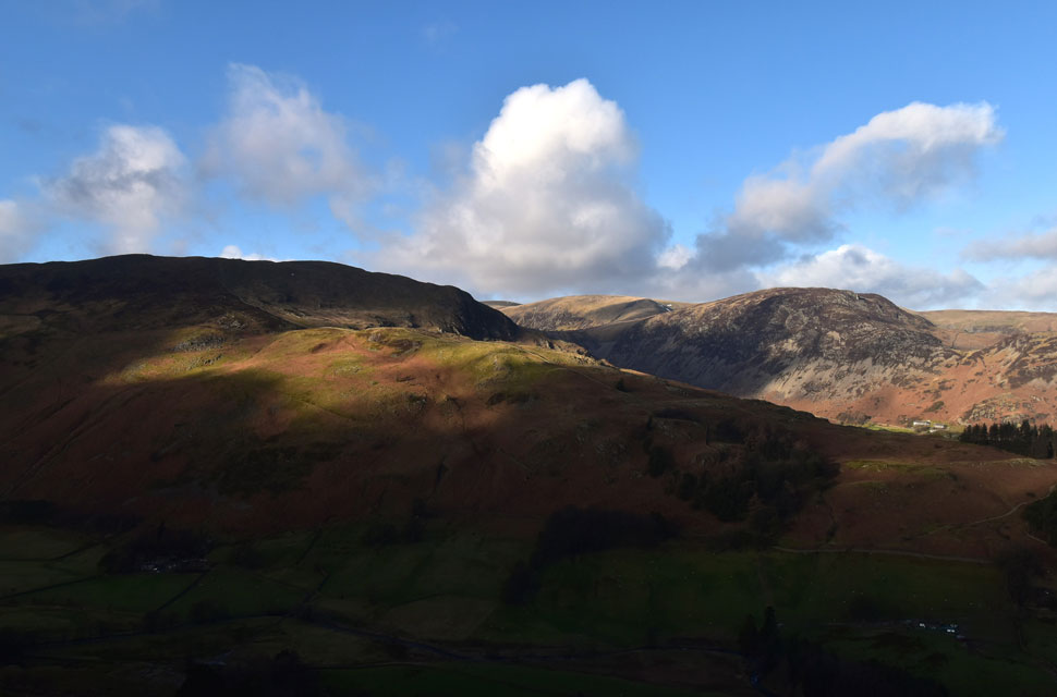
| Dollywagon Pike, Nethermost Pike and Low Spying How from Thornhow, Grisedale 6°C 9:00am |
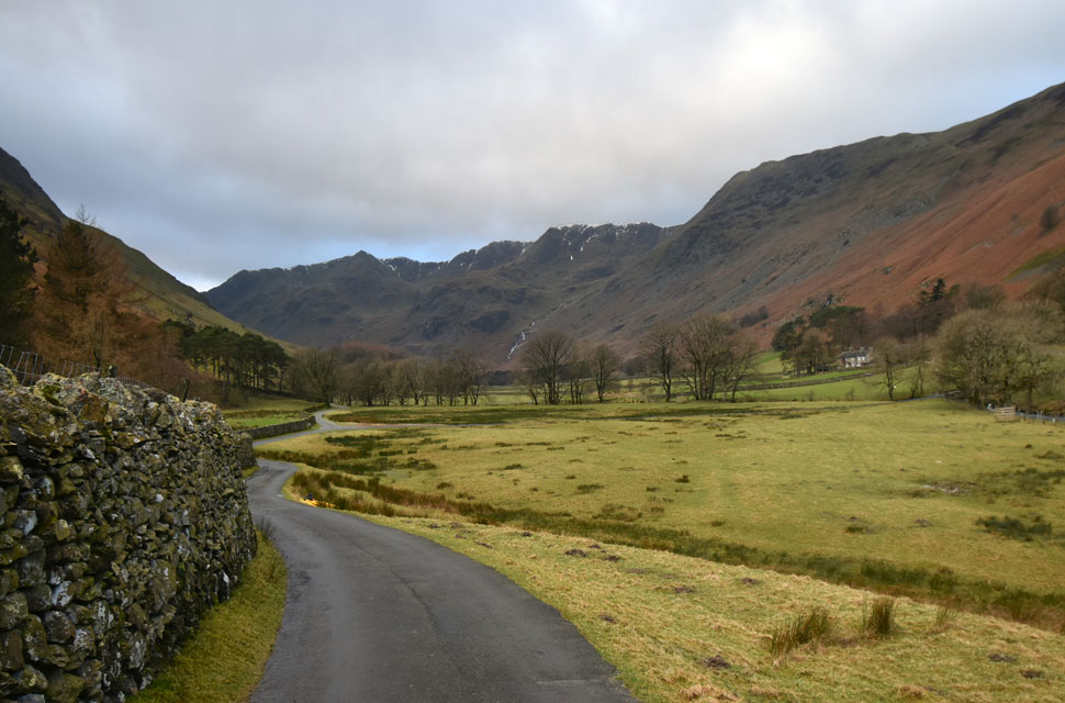
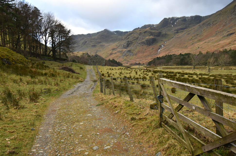
It was windy but clear when I left home, and I was surprised to find it had clouded over when I arrived in Patterdale with the intention of parking at the Cricket Club, but I managed to squeeze into a space at the layby opposite the White Lion Pub. Patterdale was deserted, with just the odd car passing as I switched the engine off. The noise from the wind outside instantly took over. With the summit windchill into double figures, I kitted up for a chilled day on the hill, not bothering with my mitts instead I dug out my Montane winter gloves meaning I wouldn't be handling my mobile phone which I stored in my pack's lid pocket. I even remembered to slide my buff over my head to keep my neck warm, and after a longer than usual kit-up, I locked my car and left Patterdale for Glenamara Park.
Within minutes, it started to rain as I passed through the woodland behind Patterdale Hotel, but it soon stopped the moment I'd cleared the trees, where I was presented with views of Arnison Crag's north ridge and Birk's directly behind. The path was swollen, almost flowing underfoot, as I made my way through Glenamara Park, where I crossed Hag Beck by half a dozen well-placed stepping stones. Thankfully, the stones protruded just above the water line managing to keep my boots dry for now at least. With Arnison Crag behind me the path passes below Thornhow End, which I'll be descending by later. From here, I swerve right and drop onto Grisedale Lane and the Grisedale Valley shortly after. |
 |
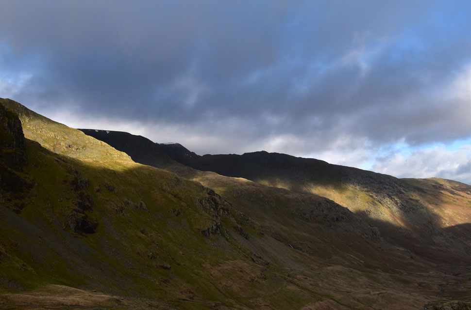
| Dollywagon Pike, The Tongue, Nethermost Pike and Nethermost Pike East Ridge from Cruck Barn, Elm How. |
Up until now, I'd been protected from the elements, but the further I walked into the valley, the windier it got, and with it came a brutal windchill causing my eyes to water. We're not into minus double figures just yet, but not far off.
Last November's turn around came flooding back to me, and as I watched the clouds scuttle across the sky while my conscious repeating the question, 'What are you doing here?' I'm not one to walk myself into trouble; should the conditions worsen, I won't have any issues turning around, but I'm gonna put up a fight first. |
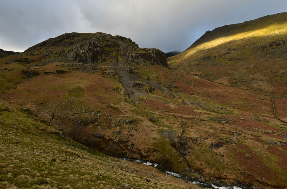 |
| Eagle Crag and a splash of sunshine over Low Spying How. |
| Not only was the noise from the wind powerful so to was Grisedale Beck below which had turned into rapids such the water draining into the beck from the fell side. |
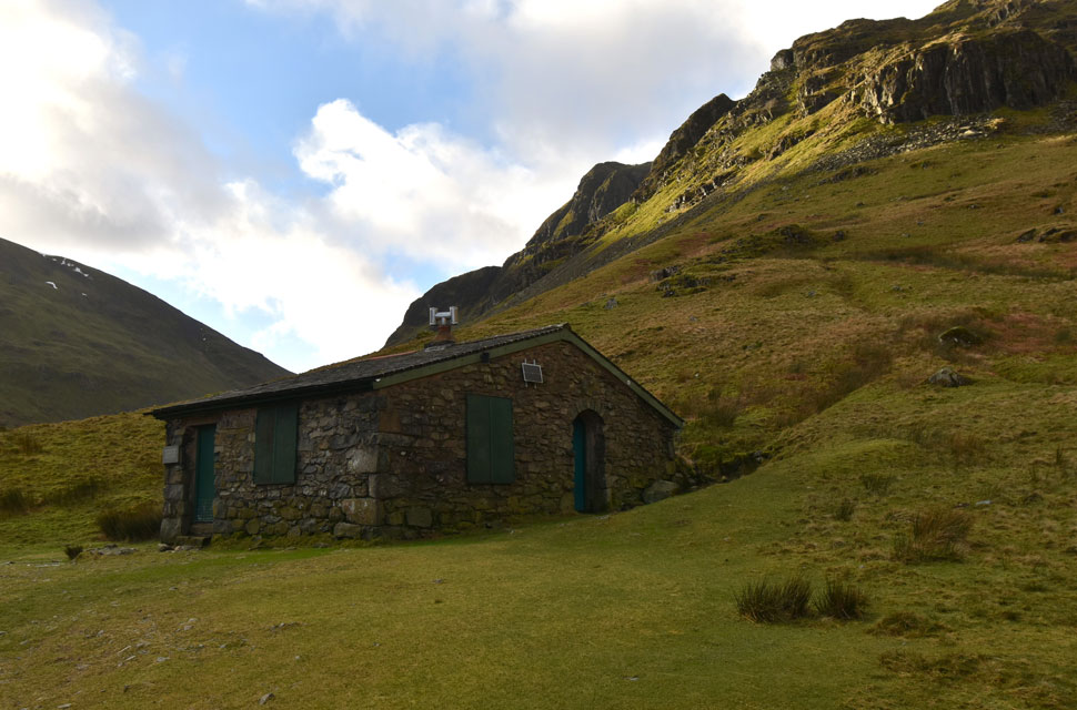 |
| Ruthwaite Lodge. |
| i crossed Grisedale Beck by familiar wooden footbridge and began the steady climb towards Ruthwaite Lodge as the wind began to drop due to my sheltered position within the valley. I'd used the gable end of the lodge to make my decision to turn around last November today, there was no such negativity instead I continue towards Grisedale Tarn. |
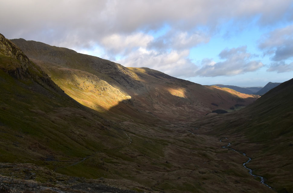 |
| Looking back through Grisdale. |
| As the clouds break allowing more sunshine to seep through. |
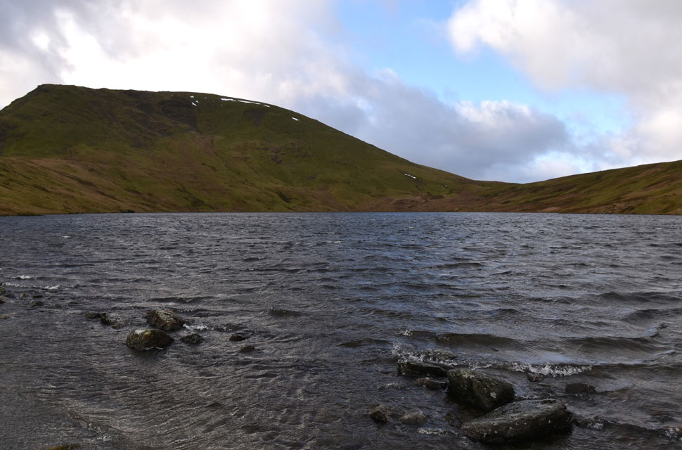 |
| Seat Sandal from Grisedale Tarn. |
| To some extent the wind had dropped by the time I'd reached Grisedale Tarn but it still felt wild and as exposed. On the other side of the tarn three mountain bikers were about to drop into the Grisedale valley and I even managed to spot a walker in ascent on the Dollywagon zigzags. Grisedale Tarn is a beautiful place but it was no place to hang about and after a couple of photo's I crossed the tarn's outlet before locating the path bound for Deepdale Hause. |
 |
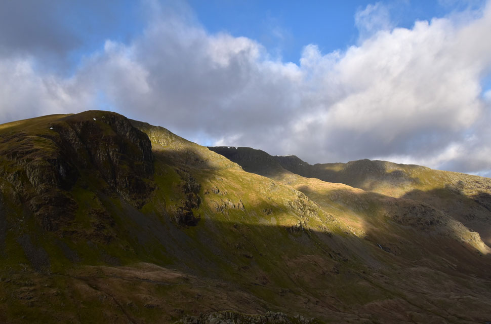
| St Sunday Crag and Deepdale Hause. |
| After walking through the sodden valley my boots waterproofing had finally given up after passing through the tarn's outlet not helped by the sodden ground the lower section of path passes through. The good news was I'm wearing my first pair of Sealskinz waterproof socks which are doing a grand job of keeping the damp out. |
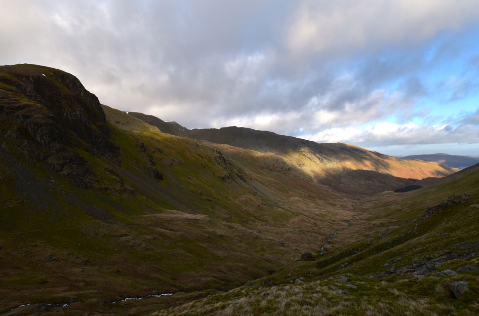 |
| Views into the Grisedale Valley. |
| With Dollywagon Pike, The Tongue, Nethermost Pike East ridge, Striding Edge and finally Birkhouse Moor. |
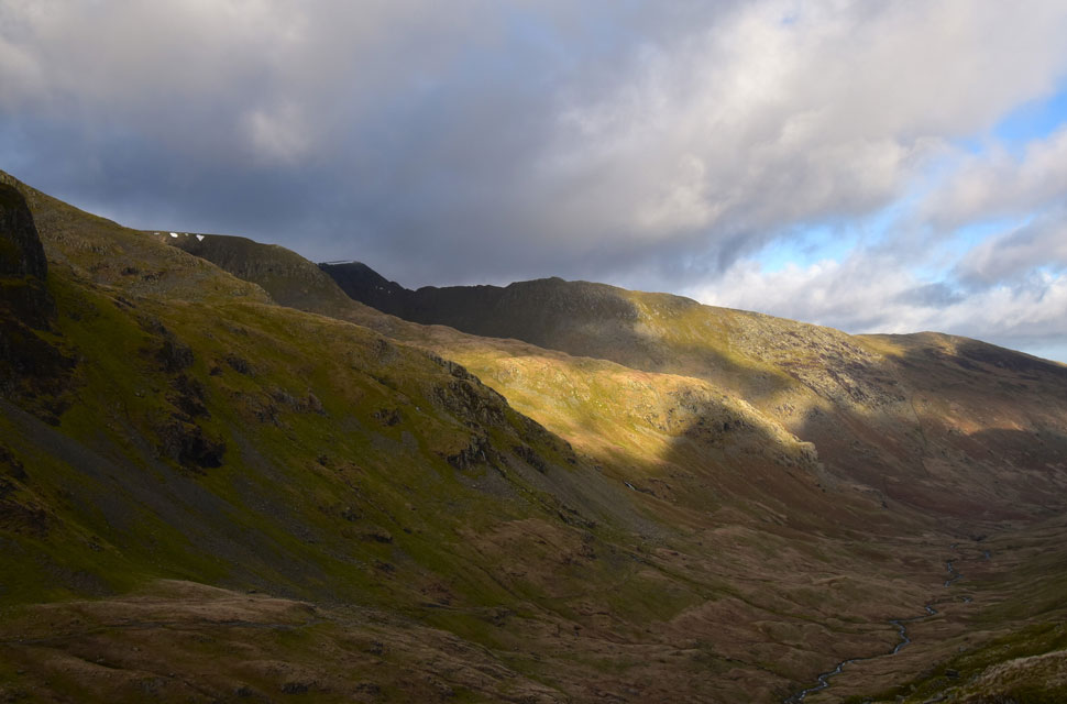 |
| Incredible light over Nethermost Pike East Ridge into Nethermost Cove. |
| With the wind on my back I could now enjoy the ascent on Deepdale Hause while taking in the sunlit views across the valley. |
 |
| Dollywagon Pike, The Tongue, Nethermost Pike East Ridge, Helvellyn and Striding Edge. |
| Loving the dramatic light. |
 |
| Sunlight and ridges. |
| With views like this... |
 |
| Dollywagon Pike, The Tongue, Nethermost Pike, Nethermost Pike East Ridge, Helvellyn and Striding Edge. |
| ...I'd be happy to turn around feeling like I'd had a great day on the fells. |
 |
| The Tongue, Nethermost Pike, Nethermost Pike East Ridge, Helvellyn and Striding Edge. |
| Bloody marvellous. |
 |
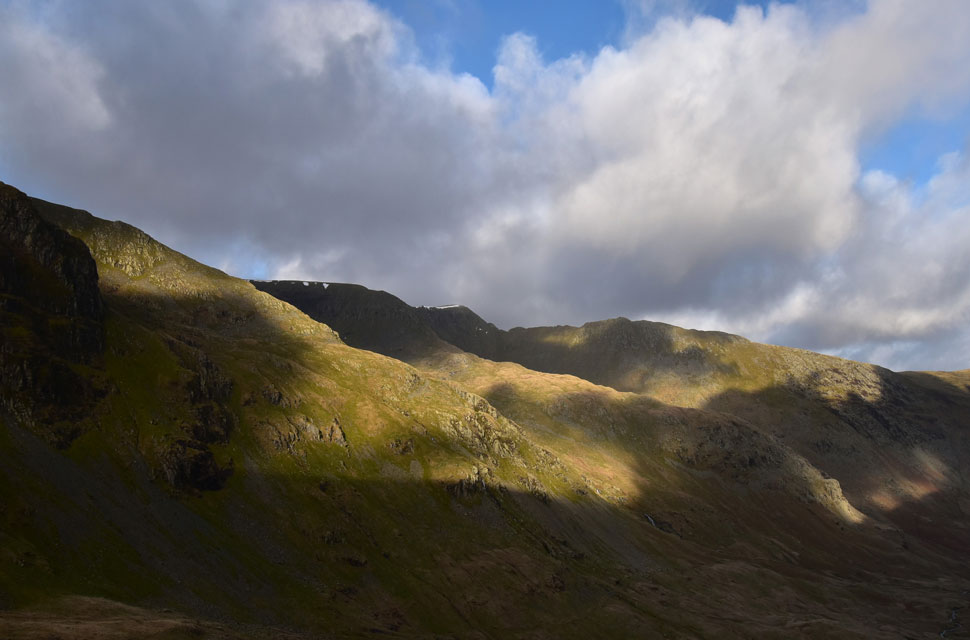
| Fairfield seen beyond Cawk Cove from Deepdale Hause. |
| The path plateaued, which allowed me to take in the previous views before the steep last push onto Deepdale Hause. I didn't need a warning about the strength of the wind; I could hear it. I composed myself before the final steep haul onto the Hause, making sure any loose webbing was tucked in, and finally added my sunglasses to protect my streaming eyes. This was the only photo I took of Fairfield while facing the onslaught of the wind. It was time to turn my back to the wind and head for the summit. |
 |
| Gavel Pike from St Sunday Crag. |
The further I grew towards the summit, oddly the winds eased a little having little effect on the windchill which was brutally cold leaving exposed skin wind burned and painful. Summit time was kept to a minimum again by which time it had clouded over which probably descended the temperature another couple of degrees, but blue skies were opening up over Ullswater in contrast to just how uncomfortably cold I was feeling.
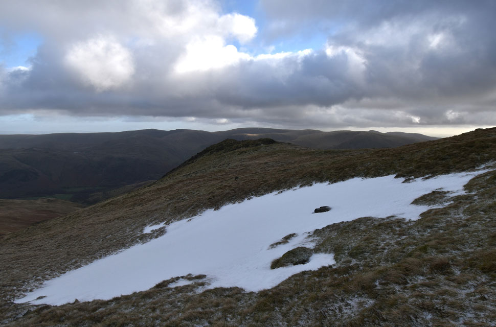
After one photo from the cairn, I left, deciding to descend the path above Gavel Moss which had a fresh coating of snow disguising any ice below. Gavel Pike was close but it was a summit too exposed to the wind and I decided to give it a miss instead I descended as quickly as possible while trying to keep the blood flowing in my frozen feet. |
 |
| Gavel Pike and St Sunday Crag from Birks. |
| It was a brutally cold descent, feeling just as exposed to the wind as I had through the valley and indeed back at the summit, but the winds eventually eased as I reached the grassy col linking where I passed a young couple in ascent. |
 |
| Great Mell Fell, Gowbarrow Fell, Ullswater and Place Fell from Birks summit. |
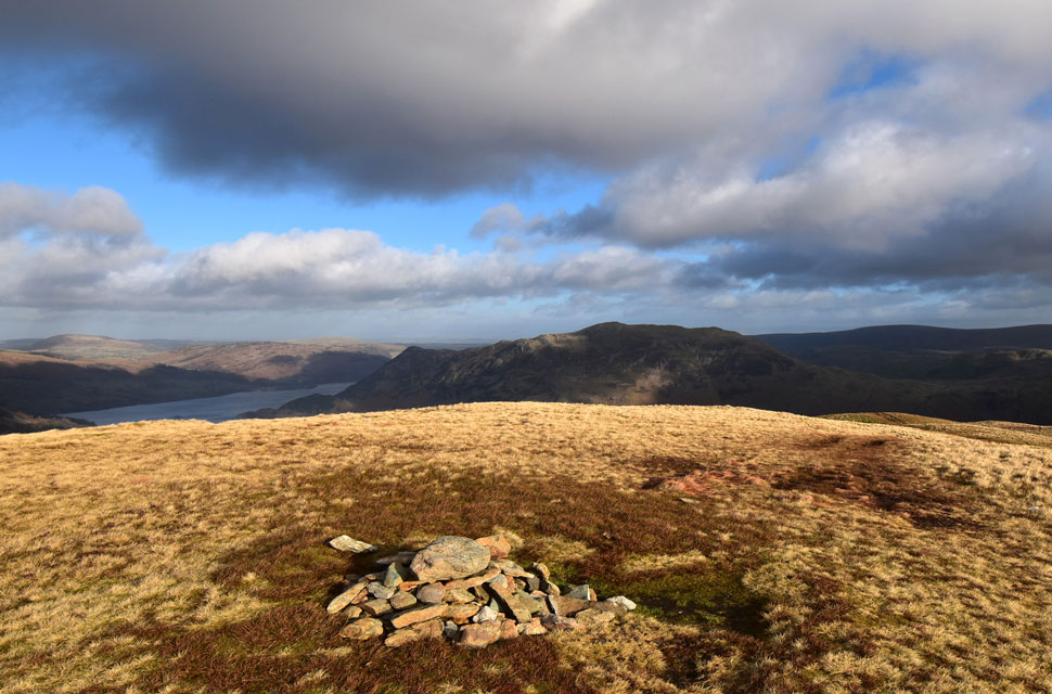
| The wind seemed to grow in strength again as I crossed Birks in winter sunshine which had a counter affect on the windchill. I arrived at the summit the same time as a chap and his dog but we struggled to chat over the deafening wind, but I did catch him saying that Birks was his next-to-last Wainwright as he pointed towards Catstye Cam, his final Wainwright. There was no point trying to have a conversation, so we just nodded, smiled and waved each other off. |
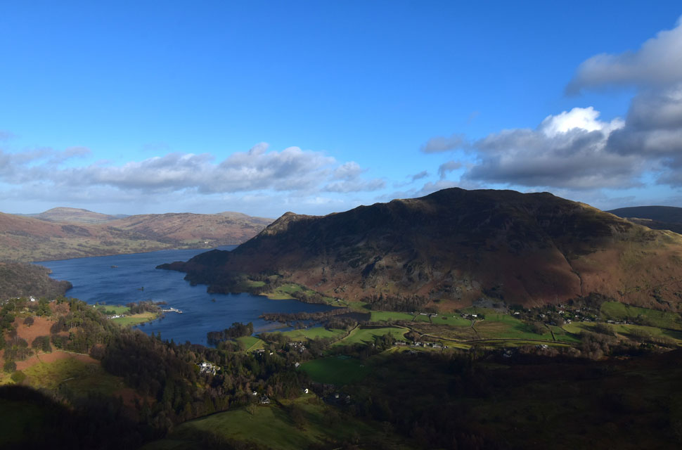 |
| Great Mell Fell, Gowbarrow Fell, Ullswater and Place Fell. |
| Taken as I begin my descent via Thornhow End. |
 |
| Across the Grisedale Valley... |
| ...views of Birkhouse Moor and Sheffield Pike. |
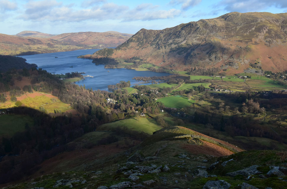 |
| Great Mell Fell, Gowbarrow Fell, Ullswater and Place Fell from Thornhow End. |
The wind eased as I continued my descent under winter sunshine. The windchill didn't feel half as cold as I took in fantastic views over Ullswater and Place Fell. With the descent behind me, I reached the path below and began the short walk back to Patterdale while the sun beamed directly above Trough Head at the head of Hag Beck. It felt a million miles from the chill of Deepdale Hause as I began to overheat from the exertion of the walk, but I'd put up with it as the Patterdale was so close.
Patterdale was only slightly busier than this morning, where the sight of a gang of scaffholders working at The White Lion Pub brought me back to reality as I collapsed my walking poles and began my kit down, first easing off my boots to see how the Sealskinz socks had faired. Yes, they had kept the damp out, but I think next time I should invest in a winter pair rather than an all-season because my feet felt like blocks of ice. I switched the engine on to warm up directing the heater vents towards my feet for obvious reasons. I took my time kitting down; there was no rush to get home as I soaked up the winter sun before I climbed back in the car, closed the door, and relished the silence while the engine warmed up. |
|
| |
| Back to top |
 |
|