|
Mellbreak, Red Pike & Great Borne from Loweswater |
 |
 |
8th September 2023 |
 |
|
After watching the Great Mountain Sheep Gather on BBC4 last weekend I was inspired to plan a walk through Great Moss in Upper Eskdale to climb Pen on Esk Buttress, then, after summiting Scafell Pike, gain Sca Fell via the West Wall Traverse and Deep Gill, a walk that was hard to beat. That was until I remembered this walk, a walk that I last completed back in September 2013 and a walk that I'd always wanted to repeat, and with some time off work, there was no better time to plan a revisit.
It's fair to say that the country has been within the grip of a heatwave during the last week, which is kind of unheard of for September, but given how we lost this summer to more unsettled weather than you can shake a stick at, who am I to complain? Although I have to add that while we're all struggling with the heat, signs of autumn are already here with the leaves already starting to fall from the trees, which is a total bizarre combination. The only thing I changed about today's walk from when I walked it ten years ago was to include the summit of Hen Comb, by which time I'd been walking for nearly seven hours in 100% humidity and 29°C heat, where I didn't so much summit Hen Comb as I did stagger to it. |
|
| Wainwright Guide Book Seven |
 |
| The Western Fells |
| Great Borne is the name of the summit of the fell and correctly know as Herdus, an abbreviated version of the former name of Herdhouse. The fell is a familiar sight to the West Cumbrians: from Ennerdale Water it rises as a massive buttress to the High Stile ridge. |
 |
|
|
|
| |
|
Overview |
|
|
| Ascent: |
4,346 Feet - 1, 324 Metres |
| Wainwrights: |
5, Mellbreak - Red Pike (Buttermere) - Starling Dodd - Great Borne - Hen Comb |
| Visiting: |
3, Mellbreak (North Top) - Little Dodd - Gale Fell |
| Weather: |
Hot Sunshine Humid & Hazy. Highs of 29°C Lows of 16°C |
| Parking: |
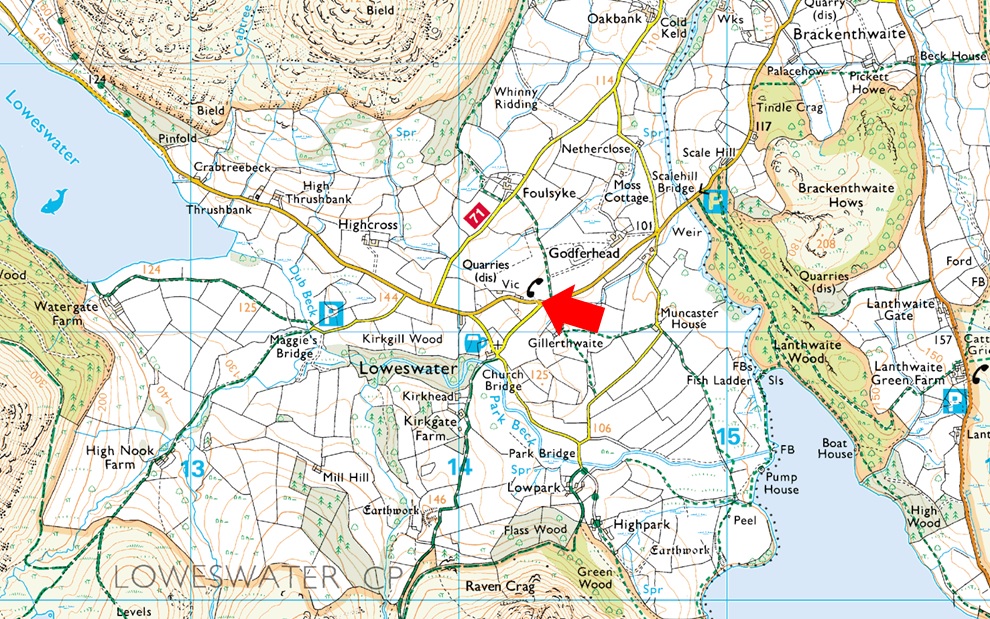
Parking Spaces, Loweswater (red phone box) |
| Area: |
Western |
| Miles: |
10.5 |
| Walking With: |
On My Own |
| Ordnance Survey: |
OL4 |
| Time Taken: |
7 Hours 30 Minutes |
| Route: |
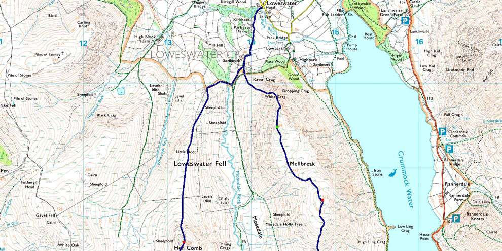
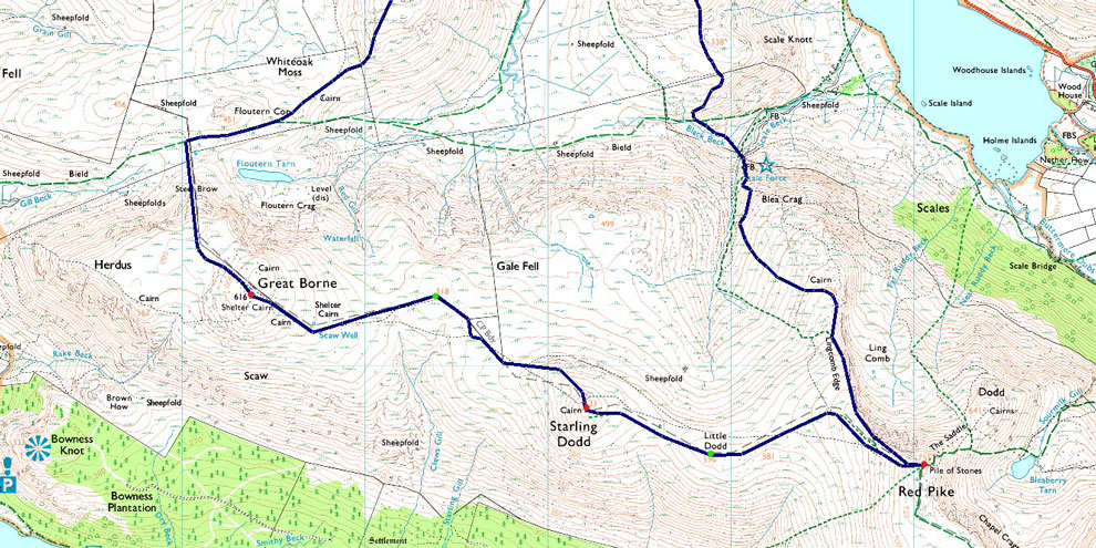
Loweswater – Kirkgate Farm – White Crag – Mellbreak – Scale Force – Lingcomb Edge – Red Pike (Buttermere) – Little Dodd – Starling Dodd – Gale Fell - Scaw Well – Great Borne – Steel Brow – Floutern Tarn – Whiteoak Moss – Hen Comb - Mosedale Beck – Kirkgate Farm – Loweswater |
|
| |
|
Parking Details and Map |
|
|
| Nearest Post Code: |
CA13 0RU |
| Grid Reference: |
NY 143 021 |
| Notes: |
Despite the popularity of the Loweswater Fells parking can be difficult due to limited spaces. The Red Phone Box in the centre of the village is what the Wasdale Inn is to Wasdale Head and here you will find parking spaces for around five well parked cars. The Phone Box now had a defibrillator inside as do most rural phone boxes. My advice as with many other premium parking spaces is to arrive early and you shouldn't have any trouble parking. The parking spaces provide access to of course the whole of the Loweswater fells or just walks around Loweswater with the Kirkstile Inn close by for food and drink. Parking is free. |
|
| |
|
Map and Photo Gallery |
|
|
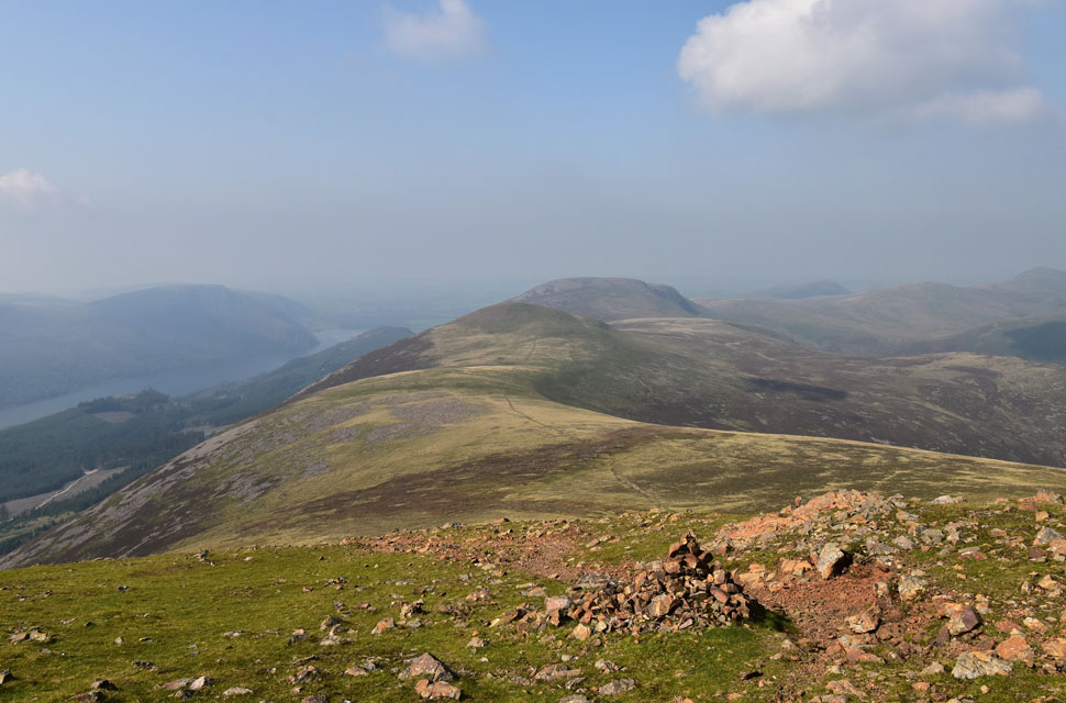
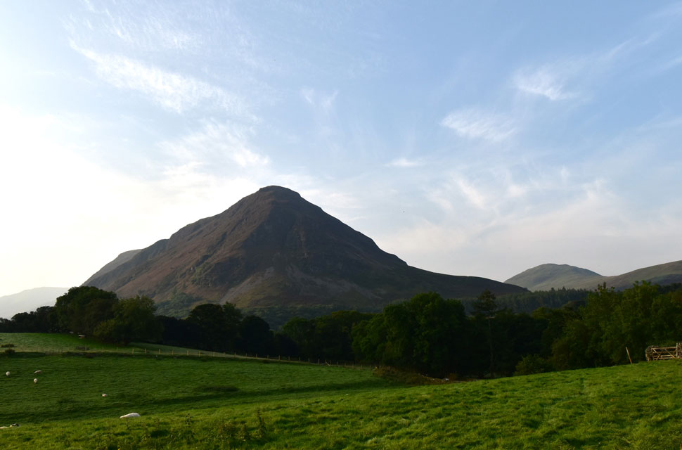 |
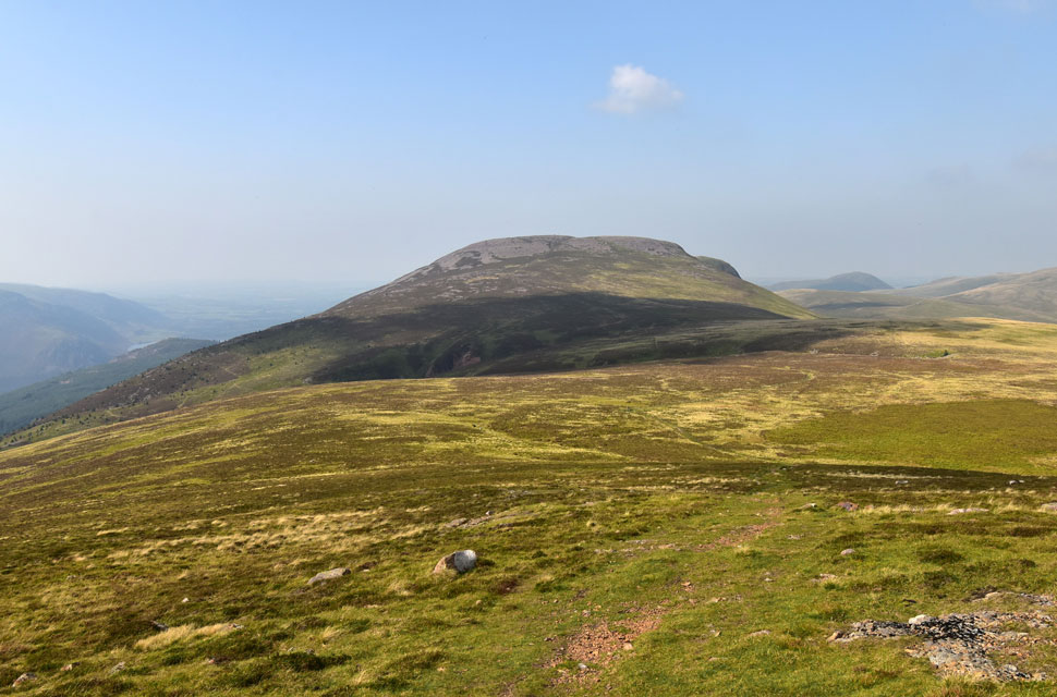
| Todays first and final summits of Mellbreak and Hen Comb from the parking spaces at the red phone box, Loweswater 16°C 7:55am |
It was pitch black when I left home, and I was lucky enough to witness a lovely sunrise in the eastern skies. Haze was present from the early hours with high-level clouds beyond, which isn't the best combination as it will trap the heat and raise the humidity.
I was the first to arrive at the parking spaces next to the red phone box at Loweswater, and with time to spare, I took my time kitting up while finishing off one of two Lucozade Sports before I performed a final sweep of the boot, extended my walking poles, and locked the car. Other than the odd car passing Loweswater, it was lovely and quiet, with sheep grazing beyond the stone wall and the odd squark from a raven breaking the silence. |
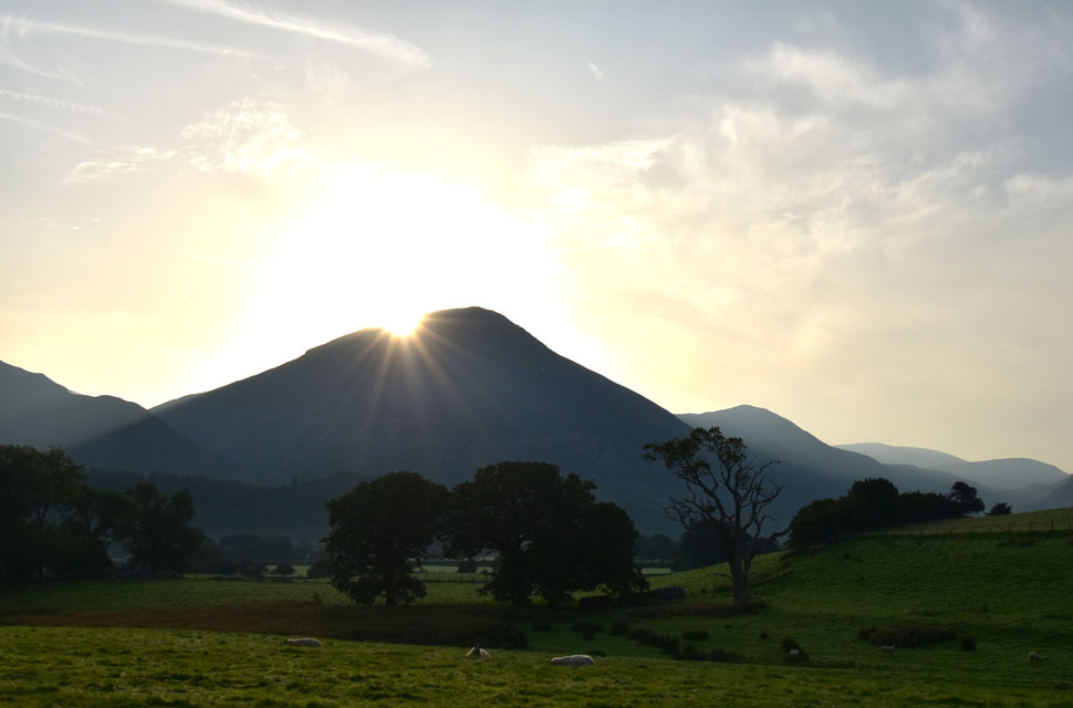 |
| Sunrise over Grasmoor. |
| With my car locked and my hands strapped in my walking poles, I Ieft the car and began the walk towards the Kirkstile Inn, where I received a 'morning' from a labourer who was spading sand into a mix of concrete. Continuing down the lane, I passed Kirkgate Farm, where my nostrils were treated to the smell of slurry. Flanked by stone walling, a bull from a nearby field watches on as I head towards a gate below a coppice of pine trees, from where the official ascent of Mellbreak begins. |
 |
| Loweswater, Fellbarrow and Low Fell from the ascent on Mellbreak. |
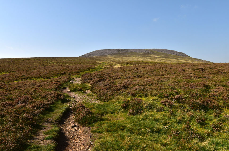
| Despite it being a tepid 16°C the temperature felt much higher from the moment I began my ascent on Mellbreak. Undeterred I continued through the break in the pines towards the steep, rocky path that zigzagged its way towards White Crag. |
 |
| Grasmoor, Whiteless Pike, Rannerdale Knotts and Robinson from the first promontory. |
| The high humidity meant that I was drenched in sweat by the time I had reached the first promontory, from where I realised just how thick the haze was, obscuring the Grasmoor range less than half a mile away into deep silhouettes, with any views further lost to the haze. |
 |
| Mellbreak South Top (summit) from Mellbreak North Top cairn. |
| After experiencing the haze firsthand from the first promontory I didn't bother checking the view from the second; instead, I concentrated on controlling my breathing, trying to inhale large amounts of air to fill my lungs, but it seemed futile; there was now't going in while sweat continued to pour off me. Even at this early hour the humidity was stifling. |
 |
| Crummock Water and Buttermere from the descent of Mellbreak. |
From Mellbreak's north top, I dropped into the saddle, where I was met with the slightest of breezes before the short grassy rise onto the summit. I reached the summit in no time and was miffed to find someone had relocated the summit cairn to a rocky knoll about 120 feet south of the actual summit. Visually, there was no comparison as to which was the higher ground.
Still feeling a little miffed, I didn't bother to take a photo. I left the summit and began my descent, capturing this lovely view of Crummock Water shimmering through the haze below. It was also here that I spotted a paddle boarder who I'd last seen entering Crummock Water from the Highpark area of the lake. It seemed they were boarding a lap of the lake, and for a split second, I'd have traded places with them. |
 |
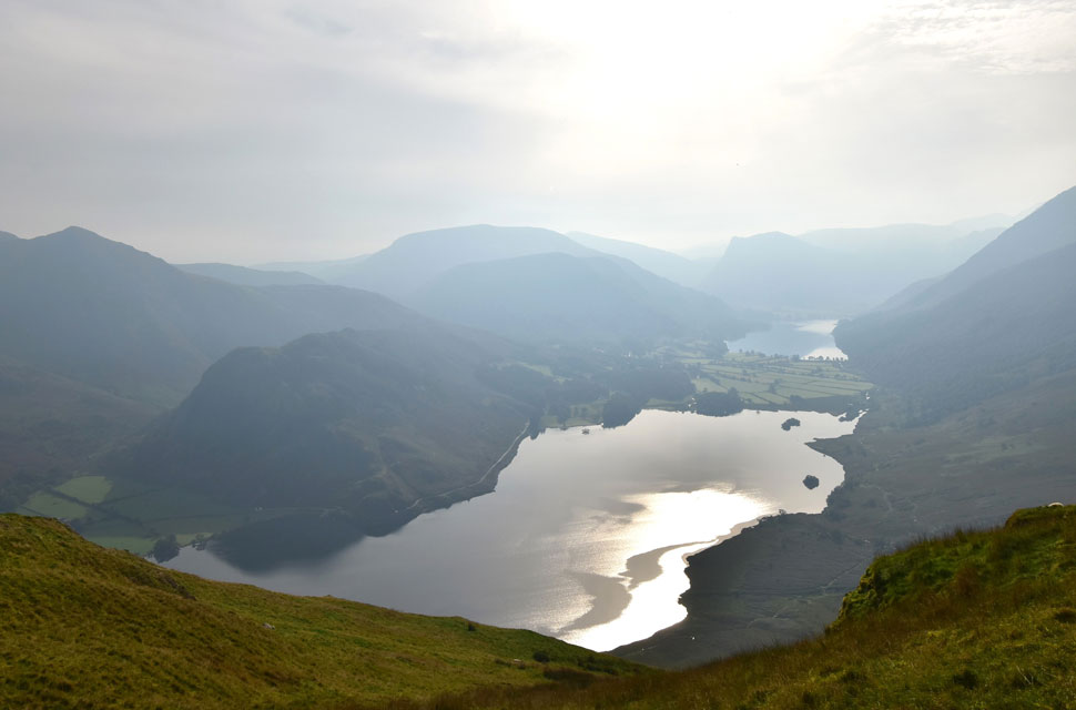
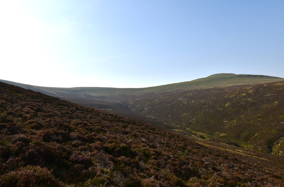
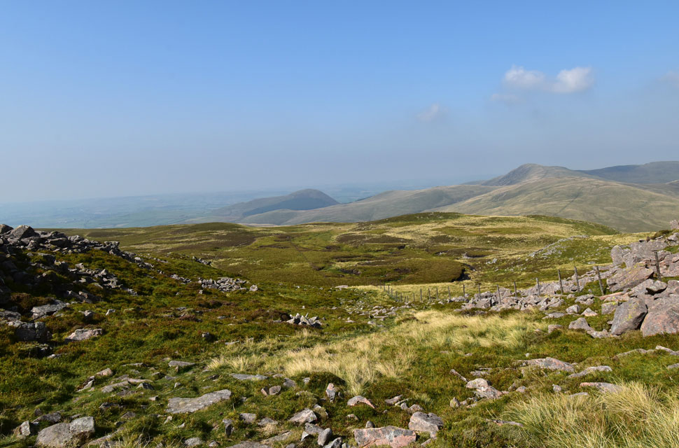
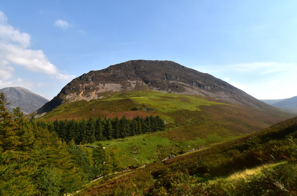
| Looking over Whiteoak Moss towards Gale Fell (left) Great Borne and Floutern Cop (right) |
| With the haze keeping my views to a minimum my descent from Mellbreak was as quick as it was steep as I flanked Scale Knott to my left before another sharp descent towards Black Beck. |
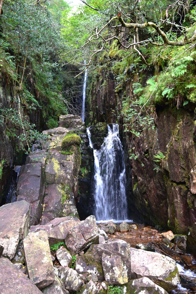 |
| Scale Force falls. |
Disturbing a large flock of sheep, I crossed Black Beck with a jump before joining the path on the opposite side of the beck. From here, a narrow path flanks Black Beck before passing through Bracken eventually emerging at the footbridge over Scale Beck and Scale Force falls.
Scale Force is one of my favourite waterfalls in the district, and I guess it was here I was able to recompose myself, which included long sips from my bite valve, the contents of which were still cool after leaving my bladder pack in the fridge over-night. |
 |
| Little Dodd (left) and Starling Dodd (right) from my ascent via Scale Beck. |
| Feeling rejuvenated, I joined the red stone path, which at first climbs alongside Scale Force before flanking Scale Beck thereafter. Entombed within the ghyl the air was cool, and on more than one occasion I cupped water from the beck over my face and then let the breeze cool me down, which felt like outside air conditioning! With Scale Beck now a fair drop below, the path rises onto the open fell side, with Little Dodd and Starling Dodd domineering the skyline. |
 |
| Views over Ling Comb towards Red Pike (Buttermere) and High Stile from Lingcomb Edge. |
Opting to take a direct ascent on Lingcomb Edge via the flanks of Blea Crag, I left the footpath for a worn trod through heather, and after a very steep ascent, I reached the summit cairn on Blea Crag, where I was surprised to find a solo chap taking in the views. He was the first person I'd seen all morning, and sadly, he didn't seem up for conversation, leaving with just a 'hi' as I approached the cairn.
This was probably best because the steep pull on Blea Crag had taken it out of me, and to state the obvious, I wasn't up for polite conversation either; in fact, that last ascent had beaten me up and left me with a bloodied lip. The rising heat and humidity were starting to get the better of me. |
 |
| The view down Lingcomb Edge towards a hazy Mellbreak. |
| With Grasmoor, Whiteless Pike Rannerdale Knotts and Crummock Water towards the right. |
 |
| High Stile, Bleaberry Tarn and Pillar from Red Pike (Buttermere) |
Even on long walks I rarely stop to eat, especially if I'm walking alone, but I had to stop twice during the ascent of Red Pike, where the heat and humidity continued to get the better of me, leaving me with a total lack of energy and, not to mention, willpower. By now I was soaked through, and through sheer sweat, I struggled to grip the handles of my poles, which had left a blister in the palm of my right hand. I rarely feel beaten, but during the ascent I was talking myself out of completing the route and instead finding the quickest way back to Loweswater.
My morale was taking a beating. Gathering myself as I shouldered the summit, I found a young lass smothering herself in sun tan lotion wearing nothing but a vest and shorts. I passed on a 'hi' trying not to look as dishevelled as I felt inside. Another woman, slightly older, and her dog arrived from Bleaberry Tarn and slumped into the deserted stone shelter. I make my way over to the grassy egde, de-shouldered my pack over looking two shirtless lads eating their lunch below, and more 'hi's are shared.
My heart rate returns to normal as I drink half the contents of the second Lucozade bottle before breaking out lunch. I needed fuel. Lunch came in the form of roast beef and mustard on grannery bread, a favourite of mine that I struggled to digest, so I ate it in small bites and washed it down with the rest of the Lucozade, an Ibuprofen tablet, and half a dozen fruit pastels. Before I re-shouldered, I would continue to take in the views despite the haze and heat. With the wind back in my sails talking myself out of the walk was now just memories. |
 |
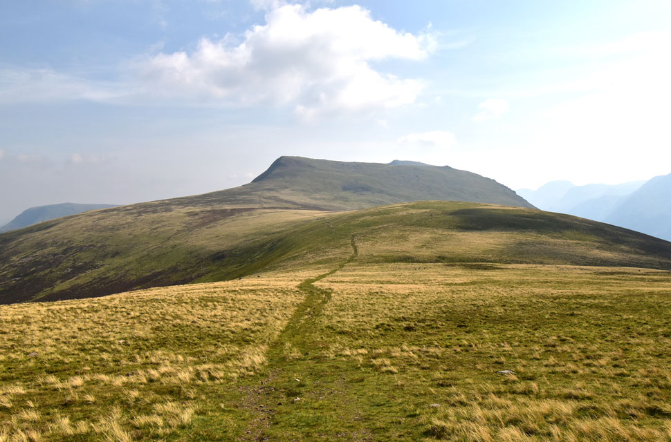
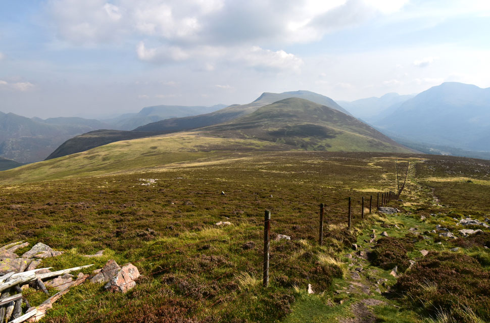
| Little Dodd, Starling Dodd and Great Borne from the descent of Red Pike (Buttermere) |
I generally felt that eating lunch had given me the kick up the arse that I needed. From my lunch spot, I had watched two walkers on Lingcomb Edge who I passed during our descents and ascents. I was keeping myself to myself because we were on separate paths, but I got a 'hi' from the chap, who, as it turned out, was American.
The heat was never mentioned, but we did share our routes, explaining that he had come up from the town of Buttermere below. I didn't bother to correct him; in fact, I had only admiration for anyone from another country who comes here to walk the Lakeland fells. |
 |
| Red Pike (Buttermere) from Little Dodd. |
| With Red Pike behind me, the temperature continued to climb which would peak in around an hours time. By now I wasn't climbing directly into the sun as I had earlier, and with the sun on my back it kind'a felt like a day of two halves as I left the ridge path and took in the slight ascent before gaining Little Dodd summit. |
 |
| Red Pike (Buttermere) and Little Dodd. |
| Taken shortly before beginning my ascent on Starling Dodd. |
 |
| Red Pike (Buttermere) and Little Dodd from Starling Dodd. |
| That's Green Gable, Great Gable and Kirk Fell seen beyond the Ennerdale valley which is still trapped in haze. |
 |
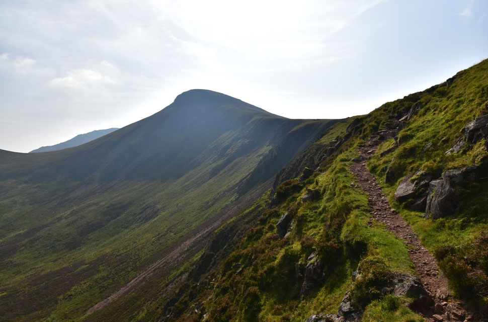
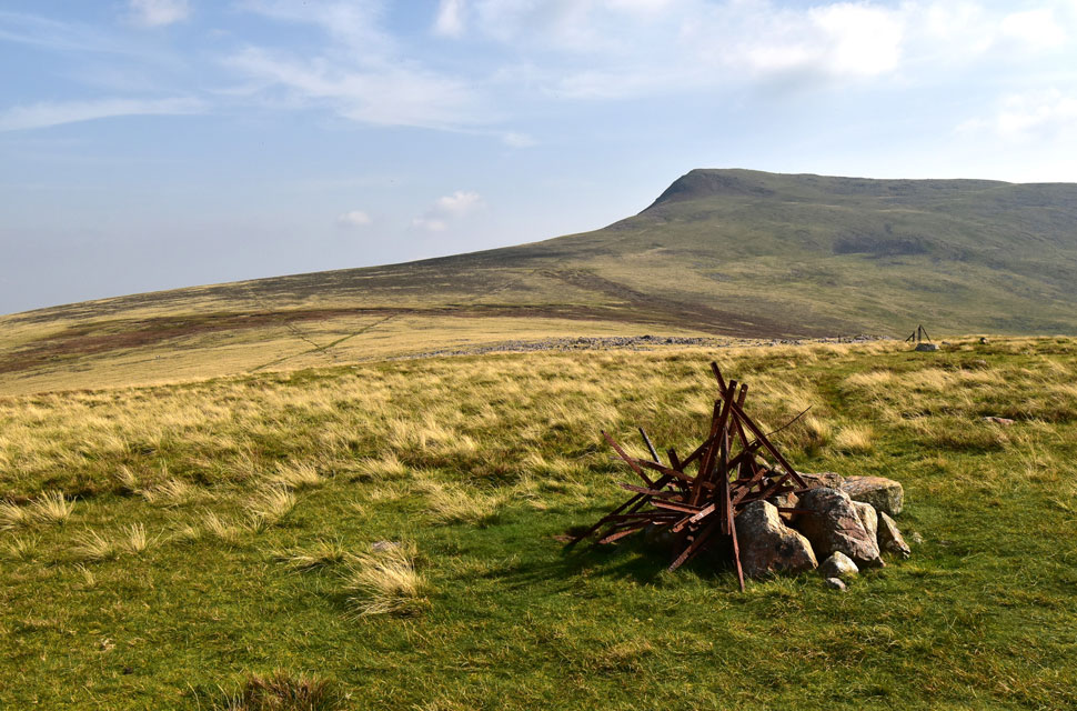
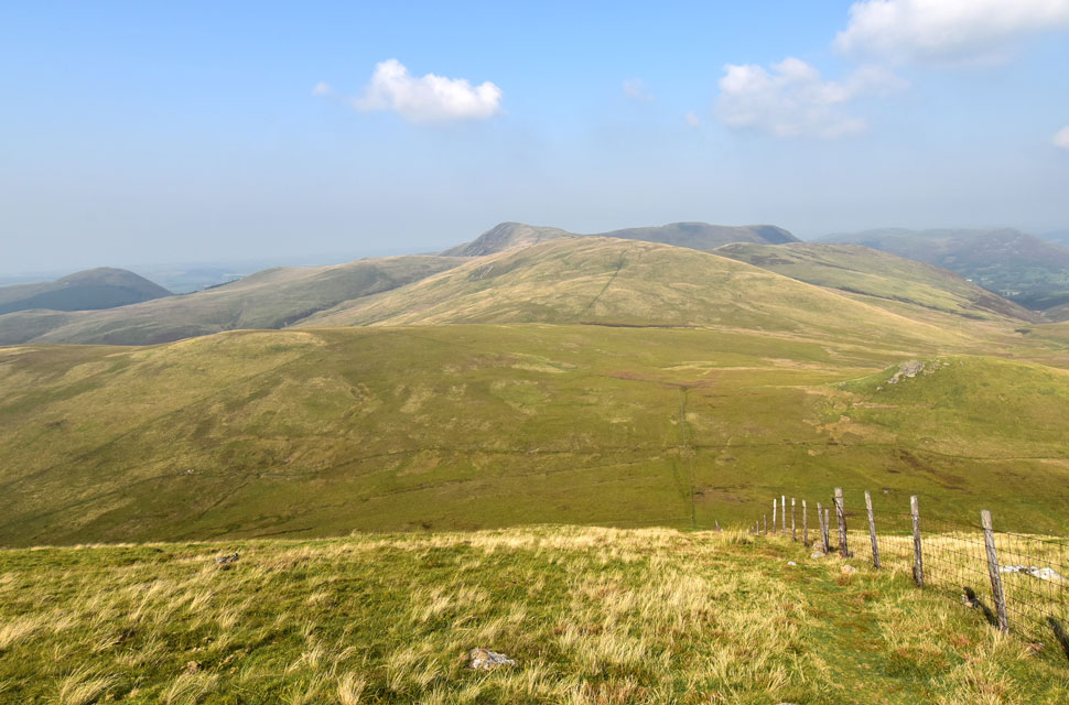
| Great Borne and Gale Fell with Knock Murton seen beyond. |
| I was met with a slight breeze whilst summitting Starling Dodd which would continue to stay with me all the way to Great Borne which on more than one occasion caused the hairs on my arms to stand on end, I at first feared I was showing the early signs of heat-stoke but nothing more came of it. |
 |
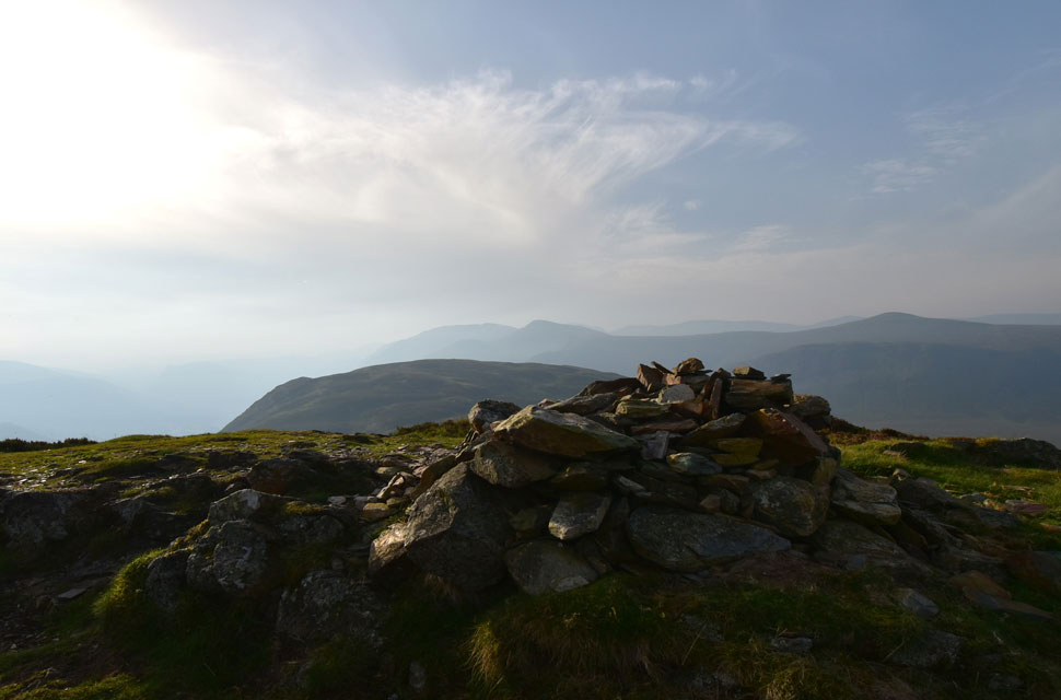
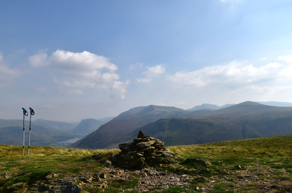
| Ascent on Great Borne. |
| I had followed the fence line over Gale Fell and felt disappointed to find no summit cairn, just tufts of long grass and dried mud. Returning to the path I passed Scaw Well from where I took in the view towards a hazy Ennerdale Valley beyond which an equally hazy Crag Fell and Grike shimmered in the heat of the afternoon. |
 |
| Looking back on Gale Fell, Starling Dodd, Red Pike (Buttermere) Blea Crag and Lingcomb Edge. |
| With the Gables and Kirk Fell seen to the right. |
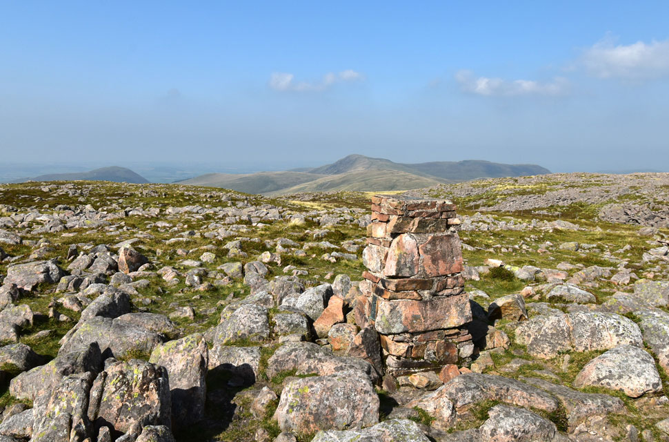 |
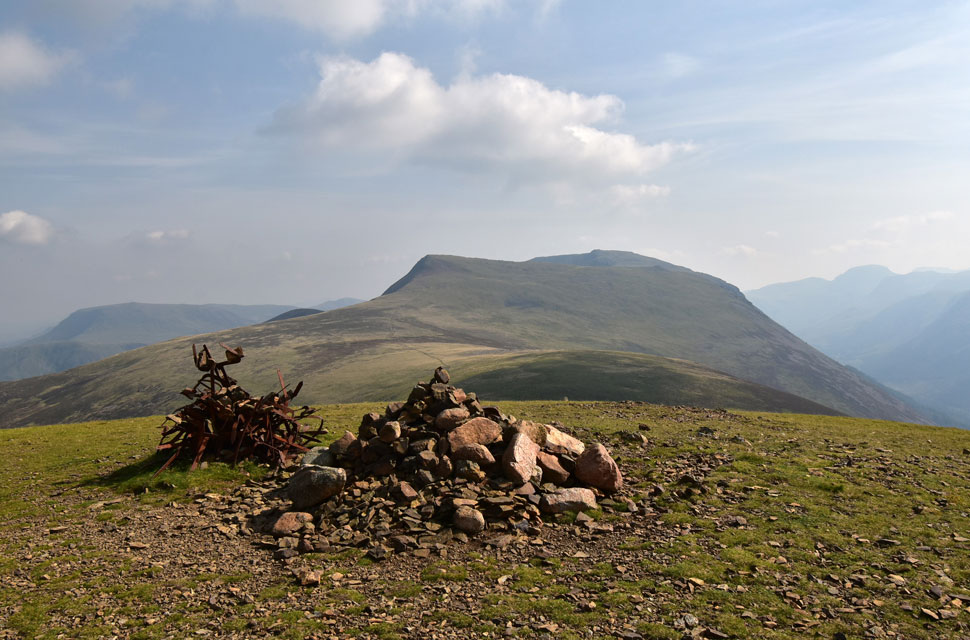
| Knock Murton, Gavel Fell and Blake Fell from Great Borne. |
| Great Borne was reached in the heat of the afternoon and I was thankful that for now, I still had the slight breeze to help keep me cool. |
 |
| Descending Great Borne. |
| I descended the rock strewn summit of Great Borne and followed the fenceline northwards until the fence veered right towards the top of Steel Brow, my descent line back to Floutern Tarn. |
 |
| Descending Steel Brow with views of the Loweswater Fells. |
| As you can see Steel Brow isn't without its steepness descending three false summits during the course of the descent. |
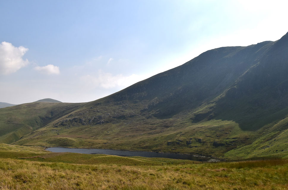 |
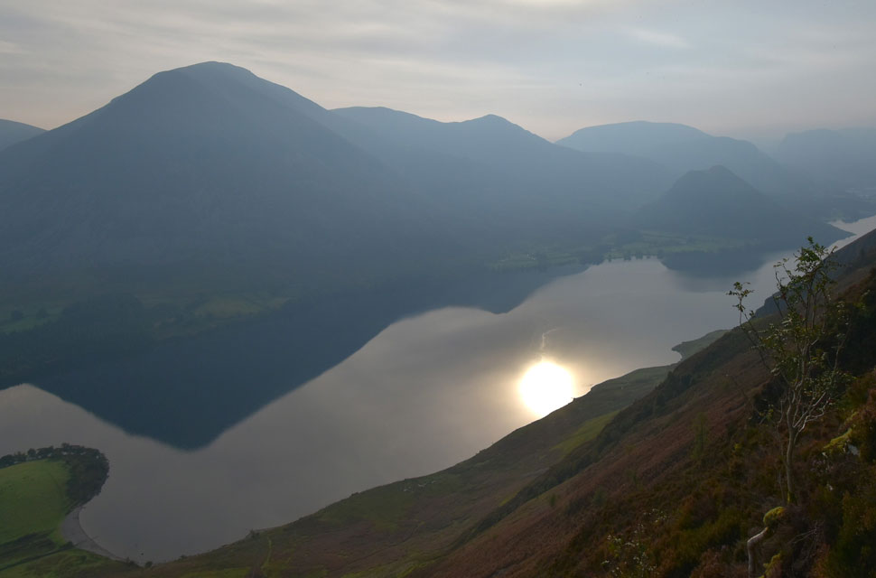
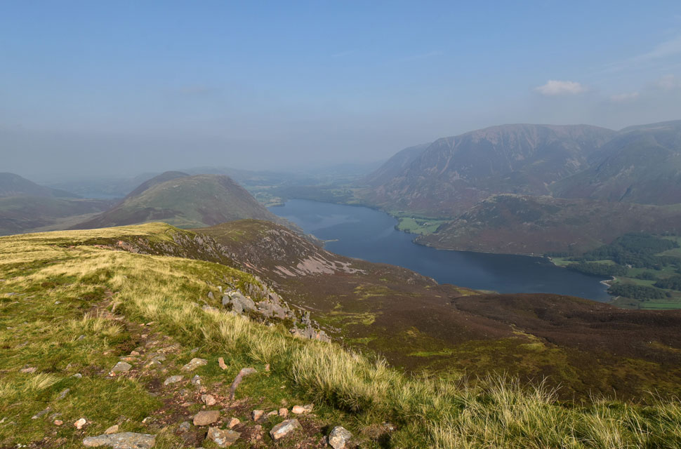
| Starling Dodd and Floutern Crag (Great Borne) from Floutern Tarn. |
| I am always surprised by how steep Steel Brow is and was pleased I was in descent rather than ascent, Still, the descent is relatively short and after passing over a wooden style I could take in the views over Floutern Tarn which, had it been any closer I'm sure I'd of gone in for a dip! |
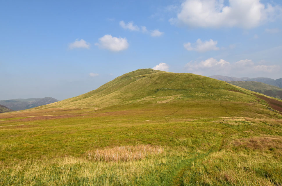 |
| Todays final summit, Hen Comb. |
| If Great Borne was out of the question while I was ascending Red Pike earlier, Hen Comb certainly was as the heat of the afternoon peaked. I had lost the breeze now but was on the home stretch and despite my dwindling energy, there was no way I was going to miss out on the final summit. |
 |
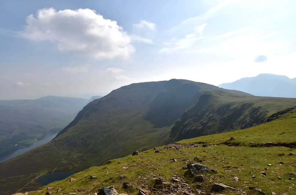
| Buttermere, Fleetwith Pike, High Crag, High Stile, Red Pike (Buttermere) The Gables, Blea Crag and Starling Dodd from Hen Comb. |
The heat bore down, and no sooner had I begun my ascent, my stride began to narrow, and I found myself sipping at the dregs of my bladder pack. Feeling determined, I pressed on, only to come to a stop as I chatted with a young lad descending the summit, whose next summit would be Gavel Fell. He was shirtless, and the sun had turned his torso red and raw; it looked painful. He explained he was going onto Gavel, Blake, and Burnbank Fell before returning to his tent at Loweswater. We chatted for a few more minutes, and the lad seemed impressed by my route, which I toned down after telling him how much the heat had affected me. We agreed that the heat sapped at energy levels before bidding one another to enjoy the rest of our walks.
Next, I was joined by a young girl who made her way to the summit whose step seemed to have a stagger to it. I passed on a 'hi' and she smiled and said that it was "too hot" I asked where she had come from, and she replied Loweswater. Not wanting to take pleasure from this girl who was half my age but clearly suffering with the heat, I left, and I stopped beating myself up over my performance. Young or old, the heat will drain at your energy levels. |
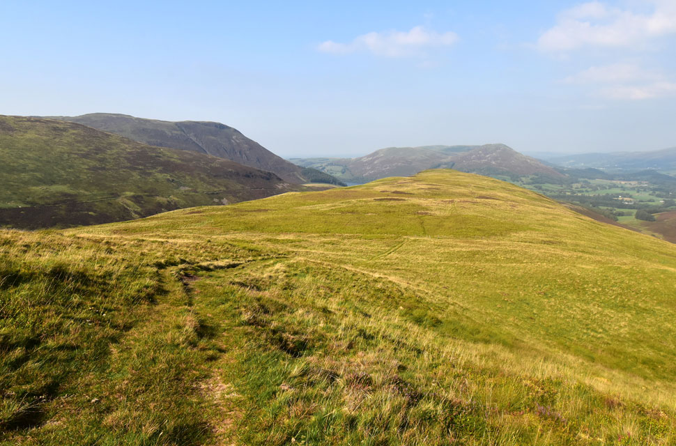 |
| The view towards Little Dodd on Hen Comb. |
| With Black Crag (Gavel Fell north ridge) Blake Fell (left) Fellbarrow and Low Fell (ahead) |
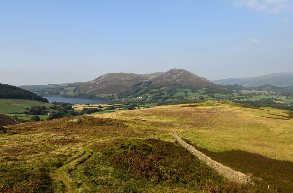 |
| Views of Loweswater. |
| Fellbarrow and Low Fell as I near the edge of the ridge. |
 |
| Mosedale. |
| With Mellbreak seen left, Hen Comb right, Red Pike, Gale Fell and Starling Dodd ahead. |
 |
| Mellbreak seen over Mosedale. |
As I began my descent towards Mosedale Beck the whaleback of Mellbreak dominated my view. In the heat of the afternoon I spotted no one in ascent or descent. It was here that I received a phone call from Paula, my wife, to ask how I was getting on and what time I would get home. Right at that point, two RAF jets thundered through the Buttermere valley, followed by two booms, and I lost what Paula had to say. Following on, I explained I'd be home around 6pm but I was still twenty odd minutes from the car. I slid my mobile back into its protective case and placed it into the lid pocket of my pack. I could hear Mosedale Beck gurgling below, and despite being so close to the car, I couldn't wait to throw cupped hands of water over my face.
Watched on by two elderly walkers, I took great delight in dousing my face in the water, which, unsurprisingly, was luke warm. I rinsed my buff in the beck too and used it to pat my face down, and while ascending the adjoining river bank, I placed the buff across my scorched neck. It felt blissful. I had caught up with the two elderly walkers who held the gate for me as I joined the walled track towards Kirkgate Farm. "It's a bit warm for walking" one chuckled, realising that there was some truth in this I replied, "It almost got the better of me" |
|
| |
| Back to top |
 |
|