|
Raise & Helvellyn from Sticks Pass |
 |
 |
5th February 2023 |
 |
|
After last weekends Lord's Seat walk we thought it fair that we were due some decent weather which came in the way of a bright forecast from about midweek onwards. With David already walking on a pre planned walk Rod and I set the stall high with an ascent of Raise and Helvellyn from Sticks Pass.
As Rod pointed out the last time I walked from the Thirlmere side of Sticks Pass was back in September 2018 during a very similar walk following Birketts route 'Raise, White Side & Helvellyn' the difference being back then being I descended back to Stanah via White Side and Brown Crag. Today Rod and I opted to descend via Browncove Crags then walk the mile back to Stanah via the high level path from Thirlspot to Stanah while taking in the long distant views through St Johns-in-the-Vale.
The forecast didn't quite turn out as planned as the Winter sunshine struggled to pierce through the high level cloud but it remained clear and dry with only a minor windchill over the most exposed ridges. |
|
| Wainwright Guide Book One |
 |
| The Eastern Fells |
| Raise It is the only summit in the Helvellyn range adorned with a crown of rough rocks - and they make a welcome change from the dull monotony of the green expanses around Sticks Pass |
 |
|
|
|
| |
|
Overview |
|
|
| Ascent: |
3,296 Feet - 1,004 Metres |
| Wainwrights: |
3, Raise - White Side - Helvellyn |
| Visiting: |
2, Helvellyn Lower Man - Browncove Crags |
| Weather: |
Dry With High Level Cloud Obscuring Sunshine. Feeling Brisk Where Exposed. Highs of 7°C Lows of 1°C Feels Like -7°C |
| Parking: |
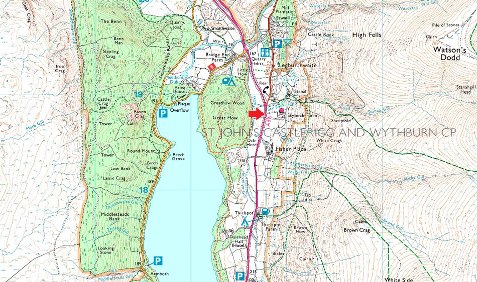
Lay by, A591 Stanah |
| Area: |
Eastern |
| Miles: |
7.5 |
| Walking With: |
Rod Hepplewhite |
| Ordnance Survey: |
OL5 |
| Time Taken: |
5 Hours 15 Minutes |
| Route: |
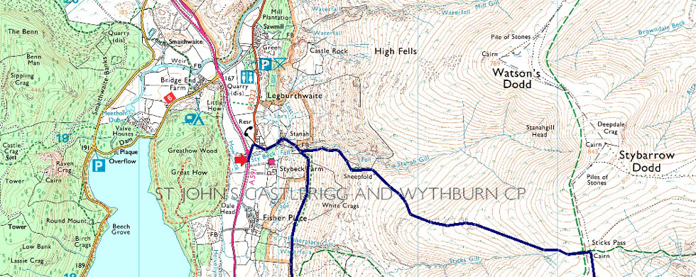
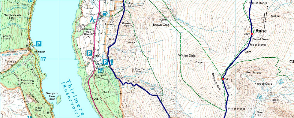
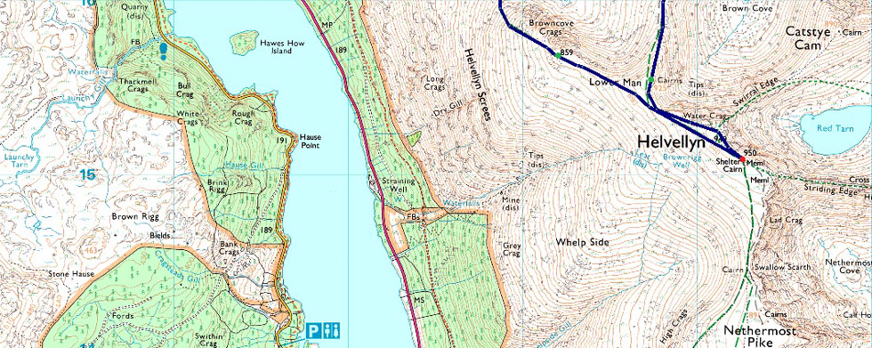
A591 - Stanah - Sticks Pass - Top of Sticks Pass - Raise - White Side - Lower Man - Helvellyn - Browncove Crags - Helvellyn Gill - Fisherplace Gill - Stanah - A591 |
|
| |
|
Parking Details and Map |
|
|
| Nearest Post Code: |
CA12 4TH |
| Grid Reference: |
NY 318 218 |
| Notes: |
A small layby can be found on the northern spur of Thirlmere on the right hand side if travelling north or just after the junction with St Johns-in-the-Vale if travelling from the south. |
|
| |
|
Map and Photo Gallery |
|
|
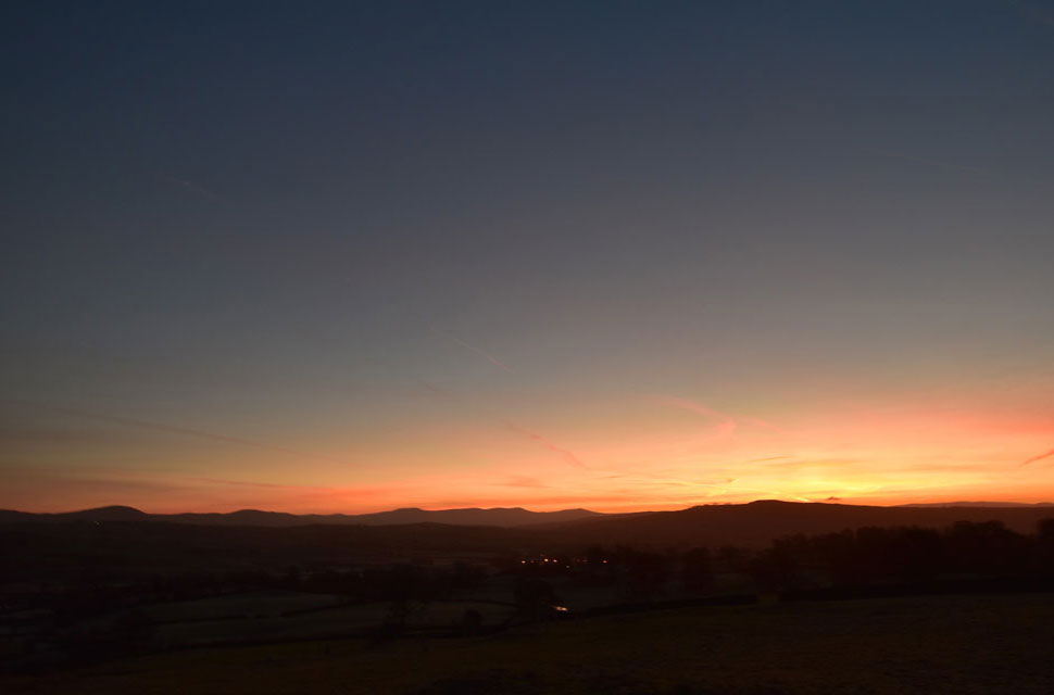 |
| Sunrise over Kendal looking towards the distant Howgill Fells 07:32am |
With the sunrise unfolding in my rear view mirror I couldn't resist a quick stop at a lay by on the A591 west of Kendal to capture this brilliant view. |
 |
| Views over Stybeck Farm towards Bleaberry Fell, the Skiddaw group and High Rigg from the ascent of Sticks Pass 08:35am 1°C |
The usual parking spaces next to the phone box at Stanah is now reserved for residents only but just beyond lies the dead end of what used to be the Keswick to Ambleside road where if careful you can squeeze half a dozen well parked cars on. This was the spot Rod and I had arranged to meet at 08:15am for a 08:30am start. I arrived early to find Rod already there and parked easily behind Rods car.
We greet with the a hand shake before informing one another how busy the layby outside Scales was and likewise, how busy the lay by's to the north and south of Grasmere were too "gonna be busy across the tops" or words to that effect passed my lips. Funnily enough though there was only me and Rod here and that would do for us. Even though the temperature was hovering just above zero a windchill of around -7°C was forecast at 750m and we kit up accordingly even adding gaiters should we encounter the mud and bogs notorious to the west side of Sticks Pass. |
 |
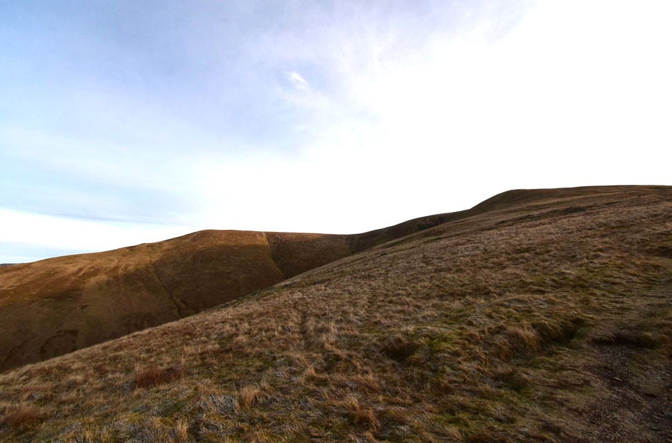
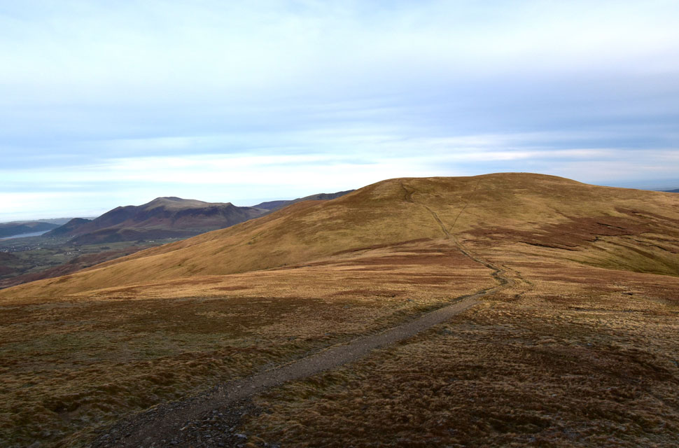
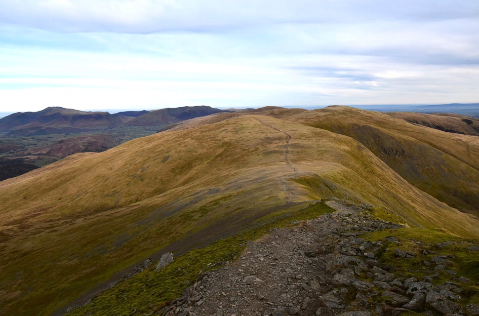
| Views opening up to include High Seat with Grisedale Pike and the Lord's Seat Fells beyond. |
| There was no need to worry about the mud and bogs encountering frozen ground underfoot which took the mind off the steep incline. With Stanah Gill falling away over our shoulders we arrived at the sheepfold and spent a few minutes taking in the view whilst getting our breath back. |
 |
| Stybarrow Dodd (right) and Watson's Dodd (left) from Sticks Pass. |
| Sunlight was only just starting to breach the higher tops above our heads just as we strode into a cool headwind which caused the usual snurches cleared by blocking one nostril and blowing down the other, effective but crude I know. |
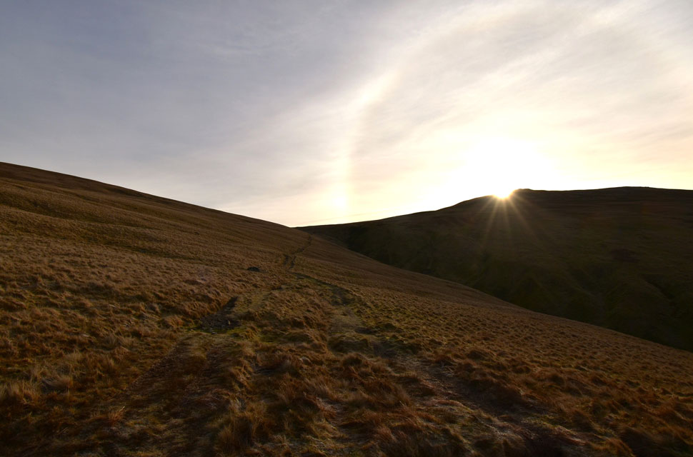 |
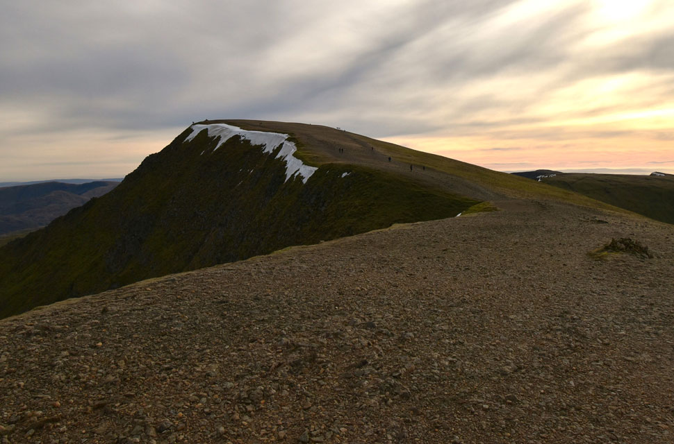
| Sunrise breaches Raise. |
| Given the great forecast and all the parked cars we had passed you'd have thought we'd have been struggling for space along here but up until now we had only been passed by one fell runner heading up the pass and one lady heading back down who had more than likely had been up to catch the sunrise. |
 |
| Extensive views beyond the Central ridge towards Base Brown, the Gables, Pillar and the Grasmoor group to name a few. |
| Not far from the top of Sticks Pass now highlighted here by this lovely level section of ground which falls away into Sticks Gill over on the left. |
 |
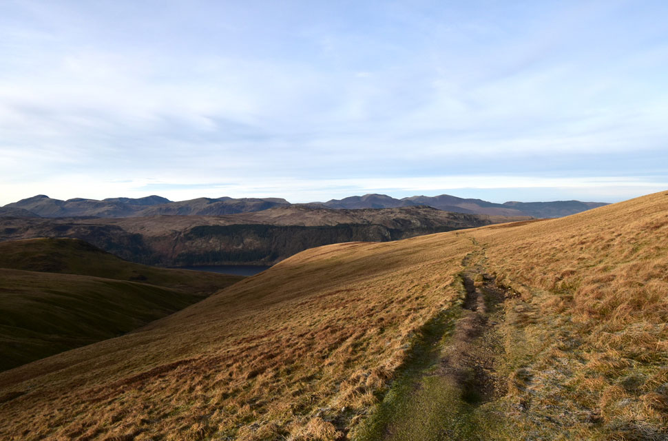
| White Stones, Ullswater and the North Pennines from the top of Sticks Pass. |
| We arrived at the top of Sticks Pass expecting to see hoards arriving from the Glenridding side but sighted no one, in fact other than a fellow much further down the pass we had the top of the pass to ourselves and didn't waste any time advancing on Raise. |
 |
| Stybarrow Dodd seen beyond the top of Sticks Pass. |
| With Watson's Dodd poking out over on the left and the Skiddaw Group looking as impressive as ever. |
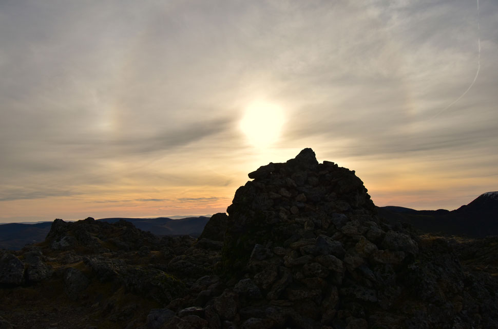 |
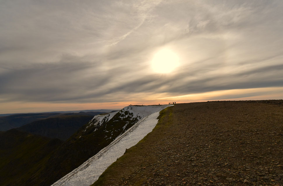
| Sun halo from Raise summit. |
| We made great time ascending Raise where Rod noted that the wind had faded but high cloud had increased which in turn created a halo around the sun. |
 |
| White Side, Lower Man, Helvellyn, Catstye Cam and Nethermost Pike from the descent of Raise. |
| Despite the low light this section of ridge spanning the heads of Kepple Cove and Brown Cove has to be one of the best high level ridges in Lakeland. What a place and what a view, pity about the low light mind. |
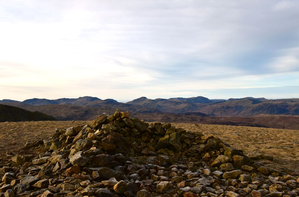 |
| Bow Fell, Esk Pike, Great End, III Crag, Scafell Pike, Lingmell, The Gables, Pillar and the Grasmoor group just to name a few from White Side. |
| It was only when we crossed over the top of Brown Cove did we spot the dozens of walkers ascending via the Kepple Cove zigzags. One of these was a elderly chap who held pace that Rod and I would have been proud of who shortly over took us, shared brief pleasantries before continuing on towards Lower Man. |
 |
| Looking back towards White Side, Raise, Stybarrow Dodd, Watson's Dodd, Great Dodd, Clough Head, Blencathra and finally Skiddaw. |
| The ascent of Lower Man was the last 'real' ascent of the morning and no matter how daunting it can look I always end up enjoying its steepness thanks to views like this. |
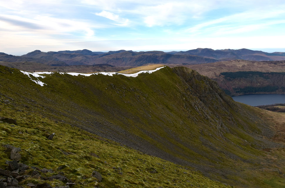 |
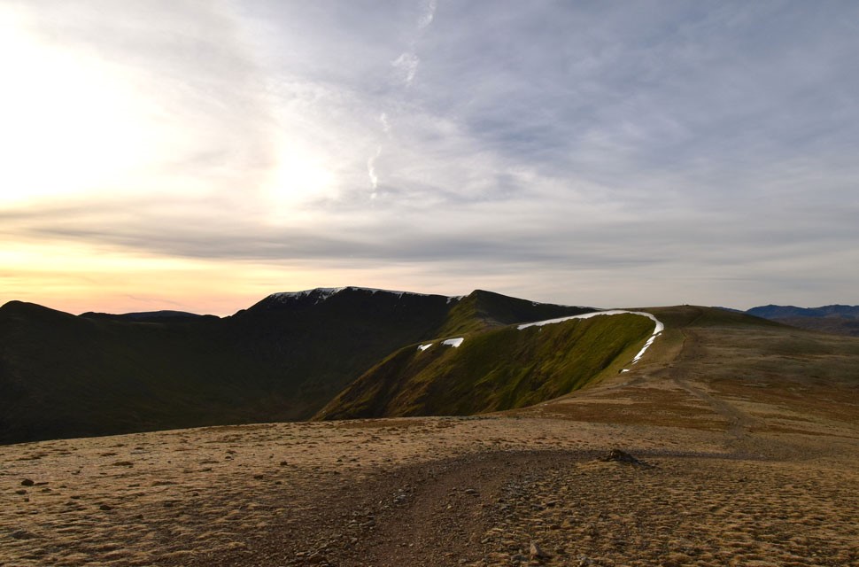
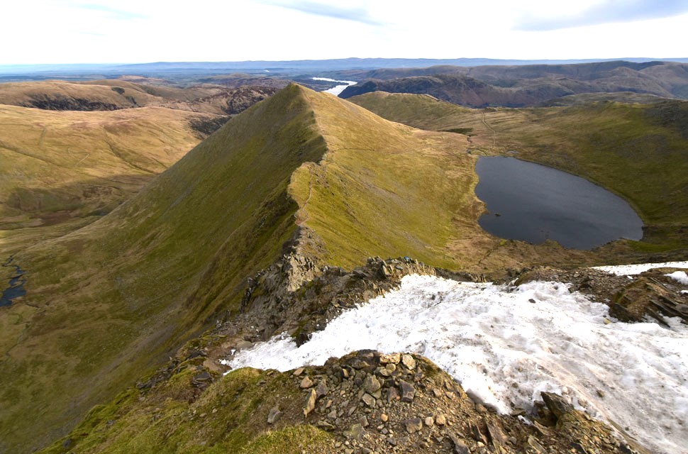
| Browncove Crags from the ascent of Lower Man. |
| You might be able to spot the tiny figures heading from Browncove Crags towards Helvellyn, a sure sign of what to expect when we get there. |
 |
| Views over Brown Cove towards Catstye Cam, Stybarrow Dodd, White Stones, Harts Side, Sheffield Pike and Ullswater. |
| It was Rod who spotted movement in Brown Cove sighting a group of walkers who had just passed the ruined Dam below. |
 |
| Helvellyn from Lower Man. |
| The low light wasn't so apparent as I was taking the photos but as you can see my camera, with all its knobs, gadgets and switches didn't like the light "learn to adjust the settings I hear you say" nah, that just isn't me. The day I start adjusting my camera settings is the day I turn from fell walker into photographer. |
 |
| Helvellyn and Swirral Edge from the top of Brown Cove. |
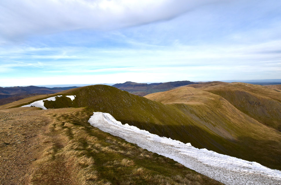
| Despite carrying micro spikes we hadn't encountered any ice with only scarce patches of snow here and there with the exception of Helvellyn's north east facing corries and edges where snow cornice was still a present danger. |
 |
| Looking back towards Lower Man, White Side, Raise, Stybarrow Dodd, Watson's Dodd, Great Dodd, Blencathra and Skiddaw. |
| Whoo whoo it looks like we're finally in the sunshine! |
 |
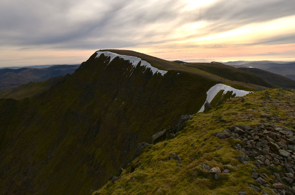
| Helvellyn summit. |
| Spoke too soon. |
 |
| Swirral Edge and Red Tarn. |
Seconds before taking this photo Rod and I witnessed a potentially heart stopping moment after a walker nearly slipped on the ice. She was part of a couple her partner and his dog had just successfully (without spikes) ascended over the hard ice and was watching his partner crest the final part of the exit. In a panic stricken voice looked up at her boyfriend and said "I can't do it it's too slippy"
Her partner who still had his dog looked at me as if to say "I've got the dog" "give me the dog" looping the dog lead around my wrist as the guy went down for his partner, grabbed her hand and guided her up. The guy thanked me just as I caught Rod giving me 'the look' which I returned. Jeeez that could have gone so wrong we both thought. |
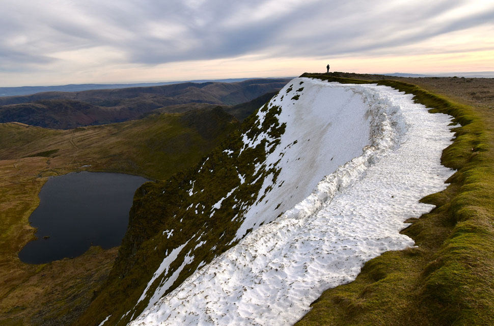 |
| Snow cornice, Helvellyn head wall. |
| We left the top of Swirral Edge and given how many people were queueing to take photos from the trig point continued towards the summit cairn right where the solo walker is standing in this photo. |
 |
| Nethermost Pike from Helvellyn summit. |
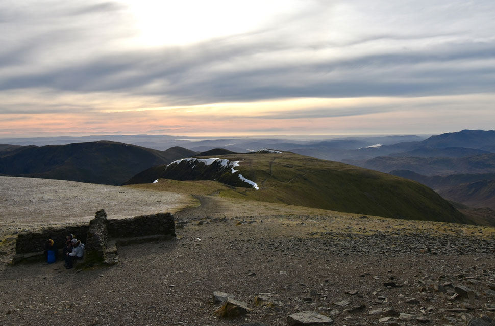
| The summit was much less busier around the summit shelter where only three people sat huddled. I didn't say anything but was instantly reminded of the moments I spent at the shelter back on Boxing Day when during a hail storm I stopped to add my goggles and came away with a pack full of hail. This morning despite the -7°C windchill all is well. |
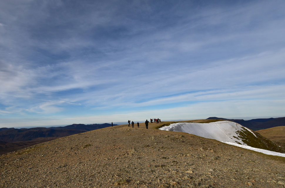 |
| We head back across the summit. |
| The summit is a little less busier now but there was still a queue forming for folk to have their pictures taken at the summit trig point so we gave the trig another miss before descending the ridge that forms the top of Browncove Crags. |
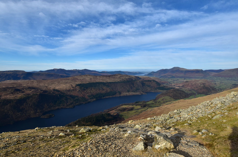 |
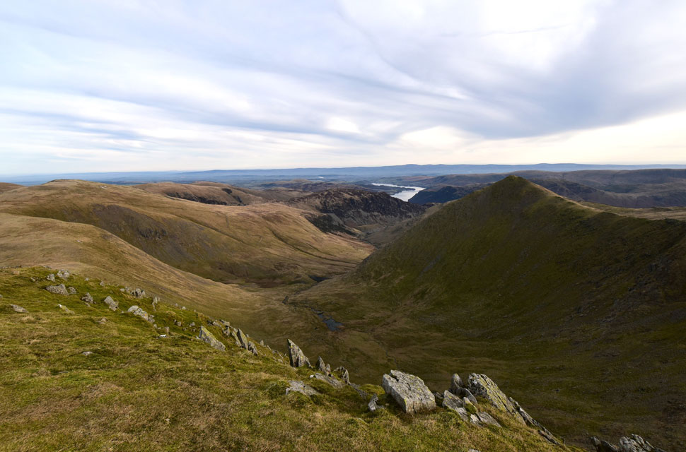
| Views over Thirlmere and beyond. |
| Now heading into the crowds walking towards the summit we began the steep twisting descent often overtaking others making their own descent and even though we didn't speak of it, it wasn't long before the knee pain crept in. |
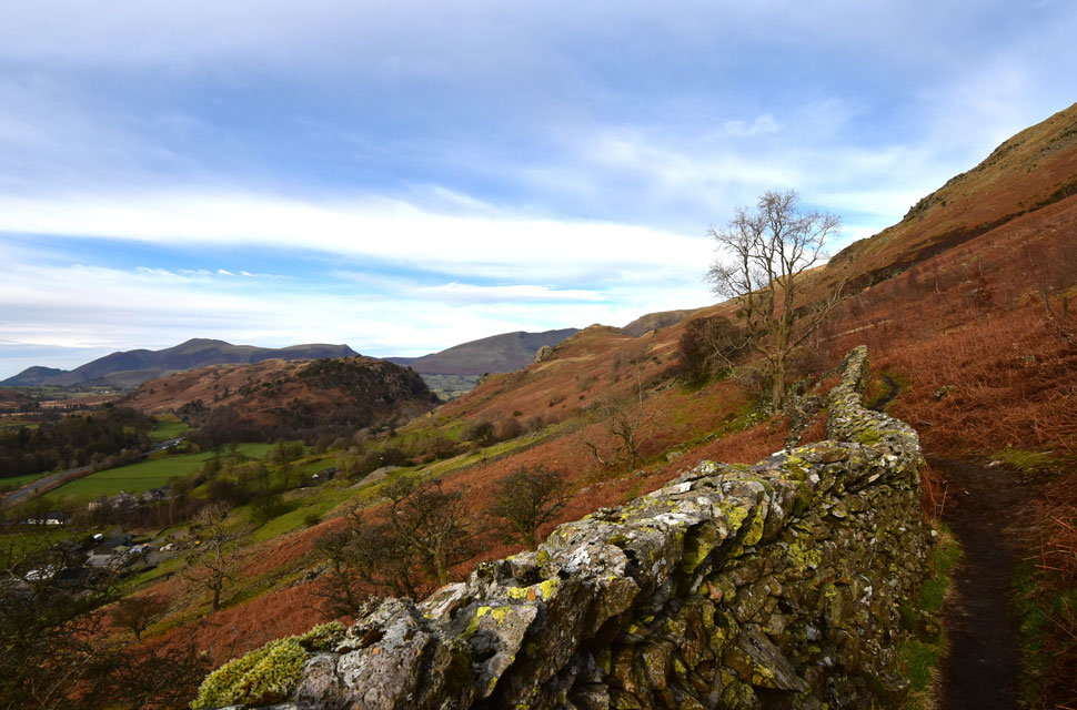 |
| The high level path linking Thirlspot with Stanah. |
Under mild afternoon sunshine we made great time with our descent much to the pain of our knees and hips whilst still being asked "how far to the summit" which was fine when we replied "just another five or ten minutes" but time was creeping on and we were still being asked the question as we reached the footbridge over Helvellyn Gill where five minutes turned to two hours of ascent time.
Kicking feet into the backs of boots we crossed Helvellyn Gill and I had a sneaky pee as we joined the high level path back to Stanah when no one was looking. We had the path to ourselves until we reached the area above Thirlspot Farm when I spotted a walker who I'd seen back at the summit making her descent. The path sometimes rose and then levelled out again, the stone wall to our left sometimes completely obscuring our view, others where it had sadly fallen teased the view below. Just before the falls at Fisherplace Gill we were stopped by a young family wearing high street clothing who asked "how far to the top" "which top" Rod asked? "Helvellyn" the chap answered. Staggered Rod courteously replied while looking back at me for an approximate ascent time "from here, a good two and a half hours" I answered. The chap looked deflated replying "my young lad doesn't want to go anyway so I think it's best we turn around "aye "for the best" we returned.
After passing the falls at Fisherplace Gill we looked up to find two girls wearing trendy ankle length high street jackets making a pathless ascent through the bracken alongside the ravine, where were they heading - we gave each other 'the look' again. Our cars could now be seen through a canopy of trees and the mild afternoon air had a tinge of wood smoke to it from Stybeck Farm below. Other than the noise of distant traffic travelling along the A591 Lakeland retained its quietude as we arrived back at Stanah to be greeted with stunning views of Blencathra at the head of St Johns-in-the-Vale. It had been a day of surprises and downright craziness but that did nothing to take away the highlights of the high level ridge that links Raise with Helvellyn. |
|
| |
| Back to top |
 |
|