A Round of Marchlyn Mawr

12th November 2022

Despite the incredibly mild temperatures all it seems to have done these last few weeks is rain and frustratingly, the drier weather seems to have been confined mid-week and yet as I type this there's a voice inside my head saying "it's Autumn, it's typically wet and you've been through this many a year before" Doesn't stop the frustration though.

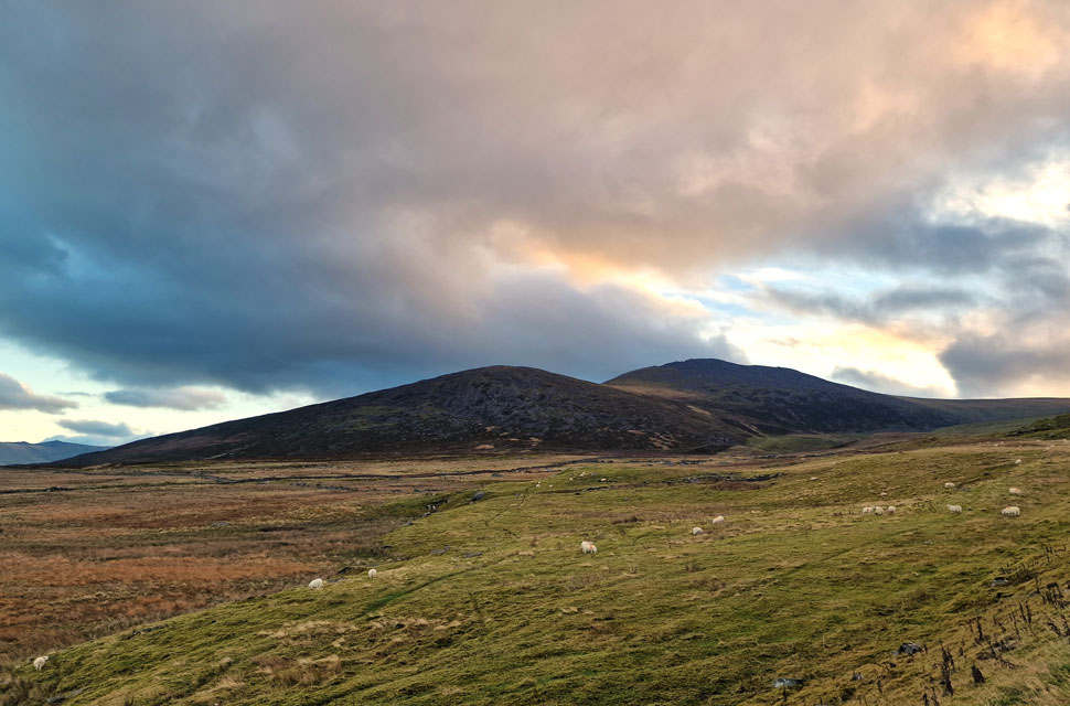
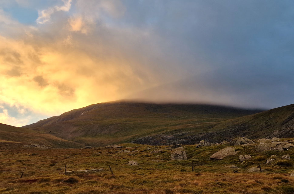
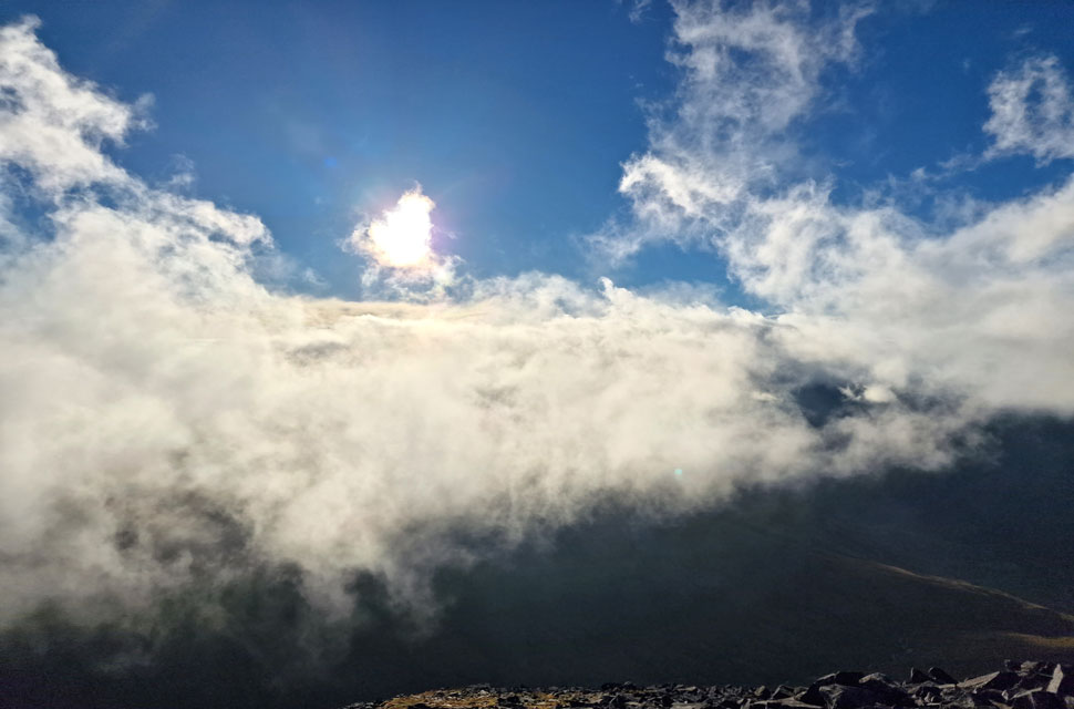
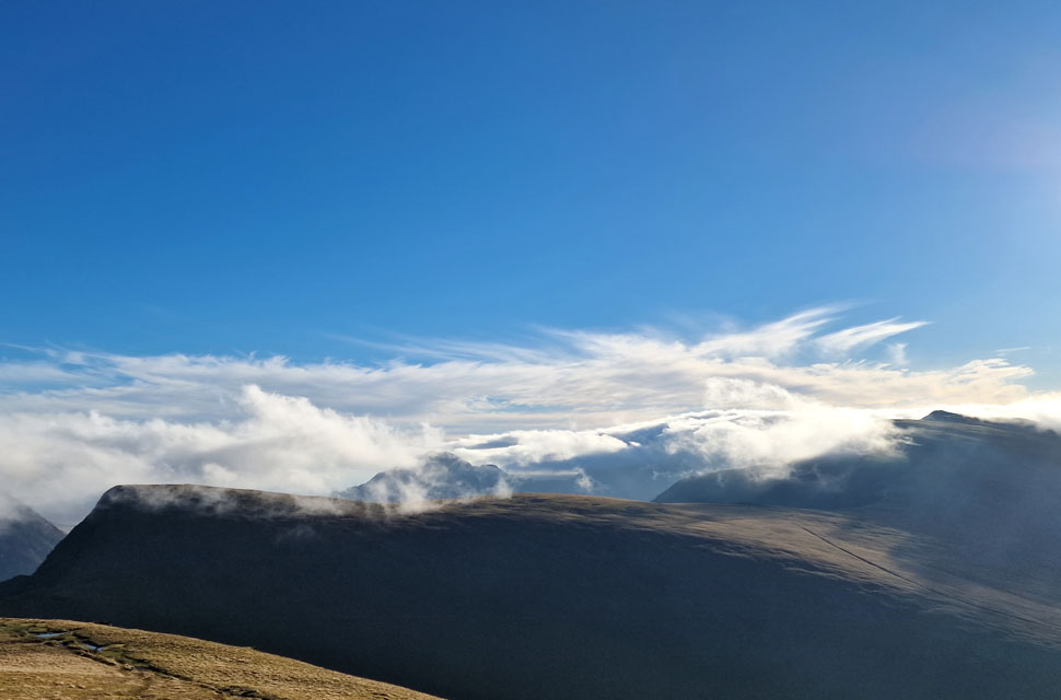
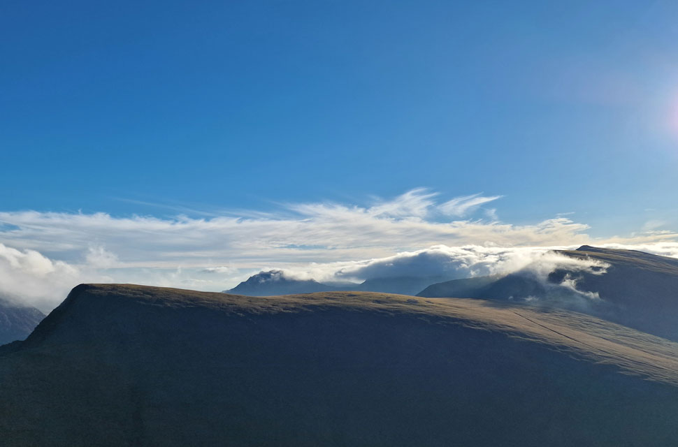
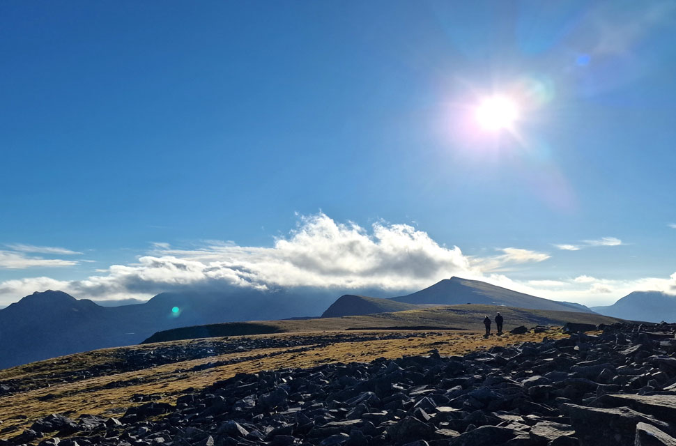
The good news however, was Saturday looked an absolute blinder with sunshine forecast for not just the Cumbrian fells but for most of the country and that included Sunday too. I had a family engagement to attend to which meant whichever walk I choose it had to be scaled down as I was on orders to be home no later than 4pm.

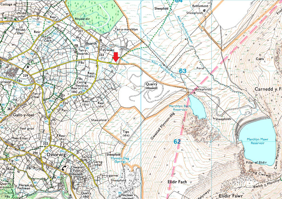
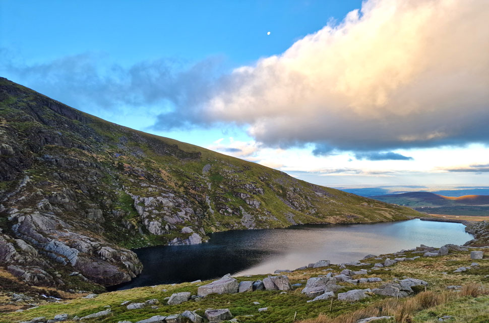
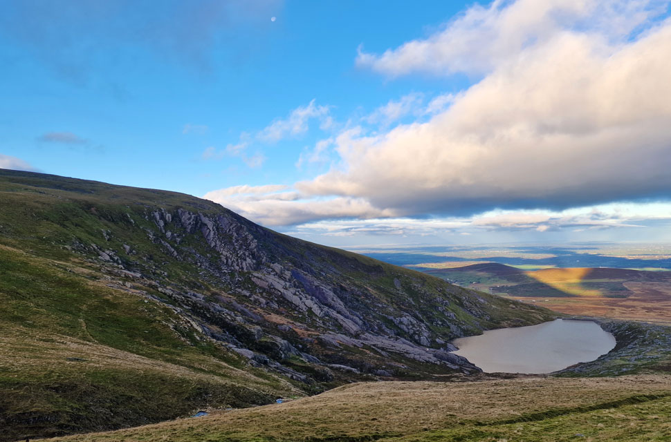
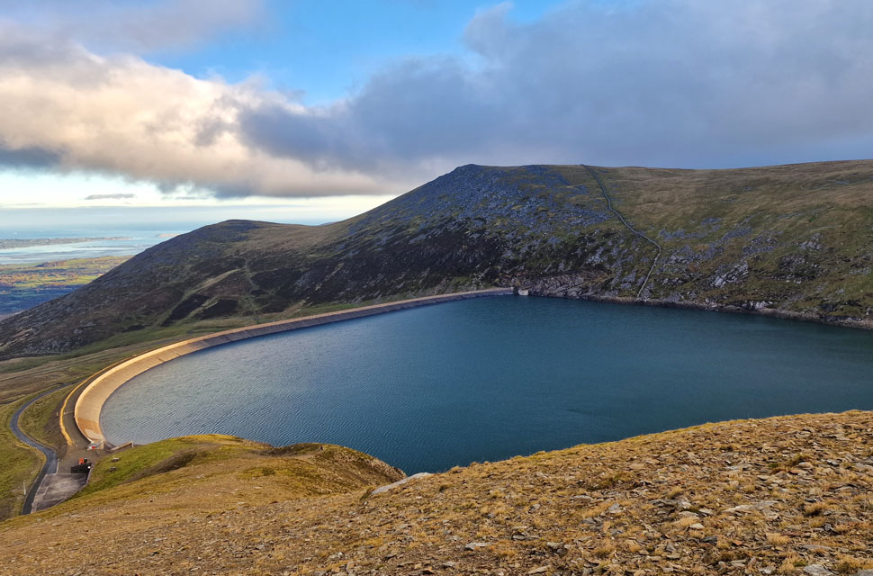
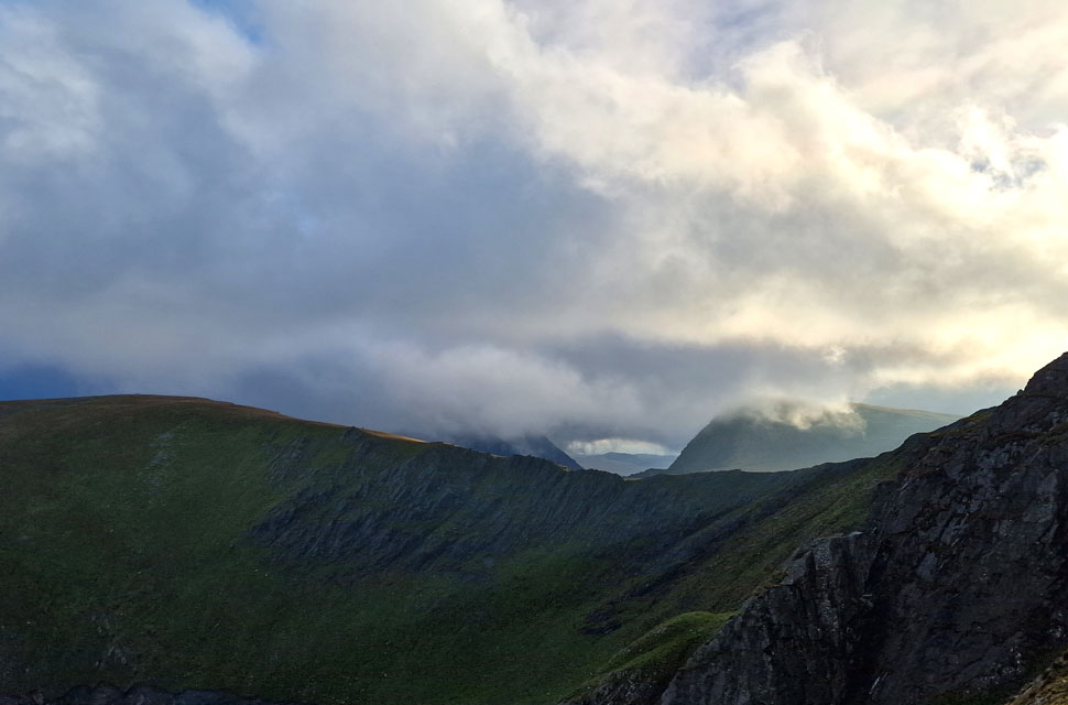
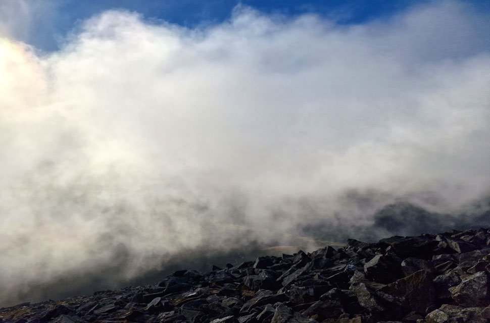
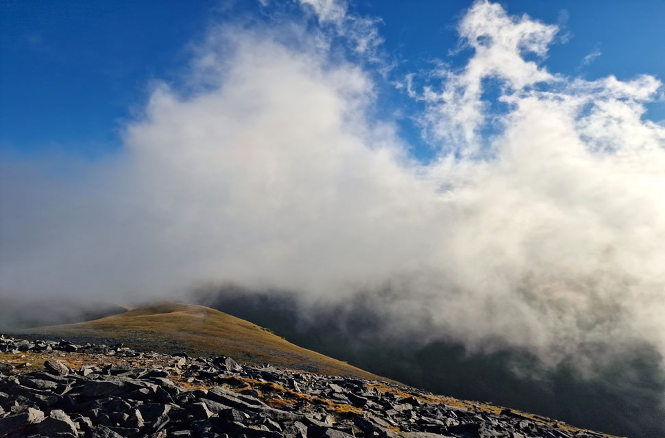
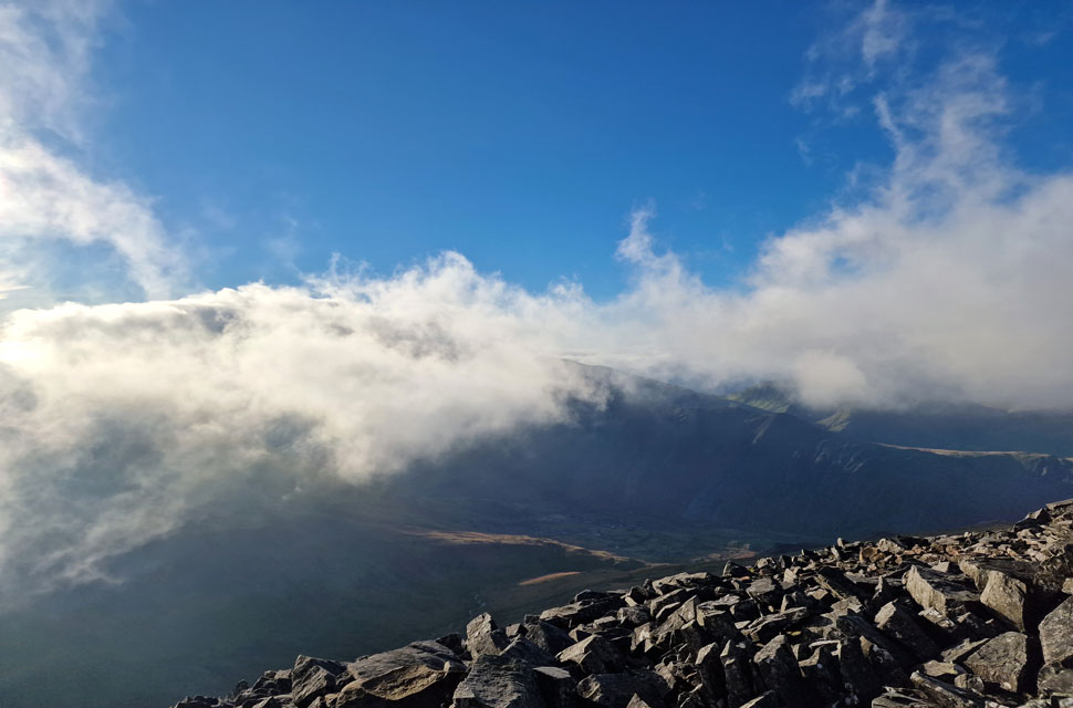
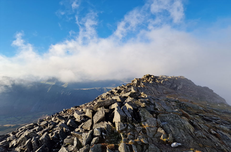
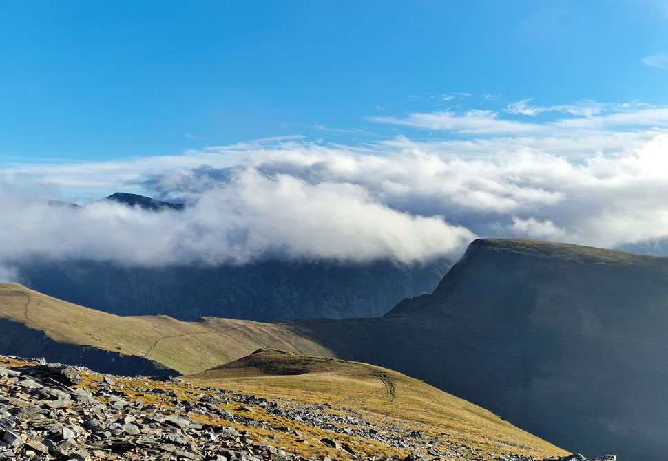
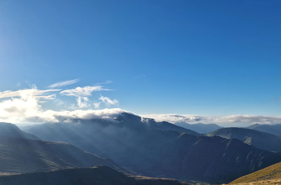
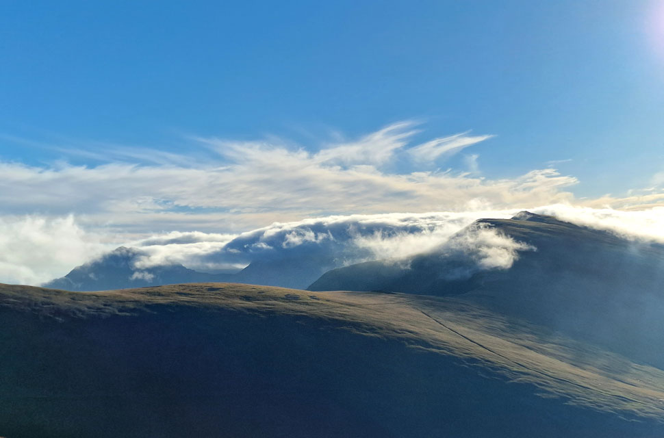
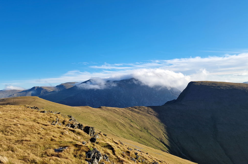
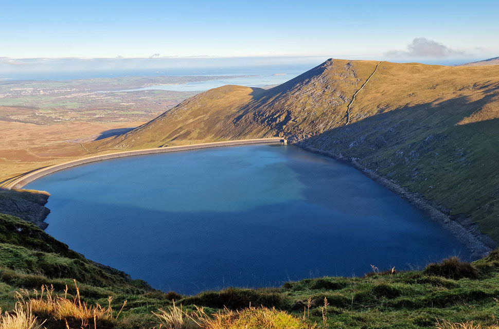
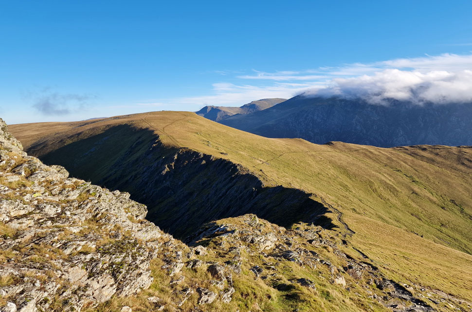
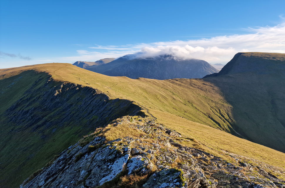
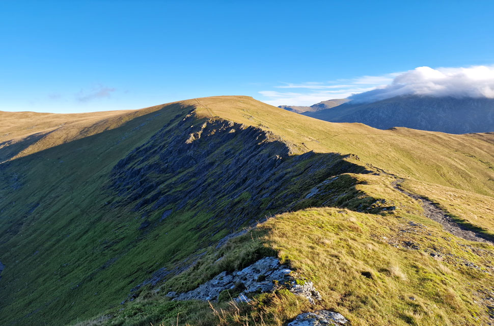
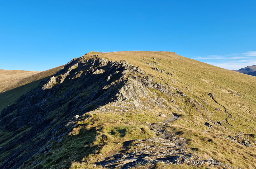
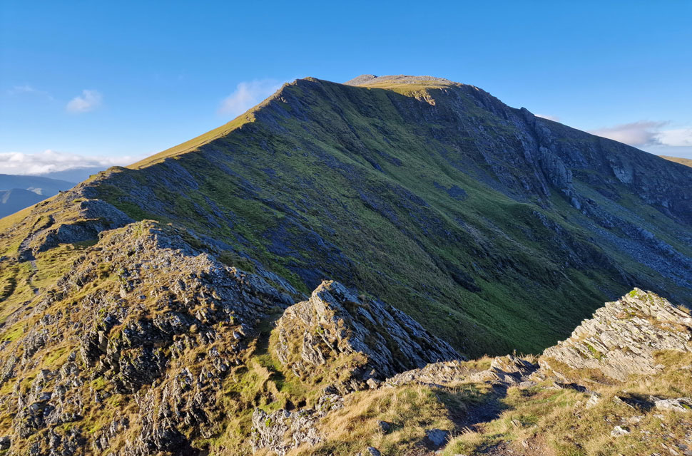
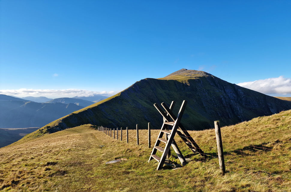
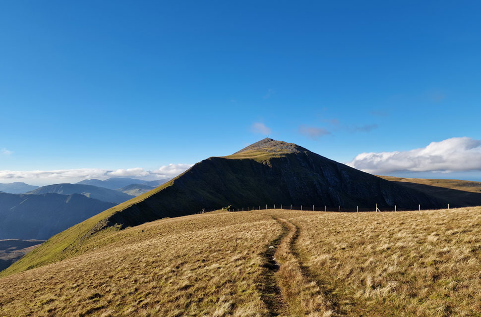
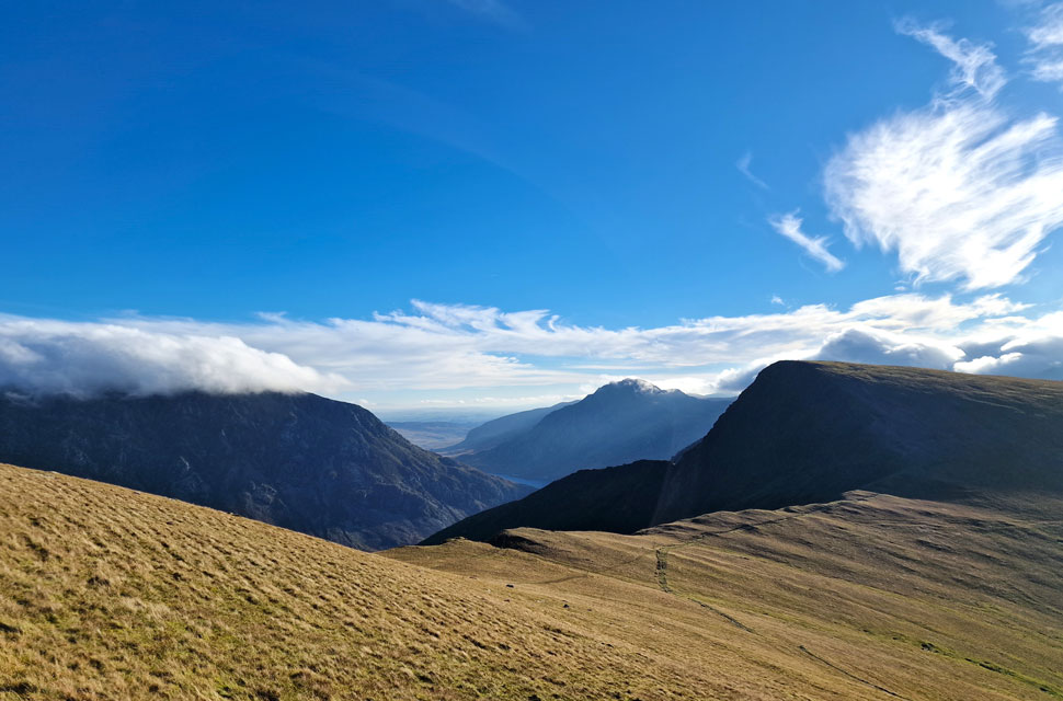
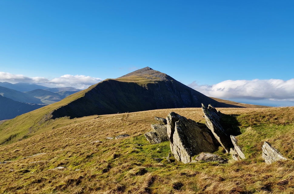
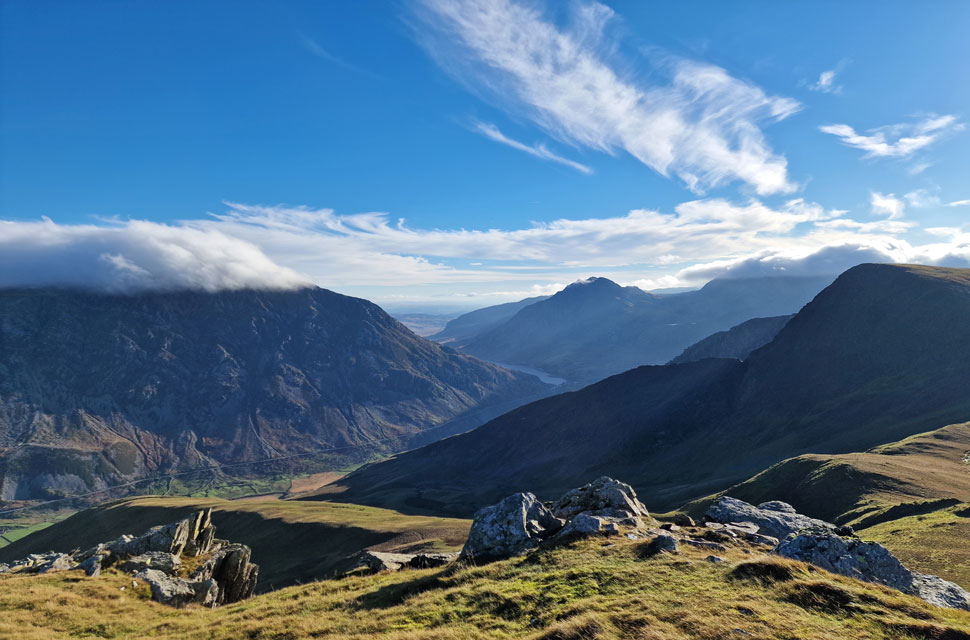
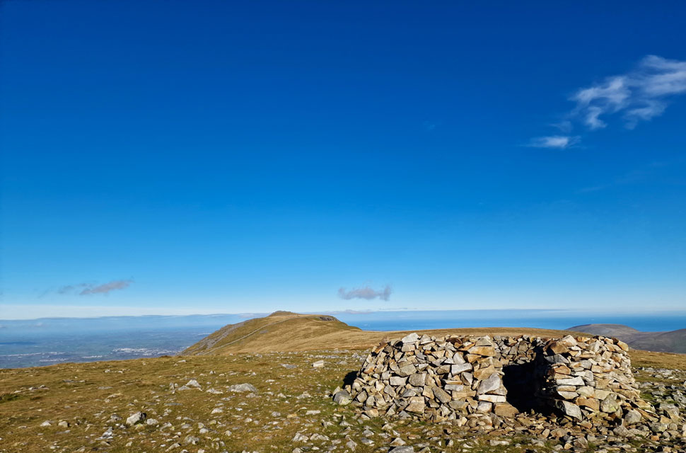
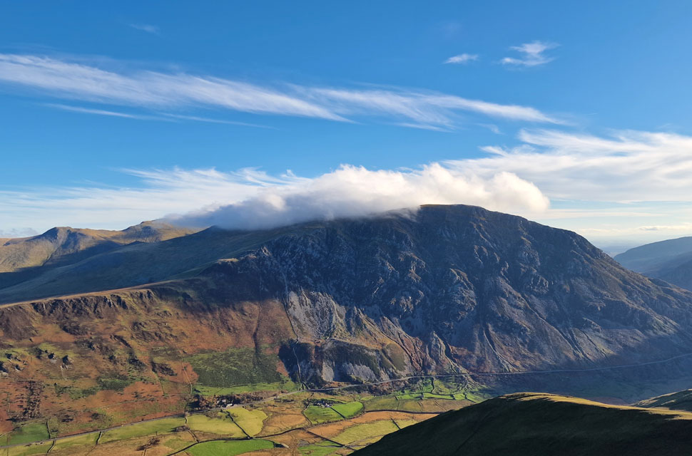
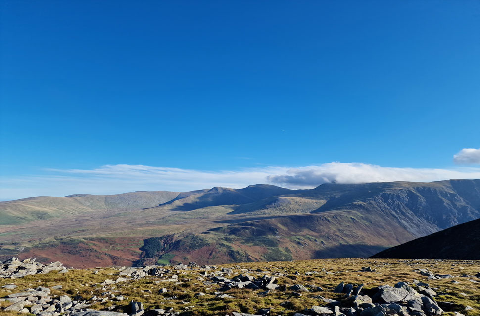
With the on going lane closures on the M6 southbound carriageway I didn't want to chance getting held up in traffic on the way home so I turned my head to North Wales to walk a route that's fast becoming my Welsh 'go to' walk.

 
Ordnance Survey 17
Snowdon/Conwy Valley
 

Overview
Ascent: 2,153 Feet - 656 Metres
Summits: 4, Elidir Fawr - Mynydd Peredd - Carnedd y Filiast - Y Fronllwyd
Weather: A Cloudy Start Sunshine Soon Breaking Through. Windy At All Levels. Highs of 16°C Lows of 14°C Feels Like 5°C
Parking: Roadside Parking, Access Road Marchlyn Mawr Reservoir, Deiniolen
Area: Snowdonia National Park
Miles: 6.5
Walking With: On My Own
Ordnance Survey: OL17
Time Taken: 4 Hours 10 Minutes
Route: Access Road Marchlyn Mawr Reservoir - Marchlyn Mawr Reservoir - Elidir Fawr North Ridge - Elidir Fawr - Bwlch y Marchlyn - Mynydd Perfedd - Carnedd y Filiast - Y Fronllwyd - Marchlyn Mawr Reservoir - Access Road Marchlyn Mawr Reservoir
 

Parking Details and Map
Nearest Post Code: LL55 3NA
Grid Reference: SH 596 630
Notes: The access road to Dinorwig Power Station also hosts a number of off road parking spaces with room for upto fifteen cars. The locals refer to the parking here as a 'hidden gem' because not that many people know about it and if I'm honest, there's a feeling of guilt dawning down on me as I write this. Please respect the area and the locals, arrive early to avoid disappointment. Parking is free.


Map and Photo Gallery


Y Fronllwyd (left) and Carnedd y Filiast (right) from Marchlyn Mawr Reservoir access road 08:10am 12°C
I can drive to North Wales in about the same time it takes me to get to Coniston and this morning I landed a whole 30 minutes earlier than I'd planned. Despite the fiery afterglow in my rear view mirror during the drive the sun was too low to leave any impression so on arrival I span my car around and waited it out. By 08:00am streaks of light were casting across the saddle of Y Fronllwd so I laced up.

Not only has it been wet as of late but it's been windy too which was confirmed by the cloud scurring across the sky at a right rate of knotts. It's mild though and I kit up wearing my fleece lined walking trousers topped off with a stretchy hoodie and softshell jacket, no need for a hat or gloves just yet which I tuck into the side pockets of my pack just in case I need to make a quick grab for them later. The parking spaces are quiet for now and over the wind I take in the coastal views of a distant Puffin Island off Penmon Point.

The underbelly of the clouds are tinged with the first rays of sunlight rising in the east which was my signal to get a move on. It's been three weeks since my last 'proper' fell walk and four weeks since my last 'high level' walk which goes without saying in that time you can lose your fell feet along with some fell fitness, or at least it feels that way.


Elidir Fawr from the access road.
It's almost two miles to Marchlyn Mawr Reservoir and in that time I cover 900ft of ascent, it's not exactly a lung busting start to the walk but it certainly gets the calfs going. I'm hoping by the time I reach the reservoir the summit cloud would have dispersed with a little help from the wind.

Marchlyn Bach Reservoir.
From the access road I take in the view over Marchlyn Bach Reservoir with Elidir Fach north ridge beyond.

Elidir Fawr.
You might have heard me mention during previous visits that Elidir Fawr has a power station inside the mountain, nope? Well here's the entrance...it's nickname is the 'electric mountain'

Elidir Fach and Marchlyn Bach.
The wind is so strong here it's making my eyes water causing my tears to dry down the side of my face, that's kinda where I am right now, loving it. Between my eyes streaming I've managed to spot five walkers and their dog descending Elidir Fach ... Either they'd ascended real early or they're returning from a wild camp.

Y Fronllwyd and Carnedd y Filiast seen beyond Marchlyn Mawr Reservoir.
From the base of the north ridge the view over the reservoir and dam wall is fantastic but it was just too windy to hang around. As soon as my boots hit the ridge I began the ascent until the slope started to provide protection from the wind, it was here I stopped to add a hat and sunglasses if only to stop my eyes from streaming.

Foal-goch seen beyond the Bwlch y Marchlyn ridge.
The sun was still struggling to penetrate through the cloud but it did create some interesting streaks of light over the Bwlch y Marchlyn ridge. That's Pen yr Ole Wen over on the left still lost in cloud for now.

Approximately 2,770ft
The singular path leaves the cliff path behind and traces right across the waist of the mountain where eventually the grassy path ends at this boulder field. In the past I've fell foul of these boulders which are unpredictably loose so my advice would be to trust your footings unless the rock is large enough to support your weight.

Elidir Fawr summit shelter comes into view.
Once I'd ascended the boulder field the cloud rolled in and although still protected from the wind, the temperature took a huge drop or at least it felt that way. Tracing slightly left I linked up with the main summit path stopping every few seconds to see how the cloud was reacting around me which was causing my stomach to drop. I kept asking myself was the summit going to be poking out above the cloud? it was touch and go in all this wind.

I spotted movement in the shelter but with unsteady rock underfoot I made sure I was still trusting my footings rather than thinking about who was. The rock firmed and from the shelter a young girl emerged and 'mornings' were shared. The girl sounded local and spoke like she knew the area well adding that she had parked in the same place as me but had ascended via Elidir Fach instead, she gave a good description of her route without me asking which I liked before leaving with a cheery goodbye.

The shelters walls were thick and high enough to provide more than enough protection from the wind where I was tempted to take a seat for a few minutes but there was too much going on the other side.


No sooner had I peered over the shelter wall...
...the cloud was beginning to lift and break all around me, what great timing I thought.

Gaps in the cloud.
This is what it's all about.

If I didn't pay attention.
I'd miss it.

Here looking towards the Bwlch y Marchlyn ridge.
To put a time on how long I've been watching the cloud the young girl I was speaking to earlier is now joining the Bwlch y Marchlyn ridge below.

The view South.
Over the Llanberis valley towards Garnedd Ugain and Snowdon.

Officially above the cloud.
As I take in the view towards Foel-goch and Y Garn.

Looking along Elidir Fawr summit crest.
Time seemed to slip away while my eyes scanned the compass at my ever changing view. By now I was starting to feel the affects of the windchill which meant it was time to leave.

The summit of Carnedd Dafydd pokes out between the cloud while Pen yr Ole Wen is still submerged.
Even though I was against the clock my original plan was to include Foel-goch seen over on the right but due to spending so much time at Elidir Fawr summit I thought it best to continue over the Bwlch y Marchlyn ridge which leads directly onto Mynydd Perfedd seen over on the left.

As far as mountain scenery goes...
...this morning had it all, here looking towards Foel-gogh (left) Y Garn (right) and a cloud topped Tryfan (centre)

Looking back on Snowdon.
Which was still cloud topped but it wouldn't be for long in all this strong sunlight and wind.

Y Garn, The Glyders Bwlch Tryfan and Tryfan.
I couldn't have asked for a better location but being stood on Y Garn's summit right now would come a very close second.

In the distance is Pen yr Old Wen, Carnedd Dafydd, Carnedd Llewlyn and Yr Elen from the Bwlch y Marchlyn ridge.
Not forgetting Mynydd Perfedd (left) Bwlch y Brecan (centre) and Foel-goch (right)

From the Bwlch y Marchlyn ridge.
I peer down on Marchlyn Mawr Reservoir, Carnedd y Filiast (right) and Y Fronllwyd (left),

Impossible to ignore.
 

Mynydd Perfedd seen beyond the Bwlch y Marchlyn ridge.
The ridge is gained easily via a steep twisting path of grass and rock before following the path seen right across the ridge. I'm heading left after traversing the ridge before the short, but glorious grassy pull onto Mynydd Perfedd summit.

Mynydd Perfedd, Bwlch y Brecan and Foel-goch from Bwlch y Marchlyn.
While over in the distance Pen yr Ole Wen is still struggling to shrug off that summit cloud.

Mynydd Perfedd from Bwlch y Marchlyn.
 

Mynydd Perfedd from Bwlch y Marchlyn.
In order to gain Mynydd Perfedd I fork left and continue along the ridge towards the grassy outcrops.

Elidir Fawr from Bwlch y Marchlyn.
A short pull through the crags allows this fabulous view back along the ridge towards this epic view of Elidir Fawr.

Elidir Fawr from the ascent of Mynydd Perfedd.
Once clear of the crags it's just a case of following the fence line all the way to Mynydd Perfedd summit.

Elidir Fawr and Bwlch y Marchlyn from Mynyedd Perfedd.
Instead of heading straight for the summit I strike right to take in the views over the Ogwen Valley.

The view over Bwlch y Brecan towards Foel-goch, Pen yr Ole Wen and Tryfan.
Do mountain days get any better?

Elidir Fawr from Mynydd Perfedd.
The light was so poor when I set off I started taking photos using my mobile phone then swapped to my DSLR but realised there'd be image differences which I didn't want so I reverted back to my mobile phone.

Pen yr Ole Wen, Llyn Ogwen, Tryfan, Glyder Fach, Y Garn and finally Y Galan (foreground)
The wind was still pushing strong but there were plenty of places I could tuck myself in behind clusters of rock where I could take in the views in relative comfort.

Carnedd y Filiast from Mynydd Perfedd.
I eventually pulled myself away and traced my way towards Mynydd Perfedd summit shelter, even though the gusts were strong the sunlight was mild enough to take the edge off the windchill now.

Pen yr Ole Wen, Carnedd Dafyyd (below cloud) Carnedd Llewelyn and Yr Elen from Mynydd Perfedd summit.
It looks like the cloud is eventually clearing from the summit of Pen yr Ole Wen now.


Tryfan, The Glyders (below cloud) Y Garn, Foel-goch and Mynydd Perfedd from Carnedd Filiast.
It was difficult to turn my back on the views over the Ogwen Valley but time was ticking so I left Mynydd Perfedd summit shelter and began to make my way across the grassy saddle towards Carnedd Filiast passing a walking trio and their dog in doing so. Up ahead todays final summit of Carnedd Filiast where I could see two walkers sitting at the summit cairn. Despite its visual ease Carnedd Filiast has a rocky summit that would give Bowfell a run for its money which I scaled under the watchful eye of the two walkers. I finally made it to the summit from where I took in the view of Marchlyn Mawr and Elidir Fawr before opening conversation with the couple "perfect day for it" The couple went onto ask me of my route which I explained in my broad Wigan accent, I could feel the earth swallowing me up and the lady kindly finished my route in native Welsh, there was absolutely no malice in it I guess she could sense the embarrassment of me murdering the names of the peaks I'd visited.

After establishing where I was from and where I predominantly walked the chap asked me "has the lakes calmed down after the lockdowns" yes I replied but slowly "are you heading for Y Fronllwyd" the guys wife asked? which is the parent peak of Carnedd Filiast, I answered yes which was true on this occasion as during previous visits I'd always left it out. The couple left and I took their place for a few minutes before the sound of rock on rock drew me to a second couple heading towards me. I couldn't have asked for a better day on the hill and with that I reluctantly began my descent but not before taking in one last view of Pen yr Ole Wen. Leaving boulder behind the path zigzagged its way down towards the grassy col linking Carnedd Filisast with Y Fronllwy.

It took me next to no time to reach Y Fronllwyd rock strewn summit where my eyes reccie routes up onto the high Garneddau plateau while mouthing the words "there's absolutely nothing stopping me linking this with that and so on. Maybe when I have more light though. I left Y Fronllwyd and crossed the grassy col again and began the easy descent of Carnedd Filiast passing a large walking group who were all equipped with handheld radios "great idea" I thought. Right on queue as I neared the access road dark cloud obscured the sunlight backed by more cloud. The light faded slightly and I felt sorry for the folk I'd passed who were only going off a 100% clear forecast. In the two miles I walked back to the car I'd only passed around half a dozen walkers and I couldn't help but feel guilty that I'd already taken the best out of the day.


Back to top