|
Fairfield via The Step |
 |
 |
13th October 2022 |
 |
|
Todays original plan was to traverse Striding Edge from Patterdale but the previous night I'd remembered about the resurfacing work between Patterdale and Dockray which has created a nightmare 47 mile detour. That said I thought I'd try my luck on the off chance I could still park in Patterdale and complete the walk. After passing Hartsop I passed a sign reading 'Patterdale Business Open As Usual' so I thought 'great' it looks like I'll be able to park in the village. Two minutes later I was stopped in my tracks by a manned barrier at the junction where the road bridge passes over Goldrill Beck. Bugger, it wasn't just me quite a few drivers had thought the same and like me, had to turn around.
I span around and started to make my way towards Deepdale Bridge where I still had plenty of options to plan a walk from. There was only one other car parked up when I arrived and by the time I'd applied the handbrake I knew where I'd be walking. It had to be a re-visit to Fairfield, ascent via The Step. For anyone who hasn't gained Fairfield via The Step be prepared for a tough slog, prepare by eating three weetabix then eat three more. Gaining The Step is via Link Cove which is a fantastic ascent and not to be confused with ascent via Greenhow End via a series of grass rakes but on a personal level, I prefer the Link Cove option. The only thing which could have made this walk even better than it did were the perfect conditions I walked it in. |
|
| Wainwright Guide Book One |
 |
| The Eastern Fells |
Greenhow End
The towering cliffs of Greenhow End and the mile long facade of imposing crags and deep ravine gullies on Fairfield's north east face are ample recompense for the immediate dreariness of Deepdale. |
 |
|
|
|
|
| |
|
Overview |
|
|
| Ascent: |
3,015 Feet - 919 Metres |
| Wainwrights: |
2, Fairfield - St Sunday Crag |
| Visiting: |
2, Cofa Pike - Gavel Pike |
| Weather: |
Autumn Sunshine Throughout Highs of 19°C Lows of 3°C Max Wind Speed 18mph Feels Like 4°C |
| Parking: |
Parking Spaces, Deepdale Bridge |
| Area: |
Eastern |
| Miles: |
8 |
| Walking With: |
On My Own |
| Ordnance Survey: |
OL5 |
| Time Taken: |
5 Hours 40 Minutes |
| Route: |
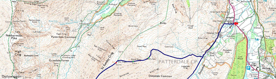
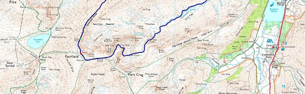
Deepdale Bridge – Wallend – Deepdale – Mossydale – Link Cove – The Step – Link Hause - Fairfield – Cofa Pike – Deepdale Hause - St Sunday Crag - Gavel Pike - Lord's Seat - Coldcove Gill - Deepdale - Deepdale Bridge |
|
| |
|
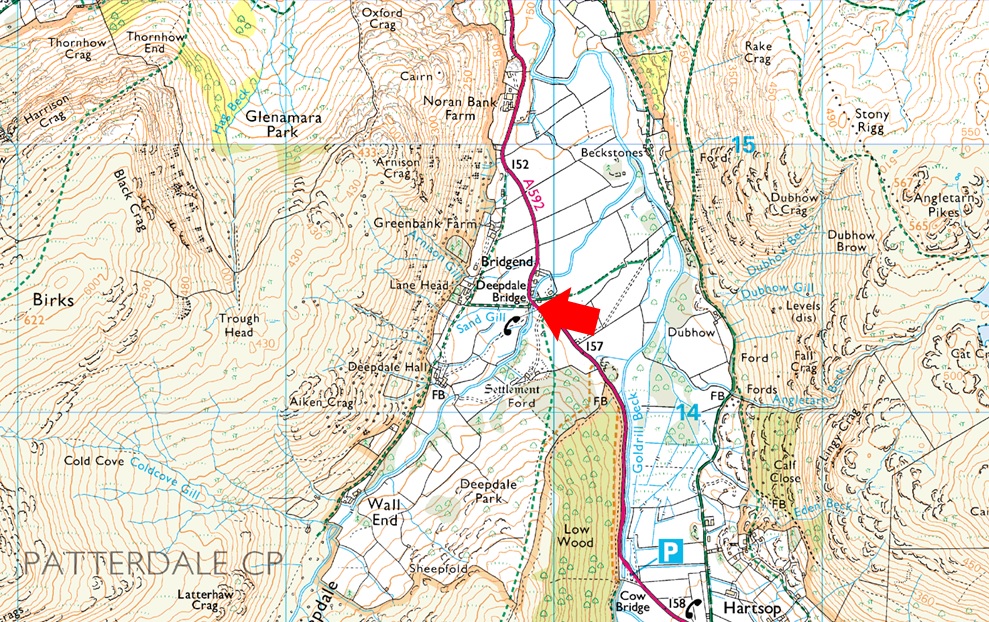
Parking Details and Map |
|
|
| Nearest Post Code: |
CA11 0NS |
| Grid Reference: |
NY 399 414 |
| Notes: |
There are limited parking spaces at Deepdale Bridge with spaces for around half a dozen well parked cars. Due to the popularity of the fells around the Deepdale Valley parking here can be difficult after mid morning, my advice is to arrive early and you shouldn't have any trouble parking. Parking is free. |
|
| |
|
Map and Photo Gallery |
|
|
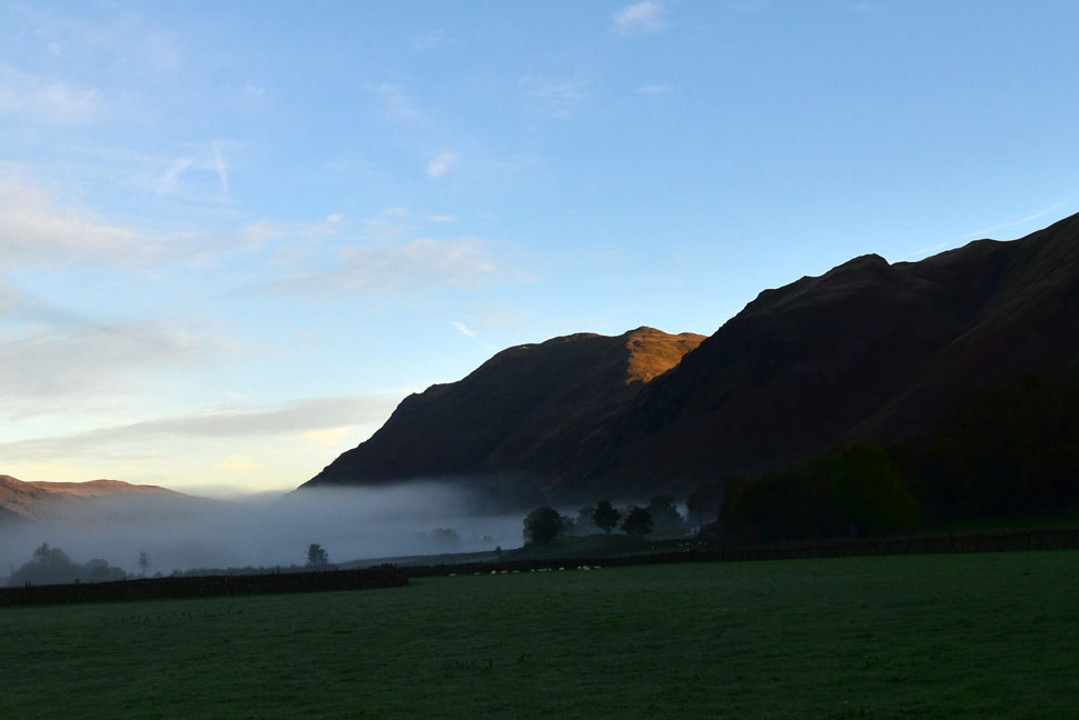 |
| Place Fell from Hartsop. |
| On route to Patterdale I had to stop at Hartsop to grab this quick snap of the low lying mist with a hint of sunshine over Boredale Hause and Place Fell. |
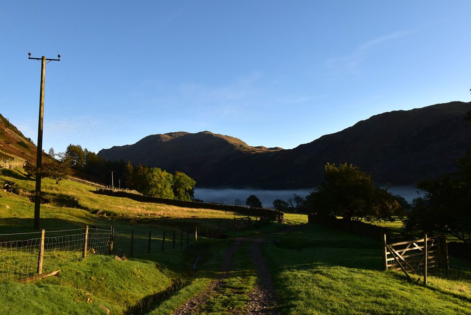 |
| Place Fell, Boredale Hause and Rake Crag from Deepdale Hall 08:15am 3°C |
| I admit my decision to ascend Fairfield via The Step was rash so I spent a few minutes studying the route on my mapping software and when I was happy, slipped my phone in to its waterproof case which I then zipped into the hood pocket of my pack. It's quite a nippy morning so I add a pair of gloves and slide my hat into the side pocket of my pack should I need it later.
With my boots laced up I locked the car and walked up the lane towards Deepdale Hall stepping aside to let a transit van pass. I'd only been walking for less than a minute and the strong sunlight was already causing my eyes to stream which is a small price to pay for the Autumnal sunshine.
At the top of the lane builders work on a extension at one of the cottages which explains the transit van minutes earlier. I turned left and passed through the first of two gates by which time the sun had just crested above Gray Crag casting brilliant sunlight over the adjoining fields. |
 |
| The Hartsop above How Ridge, Hart Crag and Latterhaw Crag lit up in morning light. |
| I passed through the second gate which a had a thin layer of frost over it then followed the track into the valley which was completely in shade with the exception of Latterhaw Crag seen over on the right. It's going to be at least mid morning by the time sunlight reaches the valley floor by which time I'd ascended into Link Cove. |
 |
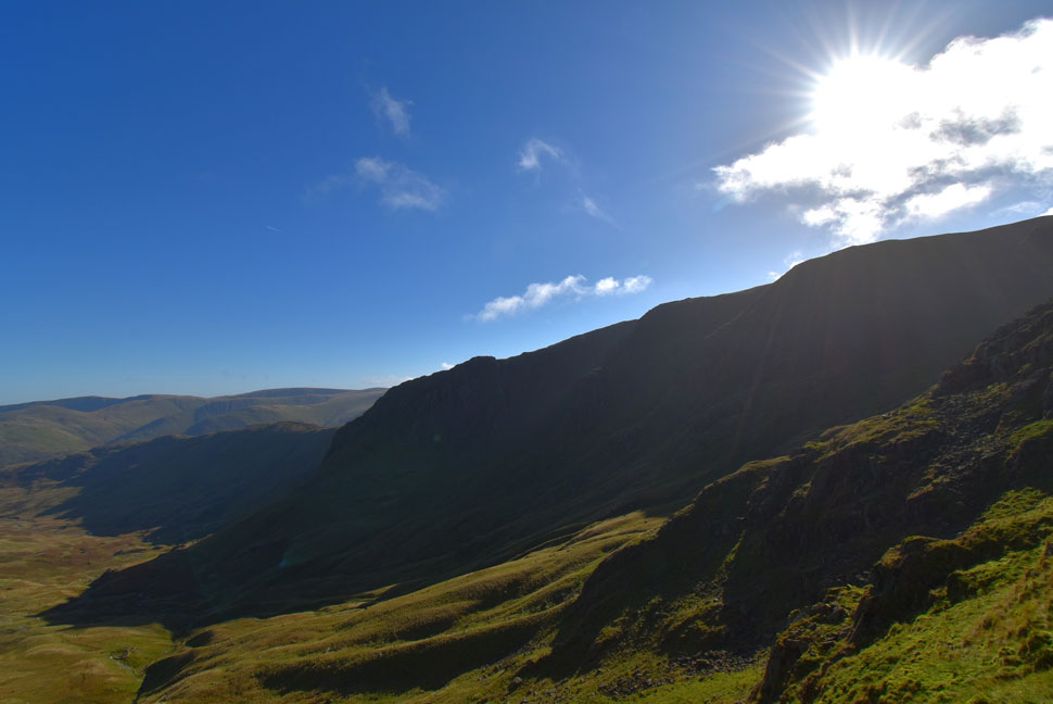
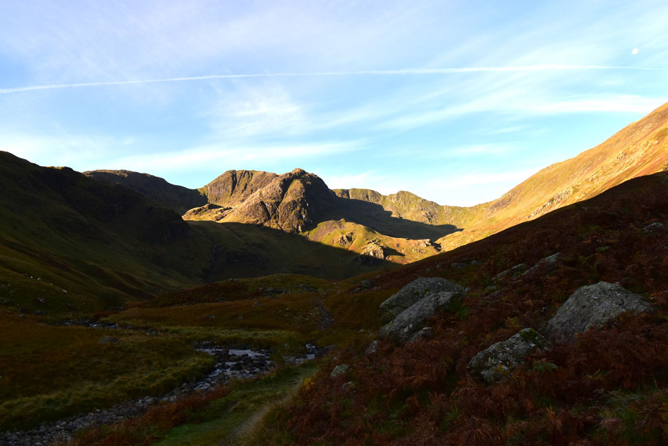
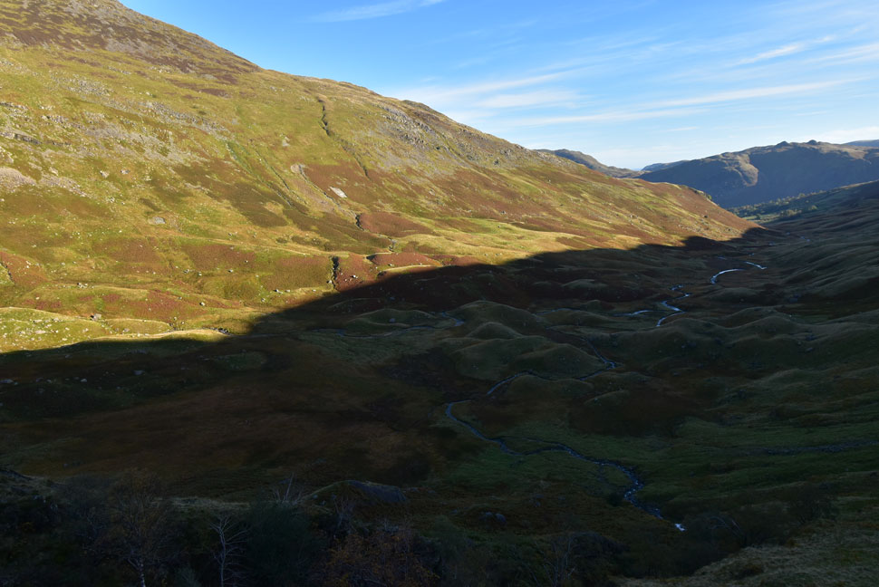
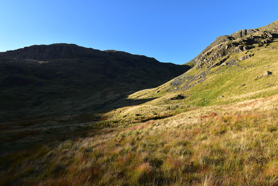
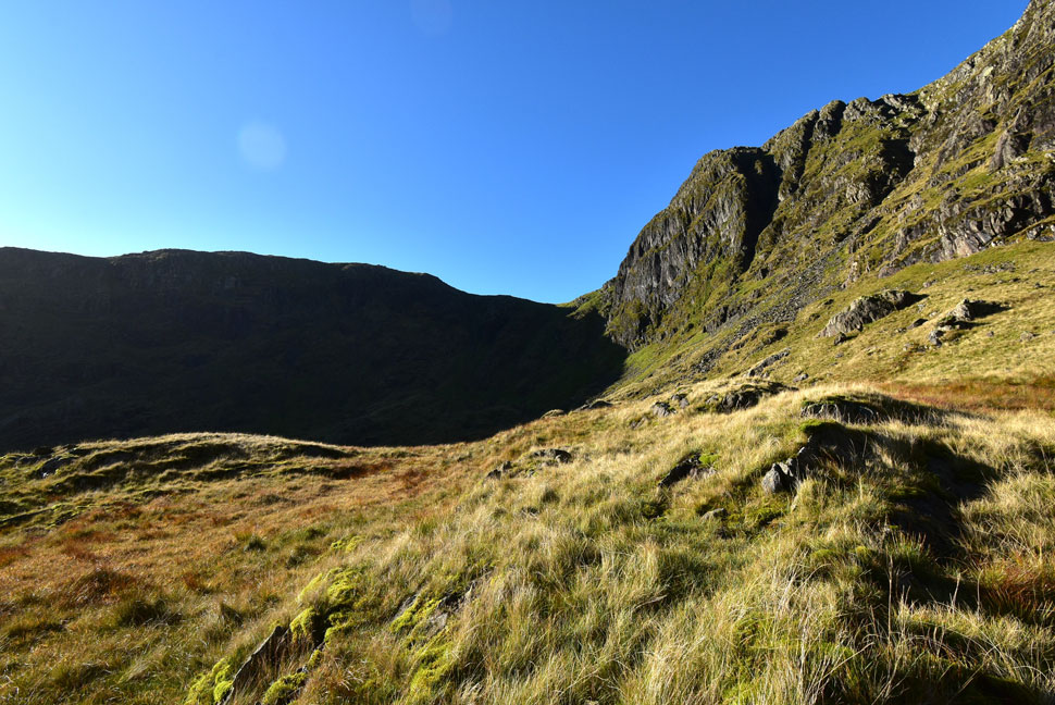
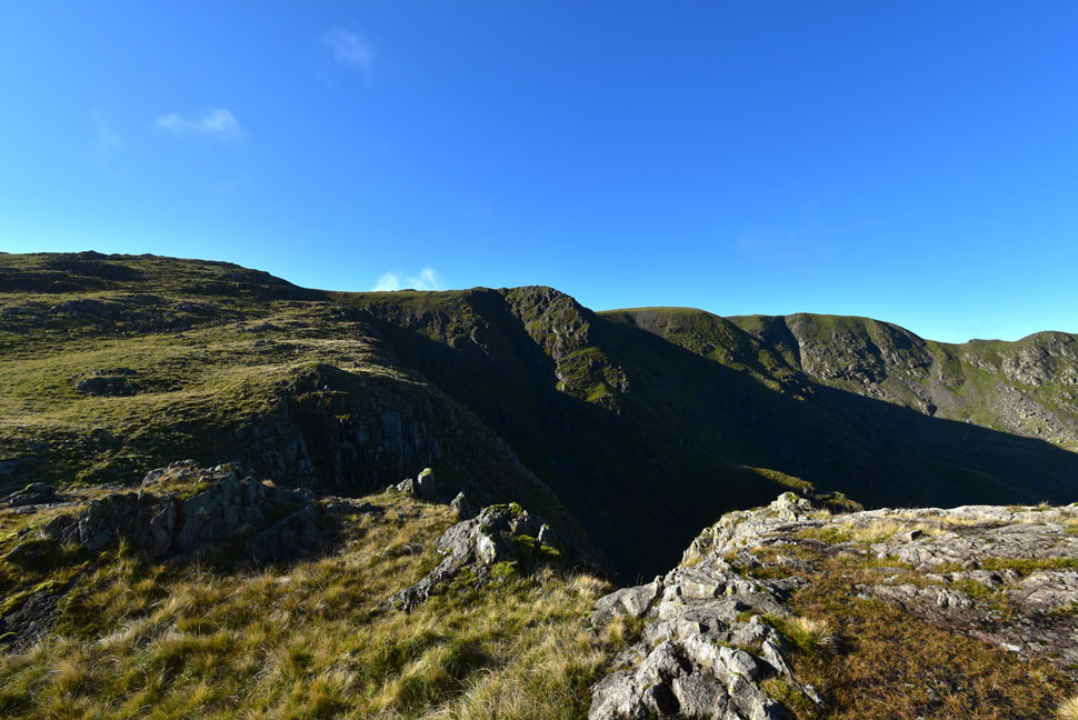
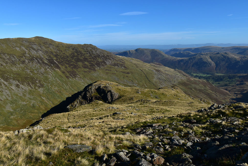
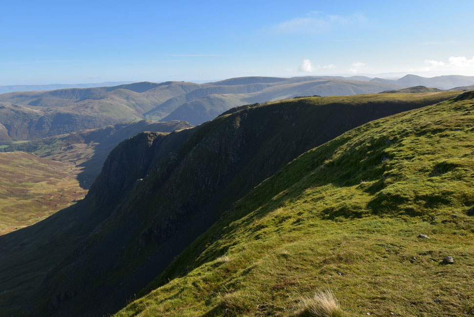
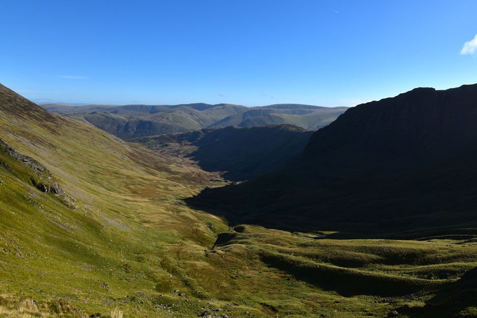
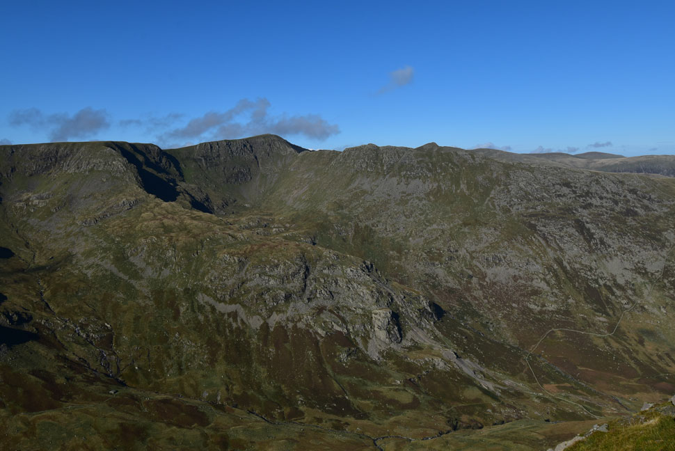
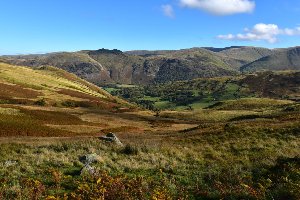
| Link Cove, Hart Crag, Greenhow End, Mart Crag, The Step, Cawk Cove, Fairfield, Cofa Pike and Deepdale Hause from the Deepdale Valley. |
| Walking through the valley wasn't as straight forward as it should have been due to the saturated paths and detours which lead into more bogs. By the time I got my first view of Greenhow End my right boot was already starting to leak resulting in a damp sock. |
 |
| The further I edge into the valley... |
| ...the more the sunlight creeps down. |
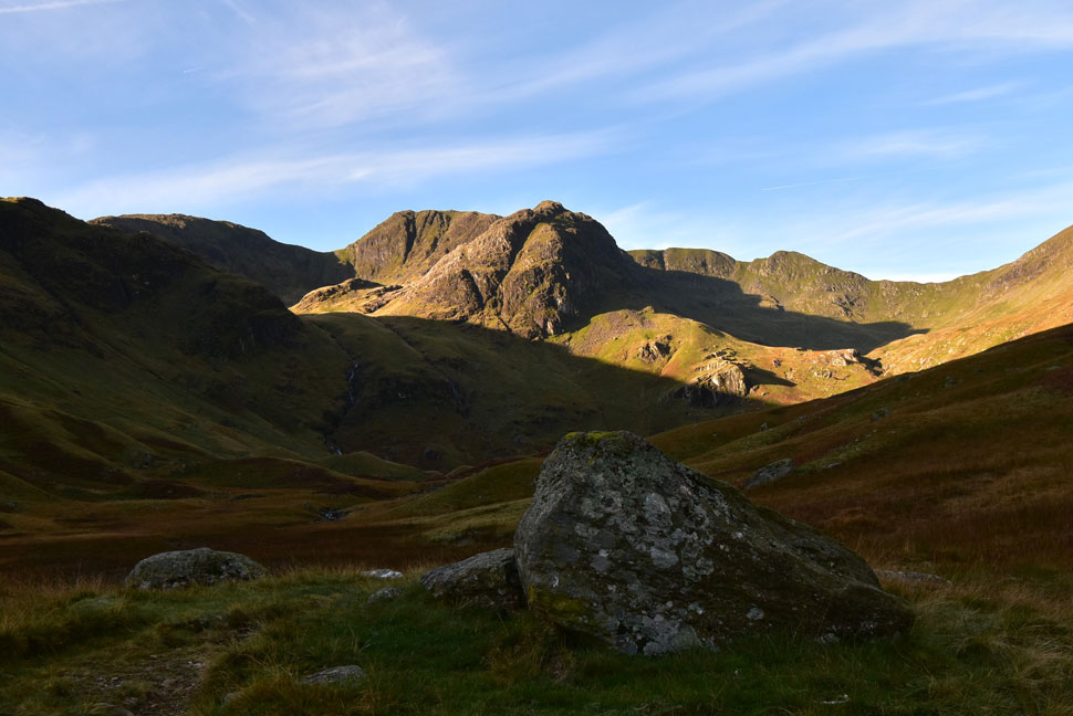 |
| Link Cove, Hart Crag, Greenhow End, Mart Crag, The Step, Cawk Cove, Fairfield, Cofa Pike and Deepdale Hause. |
| That's Link Cove over on the left which I will ascend via the far left falls. If ascending Greenhow End via the grass rakes ascent would be via the falls over on the right. Both ascents to gain the Link Cove are extremely steep. |
 |
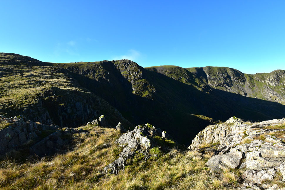
| Link Cove, Hart Crag, Scrubby Crag, Greenhow End, Mart Crag, The Step, Cawk Cove, Fairfield and Cofa Pike from Deepdale Beck. |
| The path starts to ascend right towards Deepdale Hause where an accumulation of moraines are reached which was my indication to head left to make a pathless traverse through the moraine field. |
 |
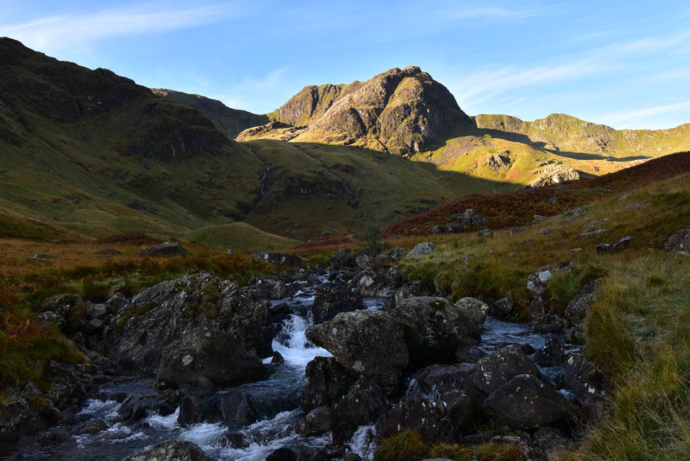
| Greenhow End, Mart Crag, The Step, Cawk Cove, Fairfield, Cofa Pike and Deepdale Hause. |
| The ascent starts at the base of the far left falls so I continue my trek through the moraines jumping feeder streams which eventually flowed into Deepdale Beck. By now both my boots had given up and were seeping water in making my left sock feel as damp as my right. |
 |
| Looking down on the Deepdale valley with views towards Gavel Pike, Place Fell and Angletarn Pikes. |
| Laden with wet leather boots and wet socks I began the steep ascent where there was no path to follow so instead I used objects such as large boulders, craggy outcrops and even the odd grazing sheep to plan a line of ascent. |
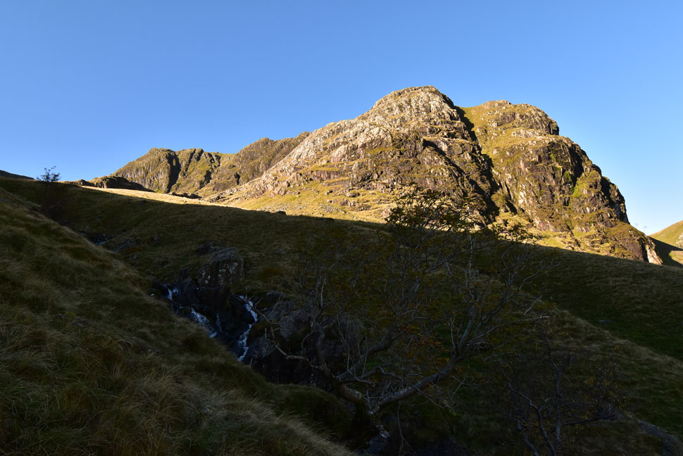 |
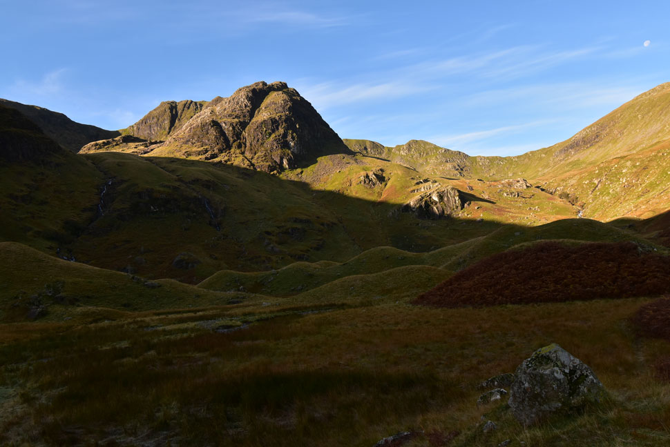
| Greenhow End, The Step and Scrubby Crag come into view. |
| This tree wasn't in my line of ascent but somehow I managed to wrangle my way towards it, lured in by the waterfalls no doubt. |
 |
| Hart Crag, Link Cove, Scrubby Crag and The Step. |
I'd paced myself making sure I only stopped once the designated markers where reached. The sheep were the final marker who scurried around me and vaulted back down the slope.
I was never far away from the sound of cascading water and was treated to this waterfall at the edge of the cove which fed the two lover falls. Funny, I don't remember this water fall during my last visit though. |
 |
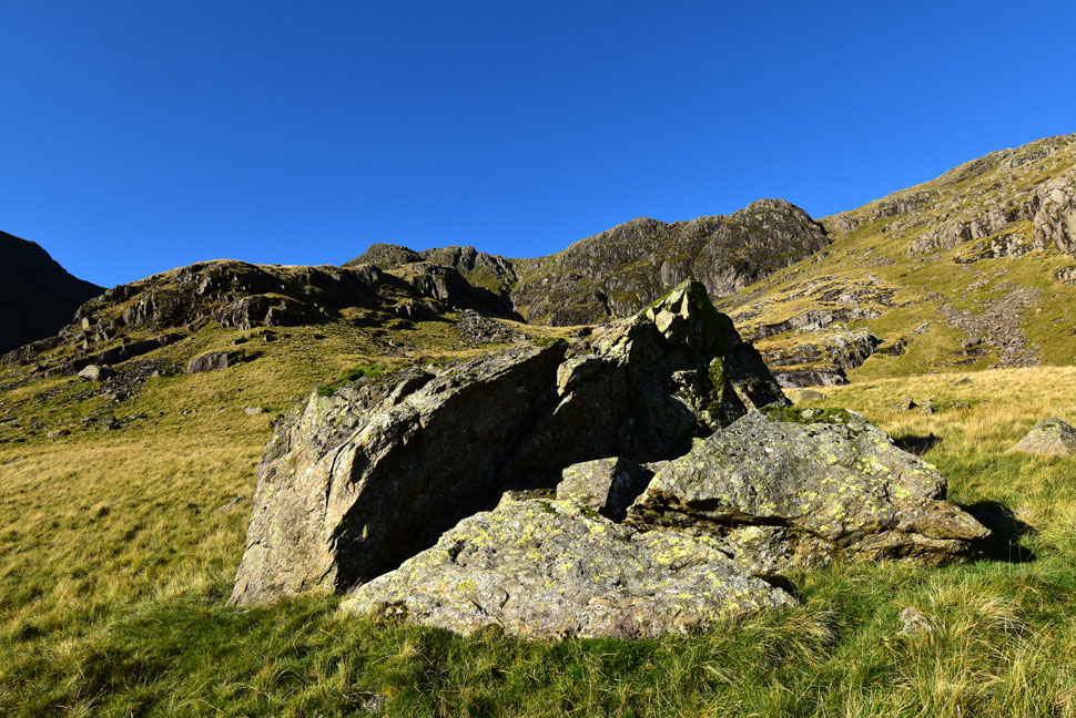
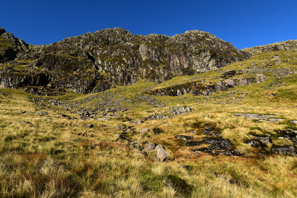
| Amazing Link Cove. |
Hart Crag (left) and Scrubby Crag (right) dominate Link Cove and even though I was still getting my breath back I was starting to plot my route of ascent. Once into the sunlight I head towards the large boulder seen foreground, then ascend towards the right of the scree continuing on to the base of Scrubby Crag from where I'll pick up what appears to be a grass terrace before ascending right towards the grass gully seen far right.
The vastness of Link Cove makes things appear much smaller than they actually are as I soon discover. |
 |
| Hart Crag. |
| I ventured a little further into the cove and into the sunlight for the first time in a couple of hours which helped to recharge the batteries and forget about the wet socks. |
 |
| I make my way towards the boulder. |
| Which I was surprised to find was the size of a large SUV. |
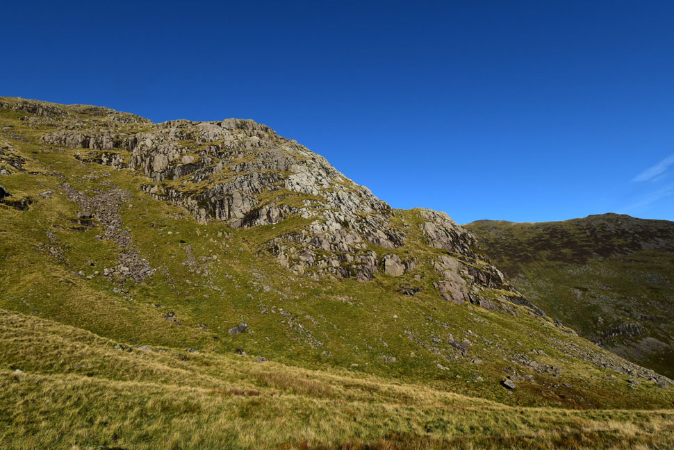 |
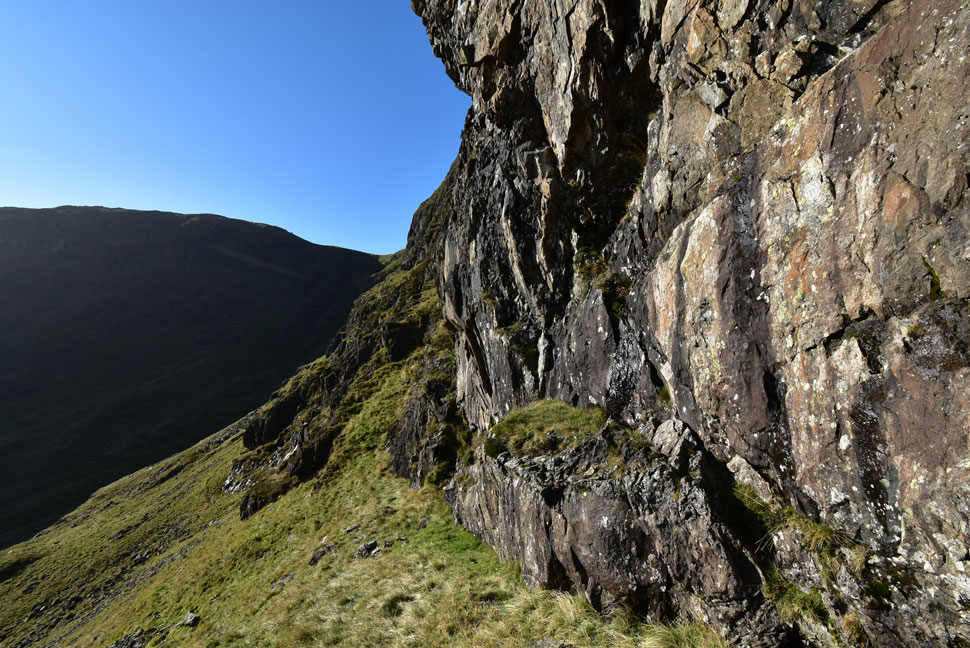
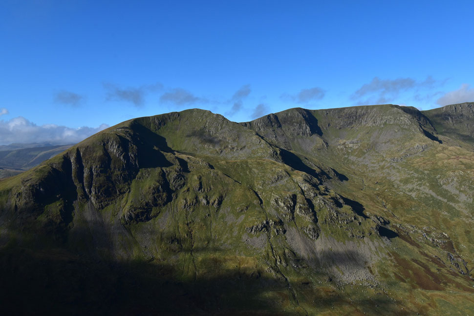
| Greenhow End broadside. |
| That's the first of the grassy rakes seen over on the right which leads onto a second rake further up between the crags. I predict a third visit to Link Cove in the not too distant future! |
 |
| Meanwhile... |
| ...I ascend steeply towards the scree I mentioned earlier with Scrubby Crag towards the left and The Step over on the right. |
 |
| Hart Crag and Scrubby Crag from Link Cove. |
| |
 |
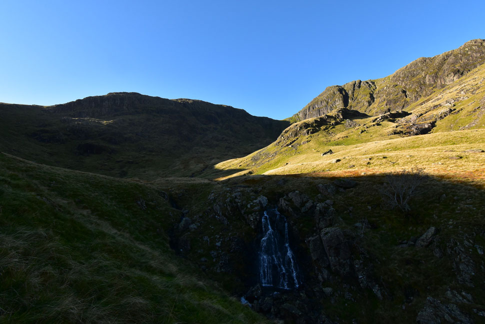
| The Step from Link Cove. |
| After a quick breather I continue towards the scree seen ahead before picking up the grassy terrace path beyond. |
 |
| From Link Cove. |
| Views extend towards Hartsop above How, Angletarn Pikes, Brock Crags, Rest Dodd, The Nab, Wether Hill, Rampsgill Head, High Raise, High Street, Gray Crag, Hartsop Dodd and finally Caudale Moor. |
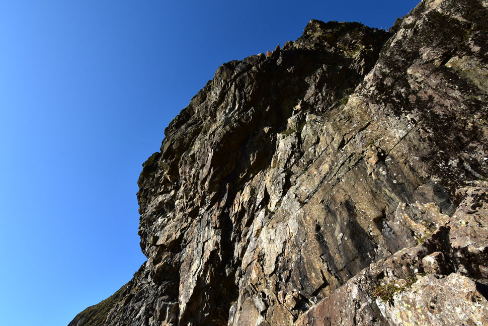 |
| Looking up on The Step. |
| And its vertical over hanging crags. |
 |
| Looking back along the grass terrace. |
| Which was easy to traverse with no exposure whatsoever. |
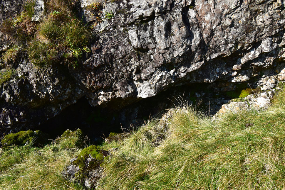 |
| Towards the end of the grass terrace. |
| A small cave suitable to bivvi is passed. |
 |
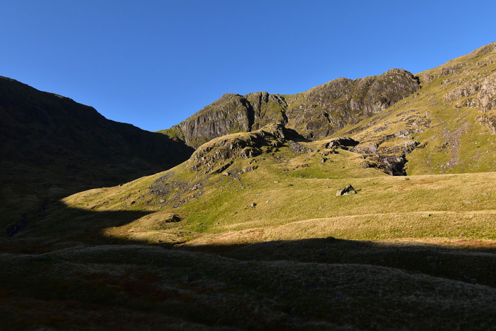
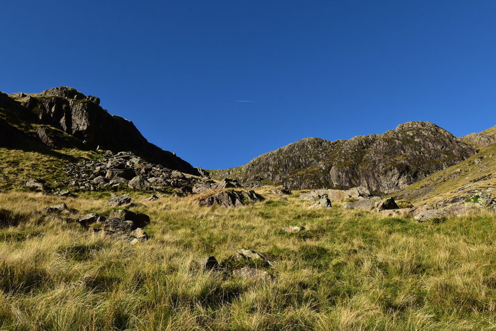
| All routes point up. |
| At the end of the terrace the gully is reached which narrowed with ascent, other than the odd rock step and grasp of grass there was no exposure from the gully. |
 |
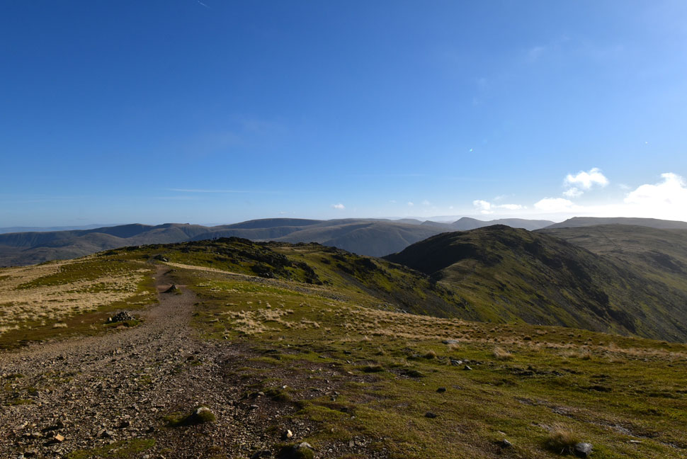
| Admiring the view from the top of the gully. |
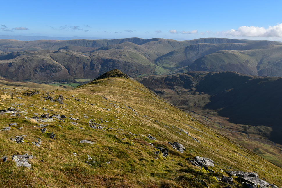
From the top of the gully a faint track traces towards Link Hause but if you want to take in the views in to Hog Hole and Cawk Cove head right and follow the ridge line which forms The Step from Greenhow End. |
 |
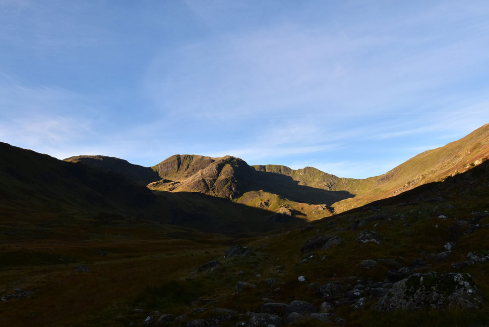
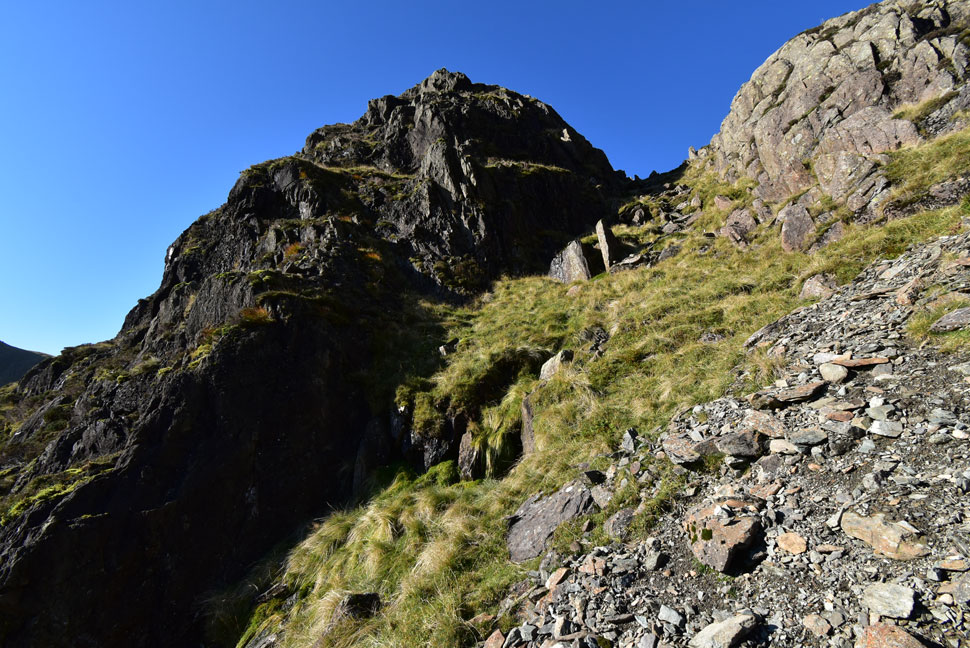
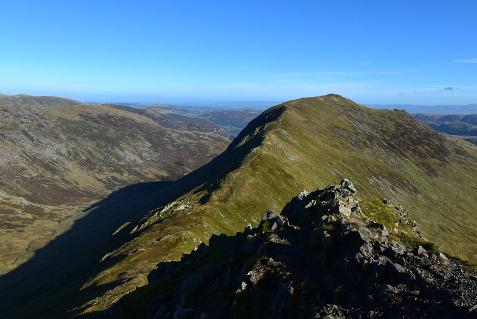
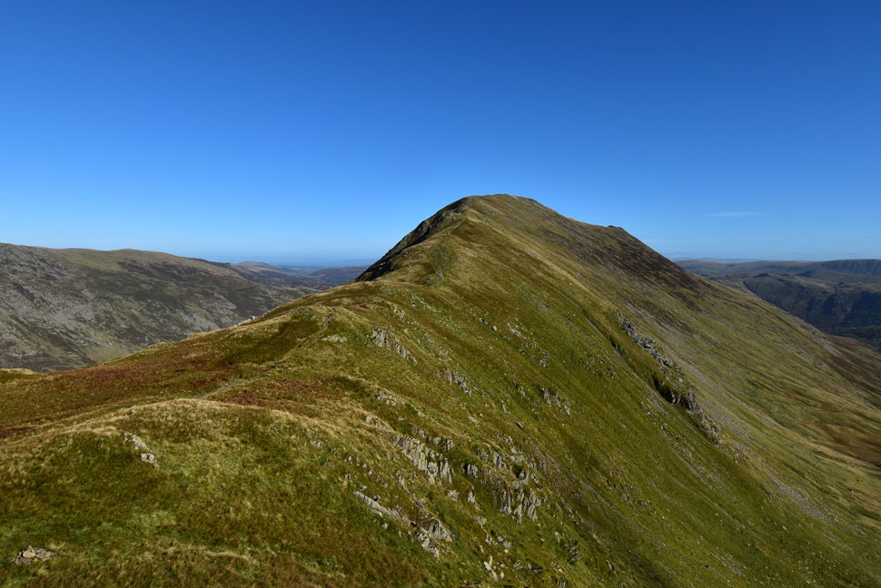
| Link Hause, Fairfield and Cofa Pike from the top of Hutaple Crag. |
| After a short distance I arrived at the head of Hutaple Crag and viewed the cliffs of Fairfield's north face. |
 |
| Fairfield's North face. |
| Even in good visibilty it's advisible to keep well away from the edge and sheer drops. |
 |
| Taking in the view over Cawk Cove towards Dollywagon Pike, High Crag, Nethermost Pike and Helvellyn. |
| Not forgetting Cofa Pike seen over on the left and Deepdale Hause on the right which continues onto St Sunday Crag. |
 |
| Black Buttress is seen lower right... |
| ...with Fairfield, Cofa Pike, Dollywagon Pike and Nethermost Pike beyond Cawk Cove. |
 |
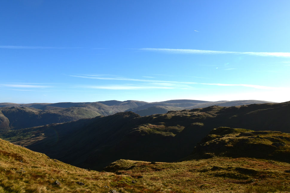
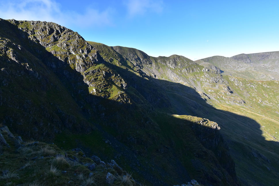
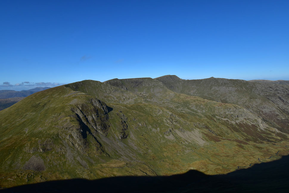
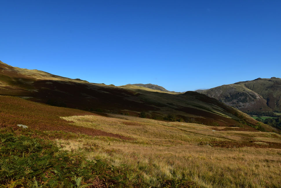
| Looking back over The Step towards Greenhow End. |
| With St Sunday Crag, Gavel Pike, Place Fell, Angletarn Pikes, Beda Fell, Wether Hill, Loadpot Hill and finally Arthur's Pike in the distance. |
 |
| Hart Crag and Dove Crag from Link Hause. |
| I followed the singular track which navigates around the impressive gully of Black Tippet before joining the path on Link Hause. Two walkers had just passed who I doubt had seen me. Up ahead Fairfield awaits and if my eyes don't deceive me, it looks like I might get the summit to myself. |
 |
| Fairfield summit from Link Hause. |
| I'd been protected from the elements whilst I was in Link Cove and I'm certainly starting to feel the pinch now so on goes the hat to keep my gloves company. |
 |
| Dollywagon Pike, High Crag, Nethermost Pike, Helvellyn, Striding Edge and Catstye Cam from Fairfield summit. |
| I couldn't help but wonder if the road closure in Patterdale has affected foot traffic on Helvellyn. With views as clear as this I can only spot two people on Dollywagon Pike and two more on Helvellyn. |
 |
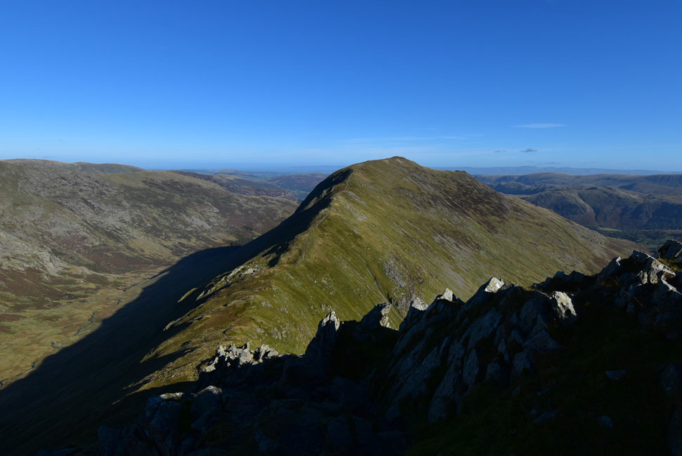
| Looking back on Greenhow End from Fairfield summit. |
| The Step is only just in view due to the north facing cliffs. |
 |
| Descending Cofa Pike with views of St Sunday Crag. |
I left a deserted Fairfield summit and began the short descent towards Cofa Pike, then the even shorter ascent on Cofa Pike always remembering the large rock to the right of the summit which when navigating the path below, can easily throw you off balance.
With more rock steps, twist and turns than you can shake a stick at the descent from Cofa Pike requires a lot more concentration than if going t'other way around. |
 |
| Incredible views over the Grisedale Valley. |
| Towards Dollywagon Pike, Cock Cove, The Tongue, High Crag, Nethermost Pike. Nethermost Cove, Nethermost Pike east ridge, Helvellyn, Striding Edge and just the summit of Catstye Cam. |
 |
| Another view of St Sunday Crag. |
| With Deepdale Hause seen in the foreground. |
 |
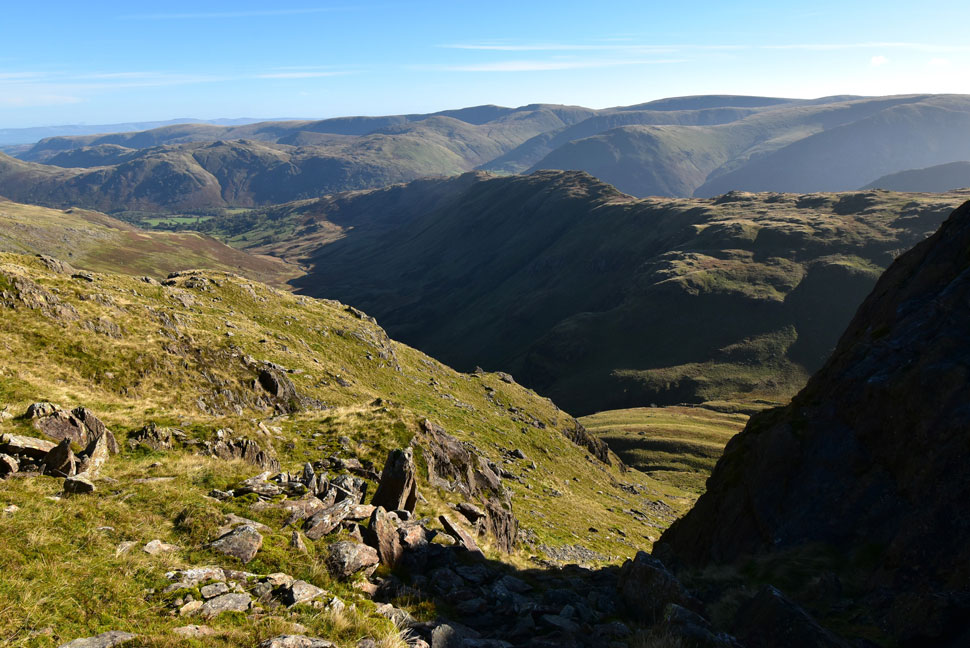
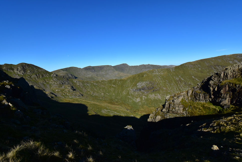
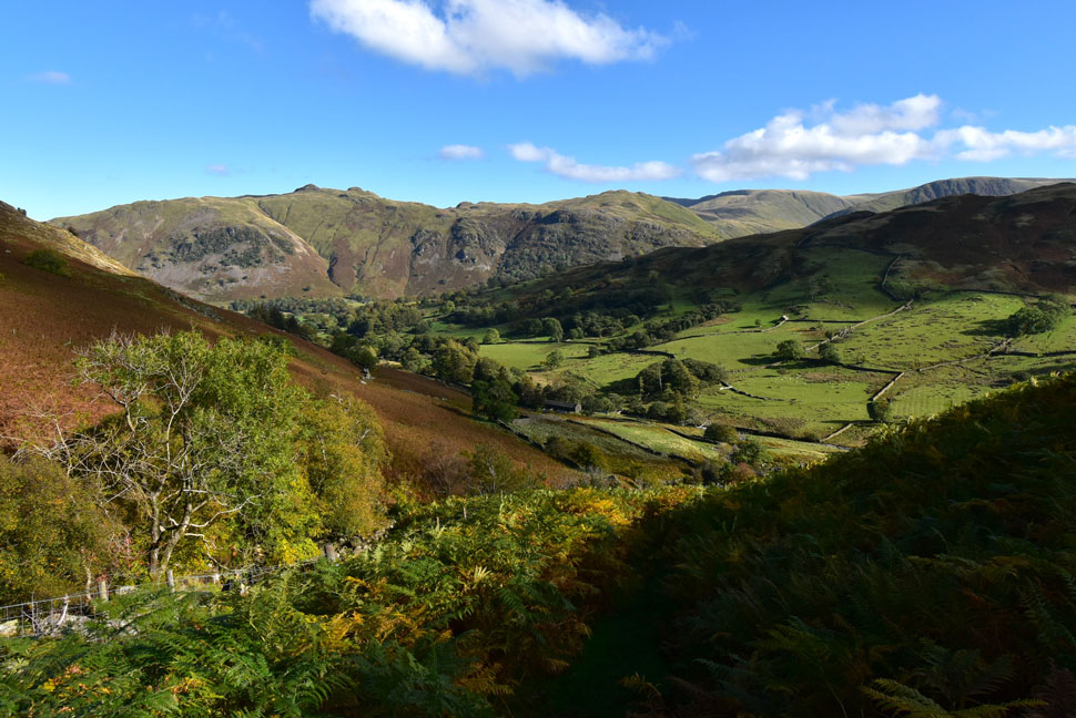
| The Deepdale Valley from Deepdale Hause. |
| With Greenhow End and the Hartsop above How ridge seen in the distance. It's fair to say my socks won't forget Deepdale in a hurry! |
 |
| St Sunday Crag from Deepdale Hause. |
| With the descent of Cofa Pike behind me I made some clothing adjustments you know what I mean, removed this, tucked in that pulled the rear of my jacket down for the nine millionth time which always rides up my back...just the usual. |
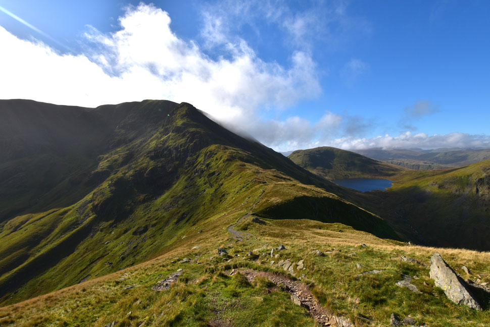 |
| Looking back on Fairfield, Cofa Pike, Seat Sandal and Grisedale Tarn. |
| As wisps of cloud begins to surround Fairfield summit which looked awesome. |
 |
| Dollywagon Pike, The Tongue, High Crag, Nethermost Pike and Nethermost Pike East Ridge. |
| Not forgetting Cock Cove, Ruthwaite Cove and Nethermost Cove. |
 |
| Focusing on Nethermost Pike East Ridge and Striding Edge. |
From Deepdale Hause I began the enjoyable ascent on St Sunday Crag and passed three walkers heading towards the hause. Cloud was still swirling over Fairfield summit which added a little drama to the view.
Two more walkers were passed as I crested the summit shoulder as I arrived at St Sunday Crag the same time as a young couple from the opposite direction. I took this photo and quickly left not wanting to be the summit hog before begining the short descent towards Gavel Pike. |
 |
| Descending towards Gavel Pike. |
| With extended views towards a host of far eastern fells. |
 |
| Lunch with a view from Gavel Pike. |
| By now it was midday and my stomach had been telling to me to put food in it since the descent of Cofa Pike so I found a spot out of the wind a little lower down from Gavel Pike summit and tucked into two delicious chicken salad sandwiches. |
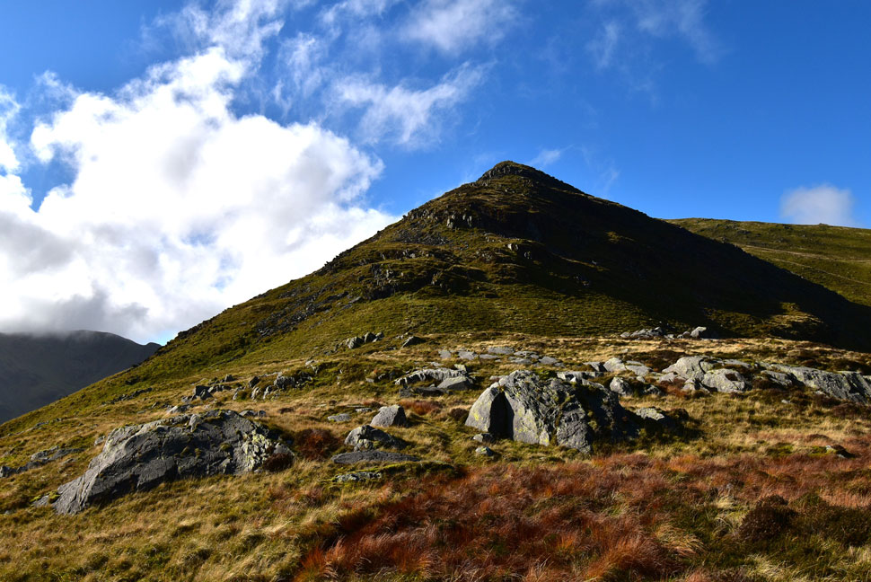 |
| Looking back on Gavel Pike from Lord's Seat. |
| A harmless enough descent if you take into consideration the odd rock step and twisting path. |
 |
| Descending into Cold Cove from Lord's Seat. |
| Shortly after taking the previous photo from out of nowhere I bumped into a chap and his labrador and we struck up conversation "didn't expect to see anyone up here today" he smiled "aye me too" I replied. He was sweating like a good-un no doubt due to the steep pathless terrain but seemed to enjoying himself "I was on High Street Tuesday" he said "what a coincidence me too" I replied. We chatted about the glorious weather and for October, how mild it was before bidding each other to 'enjoy the rest of our day' |
 |
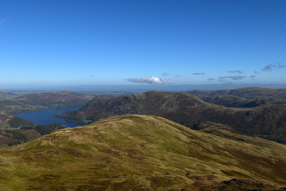
| Trough Head, Place Fell, Boredale Hause and Angletarn Pikes from Cold Cove. |
| Had I really put more thought into todays route I could have included the addtional summits of Birks and Arnison Crag then doubled back into Cold Cove via Trough Head which is roughly about half the way across the shaded ridge line. |
 |
| Incredible Autumnal views as I descend alongside Coldcove Gill. |
| With the descent of Cold Cove behind me I keep right and pick up the familiar footpath which descends alongside Coldcove Gill where I was treated to these fantastic views over Deepdale towards Angletarn Pikes, Brock Crags, The Knott, Rampsgill Head and Gray Crag. |
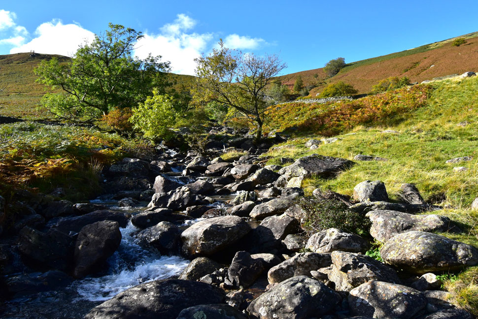 |
| Coldcove Gill. |
With the walk almost over I kicked my feet into the backs of my boots and the shift felt heavenly. It was approaching that time when my stomach began to perform somersaults, I knew the walk would end soon but conditions were just too perfect and thanks to resurfacing work in Patterdale, I'd walked the perfect walk under perfect conditions. The autumn sunshine continued to shine down as I left the Deepdale valley behind where it was approaching 20°C heat.
I'm joined by a hound from a nearby farm who inquisitively barks at me and for a slight moment I wondered should I be worried, the dog pee's and continues to bark only this time she's wagging her tail. The dog followed me for a few minutes before vaulting over a wall into the farm yard. I join the farm track where the noise from a chain saw from nearby woodland breaks the afternoon silence. I pass through the gate, its coating of morning frost long gone then the second gate over looked by the same builder I'd seen this morning. I'm just minutes away from the car now as sheep graze in nearby fields undisturbed by the noisy chainsaw before crossing Deepdale Beck for the last time today. |
|
| |
| Back to top |
 |
|