The Old Corpse Road, Selside Pike & Branstree

31st July 2022

Saturday ended up being a washout and yet again put a stop to our wild camp plans. We could have planned a low level walk somewhere but with rain falling from the off there's only so much enjoyment you can take from walking in the rain although with that said the admiration I had for the fell runners competing in the Montane 50 and 100 trail runs goes beyond words.

Sunday was a different day which would see the worst of the rain push east making way for some much needed afternoon sunshine so I planned two walks depending which had the best forecast 'Blencathra from Mungrisdale' would include Bannerdale Crags east ridge and 'A Riggindale Circuit' would have suited me down to the ground and in the end I opted for the later it being a few months since I was last on my favourite fell.

I'm not sure what happened or why I changed my mind so rapidly as I drove alongside Haweswater Reservoir but I had a sudden change of plan. A walk that is fast becoming my 'go to' walk only this time I would walk it in reverse.

 
Wainwright Guide Book Two
The Far Easten Fells

The merit of the ascent by the north ridge lies in the intimate views of Mardale Head and Harter Fell


Overview
Ascent: 1,725 Feet - 526 Metres
Wainwrights: 2. Selside Pike - Branstree
Visiting: 2, High Howes - Artle Crag
Weather: Warm & Sunny With Some High Cloud. Highs of 23°C Lows of 18°C
Parking: Roadside Parking Close to Rowantreethwaite Beck
Area: Far Eastern
Miles: 6.3
Walking With: On My Own
Ordnance Survey: OL5
Time Taken: 2 Hours 45 Minutes
Route: Mardale - Old Corpse Road - Selside End - Selside Pike - Captain Welter Bog - High Howes - Artle Crag - Branstree - Branstree North Ridge - Rowantreethwaite Beck - Mardale
 

Parking Details and Map
Nearest Post Code: CA12 2RP
Grid Reference: NY 479 119


Map and Photo Gallery


Mardale Head from the Old Corpse Road 12:30pm 18°C

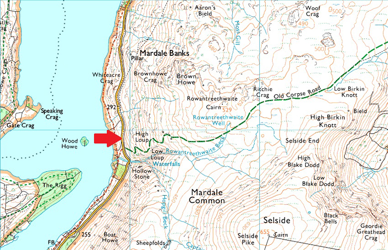
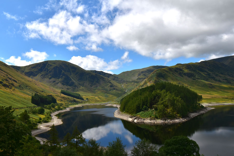
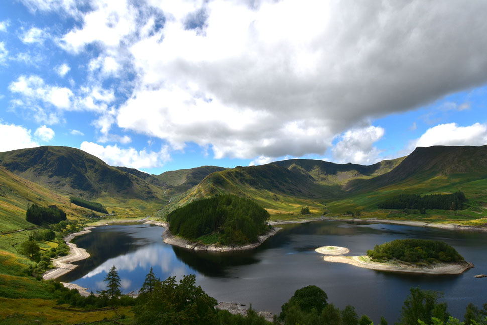
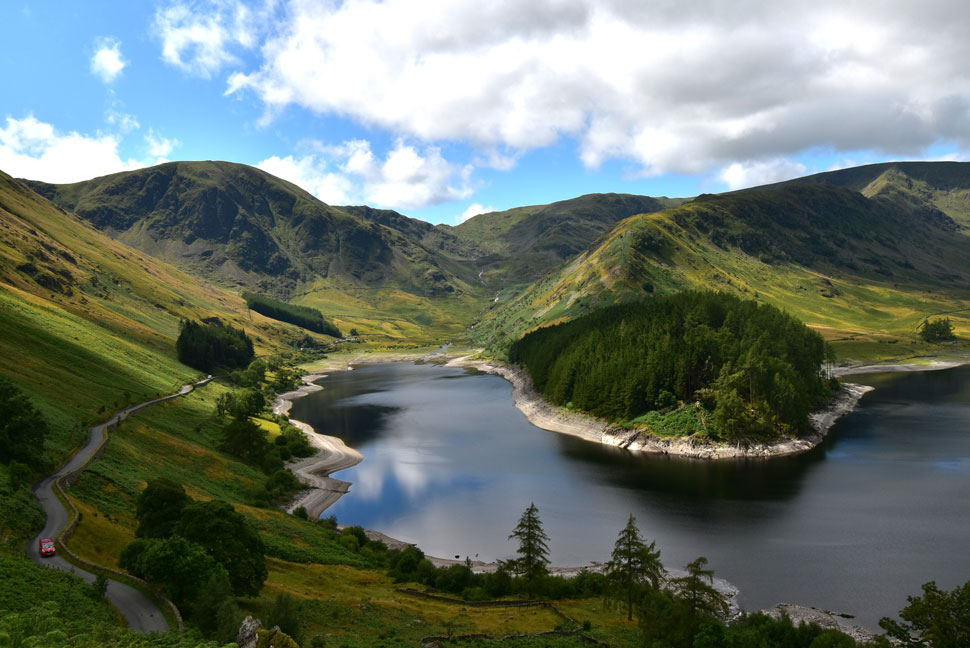
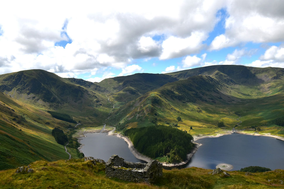
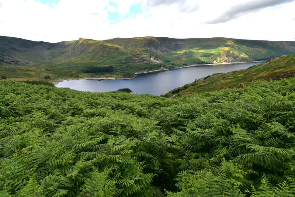
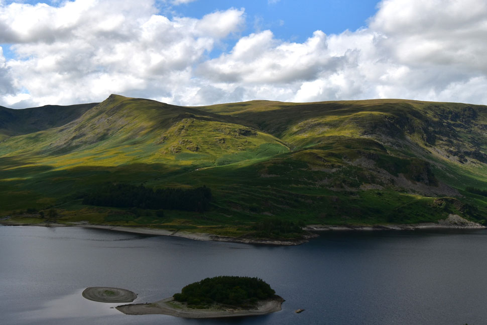
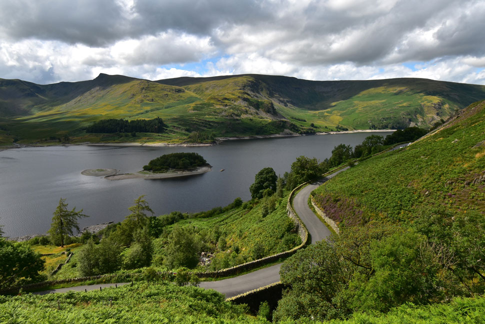
There were no signs of any grey skies as I left the motorway at Shap and drove the walled lanes passing through Bampton before finally arriving at Haweswater Reservoir. Passing the lay-by close to Rowantreethwaite Beck I spotted one space left right at the front of the lay-by and not wanting to miss it I tucked the car straight in. Opening the car door to views of Mardale Head felt like one of those 'pinch me' moments, everything was perfect from the view to the blue skies and a climbing temperature. I walked over to the wall just taking it all in before remembering I'd come here to do a walk so I returned to my car and laced up my boots.

There was no need to add a layer over my technical T and should I need one the 'back up' fleece that I keep in my pack for emergencies would do just fine. It was warmer than expected and I hydrate by finishing the last half litre of hydration during my drive north before making a mental note that I'd only filled my 3ltr bladder with around 2.0ltrs of Summer Fruits, given todays route it should be plenty. The sound of a gate latch opening then wood clashing against wood broke the silence, it was a girl with a Collie and a Jack Russell in tow who by now were making their way towards Mardale Head. It's a longer walk than you think but the views make up for it.

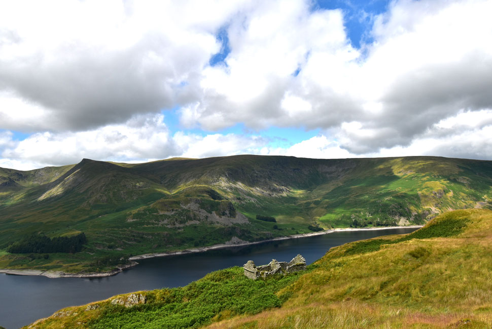
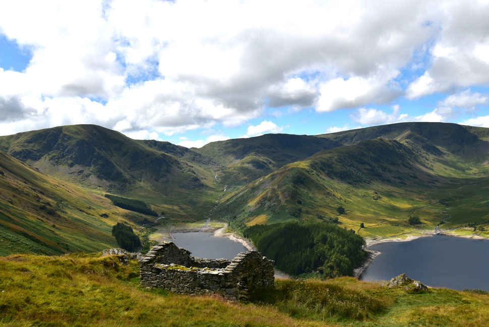
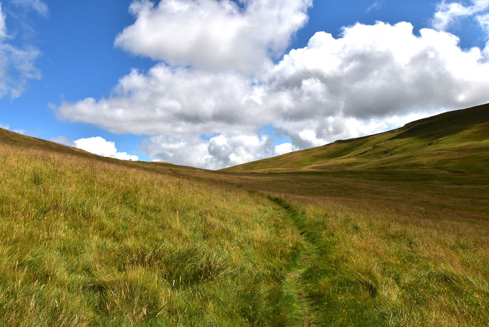
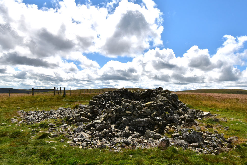
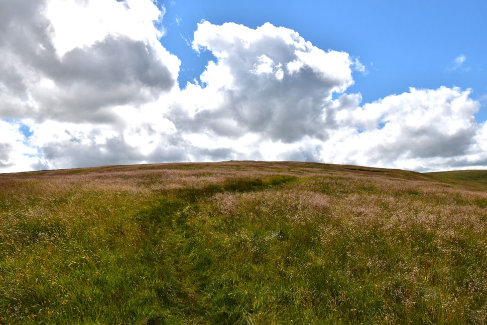
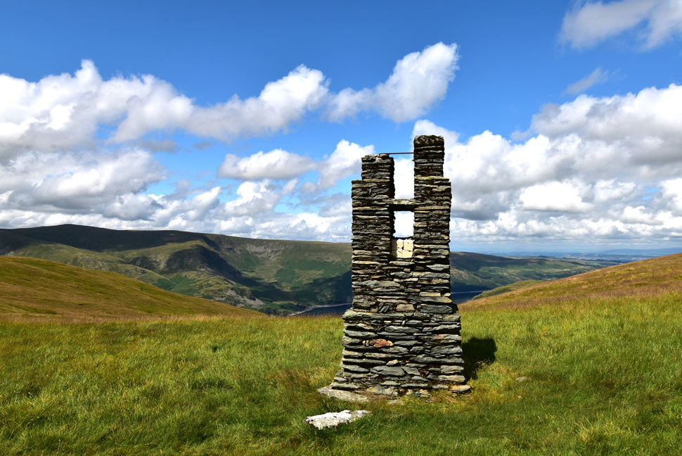
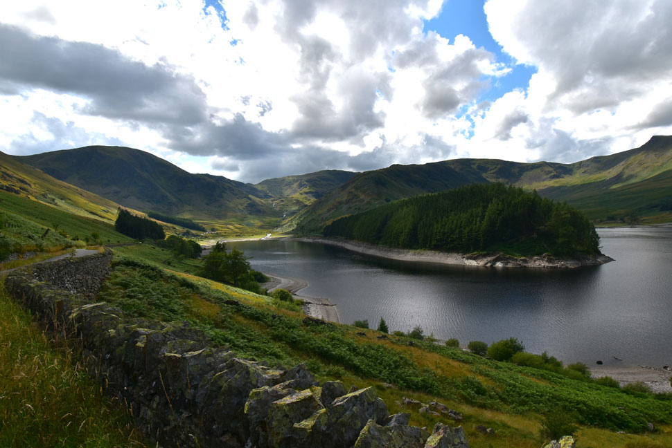
Closing my tailgate I left the lay-by and opened the gate then began the steady climb towards the ruined Peat Huts not forgetting the view I had over my shoulder.


Mardale Head.
The wide angle lens allowed me to capture Mardale Head, the valley of Riggindale and Kidsty Pike too.

Harter Fell (Mardale) the top of Nan Bield Pass, Mardale III Bell, The Rigg, the Rough Crag Ridge and High Street.
The water level is looking low again but nothing compared to how low it was last year when you could walk around The Rigg without getting your feet wet.

The top of Nan Bield Pass, Mardale III Bell, The Rigg, The Rough Crag Ridge, High Street, Riggindale and Kidsty Pike.
You don't have to walk your favourite Lakeland fell to enjoy it, taking in its view gives me exactly the same buzz as climbing it.

Kidsty Pike, High Raise (Martindale) Low Raise, Castle Crag, Whelter Crag and Long Grain.
The heat of the afternoon saw me wiping away sweat by the time I'd reached the ruined Peat Huts where I stopped to take a few photos, here I take in the view across Haweswater towards Kidsty Pike and High Raise.

Mardale Head from the ruined Peat Huts.
Arguably one of the best views Lakeland has to offer.


The Old Corpse Road.
I left the Peat Huts behind and continued following the Old Corpse Road which for the most part, was quite wet underfoot. Up ahead a trio of walkers wait for two friends who catch up as I pass.

Looking back on Mardale Head from the Old Corpse Road.
While over on the left is todays descent route Branstree north ridge, it's a ridge I've climbed many times but today and for the first time I'll be descending it.

The view across Mardale Common.
Towards Selside Pike, Branstree and Harter Fell.

Looking back on Hare Shaw from Selside End.
 

The Swindale Valley from High Blake Dodd.
I can't look into the Swindale Valley without thinking of the late great Author Ron Black. Ron was a dear friend of mine who loved this valley and had me walking up and down Swindale taking photos for his books.

Selside Pike summit shelter.
The dampness underfoot continued as I climbed the flanks of Selside Pike under what was turning into a hot day on the hill. With the summit shelter reached I took in the view over our proposed wild camp location on Harrop Pike across the Mosedale Valley thinking 'Summer's not over yet'

Descending Selside Pike with views of High Howes (left) Branstree, Harter Fell and Mardale III Bell.
I'm heading for High Howes next which I always include when walking this route.

High Howes.
What a lovely little hill top. I say little, it's a steep and sometimes pathless pull when climbed from the Swindale valley.

Looking back on Selside Pike from High Howes.
 

Artle Crag, High Street, Kidsty Pike and High Raise (Martindale)
Taken from the nameless tarns found at the col between High Howes and Artle Crag.

Haweswater Survey Pillar.
I thought the familiar steel plate had gone missing until I found it on the other side of pillar. Out of sight out of mind or so it goes.

Selside Pike and High Howes from one of two stone pillars on Artle Crag.
I didn't want to disturb a trio of walkers who had stopped at the second pillar so with a wave I trundled on past.

Marlake III Bell, Blea Water High Street, the Rough Crag Ridge, Kidsty Pike and High Raise (Martindale) from Branstree.

A solo walker was sat down close to the fence which saddles the summit who turned out to be with the trio who by now where making their way towards the summit. We got chatting and were soon joined by the trio who amongst other things took interest in my camera which I had fastened to my camera clip "what do you do with the photos?" one chap asked? I replied that they were for the website which I'm not always comfortable talking about especially when no one knows you from Adam.

Turns out though these guys were a real friendly bunch from Nottingham who were staying over in Kentmere and walking the Lakeland fells having already completed the Kentmere Horseshoe only yesterday. After a good chat we parted ways them descending towards the top of Gatescarth Pass and me, Branstree north ridge.


Haweswater, Castle Crag and Brown Howe from Branstree North Ridge.
The only real path to follow is from the top of Rowantreethwaite Beck the head of which can be seen as the 'gorge' below. After that it's mostly faint sheep trods. The best advice I can give is to stick to the centre of ridge and avoid altogether in bad visibility unless you are familiar with the route.

Descending alongside Rowantreethwaite Beck.

I was really pleased taking just twenty minutes to descend from summit to the two ruined Peat Huts found at the top of Rowantreethwaite Beck which was when I lost the path in what can only be described as shoulder high bracken. I remembered that all my past ascents had been in Winter when the path was clear and easy to follow.

Taking stock I sighted over the top of the bracken young tree saplings that still had their protective shrouds around them. Remembering that the path flanked the saplings I made my way across and soon located the path which I descended for the most part still fighting through the bracken.


Kidsty Pike, High Raise (Martindale) Low Raise and Catle Rock.
Not forgetting Wood Howe island below.

Haweswater from Rowantreethwaite Beck.
When your car comes into view (far right) but your still fighting through the bracken.

Mardale Head.

The sound of Rowantreethwaite Beck accompanied my tangled descent through the bracken which was all forgotten about as I cupped hands and splashed the cold water over my face once Rowantreethwaite Beck was reached which felt like heaven. I passed through the gate and took in the view from the opposite side of the bridge while at the same time being passed by the odd car.

It's a Sunday afternoon in the heat of Summer and I'm in my favourite Lakeland valley taking in the view of my favourite Lakeland fell and for those few moments I guess I was lost on the haze of it all.


Back to top