|
Great Gable & Kirk Fell from Honister |
 |
 |
9th July 2022 |
 |
|
With David and Jennifer on holiday in Dartmoor today I'm teaming up with Rod again to walk the classic that is Great Gable and Kirk Fell from Honister. When you think of Great Gable and Kirk Fell you instantly think Wasdale Head which is probably the common dominator but for me the most enjoyable way up these two giants is from Honister Mine and the reason for that is simple.
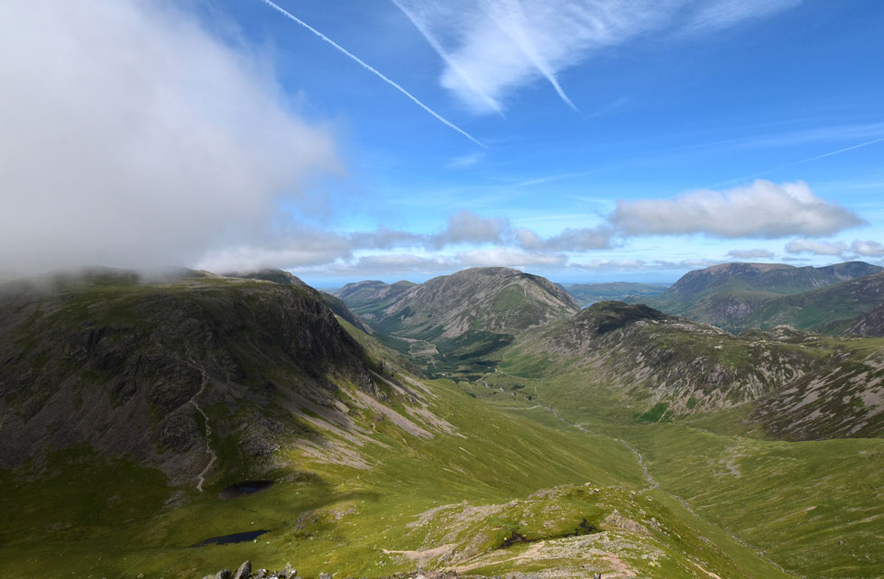
The views from the ridge linking Grey Knotts and Brandreth down into the Buttermere and Ennerdale valleys are out of this world. Okay, today we weren't quite so lucky as unscheduled summit cloud limited our views during the morning but once the cloud lifted it was like looking into a slice of heaven.
Rod joins me on the back of walking not just the Kentmere Horseshoe but a rather epic Grisedale Horseshoe this week which included a traverse of Striding Edge and ended on Arnison Crag so you might think Rod might be wanting to take it easy today. There was no chance, Rod's engine just kept motoring. |
|
| Wainwright Guide Book Seven |
 |
| The Western Fells |
Grey Knotts geographically is the first stepping stone to Great Gable from the north (although not commonly used as such) the connection being a high ridge that runs the two intermediate summits of Brandreth and Green Gable. |
 |
|
|
|
|
| |
|
Overview |
|
|
| Ascent: |
3,397 Feet - 1,036 Metres |
| Wainwrights: |
5, Grey Knotts - Brandreth - Green Gable - Great Gable - Kirk Fell |
| Visiting: |
Kirk Fell North Top |
| Weather: |
Bright & Sunny With Summit Cloud At Height - Breaking Up After Noon. Highs of 23°C Lows of 14°C |
| Parking: |
Layby below Honister Hause |
| Area: |
Western |
| Miles: |
8 |
| Walking With: |
Rod Hepplewhite |
| Ordnance Survey: |
OL4 - OL6 |
| Time Taken: |
5 Hours 40 Minutes |
| Route: |
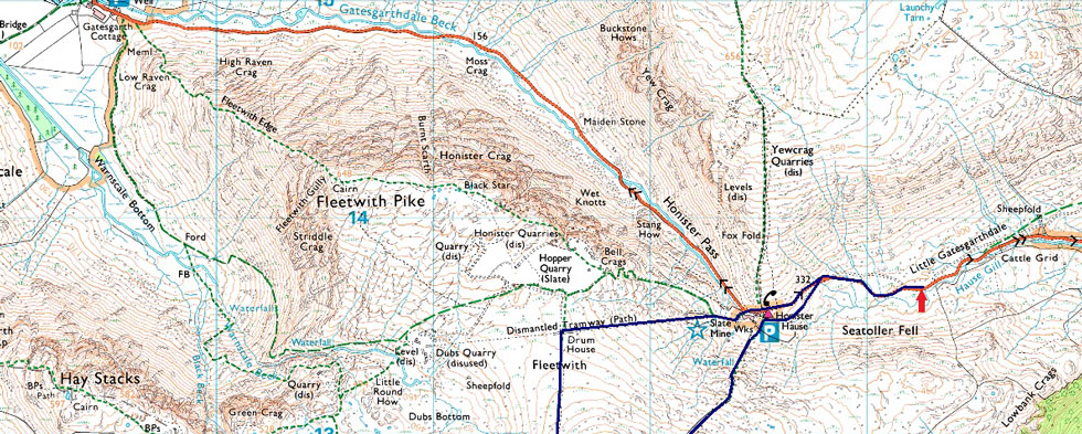
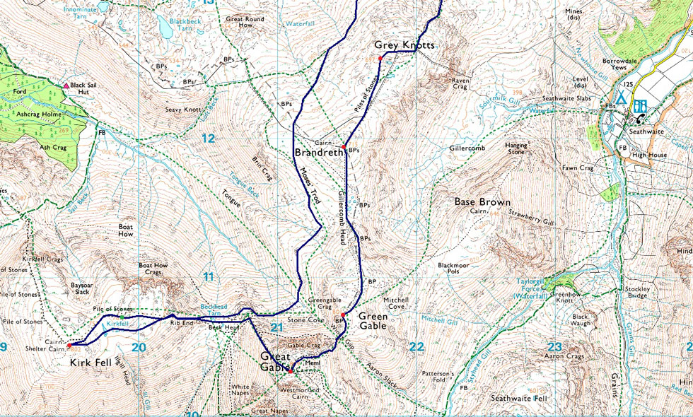
Honister - Grey Knotts - Brandreth - Gillercomb Head - Green Gable - Windy Gap - Great Gable - Beck Head - Rib End - Kirk Fell North Top - Kirk Fell - Rib End - Beck Head - Stone Cove - Moses Trod - Drum House - Honister |
|
| |
|
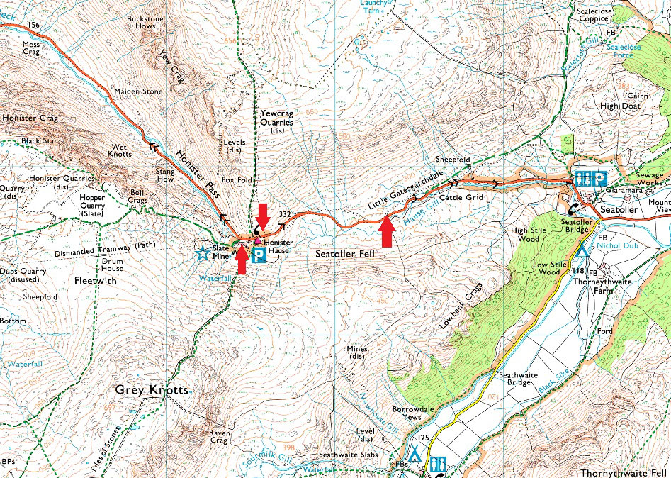
Parking Details and Map |
|
|
| Nearest Post Code: |
CA12 5XN |
| Grid Reference: |
NY 225 313 |
| Notes: |
There is a large car park situated at Honister Slate Mine which is free to use if your a Slate Mine or Ferrata's customer. For non customers there is a a charge and tickets can be purchased from the gift shop. If the main car park is full there is an over flow to the left of the entrance. Charges apply. |
|
| |
|
Map and Photo Gallery |
|
|
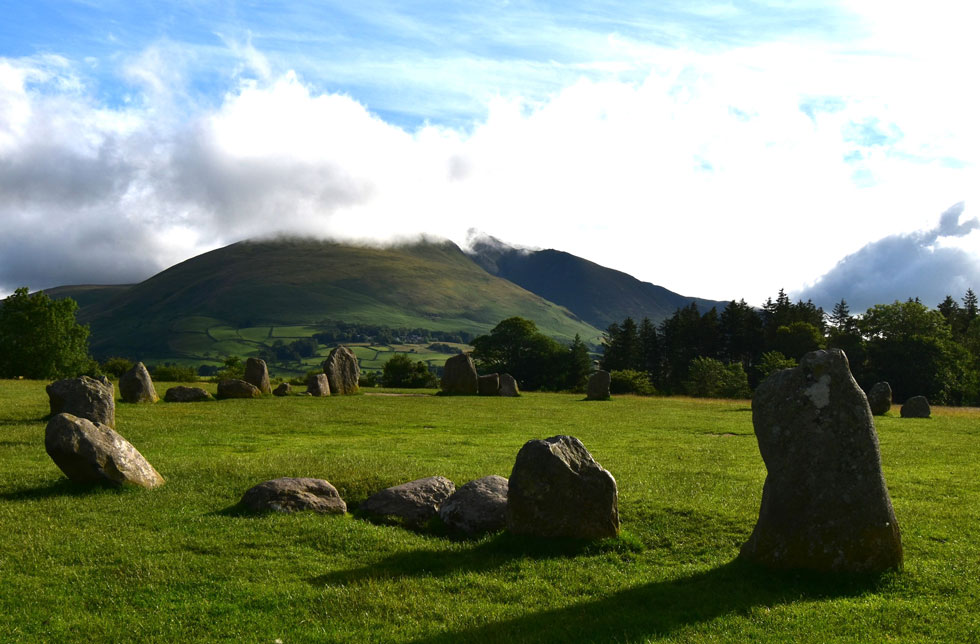 |
| Blencathra from Castlerigg Stone Circle. |
| Rod and I had arranged to meet at the lay by below Honister Hause at 8:15am and I wasn't exactly running early but the opportunity to miss this view of Blencathra from Castlerigg Stone Circle was too great to miss so I made a quick pit stop, grabbed a few photos and returned to my car by which time I was now running late. |
 |
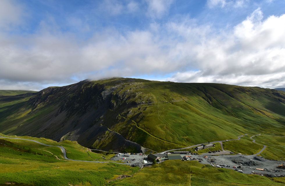
| Honister Mine 08:15am 14°C |
Rod was already there when I arrived at the lay-by and I only just managed to grab the last space right next to Rod's car "not like you to be running late Paul" I know I had an unscheduled stop at Castlerigg Stone Circle and in the end all I managed was a couple of rushed photo's I explained. Rod had been there since 07:45am and was ready to go all I needed to do was lace up my boots, shoulder my pack and lock the car. It wasn't exactly tropical so windproof's were added safe in the knowlegde that they'd be removed within the hour but they took the bite away for now.
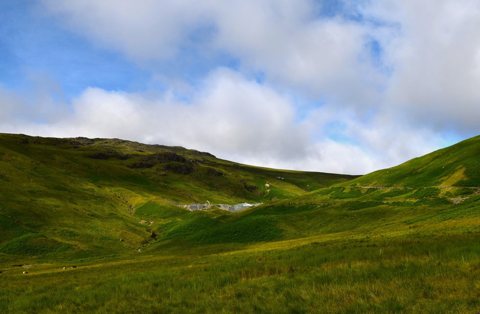
With the cars locked we set off towards the top of Honister Pass only being passed by the odd car or two. We soon arrived at the junction where a gravel road leads onto the mine overspill car park. It's from the other side of the car park does the steep ascent on Grey Knotts begin. |
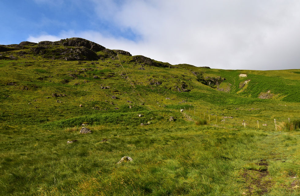 |
| Ascent on Grey Knotts. |
| Its just a case of following the fence which leads as near as dam it all the way towards the summit, great for navigation if the cloud is down not so great because its steep from the off! Before we begin I removed my left boot to remove a tiny stone that had somehow found its way in there. |
 |
| Looking back on Black Star on Fleetwith Pike (left) Dale Head(right) and Robinson (centre) |
| With Honister Slate Mine seen below. |
 |
| Dale Head seen towering above Honister Slate Mine. |
| I'm back to using my DSLR today making use of the wide angle lens which captures the mass of Dale Head. |
 |
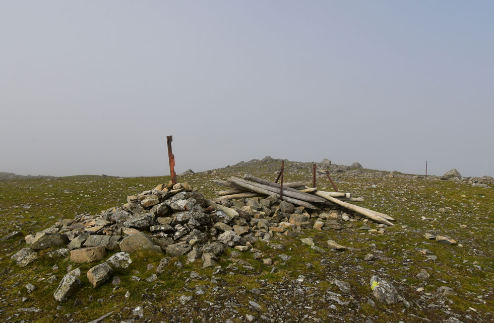
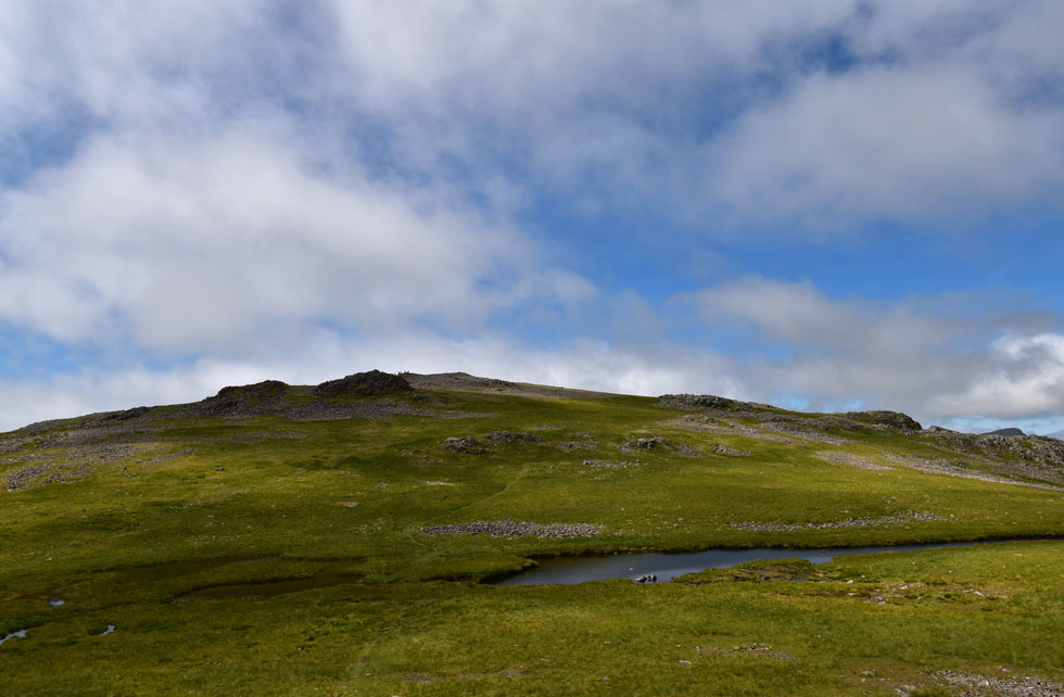
| Grey Knotts summit. |
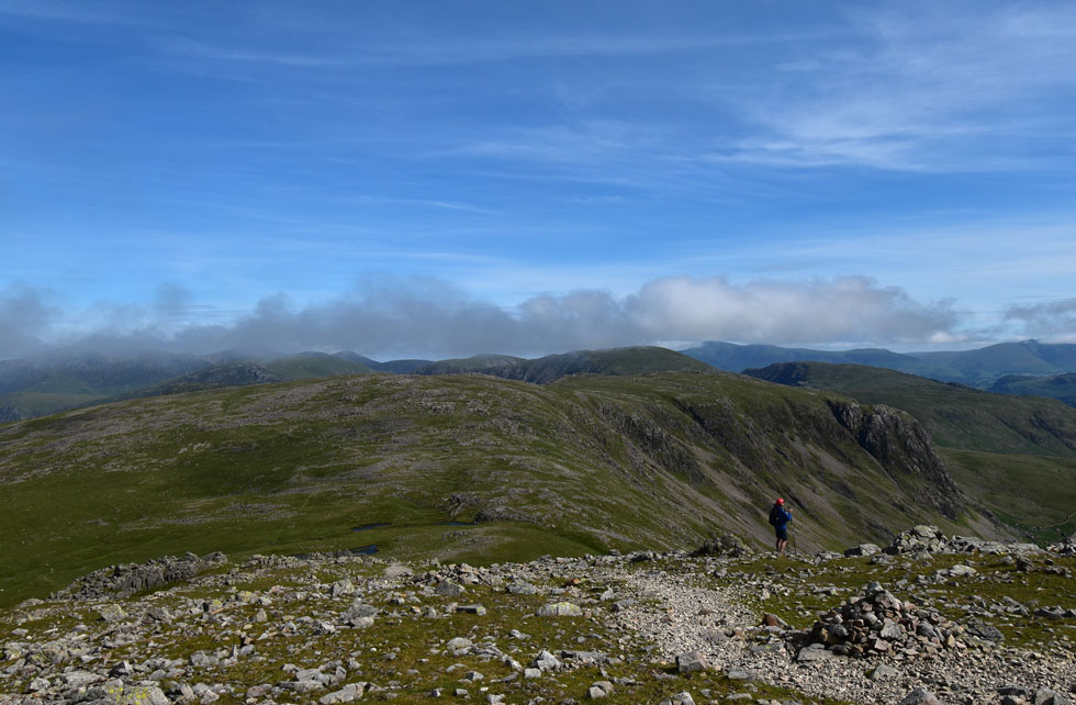
| We continued to follow the fence until it traced right then broke left across the saddle of the summit. We traced right and approached the summit sighting a chap who appeared to be taking selfies using the timer on his camera. By the time we arrived he was making his way down and 'mornings' were shared as we passed one another. |
 |
| Haystacks, High Crag, High Stile, Red Pike (Buttermere) Rannerdale Knotts, Mellbreak and the Loweswater Fells from Grey Knotts. |
| This is the view we'd come to see which was terrific, trouble was it wasn't clear in every direction. |
 |
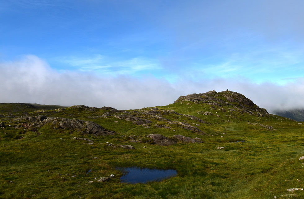
| Brandreth lost in cloud. |
| No cloud had been forecasted so we were a little shocked to find ourselves heading into it. The good news was it appears to be confined to the summits which is common and should lift as the temperature starts to rise. |
 |
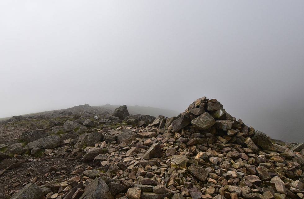
| Brandreth summit. |
| We left Grey Knotts behind and with it our views. As soon as we entered the cloud we must have lost what felt like 10°C and with the temperature taking a plummet the thought of adding a pair of gloves did cross our minds but being the stubborn fools that we are we let our hands get cold. |
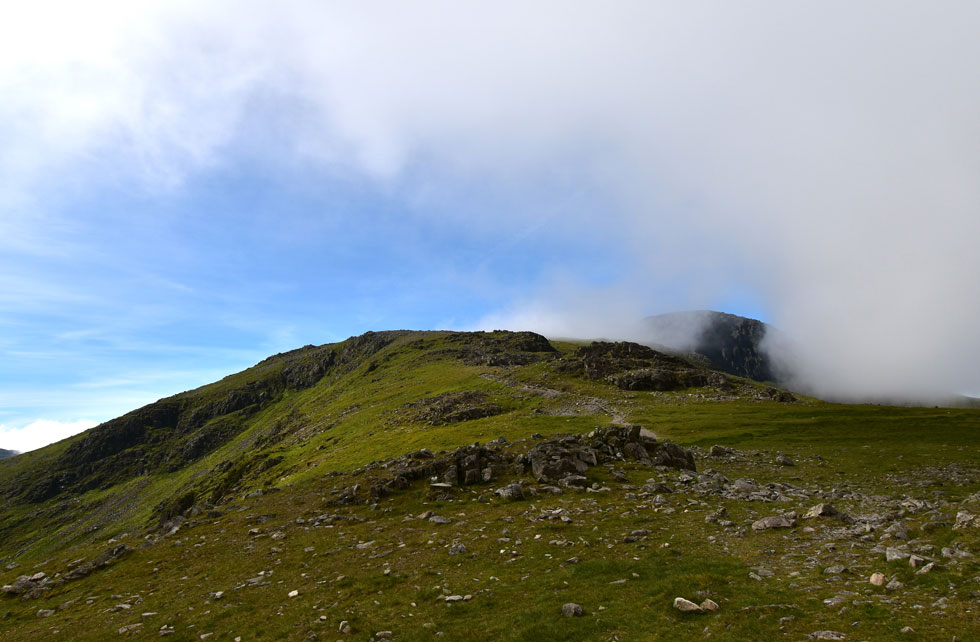 |
| Green Gable and Great Gable appears. |
| We left Brandreth in the cloud and crossed Gillercomb Head where the cloud seemed to be lifting which was great news. |
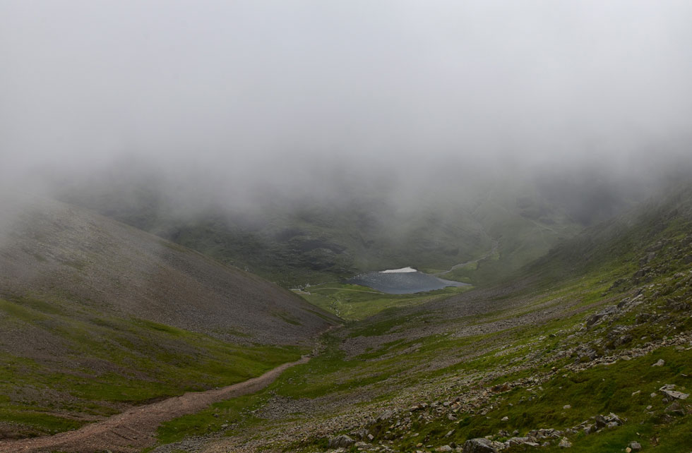
 |
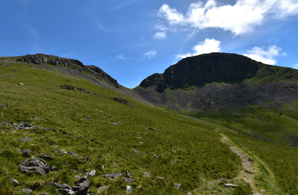
| The view from Gillercomb Head towards Kirk Fell, the top of Black Sails Pass, Pillar and Scoat Fell. |
| |
 |
| The hanging valley of Gillercomb. |
| With Raven Crag to the left and Base Brown over on the right. |
 |
| Looking back on Brandreth, Grey Knotts, Dale Head, High Spy and Robinson to name a few. |
| We began our ascent on Green Gable while taking in the views over the Gillercomb valley as the cloud continued to clear and just when we thought we were in the clear... |
 |
| Green Gable summit. |
| ...the cloud rolled back in with a vengence. |
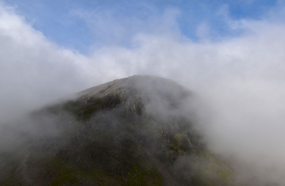 |
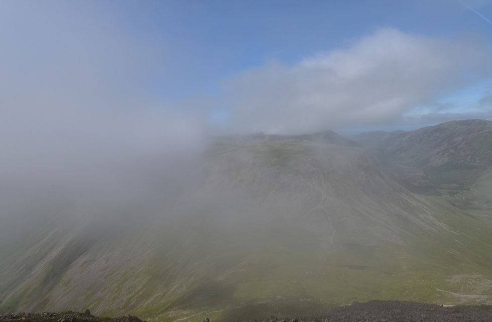
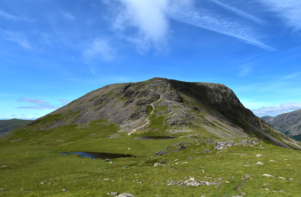
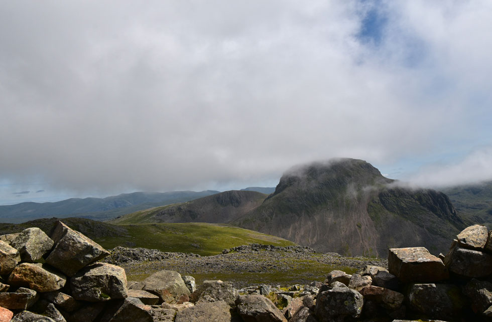
| Great Gable appears through gaps in the cloud. |
| Instead of descending to Windy Gap Rod suggested that we should wait to see if the cloud would lift so we hunkered down in the summit shelter and waited to see what happened. The cloud did break only for it to roll back in again so after a good ten minute we left the shelter and began our descent towards Windy Gap. |
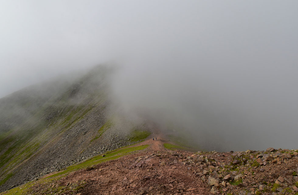 |
| Descending towards Windy Gap. |
| Well at least we can see it. |
 |
| Peering down Aaron Slack towards Styhead Tarn. |
| The sun caught the far side of the tarn and for a while it looked like the tarn had developed a beach but we soon realised it was just the sunlight reflecting off the waters surface, |
 |
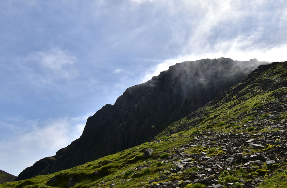
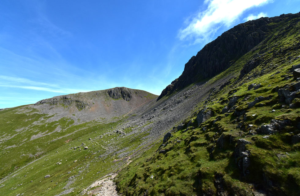
| Not too far from Great Gable summit. |
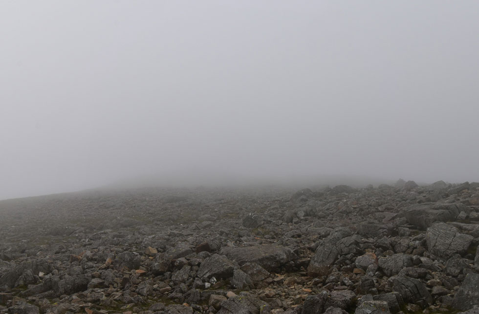
| We entered the cloud just above Windy Gap where it stayed with us all the way to Great Gable summit. The odd thing was it was quite breezy on Grey Knotts and Brandreth but the air was so still on Great Gable. |
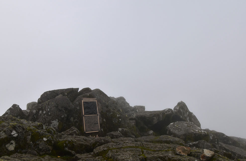 |
| Great Gable summit. |
We followed the cairns all the way towards the summit and found the couple who had over taken us while we were sat in the summit shelter on Green Gable on the other side of the summit rocks. I joked that I was going to write a strongly worded message on Trip Advisor referring to the lack of views on Great Gable and I think that the couple thought I was serious until I laughed it off.
We made a small navigational error and found we were walking towards the Westmoreland Cairn which, had we had the views we would have visited so the error was corrected and we began the rocky northerly descent towards Beck Head. |
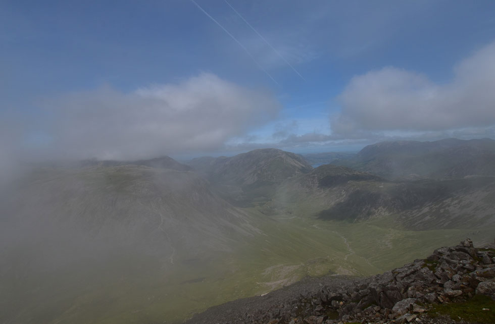 |
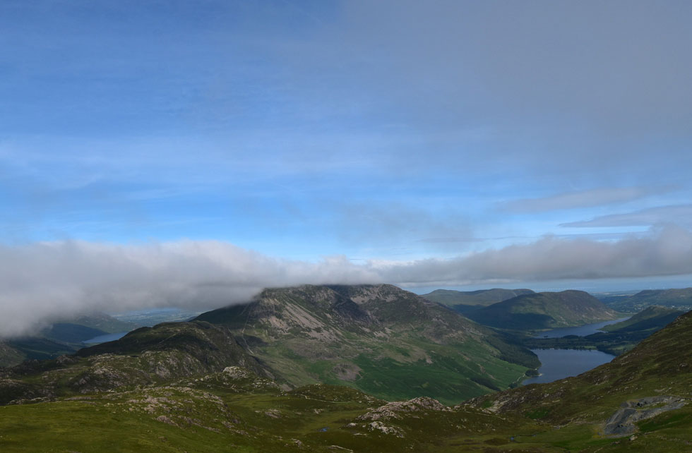
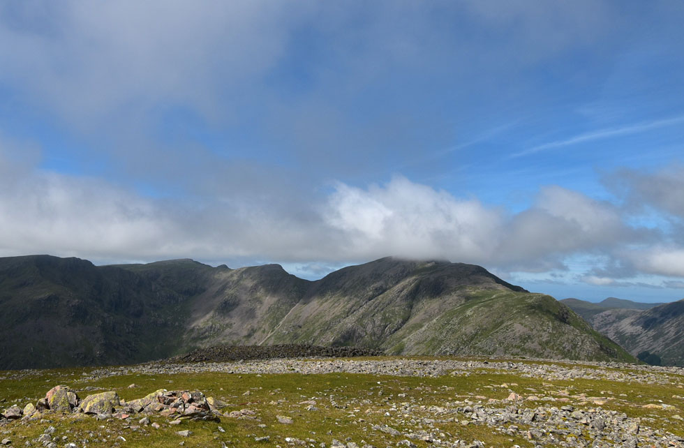
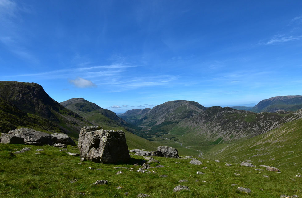
| Kirk Fell, the Ennerdale Valley, Haystacks, High Crag, High Stile, Red Pike (Buttermere) and the North Western fells from Great Gable. |
| Back on track we continued to follow the rocky strewn path which twisted and sometimes required the use of two hands to clamber down the rock. Soon the cloud began to clear bringing with it instant heat and eye watering views. |
 |
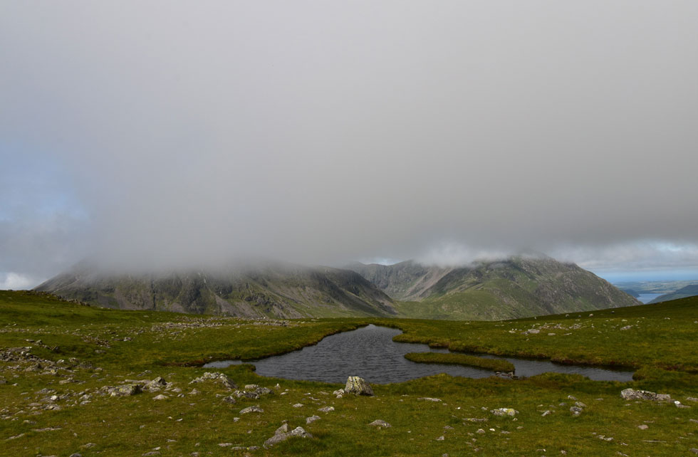
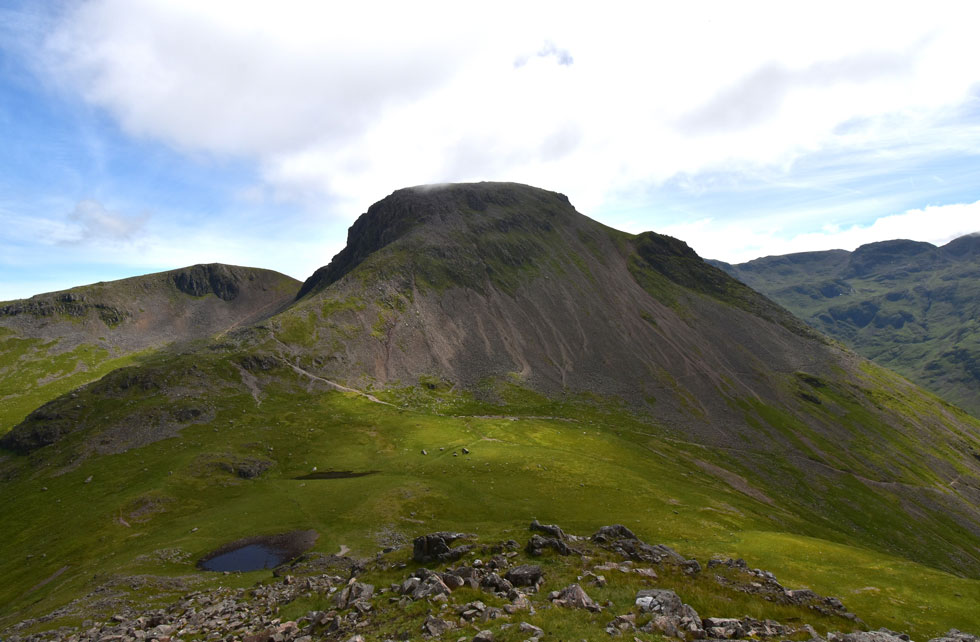
| Kirk Fell seen over Beck Head. |
| Anytime now... |
 |
| Kirk Fell beyond Beck Head. |
| ...there she goes. |
 |
| The Ennerdale Valley with the North Western fells beyond. |
| The path veers right onto a more stable footpath which after taking this photo I crossed onto but Rod being the sadomasochist continued his descent over rock and scree "see you at the bottom" "aye OK" Rod replied. |
 |
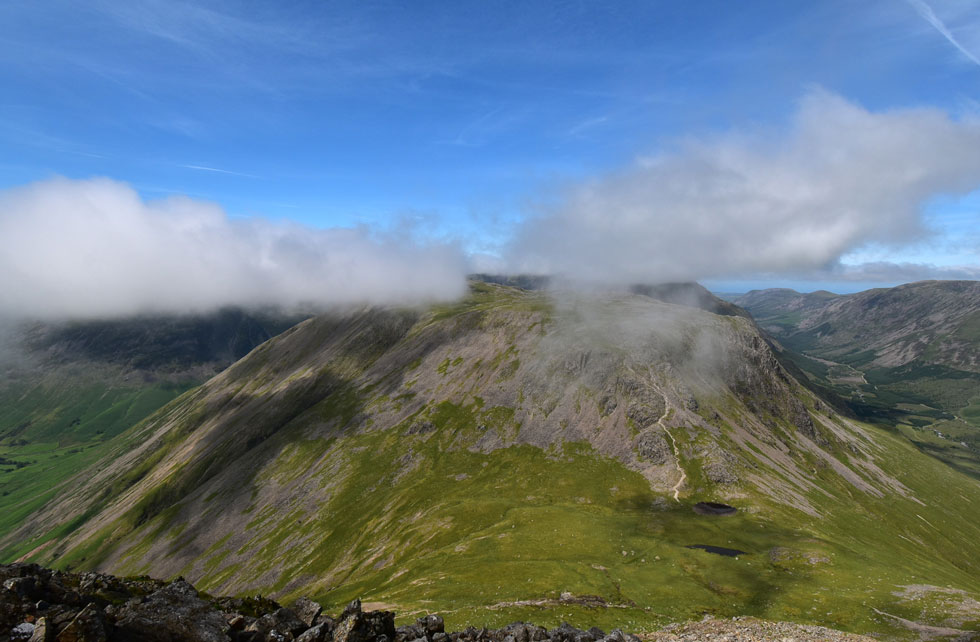
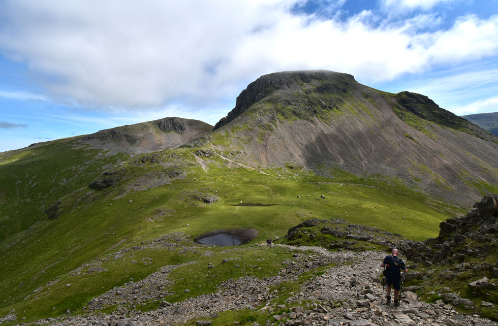
| Wonderful Kirk Fell. |
| It was approaching lunch time and it was agreed we'd stop to eat on either Kirk Fell north top or the summit itself depending on how busy we'd find it. |
 |
| The Ennerdale Valley. |
| With the entire High Stile ridge extending from High Crag all the way to Great Borne. |
 |
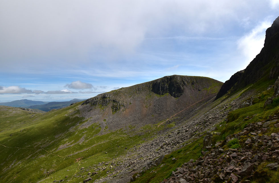
| Looking back up the North ridge. |
| With Gable Crag domineering the view. |
 |
| Green Gable seen over Stone Cove. |
| The path seen in Stone Cove below leads onto Moses Trod which we'll be returning by later. |
 |
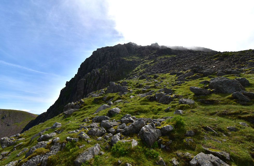
| Gable Crag. |
| It looks like the cloud is completely cleared from Great Gable now with just a few pockets of mist lingering over the higher crags. |
 |
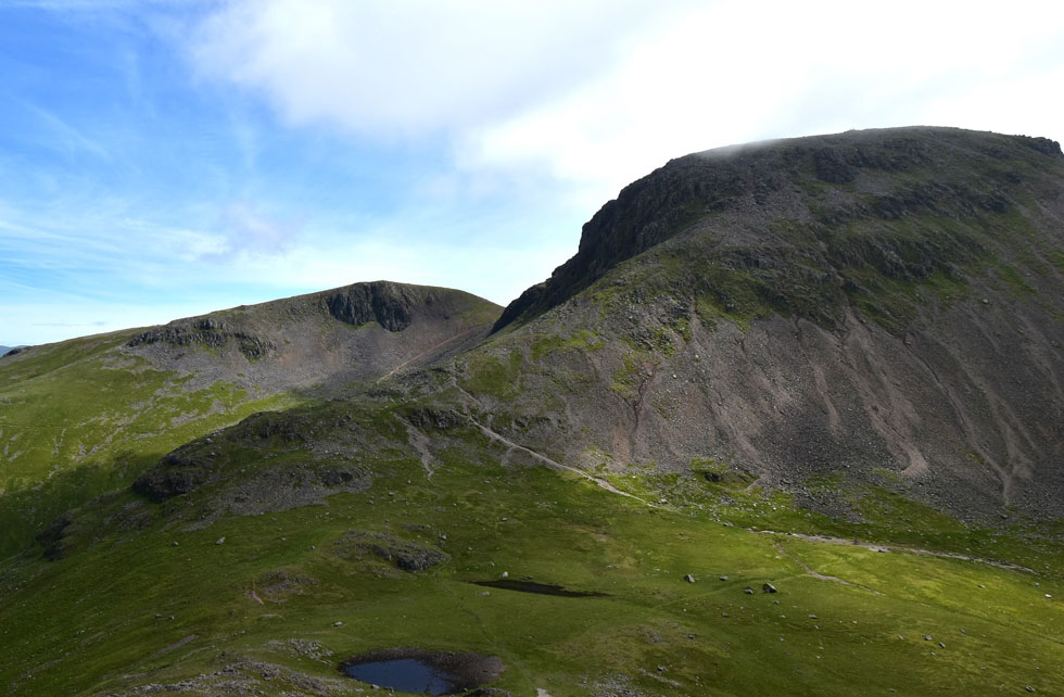
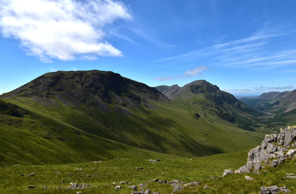
| Kirk Fell and Rib End from Beck Head. |
I was getting a tad worried because I couldn't see Rod around about the same time a lady approached me and said "hi it's Paul Sharkey" I was a little shocked (sorry if your reading this as my mind was still on Rod's whereabouts) We had actually met before on Hartsop above How back in August 2020 and to meet again was something special. It was really nice to see you again.
A young lad and his girlfriend caught wind of our conversation and he too was interested in who I was which was a little uncomfortable because he had no idea who I was. The couple had set off from Seathwaite and had ascended Aaron Slack, traversed Stone Cove and were about to descend to Wasdale Head for lunch before returning to Seathwaite via Styhead Pass. During that conversation Rod appeared over the lad's shoulder and started to make his way across Beck Head and after saying goodbye to the young lad I joined Rod.
"is my arse clean" he laughed "slid a few times did we" I laughed back. Before our ascent on Kirk Fell we de-layered and re-shouldered our packs. If one thing is going to spur me up Kirk Fell it's the thought of eating lunch at the summit. |
 |
| Green Gable, Stone Cove and Great Gable seen over Beck Head. |
| We had plenty left in the engine for todays final assault and summited the shoulder of the fell in a little over ten minutes. |
 |
| Green Gable, Stone Cove, Great Gable and Beck Head. |
| |
 |
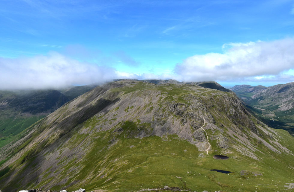
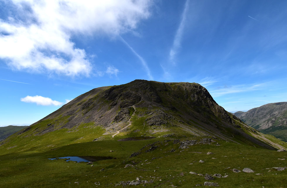
| Kirk Fell from Kirk Fell North Top. |
| The original plan was to summit Kirk Fell first and return via the North Top but for some reason or another we ended up summating the North Top first. It's looking busy on the main summit but we decide that's where we're going to eat lunch anyway. |
 |
| Lunch with a view. |
| By the time we arrived at the summit the crowds had disbanded leaving a group of young girls who were also getting ready to leave. We picked our table at the worlds most scenic restaurant and tucked into lunch. |
 |
| Peering over the summit wall towards... |
| ...Pillar, Wind Gap, Black Crag, Scoat Fell and Red Pike (Wasdale) |
 |
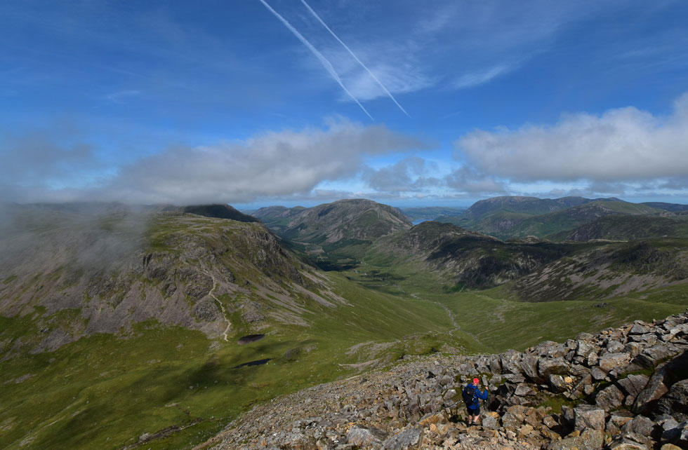
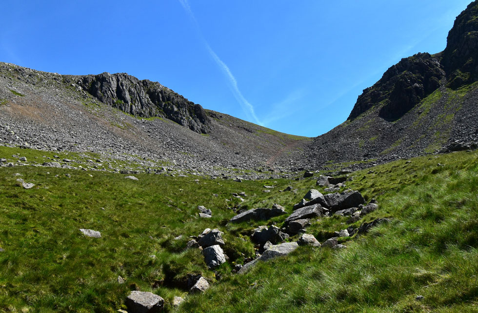
| Descending Rib End with glorious views of the Gables over Beck Head. |
| To gain Stone Cove we first need to ascend the very base of the north ridge. |
 |
| One last look at Kirk Fell before we descend into Stone Cove. |
| Flown respectively I don't mind drones but the chap who was flying the drone over Beck Head flew the drone right above our heads no doubt showing off his skills to his girlfriend. I'm sure Rod would agree that it wasn't just me who wanted to see how a drone would react to a walking pole being thrown at it. |
 |
| Green Gable and Gable Crag from Stone Cove. |
| In terms of scenic views you get the very best from Stone Cove. |
 |
| Kirk Fell, Looking Stead, Pillar, The Ennerdale Valley, the High Stile Ridge and Grasmoor from Stone Cove. |
| No words needed. |
 |
| Looking up to Windy Gap. |
| With Greengable Crag and Green Gable seen left and Gable Crag seen right. |
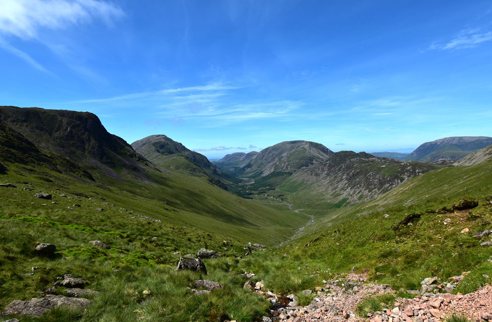 |
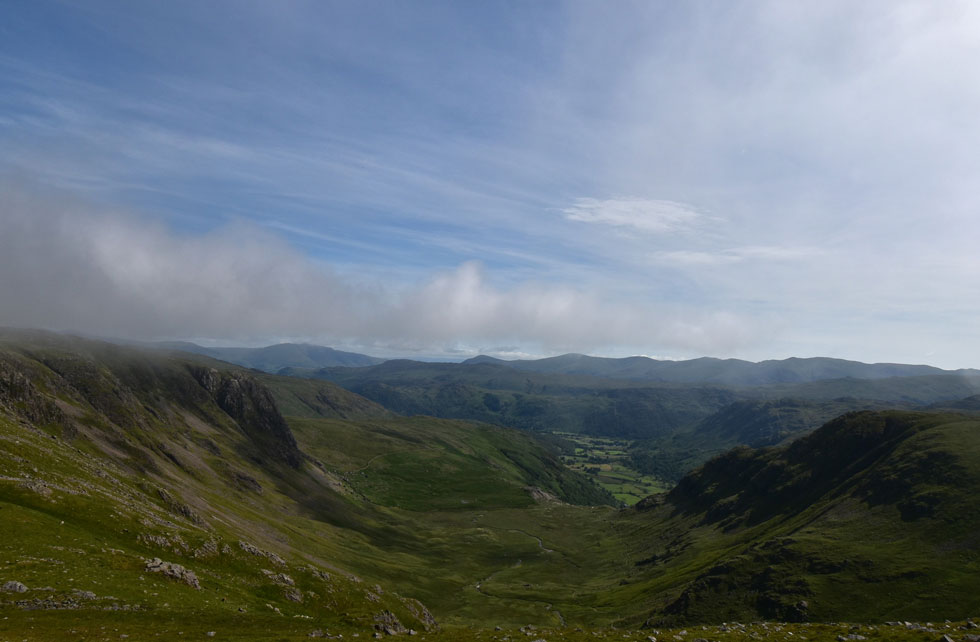
| The Ennerdale Valley. |
| Even after walking the Ennerdale Horseshoe a couple of years ago I'm still staggered by the sheer size and not to mention beauty of the Ennerdale Valley. |
 |
| Looking back on Green Gable, Windy Gap and Great Gable from Stone Cove. |
| After leaving Stone Cove behind we picked up the Moses Trod path which out flanks both Brandreth and Grey Knotts. |
 |
| Kirk Fell, the top of Black Sails Pass, Looking Stead, Pillar, Black Crag, Scoat Fell and the Ennerdale valley from Moses Trod. |
| The views just keep on coming. |
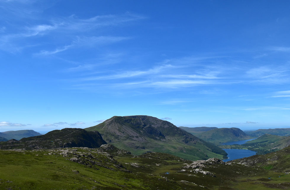 |
| The view beyond Royd How towards Haystacks, Gamlin End, High Crag and High Stile. |
| With Mellbreak, Buttermere, Crummock Water and the Loweswater Fells in the distance. |
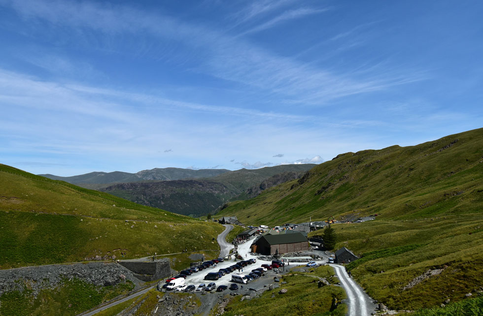 |
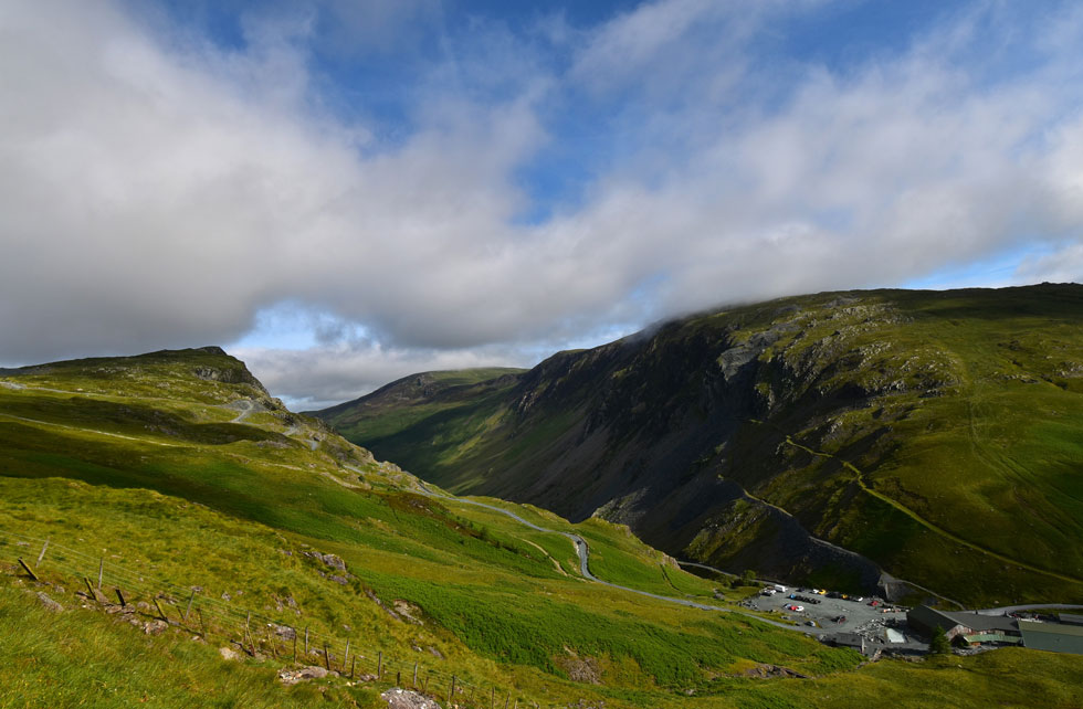
| Back at Honister Slate Mine. |
Somehow we had to tear ourselves away from the views as the heat from the afternoon sun scorched exposed skin. With the flank of Grey Knotts to our immediate right we continued towards Drum House where folk rested in the sunshine before joining Lakelands straightest half mile back to Honister. Feet were beginning to ache and I longed to kick them into the backs of my boots but not until the mine was reached. Rod traced left and passed through the car park while I passed the large shed and peered in through the dust and blackness, a pair of eyes stared back and continued with his work. Rod and I linked up again as we passed a large group gearing up wearing helmets and harnesses no doubt waiting for the Via Ferrata.
We passed through the over spill car park where I glanced over at the fence we had followed this morning and spotted no takers in ascent or descent. Joining the pass we descended towards the lay-by where a camper van had parked next to my car and whose Spaniel was playing in Hause Gill just behind the cars. The first thing we did was let the windows down only to be blasted by a wall of trapped heat and a piping hot steering wheel. I returned to the boot and eased my feet out of my boots then rubbed the sole of my feet and toes...Had Hause Beck been anything more than a trickle I'd have joined the Spaniel but the soft grass underfoot more than compensated. Easing into my North Face mids which I have owned since the beginning of time meant it was time to head home so after thanking Rod for his company I eased myself into the driving seat, let the steering wheel set my hands on fire and joined the masses just outside of Keswick while waiting for two sets temporary traffic lights to turn to green.
What a day though. |
|
| |
| Back to top |
 |
|