|
Latrigg, Lonscale Fell & The Threlkeld to Keswick Railway Path |
 |
 |
25th June 2022 |
 |
|
When Rod emailed me last Monday about walking this weekend it usually means he's wasn't having the best start to the week and that made two of us. By the time Wednesday came I'd emailed Rod a route that I'd had on my mind for a couple of weeks which took in Silver Howe, Blea Rigg, Sergeant Man and Tarn Crag from Grasmere.
Rod Returned my email asking did I fancy walking the Greenburn Horseshoe and I replied yeah why not. Rod's final email came with a twist 'why don't we walk the Far Easedale Horseshoe?' a walk that met both our needs and that was it, we agreed on a time and all we had to do was get through the working week.
As you know we'd had a blinder of a week with wall to wall sunshine and blue skies galore only for it to break come Saturday, typical eh. Undeterred, and despite a rather unhinged forecast we kept to our original plan and arranged to meet at the lay north of Grasmere for 08:15am.
By the time I arrived in Grasmere it wasn't just raining but bucketing down and drastic times mean drastic measures. We needed a plan B. |
|
| Wainwright Guide Book Five |
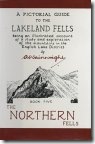 |
The Northern Fells
Latrigg is to Keswick what Loughrigg is to Ambleside and Helm Crag to Grasmere: a small hill, an excellent viewpoint. a great favourite of local folk and visitors. |
 |
|
|
|
|
| |
|
Overview |
|
|
| Ascent: |
2,350 Feet - 716 Metres |
| Wainwrights: |
2, Latrigg - Lonscale Fell |
| Visiting: |
Burnt Horse |
| Weather: |
Sunshine & Showers. Strong Winds Where Exposed. Highs of 19°C Lows of 12°C |
| Parking: |
Roadside Parking, Spooney Green Lane Keswick |
| Area: |
Northern |
| Miles: |
12.7 |
| Walking With: |
Rod Hepplewhite |
| Ordnance Survey: |
OL4 |
| Time Taken: |
5 Hours 30 Minutes |
| Route: |
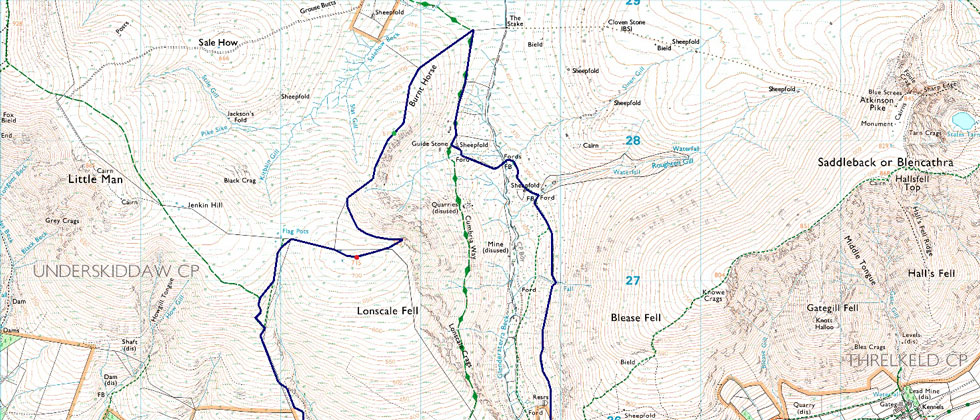
Brundholme Road - Spooney Green Lane - Cumbrian Way - Mallen Dodd - Latrigg - Hawell Monument - Skiddaw Tourist Path - Lonscale Fell - Lonscale Pike - Burnt Horse - Cumbrian Way - Blencathra Centre - Threlkeld - A66 - Keswick Railway Path - Brundholme Road |
|
| |
|
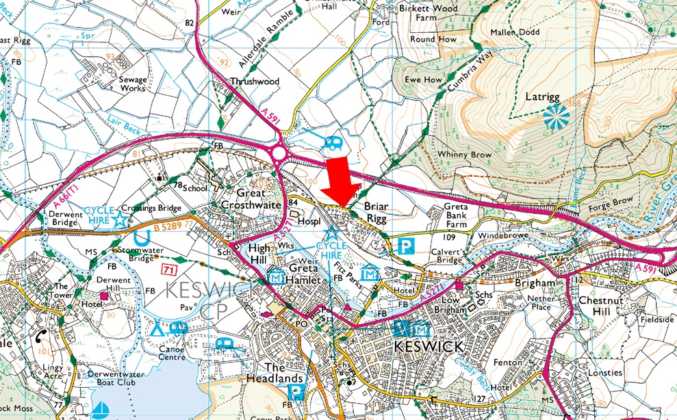
Parking Details and Map Spooney Green Lane (Briar Rigg) |
|
|
| Nearest Post Code: |
CA12 4PJ |
| Grid Reference: |
NY 267 324 |
| Notes: |
Spooney Green Lane, Keswick is perfectly positioned for a short walk onto Latrigg, a visit to the old Keswick Railway or even Skiddaw. There is room for up to half a dozen cars but please be considerate when parking as this is a residential street. Parking is free. |
|
| |
|
Map and Photo Gallery |
|
|
  |
| |
| |
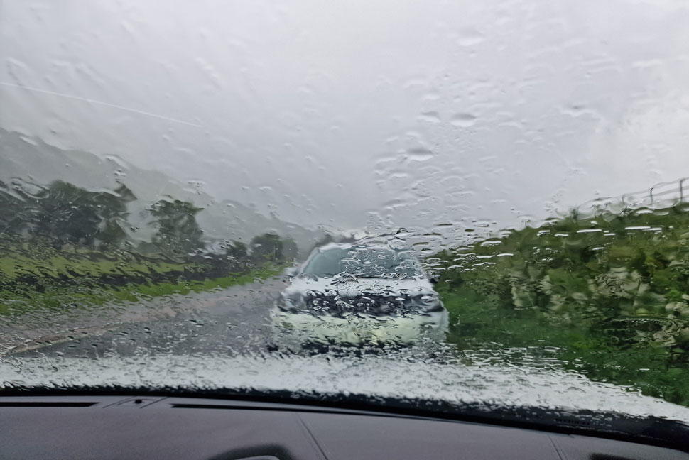 |
| Lay by A591 outside Grasmere 07:50am 12°C |
I left home under the clearest of blue skies which broke as I continued north and it had completely clouded over by the time I reached Ambleside. As I drove towards Grasmere speckles of rain started to hit the windscreen and by the time I arrived in Grasmere my wipers were going like the clappers. Not only was it raining but the car was being rocked by the wind which had been forecasted to get much stronger across the tops.
A pair of waterproof trousers would suffice which I could easily slip over my shorts and to protect from the wind I changed my light base layer to a thicker one while adding my boots still sat in the drivers seat. More cars started to arrive whose occupants just like me waited for the rain to ease which it did in between the downpours. Rod arrived and span his car around during which time the rain had eased enough to have a quick chat outside the cars, our Far Easedale walk deserved a better hand that we had been dealt and that's when Rod added "I've come along the A66 and it's much clearer further north, let's drive to Briar Rigg near Keswick and we can make up a low level walk from there"
By this time it had started to rain again and we were using our hands to stop the wind whipping the rain into our faces "I'll follow you mate" and with that I span my car around and followed Rod over Dunmail Raise to a view that almost caused my jaw to drop. |
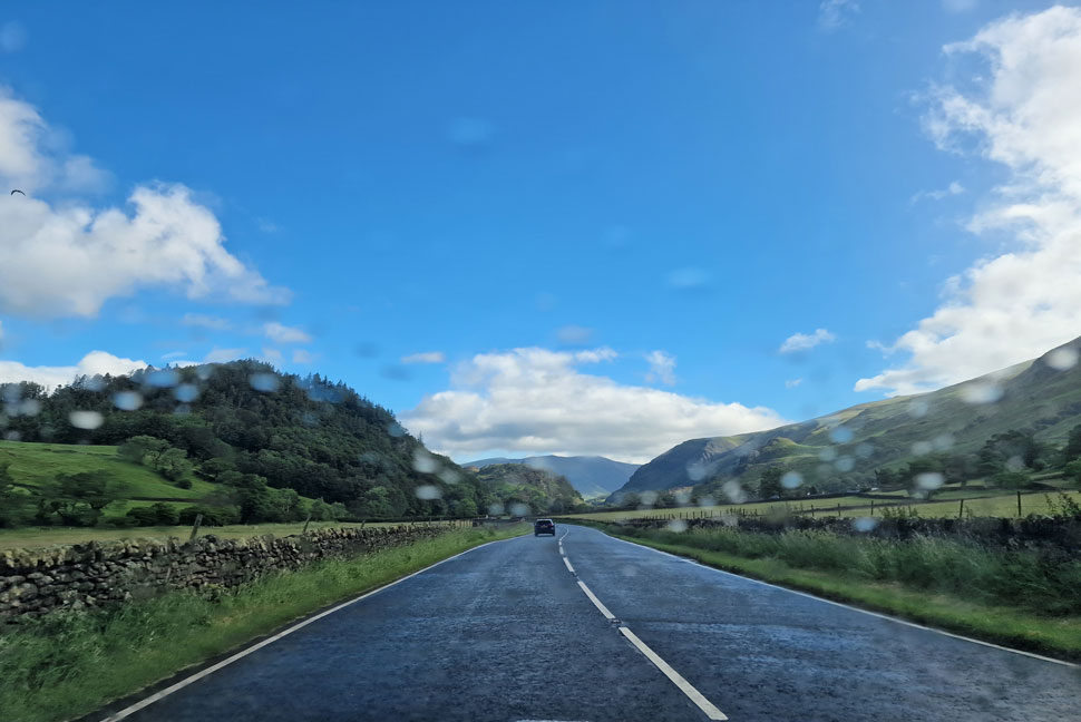 |
| Blue skies and sunshine as we drove towards Keswick. |
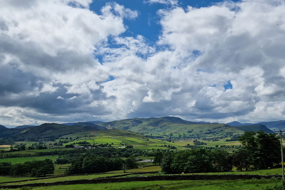
Despite the cloudy skies as we drove past Thirlmere Reservoir I noticed how vivid the waters surface looked and as we approached Legburthwaite the grey skies were confined to our rear view mirrors.
The contrast between central and northern Lakeland was amazing even to the most seasoned of fell walkers. |
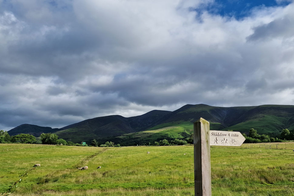 |
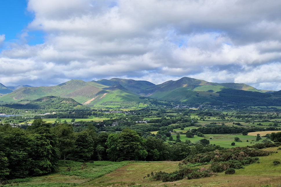
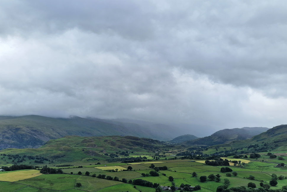
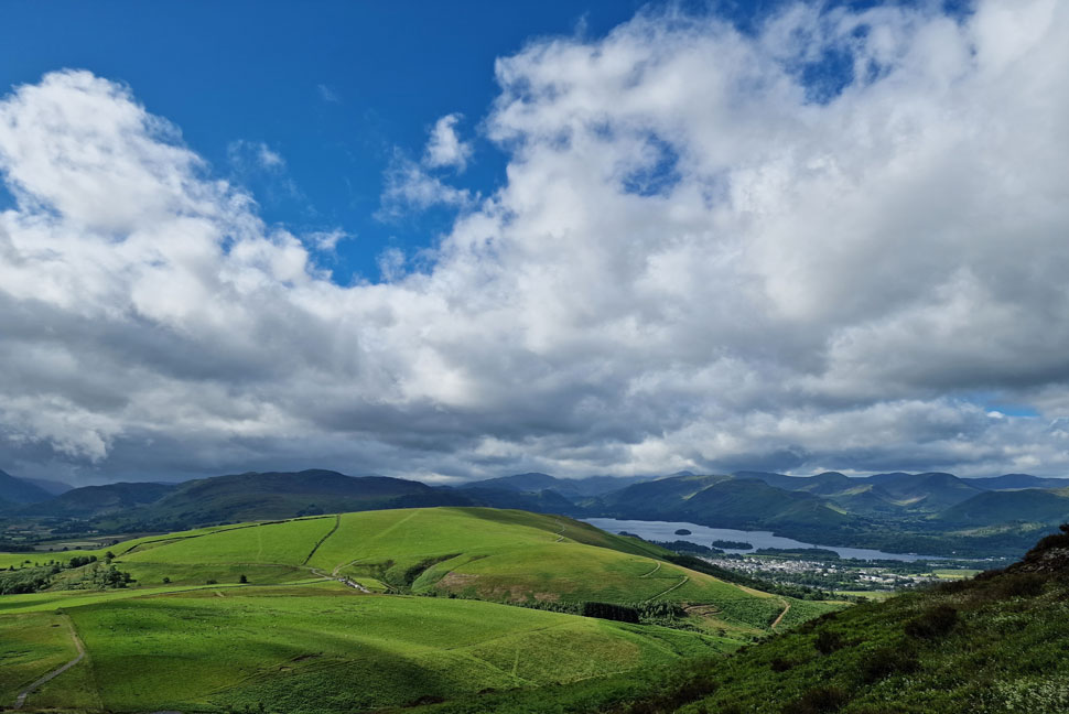
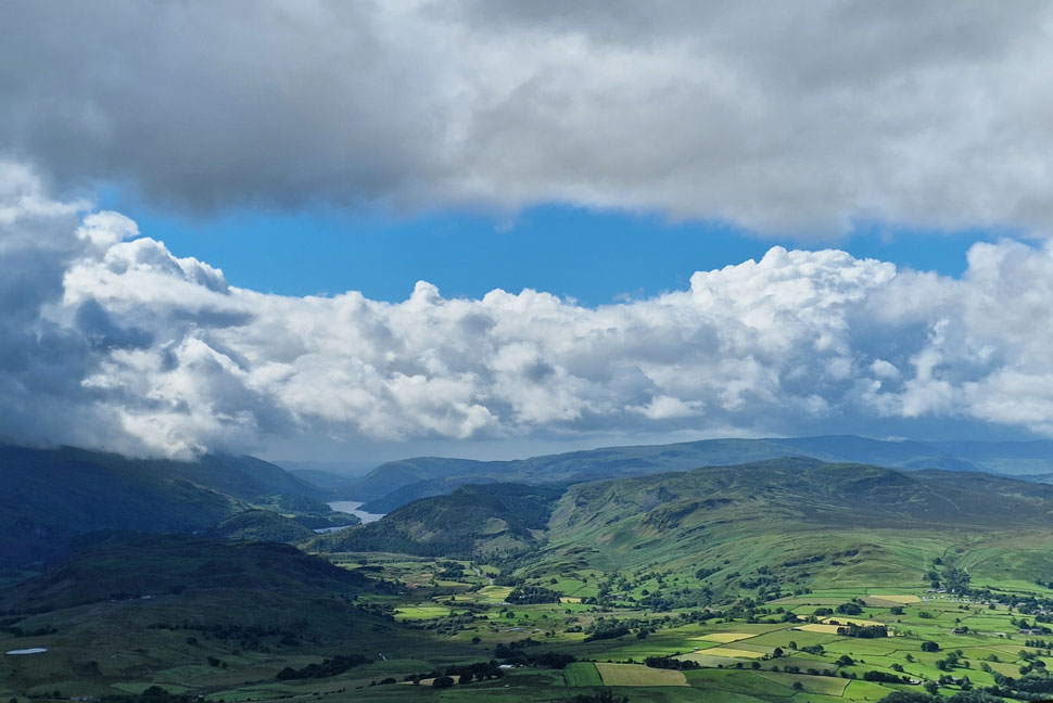
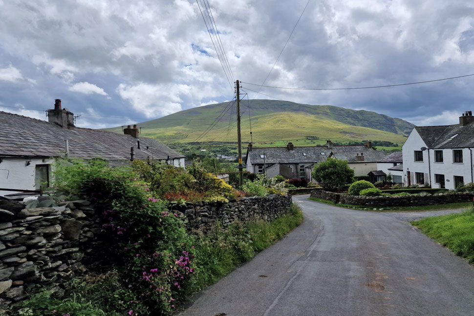
| Dodd and the Skiddaw Massif from Spooney Green Lane / Brundholme Road. |
Twenty minutes later we were parking up at the end of Spooney Green Lane under a mix of cloud and warm sunshine. Kitting up for such a forecast when the temperatures were set to reach the twenties was going to be tricky because quite rightly so we couldn't rule out another soaking but we had to protect against the wind too which left us no other choice than to add waterproof jackets from the off. It's going to be a uncomfortable sticky start to the walk but as the morning progresses choosing to wear our waterproof jackets proved to be the best choice.
It's going to be a 'make it up as we go along walk' given the interchangeable weather and wind which was carrying the clouds above our heads at a fair rate of knotts. The initial plan is to head for Latrigg then up onto Lonscale Fell via Skiddaw's tourist path. |
 |
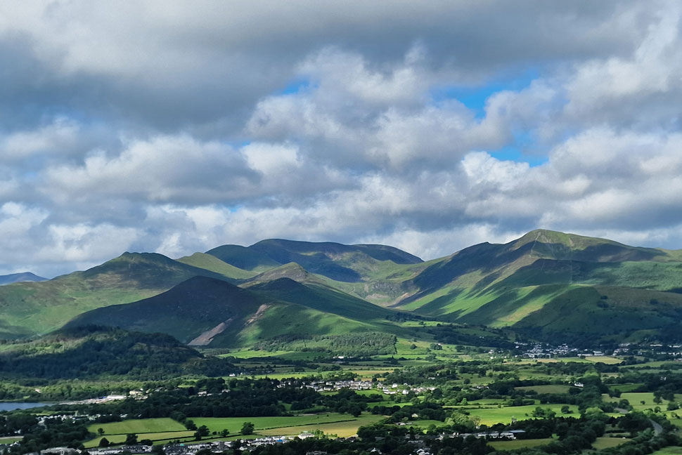
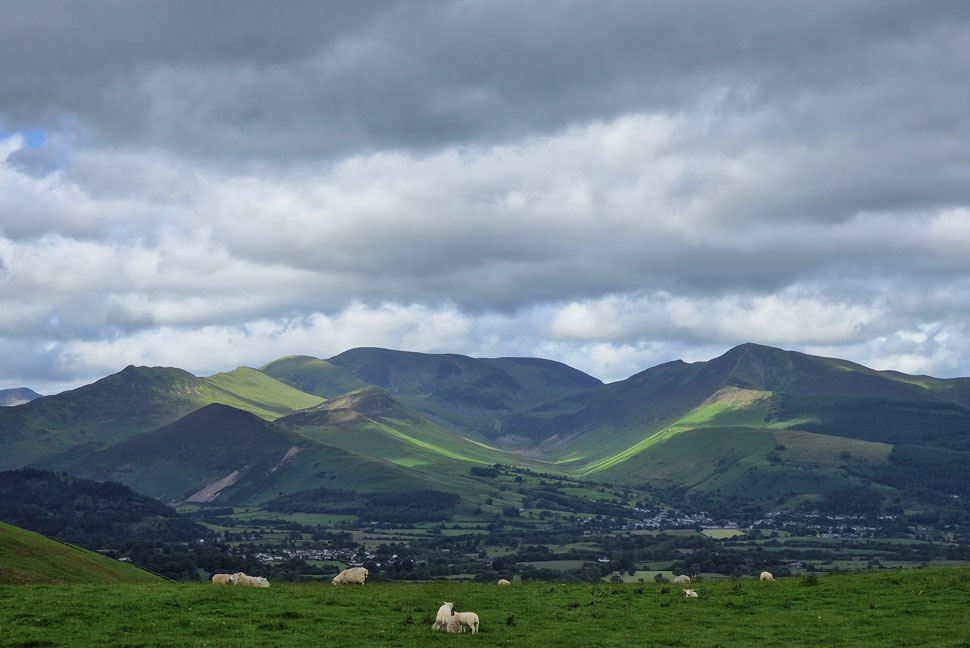
| The Coledale Valley and surrounding fells. |
| With views towards Swinside, Causey Pike, Barrow, Stile End, Outerside, Scar Crags, Sail, Eel Crag (Crag Hill) Grasmore, Hopegill Head and Grisedale Pike. |
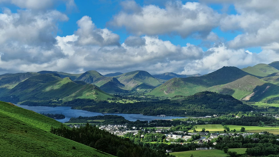 |
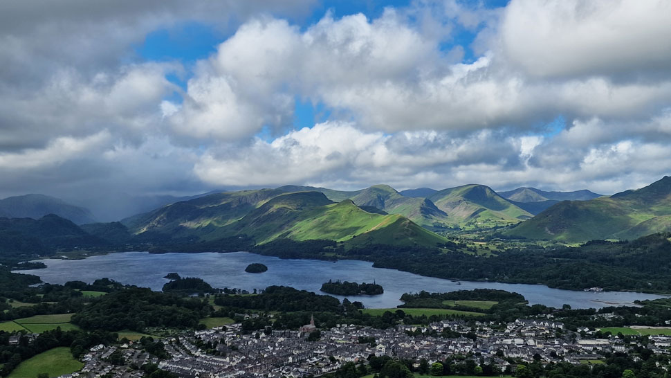
| Incredible views over Derwent Water as we gain Height. |
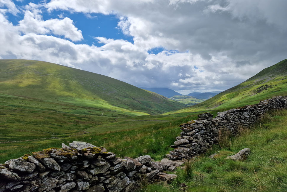
| Having crossed the A66 by the footbridge we followed the steep track until we arrived at the base of Mallen Dodd where a steep grassy path ascended onto Latrigg's main footpath. Here we stop to take in the views over Derwent Water towards Cat Bells, Maiden Moor, Dale Head, Hindscarth, Robinson, Causey Pike, Sail and Scar Crags. |
 |
| The heart of the Coledale valley. |
| The high winds and cloud left the views changing almost by the second. Just brilliant. |
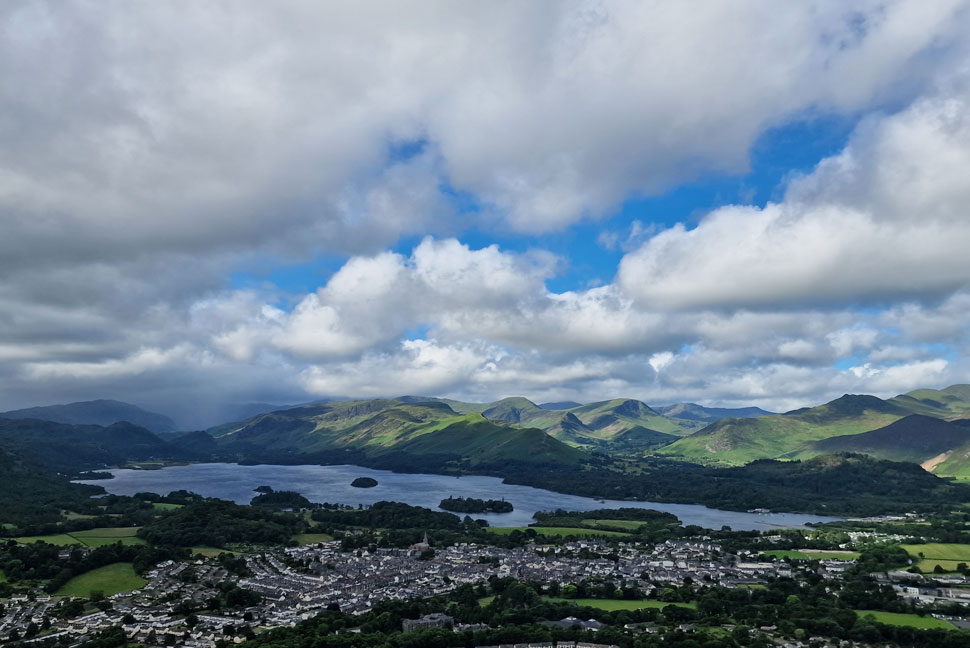 |
| The wider view. |
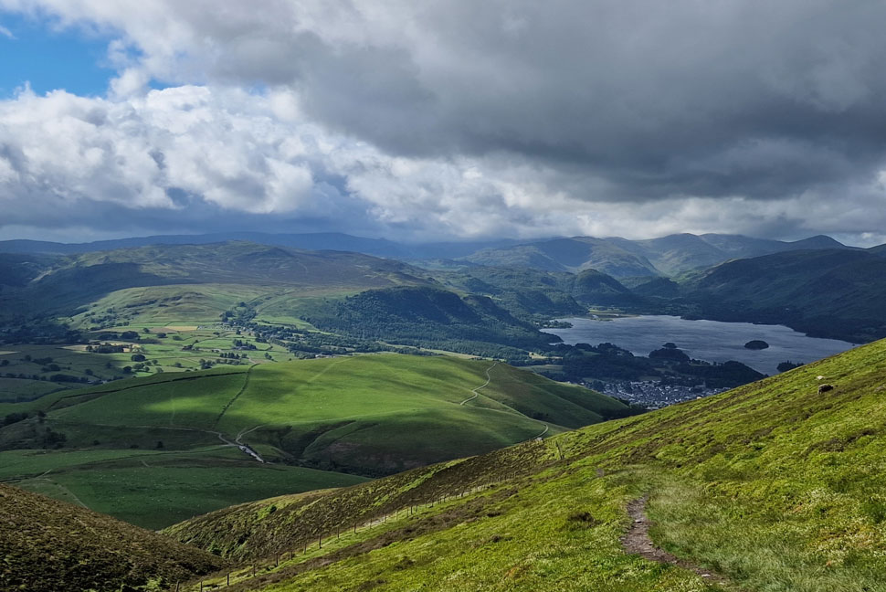
| Sweating it out we easily gained the shoulder of Latrigg from where the incredible views continued. For the best part of the day the north western fells remained sunny and dry while further south towards Borrowdale the rain continued to pour. |
 |
| Views over St Johns-in-the-Vale towards the Helvellyn range. |
| Sadly it was the same for anyone walking the Helvellyn range where the rain and cloud seemed relentless. |
 |
| The Coledale Valley. |
| We summitted Latrigg and were surprised at 1,200ft how strong the wind was which we estimated to be between 25-30mph which was when I looked back on Helvellyn and wondered how wild it must have been up there. |
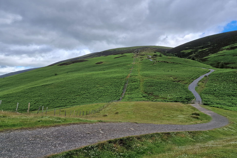 |
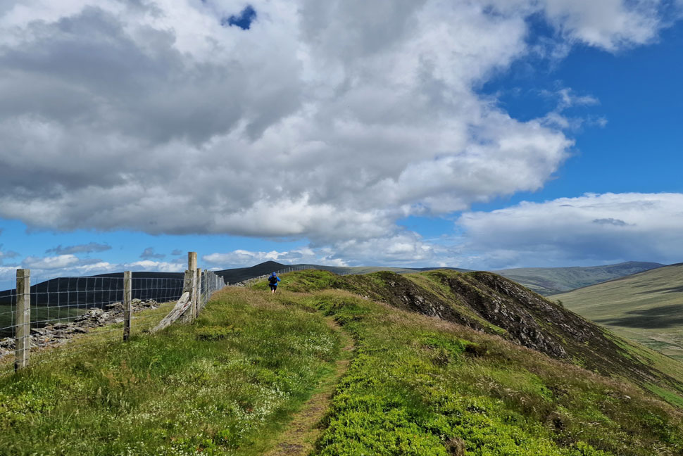
| Opting for Skiddaw's tourist path. |
| During the descent of Latrigg we discussed which way we were going to ascend Lonscale Fell and agreed to opt for the Skiddaw's tourist path which as you can see, isn't very busy. |
 |
| Every now and again... |
| ...the cloud would lift over the Helvellyn range but we agreed it still looked wild up there. |
 |
| Bright sunshine over Latrigg. |
| Experience told us the tourist path was a very steep start but we just ploughed into the ascent and kept a good pace only stopping to look back on the view which changed minute by minute. |
 |
| A similar view as we struck right and left the tourist path behind. |
Just in case it clouded over we fixed eyes on the path from Latrigg which diverts from the tourist towards the Col between Jenkin Hill and Lonscale Fell located about eighty yards beyond the zigzags.
It wasn't the cloud that nearly caused us to the miss the path but us jabbering on about Glastonbury's line up and who we were looking forward to watching later that night. |
 |
| Views beyond Jenkin Hill with Lesser Man, Little Man and Siddaw as we gain ground on Lonscale Fell. |
| You can see the Col below which we had just ascended towards the left of the photo. |
 |
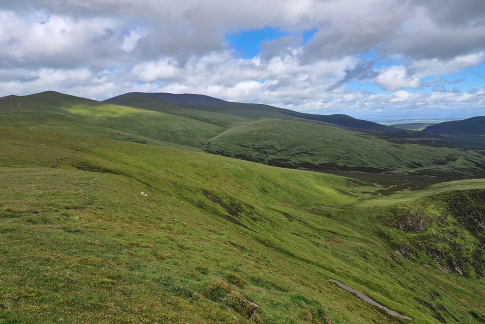
| Carrock Fell, High Pike (Caldbeck) and Knott from Lonscale Fell summit. |
| Lonscale Fell was easily reached were as predicted the temperature dropped as the wind speed increased. The good news was what sunshine there was took the 'edge' from the wind as we agreed to have a wander over to Lonscale Pike which was just a few minutes walk away. |
 |
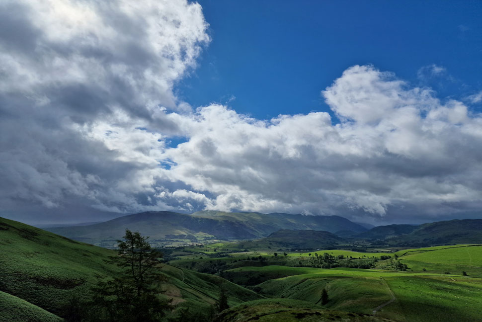
| Looking South towards Thirlmere. |
| Where the cloud appears to have lifted above the central fells and it's stopped raining now. |
 |
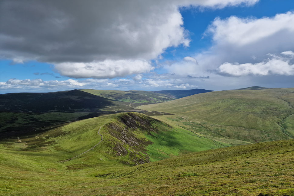
| Skiddaw, Bakestall and Sale How. |
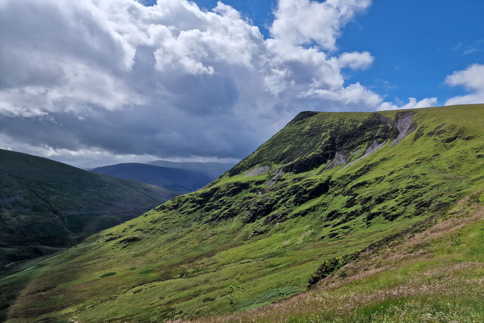
It had been raining on and off and as we reached Lonscale Pike summit it clouded over for a few minutes with Blencathra taking the brunt of low cloud and a passing shower.
From Lonscale Pike our 'making it as we went along' would now ventured further north onto Burnt Horse which is the fell seen lower right and to reach it, a devilishly steep descent via the fence line seen centre. |
 |
| We didn't have to wait long until the sunshine reappeared. |
| With Burnt Horse seen directly below with Great Calva, High Pike, Carrock Fell and Mungrisdale Common beyond. |
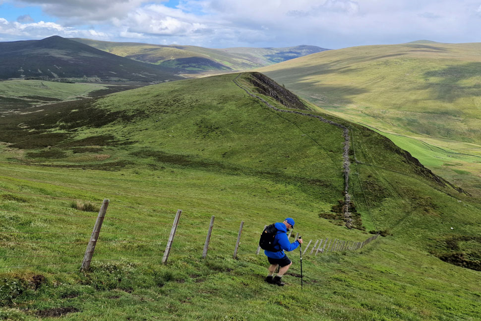 |
| Rod taking it easy during the steep descent. |
| With Burnt Horse waiting beyond. |
 |
| Whoo hoo the sun's back out. |
| It was the type of descent where you had no choice other than to take it slow and by the time I reached the base I kicked my feet into the backs of my boots before joining Rod who by now was crossing the thin ridge like path over Burnt Horse. |
 |
| The perfect profile of Lonscale Pike East ridge. |
| Which all three of us have all climbed on separate occasions. Steep doesn't even come into it! |
 |
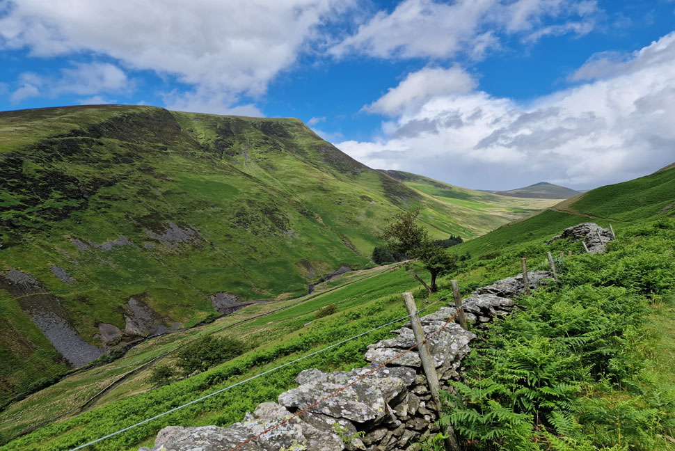
| Descending Burnt Horse. |
| We descended the full length of Burnt Horse north ridge taking us to within spitting distance of Skiddaw House as our view was filled with Little Calva (left) and Great Calva (right) and the summit of Knott beyond. |
 |
| Great Calva, Knott, Coomb Height and Carrock Fell. |
| It feels like ages since I was last here. |
 |
| Blease Fell and the base of Lonscale Pike East ridge divided by Glenderaterra Beck. |
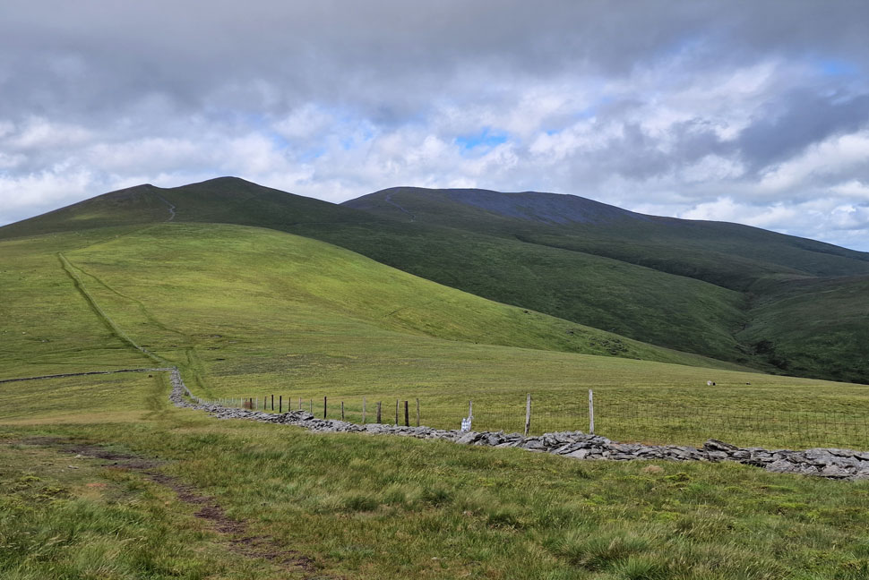
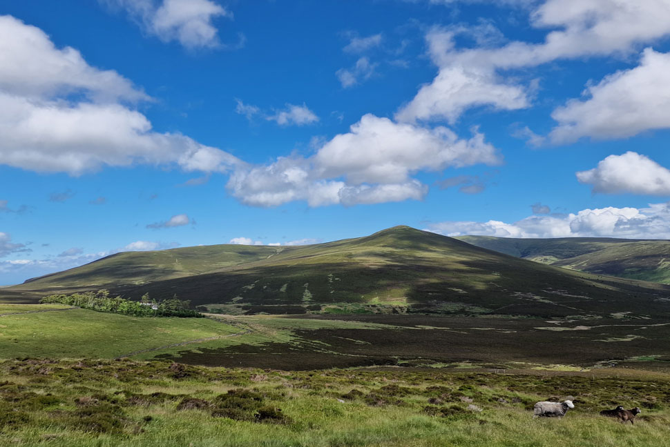
Having decended Burnt Horse north ridge we joined the Cumbrian Way just as a large family were heading towards us who were the first people we'd seen since Latrigg. We passed with Hi's then began the slight descent towards the footbridge over Glenderaterra Beck.
We were a good deal out of the wind by now and with a warm sun over head Rod removed his Waterproof jacket for the first time while I opted to keep mine on until we'd crossed Glenderaterra Beck a little further on. |
 |
| Lonscale Fell, Lonscale Pike East Ridge, Burnt Horse and Great Calva. |
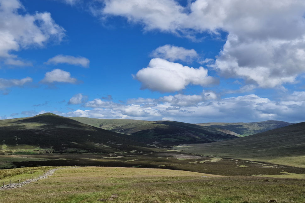
We left the Cumbrian Way and made the slight descent over Glenderaterra Beck which was when the skies darkened. Continuing on I spotted a curtain or rain passing over Blencathra and Mungrisdale Common below. Looking as localised as it did we prayed we'd only get hit by the fringes of the shower but what was light rain turned into full on vertical which saw Rod reaching for his waterproof as I waited on.
The rain continued to pour as I looked down on my tanned hands which were turning white with cold. As we rounded the valley above the Blencathra Centre as quickly as the rain started it stopped and the sun came back out by which time I was soaked through to the boxers. The good news was the wind coupled with this warm sunshine should have me dried out in no time. |
 |
| The view towards Low Rigg, High Rigg, Walla Crag and Bleaberry Fell. |
| With a glimpse of Tewit Tarn in the sunshine. |
 |
| St Johns-in-the-Vale from the outskirts of Threlkeld. |
| We continued towards the Blencathra Centre then passed through the car park below Blease Fell which we'd seen a lot busier for a Saturday. Continuing towards Threlkeld we left the road and took the bridleway through a number of sheep filled fields where the view into St Johns-in-the-Vale was second to none. |
 |
| Threlkeld Village with Clough Head in the distance. |
The bridleway ended in the centre of Threlkeld close to the Primary School. Passing the School we arrived at the T-Junction and turned right towards Keswick where we agreed to stop to eat lunch before taking on the Threlkeld to Keswick Railway path.
We found a bench at the far end of the village which overlooked the A66 which was set back on a verge overlooked by a canopy of trees and no one really knew we were there unless you walked past us. Eating lunch and strecthing limbs as the traffic hurled past Im sorry to say it wasnt one of those 'lunch with a view' kind of moment unless photos of blurry traffic is your thing. |
 |
| Threlkeld to Keswick Railway Path. |
| The path was re-opened exactly five years to the day after Storm Desmond caused the River Greta to wash away a number of bridges and footpaths. Not only were two damaged bridges replaced, a third bridge was extensively repaired while river banks, footpaths old and new were defended against future flooding. |
 |
| Latrigg appears. |
| Taken shortly after a sun shower had passed through. |
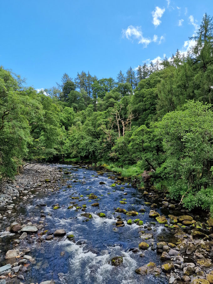 |
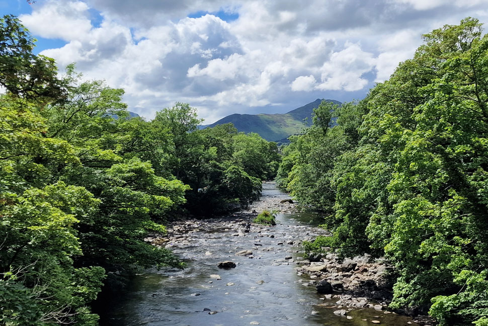
| The River Greta. |
| |
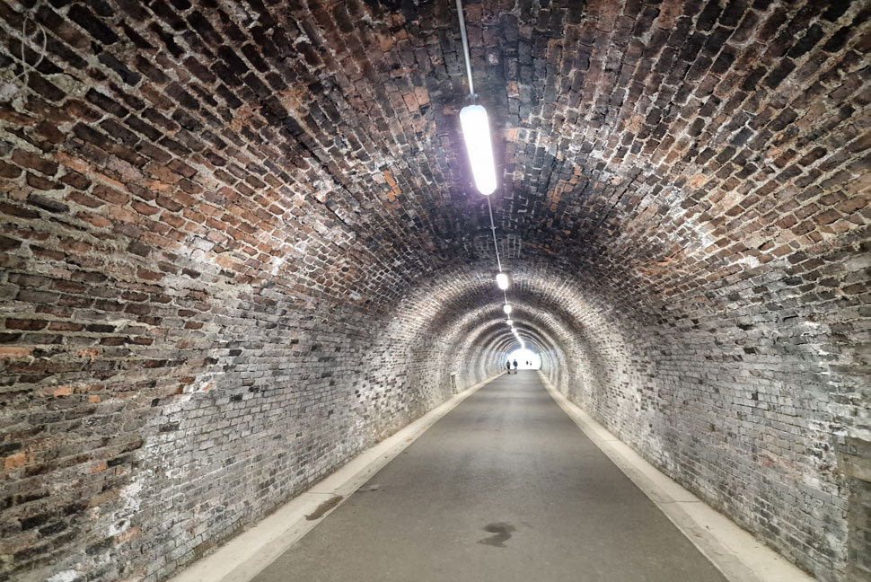 |
| Bobbin Mill Railway Tunnel. |
| Which was re-opned as part of the project after being bricked up for 40 years. |
 |
| Causey Pike and Rowling End from the River Greta. |
We estimated to walk from Threlkeld to Keswick in about an hour which we over ran by about ten minutes due to Rod being asked to complete a survey about the new path by two pretty young girls (had these been male I'm sure he would have passed!) I was asked too but from a safe distance declined. I was still wearning my jacket and my body tempreature felt like it was creeping into the red but with just five minutes of walking left I sweated it out when really I should have removed it miles eariler. Rod found a very narrow footpath walled between a treeline and a fence which was only wide enough for one person, sure enough we encountered a young girl walking a panting Husky and luckily there was just enough room to pass.
The footpath lead us onto a second path with Brundholme Road on one side and striking views of Lonscale Fell and Skiddaw on the other. Our cars came into view as did the many others which had parked up after us. Once my jacket was removed I waffed my base layer up and down to let the wind on my stomach and back which felt heavenly. We'd walked through everything from strong winds, sunshine and vertical rain and as a reward, the sun always came out afterwards. |
|
| |
| Back to top |
 |
|