|
The Glyders via the Y Gribin Ridge |
 |
 |
11th July 2020 |
 |
|
I had always planned to return to Snowdonia but due to the Welsh governments strict lock down guidelines I was unable to, that was until I read that the guidelines were to ease as of Monday 6th July which was when I set about planning this walk. My intentions on my return were to climb Tryfan and this is still true but my attention was diverted towards Glyder Fawr and Glyder Fach more commonly known as 'The Glyders' with each summit only being separated by less than a mile which has great appeal.
Most of the walkers I bumped into today had either ascended via the Devil's Kitchen or Bwlch Tryfan below Tryfans far south peak which are both great ascents but I wanted something different, more exhilarating so I chose to ascend via the Y Gribin ridge which starts from the shores of Llyn Bochlwyd via a grassy ridge which forms a sharp rock arete below the summit of Bwlch y Ddwy-Glyder, a ridge that takes you totally by surprise no matter how extensive my research were instead of claiming the Glyders as the highlight of the walk Y Gribin won hands down. |
|
| Ordnance Survey 17 |
 |
| Snowdon/Conwy Valley |
| |
| |
|
|
|
| |
|
Overview |
|
|
| Ascent: |
2,621 Feet - 799 Metres |
| Summits Over 3,000ft: |
2, Glyder Fawr - Glyder Fach |
| Weather: |
Overcast To Start With Some Sunny Spells. Sporadic Summit Cloud and a Cool Summit Breeze At Height. Highs of 18°C Lows of 7.4°C |
| Parking: |
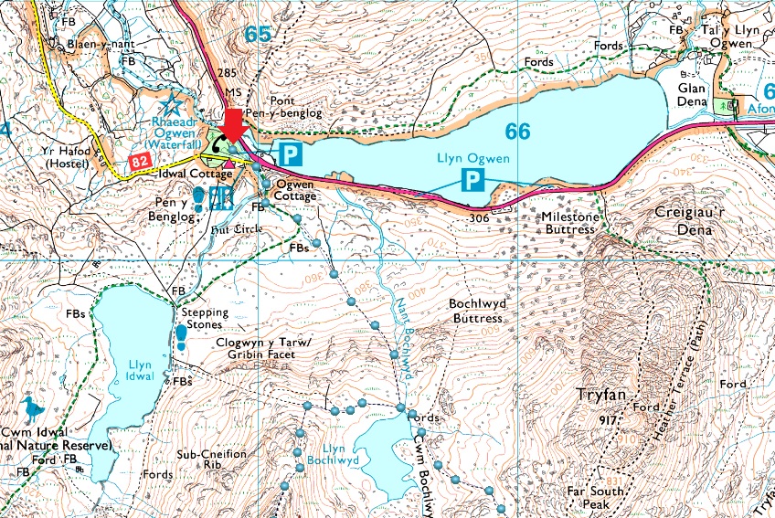
Car Park, Ogwen Tourist Centre, Just Off The A5, Ogwen |
| Area: |
Snowdonia National Park |
| Miles: |
5.2 |
| Walking With: |
On My Own |
| Ordnance Survey: |
OL17 |
| Time Taken: |
5 Hours 10 Minutes |
| Route: |
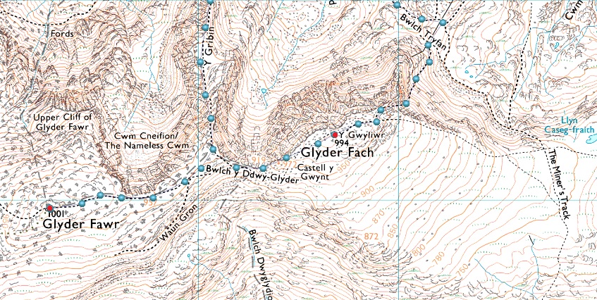
Ogwen Tourist Centre - Nant Idwal - Nant Bochlwyd - Llyn Bochlwyd - Y Gribin - Bwlch y Ddwy Glyder - Glyder Fawr - Bwlch y Ddwy Glyder - Castell y Gwynt - Glyder Fach - Y Gwyliwr - Bristly Scree Path - Bwlch Tryfan - Llyn Bochlwyd - Nant Bochlwyd - Nant Idwal - Ogwen Tourist Centre |
|
| |
|
Parking Details and Map |
|
|
| Nearest Post Code: |
LL57 3LZ |
| Grid Reference: |
SH 649 604 |
| Notes: |
Ogwen Tourist Centre offers two car parks which can accommodate up to eighteen cars, there is free off road parking along the A5 to the east along the shores of Llyn Ogwen. Parking Charges apply at Ogwen Tourist Centre during my visit I was charged £6.00 for all day or £4.00 for four hours. Parking up to twenty minutes is free. |
|
| |
|
Map and Photo Gallery |
|
|
  |
| |
| |
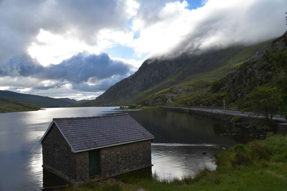 |
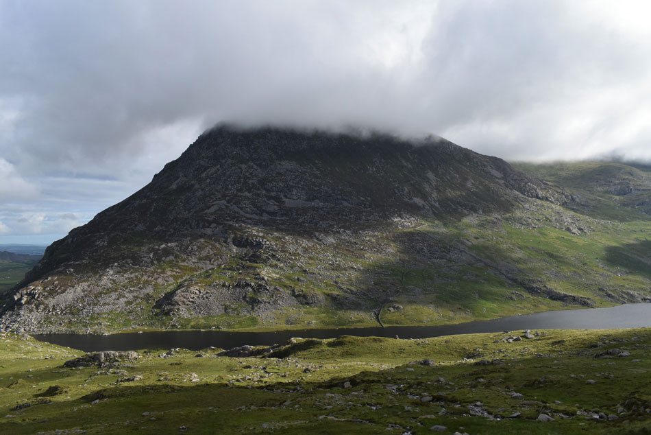
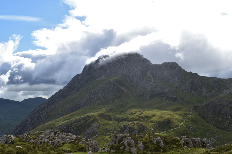
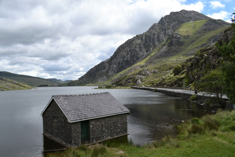
| Tryfan from Lyln Ogwen Boat House 7.30am 13°C |
With lock down measures eased I expected to find the car park at Ogwen Cottage bursting at the seams but it wasn't the case when I arrived around 7.20am with less than ten cars occupying the two car parks. I knew I wasn't in for a blue sky day, it felt more like Autumn rather than mid July with low cloud clinging to Tryfan's north ridge, surrounding peaks were also below cloud which I wasn't too phased about as it was forecast to lift by mid morning. My plan was to set of by 07:50am which gave me plenty of time to have a wonder down to the Llyn Ogwen boat house on the opposite side of the A5. It was here I stumbled across a young photographer who had set up a tripod and 'mornings' were shared "I've only enough battery left to take one or two more pictures" he explained, just when thing's where starting to get interesting I replied.
By 7:40 I was back at my car where I started to kit up adding my Montane soft shell if only to take the morning nip from the air. Last night while filling the car with fuel I asked the attendant to change a ten pound note for pound coins so I'd have enough change for the parking meter but on attempting to pay a sign had been put up explaining 'card payments only' blimey good job I had my wallet with me. Before I left I made use of the toilets to have a quick pee and took note of the social distancing rules which included only two people allowed in the toilets at the same time before returning to my car for a 'pat down' yep, got everything...hang on why do I need another pee! that'll be the nerves but not 'nervous nerves' good vibe nerves so I obliged my bladder again. |
 |
| Heading towards Nant Bochlwyd with a cloud topped Tryfan dominating the view. |
| Those who had parked up were also setting off and I followed a few pairs of walkers who where heading towards Llyn Idwal before I steered left at a fork in the footpath. I'm heading towards Llyn Bochlwyd via Nant Bochlwyd falls which can be seen in the dark area in the centre right of the photo. This is the same footpath used to climb Tryfan via Tryfan's Far South Peak or to you and me, the less scrambly route. |
 |
| Looking back on Pen yr Ole Wen seen over Llyn Ogwen. |
| With the cloud still lingering above the summits I backed off to a dawdling pace and began to enjoy my surroundings rather than focus on todays objectives which should allow time for the cloud to lift plus place me in a more relaxed mood rather than rushing through the day then before I know I'm heading home! I'm of course carrying a hard copy of todays route plus the mapping software on my phone but with any luck I won't need either after the amount of research the vast majority of todays route is held in my head.. |
 |
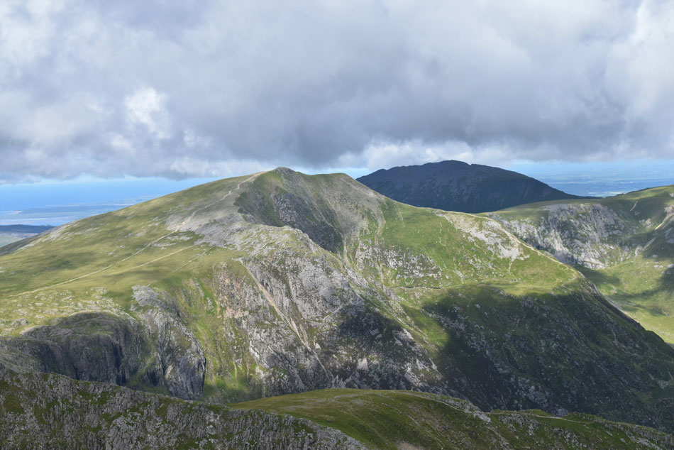
| Looking back on Y Garn, Foel-goch and Y Llymllwyd. |
| Whose summits are just about to clear from cloud. |
 |
| Pen yr Ole Wen with Llyn Ogwen widening out below. |
| |
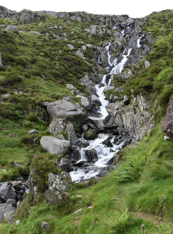 |
| Nant Bochlwyd falls. |
| The path rises steeply alongside Nant Bochlwyd falls where despite taking my time I pass a solo walker who had set off from Ogwen Cottage ahead of me. It was during this ascent I am passed by two walkers in descent who appeared to be brothers and we stopped to chat for a few minutes "cloudy up top I asked" aye it's clear one minute then cloudy the next one brother replied while the other chipped in "didn't stop me going for a dip in Lyln Bochlwyd" he laughed..."rather you than me I replied!" |
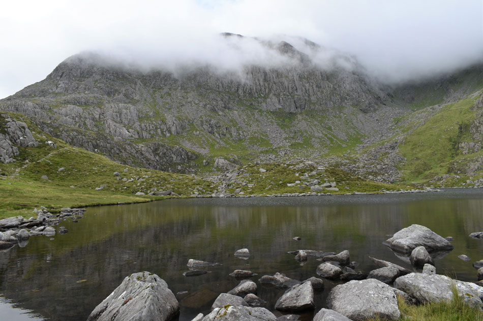 |
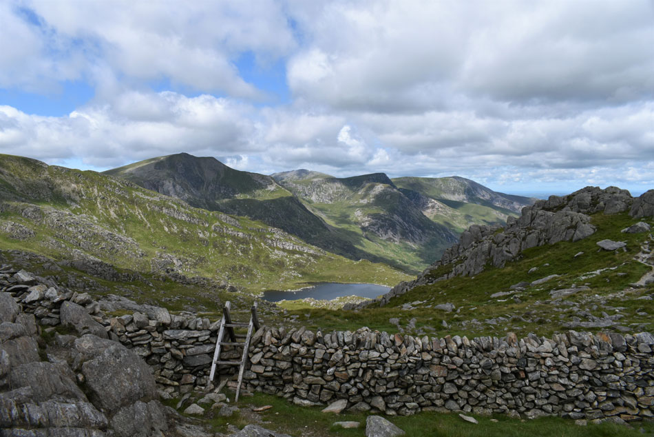
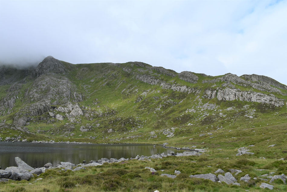
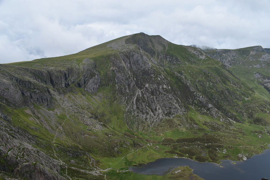
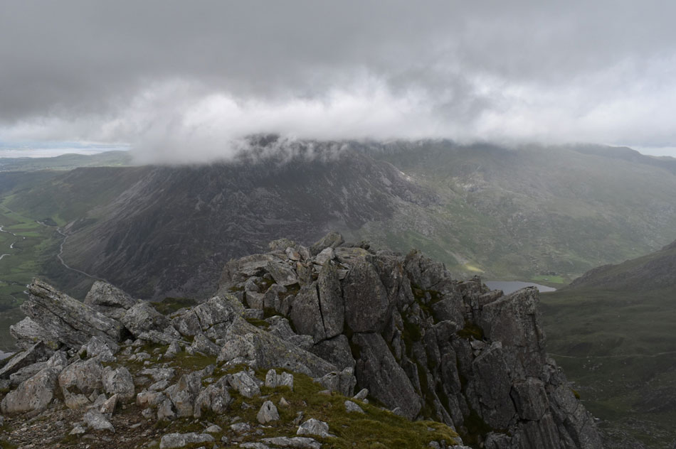
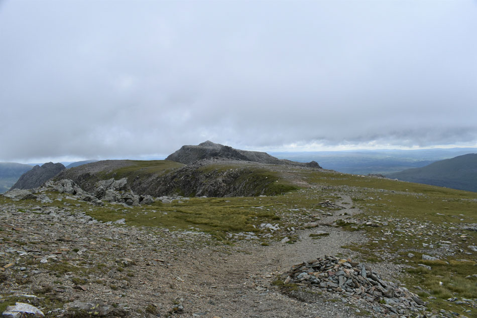
| Bristly Ridge (left) and Glyder Fach from Llyn Bochlwyd. |
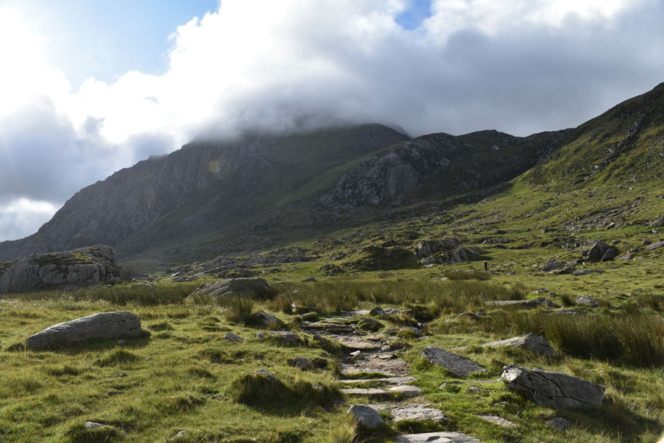
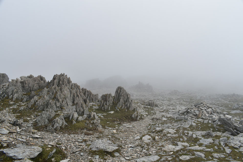
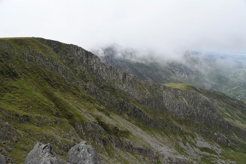
The path alongside Nant Bochlwyd falls was as reminiscent of any path found in Great Langdale with blocks of stone pitched perfectly into the path. Soon I arrived at Llyn Bochlwyd and the question I had been asking myself during my early ascent was answered, Glyder Fach summit was indeed below cloud and Y Gribin arete (far right) was immersed in thick swirling mist but I keep faith in the ever changing conditions as well as the forecast. |
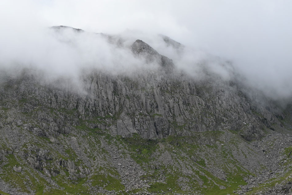 |
| Summit cloud, Glyder Fach. |
| Menacing but dramatic all the same. |
 |
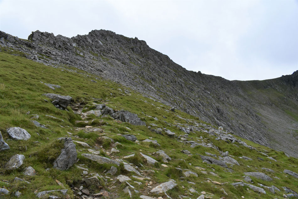
| The start of the Y Gribin Ridge from Llyn Bochlwyd. |
| I followed a grassy trod along the shores of Llyn Bochlwyd towards the footpath at the start of the Y Gribin ridge. My slow pace had allowed a few walkers to catch up who had just arrived at Llyn Bochlwyd all of whom continued towards Bwlch Tryfan, and the Far South Peak, for now it appears I shall have Y Gribin to myself. |
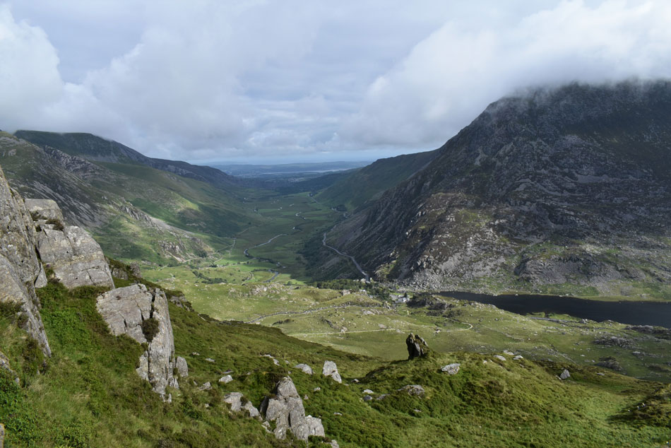 |
| The view through the Ogwen Valley from Y Gribin Ridge. |
| With Pen yr Ole Wen seen right, Elidir Fawr over on the left and the Menai Straights seen in the distance. |
 |
| Continuing ahead, Y Gribin Ridge. |
| I continue to follow a good path (seen right) which steepens with height gained. The cloud is playing dramatics and I am treated to a wonderful cloud display over Tryfan which changes minute by minute. |
 |
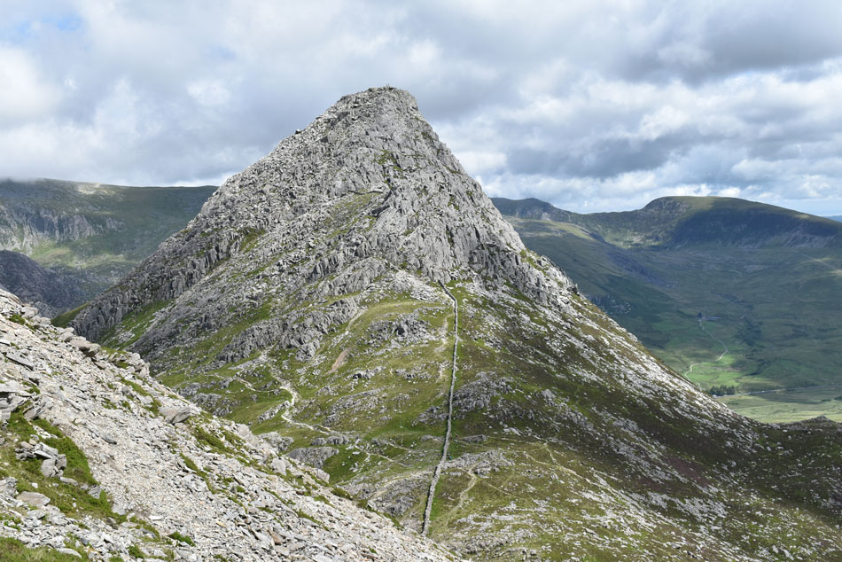
| Tryfan and Tryfan Far South Peak from Y Gribin. |
| The footpath seen below is the one I've just left at Llyn Bochlwyd but will be using on my return later. |
 |
| The Devil's Kitchen, Y Garn, Foel-goch and Llyn Idwal from Y Gribin. |
| With more height gained I was treated to teasing views over Llyn Idwal towards Y Garn from which the voices of its morning ascenders could be clearly heard. |
 |
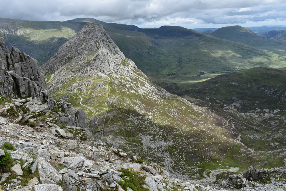
| Dramatic views over Llyn Ogwen, Llyn Bochlwyd, Tryfan, Tryfan Far South Peak and Bwlch Tryfan. |
| Bwlch Tryfan is the area given to col (seen right) which divides Tryfan from Bristly Ridge, I'll be up close and personal with Bwlch Tryfan (col) later once I have descended Glyder Fach. |
 |
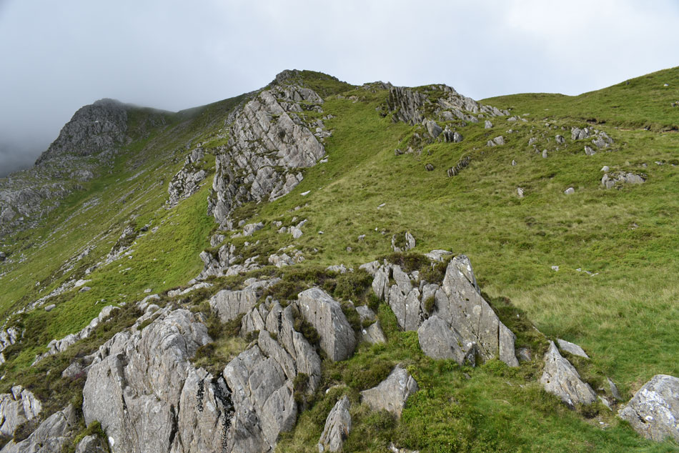
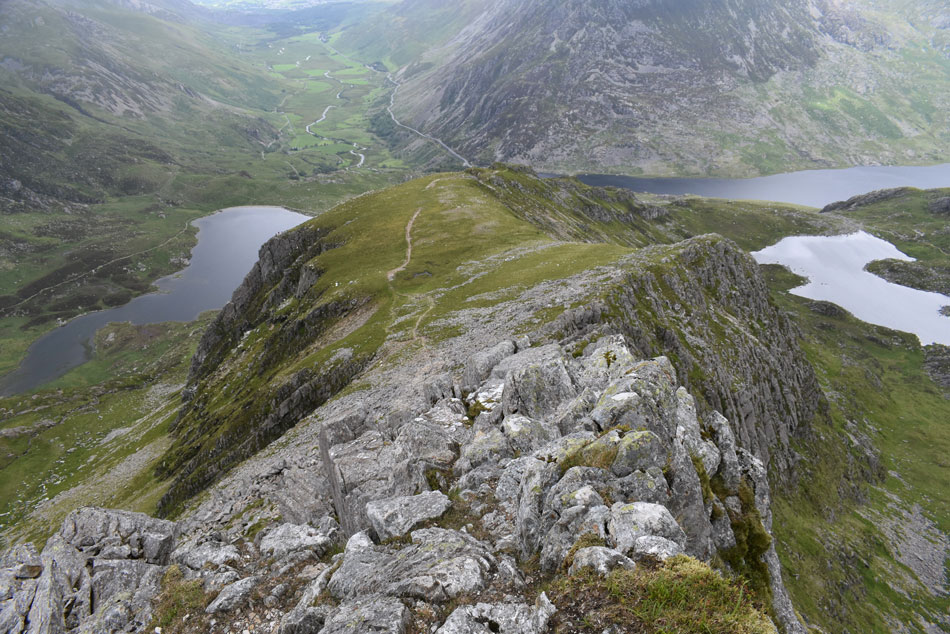
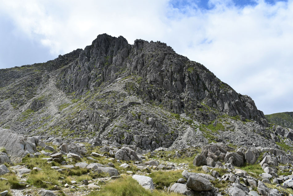
| Y Gribin comes into view. |
| I continued with my ascent while my view ahead is always obscured by the grass ridge ahead of me, that was until I reached the grassy plateau which forms at the head of a rock buttress from which I could hear the voices of climbers ascending. |
 |
| Y Gribin and Cwm Cneifion - The Nameless Cwn. |
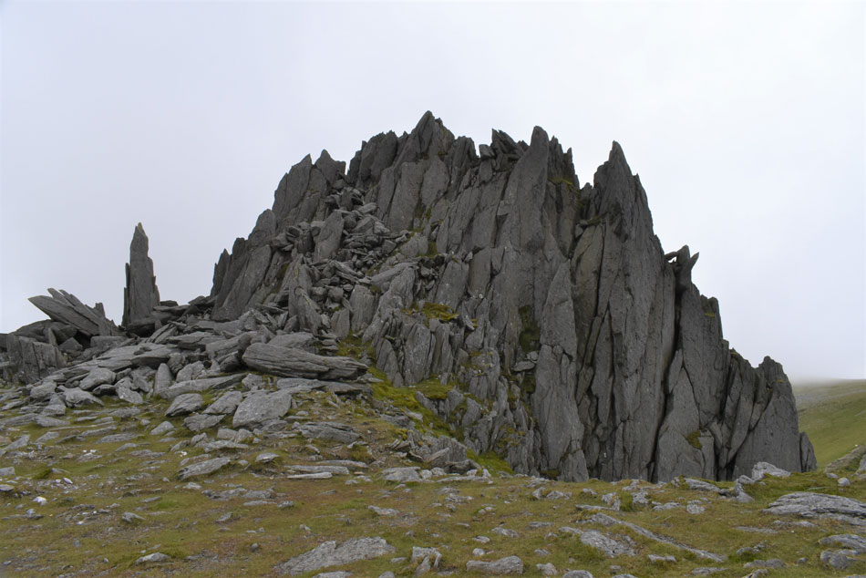
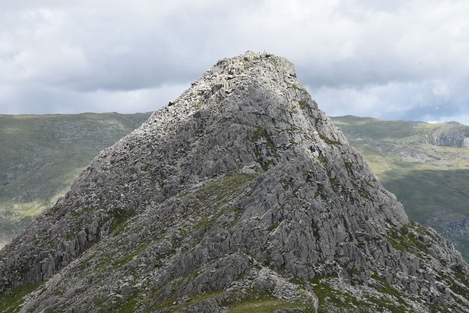
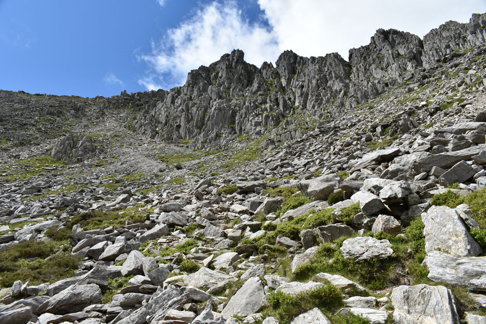
| On reaching the grassy plateau I was presented with the intimidating view of Y Gribin as its grass slopes made way for pulverized rock thrusted up to form a knifes edge arete, my calm exterior disguised the somersaults inside my stomach, this was it, there was no going back now. I take control and study my route of ascent, a path to the right avoids the main ridge, parts of which I will use but my plan is to traverse the ridge for as much as I can. |
 |
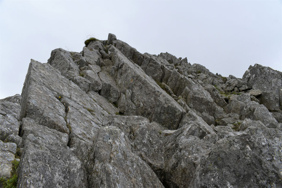
| Y Gribin. |
| |
 |
| Views down towards the Ogwen Valley and Pen yr Ole Wen from Y Gribin. |
I followed the path over the grassy plateau from which three climbers emerged from the rock buttresses during which time it had started to drizzle, its timings couldn't of come at a worse time but thankfully nothing more came of it. I studied the ridge with content, this is what you can't see on Google Earth I thought; my confidence growing which each step closer.
I scanned the ridge like something from the Terminator movie making sure I'd covered every inch of path and rock from base to summit, one path seamlesley came to an abrupt stop where scrambling upward onto the arete was the only way forward - this was where I would let my hands and feet do the work. |
 |
| Tryfan from Y Gribin. |
| |
 |
| Onwards and upwards. |
The path split again where I had the option to steer below the ridge or scramble above it, I studied my route from below taking into account that if I had a leg wobble I'd be able to make my way back down. The route up was good to go, and for the very part, enjoyable although I tried not to peer too far over to my left where a 800ft vertical drop plumited below.
If anyone ever needed a longer, perhaps more exposed version of Sharp Edge then Y Gribin it is. |
 |
| Tryfan, Tryfan Far South Peak, Bwlch Tryfan and Bristly Ridge from Y Gribin. |
| |
 |
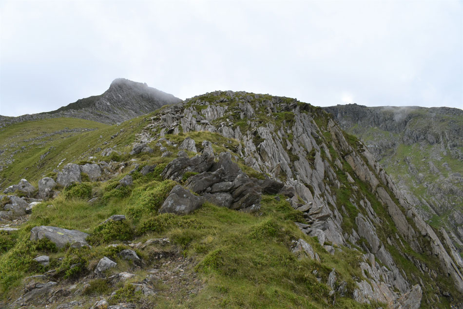
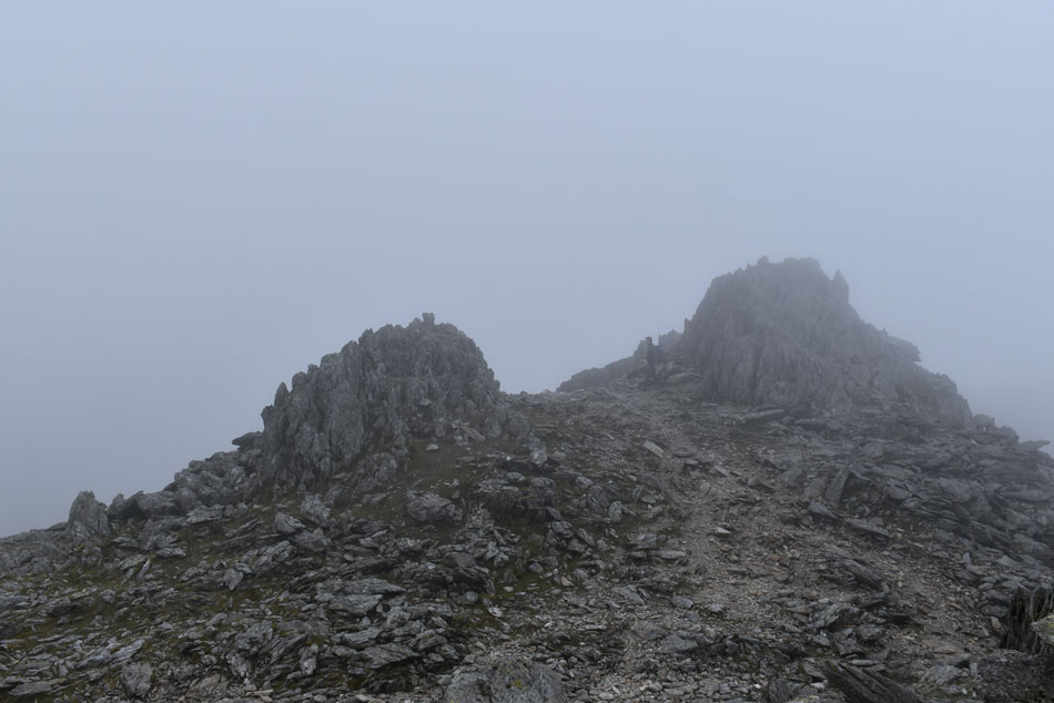
| Looking back onY Gribin. |
| Not only was I reminded of Sharp Edge but I also came across a crux very much alike the one found on Sharp Edge and just like the crux on Sharp Edge I I eased myself down while taking second and third point contact at the same time. From the crux the scramble up looked too daunting where small blocks of rock formed the base of rock towers, ahead, the "chicken out path" which I followed until I'd out-flanked the rock towers, then I began the easy scramble towards the top. |
 |
| Dramatic views keep the pulse going. |
| |
 |
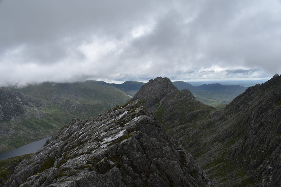
| Y Gribin Ridge from Y Gribin. |
| With Tryfan and Pen yr Ole Wen looking menacing in the low light. |
 |
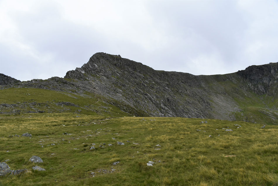
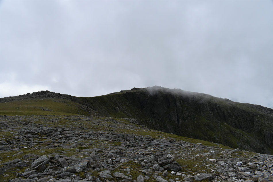
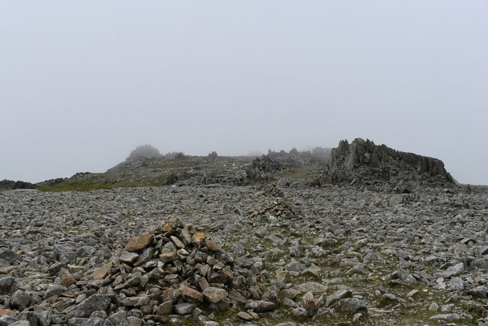
| Perched boulders at the top of Y Gribin with Glyder Fawr in the distance. |
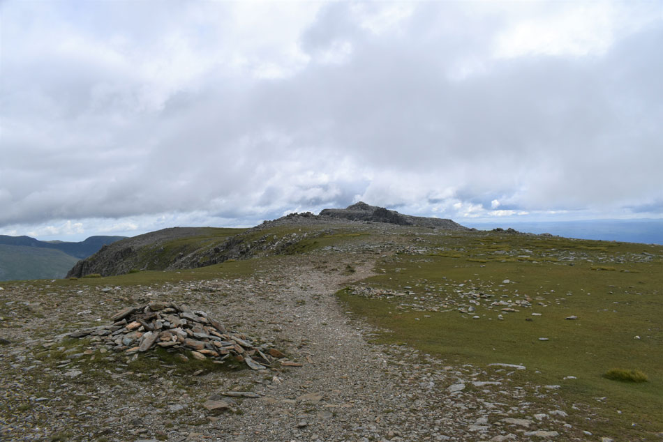
| Feeling exhilarated I reached the top of the ridge and downed my pack to grab my walking poles that I had collapsed at the base of Y Gribin . By now the cloud was swirling just feet above my head but thankfully the ridge route to Glyder Fawr was clear, Before I head out I walk back to the summit of Y Gribin which was marked by a large cairn |
 |
| Pen yr Ole Wen from the top of Y Gribin. |
| |
 |
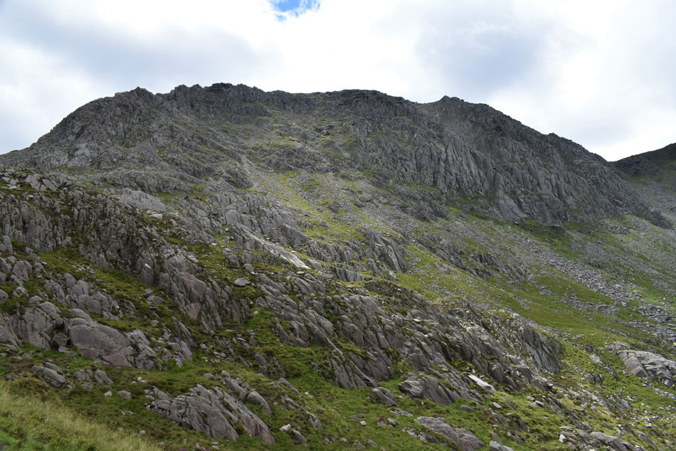
| Glyder Fawr from Bwlch y Ddwy-Glyder. |
| With my walking pole handles looped around my hands I set off for Glyder Fawr, my stomach still performing cart-wheels from the ascent of Y Gribin. If anything was going to return my nerves to normal it was the pleasant walk between Bwlch y Ddwy-Glyder and Glyder Fawr summit. |
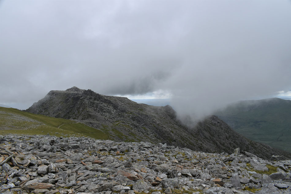 |
| Between a gap in the cloud Glyder Fach appears. |
| I am somewhat impressed by the size of Glyder Fach summit rocks not to mention Castell y Gwynt seen in the foreground. |
 |
| The Y Gribin Ridge over Cwm Cneifion - The Nameless Cwn with Glyder Fach over on the right. |
| |
 |
| Looking back on Tryfan and Glyder Fach seen over Bwlch y Ddwy-Glyder. as I approach Glyder Fawr. |
| By now it's mid morning and I seem to be doing ok by time but as for the cloud that was meant to lift I think I'm going to have to wait a while longer. |
 |
| Glyder Fawr rock strewn summit plateau. |
| It's just a case of following the stone cairns towards the summit seen left. |
 |
| Glyder Fawr summit. |
| By the time I arrived at Glyder Fawr summit the cloud had descended and with it, came a drop in temperature. I make my way over and strike up a conversation with a young fellow from Shropshire who was adding layers having ascended via the Devil's Kitchen route, he explained it was his first time on Glyder Fawr and like me was heading onto Glyder Fach afterwards, it felt good knowing I wasn't the only newbie on the Glyders this morning. |
 |
| Retracing steps as I head back towards Bwlch y Ddwy-Glyder. |
| The low light and swirling cloud felt a little eerie. |
 |
| Moon scape. |
| |
 |
| Glyder Fach seen over Bwlch y Ddwy-Glyder. |
| That's much better and with any luck I'm hoping that's the last I'll see of the low cloud. |
 |
| Lighting the way. |
| I passed over Bwlch y Ddwy-Glyder then began the grassy descent towards Glyder Fach. |
 |
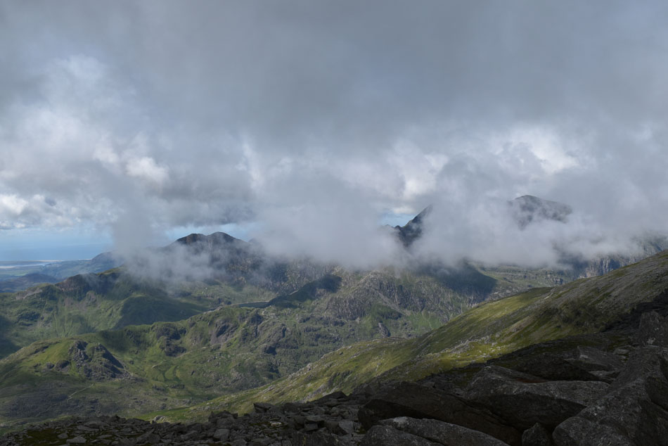
| Looking back I get a glimpse of the Snowdon Horseshoe as the cloud begins to lift. |
| That's Grib Goch seen right with Snowdon's summit below cloud far right. |
 |
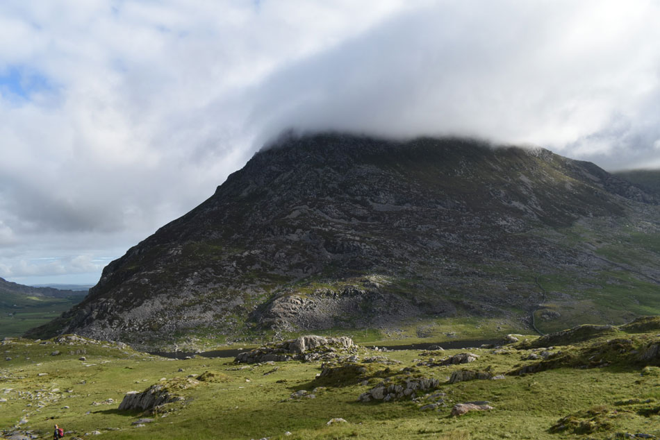
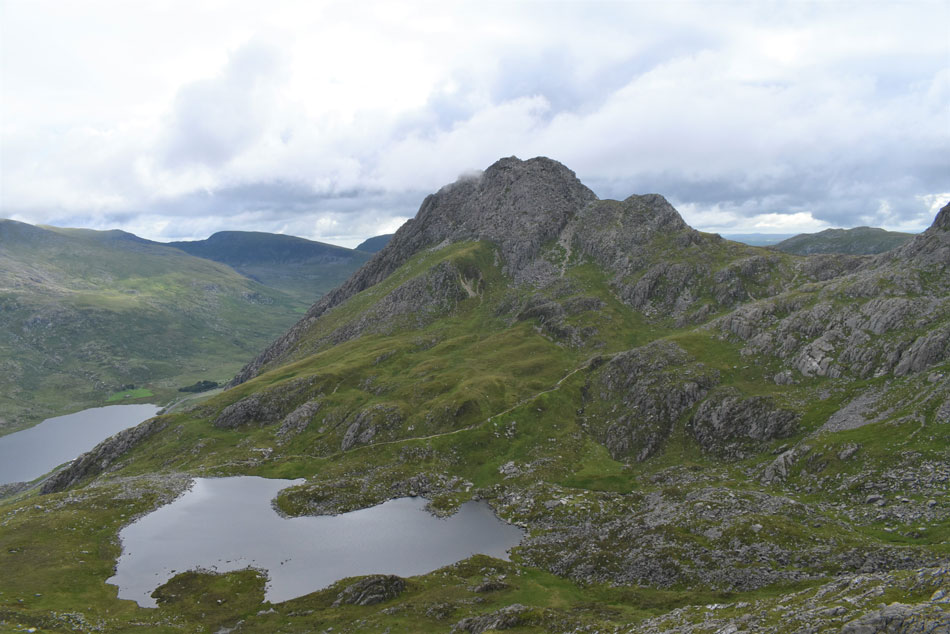
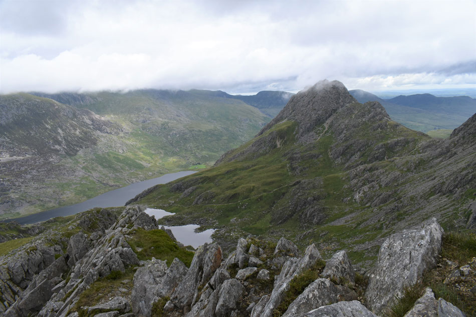
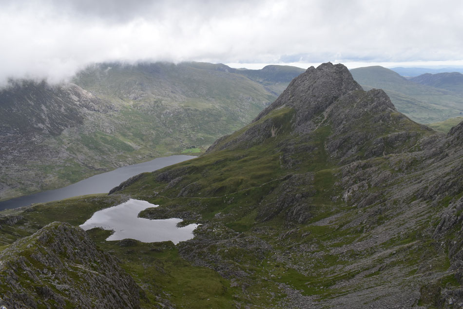
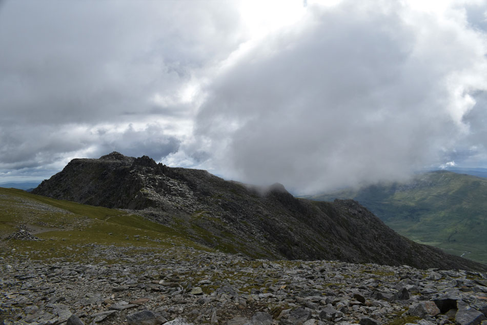
| Glyder Fach from Castell y Gwynt. |
| I left the grassy plateau behind and followed a rocky path to the western base of Castell y Gwyntt, the obvious route was to head up over huge granite rock slabs which were fun to negotiate taking care not to ascend to high unless your goal is to summit Castell y Gwynt itself. A young man passes through the rock slabs as I contemplated my next move, he had inadvertently paved my exit from the rock slabs so I follow his route which lead me around the base of Castell y Gwynt from where I took this photo looking out towards Glyder Fach summit. |
 |
| Castell y Gwynt/Glyder Fach. |
| Made famous by featuring in Walt Disney's Dragonslayer along with the Cantilever Stone which I'll be visiting after summating Glyder Fach, what a place! |
 |
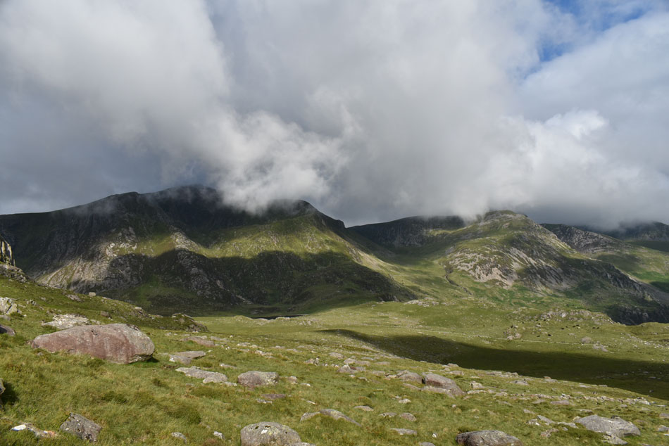
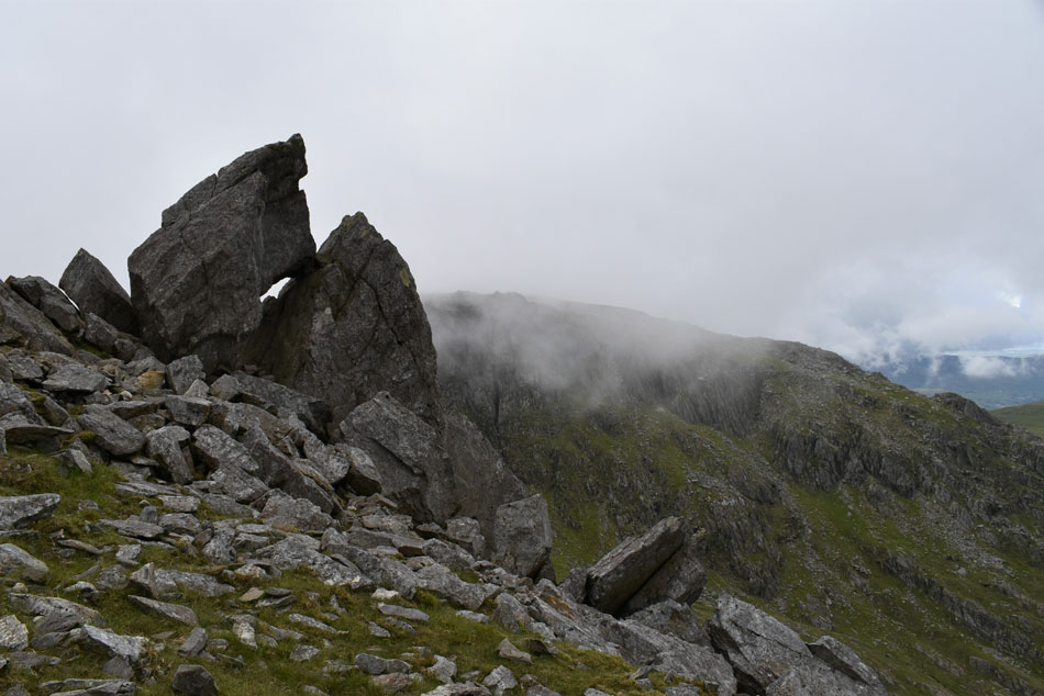
| An extended view of Y Gribin and Cneifion Arête from Glyder Fach. |
| |
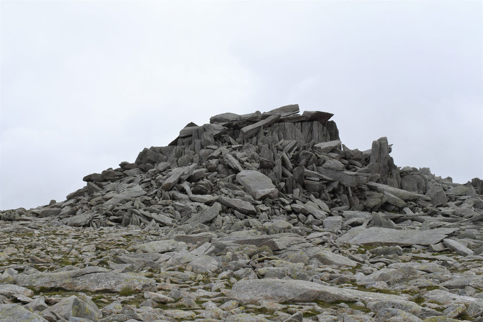 |
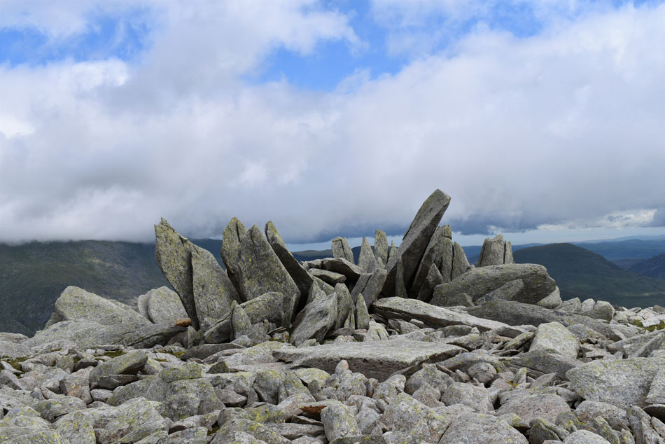
| Glyder Fach summit. |
| With Castell y Gwynt behind me I made my over towards the summit where I was mesmerised by the size of rock which make up the summit some of which rose vertically (see right) while others the size of small cars surround, no wonder the summit stands out for miles. |
 |
| The Snowdon Horseshoe from Glyder Fach summit. |
| Reaching the top of the summit was much harder than it looked after choosing two routes from which I had to turn back from after rock slabs gave way for ground too high to climb out from. Eventually after doing a full circle of the summit I weaved my way over slab and rock and took a seat while taking in the view over the Snowdon Horseshoe. |
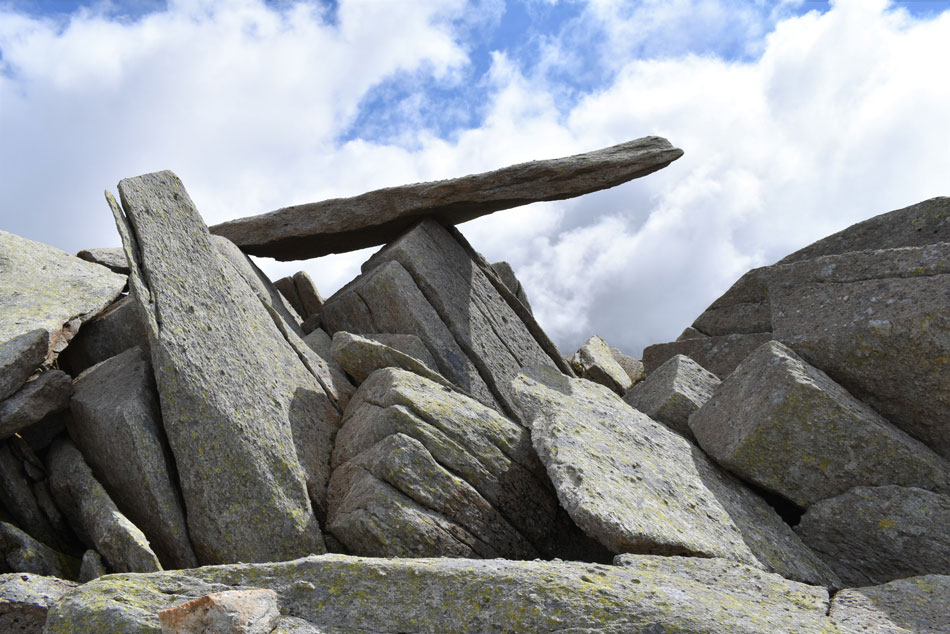 |
| The Cantilever Stone, Glyder Fach. |
| I carefully descended the summit using the same route I had ascended by before making my way over towards the Cantilever Stone which is another feature of Glyder Fach summit by which time the sun had come out and the drizzle and cloud was just a fading memory. |
 |
| Magnificent rock structure, Glyder Fach. |
| |
 |
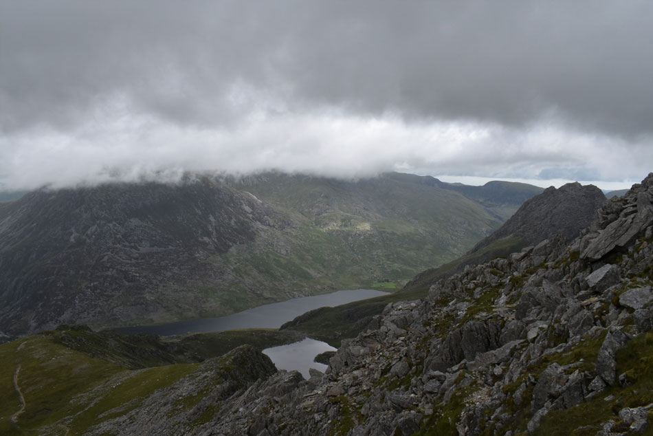
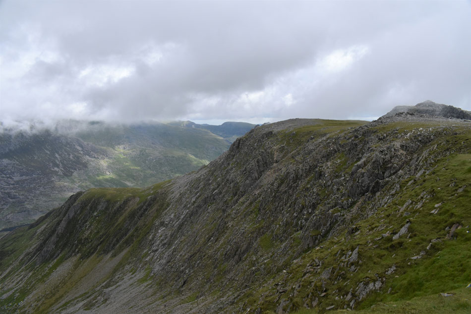
| The Devil's Kitchen, Y Garn from Glyder Fach. |
| With Y Gribin's grassy plateau seen below. |
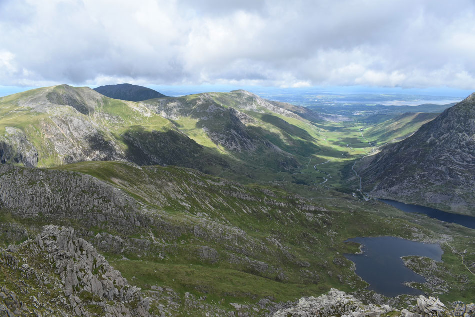 |
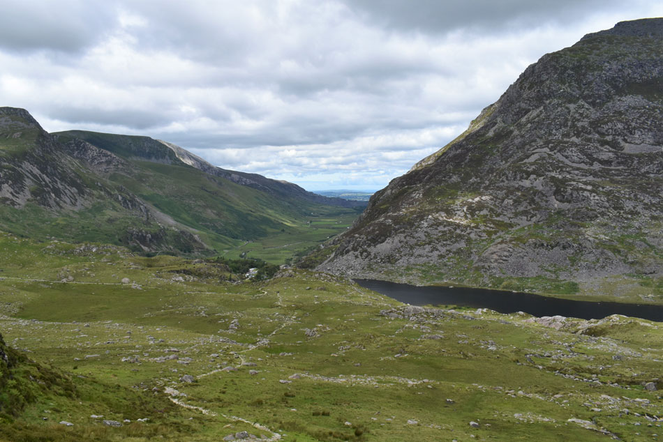
| The Ogwen Valley. |
| I can actually see my car from here but never mind that, what a view! |
 |
| Tryfan and Tryfan Far South Peak from the top of Bristly Ridge. |
| I left Glyder Fach and started to make my way towards the top of Bristly Ridge, it's from here I start to make my descent via Bristly Scree Path. |
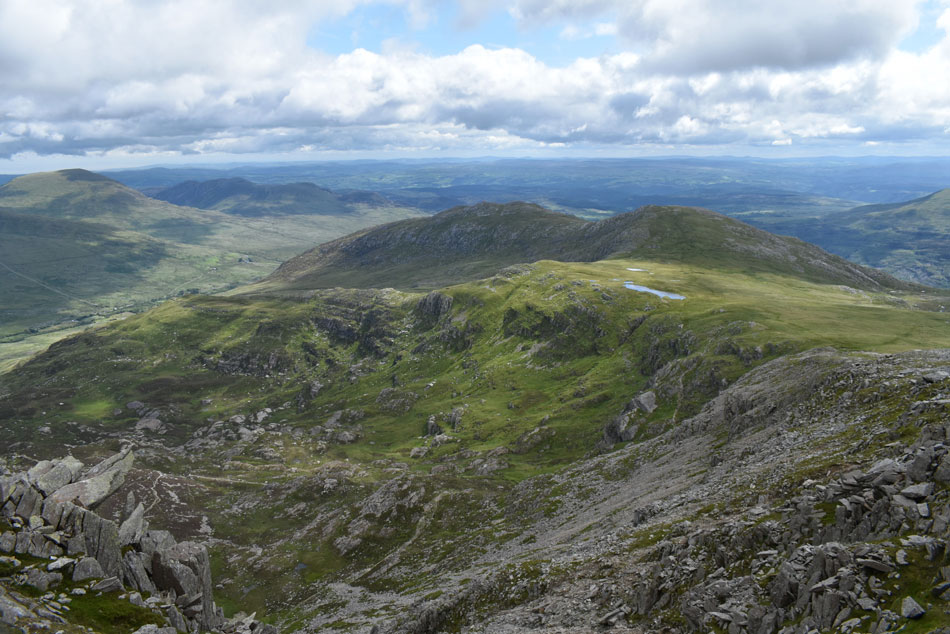 |
| Cwm Tryfan from the top of Bristly Scree Path. |
| |
 |
| Tryfan from the top of Bristly Scree Path. |
| If your thinking "that looks steep" then you'd be right. Bristly Scree Path isn't for the faint hearted and with care, took me the best part of forty minutes to descend a hellish 750ft. There is a path on the Bristly Ridge side (left) and a second path can be found towards the right, both of which are heavily eroded, loose and very steep but with the aid of walking poles and a lot of patience a safe descent can be negotiated. |
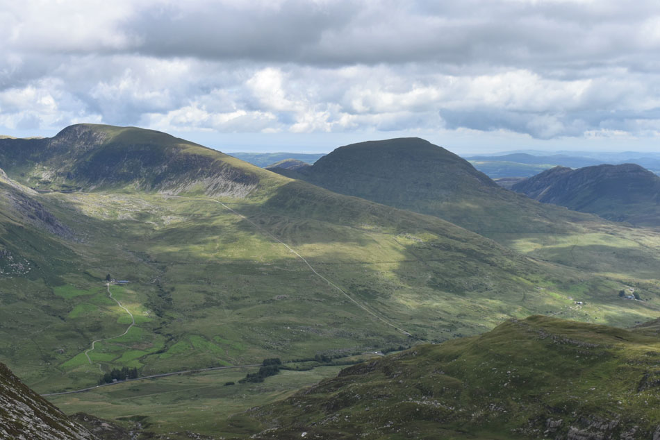 |
| Views over the A5 towards Y Braich, Pen Llithrig y Wrach and Creigiau Gleision. |
| |
 |
| Sunlight captures Tryfan. |
| Which is looking busy with plenty of walkers on the summit, tempting, very tempting. |
 |
| Tryfan with Bwlch Tryfan below. |
| The walled area known as Bwlch Tryfan is where I'm heading next, it's a busy place with people passing en-route to Glyder Fach, Tryfan and the Bristly Ridge, I'm hoping to stop there for lunch soon. |
 |
| The Eastern flank of Bristly Ridge with Bristly Scree Path seen left. |
| It's fair to say I won't be forgetting Bristly Scree path in a hurry! Aside the numbness in my feet the path does offer outstanding views over Tryfan and Tyrfan Far South Peak so it gets forgiven, it's now time for a well earned lunch. |
 |
| Todays lunch with a view. |
| Bristly Ridge. |
 |
| Bristly Ridge and Y Gribin. |
| With lunch over I started to make my descent towards Llyn Bochlwyd using the same path that I'd spotted from Y Gribin earlier. |
 |
| Glyder Fach. |
| With Bristly Ridge seen left. |
 |
| The Ogwen Valley. |
| Pen yr Ole Wen to the right. |
 |
| Back at a favourite haunt. |
By the time I was descending alongside Nant Bochlwyd falls my body started to feel like I'd given it a real workout with rugged ground underfoot for much of the way my legs were feeling like I'd walked twice as many miles. The ground levelled as the midday sun dried the sweat across my forehead while I randomly kick my aching feet into the backs of my boots. I soon joined the main foot path for Llyn Idwal and with it I start to pass the masses most of whom were tourists out for a stroll. Before I pass Nant Idwal via the wooden bridge I'm passed by a group of fell runners before I stop to look back on Glyder Fach which by now is partially hidden by high ground known as Gribin Facet.
Ogwen Visitor Centre is descended upon and next to it I can see that the ice cream stall is open which explains why everyone is eating ice cream except for me that is. I'd saved one sandwich and a chocolate bar for one of my favourite places in the Ogwen Valley, right next to the Boat House where I sat down, backed off my laces and finished off lunch under the gaze of Tryfan, a mountain that had featured so heavily in todays walk but was sadly a mountain too far. |
|
| |
| Back to top |
 |
|