 |
Y Garn via Devil's Kitchen from Ogwen |
 |
 |
18th January 2020 |
 |
|
Strangely enough I have Highways England to thank for this walk because it was they who at the beginning of January reported that the M6 northbound would be closed every weekend for the rest of the month to enable for them to remove a bridge, the bridge was removed in just one weekend but by then I'd already gone to ground to see where else I could walk taking a specific interest in the Snowdonian, and Peak District National Parks.
Even with these options I couldn't just dive and drive straight in, I like to plan to a point where I've walked the route in my head before boot has set foot on fell and this planning lead me to Y Garn in the northern range of the Snowdon National Park. At 3,106 feet Y Garn is Wales's 7th highest peak and can be linked with Foel-goch to the north and the Glyder's to the south but I won't be taking on such challenges today, today I choose to gain Y Garn via Devil's Kitchen, it's a route I've only ever read about in much detail and all that was required was a green light forecast, today I got that forecast. |
|
| Ordnance Survey 17 |
 |
| Snowdon/Conwy Valley |
| |
| |
|
|
|
| |
|
Overview |
|
|
| Ascent: |
2,105 Feet - 642 Metres |
| Summits Over 3,000ft: |
Y Garn |
| Weather: |
A Cool To Start With Mixed Cloud Above The Summits, Turning Brighter Late AM. Highs of 6°C Lows of 1°C Feels Like -2°C |
| Parking: |
Car Park, Ogwen Tourist Centre, Just Off The A5, Ogwen |
| Area: |
Snowdon National Park |
| Miles: |
4.7 |
| Walking With: |
On My Own |
| Ordnance Survey: |
OL17 |
| Time Taken: |
4 Hours |
| Route: |
Ogwen Tourist Centre - Nant Idwal - Llyn Idwal East Shore - Idwal Slabs - Devil's Kitchen - Llyb y Cwn - Y Garn - Y Garn North East Ridge - Llyn Clyd - Llyn Idwal - Nant Idwal - Ogwen Tourist Centre |
|
| |
|
Parking Details and Map: Car Park, Ogwen Tourist Centre, Just Off The A5, Ogwen |
|
|
| Nearest Post Code: |
LL57 3LZ |
| Grid Reference: |
SH 649 604 |
| Notes: |
Ogwen Tourist Centre offers two car parks which can accommodate up to eighteen cars, there is free off road parking along the A5 to the east along the shores of Llyn Ogwen. Parking Charges apply at Ogwen Tourist Centre during my visit I was charged £6.00 for all day or £4.00 for four hours. Parking up to twenty minutes is free. |
|
| |
|
Map and Photo Gallery |
|
|
 |
| |
| |
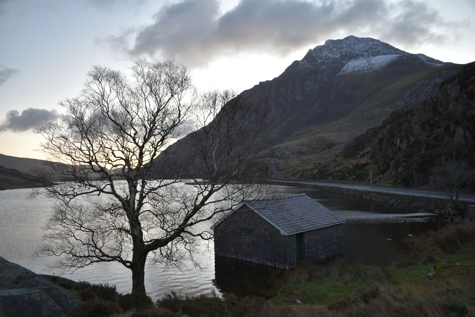 |
| Tryfan from Llyn Ogwen Boat House 08:10am 2°C |
It was still dark when I arrived at Ogwen Tourist Centre but the signs were there sunrise was just around the corner. I managed to park right opposite the footpath close to the Visitor Centre and helped myself to a cup of hot Vimto while waiting for sunrise. The Visitor Centre car park was starting to fill quickly and resembled a fashion show for outdoor gear enthusiasts most of whom were wearing B1 and B2 rated climbing boots along with technical ice axes fastened to the backs of their packs which made me wonder did they know something that I didn't? Another camper van draws up one space over to my car and two young lads jump out and start taking pictures from funny angles of his camper van, my eyes however, are drawn to the off side front wheel which has gone over the white line which sets off my OCD but all this is temporary as all they wanted to do it seems was stop to take photos and they left soon after. I wander over to the ticket machine where an orderly queue has formed, the guy right at the front is paying with his credit card and can't read the instructions which is causing a line of frustration while I shivered waiting at the back of the queue. Glimpses of light start to appear but by no means was it filling the sky, Tryfan's summit stole all my attention while walking back to the car from where I start to kit up. It's relatively mild with only the slightest of breezes blowing yet despite this I kit up in full Winter gear packing my crampons along with my trusty long handled Grivel ice axe, anything that I wasn't wearing gets packed into my pack which is heavy and appears to be at busting point.
After a sweep of the boot I locked my car, the light was still dim but that didn't stop the crowds from setting off for Llyn Idwal, I hadn't really familiarised myself with faces leaving the car park but during the course of the morning I will. The light is still low so instead of starting my walk I left the Visitor Centre and crossed the A5 just so I could get a wider view of Tryfan, finding a gate in the wall I found the perfect spot close to the Llyn Ogwen Boat House where I hung around a while - eyes gazed upwards whilst thinking "that's one hell of a mountain" that it maybe, but by Summer hopefully I would have climbed it.
I realise I need to pee. |
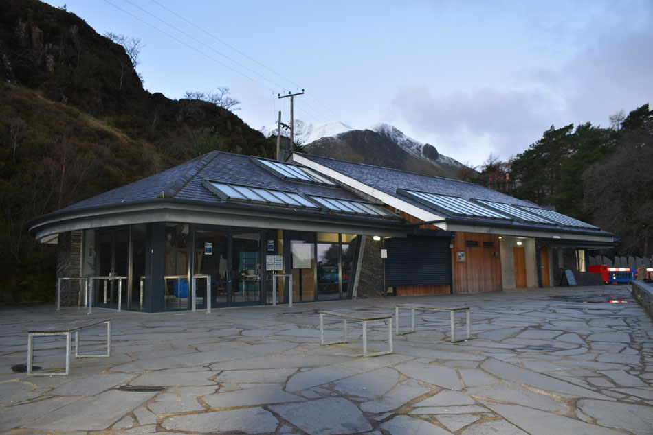 |
| Ogwen Visitor Centre. |
| It was time to head back to the Visitor Centre and used the toilets at the far end were one chap, like me was fully kitted up although unlike me he was having a one on one conversation with a guy sat in a cubicle, we locked eyes on my way out and shared a nod, he had an Australian accent and was wearing a GoPro camera fixed to his chest which I hoped wasn't recording. From the Visitor Centre I head right and onto the path bound for Llyn Idwal. |
 |
| First light over Pen yr Ole Wen from the approach to Llyn Idwal. |
| Along with Tryfan, Pen yr Ole Wen dominates Ogwen from the A5. It is a colossal mountain and ranks as Wales 11th highest peak, here I look back on Pen yr Ole Wen which is labelled as one of the most unsympathetic ascents in Snowdonia, you can definitely see why. Note the erratic boulder in the foreground. |
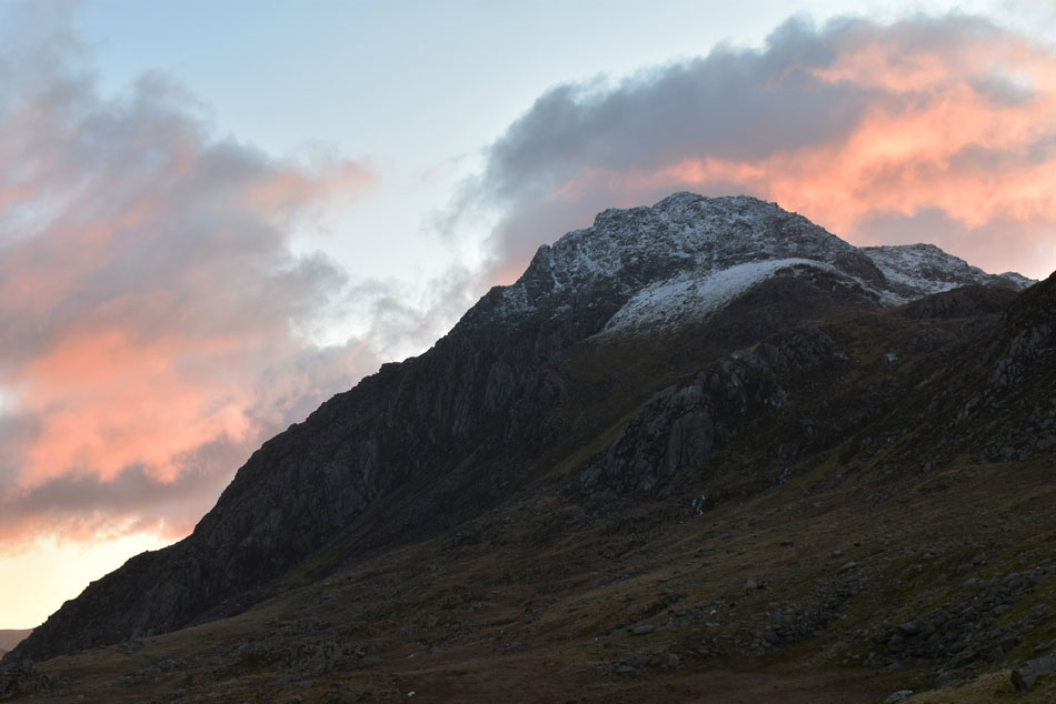 |
| Tryfan sunrise. |
| Turning around I took this picture of Tryfan as the sunrise illuminated the morning sky behind. |
 |
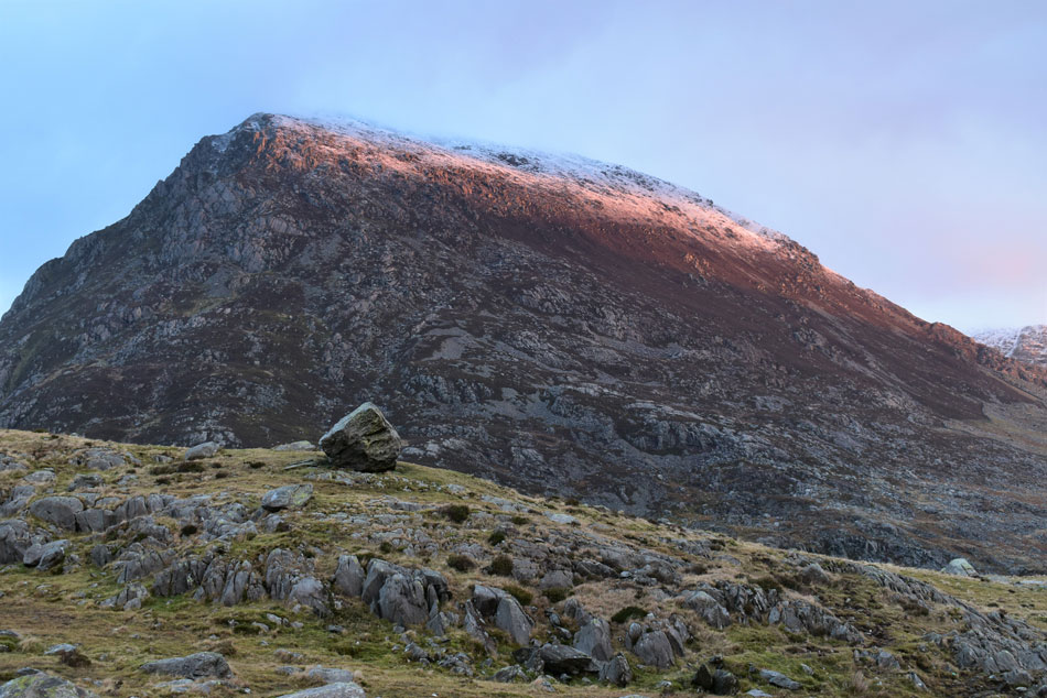
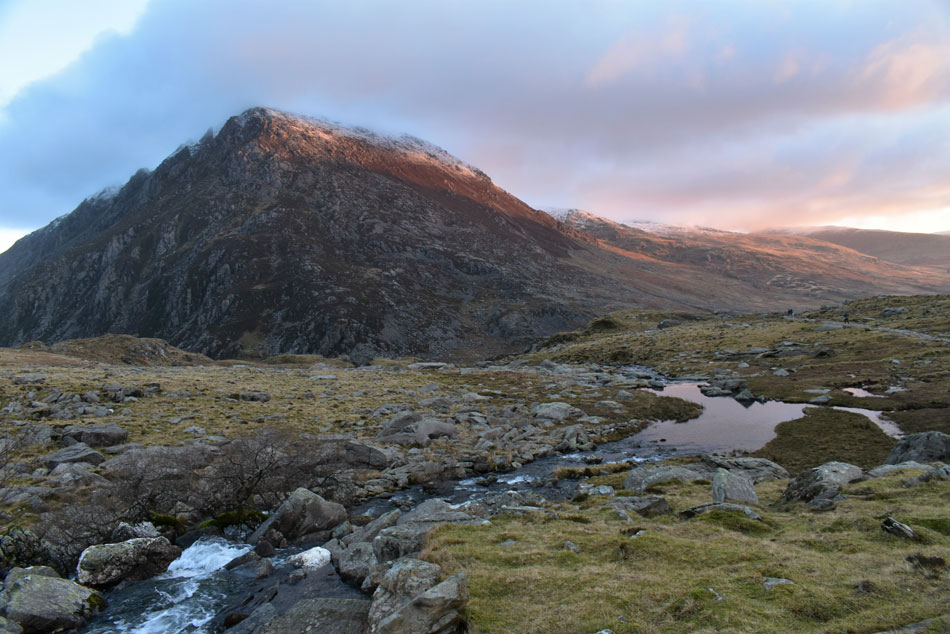
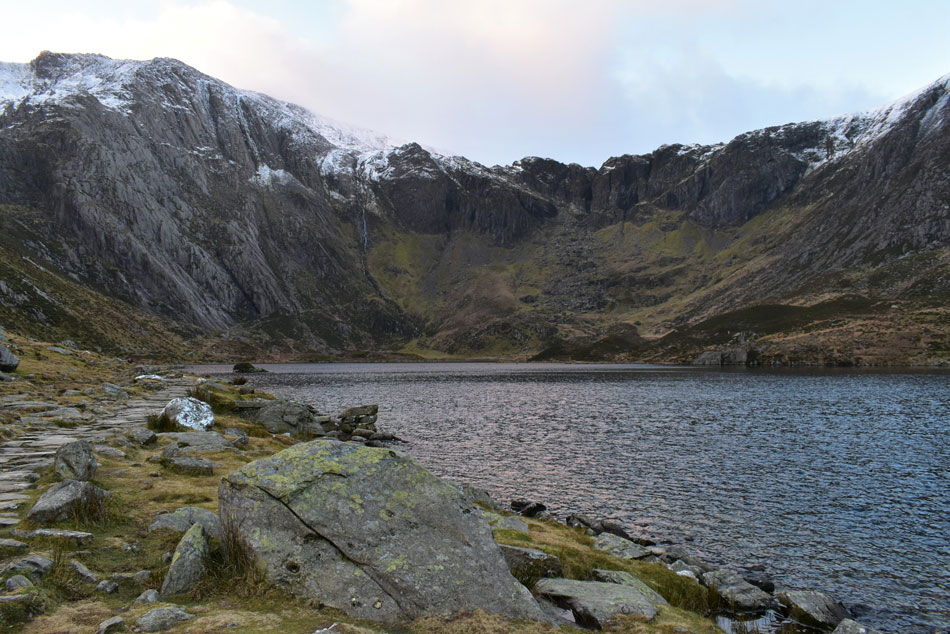
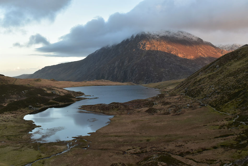
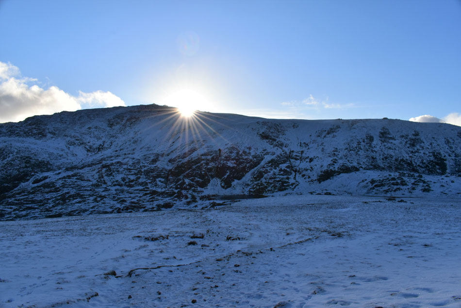
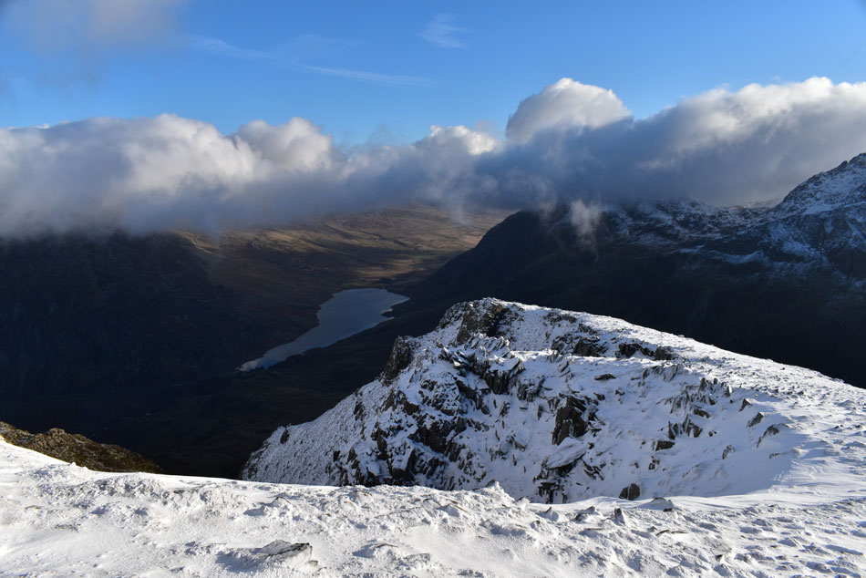
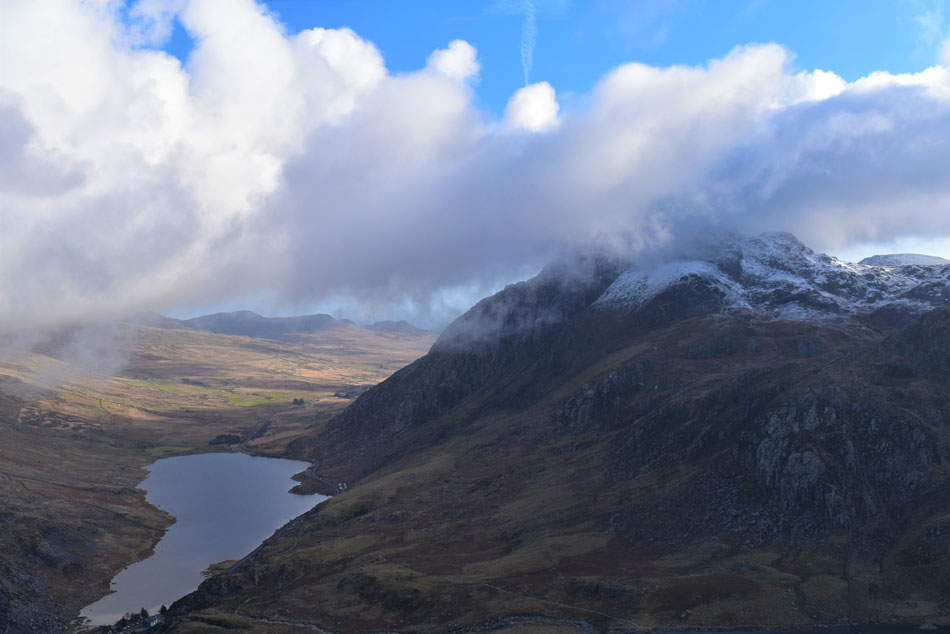
| Y Garn. |
| The sun had to do a lot of climbing before it breached Llyn Idwal which left Y Garn looking rather menacing as I took my first real glimpse. Ahead are Y Garn's East, and North East ridges the latter of which I'll descend later seen over on the right. The group ahead had been kitting up on the car park and had left moments after me, they were a lively, but friendly bunch from Liverpool and by the sounds of it, one member of the group knew the area well, I let them pass and get a good lead on me while I stop to take photos. |
 |
| Pen yr Ole Wen from Nant Idwl. |
| I continued to follow the footpath whilst getting familiar with my surroundings, with Llyn Idwal just a short distance away I still couldn't lay my eyes on Devil's Kitchen just yet but when you have views as good as this Devil's Kitchen can wait. |
 |
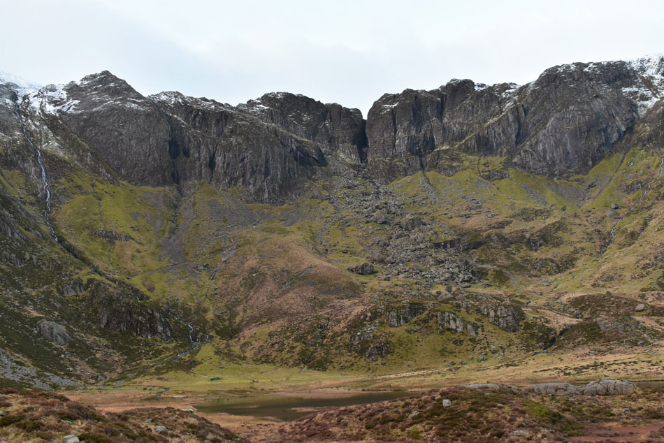
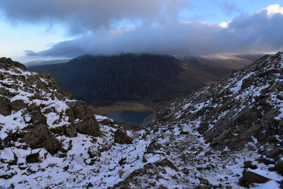
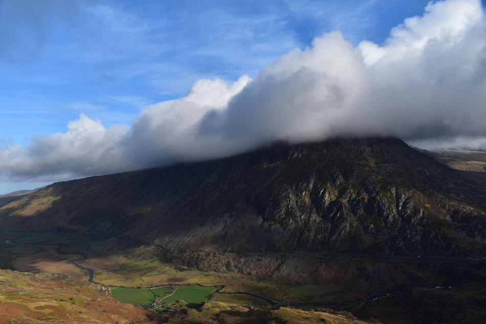
| Devil's Kitchen from Llyn Idwal. |
| The group that passed me earlier had long gone by the time I arrived at Llyn Idwal but I could still hear their banter as it faded into the distance. With Llyn Idwal reached I could now survey my route through Devil's Kitchen which starts below Idwal Slabs seen left, if you look closely you can see the footpath rising steadily towards the centre of the picture below Devil's Kitchen towards the boulder field, that's where the going gets steep I guess but for now everything is slotting into place thanks to my research and Google Earth .
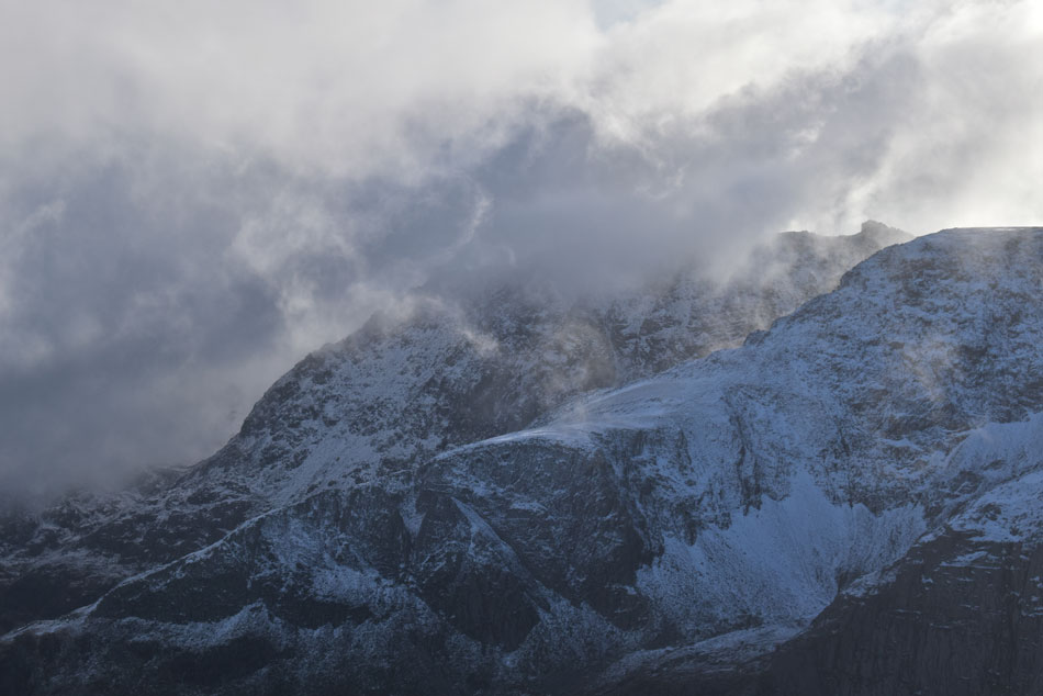
Devil’s Kitchen is the name given to the large gorge which splits the rock of Clogwyn y Geifr (Cliff of the Goat) between Y Garn and Glyder Fawr. The Welsh name for Devil’s Kitchen is Twll Du, meaning ‘black hole’. Twll Du is known as the Devil’s Kitchen because of the plume of steam that is often seen rising from the gorge resembling a chimney. It’s said when steam can be seen rising from the chimney the Devil was cooking. |
 |
| Calm over Llyn Idwal. |
| With Pen yr Ole Wen catching the sunlight in the distance. |
 |
| Devil's Kitchen (Twll Du) |
In this photo you can see the path rising from left to right towards the boulder field seen centre where it appears the path disappears, this isn't so as the path rises steeply towards the large gorge before heading east (left) between the second and third buttresses.
Never mind Devil's Kitchen, devil's teeth come to mind! |
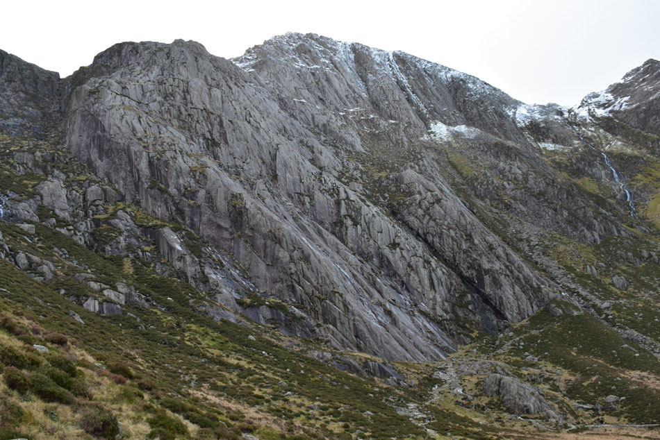 |
| Idwal Slabs. |
| After leaving Llyn Idwal I made my way towards Idwal Slabs where the path passes below. Idwal Slabs is popular with climbers and reminded me of Bowfell's Great Slab but on a much larger scale. This is classic hanging valley territory. |
 |
| Pen yr Ole Wen seen beyond Llyn Idwal. |
| The path starts to rise quite steadily and in doing so I pass an elderly couple who had stopped to take photos, I had remembered them setting off from the car park while it was still dark earlier and a 'morning' was shared. The group of lads however, had disappeared and were no longer ahead, I went over the map in my head and couldn't remember any other paths apart from this one so where had they gone? for now it remained a mystery. |
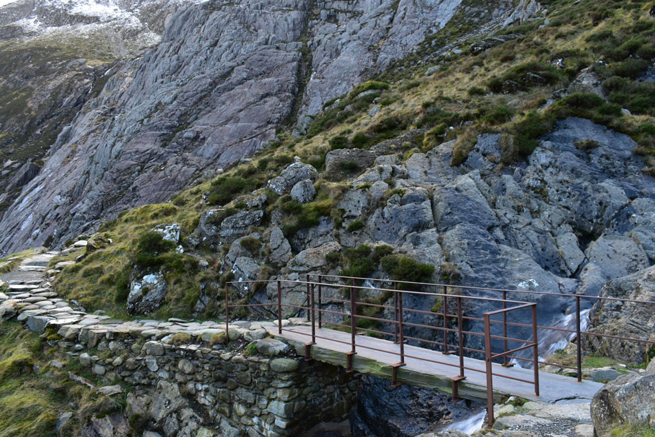 |
| Crossing Twll Du waterfall. |
With the path continually rising I came across Twll Du waterfall which was heard well before it was seen, I was more impressed however, by the footbridge which was constructed from one solid single span of slate.
I hung around a while because I could here voices from below who turned out to be the gang from Liverpool, it would appear for whatever reason they had left the footpath and were making their way back up which explains why I couldn't see them earlier. |
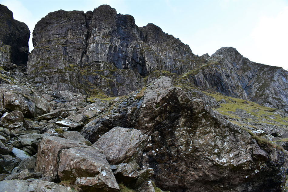 |
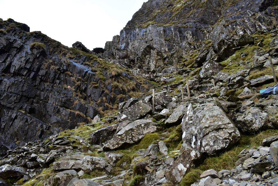
| Devil's Kitchen boulder field. |
| After passing over the footbridge I continued to rise although less steeply, even though I knew I was about to begin the steeper climb a slight panic set in because I couldn't see the whereabouts of the path as it mingled into the boulders making it hard to make out but sure enough it was there after I traced it from the top down, I was stood at the base where a collection of boulders and a slight rock step obscured it. By now the gang had remarkably caught up with me and in the distance, the elderly couple were also in tow. |
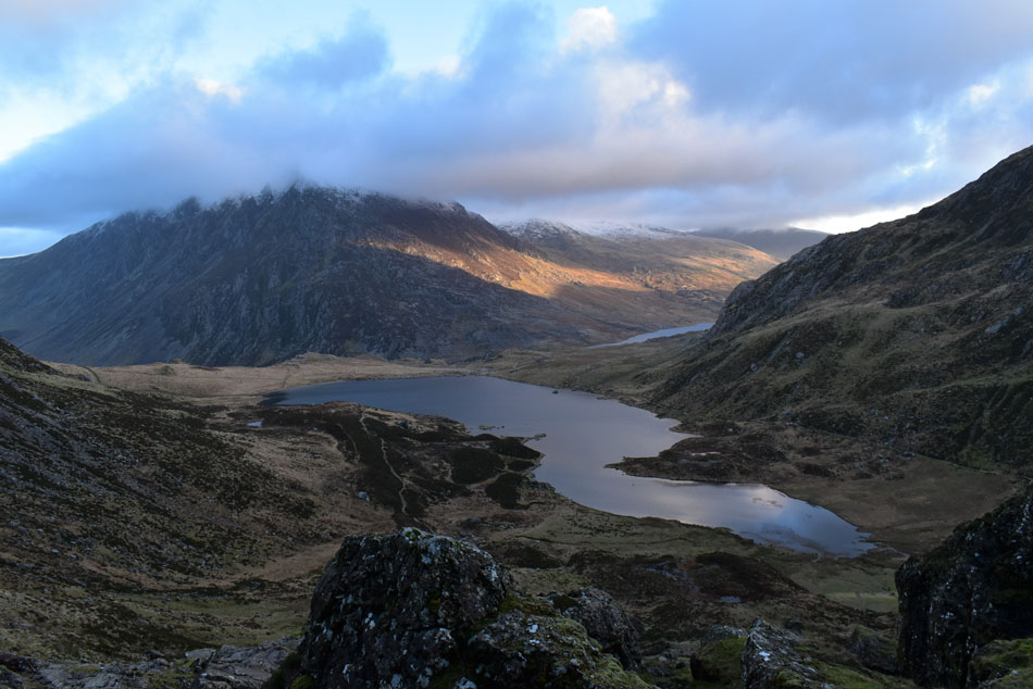 |
| Llyn Idwal and Pen yr Ole Wen from Devil's Kitchen. |
| I shared banter with the lads from Liverpool joking that seeing I was the slowest it was best I let them go first, the group consisted of five friends, four of whom where fell fit and the fifth, a friendly burly chap took the ascent in his stride from the rear. I gave them a good five minutes lead before I set off but as friends do, they would wait for the slowest member of the group which meant I was soon passing them. |
 |
| Ascending Devil's Kitchen. |
| Even though I had passed the lads I could still hear them which in a way came as a comfort given my 'not so known surroundings' The strongest member of the group would often catch up with me and we'd share a few words whilst he waited for his mates further back. Here the path was at it steepest but by no means exposed, the path had been constructed with large stone and looked like it could last a thousand years which I was impressed with. The key here was to keep eyes down at all times as the path swerved from left to right at any given point and I only looked up to check on progress while keeping one eye on the path up ahead. |
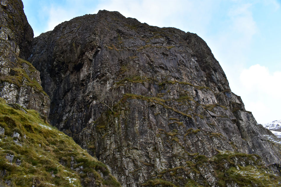 |
| Passing the large gorge. |
| No plumes of steam today. |
 |
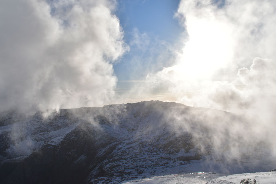
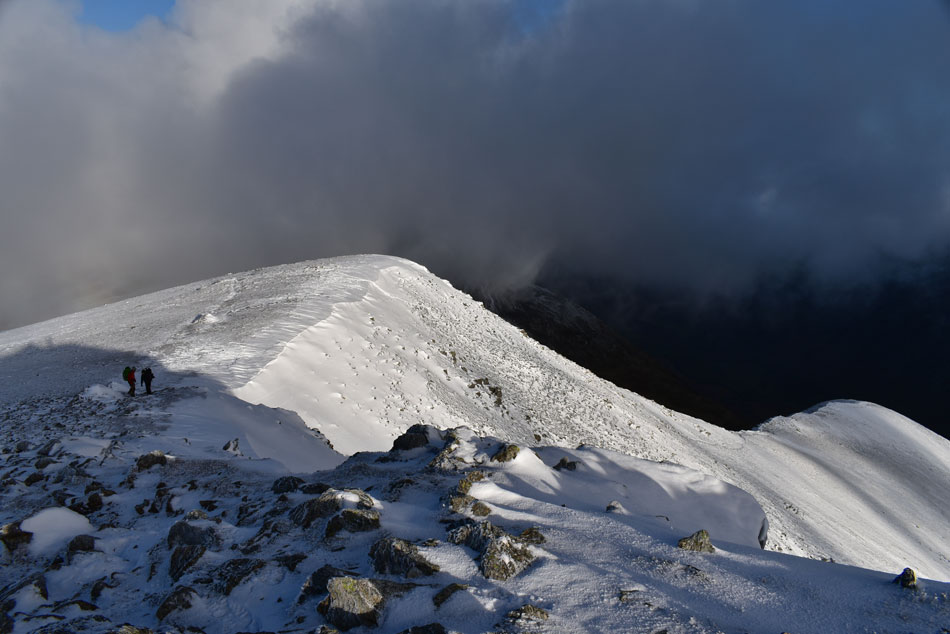
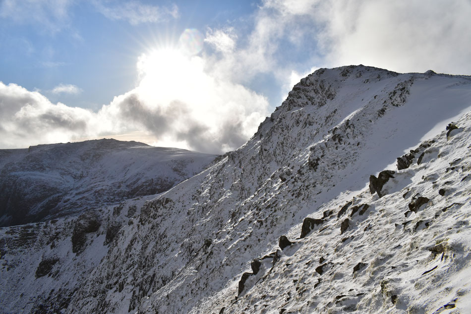
| Y Garn summit appears over Devil's Kitchen. |
| Continuing with the steep climb over my shoulder Y Garn summit appeared over Devil's Kitchen, It was tiring work but the good news was I was close to the top and most importantly, look at all that blue sky. |
,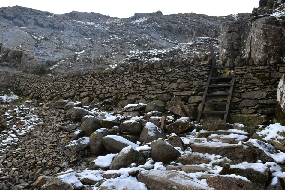 |
| The sty in the wall, top of Devil's Kitchen. |
| At approximately 2,000ft I entered a vague snow line although my main concern wasn't snow but ice which now covered most parts of the path onwards, had the lads behind me been within earshot I would have warned them. I remember looking at this wall using Google Earth which funnily looked like a huge dam. I cross the sty before continuing towards Llyn Cwn. |
 |
| Looking back on Llyn Idwal and a cloud topped Pen yr Ole Wen from the top of Devil's Kitchen. |
| After crossing the wall I continued whilst still rising steadily, by now the air had turned much colder and my chest was starting to wheeze slightly, perhaps I should have stopped to rest but instead I continue towards Llyn Cwu. |
 |
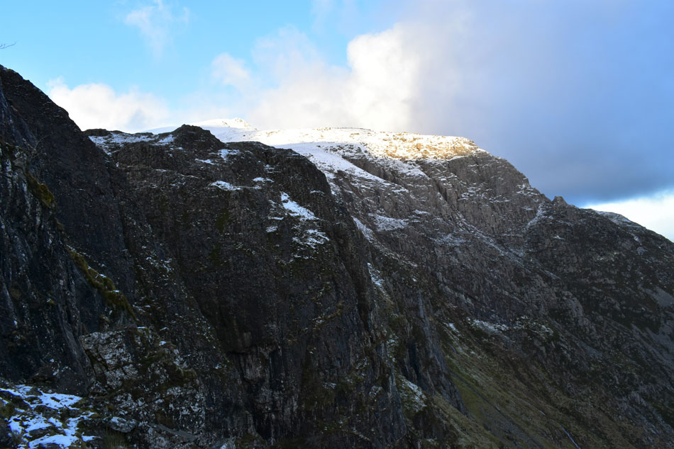
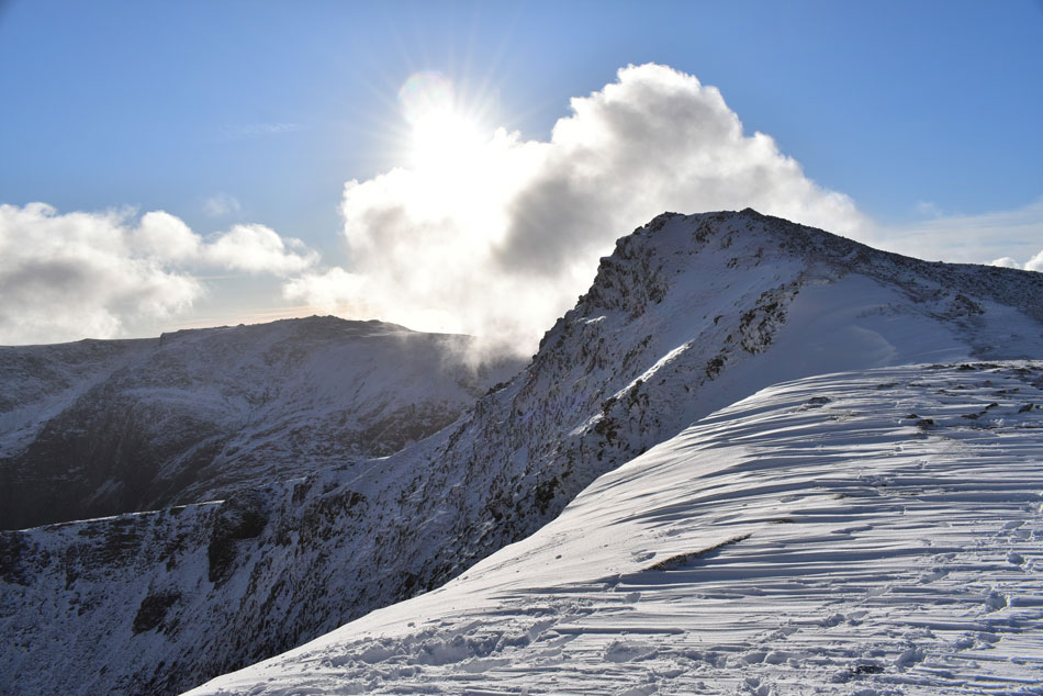
| Y Garn. |
From the the top of Devil's Kitchen I was flanked by craggy outcrops which created an 'alley effect' along the narrow footpath but once clear of the crags Y Garn in all its glory appeared and my wheezing chest was replaced by the butterflies in my stomach.
The school boy error here would be to head straight over the crags before joining the path for the summit but I don't do this (although my head was telling me to do so) Instead I trace over snow covered swollen ground before arriving at Llyn Cwu a short distance away. |
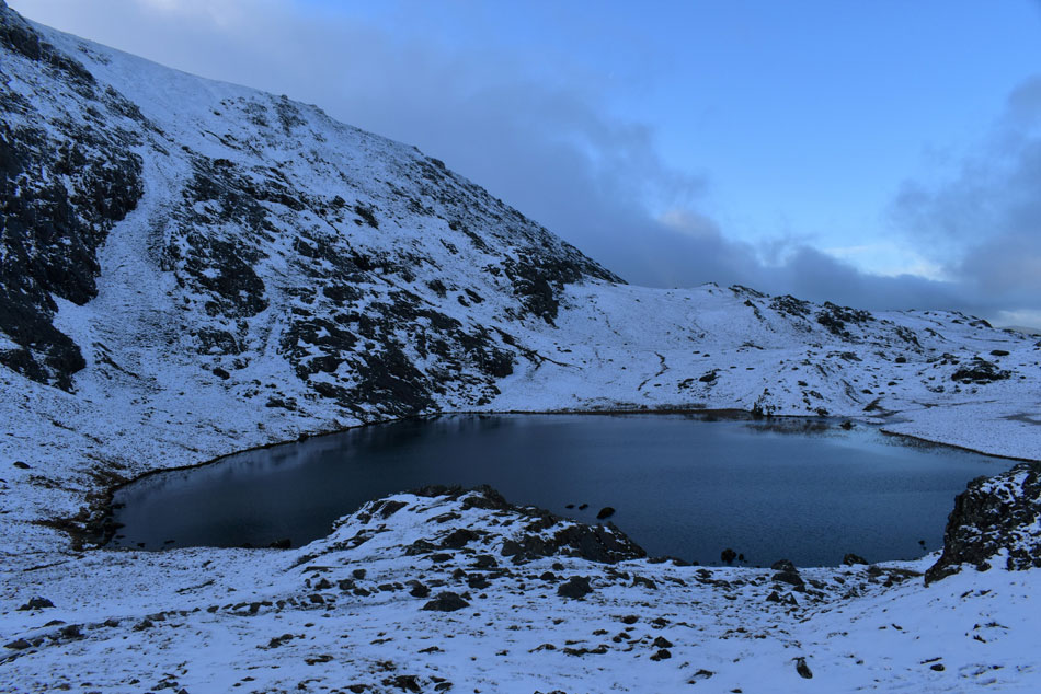 |
| Llyn Cwu. |
| Despite its cold appearance I found Llyn Cwu sheltered and it was here I regained my breath. It was mild although that could be put down to me generally over heating! I could now see two paths leading directly towards Y Garn summit one of which took a line directly towards the summit while the other took in the summit ridge which was where I was heading next. |
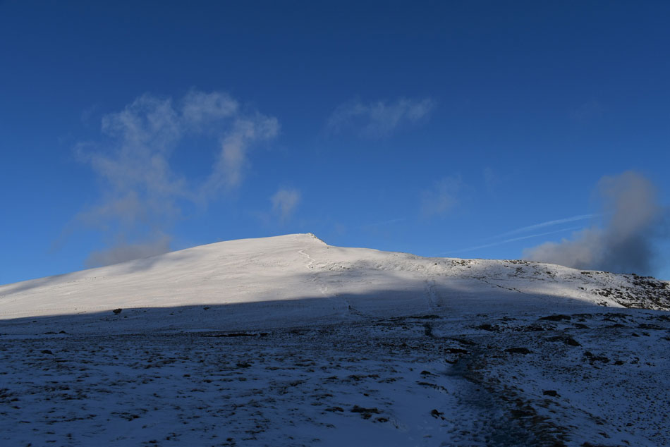 |
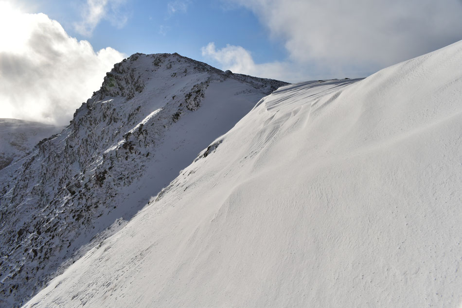
| Y Garn from Llyn Cwu. |
I left Llyn Cwu while spurred on by the sunshine over Y Garn summit, you might be able to make out the two paths in this photo, the direct path is seen centre while the ridge path appears further right.
By this point I had been passed by a solo walker who had just left the summit followed by two young girls all of whom are wearing crampons. Underfoot there is fresh snow which has fell on a mix of old snow and ice, traction without crampons was fine for now but with the three people who had just passed me wearing crampons perhaps I'm soon to encounter ice so I stop, de-shoulder and add my crampons.
As the saying goes 'add them before you need them' |
 |
| Sunrise breaches Glyder Fawr. |
| With the inky blackness of Llyn Cwu below. |
 |
| To the East, Tryfan. |
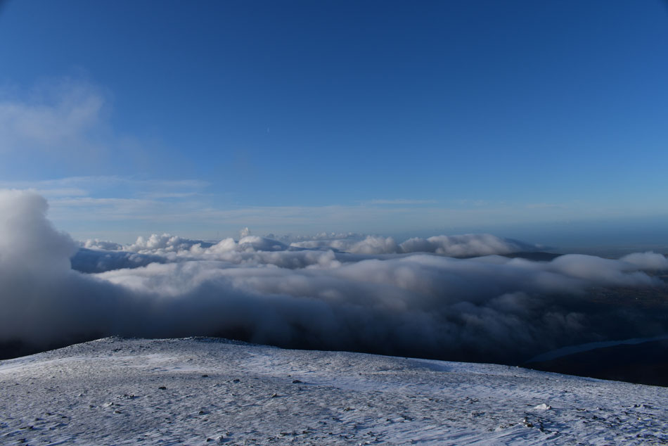
| Now below a belt of low cloud which seems to be circling around Y Garn summit. |
 |
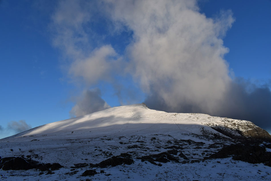
| Y Garn summit. |
| Between LLyn Cwu and Y Garn I pass over a wooden sty, something that I have never done and wouldn't recommend whilst wearing crampons. From the sty all that is left is 700ft of steady ascent before the summit is reached. As previously mentioned my aim was to ascend by the summit ridge although reaching it was somewhat tiring whilst blazing through fresh snow but the summit ridge was soon reached after a couple of stops, by which time the group of lads who I had left at the top of Devil's Kitchen were making their own advances to a point where we were almost parallel to one another in ascent. |
 |
| Y Garn summit. |
| |
 |
| Tryfan and Llyn Ogwen from the top of the North East ridge. |
| |
 |
| Pen yr Ole Wen , Llyn Clyd and Llyn Ogwen from Y Garn. |
| |
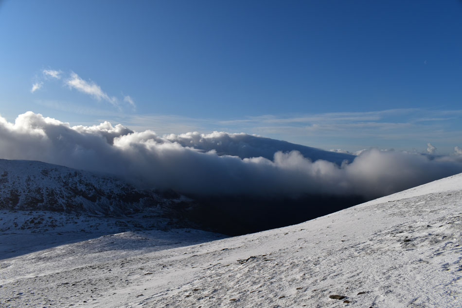 |
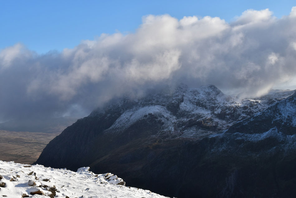
| The view south towards the Snowdon range now completely engulfed by low cloud. |
| With Esgair Felen (the south spur of Glyder Fawr) seen below. |
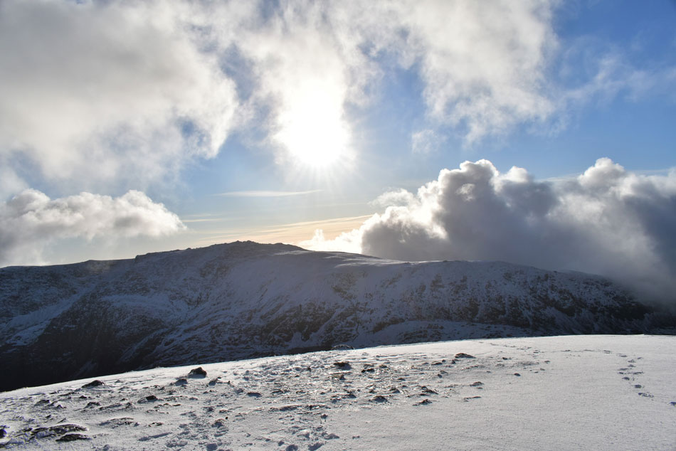 |
| Glyder Fawr summit from Y Garn. |
| I'm almost at Y Garn summit now but conditions are preventing me from putting the camera away! |
 |
| A close up of Tryfan and Y Gribin from Y Garn. |
| |
 |
| The view South. |
| With a glimpse of Llyn Padarn (Llanberis) below. |
 |
| Y Garn summit with Glyder Fawr and Glyder Fach in the distance. |
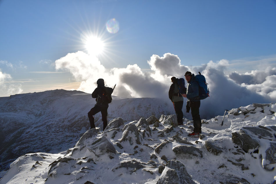
| With just 200ft feet to go the summit ridge path fell back in line with the direct path where a series of zigzags lead towards the summit, I joined the lads from Liverpool behind its two fittest while the rest of the group waited for the others to catch up, by this time another group had approached from the direction of the north east ridge and four suddenly turned into eight. Soon the rest of the gang caught and summit space was running low so I dropped down to a safer vantage point and took out my camera. |
 |
| Spectacular mountain scenery. |
| Here looking towards Glyder Fawr (left) and Glyder Fach commonly know as 'The Glyders' |
 |
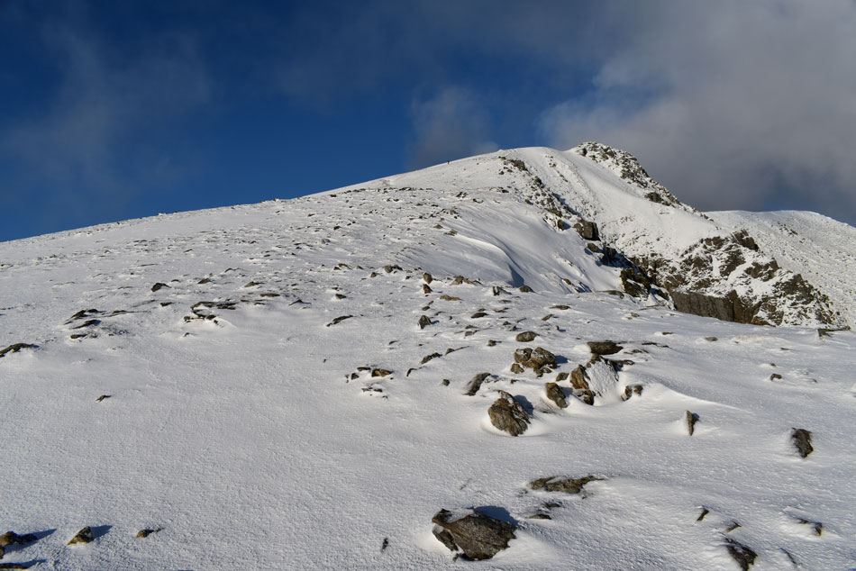
| Y Garn North East ridge from the summit. |
| While cloud continued to surround the summit Y Garn itself was left unscathed instead its snow covered peak and ridges basked under Winter sun glory. With a packed summit I decided to leave why the sun was still shining, my descent would be by the North East ridge seen here, I had previously read that the top of this ridge cornices in Winter which was just what I had presented before me. The two walkers below are the Aussies who were chatting to one another through the toilet cubicle door back at Ogwen Visitor Centre although I'm pleased they didn't remember me as we passed comment on the North East ridge "be careful mate, it's slippy" As they weren't wearing crampons I took their advice with a pinch of salt although I knew extreme care had to be taken whilst descending through the cornice. |
 |
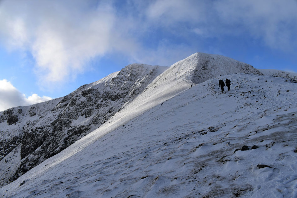
| Looking back on Y Garn with the Glyders in the distance. |
| |
 |
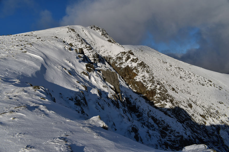
| Cornice, Y Garn North East ridge. |
| A cairn marks the top of the descent route which descends the inside of the ridge rather than above it. I found the cornice easy to negotiate finding up to 3ft depth of semi frozen snow, first I zigzag the first few steps keeping in line with previous descenders before the incline eased through soft snow. |
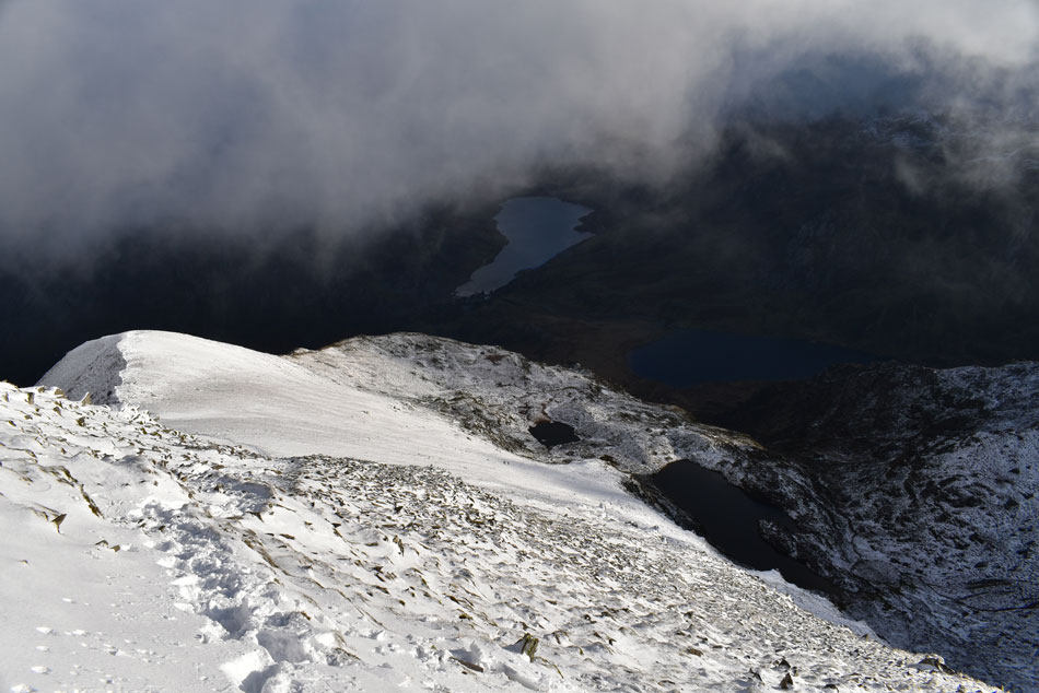 |
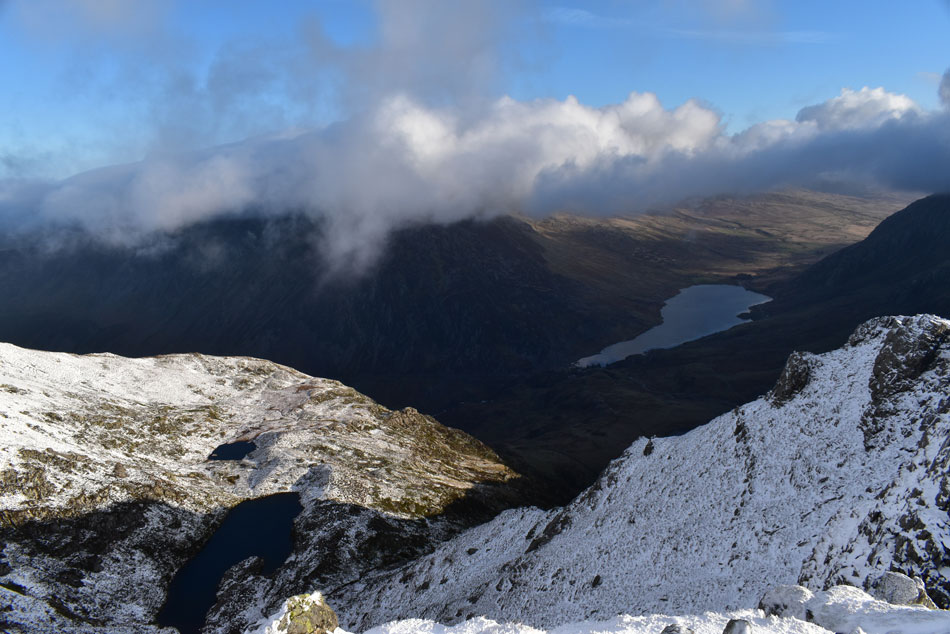
| Y Garn North East ridge with Llyn Clyd, Llyn Idwal and Llyn Ogwen seen below. |
| I follow the line of the ridge as far as Llyn Clyd below, it was here I am passed by walkers coming from the opposite direction most of whom ask about conditions on top as they spot my crampons "they're not 100% necessary" I reply, "but I wouldn't want to descend through the cornice at the top of the ridge without them" as I looked back. |
 |
| Y Garn and The Glyders from the North East ridge. |
| |
 |
| Y Garn North East ridge. |
| And still the sun shines. |
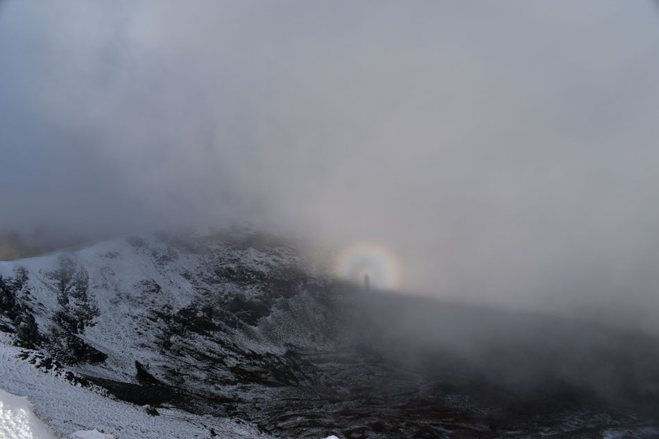 |
| Perfect brocken spectre over Cwn Cywion. |
| |
 |
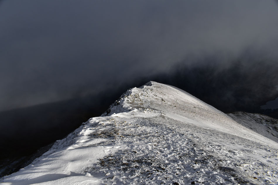
| Looking back up towards the summit along the North East ridge. |
| I was passed by many walkers today but non were as friendly as these two locals from Prestatyn, I didn't manage to get their names but within the space of twenty minutes I felt like I'd known them for twenty years, two top blokes. |
 |
| Tryfan and Llyn Ogwen. |
| |
 |
| Pen yr Ole Wen across the Ogwen valley. |
| It was only by chance this morning that I got to see Pen yr Ole Wen without cloud over its summit but all the same, what a fantastic view. |
 |
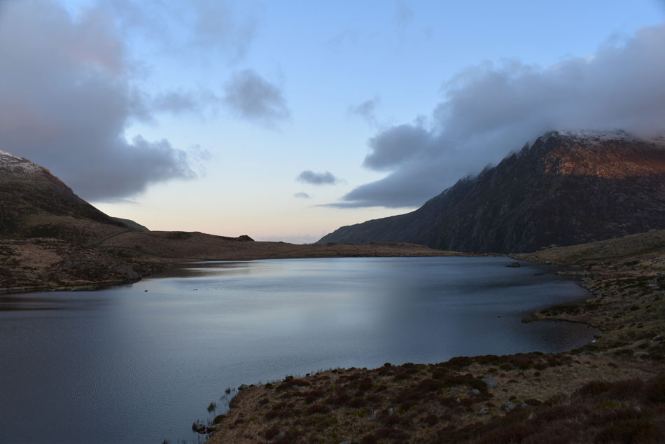
| Llyn Ogwen. |
| |
 |
| Y Garn from Llyn Idwal. |
| |
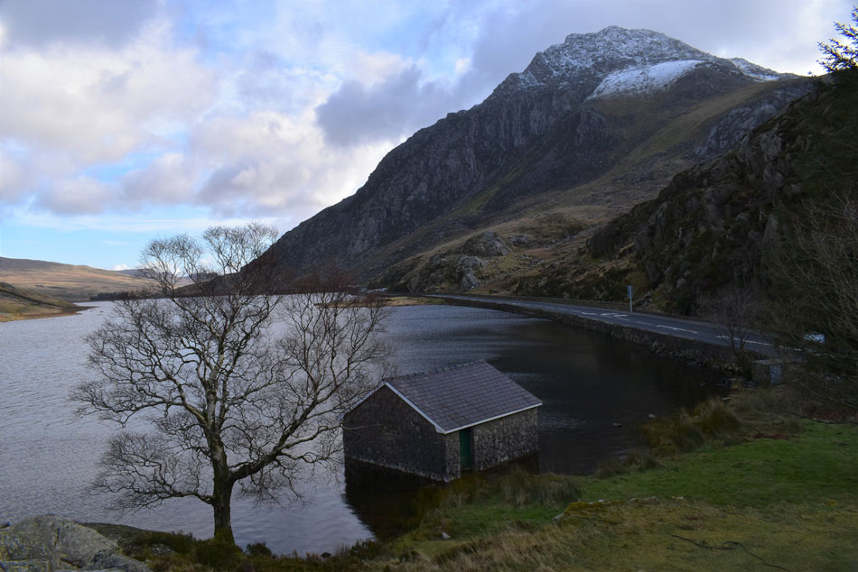 |
| Tryfan from Llyn Ogwen Boat House. |
Despite my descent almost coming to an end it wasn't without various rock steps which had to be negotiated and slowed things down a little, it was here I am passed by dozens of walkers in ascent and I wondered of their timings much the same as I would passing anyone during the ascent of Helvellyn at midday within the depths of Winter. By the time I left the North West ridge my feet were ready for the shingled shoreline of Llyn Idwal where families wrapped up whilst eating lunch and dog walkers walked their dogs. I pass a photographer in conversation with another chap and overheard him saying "this is my favourite place to come no wonder I take so many pictures" I certainly know how that feels I said to myself.
I rejoined the path back to the Visitor Centre passing dozens more walkers and dog walkers and within minutes I can see a long line of cars choking the A5 as far as the eye can see. The visitor Centre is reached right after crossing Nant Idwal via its footbridge but before I head back to the car I want to go back to the Boat House on the shores of Llyn Ogwen to eat lunch, I pray there is no one else there and my prayers get answered. By now Tryfan is free from cloud but Pen yr Ole Wen isn't so lucky. I down pack, find a dry rock and perch myself upon it and tuck into lunch whilst pondering this brilliant alternative to the Cumbrian Fells less than two hours away.
After lunch I retrace my steps and cross the A5 and make my way back to the Visitor Centre where as expected was a hive of activity where people queued for food at the shop and cars came and went looking to park, mine will be available in a few moments but you're not having my parking ticket, I'm keeping that for memories. |
|
| |
| Back to top |
 |
|
